INFORMATIONAL POSTING -35th Annual Beginning Backpack Class Have you ever wanted to learn to backpack and get away from the crowds of people? Learn how to backpack in 3 Saturday courses (4/27, 5/4, 5/11) culminating in a backpack 6/1-2. Course times are 10:30 AM - 2:30 PM Learn what to take, latest in equipment, what […]
This hike begins from the top of King James Court, a cul-de-sac off Lindero Canyon Road. Begin up the trail at the top of the road, passing through a gate by a sign that reads “China Flat Trail Head.” It will pass through the branch of Suicide Trail and another branch of China Flat Trail. […]
Join us on an out and back hike up the Ray Miller Trail and the Overlook Trail. We’ll enjoy beautiful ocean views as we descend. We'll pick up about 1300’ gain on this 7 mile adventure. Lying along the brilliant blue Pacific Ocean at the west end of Malibu (just shy of Port Hueneme), the […]
NOTE: This is an alternative hike for Tuesday, a little slower. We will take the Los Robles East trail with lots of trees and shade. We will do an in/out of 5 miles with about 800' of total elevation gain, spread out nicely. "Robles" is Spanish for oaks, and we'll see plenty of them on […]
This hike will be about 5.4 miles total with 820 ft. of elevation gain. We are starting at the parking lot at the Wahoo's parking lot. We will take Live Oak Trail. This turns into Serrano Road which will take us to Serrano Cow Trail. At this part of the trail, we usually see a […]
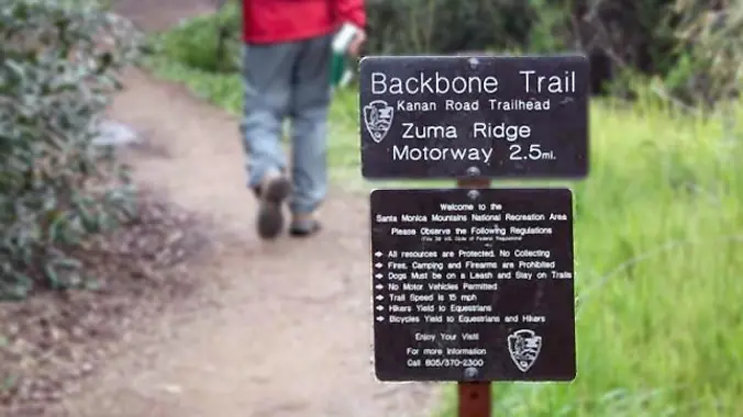
http://photos1.meetupstatic.com/photos/event/b/a/2/4/event_99467652.jpeg Rain is predicted for late night. If it is expected to arrive earlier, the hike will be canceled. Hoping the waterfall will be flowing. From the Kanan Rd trailhead, we'll jump on the Backbone Trail for a cruise down into Newton Canyon. On our way there, we'll cross the creek, pass under an oak […]
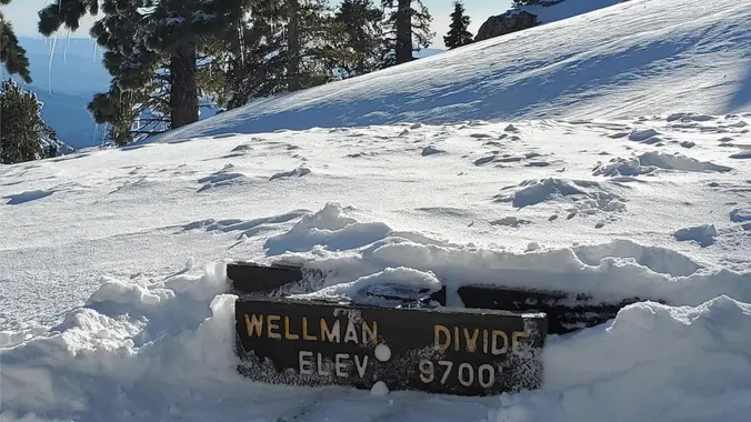
COLD WEATHER BACKPACKING!! ****THIS TRIP MAY BE RESCHEDULE DO TO WEATHER CONDITIONS*** Difficulty level: Intermediate Weather: The weather can be unpredictable. Night time temperatures can range from mid 20’s to mid 30’s. NO PLUS 1 Distance – 10 miles round trip Peak Elevation: 10,834 Elevation Gain/Loss: 800-2000 Terrain Type – Snow Difficulty – Intermediate At […]
DESCRIPTION: I discovered this is an old club favorite after looking through the last five years of hikes. It’s an out-and-back trail that is popular for birding, hiking, biking and running, but should not be too busy during our trek (I hope). Dogs are welcome but must be on a leash. It also happens I […]
This hike will be about 7 miles with about 700 ft. of elevation gain. We will start the hike at Cañada Vista Park. From here we will take the Tijeras Creek Trail to the Arroyo Trabuco Trail and use this to loop back to where we started. There will be a few water crossings, so […]
The hike I am planning is around 6.3 miles with about 700 ft. of elevation gain. It starts at the very end of the paved road, the long gray strip that can be seen on the map. We will begin at the Bell Canyon Trail head. We will continue onto that and then take it […]
The Morrison Ranch Trail is a unpaved service road beginning at Las Virgenes Road and heading up to Cheeseboro Ridge. We'll traverse oak savannas and a nice walnut woodland getting to the ridge. We'll take a break atop Mount Basura, overlooking Cheeseboro Canyon. We'll descend into Cheeseboro Canyon via the Canyon View Trail and make […]
Let's hope that the weather permits a great hike! Fit Beginner 4.3 miles, 480' gain. Easier Option: 4 miles, 230' gain. We walk a mostly flat section for 1.1 mi. to the 2nd junction. Easier option: Continue straight for 3/4 mi., left at the split, right after another 500', arriving at some picnic tables on […]
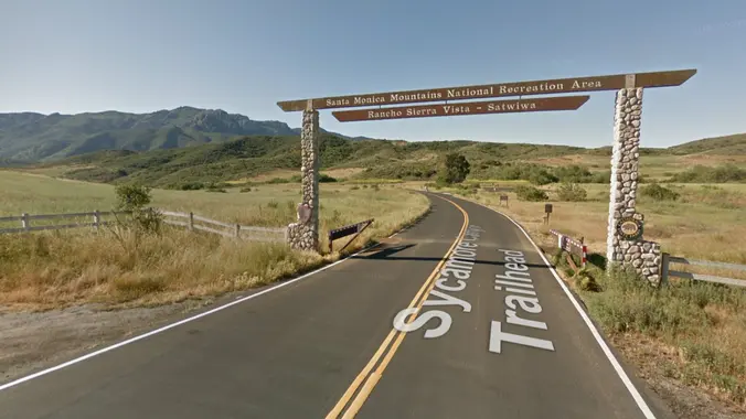
***Downpour Cancels*** Please check before driving to the hike Once again (again!) because of this weekend’s downpour, we will avoid mud as much as possible and protect out local trails with an asphalt -only route. We'll meet near the bathrooms in the Rancho Sierra Vista parking lot, then hike down Sycamore Canyon to the Danielson […]
5k hike plus tacos after the hike All levels welcome 🤗 ( only positive vibes) water headlamp *good pair of shoes By accepting the invite : please come prepared to hike, I will not tolerate any negativity plus beware that I’m not a guide, hike on your own risk but I will wait for everyone […]
If the rain should stop in time for this event, it will go on. Otherwise rain will cancel it. PLEASE NOTE THE PARKING/MEETUP LOCATION ABOVE (IT'S NOT WENDY & POTRERO). Do not park on Potrero Road as it is for residents only. Take a right at the stop sign on Potrero Road and park on […]
Check out my Amazon Top 10 for Cheap Hikers There are 3 waterfalls in the West San Fernando Valley -- all within a couple miles of each other. They are not linked by trails but its a short drive to each of the trail heads. From each trail head its a short hike to […]
Intermediate/Advanced Hike! Pull out your Butt Kicker Boots. DESCRIPTION: Bring your A-game, and let the mountains become your personal Stairmaster – because who needs a gym when you've got nature's masterclass in butt-kicking? We will meet at the gate at the ruins of the old Cobb Estate. There is only neighborhood parking so please be […]
The total distance for this hike is 4.5 miles with about 650 ft. of elevation gain. There are great mountain and ocean views along the ridge. We are going to start on Bommer Ridge Trail and take this to Lizard Trail. We will go down that and loop back up to Bommer via Upper Laurel. […]
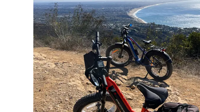
All bikes are welcome. On this one we’ll travel through Topanga State Park with stops at Eagle Rock, Parker Mesa, the Hub, Eagle Springs and more. This is an intermediate ride on mostly fireroads. There will be nothing technical. Planned ride is a about 22 miles with 3,500 ft total ascent. If everyone's battery is […]
The hike we will be doing will be around 5 miles long with 875 ft. of elevation gain. This will be a loop starting at the parking lot of Nix Nature Center. As you will see on the map, this is at the main park entrance off of the 133 (Little Sycamore Canyon Staging Area). […]
Don't forget to join our FB group at https://www.facebook.com/groups/hikingwithdean/ Our 9th Annual Super Bowl Pre-Game Hike is perfect. Short enough to get you home on time and prepare for parties and kickoff, yet big on beauty and adventure. You will even have time to get to Vegas. ✈️ Our destination is a familiar one but […]
Let's hike at the Back Bay in Newport. The plan is to do 5-5.5miles. It will be an out and back. A lot of the trail is asphalt. You can wear hiking or running shoes. There is a Upper Newport Back Bay Nature Preserve parking lot right off University Dr. and Irvine Ave. (See Map) […]
This hike will be about 5.4 miles total with 820 ft. of elevation gain. We are starting at the parking lot at the Wahoo's parking lot. We will take Live Oak Trail. This turns into Serrano Road which will take us to Serrano Cow Trail. At this part of the trail, we usually see a […]
Oak Creek Canyon Trail is a rather special trail in Los Robles Open Space that is designed for the blind as well as the sighted. The all-access trail is shaded by a canopy of oaks, while the loop trail spends more time in the chaparral. We will start at Oak Creek Canyon and proceed to […]
Join us on a fun stroll through the Simi foothills after all our recent rains... visiting THREE of the prettiest little unique canyons in Eastern Ventura County. Specially chosen trails are an eclectic mix of single-track, double-track, deer-track, ranch-road, fire-road, creek-bottom, rain-drain & spill-way :) This dogbone-shaped Easier Intermediate route will take us on roughly […]
http://photos1.meetupstatic.com/photos/event/b/a/2/4/event_99467652.jpeg Please follow the written directions as the map may be incorrect. Let's do this hike again as the waterfall should be flowing nicely. From the Kanan Rd trailhead, we'll jump on the Backbone Trail for a cruise down into Newton Canyon. On our way there, we'll cross the creek, pass under an oak canopy, […]
DESCRIPTION: SOMETHING NEW AND DIFFERENT FROM YOUR FAVORITE HIKING CLUB – WEEKDAY HIKING! This route takes you along a trail through Newhall Pass Open Space, a critical wildlife corridor in the Santa Susana Mountains. You'll get great views of the San Fernando and Santa Clarita Valleys, and even downtown LA on a clear day, and […]
Let's hike at the Back Bay in Newport. We will be doing about 5 miles. It will be an out and back. A lot of the trail is asphalt. You can wear hiking or running shoes. There is a Upper Newport Back Bay Nature Preserve parking lot right off University Dr. and Irvine Ave. (See […]
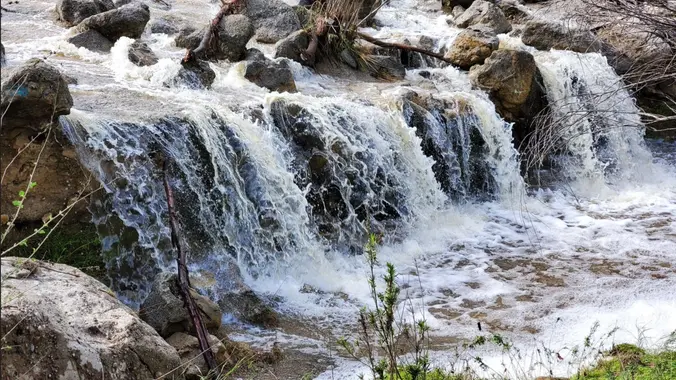
Assuming today's forecast is correct, we should be able to squeeze this one in on Thursday, and enjoy the waterfalls that are flowing! We're only going 5 miles, but we'll be going fairly quickly so we can gawk at the falls. From the Kanan Rd trailhead, we'll jump on the Backbone Trail for a cruise […]
TRIP IS OPEN COLD WEATHER BACKPACKING!! ****THIS TRIP MAY BE RESCHEDULE DO TO WEATHER CONDITIONS*** Difficulty level: Intermediate Weather: The weather can be unpredictable. Night time temperatures can range from mid 20’s to mid 30’s. NO PLUS 1 Distance – 10 miles round trip Peak Elevation: 10,834 Elevation Gain/Loss: 800-2000 Terrain Type – Snow Difficulty […]
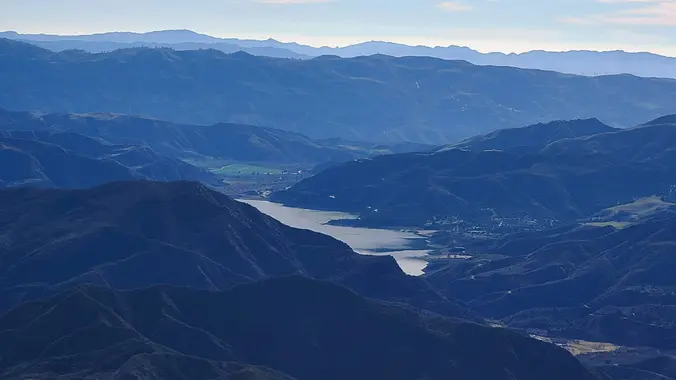
Whitaker Peak Via Oak Flat Trail DESCRIPTION: How many hikes have you been on recently where can you see three beautiful lakes (like Piru, Pyramid, and Castaic), great back country and summit views as well as burn maybe 2,000 calories? This is a local gem just off the Templin Highway exit which I recently hiked […]
Hike #2 in the 2024 Saturday in the Santa Monicas series, is a moderate 8 mile, 2000’ gain out and back hike with a couple loops starting at Leo Carrillo and hiking to scenic Nicholas Pond for lunch with spectacular ocean views and spring wildflowers. Bring water, snacks, sunscreen, and a good attitude. Rain, excessive […]
We will be playing it by ear a bit, but we will be doing a hike that will be around 5 miles with 800-900 ft. of elevation gain. **You do not need to register on LetsGoOutside.org, but if is optional and you will be emailed extra details and a map. https://letsgooutside.org/activities/2024/02/17/wilderness-access-day-bommer-canyon-116/ Enjoy self-guided access in […]
The hike we will be doing is approximately 5 miles with 870 ft. of elevation gain. We will begin at the Live Oak Trail trailhead. This is where you will see on the map that the Live Oak Trail hits the paved road. This is the parking lot closest to the Edna Spaulding Trail. (There […]
An HWD Classic! This hike is sponsored by Amazon - https://amzn.to/2GnCP0a During the 1950s, when Ronald Reagan hosted TV's "Death Valley Days," he wanted a more rural retreat than his home in Pacific Palisades. So he bought a 305-acre ranch in the hills of Malibu as a place to raise thoroughbred horses and dubbed it […]
The rain is expected to stop in the morning. Will keep an eye on the weather. Otherwise rain will cancel it. PLEASE NOTE THE PARKING/MEETUP LOCATION ABOVE (IT'S NOT WENDY & POTRERO). Do not park on Potrero Road as it is for residents only. Take a right at the stop sign on Potrero Road and […]
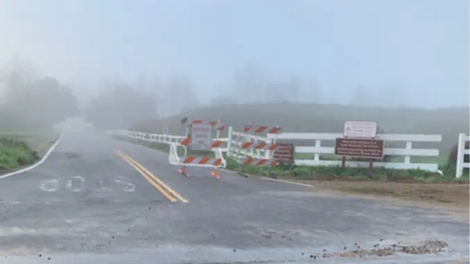
The gate to the Satwiwa parking lot is closed so we will be meeting at the intersection of Sycamore Canyon Road and Potrero Road. This is across from 4153 Potrero Road. Please follow the written directions. Once again (again!) because of this week’s rain, we will avoid mud as much as possible and protect out […]
5.75 miles, 700' gain. Easy Intermediate. Do not park on Potrero else risk getting a ticket. You need a permit to park on this street. This hike is a great trail when it might be muddy because almost the entire hike is on an asphalt path through a huge state park (> 20 sq miles). […]
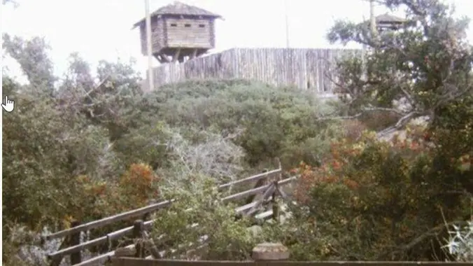
With two waterfalls, scenic volcanic outcroppings, a variety of hiking trails, several pleasant picnic areas, and abundant open space, Wildwood Park is a great place to escape the hustle and bustle of the nearby city. For you stairs fans: Did you know Wildwood has a trail with 76 steps? Highlights along the way: Fort Wildwood […]
This hike will be about 7 miles with about 700 ft. of elevation gain. We will start the hike at Cañada Vista Park. From here we will take the Tijeras Creek Trail to the Arroyo Trabuco Trail and use this to loop back to where we started. There will be a few water crossings, so […]
On Saturday, February 24th 5:30pm-7pm a very special speaker, Gen-la Kelsang Jampa will be giving a talk on The Healing Power of Meditation at the Kavli Theater located in the Performing Arts Center in Thousand Oaks, CA. Come and learn to Meditate and discover the benefit of a Mind of Inner Peace. Gen-la Jampa is […]
We begin our journey hiking south into Liberty Canyon — one of three natural preserves in Malibu Creek State Park. The canyon has a rare stand of California Valley Oak. Soon we will cross Liberty Creek turn west onto and up the Phantom Trail. After a couple miles the trail puts us down onto Mulholland […]
We are going to be starting at the Canyon View Staging Area. This hike will be about 6.2 miles with around 1,000 ft. of elevation gain. We will be starting at Canyon View Park and taking Cholla up to West Ridge and comic down Mathis. Link to Parking from Google Maps: https://www.google.com/maps/place/Canyon+View+Staging+Area/@33.585273,-117.7465062,17z/data=!3m1!4b1!4m5!3m4!1s0x80dce61b6bd45c2d:0x5ef3f1ad687cc8b5!8m2!3d33.585273!4d-117.7443175 Dogs are not […]
3.0 miles, 800' gain, easy-intermediate. Moonrise 7:03pm Let's enjoy the gorgeous sunset and the full moon, and fun loaded potluck picnic at the beautiful Angel Vista! This is a potluck hike. Please bring food, drinks to share. If your item requires utensils/plates/toothpicks, etc., please bring them. You may wish to bring your own cup, plate, […]
INFORMATIONAL POSTING -35th Annual Beginning Backpack Class Have you ever wanted to learn to backpack and get away from the crowds of people? Learn how to backpack in 3 Saturday courses (4/27, 5/4, 5/11) culminating in a backpack 6/1-2. Course times are 10:30 AM - 2:30 PM Learn what to take, latest in equipment, what […]
This is a 6- 7 mile out and back hike with about 1150’ of elevation gain from Lang Ranch Parkway in Westlake Village on the Albertsons Motorway. Our route on the Albertson Fire Road, which goes from the trailhead eastward all the way to Upper Las Virgenes Canyon, and is a favorite route for hikers […]
This double-loop route is a bisecting circumnavigation of the Lang Ranch Open Space. From the Autumn Ridge trailhead (end of North Westlake Blvd) we'll pick up the Sunrise Trail which climbs up and and along ridge overlooking Wood Ranch. After crossing the Long Canyon junction we'll rollercoaster down and up and down the Meadow Vista […]
4.6 miles, 1000' gain, Easy Intermediate Easier Option - 2.7 miles, 320' gain Many have gotten lost relying on GPS. This is the Wendy Trailhead, where S. Wendy Dr. ends at Potrero Rd. Heading out, we cross a creek, turn right at the split, then Turn right at the dead end. We regroup at the […]
This hike will be about 5.4 miles total with 820 ft. of elevation gain. We are starting at the parking lot at the Wahoo's parking lot. We will take Live Oak Trail. This turns into Serrano Road which will take us to Serrano Cow Trail. At this part of the trail, we usually see a […]
DESCRIPTION: SOMETHING NEW AND DIFFERENT FROM YOUR FAVORITE HIKING CLUB – WEEKDAY HIKES! This is one of those lesser-known local hikes you hear about from a from a friend who has trekked the trail a few times. This is a beautiful section of the Pacific Coast Trail (PCT) to explore - hope you join us! […]
Let's see if we can find any wildflowers out in Dos Vientos yet? This hike will loop around the periphery of Dos Vientos Open Space, passing Twin Ponds, overlooking Potrero Road and the Oxnard Plain with the Channel Islands in the background. We will cross 2 streets along the way. This hike is about 5.0 […]
Ski downhill or snowboard on Mammoth Mtn. Daily backcountry ski tours and snowshoe tours with the leaders. XC Ski or snowshoe on your own at Tamarack Nordic Center. Newcomers & non-skiers welcome. Tons of stuff to do in Mammoth in Winter. Quality Inn lodging, two per room, 2 beds/private bath, close to shopping, night life, […]
Join us for our third hike in the Wilderness Adventures Section 2024 Saturdays in the Santa Monica Mountains, a moderate 9 mile, 1900 gain loop hike in the Boney Mountain Wilderness on the Upper Sycamore Canyon, Fossil, and Old Boney trails with a side trip with brunch at the Danielson Monument. Bring water, snacks, sunscreen, […]
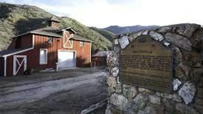
DESCRIPTION: We'll start from Mentryville (a historic SCV site) located at the base of Pico Canyon’s slopes, Mentryville was an 1880’s oil boom town built around its oil well, Pico No. 4. Named for Charles Mentry, historic buildings still stand including a thirteen-room mansion, a one-room schoolhouse, and a barn. Mentryville and Pico No. 4 […]
https://www.alltrails.com/trail/us/california/west-fork-national-scenic-bikeway Hello Fellow Hikers, Okay y'all the rain is back for the weekend. So time to hit the best hike to do in the rain! Why you ask? This is a 14.5 mile hike in the San Gabriel Mountains. This little unknown gem will follow water throughout our whole hike. But we will never have […]
The Natoma Loop Trail is a 1.7 mile lightly trafficked loop located in Woodland Hills. But anything less than a couple miles is not worth getting up for so we’ll extend the loop into the cool side of Mulholland and ramble about a network of secret and little-used trails. We'll visit and take a break […]
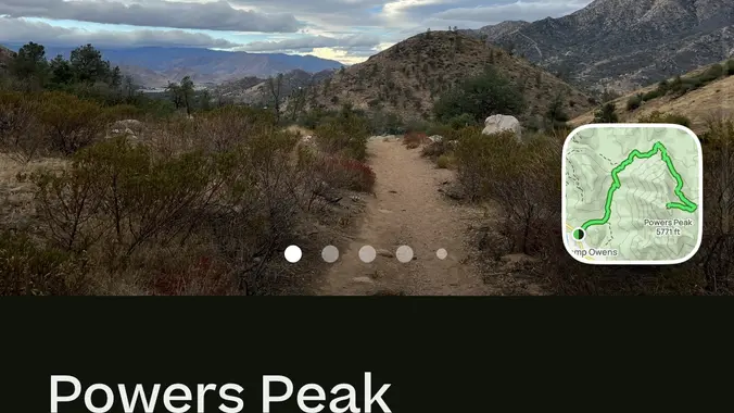
Hey hikernation: Click on the link to see the details of the hike Powers Peak on AllTrails https://www.alltrails.com/trail/us/california/powers-peak?sh=qfndye It’s fun a hike , if your coming from Bakersfield and would like to carpool we can meet at the shell on 178… if not then the start time for the hike will be at 7:30 at […]
I'm excited to do this hike again! This hike is really cool so you should come out and join us! This hike will be about 10 miles with 1,300 ft. of elevation gain. We will start at the same place we do for the falls (Black Star Trailhead). We will take this road all the […]
Trail statistics are approximate. For safety purposes always assume they are underestimated. But don’t be disappointed if they are overestimated. Bring more water and snacks than you think you’ll need.
Trail descriptions are based on previous hikes. Current conditions are unknown until arrival. Expect the unexpected and plan accordingly.
The Organizers and members of Hiking With Dean are not professional leaders, guides, or mountaineers. The function of the member or organizer is only to organize the trip. Each person who shows up for a trip/meetup (and their guest or guests) is responsible for his or her own safety. By attending a hike, or any other event organized by this group, you are acknowledging that you and any guests that you bring are aware of the risks, dangers and hazards associated with the activity and freely accept and fully assume all such risks, dangers and hazards, and further agree to release and discharge the Organizers, Members of the Hiking With Dean Meetup Group from and against any and all liability arising from your participation in the group activities per our ASSUMPTION OF RISK AND LIABILITY WAIVER and Section 6.2 of the Meetup.com Terms of Service.




















Recent Comments