

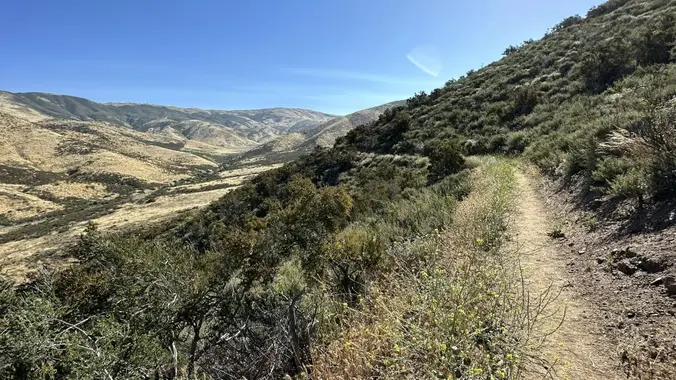
DESCRIPTION: SOMETHING NEW AND DIFFERENT FROM YOUR FAVORITE HIKING CLUB – WEEKDAY HIKES! This is one of those lesser-known local hikes you hear about from a from a friend who has trekked the trail a few times. This is a beautiful section of the Pacific Coast Trail (PCT) to explore – hope you join us! Please note we’ll be keeping the group smaller as there is limited parking, and we won’t have a sweep so will need to stay together.
Hike leader volunteers: Tim R.
Meet: Mint Canyon PCT Trailhead at 8:45 am, departure at 9:00 am sharp (Feb 29).
Distance: Approximately 8.35 miles.
Elevation gain: Approximately 1,552 feet.
Time: Approximately 4.5 hours hiking including a snack break.
Conditioning: You need to be in generally good physical condition.
Dogs: Dogs are welcome but must be on a leash.
Restrooms – None.
Adventure Pass: Not required.
IMPORTANT NOTES: We’ll hike at a brisk pace and ask everyone to stay with the group for a friendly and safe outing. Any guest that you wish to invite should join the Community Hiking Club (CHC) to participate. No stream crossings, exposures, bugs or other warnings. This event will be cancelled due to rain at the start of the hike.
ESSENTIAL GEAR:
· Hiking shoes/boots/poles.
· Layers recommended. Bring warm jacket.
· Snacks and 2+ liters of water and electrolytes or salt tablets; camera, hat and sunscreen.
THIS HIKE RANKING: Level 3, Intermediate (see chart below).
CHC HIKE RANKING SCALE:
1) Beginner: 1-3 miles, less than 500 feet elevation gain.
2) Beginner/Intermediate: 1-7 miles, less than 700 feet elevation gain.
3) Intermediate: 5-10 miles, 1000-2000 feet elevation gain.
4) Intermediate/Advanced: 7-12 miles, up to 3000 feet elevation gain.
5) Advanced: 10-17 miles, 3000 feet or more elevation gain.
TRAILHEAD LOCATION:
Mint Canyon PCT Trailhead:
Just off Petersen Road, Agua Dulce.
This is a local hike, and the drive time should be short (maybe 30 minutes north of the SCV)
FILE DOWNLOADS
We highly recommend AllTrails or GAIA apps be installed on your cell phones and/or you print a copy of the trail map so you can personally navigate the trail if you need to.
GPS Trail Map (link for downloadable mobile version)
Recommended Gear List for Hiking and Survival Safety (link) (please review to determine if you are carrying appropriate gear on your hiking adventures).
The Community Hiking Club is a Non-Profit 501C3 organization. We rely on donations to continue sponsoring hikes like this. Please contribute by donating via: Cash contribution (at each hike), or via Zelle at 6617135610; or via Venmo at: @Heidi-Webber-5
DISCLAIMER / RELEASE OF LIABILITY – IMPORTANT, PLEASE READ BELOW IN ITS ENTIRETY:
When you sign up for this event, you are releasing Community Hiking Club from any liability or responsibility with your participation in this group activity. While safety is a priority for everyone in the group, hiking can be inherently risky. By participating in any posted event, you are assuming responsibility for your own safety and well-being. The Community Hiking Club (CHC) Meetup Group and its organizers and hike leaders are not trained leaders and we do not confirm the qualifications of any of its members to lead or participate in our events. All participants take full responsibility for their own actions. If you choose to sign up for any Community Hiking Club Meetup events, you are releasing the Community Hiking Club Meetup Group and Hike Leaders from all liability in case of possible injuries or death as stated in paragraph 6.2 of the Meetup “Terms of Service” located on the bottom of the Meetup website. Your personal safety depends on your own judgment and experience. If you sign up for this hike, you are verifying that this hike is within your abilities.


