INFORMATIONAL POSTING -35th Annual Beginning Backpack Class Have you ever wanted to learn to backpack and get away from the crowds of people? Learn how to backpack in 3 Saturday courses (4/27, 5/4, 5/11) culminating in a backpack 6/1-2. Course times are 10:30 AM - 2:30 PM Learn what to take, latest in equipment, what […]
This is a 6- 7 mile out and back hike with about 1150’ of elevation gain from Lang Ranch Parkway in Westlake Village on the Albertsons Motorway. Our route on the Albertson Fire Road, which goes from the trailhead eastward all the way to Upper Las Virgenes Canyon, and is a favorite route for hikers […]
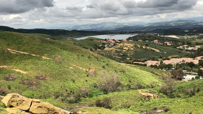
This double-loop route is a bisecting circumnavigation of the Lang Ranch Open Space. From the Autumn Ridge trailhead (end of North Westlake Blvd) we'll pick up the Sunrise Trail which climbs up and and along ridge overlooking Wood Ranch. After crossing the Long Canyon junction we'll rollercoaster down and up and down the Meadow Vista […]
4.6 miles, 1000' gain, Easy Intermediate Easier Option - 2.7 miles, 320' gain Many have gotten lost relying on GPS. This is the Wendy Trailhead, where S. Wendy Dr. ends at Potrero Rd. Heading out, we cross a creek, turn right at the split, then Turn right at the dead end. We regroup at the […]
This hike will be about 5.4 miles total with 820 ft. of elevation gain. We are starting at the parking lot at the Wahoo's parking lot. We will take Live Oak Trail. This turns into Serrano Road which will take us to Serrano Cow Trail. At this part of the trail, we usually see a […]
DESCRIPTION: SOMETHING NEW AND DIFFERENT FROM YOUR FAVORITE HIKING CLUB – WEEKDAY HIKES! This is one of those lesser-known local hikes you hear about from a from a friend who has trekked the trail a few times. This is a beautiful section of the Pacific Coast Trail (PCT) to explore - hope you join us! […]
Let's see if we can find any wildflowers out in Dos Vientos yet? This hike will loop around the periphery of Dos Vientos Open Space, passing Twin Ponds, overlooking Potrero Road and the Oxnard Plain with the Channel Islands in the background. We will cross 2 streets along the way. This hike is about 5.0 […]
Ski downhill or snowboard on Mammoth Mtn. Daily backcountry ski tours and snowshoe tours with the leaders. XC Ski or snowshoe on your own at Tamarack Nordic Center. Newcomers & non-skiers welcome. Tons of stuff to do in Mammoth in Winter. Quality Inn lodging, two per room, 2 beds/private bath, close to shopping, night life, […]
Join us for our third hike in the Wilderness Adventures Section 2024 Saturdays in the Santa Monica Mountains, a moderate 9 mile, 1900 gain loop hike in the Boney Mountain Wilderness on the Upper Sycamore Canyon, Fossil, and Old Boney trails with a side trip with brunch at the Danielson Monument. Bring water, snacks, sunscreen, […]
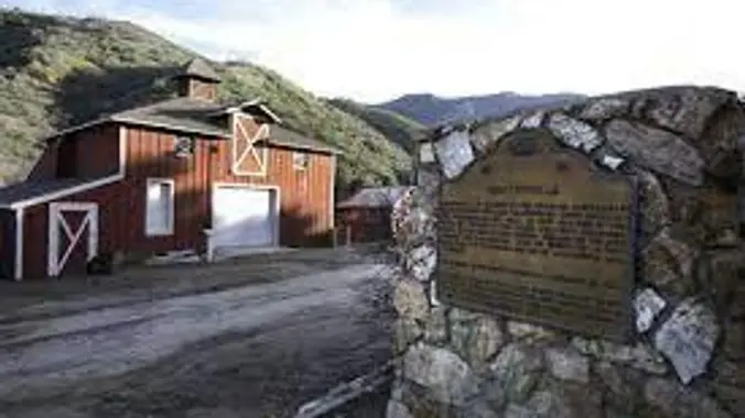
DESCRIPTION: We'll start from Mentryville (a historic SCV site) located at the base of Pico Canyon’s slopes, Mentryville was an 1880’s oil boom town built around its oil well, Pico No. 4. Named for Charles Mentry, historic buildings still stand including a thirteen-room mansion, a one-room schoolhouse, and a barn. Mentryville and Pico No. 4 […]
https://www.alltrails.com/trail/us/california/west-fork-national-scenic-bikeway Hello Fellow Hikers, Okay y'all the rain is back for the weekend. So time to hit the best hike to do in the rain! Why you ask? This is a 14.5 mile hike in the San Gabriel Mountains. This little unknown gem will follow water throughout our whole hike. But we will never have […]
The Natoma Loop Trail is a 1.7 mile lightly trafficked loop located in Woodland Hills. But anything less than a couple miles is not worth getting up for so we’ll extend the loop into the cool side of Mulholland and ramble about a network of secret and little-used trails. We'll visit and take a break […]
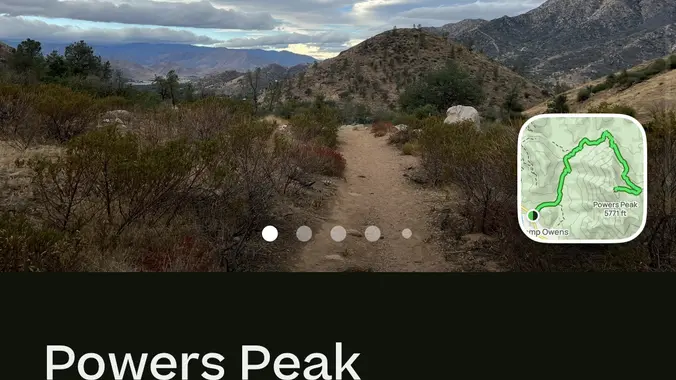
Hey hikernation: Click on the link to see the details of the hike Powers Peak on AllTrails https://www.alltrails.com/trail/us/california/powers-peak?sh=qfndye It’s fun a hike , if your coming from Bakersfield and would like to carpool we can meet at the shell on 178… if not then the start time for the hike will be at 7:30 at […]
I'm excited to do this hike again! This hike is really cool so you should come out and join us! This hike will be about 10 miles with 1,300 ft. of elevation gain. We will start at the same place we do for the falls (Black Star Trailhead). We will take this road all the […]
The hike we will be doing is a loop at about 5.5 miles with 725 ft. of elevation gain. We will meet at the Willow Staging Area that is right off of the 133. We will begin at the trail head of the Laurel Canyon Trail. We will take this to Lizard Trail, then we […]
This hike will be about 5 miles total with 840 ft. of elevation gain. We are starting at the parking lot at the Wahoo's parking lot. We will take Live Oak Trail. This turns into Serrano Road which will take us to Dreaded Hill. We will take a short break at Four Corners. Then we […]
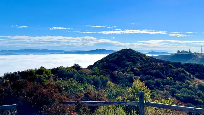
This out-and-back about 7.5-mile hike with an elevation gain/loss of +/-1500’ provides a great overview of the Thousand Oaks area, the ocean and the western Santa Monica Mountains. The first portion is a narrow trail that zigzags its way up to enjoy views of Lang Ranch and Woodridge trails on the north and more. When […]
This hike will be about 5 miles total with 840 ft. of elevation gain. We are starting at the parking lot at the Wahoo's parking lot. We will take Live Oak Trail. This turns into Serrano Road which will take us to Dreaded Hill. We will take a short break at Four Corners. Then we […]
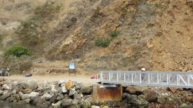
BOOK YOUR PASSAGE ASAP! Reservations fill up fast. Please book your passage before you sign-up with Trailblazers, as the boat may fill-up. The trip by boat lasts a little over an hour leaving Ventura Harbor at 9:00 AM. They want us to be at the dock 45 minutes prior to departure (8:15 AM). Once we […]
DESCRIPTION: SOMETHING NEW AND DIFFERENT FROM YOUR FAVORITE HIKING CLUB – WEEKDAY HIKES! This hike is all gain to the top (especially the heart thumping first mile) and downhill all the way back. We climb on single track through beautiful chapparal (toyan, california bay, yuccas and oaks). Eventually after a mile of oak forest and […]
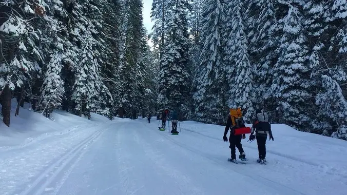
Snowshoes Required: Dates may change depending on weather conditions. Yosemite - Snow Camping (Badger Pass to Dewey Point) Winter transforms Yosemite’s familiar landscapes; exploring in winter is like finding a whole new park. But winter is less forgiving for the wilderness traveller, and some extra precautions are in order. NOT FOR BEGINNERS (We reserve the […]
Snowshoes Required: Dates may change depending on weather conditions. Yosemite - Snow Camping (Badger Pass to Dewey Point) Winter transforms Yosemite’s familiar landscapes; exploring in winter is like finding a whole new park. But winter is less forgiving for the wilderness traveller, and some extra precautions are in order. NOT FOR BEGINNERS (We reserve the […]
https://www.alltrails.com/explore/recording/afternoon-hike-8597a6c--496 Hello Fellow Hikers, We have a request from a fellow hiker to repeat this awesome hike. It has been a bit since we had done this one. We combined to popular hikes into one and it went really well. The only difference we are gonna make, is our starting point. Last time the parking […]
https://www.alltrails.com/explore/recording/afternoon-hike-8597a6c--496 Hello Fellow Hikers, We have a request from a fellow hiker to repeat this awesome hike. It has been a bit since we had done this one. We combined to popular hikes into one and it went really well. The only difference we are gonna make, is our starting point. Last time the parking […]
Many from this group, plus other friends, will attend this event at Sagebrush Cantina. Bad Habit is a great local band that is well known for delivering a wide variety of rock and dance music ranging from the 70's to today. Guaranteed they'll play something you'll like and want to dance to, so join the […]
I've never seen water at Hidden Pond, so let's go check it out. Along the way we will loop around Rancho Potrero Open Space. I believe there is another little pond nearby - we'll check that out also. On the west end of the space is a property that used to be called Olympia Farms, […]
**Must also register here: https://letsgooutside.org/activities/2024/03/09/agua-chinon-and-the-sinks-exploration-19/ We will be hiking around 8.3 miles with about 1,100 ft. of elevation gain. This is an out and back. Start your weekend off by exploring the Agua Chinon wash and the Sinks through this self-guided opportunity. Designated trails will be open for self-guided trail use in OC Parks’ Irvine […]
DESCRIPTION: Hopefully the third time will be a charm ad we'll have good weather! We'll start from Mentryville (a historic SCV site) located at the base of Pico Canyon’s slopes, Mentryville was an 1880’s oil boom town built around its oil well, Pico No. 4. Named for Charles Mentry, historic buildings still stand including a […]
The hike I am planning is around 6.3 miles with about 700 ft. of elevation gain. It starts at the very end of the paved road, the long gray strip that can be seen on the map. We will begin at the Bell Canyon Trail head. We will continue onto that and then take it […]
https://www.alltrails.com/trail/us/california/tapo-canyon-trail?u=i Hello Fellow Hikers, Join me on a easier moderate hike at Tapo Canyon Trail in Simi Valley. This hike has a nice gradual walk until we start a gradual climb were we will start our loop. We should encounter wildflowers and mountain views. Our loop will drop down then we will continue until we […]
https://www.alltrails.com/trail/us/california/tapo-canyon-trail?u=i Hello Fellow Hikers, Join me on a easier moderate hike at Tapo Canyon Trail in Simi Valley. This hike has a nice gradual walk until we start a gradual climb were we will start our loop. We should encounter wildflowers and mountain views. Our loop will drop down then we will continue until we […]
We will start (early to beat the heat) our hike near the beginning of Regal Oak Ct. on the lower Rosewood Trail, a dirt trail heading up a shaded ravine at the base of the mountains, and continue to the usual Rosewood trail. Rosewood trail presents a clear view over the 101 Freeway carving up […]
School traffic and traffic on Topanga Canyon Blvd can make the drive longer than you expect, so please allow enough travel time! Topanga State Park is 36 square miles of natural wonder ensconced within Los Angeles' city limits. Starting at Trippet Ranch, we'll ramble through a shady oak grove favored by mule deer and into […]
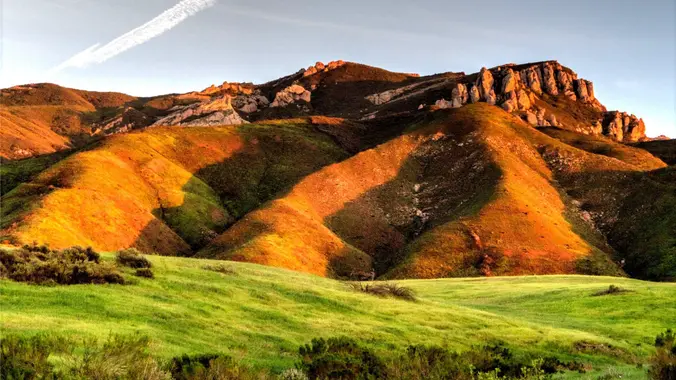
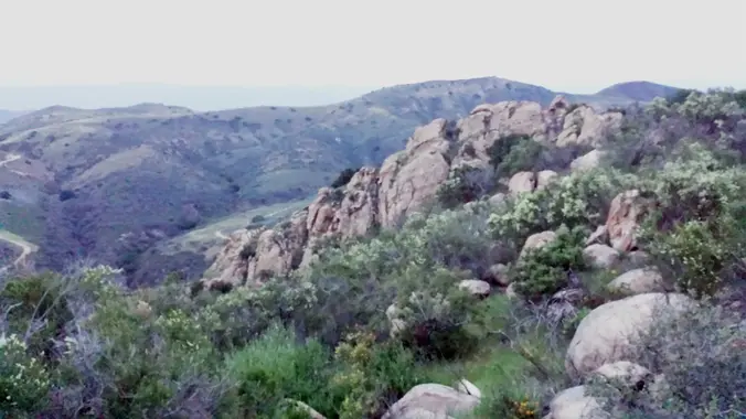
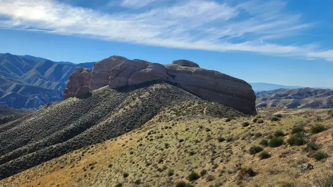
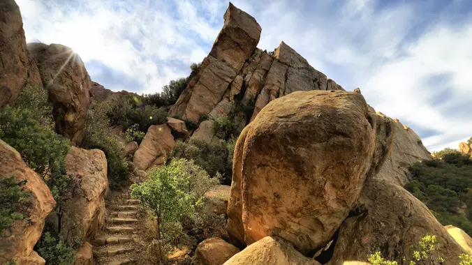
3.2 miles, 900' gain, easy intermediate. The first part is a steady incline, followed by a rolling trail to our destination. Fit beginners can complete this hike, but it will certainly get their blood pumping. There are no super steep sections. This hike takes us to a secret spot below a large rock formation. Naturally […]
INFORMATIONAL POSTING -35th Annual Beginning Backpack Class Have you ever wanted to learn to backpack and get away from the crowds of people? Learn how to backpack in 3 Saturday courses (4/27, 5/4, 5/11) culminating in a backpack 6/1-2. Course times are 10:30 AM - 2:30 PM Learn what to take, latest in equipment, what […]
Meet at the Rosewood sign, which is on the Regal Oak Ct. and Lynn Rd. intersection. The hike is about 5 miles with an elevation gain/loss approximately 900’. We'll walk a short distance on Lynn road to the lower Rosewood Trail, then take the dirt trail up a shaded ravine and continue on the Rosewood […]
This hike will be about 5 miles total with 840 ft. of elevation gain. We are starting at the parking lot at the Wahoo's parking lot. We will take Live Oak Trail. This turns into Serrano Road which will take us to Dreaded Hill. We will take a short break at Four Corners. Then we […]
Three Sisters Rock Via Pacific Crest Trail (PCT) DESCRIPTION: SOMETHING NEW AND DIFFERENT FROM YOUR FAVORITE HIKING CLUB – WEEKDAY HIKES! This is a great Spring hike and yes Springtime is already - more or less - here in SCA (not that we really get too much winter weather). This fun out and back trail […]
We will start in the parking lot of SMMNRA and go up to the monument. We will take this hike at a gentler pace and we will take some breaks to let slower hikers catch up. It is an out and back, however, and you can go at your own pace. This out and back […]
Putting this up to gather interest for an Anza Borrego Trip. I'm thinking about redoing one of my previous trips. All have water at camp. All are tough and have cross country travel (no trail). Bushwhacking Hellhole - Better than it sounds! (tracks from previous trip to camp and waterfall Afternoon hike up to Hellhole […]
We will be playing it by ear a bit, but we will be doing a hike that will be around 5 miles with roughly 800-900 ft. of elevation gain. **You do not need to register on LetsGoOutside.org, but if is optional and you will be emailed extra details and a map. https://letsgooutside.org/activities/2024/03/16/wilderness-access-day-bommer-canyon-117/ Enjoy self-guided access […]
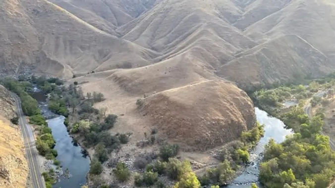
Kern Gateway Trail Proposal The Kern Gateway Trail team is a group of community members who love the Kern River Canyon and are working to create a connected trail in the Kern River Canyon. Join us to hear about and explore a spectacular section of the proposed Kern Gateway Trail. We will do a brief […]
https://www.rsrpd.org/simi_valley/trails/chumash_park_and_trail.php Hello Fellow Hikers, Gonna be doing the Chumash Trail in Simi Valley to the junction of Rocky Peak then make our way back. It's a great moderate hike and a great workout with scenery of rock formations and mountain tops. The Chumash out and back is not on AllTrails but the above website will […]
I have recently learned that there are three waterfalls in Malibu Creek State Park. Two of them are illustrated in the 1983 and 1996 edition of Milt McAuley's Hiking Trails of Malibu Creek State Park 094256829X but there are no directions or trails described. I found the person who took the photograph (several years ago) […]
Wear green! 💚 The hike we will be doing will be around 5 miles long with 875 ft. of elevation gain. This will be a loop starting at the parking lot of Nix Nature Center. As you will see on the map, this is at the main park entrance off of the 133 (Little Sycamore […]
Fit Beginner - 4 miles, 600' gain The gain is well distributed, with half being on the return. We start at the Las Flores trailhead where Las Flores dead-ends at Wildwood Park, and head west. After 1/3 mile, the trail becomes Wildwood Canyon Trail. We continue for another 2/3 mile and cross a bridge just […]
The total distance for this hike is 4.5 miles with about 650 ft. of elevation gain. There are great mountain and ocean views along the ridge. We are going to start on Bommer Ridge Trail and take this to Lizard Trail. We will go down that and loop back up to Bommer via Upper Laurel. […]
This hike begins at Upper Stunt High Trail, a couple hundred feet to the right on the other side of the street from the parking lot. The trail winds upward gradually over switchbacks, giving way as the trail heads up to a dramatic rocky overlook with striking views of the Pacific, Stunt Ranch State Park, […]
NOTE: THIS 9:00 HIKE IS MORE CHALLENGING THAN THE 8:30 HIKE Approximately 7.5 miles, 1,675 foot elevation gain. They start about 1 mile past our start trailhead on Stunt Rd 30 minutes earlier. We are likely to encounter them on the trail. Please adjust your RSVP if you switch hikes, as courtesy to the other […]
Meet at the Rosewood sign, which is on the Regal Oak Ct. and Lynn Rd. intersection. The hike is about 5 miles with an elevation gain/loss approximately 900’. We'll walk a short distance on Lynn road to the lower Rosewood Trail, then take the dirt trail up a shaded ravine and continue on the Rosewood […]
https://a248.e.akamai.net/secure.meetupstatic.com/photos/event/4/5/b/c/event_52757852.jpeg Don't show up unless you're shown on the "Attending" list Unregistered or waitlisted will be turned away No "Plus Ones" on this hike Time to re-explore the Los Robles trail system! This will be a 6 mile salt water taffy hike with approximately 1000 feet of elevation gain. We start at the trailhead at […]
This hike will be about 5 miles total with 840 ft. of elevation gain. We are starting at the parking lot at the Wahoo's parking lot. We will take Live Oak Trail. This turns into Serrano Road which will take us to Dreaded Hill. We will take a short break at Four Corners. Then we […]
Saugus to the Sea Road to Mission Point Trail DESCRIPTION: SOMETHING NEW AND DIFFERENT FROM YOUR FAVORITE HIKING CLUB – WEEKDAY HIKES! This is a fun hike through local woodlands of pine, oak and walnut trees to enjoy views both north and south with other fun hikers. Maybe we’ll even see Spring flowers! Also, you […]
Let's hike a loop through Wildwood and look for spring wildflowers. Wildwood's archetypal western look served as the set for Davy Crocket, The Rifleman, Gunsmoke, and Wagon Train back in the day, as well as the movie Spartacus. This hike takes us from the main parking lot up the Santa Rosa Trail to Mount Clef […]
Movie night …. Location will shared later … it will be a backyard movie night *food , drinks (we will make arrangements once we get closer to the date) Postive vibes only☀️
WEATHER MAY RESCHEDULE OR CANCEL TRIP THIS IS A CAR CAMPING EVENT. !!!DESPERSE CAMPING!!! JUST FYI....this is disperse camping. NO WATER, BATHROOMS, etc. Bring what you need. But we are 11 mins from a Jack n Box/KFC in Ocotillo. Option to visit two Slot Canyons. Calcite Mines (Slots) Slot Canyons of Anza Borrego Sunset @ […]
The hike we will be doing is approximately 5 miles with 870 ft. of elevation gain. We will begin at the Live Oak Trail trailhead. This is where you will see on the map that the Live Oak Trail hits the paved road. This is the parking lot closest to the Edna Spaulding Trail. (There […]
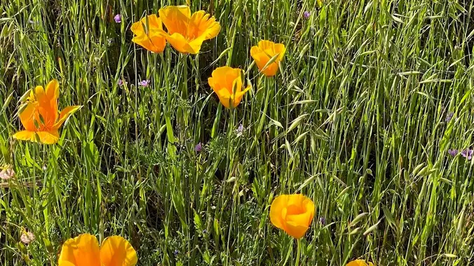
https://www.alltrails.com/trail/us/california/albertson-motorway-and-palo-comado-canyon-loop-via-china-flat-trail (Last time we did this hike the loop was full of poppies it was same time last year so lets hope we can get lucky again ) Hello Fellow Hikers, This is a great time of year to hit this trail. The mountains are so green there's water in the small pond. This route […]
PIER TO PEAK WALKABOUT IN THE DOWNTOWN VENTURA AREA! JOIN THE GROUP WHEN/WHEREEVER YOU CAN/WANT... Times given are my best guesstimate for movement between the stated destinations, including loitering time and may be adjusted slightly as needed throughout the day. Someone in the lead group may post Messages here on where we are during the […]
This hike will be about 7 miles with about 700 ft. of elevation gain. We will start the hike at Cañada Vista Park. From here we will take the Tijeras Creek Trail to the Arroyo Trabuco Trail and use this to loop back to where we started. There will be a few water crossings, so […]
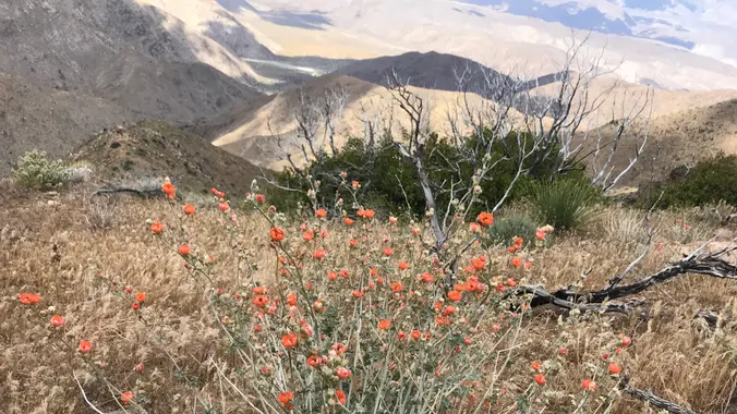
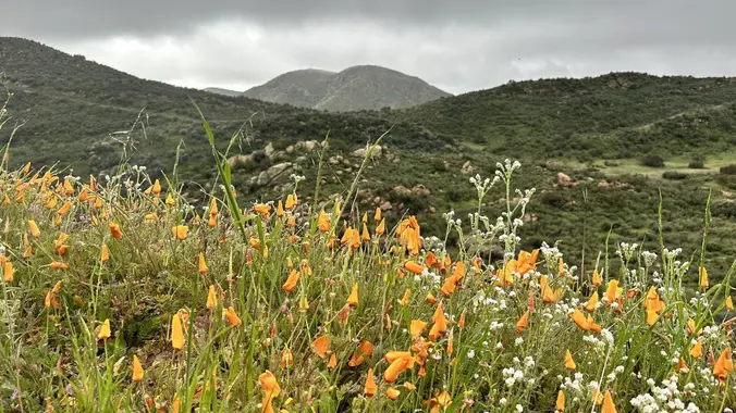
If you have never been here before . . . it worth seeing. If you have been before . . . it's time to revisit. Let's get to the event date first . . . The poppies bloom anywhere from Feb to May. April 15th is usually just right. Placing this in mid-March as it […]
https://www.alltrails.com/trail/us/california/tapo-canyon-trail?u=i Hello Fellow Hikers, Join me on a easier moderate hike at Tapo Canyon Trail in Simi Valley. This hike has a nice gradual walk until we start a gradual climb were we will start our loop. We should encounter wildflowers and mountain views. Our loop will drop down then we will continue until we […]
INFORMATIONAL POSTING -35th Annual Beginning Backpack Class Have you ever wanted to learn to backpack and get away from the crowds of people? Learn how to backpack in 3 Saturday courses (4/27, 5/4, 5/11) culminating in a backpack 6/1-2. Course times are 10:30 AM - 2:30 PM Learn what to take, latest in equipment, what […]
INFORMATIONAL POSTING -35th Annual Beginning Backpack Class Have you ever wanted to learn to backpack and get away from the crowds of people? Learn how to backpack in 3 Saturday courses (4/27, 5/4, 5/11) culminating in a backpack 6/1-2. Course times are 10:30 AM - 2:30 PM Learn what to take, latest in equipment, what […]
This hike will be about 5 miles total with 840 ft. of elevation gain. We are starting at the parking lot at the Wahoo's parking lot. We will take Live Oak Trail. This turns into Serrano Road which will take us to Dreaded Hill. We will take a short break at Four Corners. Then we […]
Wildwood Park in Thousand Oaks is one of the most versatile local parks there is, with 27 miles of trails skittering through rocky cliffs, cacti-filled desert environs, volcanic rock, riparian forest, and a cool, watery canyon. Highlights of the hike include waterfalls incorporating 40’ Paradise waterfalls along with a long creek, Indian caves, volcanic rock […]
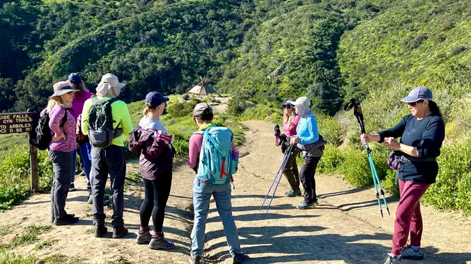
Please review the guidelines to participate in our hikes. Here are some highlights and a link to the guidelines. Restrictions apply for your safety and ours: Don't show up unless you're on the "Attending" list No "Plus Ones" on this hike Plan on sticking with the group, and completing the entire hike at a reasonable […]
INFORMATIONAL POSTING -35th Annual Beginning Backpack Class Have you ever wanted to learn to backpack and get away from the crowds of people? Learn how to backpack in 3 Saturday courses (4/27, 5/4, 5/11) culminating in a backpack 6/1-2. Course times are 10:30 AM - 2:30 PM Learn what to take, latest in equipment, what […]
INFORMATIONAL POSTING -35th Annual Beginning Backpack Class Have you ever wanted to learn to backpack and get away from the crowds of people? Learn how to backpack in 3 Saturday courses (4/27, 5/4, 5/11) culminating in a backpack 6/1-2. Course times are 10:30 AM - 2:30 PM Learn what to take, latest in equipment, what […]
DESCRIPTION: SOMETHING NEW AND DIFFERENT FROM YOUR FAVORITE HIKING CLUB – WEEKDAY HIKES! This is a great local hike on a portion of the Pacific Crest Trail (PCT). We start near Green Valley Ranger station using the PCT heading North. We will cross the fire road leading up to Grass Mtn, stop briefly if it […]
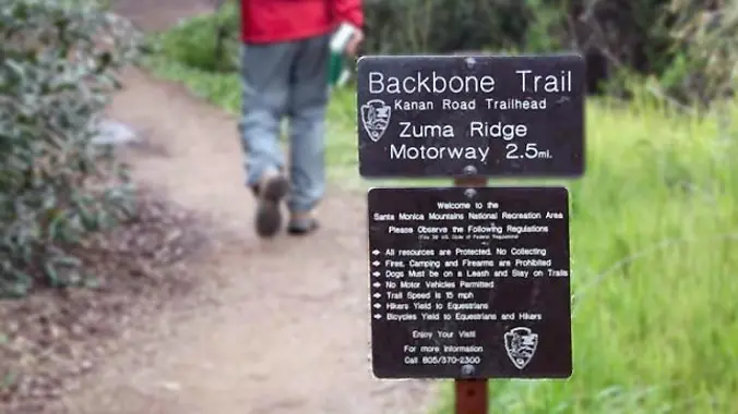
http://photos1.meetupstatic.com/photos/event/b/a/2/4/event_99467652.jpeg From the Kanan Rd trailhead, we'll jump on the Backbone Trail for a cruise down into Newton Canyon. On our way there, we'll cross the creek, pass under an oak canopy, and come out into an opening. At the opening, look toward the sandstone formations in the distance, and maybe you'll see a trickle […]
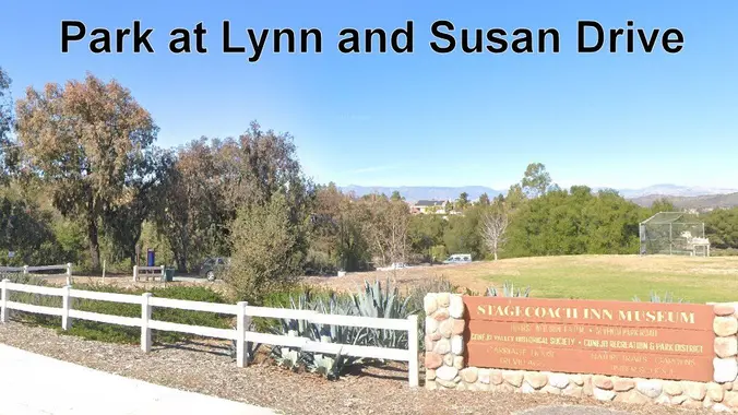
Mike is going to try again since this hike got rained out last time. This is a 4-5 mile out-and-back trip from Lynn Road to the Rosewood Trail to Angel Vista. We’ll park at the playfield near Stagecoach Inn and walk from Lynn Road on the lower Rosewood Trail, to the usual trailhead and then […]
NOTE: This is an alternative hike for Thursday, a little slower but maybe a bit longer. We will take the Los Robles EAST Trail (NOT WEST) and turn around at the 2 1/2 mile marker. We just did the Los Robles West last week. This week we will go EAST and do an in/out of […]
The road to Collins Valley washed out during the hurricane and is still closed to vehicles so this is a great opportunity to do an easy trip. There should still be plenty of flowers. I drove to the closed gate in October and a Subaru could easily make it, not sure about a regular vehicle. […]
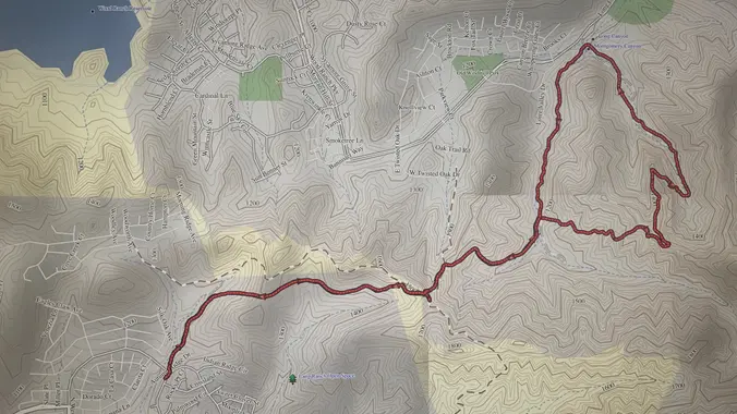
Intermediate/Advanced Hike! Bust out your Trekking Poles and boots with good traction! DESCRIPTION: This is not a trail for the faint of heart, there are also some technical spots with some mild scrambling. Trekking poles are highly recommended. This is about a 6-mile loop that will feel more like 10 when you’re done. The Backbone […]
https://www.alltrails.com/trail/us/california/magic-mountain Hello Fellow Hikers, This little known trail is where Magic Mountain theme park got its name. It's a constant climb that peaks at 4,846 ft. And as per several descriptions, this was once the site of the radar for the nuclear-tipped Ajax missiles in the 1950s. After the missiles were decommissioned, it was used […]
Live Music! Join us for a night of good food, drink, and music. Many from this group, plus other friends, will attend. This venue is indoors. The band starts at 7p, but get there early for good seating. From: https://www.eatplaytopangasocial.com/ 27 of Los Angeles’ most talked about restaurants and niche food brands come together in […]
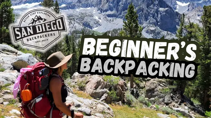
An introduction to backpacking, friendly for total beginners! If this is your first trip, or your 5th trip, you are more than welcome to attend if you have an interest in working on any of the following: How to choose a trail How to prepare How to use your gear How to filter water What […]
Trail statistics are approximate. For safety purposes always assume they are underestimated. But don’t be disappointed if they are overestimated. Bring more water and snacks than you think you’ll need.
Trail descriptions are based on previous hikes. Current conditions are unknown until arrival. Expect the unexpected and plan accordingly.
The Organizers and members of Hiking With Dean are not professional leaders, guides, or mountaineers. The function of the member or organizer is only to organize the trip. Each person who shows up for a trip/meetup (and their guest or guests) is responsible for his or her own safety. By attending a hike, or any other event organized by this group, you are acknowledging that you and any guests that you bring are aware of the risks, dangers and hazards associated with the activity and freely accept and fully assume all such risks, dangers and hazards, and further agree to release and discharge the Organizers, Members of the Hiking With Dean Meetup Group from and against any and all liability arising from your participation in the group activities per our ASSUMPTION OF RISK AND LIABILITY WAIVER and Section 6.2 of the Meetup.com Terms of Service.


Recent Comments