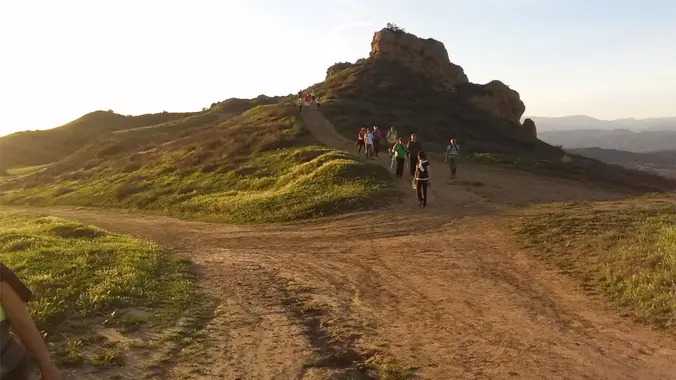
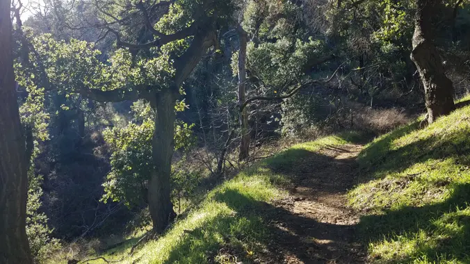
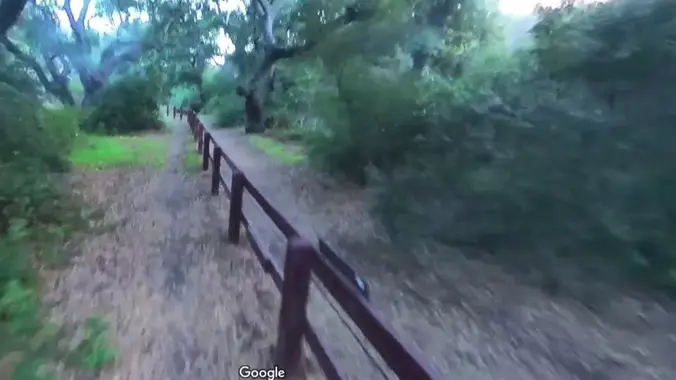
The total distance for this hike is 4.5 miles with about 650 ft. of elevation gain. There are great mountain and ocean views along the ridge. We are going to start on Bommer Ridge Trail and take this to Lizard Trail. We will go down that and loop back up to Bommer via Upper Laurel. […]
Join us on an out and back hike up the Ray Miller Trail and the Overlook Trail. We’ll enjoy beautiful ocean views as we descend. We'll pick up about 1300’ gain on this 7 mile adventure. Lying along the brilliant blue Pacific Ocean at the west end of Malibu (just shy of Port Hueneme), the […]
4.3 miles, 800' gain, Easy Intermediate. Easier Option: 3.2 miles, 400' gain, Fit Beginner. The address is not the address of the hike, but a nearby address that should get you to pass by the trailhead. The "cc" in the title means counter clockwise. We'll be stopping at various points to regroup. We will start […]
Please note this hike will start at the trailhead we use for the Boney Hike (junction of South Wendy Drive and Portrero Road). We will take the single track trail about one-half mile to where the Angel Vista TH begins to add about an extra mile to the hike. Hoping to get back before it […]
Another HWD Original! The HWD Ranch is located within the stunning Hidden Creeks parkland near the confluence of Browns Creek and Mormon Creek. The parkland provides a key migration corridor and perennial water source to a full complement of large mammals including black bear, mountain lion, mule deer, bobcat, American badger, grey fox, long-tailed weasel, […]
This hike will be about 5 miles total with roughly 900 ft. of elevation gain. We are starting at the parking lot at the Wahoo's parking lot. We will take Live Oak Trail. This turns into Serrano Road which will take us to Dreaded Hill. We will take a short break at Four Corners. Then […]
This loop hike is about 5 miles with about 800' of total elevation gain, spread out nicely, with a little bonus loop through Oak Creek Canyon. "Robles" is Spanish for oaks, and we'll see plenty of them on this beautiful, hike. Trailhead Directions: From the 101 in Thousand Oaks, turn south on Moorpark Road. Drive […]
I know . .. super short notice. But if you can . . . yay. And ADDED bonus is Wildflowers will be in bloom all over! This event has TWO options . . . (or three). Option ONE: Camping Fri and Sat Night, and Hiking on Sat The itinerary: Fri (eve): Arrive AFTER 3 PM […]
Join us for our fourth hike in the 2024 Saturdays in the Santa Monica Mountains, a moderate 10-mile, 2500' gain loop hike in the Santa Susana Mountains. We will hike on the Chumash to Humming Bird trails to Rocky Peak (2715') with spectacular views overlooking Simi Valley and of Paeloscene rock structures and natural caves. […]
Pacific Crest Trail to Martindale Ridge DESCRIPTION: This hike is another one of my local favorites, close to suburbia but feels like miles away. The hike is entirely on the well-maintained Pacific Crest Trail (PCT), that goes from Mexico to Canada. We will start at 3320' and enjoy mainly a gentle gain that PCT is […]
See the hike report from last year's trip: https://www.hikingwithdean.com/mission-point-the-hard-way O’Melveny Park spreads over 672 acres, second on the list of largest parks within the City of Los Angeles, right after Griffith Park. Noted for its picture-perfect picnic grounds with white fences and towering eucalyptus trees, O’Melveny Park also challenges hikers with several miles of steep, […]
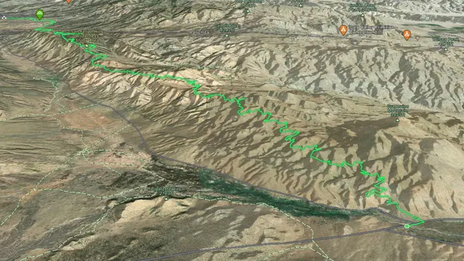
April 8th 2024 is the last total eclipse in the lower 48 until 2044. What better way to experience it than on a backpacking trip? The Eagle Rock Loop is very close to the center and will experience 4 minutes of total eclipse. Eagle Rock Loop 27 miles 4100 feet USFS Guide Alltrails FarOut Good […]
Windwolves will have a festival on April 6th and 7th. I will be there on Sunday the 7th at 8am to do a short hike then attend the festival at 10am. (4-6 mile hike)
The hike I am planning is around 6.3 miles with about 700 ft. of elevation gain. It starts at the very end of the paved road, the long gray strip that can be seen on the map. We will begin at the Bell Canyon Trail head. We will continue onto that and then take it […]
https://www.alltrails.com/trail/us/california/tapo-canyon-trail?u=i Hello Fellow Hikers, Join me on a easier moderate hike at Tapo Canyon Trail in Simi Valley. This hike has a nice gradual walk until we start a gradual climb were we will start our loop. We should encounter wildflowers and mountain views. Our loop will drop down then we will continue until we […]
Today we'll hike the Backbone Trail looking for wildflowers. We'll begin at Latigo Canyon and walk on dirt and stuff until we reach the familiar sandstone structures of Mesa Peak Motorway. Along the way, we'll cross Castro Crest and descend into Upper Solstice Canyon before we climb to Mesa Peak Motorway, at the top of […]
Let's try Ray Miller Trail after last week’s rain. The trail is an awesome blend of ocean and mountain views in Malibu’s La Jolla Canyon. We will start from the trailhead which follows the canyon eastward, away from the ocean. Then, it quickly brings you back toward the ocean at a gradual incline. There’s a […]
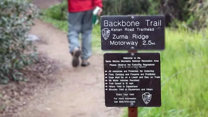
This is an easier hike for Tuesday, another has also been posted close by, please only sign up for one hike. This hike is only 5 miles and will take us on a less-traveled but quite beautiful part of the 67-mile Backbone Trail, which runs through the Santa Monica Mountains National Recreation Area from Will […]
INFORMATIONAL POSTING -35th Annual Beginning Backpack Class Have you ever wanted to learn to backpack and get away from the crowds of people? Learn how to backpack in 3 Saturday courses (4/27, 5/4, 5/11) culminating in a backpack 6/1-2. Course times are 10:30 AM - 2:30 PM Learn what to take, latest in equipment, what […]
INFORMATIONAL POSTING -35th Annual Beginning Backpack Class Have you ever wanted to learn to backpack and get away from the crowds of people? Learn how to backpack in 3 Saturday courses (4/27, 5/4, 5/11) culminating in a backpack 6/1-2. Course times are 10:30 AM - 2:30 PM Learn what to take, latest in equipment, what […]
Meet at the Rosewood sign, which is at the Regal Oak Ct. and Lynn Rd. intersection. The hike is about 5 miles with an elevation gain/loss approximately 900’. We'll walk a short distance on Lynn road to the lower Rosewood Trail, then take the dirt trail up a shaded ravine and continue on the Rosewood […]
http://photos1.meetupstatic.com/photos/event/e/3/a/0/event_167038272.jpeg This hike has some rocky parts, but no scrambling. This hike will take us on a scenic trip from the suburbs of Oak Park to the top of Simi Peak, which overlooks both the Simi and Conejo Valleys and offers splendid views of the Santa Monica range and offshore islands to the south and […]
DESCRIPTION: SOMETHING NEW AND DIFFERENT FROM YOUR FAVORITE HIKING CLUB – WEEKDAY HIKES! This hike is all gain to the top (especially the heart thumping first mile) and downhill all the way back. We climb on single track through beautiful chapparal (toyan, california bay, yuccas and oaks). Eventually after a mile of oak forest and […]
This hike will be about 5 miles total with 840 ft. of elevation gain. We are starting at the parking lot at the Wahoo's parking lot. We will take Live Oak Trail. This turns into Serrano Road which will take us to Dreaded Hill. We will take a short break at Four Corners. Then we […]
Palo Comado ("Burnt Stick" in Spanish) tells you a lot about the environs - frequently burned over by wildfires, this was directly in the line of the Woolsey Fire but much of the vegetation has re-grown. This is one of many routes from the Conejo Valley to China Flat. Except for one turn near the […]
Many from this group, plus other friends, will attend Sagebrush Cantina's 50th Anniversary Party, with "Escape", Journey Tribute band. Note the Hiking Plus time (8p) is an hour later than our prior events at this location, because the band starts an hour later. We'll be in the outdoor area without reserve seating, which is tough […]
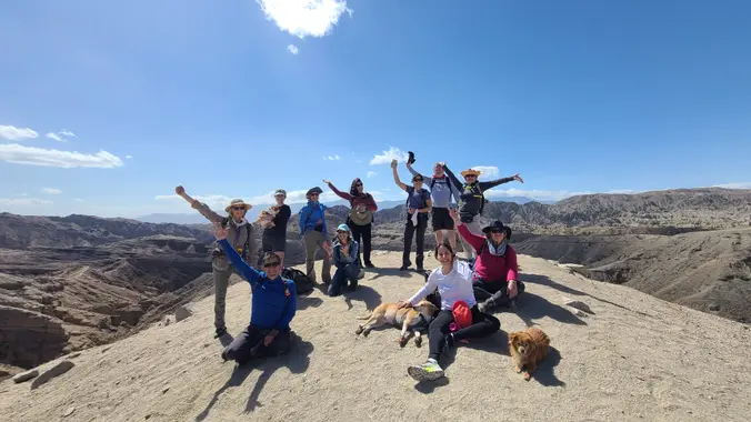
I'm excited to do another hike to the Sinks! This is an event through the Irvine Ranch Conservancy, so you must register at the below link as well. https://letsgooutside.org/activities/2024/04/13/limestone-canyon-weekend-hike-to-both-sinks-7/ The hike will be 10 miles with 1,000 ft. of elevation gain. Join us on this fast-paced hike over the ridge and the through beautiful Limestone […]
Come join us as we hike the entire Backbone Trail (67 miles) in eight hikes over four consecutive weekend Saturdays and Sundays. Our first Backbone Trail hike in the Santa Monica Mountains will be 10 miles with 2000 elevation gain on the BBT from the start at Will Rogers Park. We will first hike up […]
Intermediate/Advanced Hike! Bust out your Trekking Poles and boots with good traction! DESCRIPTION: This is not a trail for the faint of heart, there are also some technical spots with some mild scrambling. Trekking poles are highly recommended. This is about a 6-mile loop that will feel more like 10 when you’re done. The Backbone […]
Our second Backbone Trail hike in the Santa Monica Mountains will be 8 miles on the BBT with 1000 elevation gain from Skull Rock to Trippet Ranch. We will start at the Skull Rock Trailhead taking the Temescal Ridge Trail for 3 miles to pick up the Backbone Trail. We will than take the BBT […]
The hike we will be doing will be around 5 miles long with 875 ft. of elevation gain. This will be a loop starting at the parking lot of Nix Nature Center. As you will see on the map, this is at the main park entrance off of the 133 (Little Sycamore Canyon Staging Area). […]
4.2 miles, 700' gain, easy-intermediate. Easier option: 2.7 miles, 500' gain, fit beginner. This is a pot-luck hike. We'll be stopping at the 3/4 point by a picnic table, so please bring food and drink to share, and any utensils your items might require. You may wish to bring your own cup, plate, and utensils […]
We will start (early to beat the heat) our hike near the beginning of Regal Oak Ct. on the lower Rosewood Trail, a dirt trail heading up a shaded ravine at the base of the mountains, and continue to the usual Rosewood trail. Rosewood trail presents a clear view over the 101 Freeway carving up […]
Encinal Canyon is named for encina, the Spanish word for the holm oak, a lovely Mediterranean tree with holly characteristics. Holm oaks are one of the main trees used to establish truffle orchards, but we'll be nosing around the canyon strictly for its beauty. The trail from Encinal is a smooth, firm, and well-traveled single […]
This is an alternative hike for Tuesday, and not quite as fast-paced as the other hike. We're only going 5 miles to the fire road. From the Kanan Rd trailhead, we'll jump on the Backbone Trail for a cruise down into Newton Canyon. On our way there, we'll cross the creek, pass under an oak […]
Meet at the Rosewood sign, which is at the Regal Oak Ct. and Lynn Rd. intersection. The hike is about 5 miles with an elevation gain/loss approximately 900’. We'll walk a short distance on Lynn road to the lower Rosewood Trail, then take the dirt trail up a shaded ravine and continue on the Rosewood […]
Please read these restrictions before signing up. Don't show up unless you're shown on the "Attending" list Unregistered or waitlisted will be turned away No "Plus Ones" on this hike We will go to our overlook on Boney for a beautiful 360 degree viewpoint. We will have a good time hiking through the area and […]
This hike will be about 5 miles total with 840 ft. of elevation gain. We are starting at the parking lot at the Wahoo's parking lot. We will take Live Oak Trail. This turns into Serrano Road which will take us to Dreaded Hill. We will take a short break at Four Corners. Then we […]
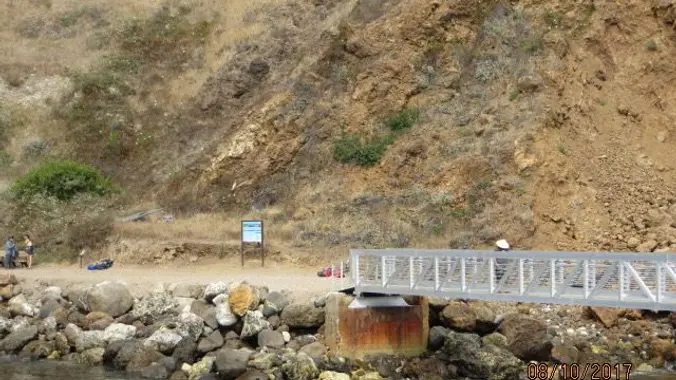
Okay, we are rescheduling this trip for April 18, the weather should be better. The water was too chopping on March 7 so they cancelled. Perhaps those who had booked for March 7 could transfer their tickets for April 18 but please contact Island Packers today. Please book your passage before you sign-up with Trailblazers, […]
Let's head out to the famed Peace, Love, Joy arch at the Danielson. This out and back hike wanders through grasslands and chaparral from the Rancho Sierra Vista trailhead, then climbs up Danielson fire road for some fantastic views north to Port Hueneme and Oxnard and west toward the Pacific Ocean. If it's really clear, […]
INFORMATIONAL POSTING -35th Annual Beginning Backpack Class Have you ever wanted to learn to backpack and get away from the crowds of people? Learn how to backpack in 3 Saturday courses (4/27, 5/4, 5/11) culminating in a backpack 6/1-2. Course times are 10:30 AM - 2:30 PM Learn what to take, latest in equipment, what […]
Many from this group, plus other friends, will attend this event at Sagebrush Cantina. The band playing (Hindsite) puts on a fantastic show, playing dance, pop, r&b/funk, and hip hop music from the 70's up to the latest hits. This is one of the best venues I've experienced on LA's west side, and this is […]
Come explore the Santa Barbara backcountry in the San Rafael Wilderness. 4/20 Meet at 8:30am at Manzana Schoolhouse trailhead. Hike about 8 miles with 365’ gain to the old schoolhouse and setup camp. Hang out 4/21 Pack up and hike out the same way. Optional lunch stop in Santa Barbara The trail requires several creek […]
DEPARTURE TIME: 10:00AM. As with all San Diego Backpacker Events, this hike will start at the designated time. Please arrive 10 minutes early to allow for parking and introductions. ABILITY LEVEL: Beginner level. These are merely descriptions of the hike, not a recommendation nor any assurance that it is suitable for your skill level. DISTANCE/DURATION […]
Our third Backbone Trail hike in the Santa Monica Mountains will be 7 miles with 2000’ elevation gain on the BBT from Topanga Canyon to the Lois Ewen Overlook. We will hike from Trippet Ranch to behind Topanga Canyon School passing across Old Topanga Canyon Road to take Hondo Canyon and then the Fossil Ridge […]
Pacific Crest Trail To Three Sisters Rock DESCRIPTION: This is a great SPRING hike and yes Spring is already here in SCA. This fun out and back trail has sweeping panoramas and if we’re lucky wildflower blossoms! We’ll start on the PCT and use a service road to get to the Three Sisters Rock. There […]
The hike will be about 5.7 miles with about 700 ft. of elevation gain. We will start on Peters Canyon Trail and take this to East Ridge View Trail. This is where we will go up Big Red. Then we will continue on this trail until we get to Eucalyptus to loop back. We will […]
Our fourth Backbone Trail hike in the Santa Monica Mountains will be 7 miles with 600” elevation gain on the BBT going from Lois Ewen Overlook to the Malibu Creek Backbone Trailhead. The hike will climb past Saddle Peak and then descend along the Saddle Peak Trail crossing Piuma Road to the Piuma Ridge Trail […]
The hike we will be doing will be around 5 miles long with 875 ft. of elevation gain. This will be a loop starting at the parking lot of Nix Nature Center. As you will see on the map, this is at the main park entrance off of the 133 (Little Sycamore Canyon Staging Area). […]
3.0 miles, 800' gain, easy-intermediate. Moonrise 5:41pm Photo Credit to Jonathan :) Let's enjoy the gorgeous sunset and the full moon, and fun loaded potluck picnic at the beautiful Angel Vista! This is a potluck hike. Please bring food, drinks to share. If your item requires utensils/plates/toothpicks, etc., please bring them. You may wish to […]
The total distance for this hike is 4.5 miles with about 650 ft. of elevation gain. There are great mountain and ocean views along the ridge. We are going to start on Bommer Ridge Trail and take this to Lizard Trail. We will go down that and loop back up to Bommer via Upper Laurel. […]
This hike starts at Castillo Trail to Wildwood Park. In the spring, it’s spectacular with an abundance of mustard greens, wildflowers and California poppies in addition to bountiful water in the waterfalls and creeks. Wildwood Park in Thousand Oaks is one of the most versatile local parks with 27 miles of trails skittering through this […]
Hike Description (Intermediate/Strenuous) We will be hiking through the eastern most portion of Malibu Creek State Park, up to the rarely seen, North East backside of Castro Crest - via the Bulldog fire road. The views are stunning, all the way to the top, with sandstone monoliths casting dramatic shadows across the land. This hike […]
Please follow the written directions below as the map may not be correct. Our Out And Back (OAB) hike will take us on a less-traveled but quite beautiful part of the 60-mile Backbone Trail, which runs through the Santa Monica Mountains National Recreation Area from Will Rogers State Park in the east to Point Mugu […]
This hike will be about 5 miles total with 840 ft. of elevation gain. We are starting at the parking lot at the Wahoo's parking lot. We will take Live Oak Trail. This turns into Serrano Road which will take us to Dreaded Hill. We will take a short break at Four Corners. Then we […]
NOTE: We will leave from the Greenmeadow Parking lot and NOT from the Moorpark Lot. There will be another hike posted for Thursday, so no rush to sign-up. Our hike leaves from Greenmeadow Trailhead (a.k.a. Braille Trail). This hike will be an IN/OUT on the Los Robles West Trail. We will go out 2 1/2 […]
Time to re-explore the Los Robles trail system. This will be about a 5-6 mile lollipop hike with approximately 700-1000 feet of elevation gain. We start at the trailhead at the back parking lot of Triunfo Park and go up to the Los Robles trail. We then loop around counter-clockwise by way of the White […]
Have you ever head of Sunken City? It's a real place. Have you ever even heard of a Grunion? The are unique to SoCal. Have you ever heard of The Big Lebowski? They filmed a main scene at Sunken City Have you heard of The Usual Suspects? They filmed a main scene at The Korean […]
Come explore the Santa Barbara backcountry in the San Rafael Wilderness. 4/27 Meet at 8:30am at Nira campground . Hike about 6.5 miles with 1,500’ gain to Manzana Narrows and setup camp. Hang out. There is a creek by camp. The weather should be warm enough to take a dip. 4/28 Pack up and hike […]
Our fifth Backbone Trail hike in the Santa Monica Mountains will be l0 miles with 2000’ elevation gain on the BBT going from the Tapia Park area to the Latigo Canyon Trailhead. We will take the Mesa Peak Trail though the upper Corral and Solstice Canyon areas. Bring water, snacks, sunscreen, and a good attitude. […]
The hike we will be doing is approximately 5 miles with 870 ft. of elevation gain. We will begin at the Live Oak Trail trailhead. This is where you will see on the map that the Live Oak Trail hits the paved road. This is the parking lot closest to the Edna Spaulding Trail. (There […]
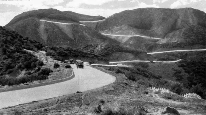
There is a lot of history on this ride. Many of you probably already know something about Route 99, and some of you who grew up in the West San Fernando Valley are probably familiar with the Knapp family. I will have a more to say about that in the coming days but I did […]
We are going to be starting at the Canyon View Staging Area. This hike will be about 6.2 miles with around 1,000 ft. of elevation gain. We will be starting at Canyon View Park and taking Cholla up to West Ridge and comic down Mathis. Link to Parking from Google Maps: https://www.google.com/maps/place/Canyon+View+Staging+Area/@33.585273,-117.7465062,17z/data=!3m1!4b1!4m5!3m4!1s0x80dce61b6bd45c2d:0x5ef3f1ad687cc8b5!8m2!3d33.585273!4d-117.7443175 Dogs are not […]
Our sixth Backbone Trail hike will be 7 miles with 700’ gain on the BBT through Newton, Zuma, and Trancas Canyons. We will start at the Latigo Canyon Trailhead taking the Backbone Trail across Kanan Road then taking the Zuma Canyon Trail over to Encinal Canyon. Bring water, snacks, sunscreen, and a good attitude. Rain, […]
https://www.alltrails.com/trail/us/california/tapo-canyon-trail?u=i Hello Fellow Hikers, Join me on a easier moderate hike at Tapo Canyon Trail in Simi Valley. This hike has a nice gradual walk until we start a gradual climb were we will start our loop. We should encounter wildflowers and mountain views. Our loop will drop down then we will continue until we […]
The total distance is around 4.6 miles with 870' of elevation gain. We will take Boat Canyon Trail up to Bommer Canyon. We will take Bommer to Water Tank trail. We will take this and then take a lower trail back to the beginning. Address: Dartmoor Trail Lookout Laguna Beach, CA 92651 https://goo.gl/maps/6N8c88XfdSeYu85M8 Dogs are […]
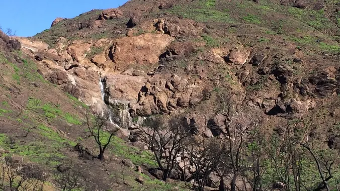
Let's go see what's in bloom in one of our favorite hiking spots, Newton Canyon to Buzzard's Roost! This area was burned over in the Woolsey fire, but since then it has been thick with wildflowers, freely flowing water, and a few waterfalls, including the Upper Newton Canyon falls, above. Last spring, we saw lupines, […]
This is a second hike for Tuesday. We did this hike a few weeks ago but this time we will go the opposite direction. We will start at the parking area in Hill Canyon, cross the bridge over the runoff creek and follow that trail past the Western Plateau turn and keep on the Hawk […]
Our Out And Back (OAB) hike will take us on a less-traveled but quite beautiful part of the 60-mile Backbone Trail, which runs through the Santa Monica Mountains National Recreation Area from Will Rogers State Park in the east to Point Mugu in the west. The route begins at Kanan Dume Road and goes southerly […]
Ornithologist and multispecies expert Dr. Julie Morley will kick off COSF's 2024 speaker series at 7:00 p.m. on May 1 with a videoconference presentation on how you can help the Hummingbirds. She will discuss how to create a hospitable hummingbird habitat in your backyard, how to choose and maintain healthy feeders, and which species you’re […]
The hike we will be doing is a loop at about 5.5 miles with 725 ft. of elevation gain. We will meet at the Willow Staging Area that is right off of the 133. We will begin at the trail head of the Laurel Canyon Trail. We will take this to Lizard Trail, then we […]
http://photos4.meetupstatic.com/photos/event/d/e/9/6/event_99896982.jpeg Don’t be left behind for this hike or we will giggle when you come racing down the street to catch up! We are starting this Wildwood hike from Wildwood Avenue NOT Wildwood Park. One of many ways to experience versatile Wildwood Park, we'll start on the ridge, and travel down to the Santa Rosa […]
This is a second Gentler Hike on Thursday. It will also be at Wildwood, but starting from the main parking lot. Wildwood Park in Thousand Oaks is one of the most versatile local parks there is, with 27 miles of trails skittering through rocky cliffs, cacti-filled desert environs, volcanic rock, riparian forest, and a cool, […]
Come join the 19th annual Backbone Trek, hosted by the Santa Monica Mountains Trails Council! For a fee of $550 this guided event includes camping every night in a State Park campground, transportation to and from the trailheads and all your meals. You will need to provide your own camping gear (tent, sleeping bag, etc) […]
Backbone Trail Trek Saturday-to-Saturday May 4th - May 11th Gear up at the Amazon Hiking & Camping store Here is an opportunity to hike the 67 mile Backbone Trail end to end in 7 days. Registration is now open for The Santa Monica Mountains Trails Council BBT Trek for 2024. For more info go to […]
Our seventh Backbone Trail hike in the Santa Monica Mountains is 10 miles with 1400’ elevation gain on the BBT. We will take the Etz Meloy Trail, the newest addition to the BBT, starting at the Encinal Canyon trailhead. We will cross the Mulholland Highway and then take the Etz Moloy Trail, with views of […]
DESCRIPTION: This is a great local hike on a portion of the Pacific Crest Trail (PCT). We start near Green Valley Ranger station using the PCT heading North. We will cross the fire road leading up to Grass Mtn, stop briefly if it is clear to enjoy the views of the Mojave Desert and Tehachapi. […]
Join our Facebook group: https://www.facebook.com/groups/hikingwithdean/ We've been following the footsteps of ET since 2008 with the original HWD ET hike and its become one of our most popular hikes. We’ll be hiking on a section of the The Palisades featured in the movie, and will take our snack break at “E.T. Park” (Aliso Canyon Park) […]
Our eighth Backbone Trail hike in the Santa Monica Mountains will be 17 miles on the BBT on the Sandstone Peak, Chamberlain, Blue Canyon, Wood Canyon, and Ray Miller Trails before finishing the La Jolla Campground. This is a Sierra Club hike, so participants must sign in, carry their medical form, and hike between the […]
This hike will be about 5 miles total with 840 ft. of elevation gain. We are starting at the parking lot at the Wahoo's parking lot. We will take Live Oak Trail. This turns into Serrano Road which will take us to Dreaded Hill. We will take a short break at Four Corners. Then we […]
Happy Cinco de Mayo!! Let's celebrate together! Easy-Intermediate, 4 miles, 800' gain. Option not to hike: If for some reason you don't want to hike but still want to come, the social event can be driven to, and the main group of hikers should get there about an hour after we begin: 23601 W Red […]
Trail statistics are approximate. For safety purposes always assume they are underestimated. But don’t be disappointed if they are overestimated. Bring more water and snacks than you think you’ll need.
Trail descriptions are based on previous hikes. Current conditions are unknown until arrival. Expect the unexpected and plan accordingly.
The Organizers and members of Hiking With Dean are not professional leaders, guides, or mountaineers. The function of the member or organizer is only to organize the trip. Each person who shows up for a trip/meetup (and their guest or guests) is responsible for his or her own safety. By attending a hike, or any other event organized by this group, you are acknowledging that you and any guests that you bring are aware of the risks, dangers and hazards associated with the activity and freely accept and fully assume all such risks, dangers and hazards, and further agree to release and discharge the Organizers, Members of the Hiking With Dean Meetup Group from and against any and all liability arising from your participation in the group activities per our ASSUMPTION OF RISK AND LIABILITY WAIVER and Section 6.2 of the Meetup.com Terms of Service.


Recent Comments