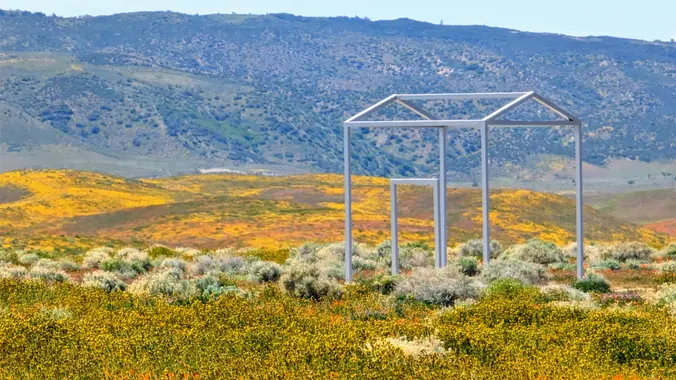
We'll do a 20+ mile ride on the dirt roads that are next to the Antelope Valley Poppy Preserve. Right now, this is possibly the best place to see poppies. Though I've only ridden on Avenue G once, it looks like a great place to start. Hence this is also exploratory. You've been warned. The […]
This hike begins at Upper Stunt High Trail, a couple hundred feet to the right on the other side of the street from the parking lot. The trail winds upward gradually over switchbacks, giving way as the trail heads up to a dramatic rocky overlook with striking views of the Pacific, Stunt Ranch State Park, […]
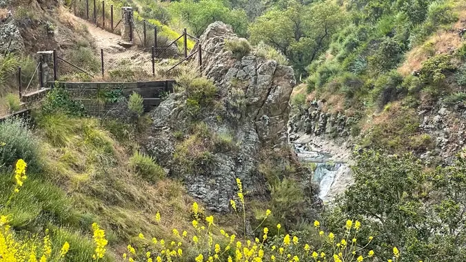
Encinal Canyon is named for encina, the Spanish word for the holm oak, a lovely Mediterranean tree with holly characteristics. Holm oaks are one of the main trees used to establish truffle orchards, but we'll be nosing around the canyon strictly for its beauty. The trail from Encinal is a smooth, firm, and well-traveled singletrack- […]
Easy Intermediate, 4.5 miles, 600' gain Easier Option, 3.5 miles, 460' gain This is a unique loop through Wildwood Park that takes us to the famous Lizard Rock. There are several extended inclines and a few short but steep climbs that cause this to be rated on the easy end of the intermediate spectrum. Beginners […]
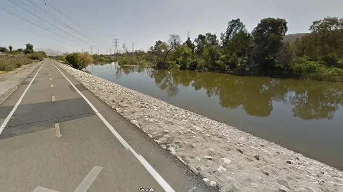
BIKE RIDE ALONG THE RIO HONDO & SAN GABRIEL RIVERS This is a chance for those with regular bikes to join me as we ride along relatively flat bike paths for the most parts. Make sure you bring along a spare inner tube and have your tires inflated before arriving. MEETUP LOCATION AND TIME: 9:00 […]
This side of the park is back open! I'm excited to be back. This hike will be about 5.4 miles total with 820 ft. of elevation gain. We are starting at the parking lot at the Wahoo's parking lot. We will take Live Oak Trail. This turns into Serrano Road which will take us to […]
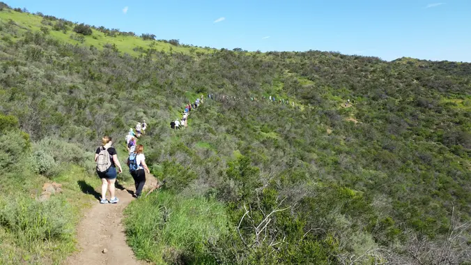
For those of you who missed this hike last week, here's another chance. There may be more than one hike posted for Thursday - please only sign up for one! And if you can't make it, please cancel as early as possible so waitlisted folks can get notice and attend. See the photos for vignettes […]
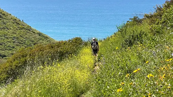
This is a second hike for Thursday because the first one if full. We will go up the Ray Miller trail to the fire road and back, about 6 miles. We may see poppies and other flowers. We’ll enjoy beautiful ocean views as we descend. Lying along the brilliant blue Pacific Ocean at the west […]
I have cancelled this hike today, I think the ground will be too wet. Directions: From Los Angeles, take the Pacific Coast Highway (PCH) north, 22 miles from Malibu Canyon Rd. Across the street from Thornhill Broome Beach is the entrance to La Jolla Canyon. It is very clearly marked. Turn right. From Ventura, take […]
EBIKE RIDE NEAR FIGUEROA MTN. TO VIEW THE WILD FLOWERS AND CELEBRATE CINCO DE MAYO AFTERWARDS By May 5th, the area around Figueroa Mountain should be in full bloom since the higher elevations bloom later than the lower valleys. If not, the views along the way will make for a great ride. Half the route […]
Details This is a beginner hike with a tad bit of challenge due to gains and a tad bit of scrambling and bush whacking. *** Safety Note: Rain or Extreme Heat at trailhead cancels hikes. Meetup Time: 7:15 A.M. (We hit the trail at 7:30) DISTANCE: 5 miles - out and back GAIN: 863 ft […]
Let's enjoy another Open Access Day! This is where we get to explore trails that are normally closed off to the public. The plan is to a loop that's 3.5 to 4 miles with around 550 ft. of elevation gain. Since this is shorter, the plan is to take our time and explore. You don't […]
The hike we will be doing is approximately 5 miles with 870 ft. of elevation gain. We will begin at the Live Oak Trail trailhead. This is where you will see on the map that the Live Oak Trail hits the paved road, right off of the parking lot marked P. This is the parking […]
The total mileage for this hike is 4.5 miles with about 460 ft. of elevation gain. We will start at the trail head of the Borrego Trail, which is right off of the parking lot. This is where we will meet. We will head up the Borrego Trail until we get to the Red Rock […]
O’Melveny Park spreads over 672 acres, second on the list of largest parks within the City of Los Angeles, right after Griffith Park. Noted for its picture-perfect picnic grounds with white fences and towering eucalyptus trees, O’Melveny Park also challenges hikers with several miles of steep, backcountry fire roads and primitive trails. Normally our hike […]
https://www.alltrails.com/trail/us/california/tapo-canyon-trail?u=i Hello Fellow Hikers, Join me on a easier moderate hike at Tapo Canyon Trail in Simi Valley. This hike has a nice gradual walk until we start a gradual climb were we will start our loop. We should encounter wildflowers and mountain views. Our loop will drop down then we will continue until we […]
Trekking poles recommended for this one: https://www.hikingwithdean.com/shop/amazon-top-10/ Today we will extend the classic version of my Heartbreak Hill loop in the Liberty Canyon Preserve. They don't call the hill "Heartbreak" for nothing. The first half mile contains a 500 ft elevation gain. The next couple miles has adds another few hundred feet along rolling hills. […]
I pre-hiked the trail this morning. The name “Zuma” is derived from the Chumash language and means “abundance.” There is an absolute abundance of beautiful and spectacular wildflowers engulfing the entire area and it appears that there was no impact from the Woolsey fire other than a few remnants of burnt trees. We will start […]
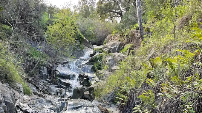
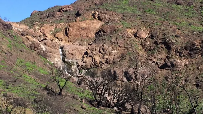
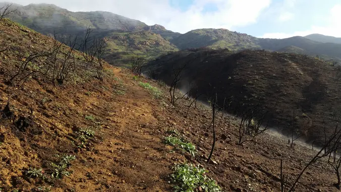
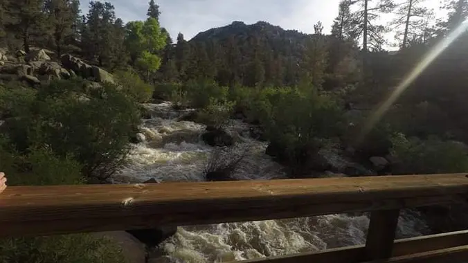
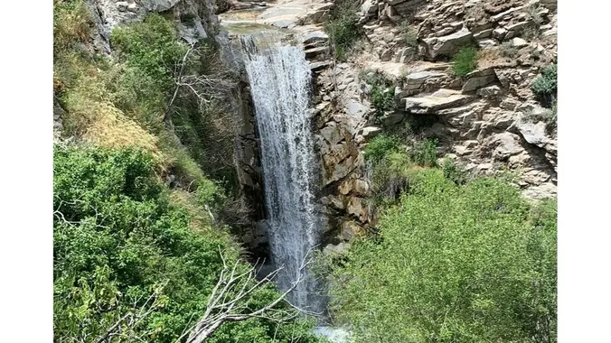
Let's go see what's in bloom in one of our favorite hiking spots, Newton Canyon to Buzzard's Roost! This area was burned over in the Woolsey fire, but spring brings wildflowers, freely flowing water, and a few waterfalls, including the Upper Newton Canyon falls. We’ve seen lupines, poppies, lilies, and a real rarity - Indian […]
The hike we will be doing is a loop at about 5.5 miles with 725 ft. of elevation gain. We will meet at the Willow Staging Area that is right off of the 133. We will begin at the trail head of the Laurel Canyon Trail. We will take this to Lizard Trail, then we […]
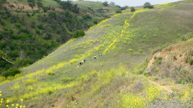
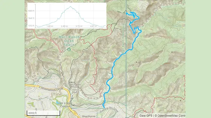
On this hike, we'll repeat our December hike where we took Las Llajas Canyon to a climb up a sweeping trail to the abandoned Coquina mine and visit the steam shovel that has been rusting patiently there for decades. According to Scott, the wildflowers are great in Las Llajas Canyon right now. This is also […]
This is an easier hike for Thursday, another has also been posted, please only sign up for one hike. This hike is 5 miles and will take us on a less-traveled but quite beautiful part of the 67-mile Backbone Trail, which runs through the Santa Monica Mountains National Recreation Area from Will Rogers State Park […]
Our hike begins in the northwestern corner of Topanga State Park on the Viewridge Trail in Santa Maria Canyon. Highlights during this stroll through a wooded canyon include ocean views. From here we’ll hook up with dirt Mulholland and head east to Garapito Canyon We’ll then descend the narrow Garapito Trail cutting a sinuous course through mature chaparral — mostly mountain mahogany and ceanothus up to […]
This is Part two of the new BKS (Butt Kicking Series) of hikes! *(Hikes with close to 3000' Gain and or 10 or more miles.) *** Safety Note: Rain or Extreme Heat at trailhead cancels hikes. Meetup Time: 7:15 A.M. ( We hit the trail at 7:30) DISTANCE: 9.9 miles - Loop GAIN: 2,795 ft […]
******* RAIN FALLING AT TRAILHEAD CANCELS ALL HIKES ******* Saturday, May 13, 2023 - Time to get your feet wet with 36 Stream Crossings! That's right kids, we are hiking Fish Canyon to Piano Box Canyon (and maybe beyond a bit up into the Narrows). Fish Canyon is a BKS Substitute hike for the previously […]
Come join us for a Mother's Day hike! The hike we will be doing will be around 5 miles long with 875 ft. of elevation gain. This will be a loop starting at the parking lot of Nix Nature Center. As you will see on the map, this is at the main park entrance off […]
https://www.alltrails.com/trail/us/california/tapo-canyon-trail?u=i (It's gonna be warm this day so we are gonna start at 8am to be off the trail by 10am..) Hello Fellow Hikers, Join me on a easier moderate hike at Tapo Canyon Trail in Simi Valley. This hike has a nice gradual walk until we start a gradual climb were we will start […]
Happy Mother's Day to all beings who have a motherly heart! Let's celebrate this special day with the beautiful Mother nature and great friends 🥂♥️ 3.5 miles, 700' gain, Easy Intermediate. Easy Option: 2.4 miles, 285' gain, Fit Beginner. We'll start by entering the Los Padres trail, through a spooky oak covered section, then move […]
Time to re-explore the Los Robles trail system. This will be about a 7 mile lollipop hike with approximately 1400 feet of elevation gain. We start at the trailhead at the back parking lot of Triunfo Park and go up to the Los Robles trail. We then loop around counter-clockwise by way of the White […]
We will start early to beat the heat, entering the north branch of Lynnmere Trail via Thistle Trail, which connects the north and south branches of Lynnmere Trail. The Lynnmere Trail is high above Thousand Oaks, providing pleasant scenery along the Conejo Canyons, Wildwood Park, Paradise Falls, Boney Mountain, the Pacific Ocean, and glimpses of […]
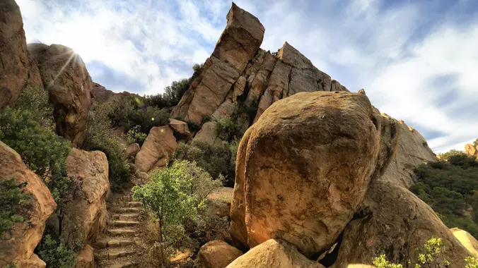
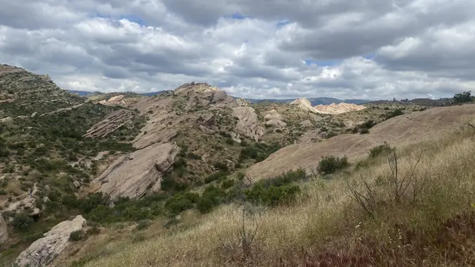
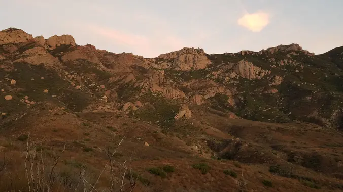
Intermediate, 4.5 miles, 1100' gain. Intermediate hikers will love this hike. It is not well suited for beginners. It has some of the most variations of terrain of any hike in the area and is one of my personal favorites. This is an interesting gem and one of the famous formations that every hiker in […]
http://photos1.meetupstatic.com/photos/event/9/9/3/6/event_278199222.jpeg Please read these restrictions before signing up. Pandemic conditions and restrictions apply for your safety and ours: Don't sign up unless you are two weeks past your 2nd vaccination Don't show up unless you're shown on the "Attending" list Unregistered or waitlisted will be turned away No "Plus Ones" on this hike You will […]
This side of the park is back open! I'm excited to be back. This hike will be about 5.4 miles total with 820 ft. of elevation gain. We are starting at the parking lot at the Wahoo's parking lot. We will take Live Oak Trail. This turns into Serrano Road which will take us to […]
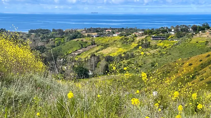
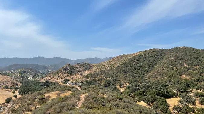
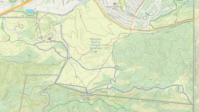
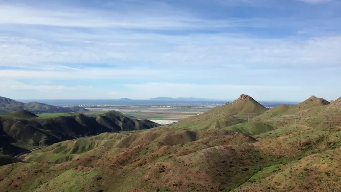
Let's head out to Hidden Valley Overlook via Rancho Sierra Vista. This double-lollipop out and back hike wanders through wildflowers, grasslands and chaparral from the Rancho Sierra Vista trailhead, then climbs up a foothill of Boney Mountain for some fantastic views east into Hidden Valley and Lake Sherwood, north to Port Hueneme and Oxnard and […]
Intermediate, 5.25 mi, 1000' gain Easy option: 2.8 mi, 700' gain. Even easier option: 2.2 mi, 600' gain. Fit beginners can complete this hike, but it will certainly get their blood pumping. This is not a conditioning hike, it's a social hike. We'll be stopping at various points to let people catch up and to […]
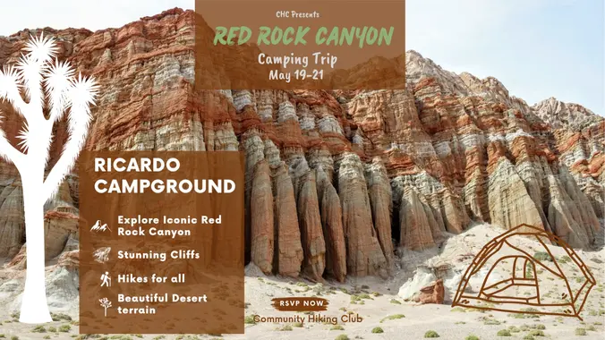
Camping at Ricardo Campground, Red Rock Canyon State Park 37749 Abbott Dr. Cantil, CA 93519 Join us for a last-minute fun weekend of camping and hiking iconic Red Rock Canyon SP! This campground is about 90 miles up the 14 freeway, just an hour and a half from Santa Clarita. Add your name to the […]
This loop will include a shortcut to the Coquina Mine in Las Llajas Canyon. It was formerly a VIP hike, however the shortcut has been getting a lot of use in recent years and I have opened the hike to entire group. We'll start behind a dam and along some lesser known trails above Chivo […]
The hike we will do starts from the parking lot across from the Ortega Oaks Candy Store. It will be 6.8 miles (total) with 1200 ft. of elevation gain. We will take the Bear Canyon Loop Trail to the 4 Corners trail junction. We will take the Bear Ridge Trail back and do a lollipop […]
https://www.alltrails.com/trail/us/california/upper-zuma-falls-via-backbone-and-zuma-canyon-trail?sh=jw81u0 Hello Fellow Hikers, This is a beautiful area still green with wild flowers, creek crossings and a waterfall ( should still have water ) this hike is a nice gradual incline so you can enjoy the views yet still get in a good workout. By 9:00am the parking lot fills up so we plan […]
The hike we will be doing is approximately 5 miles with 870 ft. of elevation gain. We will begin at the Live Oak Trail trailhead. This is where you will see on the map that the Live Oak Trail hits the paved road, right off of the parking lot marked P. This is the parking […]
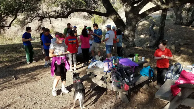
Fit Beginner - 6 miles, 600' gain (route link) Easy Option - 2 miles, 300' gain (route link) This is a social hike and an out-and-back event. There is a potluck at the M.A.S.H. site before we turn around for the return. If your item requires paper plates, utensils, etc. please bring them. Pot Luck […]
Stats: ~6 miles with ~1500 ft. of gain. Suggestted equipment: Trekking Poles and Boots. Water - 1 to 2 liters. Conditions: exposed, rocky, steep, technical descents, overgrowth, Rattlesnakes. Description: upside-down lollipop beginning with a steep ascent of 900 feet in 1.2 miles up the China Flat trail. We will take first water break at the […]
5.7 Miles, 1000' gain, Intermediate The starting point is NOT at the golf course entrance. It is at a dirt lot that can hold at least 50 cars. There is some real incline on this hike and a lot less trails coated with silt compared to the easier Happy Camp hike. Even though I have […]
Westridge-Canyonback Wilderness Park Here's a chance to get our mountain ebikes out on the dirt again. I posted the northern and southern Topanga State Park's loop in the past, now we'll take on a loop just east of these. It will involve street and dirt road riding. Make sure you bring along a spare inner […]
The total distance is around 4.6 miles with 870' of elevation gain. We will take Boat Canyon Trail up to Bommer Canyon. We will take Bommer to Water Tank trail. We will take this and then take a lower trail back to the beginning. Address: Dartmoor Trail Lookout Laguna Beach, CA 92651 https://goo.gl/maps/6N8c88XfdSeYu85M8 Dogs are […]
http://photos1.meetupstatic.com/photos/event/e/3/a/0/event_167038272.jpeg This hike has some rocky parts, but no scrambling. This hike will take us on a scenic trip from the suburbs of Oak Park to the top of Simi Peak, which overlooks both the Simi and Conejo Valleys and offers splendid views of the Santa Monica range and offshore islands to the south and […]
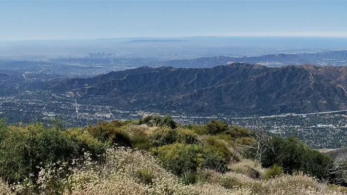
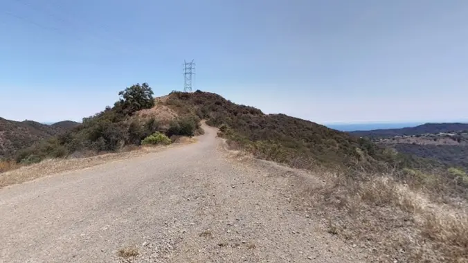
This hike will take us about 6.7 miles round-trip with 1600 feet of elevation gain on winding trails to dramatic rocky overlook with striking views of Saddle Peak, Stunt Ranch State Park, Calabasas Peak, and Old Topanga and Cold Creek Canyons. There are also longer vistas northwest into Ventura County and east to the San […]
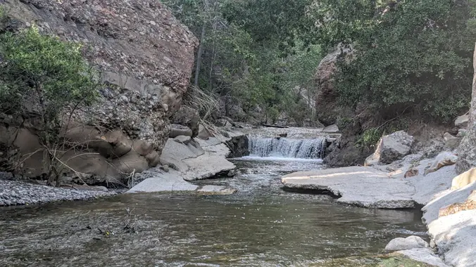
This hike starts at Gold Canyon Trail to Wildwood Canyon Trail and passes through various trails with a long creek, crossing streams and bridges, Indian caves, volcanic rock cliffs, water falls, cacti-filled desert environs, riparian forest, and wildflowers. Highlights of the hike include waterfalls incorporating 40’ Paradise waterfalls along tree canopies over approximately 5 miles […]
4 miles, 950' gain, Easy Intermediate 2 miles, 550', Fit Beginner We've been getting some rain. This one should be less muddy because the trail is hard, gravelly, and rocky. This is a modified version of the famous Rocky Peak hike. It gives those that want something easier, a chance to climb one of the […]
Our seventh Backbone Trail hike in the Santa Monica Mountains is 10 miles with 1400’ elevation gain on the BBT. We will take the Etz Meloy Trail, the newest addition to the BBT, starting at the Encinal Canyon trailhead. We will cross the Mulholland Highway and then take the Etz Moloy Trail, with views of […]
This hike will take us to the top of Bedford Peak. It will be an out and back hike at 7.4 miles total with 2,050 ft. of elevation gain. The peak has an altitude of 3,804 ft. This hike has great views of lots of the surrounding mountains and the ocean. Things to bring: lots […]
** Please read the entire description before you RSVP as things will be a little different with this hike ** https://www.alltrails.com/trail/us/california/pct-vasquez-to-indian-canyon?u=i&sh=aoxfvb Hello Everyone, We will be doing this hike northbound (opposite the AllTrails route). We will do close to 9 miles of the PCT. We will see some interesting rock formations including Three Sisters Rock […]
Our eighth Backbone Trail hike in the Santa Monica Mountains will be 17 miles on the BBT on the Sandstone Peak, Chamberlain, Blue Canyon, Wood Canyon, and Ray Miller Trails before finishing the La Jolla Campground. This is a Sierra Club hike, so participants must sign in, carry their medical form, and hike between the […]
The total mileage for this hike is 5 miles with about 800 ft. of elevation gain. We will start at the trail head of the Borrego Trail, which is right off of the parking lot. This is where we will meet. We will head up the Borrego Trail until we get to Mustard Road. Here […]
https://www.alltrails.com/trail/us/california/tapo-canyon-trail?u=i Hello Fellow Hikers, Join me on a easier moderate hike at Tapo Canyon Trail in Simi Valley. This hike has a nice gradual walk until we start a gradual climb were we will start our loop. We should encounter wildflowers and mountain views. Our loop will drop down then we will continue until we […]
The longer hike I am planning is around 6.3 miles with about 825 ft. of elevation gain. It starts at the very end of the paved road, the long gray strip that can be seen on the map. The shorter alternate cuts off the last hill and ridge. That distance is 4.8 miles with about […]
5.2 miles, 1140' gain, Intermediate Beginner Option: 3.5 miles, 500' gain, Fit Beginner Come to the hike only (3:30p), picnic only (5:00p), or both. Warning: Google Maps may take you to the incorrect location, although the address is correct. Please follow the written directions. The Hike 3:30 pm at the parking lot entrance. We take […]
This out-and-back, about 5 miles hike with an elevation gain/loss of +/-1000’ provides a great overview of the Thousand Oaks area, the ocean and the western Santa Monica Mountains. The first portion is a narrow trail that zigzags its way up and if you reach the top, you'll be enjoying 360 degree views toward Boney […]
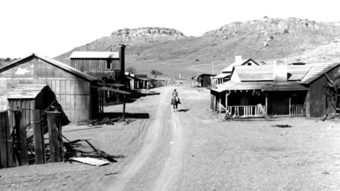
Time to check out the Santa Rosa Trail north facing slope for Spring Flowers & view some cool properties including the choo choo train collector yard accessible through Wildwood Park in Thousand Oaks. Wildwood's archetypal western look served as the set for Davy Crocket, The Rifleman, Gunsmoke, and Wagon Train back in the day, as […]
3 miles, 1000' gain, Intermediate. The entire first half is an incline. Nothing super steep, but beginners may find this climb exhausting. Fit beginners can still complete this hike, as we'll be stopping at junctions to let everybody catch up. This is not a conditioning hike, it is a social hike. There are several routes […]
Please read these restrictions before signing up. Don't sign up unless you are two weeks past your 2nd vaccination Don't show up unless you're shown on the "Attending" list Unregistered or waitlisted will be turned away No "Plus Ones" on this hike You will be asked to show your vaccination card (a photo on your […]
I came across this backpack on Amazon and noticed there was a 50% off coupon. I've ordered 2 of them (one at a time) and awaiting arrival tomorrow. I don't know how long this will last, so grab one today. A great deal for less than $25 https://amzn.to/3BQn6BK
The hike we will be doing is a loop at about 5.5 miles with 725 ft. of elevation gain. We will meet at the Willow Staging Area that is right off of the 133. We will begin at the trail head of the Laurel Canyon Trail. We will take this to Lizard Trail, then we […]
Please note this hike begins at 9:00 am! Restrictions apply for your safety and ours: Don't show up unless you're on the "Attending" list Unregistered or waitlisted will be turned away No "Plus Ones" on this hike This hike will loop around the periphery of Dos Vientos, passing Twin Ponds, overlooking Potrero Road and the […]
4 miles, 700' gain, easy-intermediate Easy option: 2.5 miles, 500' gain Parking on the south side of the CA-118 at the Rocky Peak exit. We'll walk west along the Santa Susana Pass Rd. for about 500 feet, and directly across from Lilac Ln, we'll enter a trail. We'll move along a relatively flat section for […]
This is one of the most scenic coastal and inland routes of Summerland, Santa Barbara, Montecito and Carpinteria. It includes riding in bike lanes with traffic, a dedicated bike path, rarely traveled back roads, and a 1 mile section of a hidden dirt trail (not advisable for road bikes). Make sure you bring along a […]
Serious RSVPs Only. Let's Road Trip! 🏞️🚙...........💨 Friday June 2 to Sunday June 4, 2023 🚙🏕️ We will be camping at Kennedy Meadows Campground, Inyo National Forest. ⛺The campground is no-reservation, first-come and is usually $8-12 per night. Each camping participant is to get their own space or share with a small group. Currently the […]
NO WHITE LIGHTS – Bring a green or red headlamp/light if you have one. If you don’t you can piggy back off mine and the others.’ If you have problems hiking in the dark without a white light, do not attend. Our route begins on Trailer Canyon fire road providing broad views over Santa Ynez […]
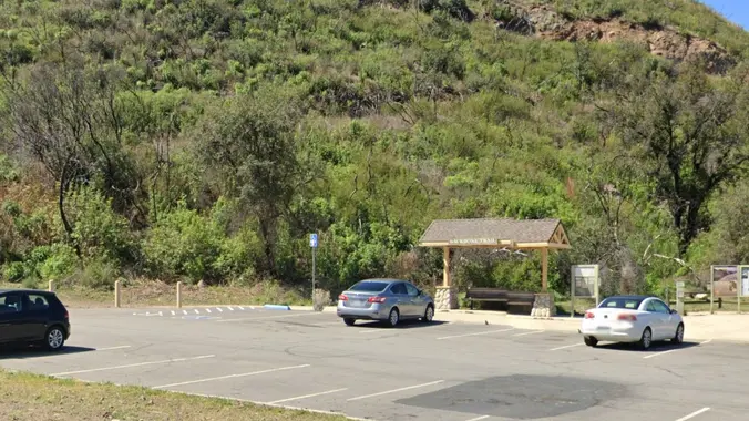
*** Safety Note: Rain or Extreme Heat at trailhead cancels hikes. Meetup Time: 7:30 A.M. (We hit the trail promptly at 7:45) PARKING/CARPOOLING - There is parking on the side of Big Tujunga Cyn Road, but this is a popular hike right now and parking is limited - so carpooling is highly recommended. DO NOT […]
This hike will be about 5.4 miles total with 820 ft. of elevation gain. We are starting at the parking lot at the Wahoo's parking lot. We will take Live Oak Trail. This turns into Serrano Road which will take us to Serrano Cow Trail. At this part of the trail, we usually see a […]
We are going to be doing a different hike at the park, (not at the main park entrance). We are going to be starting at the Canyon View Staging Area. This hike will be about 6.2 miles with around 1,000 ft. of elevation gain. We will be starting at Canyon View Park and taking Cholla […]
Fit Beginner 4.3 miles, 480' gain. Easier Option: 4 miles, 230' gain. We walk a mostly flat section for 1.1 mi. to the 2nd junction. Easier option: Continue straight for 3/4 mi., left at the split, right after another 500', arriving at some picnic tables on the right after another 750'. Regular route: Left, heading […]
Trail statistics are approximate. For safety purposes always assume they are underestimated. But don’t be disappointed if they are overestimated. Bring more water and snacks than you think you’ll need.
Trail descriptions are based on previous hikes. Current conditions are unknown until arrival. Expect the unexpected and plan accordingly.
The Organizers and members of Hiking With Dean are not professional leaders, guides, or mountaineers. The function of the member or organizer is only to organize the trip. Each person who shows up for a trip/meetup (and their guest or guests) is responsible for his or her own safety. By attending a hike, or any other event organized by this group, you are acknowledging that you and any guests that you bring are aware of the risks, dangers and hazards associated with the activity and freely accept and fully assume all such risks, dangers and hazards, and further agree to release and discharge the Organizers, Members of the Hiking With Dean Meetup Group from and against any and all liability arising from your participation in the group activities per our ASSUMPTION OF RISK AND LIABILITY WAIVER and Section 6.2 of the Meetup.com Terms of Service.


Recent Comments