The longer hike I am planning is around 6.3 miles with about 825 ft. of elevation gain. It starts at the very end of the paved road, the long gray strip that can be seen on the map. The shorter alternate cuts off the last hill and ridge. That distance is 4.8 miles with about […]
5.2 miles, 1140' gain, Intermediate Beginner Option: 3.5 miles, 500' gain, Fit Beginner Come to the hike only (3:30p), picnic only (5:00p), or both. Warning: Google Maps may take you to the incorrect location, although the address is correct. Please follow the written directions. The Hike 3:30 pm at the parking lot entrance. We take […]
This out-and-back, about 5 miles hike with an elevation gain/loss of +/-1000’ provides a great overview of the Thousand Oaks area, the ocean and the western Santa Monica Mountains. The first portion is a narrow trail that zigzags its way up and if you reach the top, you'll be enjoying 360 degree views toward Boney […]
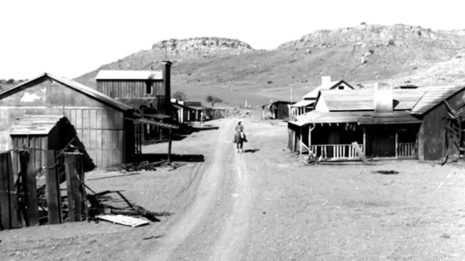
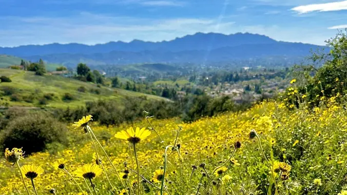
Time to check out the Santa Rosa Trail north facing slope for Spring Flowers & view some cool properties including the choo choo train collector yard accessible through Wildwood Park in Thousand Oaks. Wildwood's archetypal western look served as the set for Davy Crocket, The Rifleman, Gunsmoke, and Wagon Train back in the day, as […]
3 miles, 1000' gain, Intermediate. The entire first half is an incline. Nothing super steep, but beginners may find this climb exhausting. Fit beginners can still complete this hike, as we'll be stopping at junctions to let everybody catch up. This is not a conditioning hike, it is a social hike. There are several routes […]
Please read these restrictions before signing up. Don't sign up unless you are two weeks past your 2nd vaccination Don't show up unless you're shown on the "Attending" list Unregistered or waitlisted will be turned away No "Plus Ones" on this hike You will be asked to show your vaccination card (a photo on your […]
I came across this backpack on Amazon and noticed there was a 50% off coupon. I've ordered 2 of them (one at a time) and awaiting arrival tomorrow. I don't know how long this will last, so grab one today. A great deal for less than $25 https://amzn.to/3BQn6BK
The hike we will be doing is a loop at about 5.5 miles with 725 ft. of elevation gain. We will meet at the Willow Staging Area that is right off of the 133. We will begin at the trail head of the Laurel Canyon Trail. We will take this to Lizard Trail, then we […]
Please note this hike begins at 9:00 am! Restrictions apply for your safety and ours: Don't show up unless you're on the "Attending" list Unregistered or waitlisted will be turned away No "Plus Ones" on this hike This hike will loop around the periphery of Dos Vientos, passing Twin Ponds, overlooking Potrero Road and the […]
4 miles, 700' gain, easy-intermediate Easy option: 2.5 miles, 500' gain Parking on the south side of the CA-118 at the Rocky Peak exit. We'll walk west along the Santa Susana Pass Rd. for about 500 feet, and directly across from Lilac Ln, we'll enter a trail. We'll move along a relatively flat section for […]
This is one of the most scenic coastal and inland routes of Summerland, Santa Barbara, Montecito and Carpinteria. It includes riding in bike lanes with traffic, a dedicated bike path, rarely traveled back roads, and a 1 mile section of a hidden dirt trail (not advisable for road bikes). Make sure you bring along a […]
Serious RSVPs Only. Let's Road Trip! 🏞️🚙...........💨 Friday June 2 to Sunday June 4, 2023 🚙🏕️ We will be camping at Kennedy Meadows Campground, Inyo National Forest. ⛺The campground is no-reservation, first-come and is usually $8-12 per night. Each camping participant is to get their own space or share with a small group. Currently the […]
NO WHITE LIGHTS – Bring a green or red headlamp/light if you have one. If you don’t you can piggy back off mine and the others.’ If you have problems hiking in the dark without a white light, do not attend. Our route begins on Trailer Canyon fire road providing broad views over Santa Ynez […]
*** Safety Note: Rain or Extreme Heat at trailhead cancels hikes. Meetup Time: 7:30 A.M. (We hit the trail promptly at 7:45) PARKING/CARPOOLING - There is parking on the side of Big Tujunga Cyn Road, but this is a popular hike right now and parking is limited - so carpooling is highly recommended. DO NOT […]
This hike will be about 5.4 miles total with 820 ft. of elevation gain. We are starting at the parking lot at the Wahoo's parking lot. We will take Live Oak Trail. This turns into Serrano Road which will take us to Serrano Cow Trail. At this part of the trail, we usually see a […]
We are going to be doing a different hike at the park, (not at the main park entrance). We are going to be starting at the Canyon View Staging Area. This hike will be about 6.2 miles with around 1,000 ft. of elevation gain. We will be starting at Canyon View Park and taking Cholla […]
Fit Beginner 4.3 miles, 480' gain. Easier Option: 4 miles, 230' gain. We walk a mostly flat section for 1.1 mi. to the 2nd junction. Easier option: Continue straight for 3/4 mi., left at the split, right after another 500', arriving at some picnic tables on the right after another 750'. Regular route: Left, heading […]
Challenger park offers miles of trails connecting to Long Canyon, Oak Canyon, Trough Canyon, Lone Oak Canyon, and other adjoining open-space nature areas in the southern section of the Simi Valley. The scenery lining the trails includes extensive oak woodlands, chaparral, and coastal sage scrub. The terrain varies greatly with rolling green hills and steep […]
Restrictions apply for your safety and ours: Don't show up unless you're on the "Attending" list Unregistered or waitlisted will be turned away No "Plus Ones" on this hike Plan on completing the entire hike or please find an alternative hike that better suits your hiking level. No dogs Topanga State Park is 36 square […]
Restrictions apply for your safety and ours: Don't show up unless you're on the "Attending" list Unregistered or waitlisted will be turned away No "Plus Ones" on this hike Plan on completing the entire hike or please find an alternative hike that better suits your hiking level. No dogs Topanga State Park is 36 square […]
https://a248.e.akamai.net/secure.meetupstatic.com/photos/event/4/5/b/c/event_52757852.jpeg Pandemic conditions and restrictions apply for your safety and ours: Don't show up unless you're shown on the "Attending" list Unregistered or waitlisted will be turned away No "Plus Ones" on this hike You will be asked to show your vaccination card if you have not done so previously. (A photo on your phone […]
We are going to hike on Bommer Ridge Trail the whole time. We are going to take this until we hit the top of Boat Canyon, and then turn around. The total distance for this hike is 7.4 miles with about 800 ft. of elevation gain. There are great mountain and ocean views along the […]
Instead of our usual starting point at the Conejo Playfields, this shorter, gentler hike will start at the top of Camino Magenta, in the beautiful unincorporated Lynn Ranch neighborhood surrounded by Thousand Oaks. We'll do a loop around the gated Lynnmere community and wind up back at our starting point about 5 miles and about […]
3 miles, 650' gain, Fit Beginner Easy option, 1.4 miles, 450' gain, Fit Beginner Those that prefer the Easy Option, should head UP from the trail head, waiting when they get to the bench at the top. For the rest of us: Starting from the trailhead parking lot, we head west on the Woodridge Connector […]
San Gorgonio Mountain is the tallest peak in Southern California (11,502 feet) We will be taking the South Fork Trail to Dry Lake. We will be camping near Dry Lake. Depending on weather conditions, we might need mircro spikes or crampons. Possibly snow at higher elevation. So San Gorgonio Peak will be optional. Miles: 22 […]
This epic tour of Agoura and Calabasas departs from Agoura at the Kanan Park and Ride, then drops into the La Sierra Preserve via Kanan Road. From here we head east on Mulholland across the Triunfo Creek Bridge, and ride one of the most famous stretches of highway in the country: "The Snake" (currently closed […]
Join my other group for an epic loop around Agoura and Calabasas. See https://www.meetup.com/socal-ebike-riders/events/293747173/ for more info and RSVP
Hike #6 in the 2023 highest and most interesting peaks in the Santa Monica Mountains series is a moderate 10-mile, 2000’ gain out and bqck hike along the Secret Trail to the Calabasas Peak Motorway, stopping at the peak before heading into Red Rock Canyon. Meet at 8:00 AM at the Oak Ridge Trail - […]
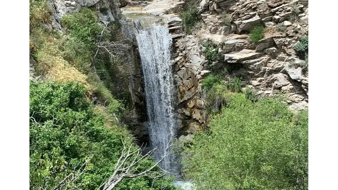
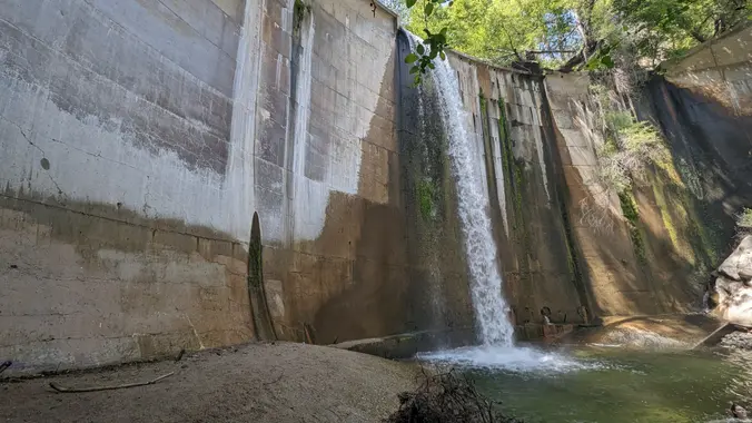
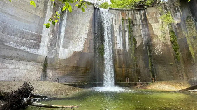
This hike is so cool! It's a good distance with little elevation gain and it is beautiful. This hike will take us to the Brown Mountain Dam Waterfall. The hike is an out and back at around 8.7 miles total with 650 ft. of elevation gain, so not steep! This area of the Angeles National […]
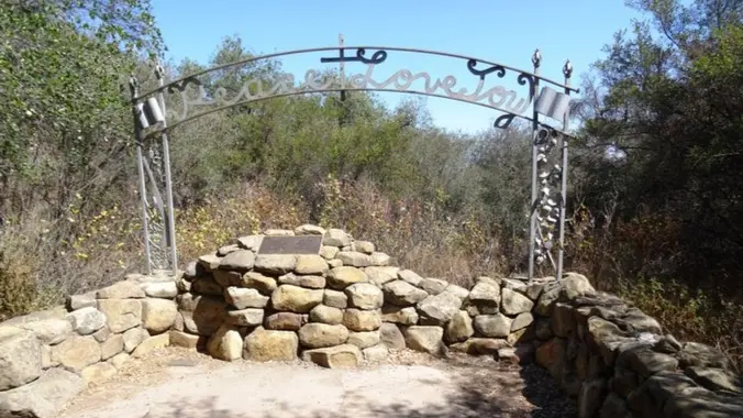
6.5 miles, 1300' gain, intermediate Let's enjoy hiking to the Danielson Monument in the Boney Mountain Wilderness and potluck lunch! This is a great way to be thankful for the beautiful nature, our health and friendships. We'll hike up to Danielson monument and enjoy potluck and "Peace, Love and Joy." Please bring food and drinks […]
We are going to be starting at the Canyon View Staging Area. This hike will be about 6.2 miles with around 1,000 ft. of elevation gain. We will be starting at Canyon View Park and taking Cholla up to West Ridge and comic down Mathis. Link to Parking from Google Maps: https://www.google.com/maps/place/Canyon+View+Staging+Area/@33.585273,-117.7465062,17z/data=!3m1!4b1!4m5!3m4!1s0x80dce61b6bd45c2d:0x5ef3f1ad687cc8b5!8m2!3d33.585273!4d-117.7443175 Dogs are not […]
Please review the guidelines to participate in our hikes. Here are some highlights and a link to the guidelines. Restrictions apply for your safety and ours: Don't show up unless you're on the "Attending" list No "Plus Ones" on this hike Plan on sticking with the group, and completing the entire hike at a reasonable […]
Join us on this sweet (maybe not so sweet!) hike that wanders through grasslands and chaparral, down into a canyon, then up to eye-stretching views. We will follow Sycamore Canyon fire road until it intersects with the Fossil Trail. We will then take the Fossil Trail to the Old Boney Trail. The Fossil Trail features […]
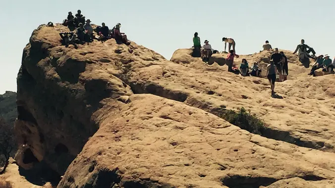
Eagle Rock, the most impressive landmark in all of Topanga State Park, will afford us an airy perch overlooking the upper watershed of Santa Ynez Canyon and the ocean beyond. We will eat, drink and explore on this impressive sandstone rock covered with crevices and caves. We begin hiking at Trippet Ranch, walking north on a paved driveway about 100 […]
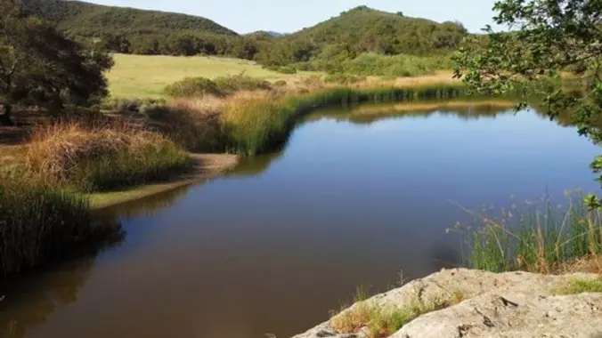
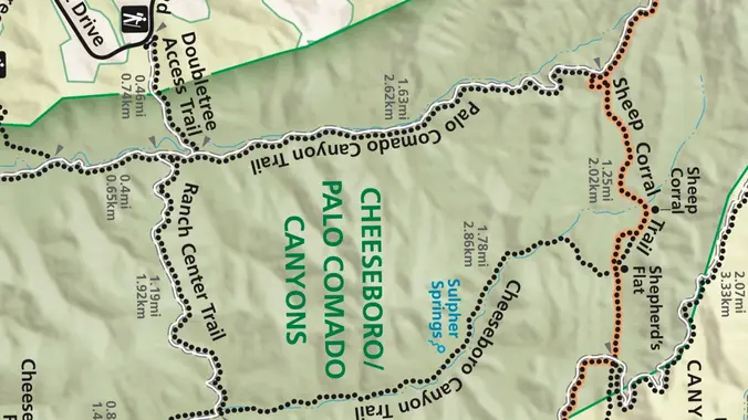
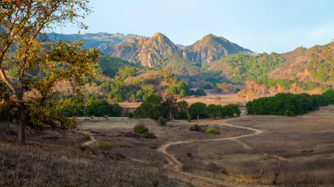
Palo Comado ("Burnt Stick" in Spanish) tells you a lot about the environs - frequently burned over by wildfires, this was directly in the line of the Woolsey Fire but much of the vegetation has re-grown. This is one of many routes from the Conejo Valley to China Flat. Except for one turn near the […]
This hike will be about 5.4 miles total with 820 ft. of elevation gain. We are starting at the parking lot at the Wahoo's parking lot. We will take Live Oak Trail. This turns into Serrano Road which will take us to Serrano Cow Trail. At this part of the trail, we usually see a […]
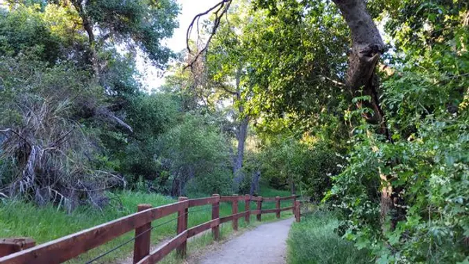
Oak Creek Canyon Trail is a rather special trail in Los Robles Open Space that is designed for the blind as well as the sighted. The all-access trail is shaded by a canopy of oaks, while the Los Robles trail spends more time in the chaparral. We will start at Oak Creek Canyon and proceed […]
Share your photos from SoCal Seven Summits hike #5 Telegraph Peak (8,989') of the Wilderness Adventure Section’s Southern California Seven Summits Series. The hike was a partial loop of 14 miles with 4,800 feet of gain up Ice House Canyon to the Saddle using the Chapman Trail, but returning directly down Ice House Canyon.
We will be playing it by ear a bit, but we will be doing a hike that will be around 5 miles with 800-900 ft. of elevation gain. **You do not need to register on LetsGoOutside.org. Enjoy self-guided access in the southern portion of Irvine’s Open Space Preserve. The entire southern Open Space Preserve trail […]
**** Rain falling at the Trailhead can cancel hike **** ================================================= *** Yes the road is open all the way to Mt Wilson *** **Highway 2 is closed beyond Red Box** DISTANCE: ~ 7 miles total (REVERSE loop style hike) HIKING TIME: ~ 4 hours LOSS/ GAIN: ~ 1500' loss/ 1500'gain RATING: Moderate + (Not […]
https://www.alltrails.com/explore/recording/woodridge-loop-and-sunset-hills-loop-trails-c900fe9 Hello Fellow Hikers, This one we will be combining two Trails in one. Will be doing both the Woodridge Loop and the Sunset Hills Loop Trail. Both of these Trails are more on the easier moderate side but combining in a loop will give us more of a workout and a moderate hike. Your […]
The Nicholas Flats Trail in Leo Carrillo State park is unique in the way it connects the mountains with the sea. Chaparral, grassland, coastal scrub and oak woodland all converge near the flat with spectacular ocean views along the way. An old cattle pond backed by picturesque sandstone outcroppings provides a home for red-wing blackbirds […]
Come join us for this fun Father's Day Hike! Bring your family. :) The hike I am planning is around 6.3 miles with about 700 ft. of elevation gain. It starts at the very end of the paved road, the long gray strip that can be seen on the map. We will begin at the […]
Easy-Intermediate, 4 miles, 800' gain. Option not to hike: If for some reason you don't want to hike but still want to come, the social event can be driven to, and the main group of hikers should get there about an hour after we begin: 23601 W Red Rock Rd, Topanga, CA 90290. It costs […]
The hike we will be doing is a loop at about 5.5 miles with 725 ft. of elevation gain. We will meet at the Willow Staging Area that is right off of the 133. We will begin at the trail head of the Laurel Canyon Trail. We will take this to Lizard Trail, then we […]
We will have two short hikes; Saddle Peak hike (about 3 miles with approximately 500' elevation gain) and Topanga Lookout hike (about 2 miles with approximately 400' elevation gain). https://www.hikespeak.com/trails/topanga-lookout/ We will begin Saddle Peak hike at the end of the Stunt Road hike near the intersection of Stunt Road and Schueren Road. Saddle Peak […]
The hike we will be doing is a loop at about 5.5 miles with 725 ft. of elevation gain. We will meet at the Willow Staging Area that is right off of the 133. We will begin at the trail head of the Laurel Canyon Trail. We will take this to Lizard Trail, then we […]
This week we’ll do a loop around the northeastern regions of the Santa Monica Mountains National Recreation Area and the Las Virgenes Open Space. This area traverses many ecosystems, including riparian, chaparral, and the rockscape from Galaxy Quest. The area is generally dry, but very nice! http://photos1.meetupstatic.com/photos/event/c/3/0/c/event_255709932.jpeg The trailhead is where Sunnycrest turns into Doubletree, […]
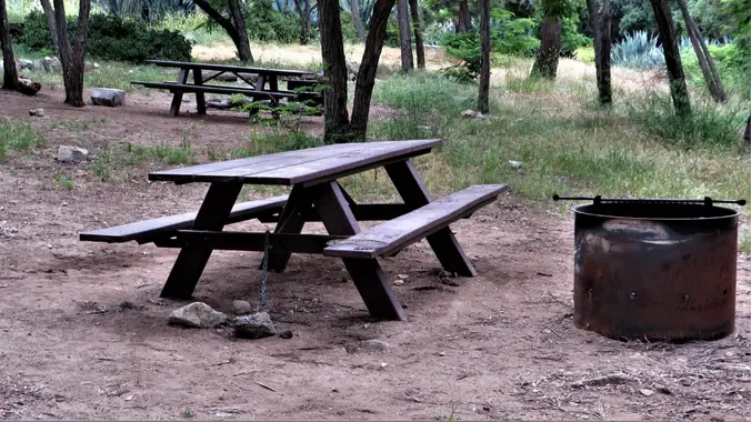
This is a walk-in trail campground. Amenities are few. There is a rest room, a 4 fire pits, a SINGLE bear vault and 4 picnic tables/benches. You cannot make reservations, so getting there early is imperative. Pack lightly. You will be walking downhill for approximately 1 mile to the camping area. There are no numbered […]
On this hike we will go up the Ray Miller trail to the fire road and back, about 6 miles. It will probably still be cool enough on the beach to start at 9:00, that will change soon. We’ll enjoy beautiful ocean views as we descend. Lying along the brilliant blue Pacific Ocean at the […]
Please review our guidelines to participate in our hikes. Restrictions apply for your safety and ours: Please don't show up unless you're on the "Attending" list Unregistered or waitlisted will be turned away Sorry, no "Plus Ones" on this hike No dogs allowed in the state park The usual access to MASH (Reagan Ranch) is […]
The total distance is around 4.6 miles with 870' of elevation gain. We will take Boat Canyon Trail up to Bommer Canyon. We will take Bommer to Water Tank trail. We will take this and then take a lower trail back to the beginning. Address: Dartmoor Trail Lookout Laguna Beach, CA 92651 https://goo.gl/maps/6N8c88XfdSeYu85M8 Dogs are […]
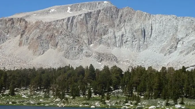
The Cottonwood Lakes are a great introduction to the high Sierras, very easy to access and relatively close to San Diego. Looks like it's still quite snowy up there. Pictures from 2021 (much less snowy!): https://www.meetup.com/sandiegobackpackers/events/278793005/ Snow depth: https://www.nohrsc.noaa.gov/interactive/html/graph.html?ey=2023&em=6&ed=16&units=0&station=CWDC1 Weather (still unseasonably cold, hopefully it will be warm up): https://forecast.weather.gov/MapClick.php?lon=-118.21492172105822&lat=36.49599812734478 BEAR CANISTER (or Ursack) REQUIRED […]
Meetup Time: 7:15 A.M. (We hit the trail at 7:30) DISTANCE: 8 miles – out and back. GAIN: 652 ft RATED: Beginner hike with some wet stream crossings. HIKE DURATION: About 3 1/2 to 4 hours (including a 20-minute snacky time!) DESCRIPTION: Brown Mountain Dam Trail, is nestled in the beautiful San Gabriel Mountains, offering […]
https://www.alltrails.com/trail/us/california/trailer-canyon-to-temescal-peak Hello Fellow Hikers, Were gonna be taking the less traveled route that leads you to both Will Rogers State Park and Topanga State Park. This route has a gradual incline to the peak with the hardest climb being a short distance to the peak. From there will have both mountain and ocean views. Our […]
Let's go see if there are still tons of frogs/toads around! The hike we will be doing is approximately 5 miles with 870 ft. of elevation gain. We will begin at the Live Oak Trail trailhead. This is where you will see on the map that the Live Oak Trail hits the paved road, right […]
Join our community for a peaceful hike for world peace on the beautiful Los Padres Trail and Vista Loop to help raise funds for world peace. Enjoy a beautiful day in serene surroundings with like-minded spiritual friends while supporting a worthy cause. Tushita KBC is a non-profit 501(c)3 organization run by volunteers that has been […]
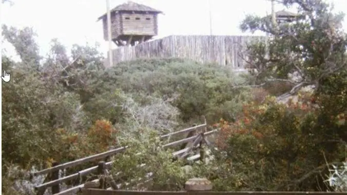
With two waterfalls, scenic volcanic outcroppings, a variety of hiking trails, several pleasant picnic areas, and abundant open space, Wildwood Park is a great place to escape the hustle and bustle of the nearby city. For you stairs fans: Did you know Wildwood has a trail with 76 steps? Highlights along the way: Fort Wildwood […]
Wildwood Park is one of the most versatile local parks there is, with 27 miles of trails skittering through rocky cliffs, cacti-filled desert environs, volcanic rock, riparian forest, and a cool, watery canyon. Wildwood's archetypal western look served as the set for The Rifleman, Gunsmoke, and Wagon Train back in the day, as well as […]
Space Mountain is the name for Los Robles Trail West, starting at Moorpark Road in Thousand Oaks and switchbacking up the hill to the west. No one seems to know why it's called Space Mountain, though maybe the Disney ride inspired it. Maybe former major league pitcher Bill "Spaceman" Lee had something to do with […]
3.2 miles, 900' gain, easy intermediate. The first part is a steady incline, followed by a rolling trail to our destination. Fit beginners can complete this hike, but it will certainly get their blood pumping. There are no super steep sections. This hike takes us to a secret spot below a large rock formation. Naturally […]
This hike will be about 5.4 miles total with 820 ft. of elevation gain. We are starting at the parking lot at the Wahoo's parking lot. We will take Live Oak Trail. This turns into Serrano Road which will take us to Serrano Cow Trail. At this part of the trail, we usually see a […]
A special hike to Rocky Peak that only HWD can deliver. Rocky Peak, located in Rocky Peak Park, is the fourth-highest point in the Santa Susana Mountains, and overlooks the San Fernando Valley and Chatsworth, the Simi Hills, and the Simi Valley in Southern California. The peak, which is 2,715 feet in elevation, sits on […]
Please join Conejo Open Space Foundation for a live online presentation by local expert Jennifer Lancaster who will discuss the origins of our water, how it’s used, where it winds up, and whether those practices are sustainable at their current levels. After the presentations, there will be a Q & A session for attendees to […]
UPDATE: Please review our guidelines to participate in our hikes. Here are some highlights and a link to the guidelines: https://www.meetup.com/The-Weekday-Trailblazers/about/ Restrictions apply for your safety and ours: Don't show up unless you're on the "Attending" list No "Plus Ones" on this hike Plan on completing the entire hike at a reasonable pace or please […]
This is a second hike for Thursday at Hill Canyon in Camarillo. It is a gentler hike. We will start at the parking area in Hill Canyon, cross the bridge over the runoff creek, and stroll a mile before turning onto the Hawk Canyon Trail. The Hawk Canyon Trail connects to Western Plateau Trail and […]
Intermediate - 3 miles, 1000' gain Easier Option - Fit Beginner, 1.4 miles, 525' gain. This hike is relatively short, but the middle portion is a rugged and continuous incline for 1 mile with about 700' of gain. Even though we'll be taking this trail at the pace of a social hike, beginners may find […]
We are going to be starting at the Canyon View Staging Area. This hike will be about 6.2 miles with around 1,000 ft. of elevation gain. We will be starting at Canyon View Park and taking Cholla up to West Ridge and comic down Mathis. Link to Parking from Google Maps: https://www.google.com/maps/place/Canyon+View+Staging+Area/@33.585273,-117.7465062,17z/data=!3m1!4b1!4m5!3m4!1s0x80dce61b6bd45c2d:0x5ef3f1ad687cc8b5!8m2!3d33.585273!4d-117.7443175 Dogs are not […]
July 1, 2023 - Shorter or Longer Local Conditioning Hike: East Canyon to its end or go on a bit longer to Mission Peak (both are Out and Back) DISTANCE/ GAIN: Both hikes are Out and Back (O/B) style; length depends on whether you do the second part (an extra ~3 miles round trip). NOTE: […]
https://www.alltrails.com/trail/us/california/brown-mountain-dam-waterfall Hello Fellow Hikers, Historical Landmark Brown Mountain Dam sits right in the Middle of the Arroyo Seco River. This 81 foot waterfall quickly transports you from the suburbans to a natural wonderland. This dam was built in the early 1940's and has become a big part of the wildlife below. Not uncommon to come […]
This hike will be about 5.4 miles total with 820 ft. of elevation gain. We are starting at the parking lot at the Wahoo's parking lot. We will take Live Oak Trail. This turns into Serrano Road which will take us to Serrano Cow Trail. At this part of the trail, we usually see a […]
3.0 miles, 800' gain, easy-intermediate. Let's enjoy the gorgeous sunset and the full moon, and fun loaded potluck picnic at the beautiful Angel Vista! This hike is rated easy-intermediate because it is a continuous incline for 1.5 miles. This isn't real steep, but it is continuous, and many beginner hikers have indicated this should be […]
Trail statistics are approximate. For safety purposes always assume they are underestimated. But don’t be disappointed if they are overestimated. Bring more water and snacks than you think you’ll need.
Trail descriptions are based on previous hikes. Current conditions are unknown until arrival. Expect the unexpected and plan accordingly.
The Organizers and members of Hiking With Dean are not professional leaders, guides, or mountaineers. The function of the member or organizer is only to organize the trip. Each person who shows up for a trip/meetup (and their guest or guests) is responsible for his or her own safety. By attending a hike, or any other event organized by this group, you are acknowledging that you and any guests that you bring are aware of the risks, dangers and hazards associated with the activity and freely accept and fully assume all such risks, dangers and hazards, and further agree to release and discharge the Organizers, Members of the Hiking With Dean Meetup Group from and against any and all liability arising from your participation in the group activities per our ASSUMPTION OF RISK AND LIABILITY WAIVER and Section 6.2 of the Meetup.com Terms of Service.



























Recent Comments