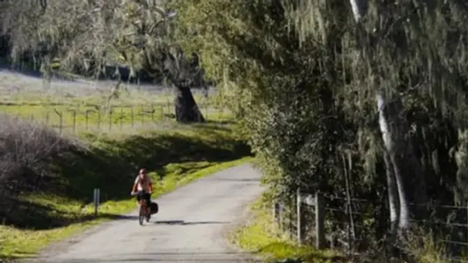
Spring has arrived and a great place to enjoy it is the serene countryside outside of Solvang. There are two roads outside of Solvang that we will be taking. The first is Refugio Rd. which follows Quiota Creek and is rimmed by mature oaks as it makes its way up to eventually West Camino Cielo. […]
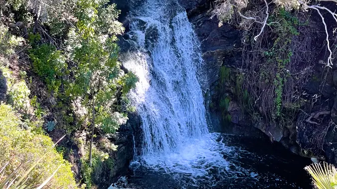
Wildwood Park in Thousand Oaks is one of the most versatile local parks there is, with 27 miles of trails skittering through rocky cliffs, cacti-filled desert environs, volcanic rock, riparian forest, and a cool, watery canyon. Highlights of the hike include waterfalls incorporating 40’ Paradise waterfalls along with a long creek, Indian caves, volcanic rock […]
http://photos1.meetupstatic.com/photos/event/b/f/8/6/event_22189030.jpeg Space Mountain is the name for Los Robles Trail West, starting at Moorpark Road in Thousand Oaks and switchbacking up the hill to the west. No one seems to know why it's called Space Mountain, though maybe the Disney ride inspired it. Maybe former major league pitcher Bill "Spaceman" Lee had something to do […]
Hoping we can squeak this in before the rain. Please check around 4 p.m. to see if the hike is still on as rain will cancel the hike. Please read these restrictions before signing up. Pandemic conditions and restrictions apply for your safety and ours: Don't sign up unless you are two weeks past your […]
This year's COSF Speaker Series theme is "Sustainability" Please join Conejo Open Space Foundation's live online presentation by a panel of three local experts who will discuss how residents can help reduce the amount of household waste that ends up in our landfills. Register through the COSF site, not via Meetup! Included will be discussions […]
Thursday's forecast is for 50% chance of rain. If it's raining at 7:30 a.m., the hike will be cancelled - please check before departing for the trailhead. For our Thursday Gentler hike, we will hike the Powerline Trail to Conejo Peak, including a brief stop at the "teardrop" loop below the final (and skippable) climb […]
This Ebike ride will be on paved roads in the Porter Ranch area. We'll be taking the Brown Canyon Road all the way to the top (Oat Mountain) which has an average grade of 12%. This will be a challenge for our ebikes. If you haven't done this before, it will be a good test […]
NEW Lollipop: PCT to Spruce Draw then hiking the Leona Divide Fire Rd west to the intersection of Lake Hughes Truck Trail; We will take a snack break at the Intersection then return counter-clock wise hiking east on the PCT back to our cars on San Francisquito Cyn Rd. DISTANCE / GAIN: ~ 8.5 miles […]
This hike will be about 5.4 miles total with 820 ft. of elevation gain. We are starting at the parking lot at the Wahoo's parking lot. We will take Live Oak Trail. This turns into Serrano Road which will take us to Serrano Cow Trail. At this part of the trail, we usually see a […]
PIER TO PEAK WALKABOUT IN THE DOWNTOWN VENTURA AREA! JOIN THE GROUP WHEN/WHEREEVER YOU CAN/WANT... Times given are my best guesstimate for movement between the stated destinations, including loitering time. This timing is delayed 30 minutes from last time and should work well, especially for those not paying for the Wine Walk. Someone in the […]
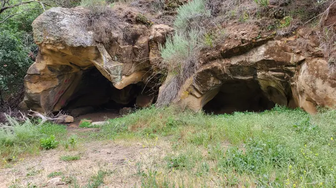
This hike has just about everything: Caves, creeks, waterfalls, velvety meadows, flowers, sandstone formations and artifacts. We start at Dayton Canyon Park then loop around the Woolsey Canyon Open Space Dayton Canyon Park is 276 acres recently given to the Santa Monica Mountains Conservancy by the Sterling Homes development at the bottom of the canyon. […]
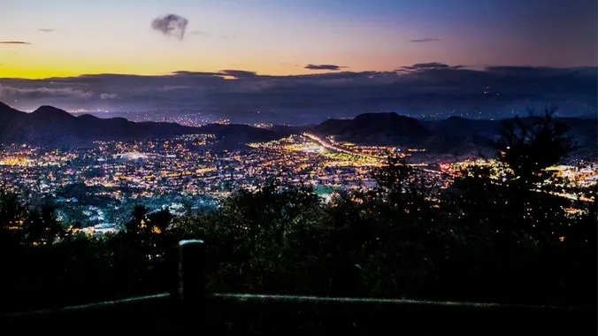
3.0 miles, 800' gain, easy-intermediate. Let's enjoy the gorgeous sunset and "Pink Moon", the April full moon, at the beautiful Angel Vista! This hike is rated easy-intermediate because it is a continuous incline for 1.5 miles. This isn't real steep, but it is continuous, and many beginner hikers have indicated this should be rated intermediate. […]
This ride will have us travel along paved roads in the Westlake Village/ Agoura Hills area that has six reservoirs that are part of the Las Virgenes water system. We'll be able to see four of these (Malibu, Lindero, Westlake and Sherwood) from paved roads. The other two (Las Virgenes and Eleanor) will require an […]
This figure 8 hike starts at the parking area in Hill Canyon, we’ll cross the bridge over the runoff creek, and stroll a mile before turning onto the Hawk Canyon Trail. The Hawk Canyon Trail connects to Western Plateau Trail and Peninsula Trail which runs back down rejoining the Western Plateau Trail to The Hawk […]
Today we'll hike the Backbone Trail looking for wildflowers. We'll begin at Latigo Canyon and walk on dirt and stuff until we reach the familiar sandstone structures of Mesa Peak Motorway. Along the way, we'll cross Castro Crest and descend into Upper Solstice Canyon before we climb to Mesa Peak Motorway, at the top of […]
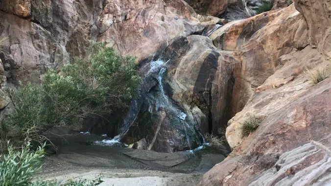
3.3 miles, 800' gain, fit beginner A hike to Paradise Falls is one of the most popular things to do for those visiting Simi Valley, yet a lot of people that live nearby rarely make this fun hike or perhaps have never done it. There are several paths one can take to the falls. This […]
INFORMATIONAL POSTING -34th Annual Beginning Backpack Class Have you ever wanted to learn to backpack and get away from the crowds of people? Learn how to backpack in 3 Sunday courses (4/30, 5/7, 5/21) culminating in a backpack 6/3-4. Course times are 1:00 PM - 5:00 PM Learn what to take, latest in equipment, what […]
AUGUST 2022 UPDATE: Please review the revised guidelines to participate in our hikes. Here are some highlights and a link to the guidelines: https://www.meetup.com/The-Weekday-Trailblazers/about/ Restrictions apply for your safety and ours: *Proof of vaccination required Don't show up unless you're on the "Attending" list No "Plus Ones" on this hike Our Out and Back hike […]
THIS Thursday's forecast is for mostly sunny weather with a high of 74° - Yay! Both Laurie and I will post hikes - please only register for one (this leaves room for others to join). For our Thursday Gentler hike, we will hike the Powerline Trail to Conejo Peak, including a brief stop at the […]
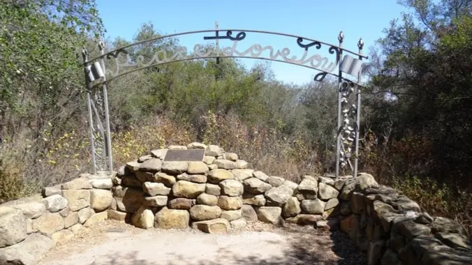
Both Steve and I will lead hikes this Thursday. Please ONLY register for ONE hike so there is room for others to join. Let's head out to the famed Peace, Love, Joy arch at the Danielson. This out and back hike wanders through grasslands and chaparral from the Wendy trailhead, then climbs up Boney Mountain […]
3 miles, 700' gain, Easy Intermediate Easier Option: 2.4 mi, 530' gain. (1343 Los Amigos Ave, Simi Valley, CA 93065, or 89 La Paz Ct, Simi Valley, CA 93065 to save another 500' distance). A special treat: The cross will be lit! The Rotary Club lights the cross for the week from Palm Sunday to […]
https://www.alltrails.com/trail/us/california/cheeseboro-ridge-las-virgenes-canyon-loop Hello Fellow Hikers, This is a really popular area on the weekends so I thought hitting during the week to stay away from the crowds and mountain bikers. This area comes alive during the winter season with lush mountain scenery. The incline is gradual. Looks like we will start on more of a fireroad […]
Saturday, April 8th , 2023 - Vasquez Rocks to Indian Cyn on Pacific Crest Trail, 1 way w/ shuttle Meet at: Indian Canyon trailhead, details below. Start Hike: We will consolidate at Indian Canyon and shuttle to Vasquez Rocks where we will start the hike, details below. Length: 9.5 miles Gain/ Loss: ~ 1273' / […]
We are going to be doing a different hike at the park, (not at the main park entrance). We are going to be starting at the Canyon View Staging Area. This hike will be about 6.2 miles with around 1,000 ft. of elevation gain. We will be starting at Canyon View Park and taking Cholla […]
Hello Fellow Hikers, Time for a road trip! Will be spending the day at the Wind Wolves Preserve. As we have a good drive ahead of us we will make the most of the day with the goal to hike four separate trails, no need to worry only two are rated moderate (on the easier […]
I posted a bike ride to Lake Hollywood and the Hollywood Sign in my other group. Join us here: https://www.meetup.com/socal-ebike-riders/events/292540026
6.5 miles, 1300' gain, intermediate Let's enjoy hiking to the Danielson Monument in the Boney Mountain Wilderness and potluck lunch! This is a great way to be thankful for the beautiful nature, our health and friendships. We'll hike up to Danielson monument and enjoy potluck and "Peace, Love and Joy." Please bring food and drinks […]
Oak Creek Canyon Trail is a rather special trail in Los Robles Open Space that is designed for the blind as well as the sighted. The all-access trail is shaded by a canopy of oaks, while the loop trail spends more time in the chaparral. The trails form a U-shape that is connected by hiking […]
This hike will be one of probably three hikes for next Tuesday. This hike will be the slowest, although it is a gentler intermediate hike. Please only sign up for one hike next Tuesday, so if you are a jackrabbit, you might want to wait for Laurie or Steve to post. This figure 8 hike […]
Let's head up to Mesa Peak, arguably the prettiest and best conditioning hike in the Santa Monica Mountains, on the Backbone, and opposite Corral Canyon from last week's hike. This invigorating out & back route goes up from the Piuma Backbone trailhead for 2.5 miles and then rolls along high above the Pacific for about […]
We are going to host two counter-rotating hikes so that we can accommodate up to 48 hikers. We will all be on the same trails, one loop going clockwise with Laurie starting at the Los Padres trailhead and one loop going counterclockwise with Steve starting at the Los Robles Trailhead. We will converge at the […]
We are going to host two counter-rotating hikes so that we can accommodate up to 48 hikers. We will all be on the same trails, one loop going clockwise with Laurie starting at the Los Padres trailhead and one loop going counterclockwise with Steve starting at the Los Robles Trailhead. We will converge at the […]
This side of the park is back open! I'm excited to be back. This hike will be about 5.4 miles total with 820 ft. of elevation gain. We are starting at the parking lot at the Wahoo's parking lot. We will take Live Oak Trail. This turns into Serrano Road which will take us to […]
Jerry Schad's Indian Canyon / Borrego Palm Canyon Traverse (see photos for description!) “This is a grand tour of one of Anza-Borrego’s most remote, rugged, and beautiful areas. In the midsection of this trip, you’ll pass through a pristine wilderness where the tracks of a mountain lion are far more common than the impressions of […]
The hike will be about 4.5 miles with about 500 ft. of elevation gain. We will start on Peters Canyon Trail and take this to East Ridge View Trail. This is where we will go up Big Red. Then we will continue on this trail until we get to Eucalyptus to loop back. We will […]
Meetup Time: 8:15 A.M. DISTANCE: 9 miles - Loop GAIN: 1,569 ft' RATED: Not for beginners. This one is Moderate / Moderate +++ mainly for almost 1600 Elevation Gain and Distance. HIKE DURATION: About 5 1/2 hours (including a 20-minute snack break) DESCRIPTION: The area of China Flat and Simi Peak is in the Santa […]
No matter what genre of music he composed, Mozart did so with masterful skill – operas, choral works, concertos, chamber music, solo songs, sonatas, chamber works, and symphonies – making him what many consider the greatest composer in history. Highlights from more than six hundred works will take you on a Grand Tour of Mozart’s […]
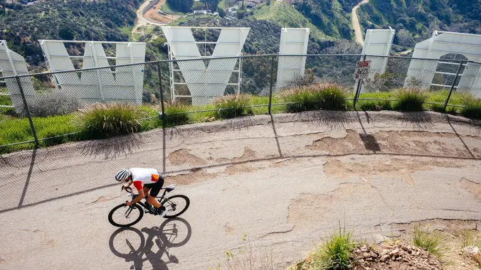
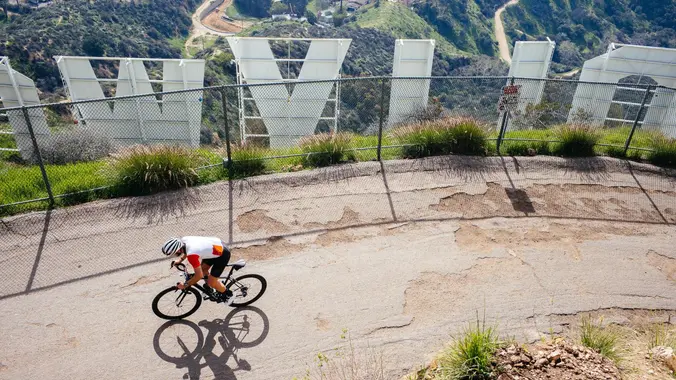
Hooray for Hollywood! There is only one legal way to bike to the Hollywood sign and that's the way we will take. But that's not all... Our all-road loop starts and ends at the Fern Dell Nature Museum in the Hollywood Hills. We'll ride west across Hollywood, mostly on Franklin Ave and Yucca St, until […]
The hike we will be doing is a loop at about 5.5 miles with 725 ft. of elevation gain. We will meet at the Willow Staging Area that is right off of the 133. We will begin at the trail head of the Laurel Canyon Trail. We will take this to Lizard Trail, then we […]
https://www.alltrails.com/trail/us/california/tapo-canyon-trail?u=i Hello Fellow Hikers, Join me on a easier moderate hike at Tapo Canyon Trail in Simi Valley. This hike has a nice gradual walk until we start a gradual climb were we will start our loop. We should encounter wildflowers and mountain views. Our loop will drop down then we will continue until we […]
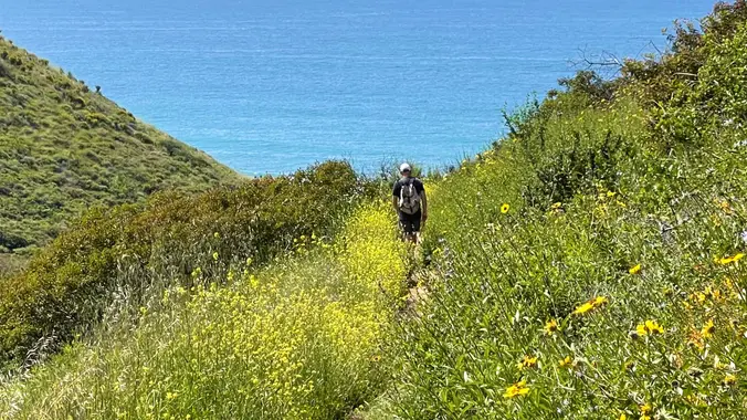
I pre-hiked the trail this morning and it is absolutely stunning with wildflowers beside the awesome blend of ocean and mountain views in Malibu’s La Jolla Canyon. The trail follows the canyon eastward, away from the ocean. Then, it quickly brings you back toward the ocean at a gradual incline. There’s a great lookout spot […]
DETAILS Only show up if you're on the "Attending" list No "Plus Ones" on this hike bring sunscreen HIKE DETAILS: This hike is one of probably three hikes on Tuesday. This hike will go from the beach up to the picnic table on the fire road, approximately 5.5 miles. We will hike a little slower […]
One of three hikes posted this Tuesday - please only sign up for one! And if you can't make it, please cancel as early as possible so waitlisted folks can get notice and attend. Note we will be crossing water (hopefully) up to a dozen times. I strongly recommend waterproof boots and trekking poles. Additionally, […]
INFORMATIONAL POSTING -34th Annual Beginning Backpack Class Have you ever wanted to learn to backpack and get away from the crowds of people? Learn how to backpack in 3 Sunday courses (4/30, 5/7, 5/21) culminating in a backpack 6/3-4. Course times are 1:00 PM - 5:00 PM Learn what to take, latest in equipment, what […]
INFORMATIONAL POSTING -34th Annual Beginning Backpack Class Have you ever wanted to learn to backpack and get away from the crowds of people? Learn how to backpack in 3 Sunday courses (4/30, 5/7, 5/21) culminating in a backpack 6/3-4. Course times are 1:00 PM - 5:00 PM Learn what to take, latest in equipment, what […]
This hike will be about 5.4 miles total with 820 ft. of elevation gain. We are starting at the parking lot at the Wahoo's parking lot. We will take Live Oak Trail. This turns into Serrano Road which will take us to Serrano Cow Trail. At this part of the trail, we usually see a […]
AUGUST 2022 UPDATE: Please review the revised guidelines to participate in our hikes. Here are some highlights and a link to the guidelines: https://www.meetup.com/The-Weekday-Trailblazers/about/ Restrictions apply for your safety and ours: *Proof of vaccination required Don't show up unless you're on the "Attending" list No "Plus Ones" on this hike Our Out and Back hike […]
A few years ago, Weekday Trailblazer members helped build a trail that extends north from the Westlake Village YMCA up into the hills west of Lindero Canyon Road. We will hike both the Bowfield Trail and Wishbone Trail on this outing. This route is about 5 miles with an elevation gain of about 1050’. I […]
This is a second hike for Thursday since the only hike posted is full. We will start near the beginning of Regal Oak Ct. on the lower Rosewood Trail, a dirt trail heading up a shaded ravine at the base of the mountain and continue to the usual Rosewood trail. We will hike to the […]
4 miles, 1100' gain, Intermediate Easy Option: 1.5 miles, 400' gain, Fit Beginner The entire hike outbound is a steady incline. Nothing super steep, just continuous and quite strenuous for many. There are virtually no junctions where one can get lost. This is one of the more famous hikes in Simi Valley, and for good […]
With all the rain we've had this winter, the trails in Pt. Mugu State Park (Sycamore Canyon) have a lot of ruts to fill and brush to cut back. How does free camping at the Danielson Ranch in Point Mugu State Park, a barbecue dinner, coffee & bagels in the mornings and the chance to […]
Santa Cruz Island camping suitable for beginners. Need to hike your gear in 1 mile. $84per person. You are responsible for your own boat ticket. You will also contribute $5 to cover the campground fees DO NOT PURCHASE BOAT TICKETS UNTIL THE SPRING There are multiple boats that leave from Ventura Harbor on 4/22 (8am, 9am, […]
This hike is going to be exploring new trails in the Saddleback Wilderness! We will be doing 3.3 miles. Come join us for this awesome event! ***Please note: You must be also be registered here: https://letsgooutside.org/activities/2023/04/22/saddleback-wilderness-access-morning-session-3/ Registration on the external site opens on 4/14/23 at 8am. Sign up ASAP as spots will be limited. They […]
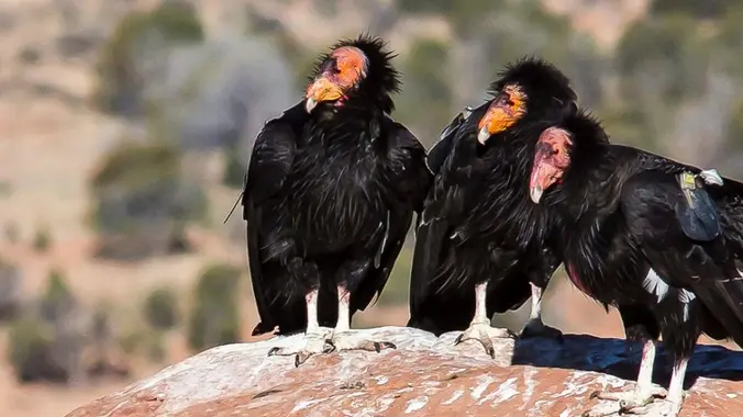
THIS IS A CHC STEWARDSHIP/VOLUNTEER EVENT, IT IS NOT A HIKE * Saturday April 22, 2023 - CONDOR CLEAN UP in the St. Francis Dam area, near Santa Clarita Description: Join us at the bottom K-Rails near the dam site for Earth Day! We need your help to pick up broken shards of glass in […]
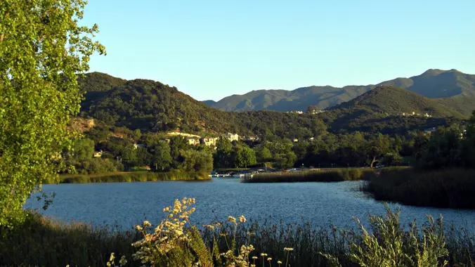
This one is another HWD original! I put this one together back in 2009 after exploring some Westlake Village use trails. With the combination of use trails, some minor rock scrambling and views of two local lakes, the result is probably the best hike in Westlake Village. The Pentachaeta Trail, the main feature of Triunfo […]
The hike we will do starts from the parking lot across from the Ortega Oaks Candy Store. It will be 6.8 miles (total) with 1200 ft. of elevation gain. We will take the Bear Canyon Loop Trail to the 4 Corners trail junction. We will take the Bear Ridge Trail back and do a lollipop […]
We are going to be doing a different hike at the park, (not at the main park entrance). We are going to be starting at the Canyon View Staging Area. This hike is roughly 7 miles with relatively low elevation gain. The expectation is to definitely make it to Cave Rock and Dripping Cave. Hopefully […]
This hike will be about 5.4 miles total with 820 ft. of elevation gain. We are starting at the parking lot at the Wahoo's parking lot. We will take Live Oak Trail. This turns into Serrano Road which will take us to Serrano Cow Trail. At this part of the trail, we usually see a […]
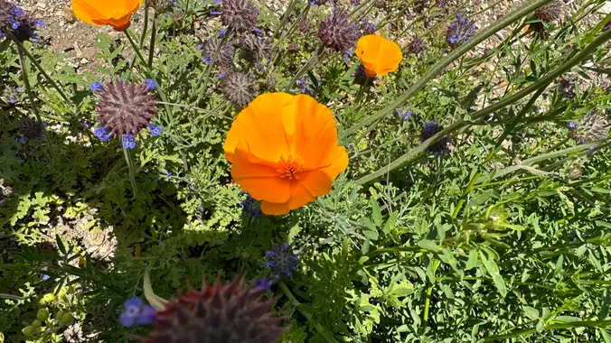
How about an earlier option on the same trail? Come out in the cool early morning for the same hike. They will see us coming back. Join us on an out and back hike up the Ray Miller Trail and the Overlook Trail. We’ll turn back around the Guadalasca Trail intersection. Poppies were plentiful on […]
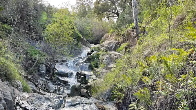
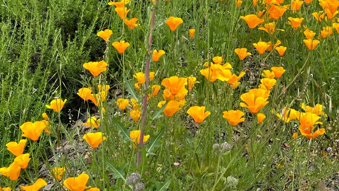
This hike starts at Castillo Trail to Wildwood Park. Currently, it’s spectacular with an abundance of mustard greens, wildflowers and California poppies in addition to bountiful water in the waterfalls and creeks. Wildwood Park in Thousand Oaks is one of the most versatile local parks with 27 miles of trails skittering through this area, which […]
Join us on an out and back hike up the Ray Miller Trail and the Overlook Trail. We’ll turn back around the Guadalasca Trail intersection. Poppies were plentiful on the Overlook trail a couple of week ago. We’ll enjoy beautiful ocean views as we descend. We'll pick up about 1500’ gain on this 8-9 mile […]
Details EBIKE RIDE ALONG ALISO CREEK - LAGUNA NIGUEL TO COOKS CORNER "The Aliso Creek Regional Riding and Hiking Trail is a well-maintained class 1 bikeway and soft recreational trail extending from foothills of Orange County to the boundary of Laguna Beach. The continuous fifteen miles of asphalt bikeway designed for multi-use travel through five […]
This side of the park is back open! I'm excited to be back. This hike will be about 5.4 miles total with 820 ft. of elevation gain. We are starting at the parking lot at the Wahoo's parking lot. We will take Live Oak Trail. This turns into Serrano Road which will take us to […]
Please read these restrictions before signing up. Pandemic conditions and restrictions apply for your safety and ours: Don't sign up unless you are two weeks past your 2nd vaccination Don't show up unless you're shown on the "Attending" list Unregistered or waitlisted will be turned away No "Plus Ones" on this hike You will be […]
We haven't done this hike in about 2 years and there are still a lot of wildflowers blooming in this big loop around Rancho Sierra Vista, so hopefully we will enjoy some of them, along with some pretty views of Boney Mountain. We will meet at the trailhead parking area at the intersection of Wendy […]
This is a gentler hike for Thursday, we will start in the parking lot at Rancho Sierra Vista and head up through grasslands and chaparral from the Rancho Sierra Vista trailhead, then climb up Boney Mountain Trail for some fantastic views north to Port Hueneme and Oxnard and west toward the Pacific Ocean. We may […]
Beginner, 5 miles, 500' gain This hike is entirely fire-road and is almost completely flat. Some of this trail is sandy, so walking it at times can be more difficult. There are a lot of different interesting plants on this hike. From the trail head, we walk along the fire road next to the golf […]
This is Part one of the new BKS (Butt Kicking Series) of hikes! *(Hikes with close to 3000' Gain and or 10 or more miles.) *** Safety Note: Rain or Extreme Heat at trailhead cancels hikes. Return to Slide to Slide Mountain Fire Lookout Tower (4,631'), overlooking Pyramid Lake not just for the challenge but […]
Kern Gateway Trail Proposal The Kern Gateway Trail team is a group of community members with a love of the Kern River canyon and are working to create a connected trail in the Kern River Canyon. There is a short but steep climb at the beginning of the trail. Bring hiking poles, trail shoes with […]
Our third Backbone Trail hike in the Santa Monica Mountains will be 7 miles with 2000’ elevation gain on the BBT from Topanga Canyon to the Lois Ewen Overlook. We will hike from Trippet Ranch to behind Topanga Canyon School passing across Old Topanga Canyon Road to take Hondo Canyon and then the Fossil Ridge […]
Many hiking groups promise to take you to Mesa Peak but they never do. That's because they have confused their peaks and take you to the wrong one. So come along with us to the real Mesa Peak! (elev 1,844 ft). Along the way there will be a creek crossing and green meadows. Our classic […]
Our fourth Backbone Trail hike in the Santa Monica Mountains will be 7 miles with 600” elevation gain on the BBT going from Lois Ewen Overlook to Tapia Park. The hike will climb past Saddle Peak and then descend along the Saddle Peak Trail crossing Piuma Road to the Piuma Ridge Trail where it intersects […]
The hike I am planning is around 6.3 miles with about 700 ft. of elevation gain. It starts at the very end of the paved road, the long gray strip that can be seen on the map. We will begin at the Bell Canyon Trail head. We will continue onto that and then take it […]
Trail statistics are approximate. For safety purposes always assume they are underestimated. But don’t be disappointed if they are overestimated. Bring more water and snacks than you think you’ll need.
Trail descriptions are based on previous hikes. Current conditions are unknown until arrival. Expect the unexpected and plan accordingly.
The Organizers and members of Hiking With Dean are not professional leaders, guides, or mountaineers. The function of the member or organizer is only to organize the trip. Each person who shows up for a trip/meetup (and their guest or guests) is responsible for his or her own safety. By attending a hike, or any other event organized by this group, you are acknowledging that you and any guests that you bring are aware of the risks, dangers and hazards associated with the activity and freely accept and fully assume all such risks, dangers and hazards, and further agree to release and discharge the Organizers, Members of the Hiking With Dean Meetup Group from and against any and all liability arising from your participation in the group activities per our ASSUMPTION OF RISK AND LIABILITY WAIVER and Section 6.2 of the Meetup.com Terms of Service.





















Recent Comments