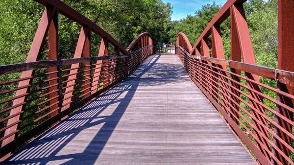
BEFORE YOU WILL BE MOVED TO THE GOING LIST, YOU WILL NEED TO UPDATE YOUR CDH PROFILE (The three questions must be answered with a "yes") IF YOU HAVE NOT ALREADY DONE SO.NEED HELP:go to: https://wp.me/P9MbG4-hC BIKE RIDE FROM VENTURA TO SEA CLIFF AND BACKWe'll be riding from San Buenaventura State Beach in Ventura to […]
BEFORE YOU WILL BE MOVED TO THE GOING LIST, YOU WILL NEED TO UPDATE YOUR CDH PROFILE (The three questions must be answered with a "yes") IF YOU HAVE NOT ALREADY DONE SO HOW TO UPDATE YOUR PROFILE:https://wp.me/P9MbG4-hC Please join me for an early, short hike to Echo mountain via the San Merrill trail. I […]
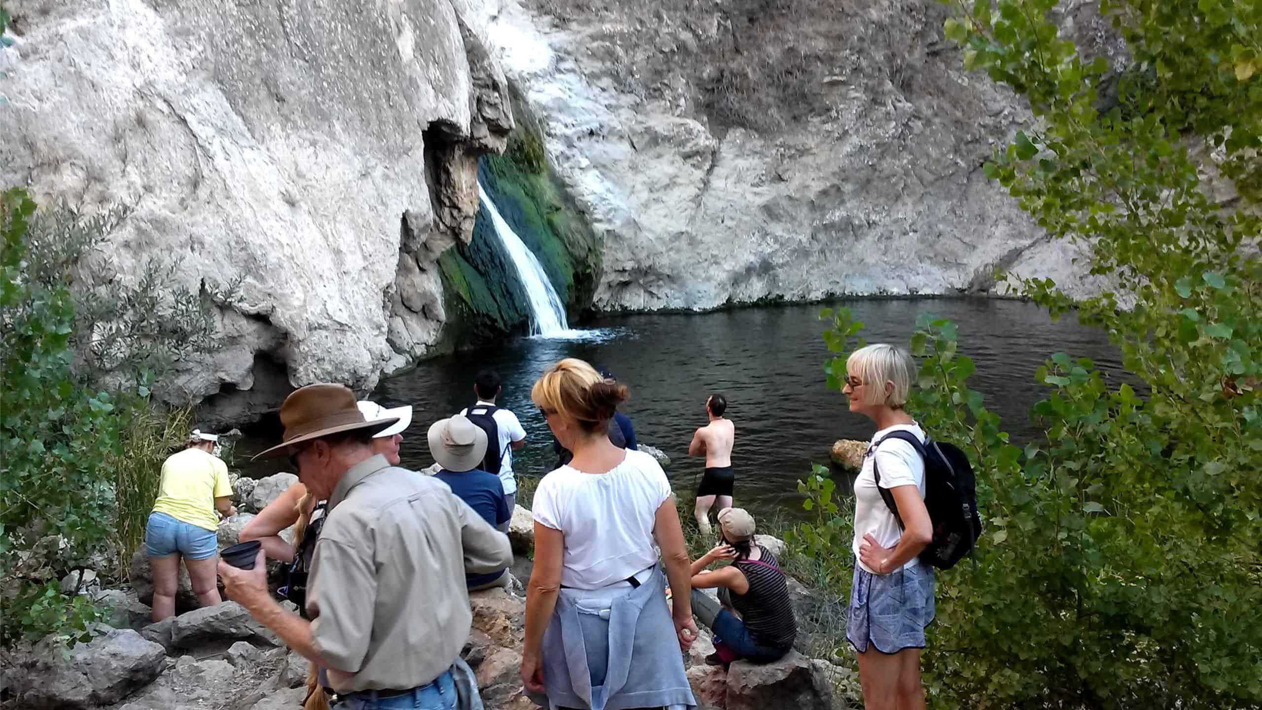
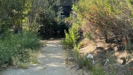
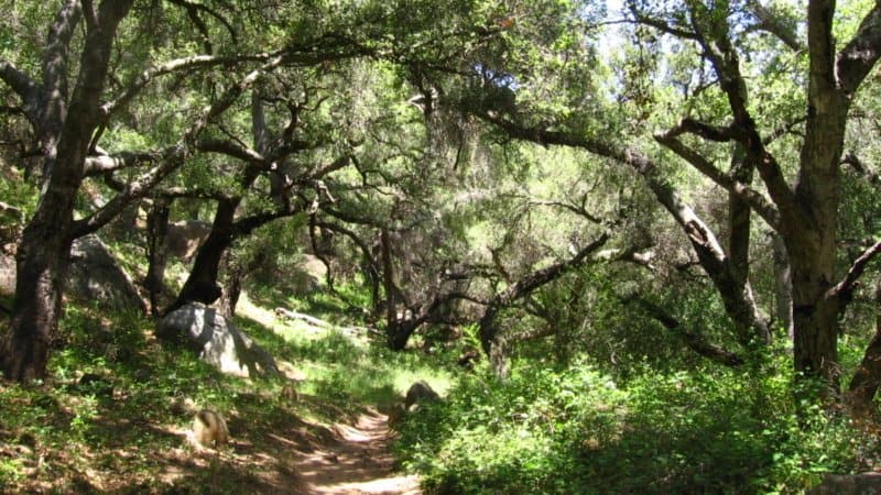
3.3 miles, 800' gain, fit beginner. A hike to Paradise Falls is one of the most popular things to do for those visiting Simi Valley, yet a lot of people that live nearby rarely make this fun hike or perhaps have never done it. There are several paths one can take to the falls. This […]
STATSDifficulty: 4/10, Steep up & down, with some slippery spotsLength: 3 miles, 2 hours plus breaksElevation Gain & Loss: 1225’; Peak: 2700’View: Amazing 360 View of Valleys and MountainsDetails: This hike has some STEEP moments but has a bench at the top to relax on. We made a new uphill trail, which is not on […]
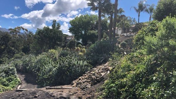
BEFORE YOU WILL BE MOVED TO THE GOING LIST, YOU WILL NEED TO UPDATE YOUR CDH PROFILE (The three questions must be answered with a "yes") IF YOU HAVE NOT ALREADY DONE SO.NEED HELP:go to: https://wp.me/P9MbG4-hC I've always enjoyed driving through Montecito, one of the most beautiful landscaped communities around. I've found trails that meander […]
This is a potluck hike in the Los Robles Open Space. We will do the Oak Creek Canyon-Los Robles-Los Padres Loop among some beautiful oak groves and great views of the Conejo Valley. That will be about 4.5 miles with 900' total ascent and is rated MEDIUM (see https://www.hikingwithdean.com/hike-rating-guide/) There are facilities at the trailhead […]
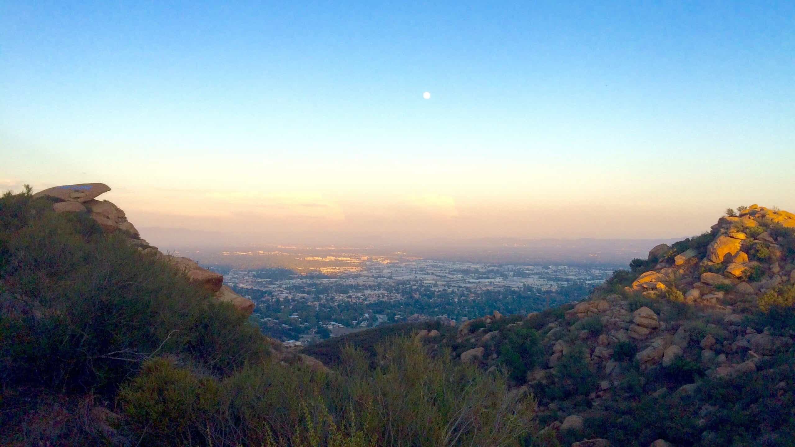
BEFORE YOU WILL BE MOVED TO THE GOING LIST, YOU WILL NEED TO UPDATE YOUR CDH PROFILE (The three questions must be answered with a "yes") IF YOU HAVE NOT ALREADY DONE SO HOW TO UPDATE YOUR PROFILE:https://wp.me/P9MbG4-hC Mount Lukens (5074') stands majestically above the Crescenta Valley as the western most peak of the San […]
Easy Intermediate, 4 miles, 900' gain. Easy Intermediate means it is on the easy end of the intermediate spectrum: https://www.meetup.com/Hiking-Plus/messages/boards/thread/50879781 This is an upside down lollipop that takes us first to the highest point in the area where the views are fantastic. The return is down around the back side of the hill at the […]
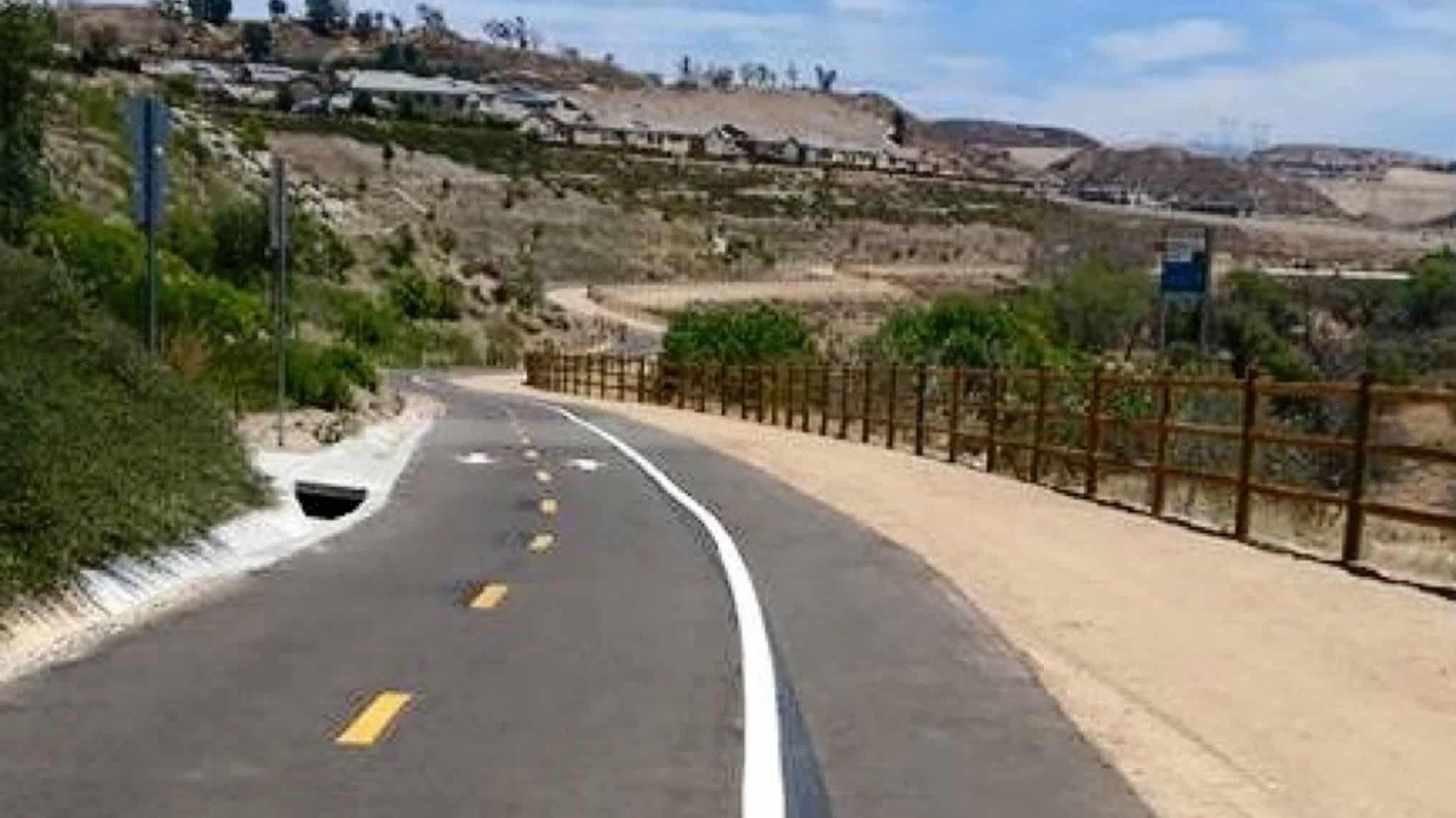
BEFORE YOU WILL BE MOVED TO THE GOING LIST, YOU WILL NEED TO UPDATE YOUR CDH PROFILE (The three questions must be answered with a "yes") IF YOU HAVE NOT ALREADY DONE SO.NEED HELP:go to: https://wp.me/P9MbG4-hC We'll be hiking 4 miles along the relatively new Las Virgenes Creek trail which will be perfect for beginners […]
https://www.alltrails.com/trail/us/california/cheeseboro-ridge-and-modelo-trail-loop Hello Fellow Hikers,Cheeseboro Ridge is a pretty open view hike of mountains and trails. Nice amount of elevation with stretches of leveled off sections. This s a popular area on the weekends with hikers and mountain bikers alike. Will be following the hike s a loop from AllTrails.I have attached the AllTrails link for […]
HWD member Arlette Apelian, along with 75 other local ceramic artists, will be showing their ceramic art pieces at the Green & Bisque Clayhouse in Pasadena. The pieces will also be for sale Free Admission • Featuring 75+ Artists • Free Giveaways • Food & Drinks The first 25 visitors on each day will receive […]
Our route begins on Trailer Canyon fire road providing broad views over Santa Ynez Canyon and the surrounding mountains. But like nature and vacuums, we abhor fire roads. Thus, shortly after the hike begins we will leave the fire road and take a small, slightly overgrown use trail that passes a clay gully and crosses […]
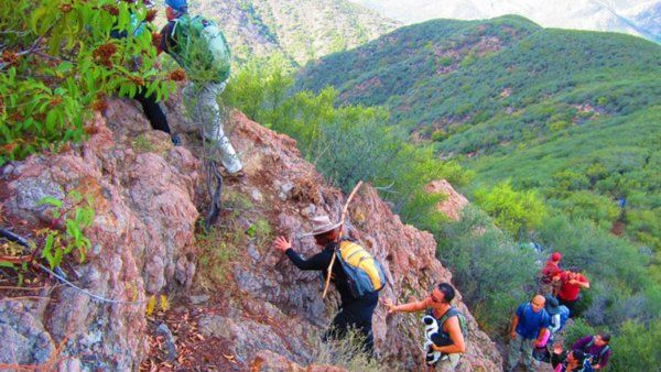
Stats: Distance: 9-10 miles, 5-7 hours Elevation Gain: 2700 ft. Rating: Moderate 8/10 Not for beginners, no sweeper! Trail: Looped, will be on mostly rocky and regular trails with a very short stretch of pavement. WARNING: There will be some short stretches of steep uphill climbs where some might feel more comfortable on their hands […]
https://www.alltrails.com/trail/us/california/trippet-ranch-to-eagle-springs-loop-trail Hello Fellow Hikers,Okay this area was hit by fire May of this year and completely changed the landscape but as most have said made it interesting to experience. To see mother nature restoring herself and wildlife returning made the trail interesting and exciting. Will be passing Eagle Rock on this one which is a […]
https://www.alltrails.com/trail/us/california/mission-point-via-bee-canyon-trail Hello Fellow Hikers,Okay I know what you're thinking 5.6 miles just over 1400 elevation gain rated hard? Yep it's rated hard for a reason. This trail starts out nice and easy through O'Melveny Park. It shaded and lined with beautiful trees a nice and easy walk. That's until you finally hit the trailhead and […]
SANDSTONE PEAK is the HIGHEST point in the Santa Monica Mountains at 3,111 feet with gorgeous views of the ocean and Channel Islands. Kinda steep in places, but we'll be taking it a relaxed pace so there be time to take photos and enjoy the scenery. The LOOP is 7 miles. Depending on the conditions, […]
Details We did this hike back in 2017 to uncover and clear a couple of my secret trails that were to be used for my Cheeseboro to the Sea hike. The trails connect Talepop with Liberty and Cheeseboro Canyons. Although uncovering the secret trails was a success, because of the Woolsey fire and other logistical […]
BEFORE YOU WILL BE MOVED TO THE GOING LIST, YOU WILL NEED TO UPDATE YOUR CDH PROFILE (The three questions must be answered with a "yes") IF YOU HAVE NOT ALREADY DONE SO.NEED HELP:go to: https://wp.me/P9MbG4-hC BIKE RIDE AROUND THE SANTA CLARA RIVERBEDThe route will be primarily along the Santa Clara River and San Francisquito […]
https://www.alltrails.com/trail/us/california/tapo-canyon-trail?u=i Hello fellow hikers,Join me on a easier moderate hike at Tapo Canyon Trail in Simi Valley. This hike has a nice gradual walk until we start a gradual climb were we will start our loop. We should encounter wildflowers and mountain views. Our loop will drop down then we will continue until we start […]
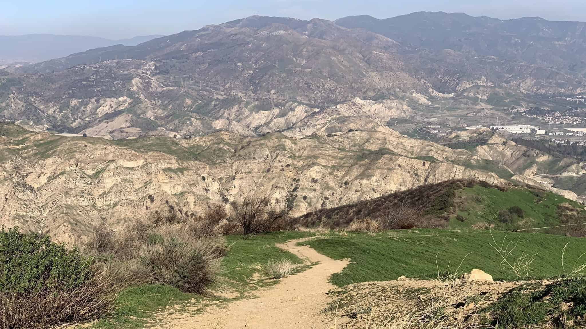
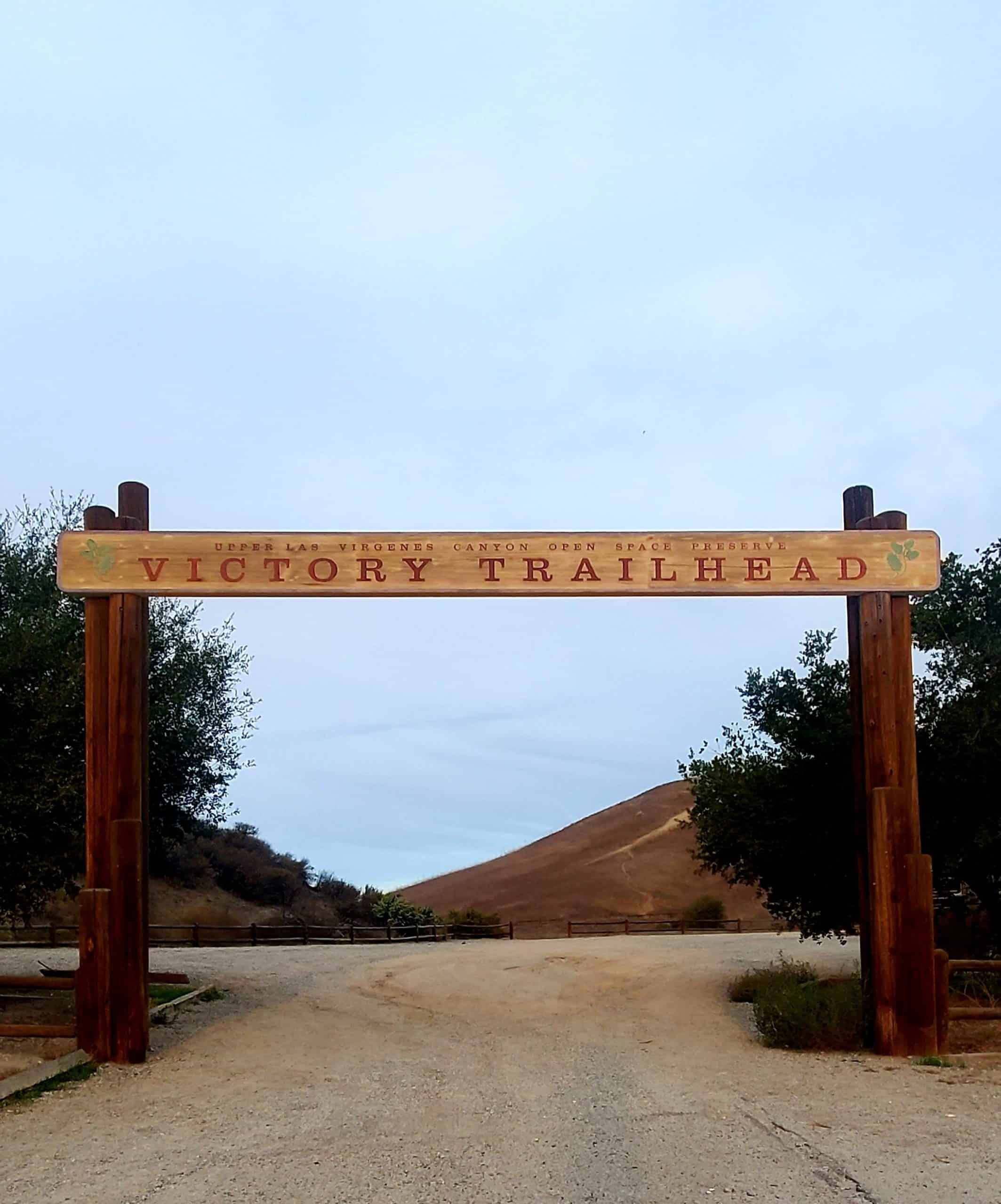
BEFORE YOU WILL BE MOVED TO THE GOING LIST, YOU WILL NEED TO UPDATE YOUR CDH PROFILE (The three questions must be answered with a "yes") IF YOU HAVE NOT ALREADY DONE SO HOW TO UPDATE YOUR PROFILE:https://wp.me/P9MbG4-hC Please join me for a nice hike in the Upper Las Virgenes Canyon Open Space Preserve I […]
4.6 miles, 1000' gain. Easy Intermediate. Different mapping apps give different directions for the same address, and many have gotten lost relying on GPS. If you don't know this location, please look on a map to find this location before heading out, and don't rely only on GPS. This is the Wendy Trailhead, where S. […]
STATSDifficulty: 4/10, Steep up & down, with some slippery spotsLength: 3 miles, 2 hours plus breaksElevation Gain & Loss: 1225’; Peak: 2700’View: Amazing 360 View of Valleys and MountainsDetails: This hike has some STEEP moments but has a bench at the top to relax on. We made a new uphill trail, which is not on […]
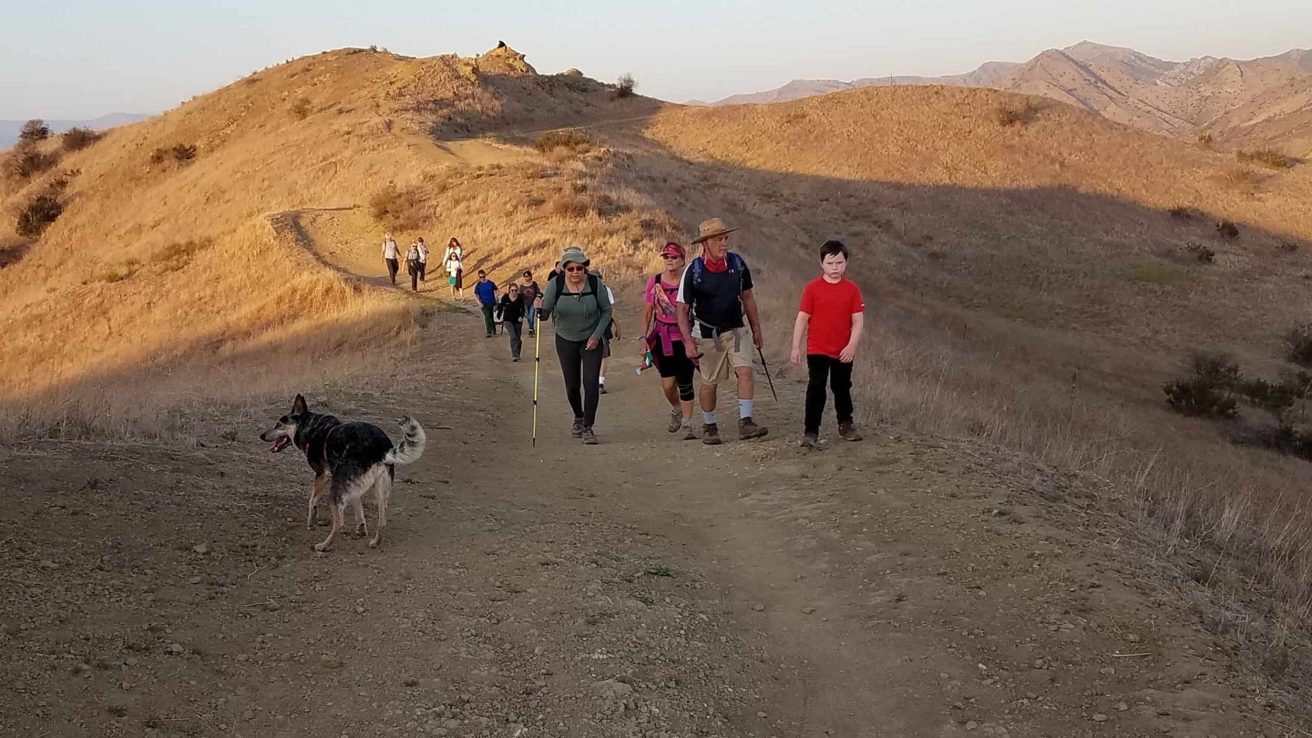
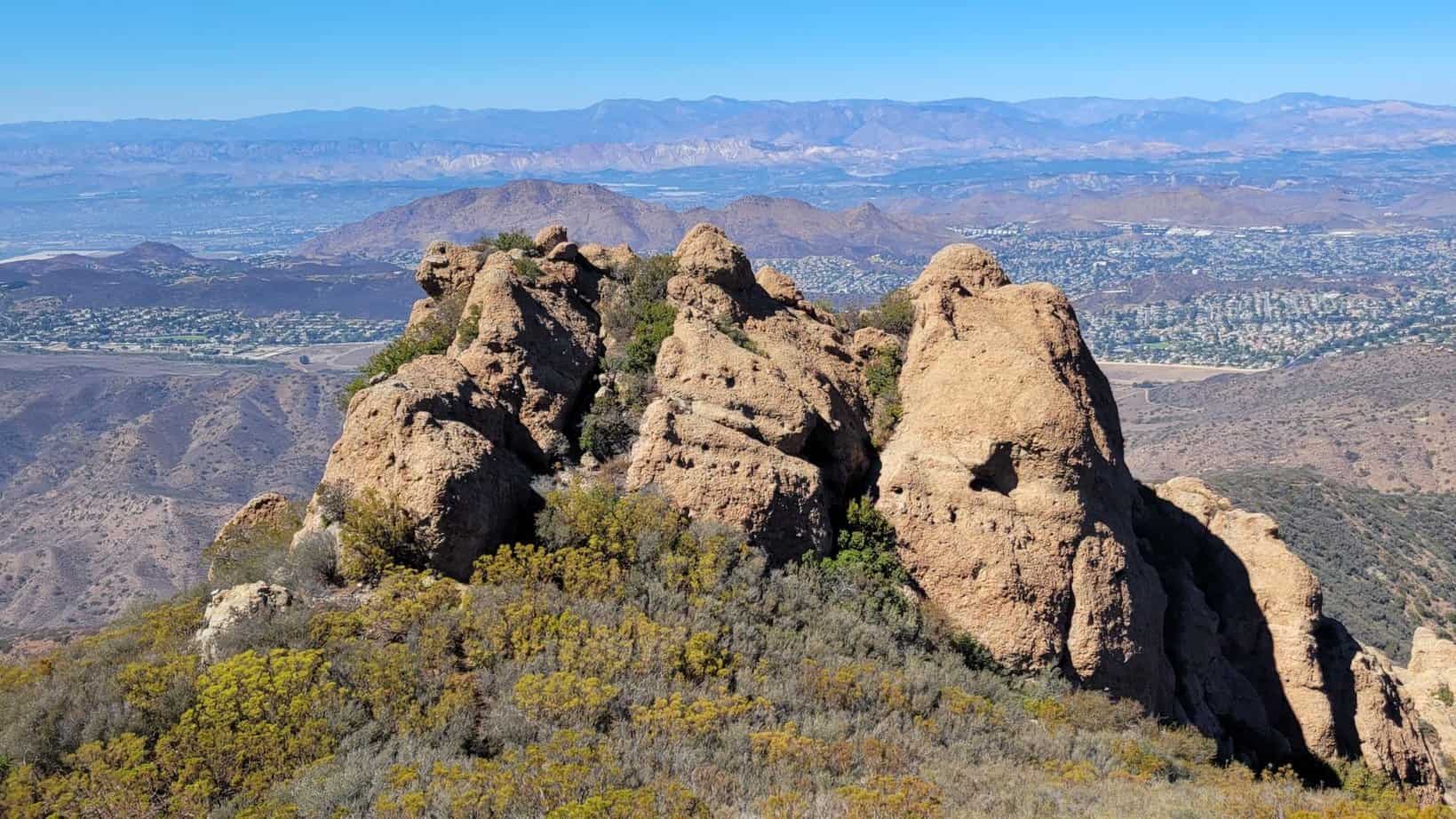
Details Join us for a the grand loop around 5,000-acre Rocky Peak Park. RPP in the Santa Susana Mountains straddles the Los Angeles-Ventura county line at the eastern end of Simi Valley. A network of hiking trails weaves through the park that is home to deep oak-lined canyons, trickling streams, and massive, sculpted sandstone formations […]
BEFORE YOU WILL BE MOVED TO THE GOING LIST, YOU WILL NEED TO UPDATE YOUR CDH PROFILE (The three questions must be answered with a "yes") IF YOU HAVE NOT ALREADY DONE SO.NEED HELP:go to: https://wp.me/P9MbG4-hC Parma Park has been on my list of areas to hike in for some time. Here's a chance to […]
5 miles, 800' gain, Easy Intermediate. This route would be classified as fit-beginner, if not for an extended incline that runs for almost a mile in the middle of the hike. It is a fire road with a continuous climb. Fit beginners should be OK on this hike, although they may wish to take several […]
BEFORE YOU WILL BE MOVED TO THE GOING LIST, YOU WILL NEED TO UPDATE YOUR CDH PROFILE (The three questions must be answered with a "yes") IF YOU HAVE NOT ALREADY DONE SO.NEED HELP:go to: https://wp.me/P9MbG4-hC Join me on another hike for our slow, old and WW (Walking Wounded) members. I will be walking at […]
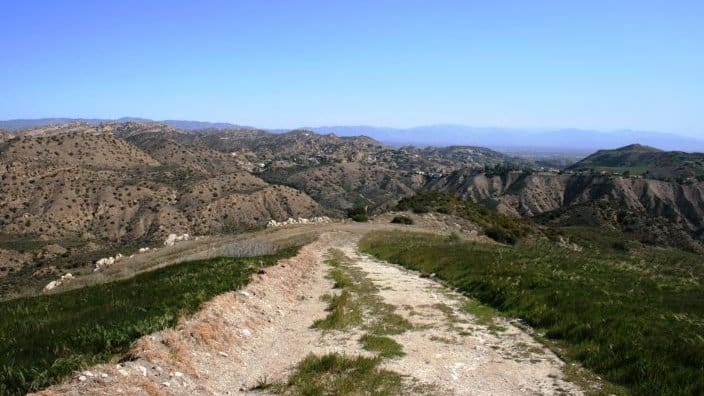
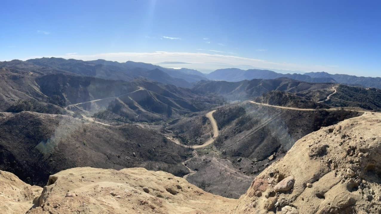
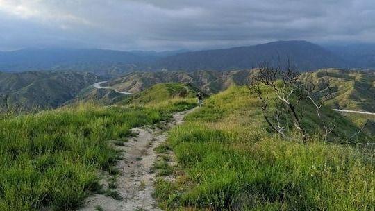
Distance: 9.5 MilesElevation Gain: 2800 ft.Trail: Single track, fire road, uneven downhills.Rating: 8/10, due to trail conditionPace: Intermediate to advanced Not for beginners-there won't be a sweeper!! The Plan StoryNot many small- or medium-sized cities can boast three mountain ranges within its border, but Glendale does. Stretching east and north from the San Fernando Valley, […]
https://www.alltrails.com/explore/trail/us/california/potrero-to-tripeaks-trail?mobileMap=false&ref=sidebar-static-map Hello Fellow Hikers,We have another request hike here. This is gonna be a good one for those who love more of a challenge. This trail is gonna be a steep climb with some rock scrambling. The trail is a harder hike and not recommended for a beginner or leisure hiker. This trail may have […]
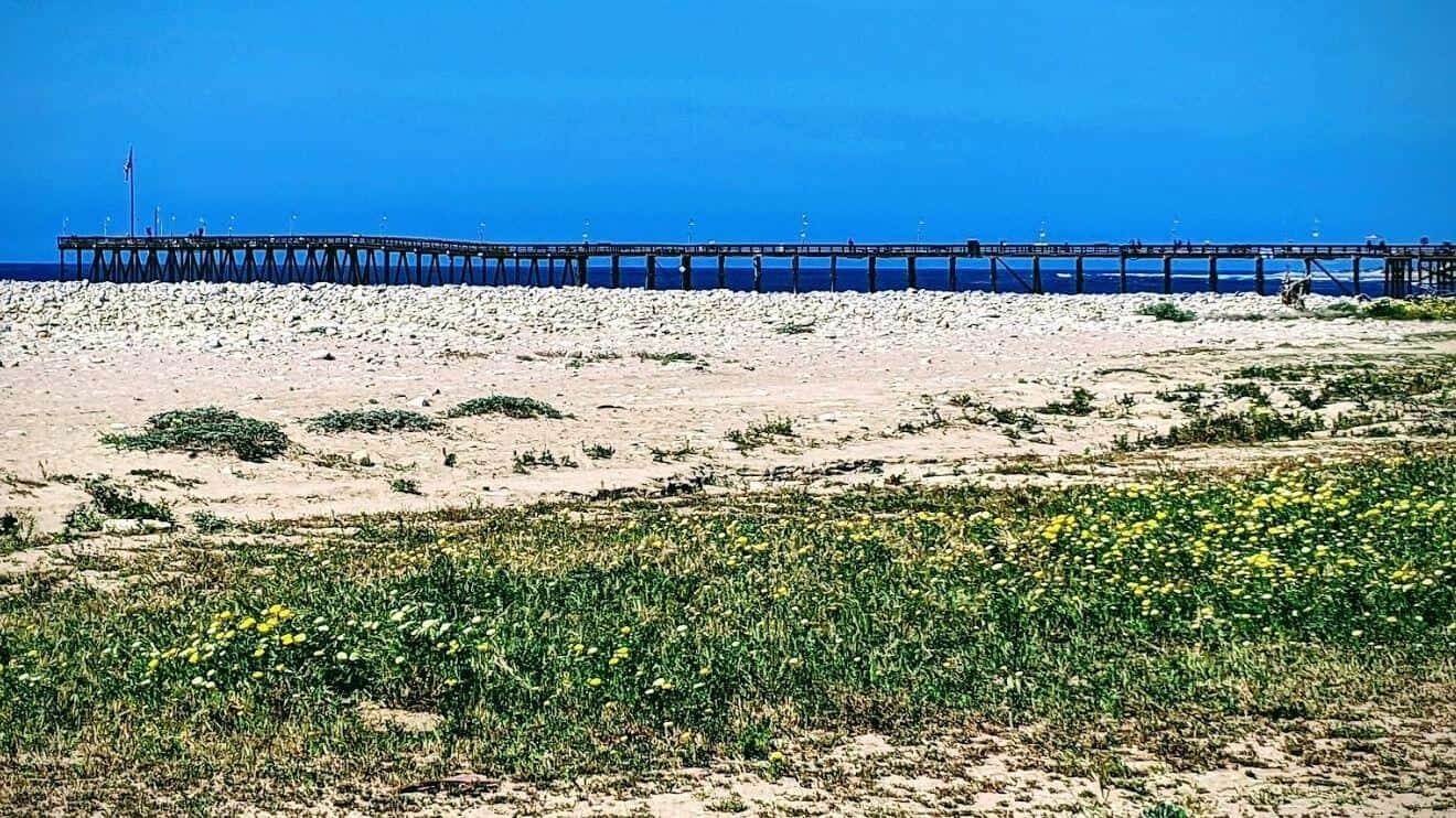
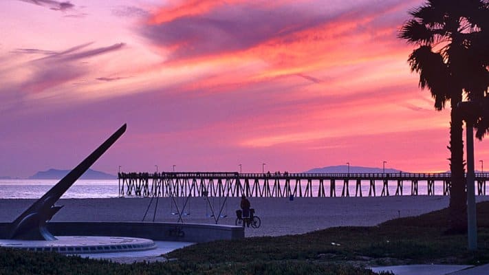
PIER TO PEAK WALKABOUT IN THE DOWNTOWN VENTURA AREA! JOIN THE GROUP WHEN/WHEREEVER YOU CAN/WANT...Times given are my best guesstimate for movement between the stated destinations, including loitering time. I may revise/fudge the times around a bit as I decide on or am advised of more realistic timing. Someone in the lead group will post […]
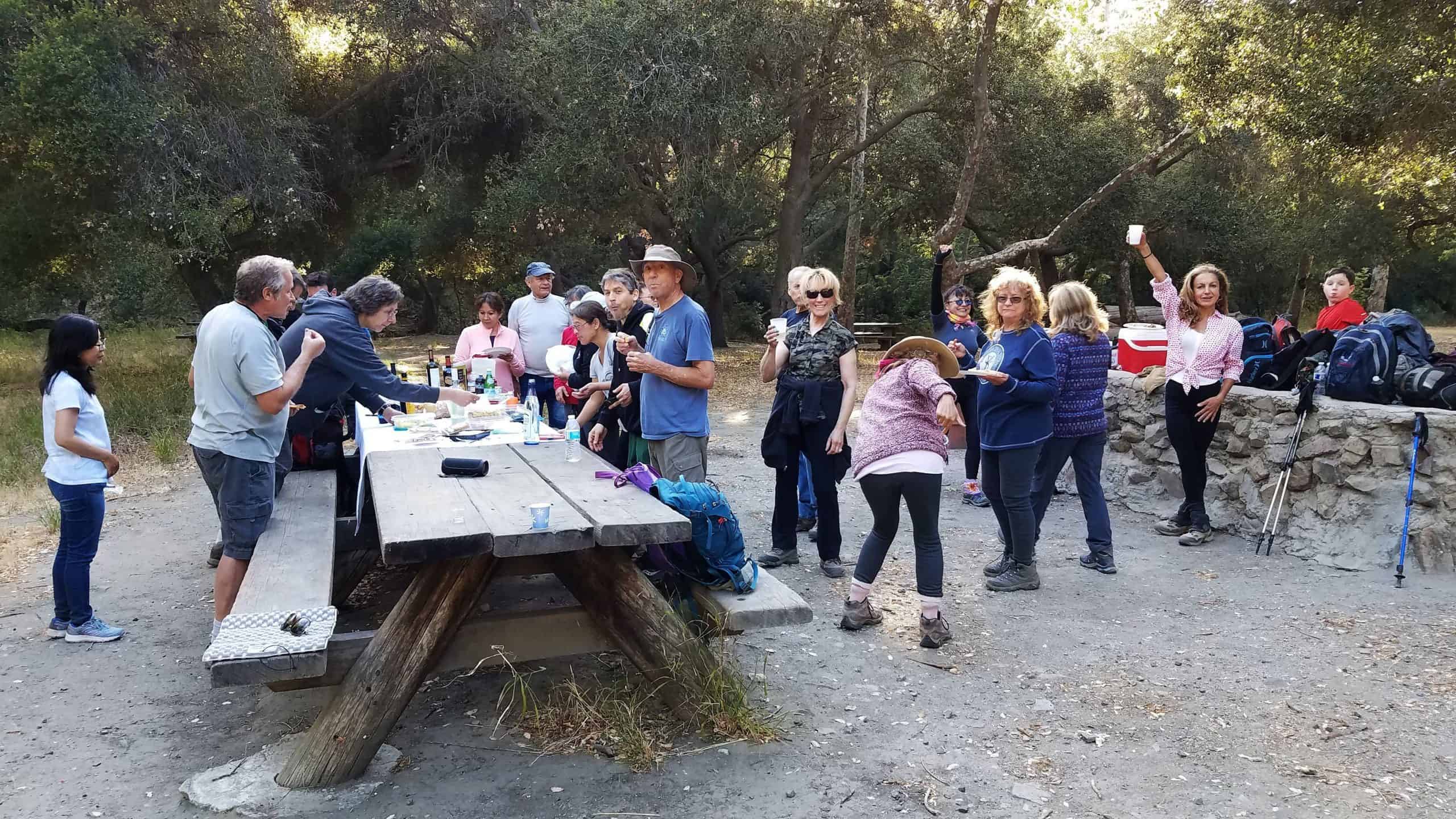
Let's enjoy hike, potluck and white elephant gift exchange! Please bring something to eat and drink to share and white elephant gift to exchange ($10-15 value).If your item requires it, bring plates and utensils to share. We'll share snacks and drinks (https://www.meetup.com/Hiking-Plus/messages/boards/thread/50879772) for 60 - 90 minutes, before heading back the way we came. We […]
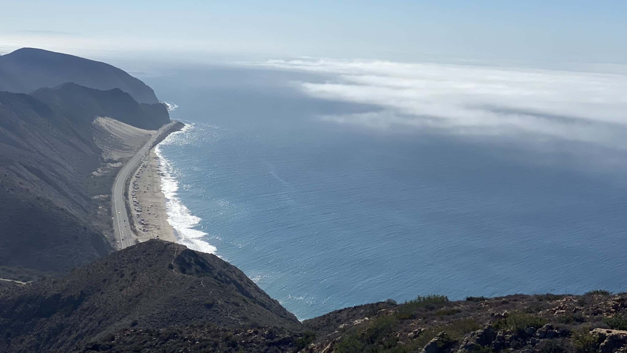
https://www.alltrails.com/trail/us/california/ray-miller-backbone-and-overlook-trail-loop Hello Fellow Hikers,Another requested trail here and I understand why. This is a really pretty area a very scenic beautiful hike. The Ray Miller Trail has everything and is very popular with Altra runners. This is a ocean and mountains view hike. I have attached the AllTrails link for directions, pics, and stats https://www.alltrails.com/trail/us/california/ray-miller-backbone-and-overlook-trail-loop […]
BEFORE YOU WILL BE MOVED TO THE GOING LIST, YOU WILL NEED TO UPDATE YOUR CDH PROFILE (The three questions must be answered with a "yes") IF YOU HAVE NOT ALREADY DONE SO.BIKE RIDE TO "OJAI" BIKE RIDE TO "OJAI" For some things in life, once a year just isn't enough. We're going back to […]
BEFORE YOU WILL BE MOVED TO THE GOING LIST, YOU WILL NEED TO UPDATE YOUR CDH PROFILE (The three questions must be answered with a "yes") IF YOU HAVE NOT ALREADY DONE SO.go to: https://wp.me/P9MbG4-hC BIKE RIDE TO "OJAI" For some things in life, once a year just isn't enough. We're going back to Ojai […]
BEFORE YOU WILL BE MOVED TO THE GOING LIST, YOU WILL NEED TO UPDATE YOUR CDH PROFILE (The three questions must be answered with a "yes") IF YOU HAVE NOT ALREADY DONE SO HOW TO UPDATE YOUR PROFILE:https://wp.me/P9MbG4-hC Every year I volunteer with the Salvation Army with differnt events they host during the Christmas season. […]
Intermediate - 3 miles, 1000' gain. This hike is relatively short, but the middle portion is a rugged and continuous incline for 1 mile with about 700' of gain. Even though we'll be taking this trail at the pace of a social hike, beginners may will find this hike to be too hard. We'll start […]
STATSDifficulty: 4/10, Steep up & down, with some slippery spotsLength: 3 miles, 2 hours plus breaksElevation Gain & Loss: 1225’; Peak: 2700’View: Amazing 360 View of Valleys and MountainsDetails: This hike has some STEEP moments but has a bench at the top to relax on. We made a new uphill trail, which is not on […]
BEFORE YOU WILL BE MOVED TO THE GOING LIST, YOU WILL NEED TO UPDATE YOUR CDH PROFILE (The three questions must be answered with a "yes") IF YOU HAVE NOT ALREADY DONE SO.NEED HELP:go to: https://wp.me/P9MbG4-hC SANTA BARBARA COAST- SERIES OF HIKES Join me on one of CDH's series of Santa Barbara Coastal Range treks. […]
https://www.alltrails.com/trail/us/california/upper-las-virgines-canyon-to-sheep-corral-trail Hello Fellow Hikers,Okay this is a popular trail with both hikers and mountain bikers. The reason is because you feel like you are truly away from the hustle and bustle and you are finally with nature. The trails out here are endless and the mountains seem to go on.This has a more gradual incline. […]
BEFORE YOU WILL BE MOVED TO THE GOING LIST, YOU WILL NEED TO UPDATE YOUR CDH PROFILE (The three questions must be answered with a "yes") IF YOU HAVE NOT ALREADY DONE SO HOW TO UPDATE YOUR PROFILE:https://wp.me/P9MbG4-hC Every year I volunteer with the Salvation Army with differnt events they host during the Christmas season. […]
https://www.alltrails.com/explore/trail/us/california/mugu-peak-to-la-jolla-nature-preserve Hello Fellow Hikers,Okay talk about a calve burner! Yes this is rated moderate but the first part (the start) is straight up! Mugu Peak is 2.7 miles (round trip) with a elevation gain of 1246 ft but once we tackle that part it's smooth sailing from there. From the parking lot we should shortly […]
3.5 miles, 800' gain, easy intermediate.Note that we are going to start from the Andora trailhead instead of our usual starting place. This hike will include an extended stay at the top, where we'll have a snack share social event (https://www.meetup.com/Hiking-Plus/messages/boards/thread/50879772) for 30-60 minutes. Nearly the entire trail is an incline. Fit beginners can complete […]
BEFORE YOU WILL BE MOVED TO THE GOING LIST, YOU WILL NEED TO UPDATE YOUR CDH PROFILE (The three questions must be answered with a "yes") IF YOU HAVE NOT ALREADY DONE SO.NEED HELP:go to: https://wp.me/P9MbG4-hC It's time to show off our ugly Xmas sweaters again. So, I thought we could do it locally on […]
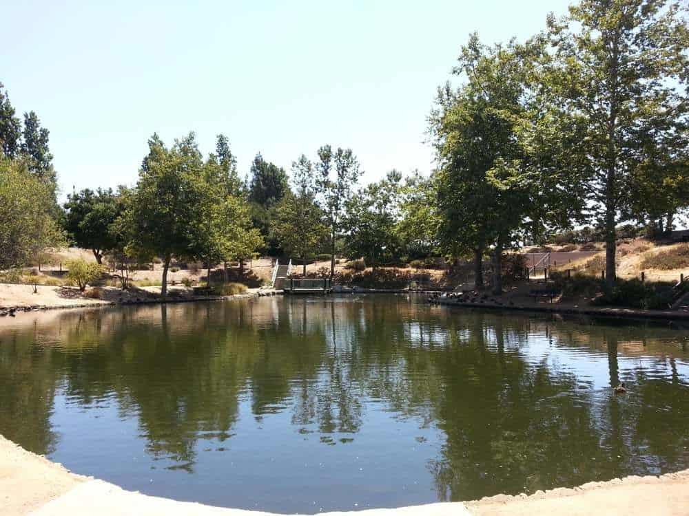
Details We'll start our loop at Dos Vientos Community Park exploring some of the neighborhood trails in the Dos Vientos area of the southwestern Conejo Valley. It provides a great overview of the nearby Dos Vientos residential area, as well as distant vistas including Camarillo, Thousand Oaks, surrounding mountains and open space, a secluded pond, […]
This is a great mid-range hike for folks who want some good exercise and at the same time enjoy the local beauty offered in the Santa Monica Mountains. Join us for a moderate out and back hike that begins at the Caballero Canyon Trailhead Hiking Difficulty:Moderate, 1000 ft elevation gain, Approximately 7 miles Bring water, […]
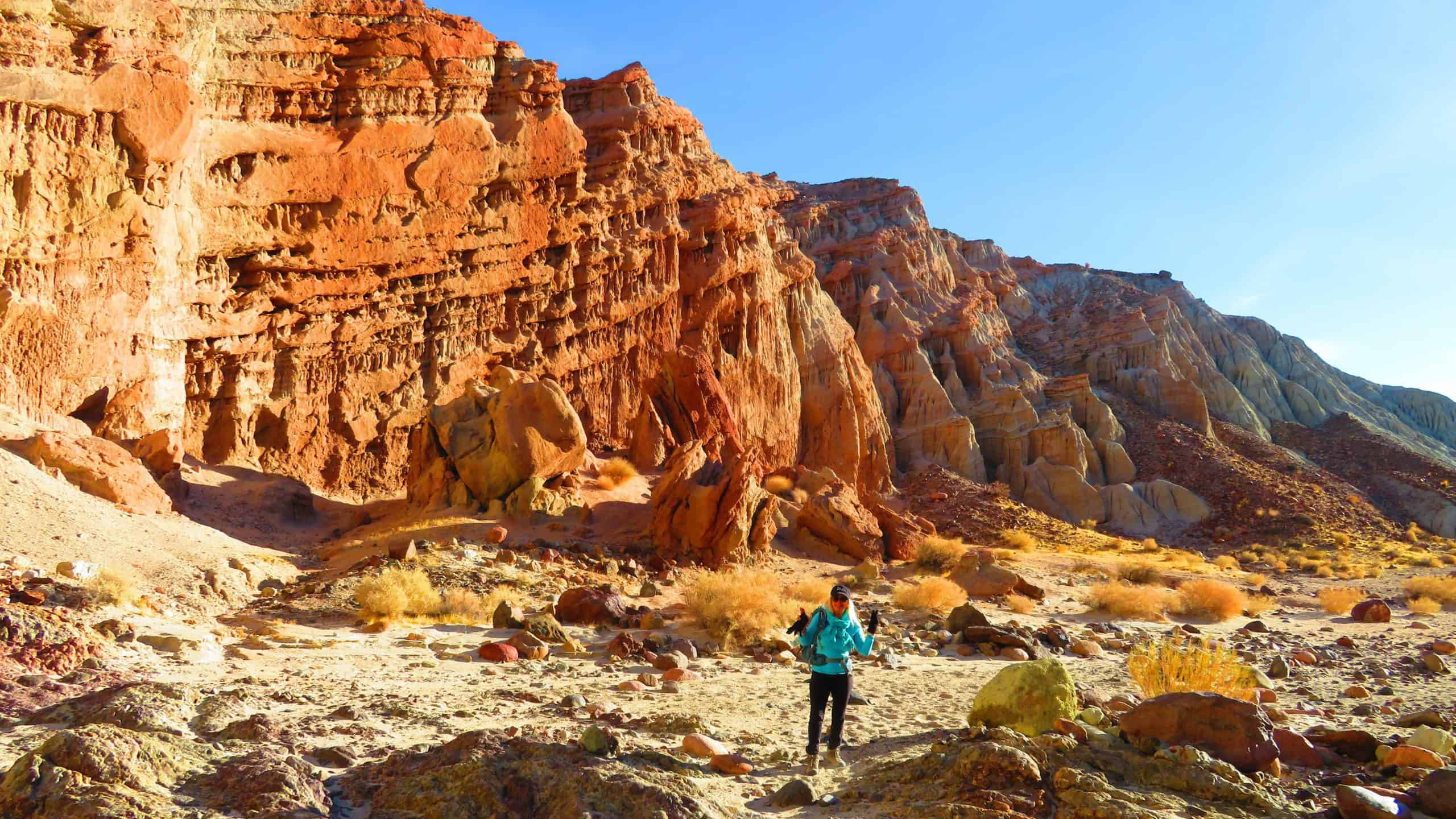
BEFORE YOU WILL BE MOVED TO THE GOING LIST, YOU WILL NEED TO UPDATE YOUR CDH PROFILE (The three questions must be answered with a "yes") IF YOU HAVE NOT ALREADY DONE SO.NEED HELP:go to: https://wp.me/P9MbG4-hC Nightmare Gulch LoopDistance: 8-9 milesElevation Gain: 1600 feetLeader: Nikki While it is possible to camp overnight in Red Rock […]
Don't forget to check my Amazon Top 10 for curated hiking gear https://www.hikingwithdean.com/shop/amazon-top-10/ For more selections see https://amzn.to/3DKfLBS I have also curated items from REI that have at least a 50% discount. You can see them here: https://www.hikingwithdean.com/rei/ For more REI specials see As an Amazon and REI partner HWD earns a small commission from […]
The old trail to the Tree of Life is still in great condition, hope you can join hike up to the tree. This is NOT for beginners. STATS Distance: <8> Elevation Gain: <2000 Not for beginners! Trail: Steep uphill section (about 2 miles), single track, fire road THE PLAN We will meet at the parking […]
Let's enjoy hike, potluck and white elephant gift exchange!This is a cross-posted event with Hiking Plus: https://www.meetup.com/Hiking-Plus/events/282441215/ Please bring something to eat and drink to share and white elephant gift to exchange ($10-15 value).If your item requires it, bring plates and utensils to share. We'll share snacks and drinks (https://www.meetup.com/Hiking-Plus/messages/boards/thread/50879772) for 60 - 90 minutes, […]
BEFORE YOU WILL BE MOVED TO THE GOING LIST, YOU WILL NEED TO UPDATE YOUR CDH PROFILE (The three questions must be answered with a "yes") IF YOU HAVE NOT ALREADY DONE SO.NEED HELP:go to: https://wp.me/P9MbG4-hC This will be a special e-bike ride in Ojai, but very strong bikers are welcomed to join us as […]
☃️❄️❄️ FREAKING AWESOME CHRISTMAS LIGHTS!!! ❄️❄️☃️ MEET at the Corner Cafe for a quick bite / coffee @ 7:00 and head out around 7:15 - 7:30 PM to check out the "Freaking Awesome Christmas Lights" Google Maps Location to Corner cafe: https://goo.gl/maps/uuczyXxDroE2 If you get there after we leave, just follow the route on the […]
There are many "Candy Cane Lanes" in the Los Angeles area, and this is a good one. Come for a walk that even a beginner can do, to see the fabulous lighting and decorative displays put on by this neighborhood, many of which appear to be done by professionals! This event is also suitable for […]
STATSDifficulty: 4/10, Steep up & down, with some slippery spotsLength: 3 miles, 2 hours plus breaksElevation Gain & Loss: 1225’; Peak: 2700’View: Amazing 360 View of Valleys and MountainsDetails: This hike has some STEEP moments but has a bench at the top to relax on. We made a new uphill trail, which is not on […]
RSVP here if you want to be on the reservation. After walking through the neighborhood, many of us will go to this popular spot for some after party. I expect it to be very crowded. This restaurant does not have any policy against minors being there after any particular time, so minors can also attend. […]
Did Santa track chimney soot all over your new carpet?Did his reindeer break some of your roofing tiles???Did Rudolph steal a bottle of Jack Daniels out of your liquor cabinet?????(Ya didn't think that red nose was NATURAL did you???)Well then join us on historic Echo Mountain to start your Xmas right!We'll be back down in […]
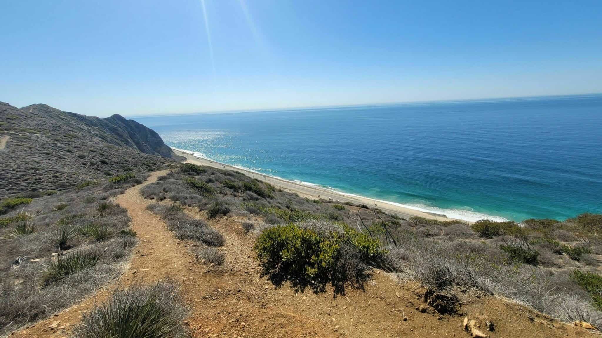
Join us for a (hopefully) sunny December day hike by the beach - or just come for lunch at Malibu Seafood around 1:30 - BYOB! Write up is Don's: The Stats Distance: 8 miles Elevation Gain: 2000 ft. Rating: 6/10 Trail: Single Track, Fire Road, rock scrambling and some overgrown Billie Goat trails Duration: 4-6 […]
DetailsBEFORE YOU WILL BE MOVED TO THE GOING LIST, YOU WILL NEED TO UPDATE YOUR CDH PROFILE (The three questions must be answered with a "yes") IF YOU HAVE NOT ALREADY DONE SO.NEED HELP:go to: https://wp.me/P9MbG4-hC This Monday I'm posting an easy bike ride for a change. This will only be around 7 miles over […]
Intermediate - 3 miles, 1000' gain. This hike is relatively short, but the middle portion is a rugged and continuous incline for 1 mile with about 700' of gain. Even though we'll be taking this trail at the pace of a social hike, beginners may will find this hike to be too hard. We'll start […]
3.5 miles, 800' gain, easy intermediate.Note that we start from the Andora trailhead. This hike will include an extended stay at the top, where we'll have a snack share social event (https://www.meetup.com/Hiking-Plus/messages/boards/thread/50879772) for 30-60 minutes. Nearly the entire trail is an incline. Fit beginners can complete this hike, but it will certainly get their blood […]
Check it out here: https://www.hikingwithdean.com/rei-co-op-editors-choice-awards-for-2021/ REI has helped generations of people find the right gear for them since 1938. Now, they are using their team’s hard-earned knowledge and expertise to recognize best-in-class gear at the co-op. With their permission I have posted their results at https://www.hikingwithdean.com/rei-co-op-editors-choice-awards-for-2021/ REI supports HWD by providing a small commission for […]
DetailsBEFORE YOU WILL BE MOVED TO THE GOING LIST, YOU WILL NEED TO UPDATE YOUR CDH PROFILE (The three questions must be answered with a "yes") IF YOU HAVE NOT ALREADY DONE SO.NEED HELP:go to: https://wp.me/P9MbG4-hC With all the rains we've had lately, I want to finish this Year off with a hike to Escondido […]
Eagle Rock, the most impressive landmark in all of Topanga State Park, will afford us an airy perch overlooking the upper watershed of Santa Ynez Canyon and the ocean beyond. We will eat, drink and explore on this impressive sandstone rock covered with crevices and caves. We begin hiking at Trippet Ranch, walking north on a paved driveway about 100 […]
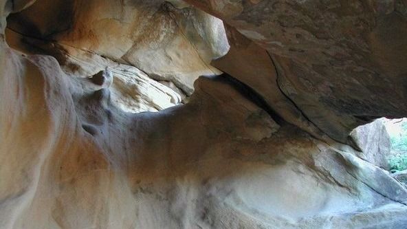
New Year, New Hike - We've never done this route out of Corriganville to the not so secret swing cave so the stats are a guess. If you can't join us for the main event, feel free to walk around the ranch (approx 1-1.5 mi) and join us for a post hike BBQ. It's mostly […]
BEFORE YOU WILL BE MOVED TO THE GOING LIST, YOU WILL NEED TO UPDATE YOUR CDH PROFILE (The three questions must be answered with a "yes") IF YOU HAVE NOT ALREADY DONE SO.NEED HELP:go to: https://wp.me/P9MbG4-hC SANTA BARBARA COAST- SERIES OF HIKES Join me on one of CDH's series of Santa Barbara Coastal Range treks. […]
Let's celebrate new year on the trail with potluck picnic! Easy-Intermediate, 4 miles, 800' gain We'll be passing through a beautiful canyon with huge red, pale purple, and tan sandstone walls. The hike begins with a steady climb on a fire road for 0.75 mile. We turn right at the junction and begin heading mostly […]
Trail statistics are approximate. For safety purposes always assume they are underestimated. But don’t be disappointed if they are overestimated. Bring more water and snacks than you think you’ll need.
Trail descriptions are based on previous hikes. Current conditions are unknown until arrival. Expect the unexpected and plan accordingly.
The Organizers and members of Hiking With Dean are not professional leaders, guides, or mountaineers. The function of the member or organizer is only to organize the trip. Each person who shows up for a trip/meetup (and their guest or guests) is responsible for his or her own safety. By attending a hike, or any other event organized by this group, you are acknowledging that you and any guests that you bring are aware of the risks, dangers and hazards associated with the activity and freely accept and fully assume all such risks, dangers and hazards, and further agree to release and discharge the Organizers, Members of the Hiking With Dean Meetup Group from and against any and all liability arising from your participation in the group activities per our ASSUMPTION OF RISK AND LIABILITY WAIVER and Section 6.2 of the Meetup.com Terms of Service.


")


Recent Comments