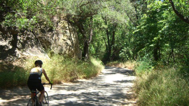
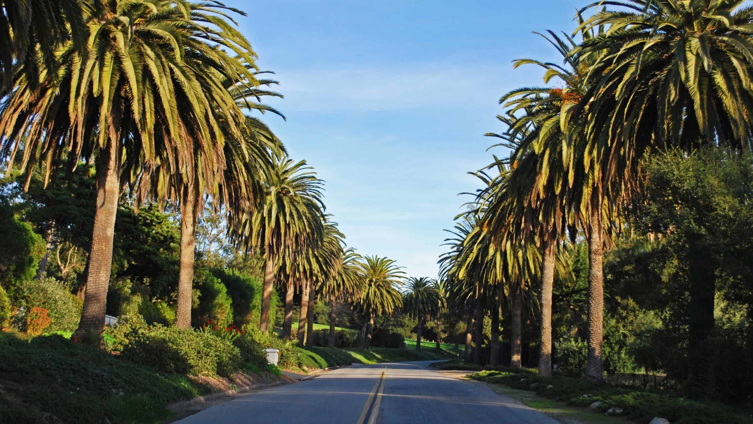
BEFORE YOU WILL BE MOVED TO THE GOING LIST, YOU WILL NEED TO UPDATE YOUR CDH PROFILE (The three questions must be answered with a "yes") IF YOU HAVE NOT ALREADY DONE SO.NEED HELP:go to: https://wp.me/P9MbG4-hC BIKE RIDE ALONG THE RIDGELINE ABOVE SANTA BARBARA I like scenery and great views when I ride my bike. […]
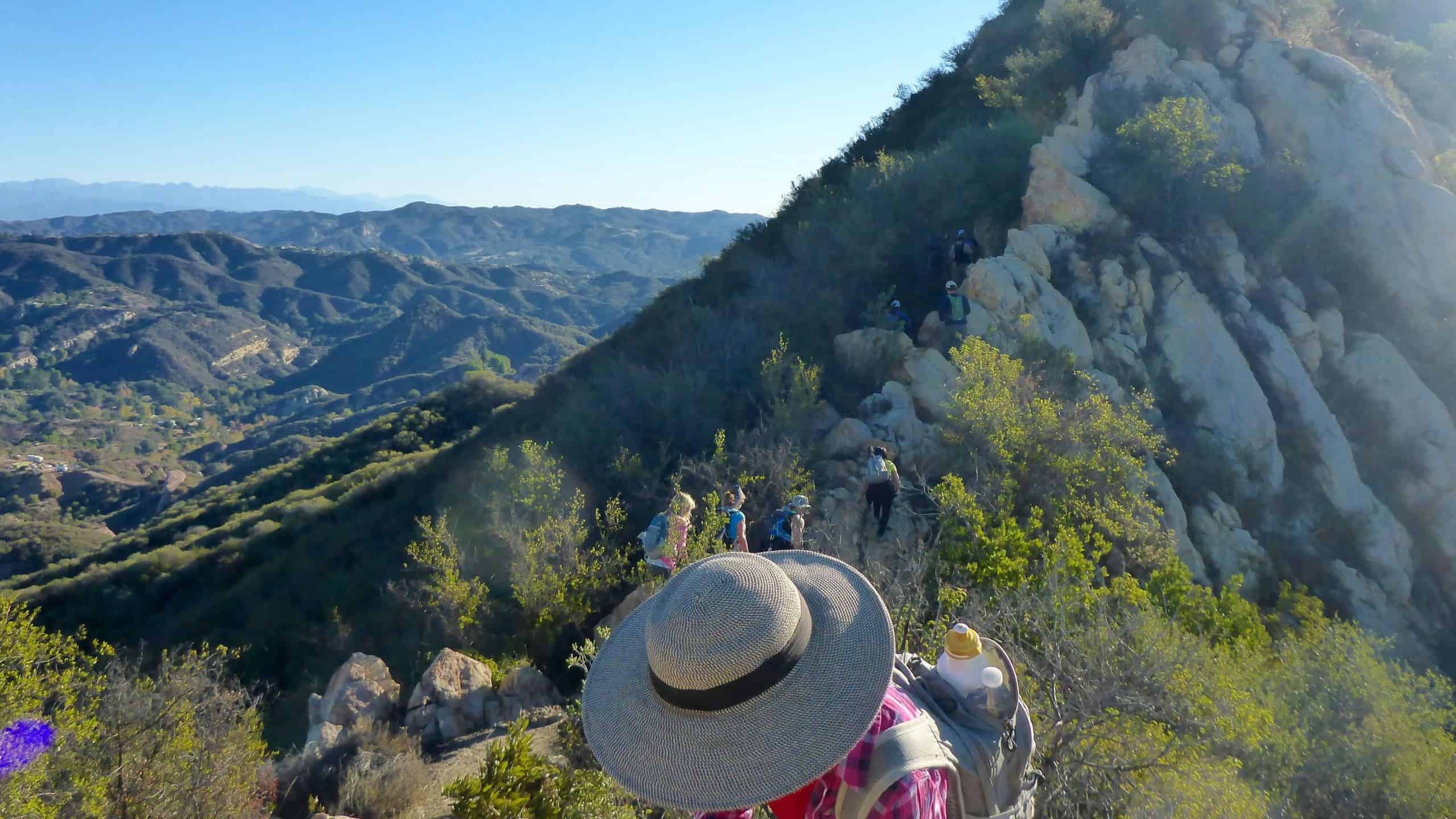
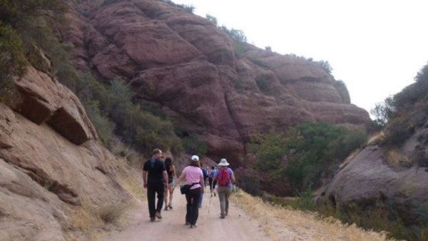
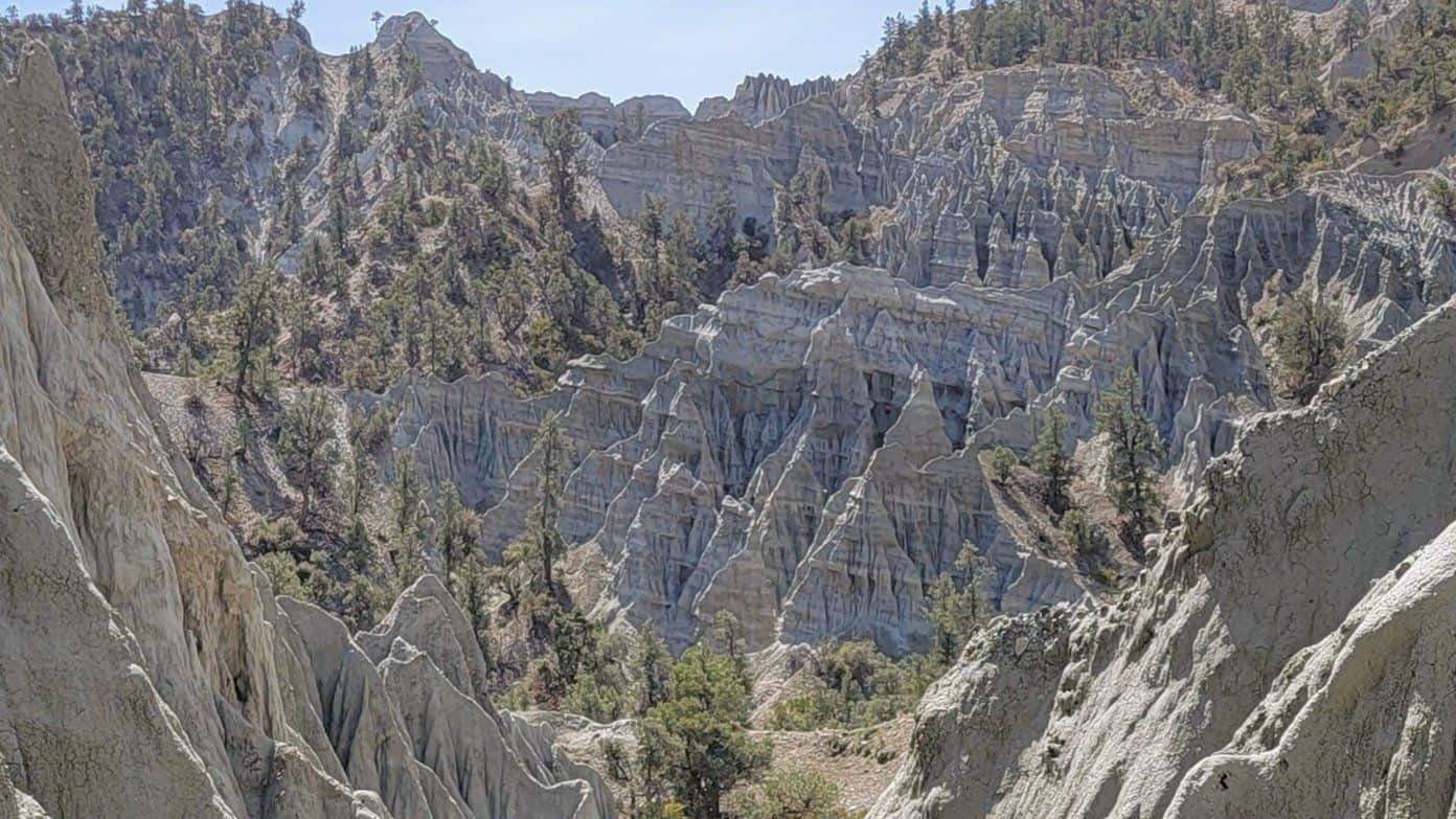
5 miles, 1200' gain, Intermediate This hike is one of the most well known in Simi Valley. It contains beautiful sandstone formations throughout the hike and there are fantastic views of the valleys. There is really no way to get lost because there are no junctions. If one chooses, they can turn around and return […]
BEFORE YOU WILL BE MOVED TO THE GOING LIST, YOU WILL NEED TO UPDATE YOUR CDH PROFILE (The three questions must be answered with a "yes") IF YOU HAVE NOT ALREADY DONE SO.NEED HELP:go to: https://wp.me/P9MbG4-hC Have you looked at our past events into the RAZORBACK ridge area of the Los Padres National Forest and […]
Another spectacular section of the Backbone Trail this hike includes staggering views of pink colored sedimentary rock formations, beautifully shaded live oak, streams and a sloping green meadow. Its perhaps one of the shadiest sections of the Backbone Trail. At the top we will see many fossils in the sandstone. Instead of the usual destination […]
I've curated the Top 10 hiking gear from Amazon that are a fit for our kind of hikes. Selection was also based on sales and ratings. Shop NOW at https://www.hikingwithdean.com/shop/amazon-top-10/ Meetup forces me to include a start and end time -- just ignore it I'll be adding more stuff so check back often Note: As […]
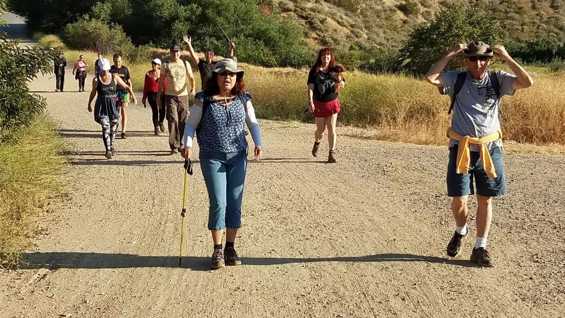
THIS A CONDITIONING HIKE! Our group hikes at a minimum of 2.5 miles per hour. You must be able to keep up with the group. Please sign up for this conditioning hike only if you can do this. Use the directions to the trailhead as described below. You must be able to hike 2.5 miles […]
3 miles, 650' gain, fit beginner. There is one extended climb in the middle of the hike that is relatively mild (it is fire road) but continues for about a mile. Being a fire road, steepness is limited to that which a vehicle can climb. Starting from the Long Canyon trailhead parking lot, we head […]
LET'S TAKE THE TRAIN --- FROM SIMI TO CARP!Saturday - October 2, 2021 Depart the Simi Valley station at 10:07 AM and arrive in Carpinteria at 11:20.We can meet near the tracks starting around 9:20 AM. Trip around the Avocado Festival, Islands Brewery, Rincon Brewery, Carpinteria Bluffs & Beach (tide pools & tar pits), great […]
Hosted by Dennis and Glenna.Their personal friends will also be coming. Location: Moorpark. The address will be sent to those that have been confirmed, a day or so before the event. There will be an outdoor movie, popcorn, and music.This is a Pot-Luck and BYOB. Please post what dish you a variety of different items.
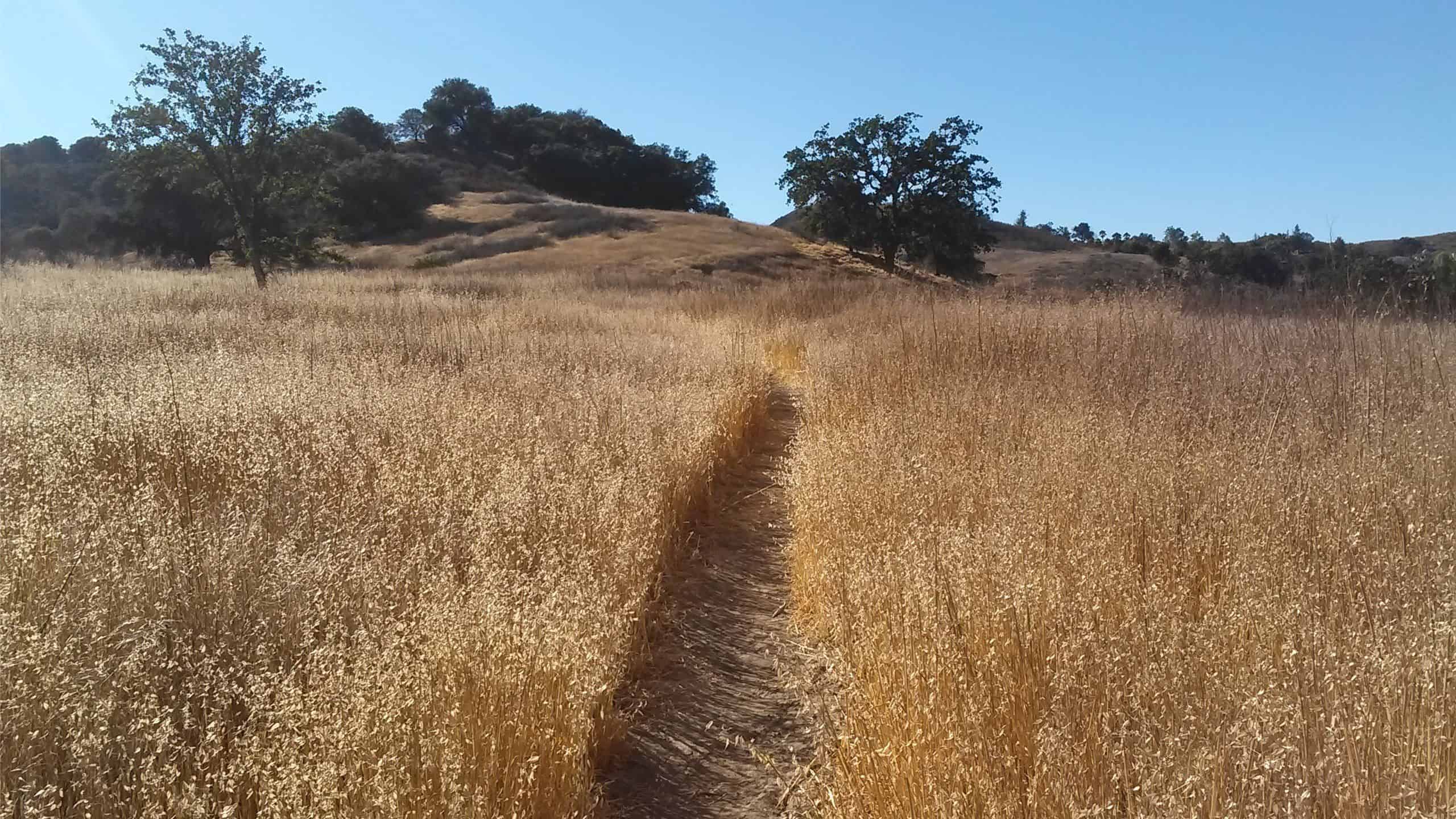
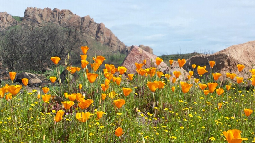
Details Join us and the small animals and birds of La Jolla Canyon on this loop hike with panoramic views of coastline and The Channel Islands. Flower blooms in the spring are phenomenal. One of the the main attractions are large swaths of native California grassland — some of the last remaining unspoiled areas in […]
FAST PACED HikeEnjoy the camaraderie of fellow Hikers and get a great workout close to home. You're done before noon! Distance: Approximately 8 miles Elevation Gain: Approximately 1,500 ft This hike is rated moderate for its elevation gain and distance. Drink plenty of water prior to and during the hike. Follow the directions to the […]
https://www.alltrails.com/trail/us/california/stunt-high-trail Hello Fellow Hikers,This trail looks so pretty a lot of shaded areas with oak trees that line the side of the trail. And open meadow sections. Also sections with gradual climbs. The trail will end at Mulholland drive will we will make our way back. Now there are two trails in this area we […]
BEFORE YOU WILL BE MOVED TO THE GOING LIST, YOU WILL NEED TO UPDATE YOUR CDH PROFILE (The three questions must be answered with a "yes") IF YOU HAVE NOT ALREADY DONE SO.NEED HELP:go to: https://wp.me/P9MbG4-hC THE ULTIMATE EBIKE RIDE up beautiful Refugio Rd. and SANTA BARBARA STATE BEACHS This time we will be heading […]
Fit Beginner, 4.1 miles, 720' gain. Is it Talepop or Talopop? Maps and signs that I have seen, use the 2nd spelling, but a lot of references use the other. There are several portions with extended inclines that will make a beginner hiker stop for a breather. There is nothing wrong with stopping, even if […]
BEFORE YOU WILL BE MOVED TO THE GOING LIST, YOU WILL NEED TO UPDATE YOUR CDH PROFILE (The three questions must be answered with a "yes") IF YOU HAVE NOT ALREADY DONE SO.NEED HELP:go to: https://wp.me/P9MbG4-hC Now that most of the construction around the trailhead to Devil's Canyon is complete, Elyse and I will be […]
Solstice Canyon is the quintessential coastal canyon. The year-round stream provides ample water to support this 550-acre park's numerous plant communities and a diverse wildlife population. There is a 30 ft water fall and some ruins that are fun to explore. We will hike the Rising Sun, TRW and Solstice Canyon trails. We'll take a […]
THIS A CONDITIONING HIKE! Our group hikes at a minimum of 2.5 miles per hour. You must be able to keep up with the group. Please sign up for this conditioning hike only if you can do this. Use the directions to the trailhead as described below. You must be able to hike 2.5 miles […]
Intermediate, 5.25 mi, 1000' gain Fit beginners can complete this hike, but it will certainly get their blood pumping. This is not a conditioning hike, it's a social hike. We'll be stopping at various points to let people catch up and to make sure they make any turns. We'll start by climbing the Triunfo Canyon […]
Fit Beginner - 6 miles, 600' gain This is a social hike and an out-and-back event. There is a potluck at the M.A.S.H. site before we turn around for the return. If your item requires paper plates, utensils, etc. please bring them. Pot Luck guidelines: https://www.meetup.com/Hiking-Plus/messages/boards/thread/50879772 We will meet at the Grasslands trail head off […]
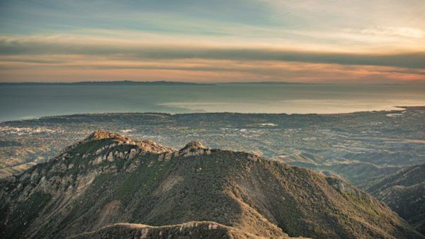
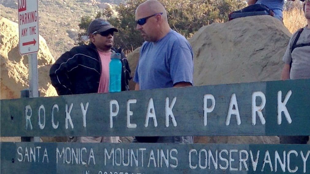
Details Rocky Peak Summit Trail is a 4.6 mile heavily trafficked out and back trail located near Chatsworth, California that features interesting rock formations, beautiful wild flowers and is rated as moderate. The trail is primarily used for hiking, running, nature trips, and mountain biking and is accessible year-round. Dogs are also able to use […]
THIS IS A PRE-ANNOUNCEMENT. GET YOUR NAME ON THE "WANNA GO" LIST TO BE NOTIFIED AND HAVE FIRST DIBS AT REGISTRATION AND THE EARLY-BIRD DISCOUNT. For all the details and to put your name on the "wanna go" list, go here: https://www.1000treks.com/trips/italy-wine-tasting-dream--tuscany--cinque-terre--venice-and-rome Highlights: - Visit several of Italy's beautiful and famous cities and areas, such […]
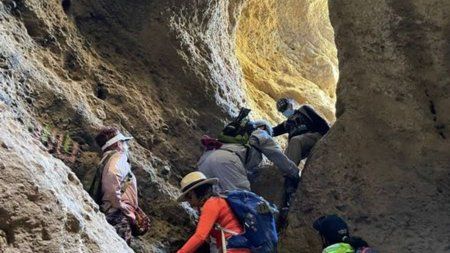
Distance: 9> Rating: 7/10, not for beginners Pace: Intermediate/advanced (will be at my pace) There won't be a sweeper!! Elevation 2620’ gain Parking permit-adventure pass required Rain Cancels According to historian John Robinson, the name "Icehouse Canyon" dates from the 1860s when an ice plant in the lower canyon supplied ice to valley residents. The […]
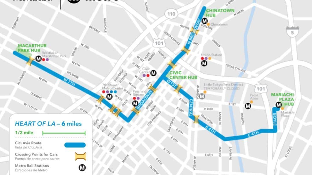
BEFORE YOU WILL BE MOVED TO THE GOING LIST, YOU WILL NEED TO UPDATE YOUR CDH PROFILE (The three questions must be answered with a "yes") IF YOU HAVE NOT ALREADY DONE SO.NEED HELP:go to: https://wp.me/P9MbG4-hC CicLavia CicLavia is a quarterly event in Los Angeles where the streets get shut down and people can bike, […]
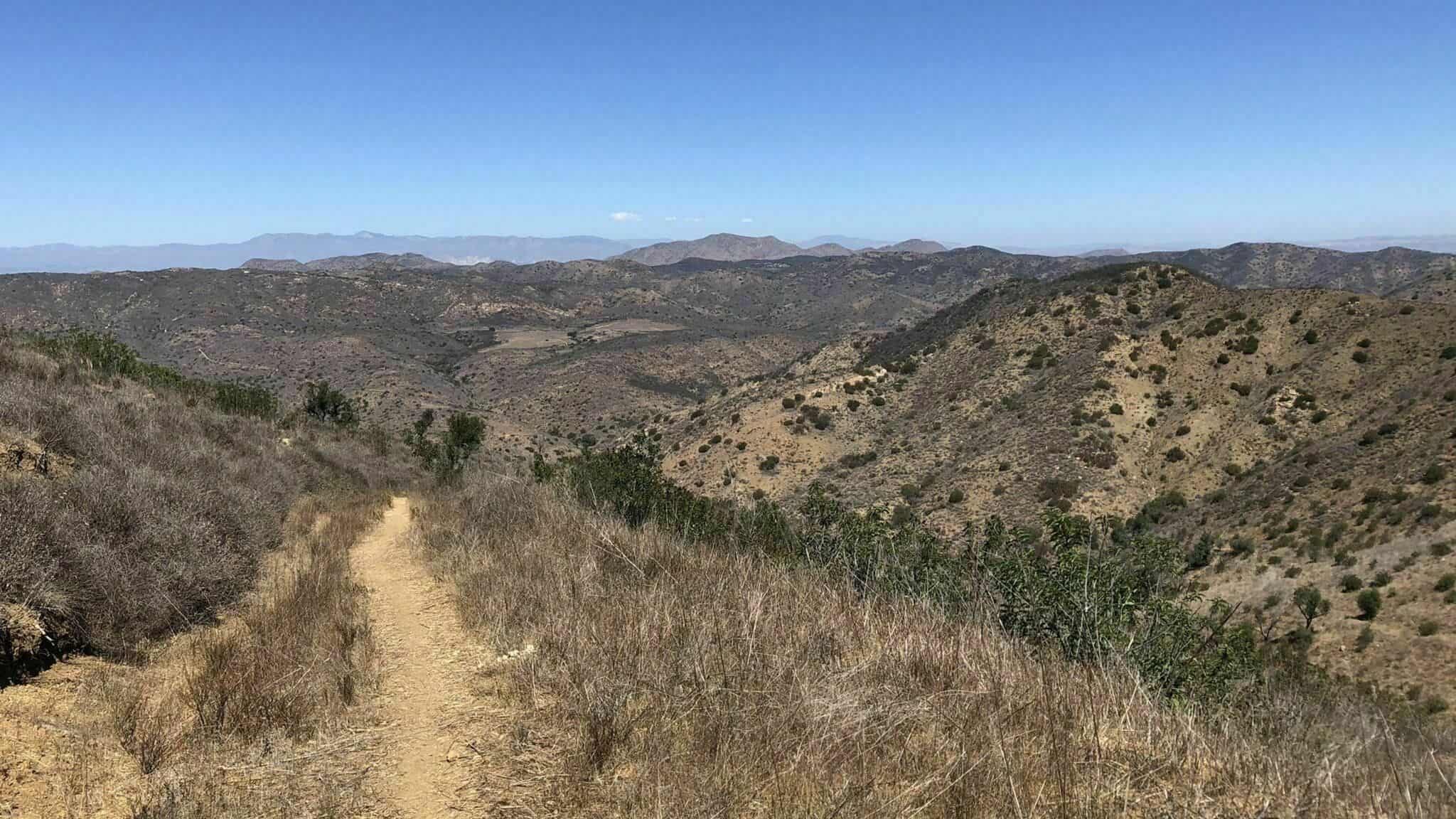
https://www.alltrails.com/explore/trail/us/california/western-plateau-trail-and-hawk-canyon-trail-loop Hello Fellow Hikers,So it finally feels like it is cooling down, so now we can head out and start exploring more open trails. I changed the start time back to 9:00am but if the weather changes on us before our hiking date I'll change back to 8:00am...Okay so many of you may have hiked […]
BEFORE YOU WILL BE MOVED TO THE GOING LIST, YOU WILL NEED TO UPDATE YOUR CDH PROFILE (The three questions must be answered with a "yes") IF YOU HAVE NOT ALREADY DONE SO.NEED HELP:go to: https://wp.me/P9MbG4-hC BEAUTIFUL BIKE RIDE THROUGH SANTA BARBARA'S HOPE RANCH AREA This time we will be heading into the Hope Ranch […]
4.5 miles, 1000' gain, Easy Intermediate. There are several extended inclines and a couple short but steep climbs. Starting from the Long Canyon trailhead parking lot, we head up Long Canyon Trail to a bench. We'll regroup and let others catch up, then head down about 1000' to the 5-points junction. We'll make the first […]
BEFORE YOU WILL BE MOVED TO THE GOING LIST, YOU WILL NEED TO UPDATE YOUR CDH PROFILE (The three questions must be answered with a "yes") IF YOU HAVE NOT ALREADY DONE SO We will begin our trek on a fire road then continue above the shaded Bear canyon to the Tom Sloan Saddle. After […]
THIS A CONDITIONING HIKE! Our group hikes at a minimum of 2.5 miles per hour. You must be able to keep up with the group. Please sign up for this conditioning hike only if you can do this. Use the directions to the trailhead as described below. You must be able to hike 2.5 miles […]
Distance: 3.5 miles, Gain: 700', Intermediate.This was previously designated easy-intermediate, but some thought it should be labeled as intermediate because of the extended inclines. A strong and motivated beginner can do this hike. They would be challenged and slow during a few of these climbs. That's OK, because this is not a conditioning hike, it […]
4.6 miles, 900' gain, easy-intermediate. This route takes us through a beautiful canyon via a counter-clockwise lollipop. Most of the hike has a clear view of the sky, with a few parts that have tree cover. We'll be stopping at the half-way point for a snack and beverage share (https://www.meetup.com/Hiking-Plus/messages/boards/thread/50879772). We'll start at the Palo […]
The hike is waitlisted. Put yourself on the list and I will add you if I feel you can complete the hike at my pace safely (Timber Mt hikers, not at that pace :) ) Distance: 9Elevation Gain: 2100Rating: Intermediate/Advanced 7-10 Trail: Fire road, single track, class 1,2 rock climbs and some street crossings. The […]
Another HWD Original! The HWD Ranch is located within the stunning Hidden Creeks parkland near the confluence of Browns Creek and Mormon Creek. The parkland provides a key migration corridor and perennial water source to a full complement of large mammals including black bear, mountain lion, mule deer, bobcat, American badger, grey fox, long-tailed weasel, […]
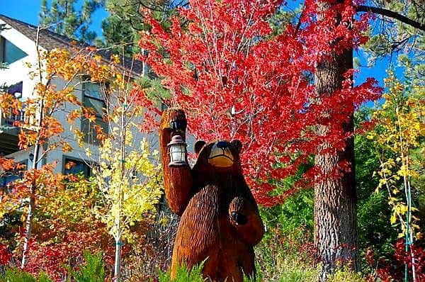
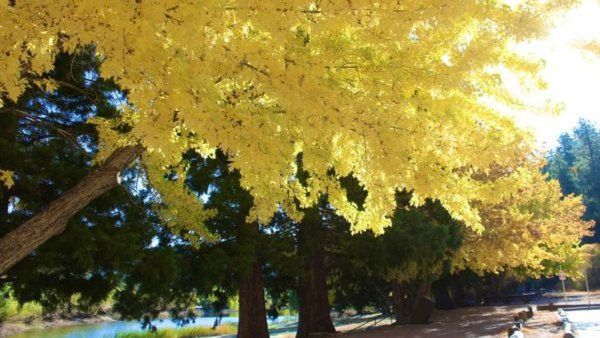
BEFORE YOU WILL BE MOVED TO THE GOING LIST, YOU WILL NEED TO UPDATE YOUR CDH PROFILE (The three questions must be answered with a "yes") IF YOU HAVE NOT ALREADY DONE SO It's that time of year when the beautiful fall colors line the streets around Big Bear Lake. I can't think of a […]
Hello Fellow Hikers,This is a great area as you park close to the beach area but were exploring in the Mountains. Will follow on both fireroad and single track trails with both gradual climb and level sections. This is a popular area to take in the beautiful Mountain views then you can head down to […]
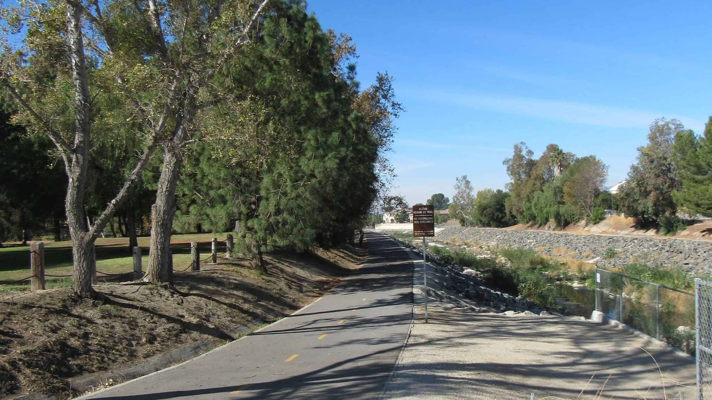
DaveR is slowly getting his bike legs back in shape with this easy bike ride on the Arroyo Simi Greenway followed by an optional lunch by picking up food at El Pollo Corona and taking it back to Rancho Simi Community Park to enjoy. Some of us will have ebikes, but we'll be going slow […]
This short hike offers a nice variety of canyon and ocean scenery, and is not as well traveled as some of the other trails in the eastern Santa Monica Mountains. We'll enjoy a great “lollipop” outing in the northeastern corner of Topanga State Park starting at the Viewridge Trailhead for Santa Maria Canyon. We'll connect […]
5 miles, 700' gain, Beginner. This hike is a great trail for beginners because all the elevation gain is distributed. It is a walk down a rolling fire road through a really cool canyon, and you will find no difficult or extended elevation climbs. This is one of my favorite trails for people new to […]
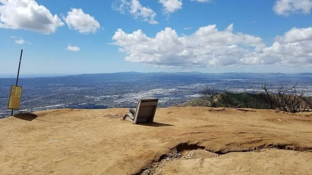
STATSDifficulty: 5/10, Moderate-Long with steep sectionsLength: 5.4 miles, 3 hours + breaksElevation:Gain/loss: 2200'Range: 1500-3000'View: Mountains & City LightsDetails: Long Hike, Great views from top ridge TRAILHEAD INFO2300 E Walnut Ave, Burbank, CA 9150 Map pin is south of address due to gates that get locked at sunset. Please park on the east side of Walnut […]
The Jackson Lake Trail is a high-quality single track snaking through the woods on the northern slope of the San Gabriel Mountains. Some of the most beautiful forest in the range can be seen along the trail, including huge ponderosa pine, jeffrey pine, white fir, live oak, black oak, big-leaf maple, alder, and willow. The […]
BEFORE YOU WILL BE MOVED TO THE GOING LIST, YOU WILL NEED TO UPDATE YOUR CDH PROFILE (The three questions must be answered with a "yes") IF YOU HAVE NOT ALREADY DONE SO.NEED HELP:go to: https://wp.me/P9MbG4-hC CASTLE PEAKJoin me on a task to storm the castle (Castle Peak) via two attempts in El Escorpion Park. […]
This event is not affiliated with Hiking Plus, however there may be members that will attend. These house parties have been very good in the past. Outdoor event. Here's an old article to get an idea of what to expect: https://patch.com/california/northhollywood/longtime-reseda-ranch-resident-wendell-baker-throws-polynesian-tiki-party-sat-sept-26-8pm-19528 Night of the Tiki / "Pirates' Island/Polynesia" party.Revenge of the Pumpkin Patch. Live band […]
Advanced Hikers Only, with Previous Summit Experience! We'll be taking the Bear Canyon Trail that starts in Baldy Village and hiking to the summit and returning the same way. Be careful where you park! Do not park in the lot across from the Baldy Lodge & Saloon. You must find a place on the street […]
🌸🌼🌻🌺 YAAAYYYYY!!!!!!! 🌼🌻 Hope everyone's safe, healthy and relatively SANE!!! 🌼🌻 4 1/2 mile HIKE THIS is where they filmed M*A*S*H*, "Planet of the Apes" and a gazillion other movies... GOOGLE MAPS TO MALIBU CREEK PARK - CLICK HERE https://goo.gl/maps/SZVdsQem2eK2 CLICK HERE FOR M*A*S*H* VIDEO http://www.youtube.com/watch?v=ICiFnQrHOrk 🌼🌻 MALIBU CREEK STATE PARK 🌼🌻 ( FEE AREA […]
Many of us from this group may attend this event. Please bring food and drinks to share. If your item requires utensils, please supply them. Concert starts at 6:00p. Free parking available on-site. Overflow parking is on the softball fields, off Thompson. Dogs on a leash are allowed on the perimeters but not in the […]
https://www.alltrails.com/trail/us/california/phantom-trail Hello fellow hikers, Exploring another area Liberty Canyon Natural Preserve. The reviews on this trail show a gradual up and down hike with areas through meadow fields. It's a good workout without feeling beaten up...lol This hike does not provide shade so if the weather changes will either start earlier or move to a […]
Come join us for a fun and food filled festival day, with all the Greek food, music, and culture you can handle! Oh, and lots of Ouzo and beer, maybe even some dancing. St. Demetrios Greek Orthodox Church is hosting their annual Greek Festival, and HP will be there to take in the sights and […]
Fit Beginner, 4.1 miles, 720' gain. Is it Talepop or Talopop? Maps and signs that I have seen, use the 2nd spelling, but a lot of references use the other. There are several portions with extended inclines that will make a beginner hiker stop for a breather. There is nothing wrong with stopping, even if […]
BEFORE YOU WILL BE MOVED TO THE GOING LIST, YOU WILL NEED TO UPDATE YOUR CDH PROFILE (The three questions must be answered with a "yes") IF YOU HAVE NOT ALREADY DONE SO We will start our hike at Juan Bautista Park and hike up the Talepop trail. We will have the option of continuing […]
4 miles, gain: 500', beginner. This is a beginner hike on the beautiful Limekiln trail. The hike starts at the trail head near the Tampa exit on I-118, just 3 miles east of the Topanga Canyon exit. This hike is a slight lollipop (from the shape of the route). There are no extended inclines, however […]
BEFORE YOU WILL BE MOVED TO THE GOING LIST, YOU WILL NEED TO UPDATE YOUR CDH PROFILE (The three questions must be answered with a "yes") IF YOU HAVE NOT ALREADY DONE SO.NEED HELP:go to: https://wp.me/P9MbG4-hC Here's a local hike in Calabasas that I have not done in a few years.We'll start off with a […]
BEFORE YOU WILL BE MOVED TO THE GOING LIST, YOU WILL NEED TO UPDATE YOUR CDH PROFILE (The three questions must be answered with a "yes") IF YOU HAVE NOT ALREADY DONE SO.NEED HELP:go to: https://wp.me/P9MbG4-hC Elyse, Howard and I will be taking our mountain ebikes on a portion of the Backbone Trail starting at […]
Join us for a short but heart-pounding hike through the old stomping grounds of Edgar Rice Burroughs in Caballero Canyon. We'll take the Dinosaur Egg Trail to Mulholland, head up for a snack on Gizmo Peak, and return to car via the Caballero Canyon Trail Hike is about 4 miles with over 1,000' total ascent […]
3.5 miles, 600' gain, Easy Intermediate. A fit beginner can handle this. Because there are a couple extended inclines, I've rated this at the easy end of the intermediate spectrum. That's OK, because this is a social hike, not a conditioning hike. We'll stop at various points to let people catch up. We'll start by […]
Details We've been doing this one in Chatsworth since 2009, and is one of our most popular hikes. It's the scariest hike this side of Transylvania! Check out the scary night version here This will be a potluck/social event so bring some booze, edibles, etc to share …..A group of innocent hikers, unaware of […]
The Stats Distance: 14 miles Up and back Elevation Gain/Loss: 4800 ft. Rating: Moderate to Strenuous 8/10 Trail: Single track, some fire road at the end. Upper 2/3 of the trail is shaded. Duration: roughly 8 or 9 hours We will stop for lunch at the Cosmic Cafe Pavilion (outdoor seating only) at the summit. […]
BEFORE YOU WILL BE MOVED TO THE GOING LIST, YOU WILL NEED TO UPDATE YOUR CDH PROFILE (The three questions must be answered with a "yes") IF YOU HAVE NOT ALREADY DONE SO.NEED HELP:go to: https://wp.me/P9MbG4-hC Have you looked at our past events into the RAZORBACKS of the Los Padres National Forest and wished you […]
We've been doing this one in Chatsworth/Twin Lakes since 2009. It's the scariest hike this side of Transylvania! Due to ongoing development in the area our exact path is unknown at this time, but I estimate it to be about 3 miles with 700' elevation gain. I will have more accurate figures after pre-scouting the […]
We hiked the Gabrielino Trail a few years ago when Carmen noticed a waterfall just off trail. We went in search of the base of the falls last year and were not disappointed. It was quite a pleasant spot to take our lunch break. There should be even more water flowing after the recent rain. […]
🦅 BUZZARDS ROOST 🦅 -5.5 mile hike -1,400 ft incline, a bit steep in places -11:AM - OCEAN VIEW at the TOP -M Café / Malibu Cafe for food and fun afterwards 🌼🌼🌼🌼🌼 🔴 car pool if possible… There is limited parking!!! 🔴 🅿️ Trailhead and Parking https://goo.gl/maps/QpRGXBF6SswhtcsH6 🅿️ more parking https://goo.gl/maps/yJ3dhVnajxT6sBkG8 🅿️ even more […]
Trail statistics are approximate. For safety purposes always assume they are underestimated. But don’t be disappointed if they are overestimated. Bring more water and snacks than you think you’ll need.
Trail descriptions are based on previous hikes. Current conditions are unknown until arrival. Expect the unexpected and plan accordingly.
The Organizers and members of Hiking With Dean are not professional leaders, guides, or mountaineers. The function of the member or organizer is only to organize the trip. Each person who shows up for a trip/meetup (and their guest or guests) is responsible for his or her own safety. By attending a hike, or any other event organized by this group, you are acknowledging that you and any guests that you bring are aware of the risks, dangers and hazards associated with the activity and freely accept and fully assume all such risks, dangers and hazards, and further agree to release and discharge the Organizers, Members of the Hiking With Dean Meetup Group from and against any and all liability arising from your participation in the group activities per our ASSUMPTION OF RISK AND LIABILITY WAIVER and Section 6.2 of the Meetup.com Terms of Service.


Recent Comments