BEFORE YOU WILL BE MOVED TO THE GOING LIST, YOU WILL NEED TO UPDATE YOUR CDH PROFILE (The three questions must be answered with a "yes") IF YOU HAVE NOT ALREADY DONE SO.NEED HELP:go to: https://wp.me/P9MbG4-hC BIKE RIDE - Westlake VillageThe route will start at Triunfo Park and continue clockwise around the lake.We'll have the […]
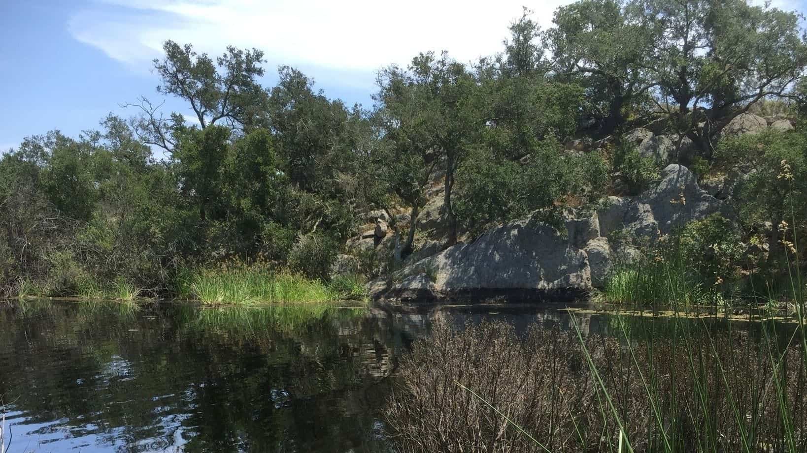
5 miles, 700' gain, Beginner. This hike is a great trail for beginners because all the elevation gain is distributed. It is a walk down a rolling fire road through a really cool canyon, and you will find no difficult or extended elevation climbs. This is one of my favorite trails for people new to […]
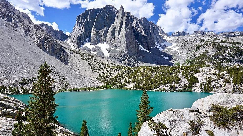
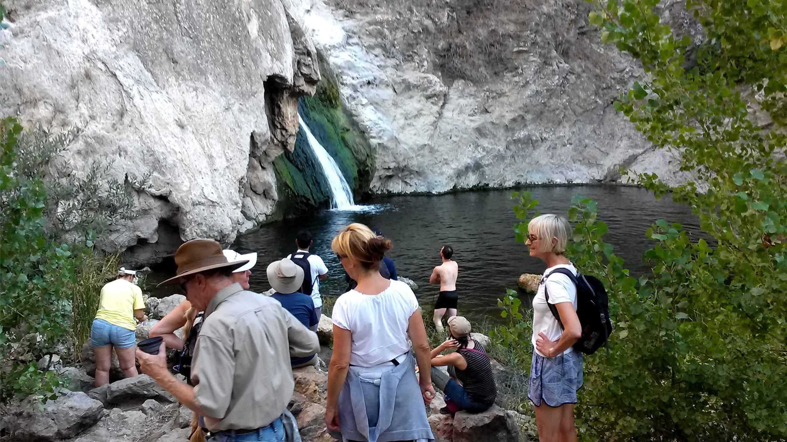
Description: This is a 2-night backpacking trip. It's on a weekday. But if you can take off from work to do it, it's highly recommended. There are two trailheads to do this hike. One is at the "Big Pine Creek Overnight Parking." And the other is at the "Big Pine Creek Trailhead," which is at […]
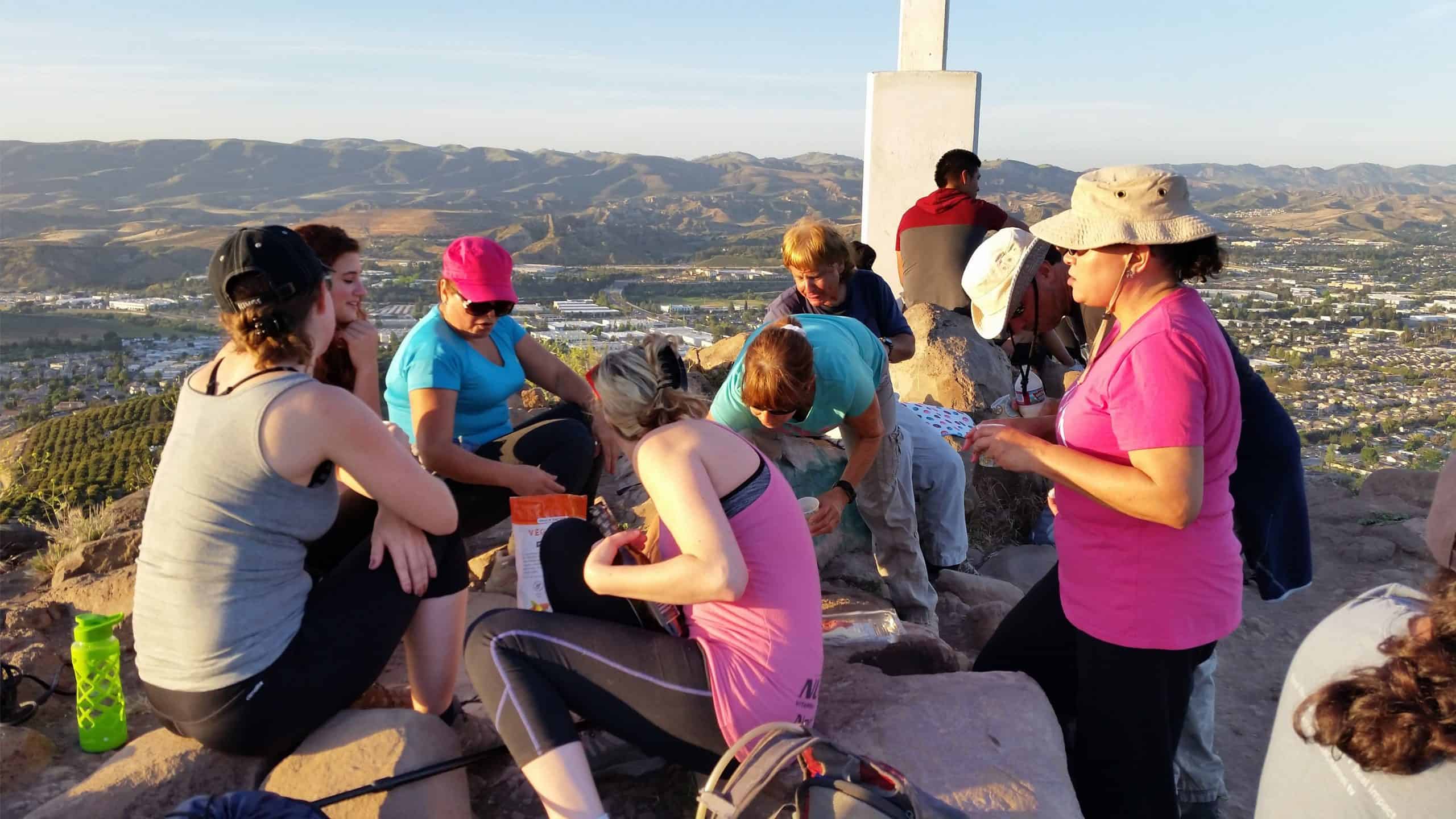
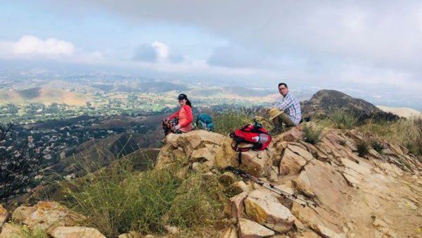
Scroll down to rsvp Details This one us my classic "Sea to Mesa Peak" hike Many hiking groups promise to take you to Mesa Peak but they never do. That's because they have confused their peaks and take you to the wrong one. So come along with us to the real Mesa Peak! […]
A VERY SHADY TRAIL AND KAYAKING TO BEAT THE HEAT Join me and some WWW members if you would like to spend all day at Big Bear Lake with us experiencing the fun that our Wednesday events offer. We'll start out with a 7 mile In and Out hike to Grand View Point via the […]
Welcome back!THIS A CONDITIONING HIKE! Our group hikes at a minimum of 2.5 miles per hour. You must be able to keep up with the group. Please sign up for this conditioning hike only if you can do this. Use the directions to the trailhead as described below. Bring a flashlight or headlamp. You must […]
4 miles, Gain: 500'.This is a beginner (https://www.meetup.com/Hiking-Plus/messages/boards/thread/50879781) hike on the beautiful Limekiln trail. The hike starts at the trail head near the Tampa exit on I-118, just 3 miles east of the Topanga Canyon exit. I haven't done this route since the fire in Oct 2019, so we'll see how this changes our route […]
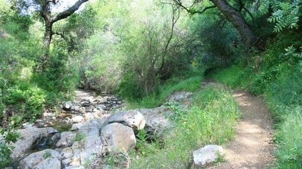
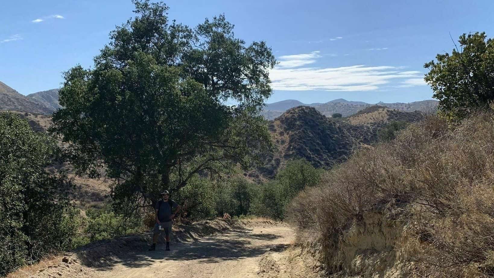
Join me on one of CDH's easier hikes as we start to build up our muscles for more challenging hikes in the future. I will be walking at a slow pace with many breaks along a paved Paseo winding its way along Madea Creek in Oak Park. This pathway is known as The Madea Creek […]
Let's beat the heat! This is a short trail but the first two miles are very steep. We'll take a short snack break at one of the towers, enjoy the view then head back down. Distance: <6 miles Elevation Gain: 1,508' Trail: Single track, firebreak, fire road, loop, mostly exposed Level: Not for beginners, will […]
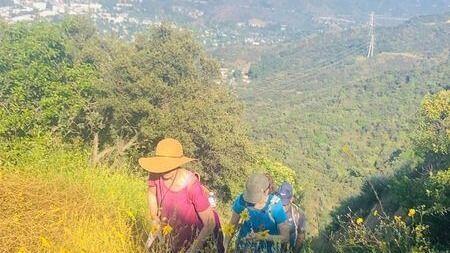
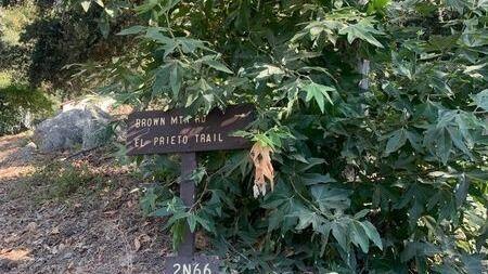
Join our Facebook group at https://www.facebook.com/groups/hikingwithdean/ I'm timing this hike with the opening of Spruzzo Restaurant in Pacific Palisades. Date may change accordingly. We begin the hike by traveling south along Santa Ynez Creek, climb a steep ridge to E. Topanga Fireroad, skirt Trippet ranch and return via a descent down into Santa Ynez Canyon. […]
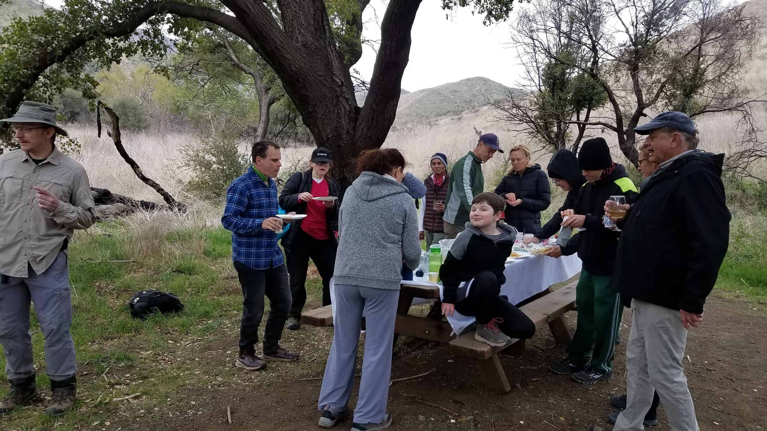
Let's start the long weekend with this fun potluck hike! Please bringFood and drink to shareYour own cup, plate and utensilsWaterGreat spirit! 4.5 mile 650' elevation gain We'll start the hike at the Avenida de Las Flores Trailhead.From the trailhead we'll take a left and head east for 1/3 mile up a gentle slope which […]
This will be our fourth 4th of July event and potluck celebration. It is well away from any traffic jams and other holiday nuisances. Difficulty: Fit Beginner (https://www.meetup.com/Hiking-Plus/messages/boards/thread/50879781) Note: The address above is where we will meet. This hike is will take us part way up the Hummingbird trail to a flat rock that is […]
BEFORE YOU WILL BE MOVED TO THE GOING LIST, YOU WILL NEED TO UPDATE YOUR CDH PROFILE (The three questions must be answered with a "yes") IF YOU HAVE NOT ALREADY DONE SO.NEED HELP:go to: https://wp.me/P9MbG4-hC BIKE RIDE - Westlake VillageThe route will start at Triunfo Park and continue clockwise around the lake. Make sure […]
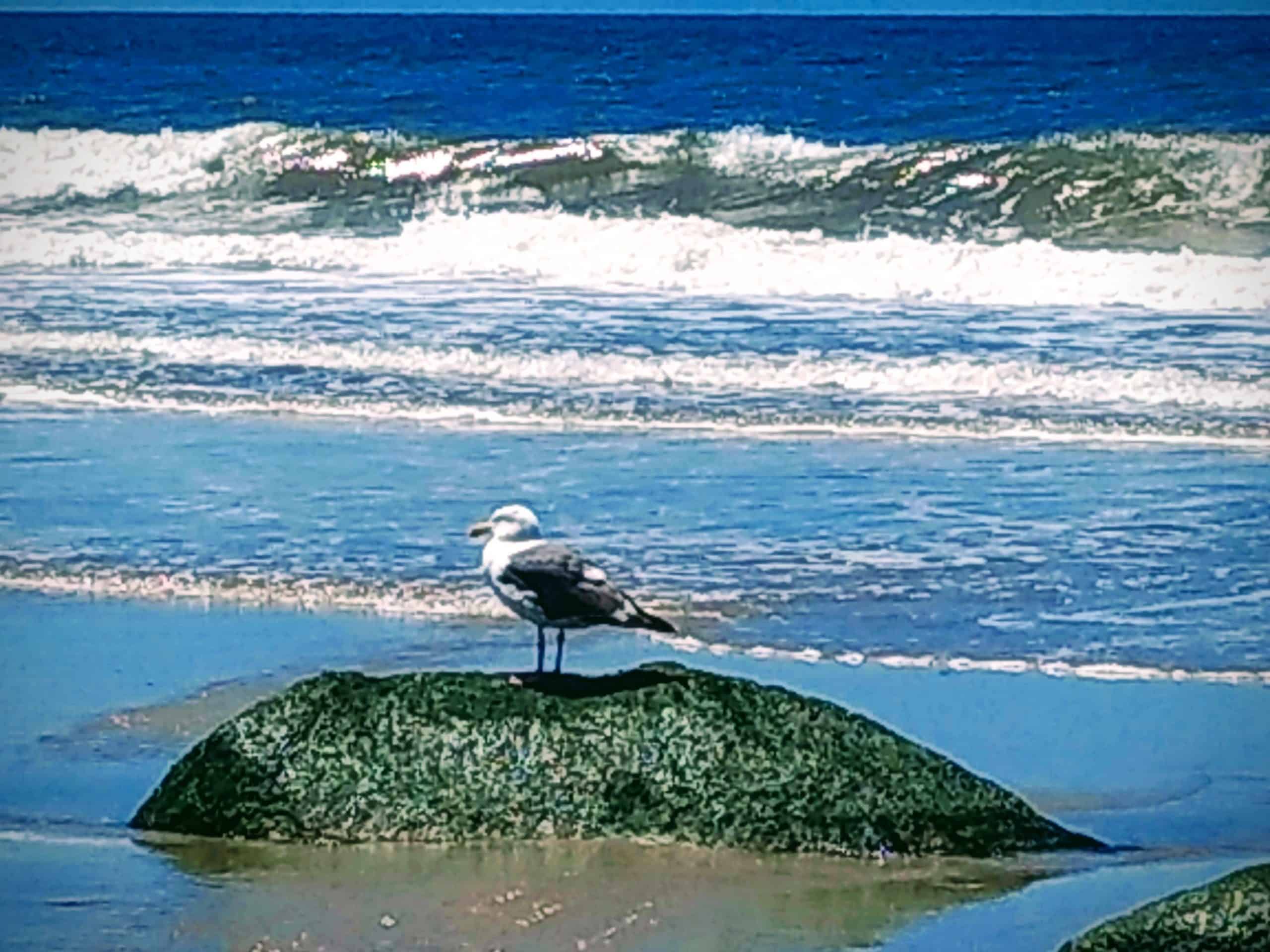
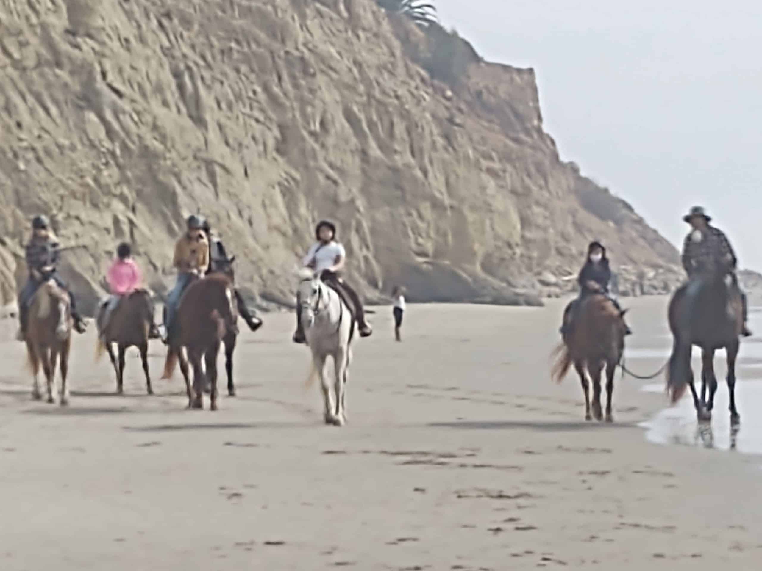
Welcome back Sierra Club group!Monday should be warm so let's kick off the re-opening with a cool beach walk.We'll walk the bluffs to the Salt Marsh and return along the shore. Approximately 5-6 miles with a minimal elevation.Wear a hat, sunscreen, and a snack if desired. There will be restrooms and water along the way.This […]
5 miles, 800' gain, Easy Intermediate. This route would be classified as fit-beginner, if not for an extended incline that runs for almost a mile in the middle of the hike. It is a fire road with a continuous climb. Fit beginners should be OK on this hike, although they may wish to take several […]
BEFORE YOU WILL BE MOVED TO THE GOING LIST, YOU WILL NEED TO UPDATE YOUR CDH PROFILE (The three questions must be answered with a "yes") IF YOU HAVE NOT ALREADY DONE SO.NEED HELP:go to: https://wp.me/P9MbG4-hC We'll start out by meeting outside the La Jolla Campground on PCH. From there we'll take on Magu Peak. […]
Intermediate, 4.5 miles, 1100' gain. Intermediate hikers will love this hike. It is not well suited for beginners. It has some of the most variations of terrain of any hike in the area and is one of my personal favorites. This is an interesting gem and one of the famous formations that every hiker in […]
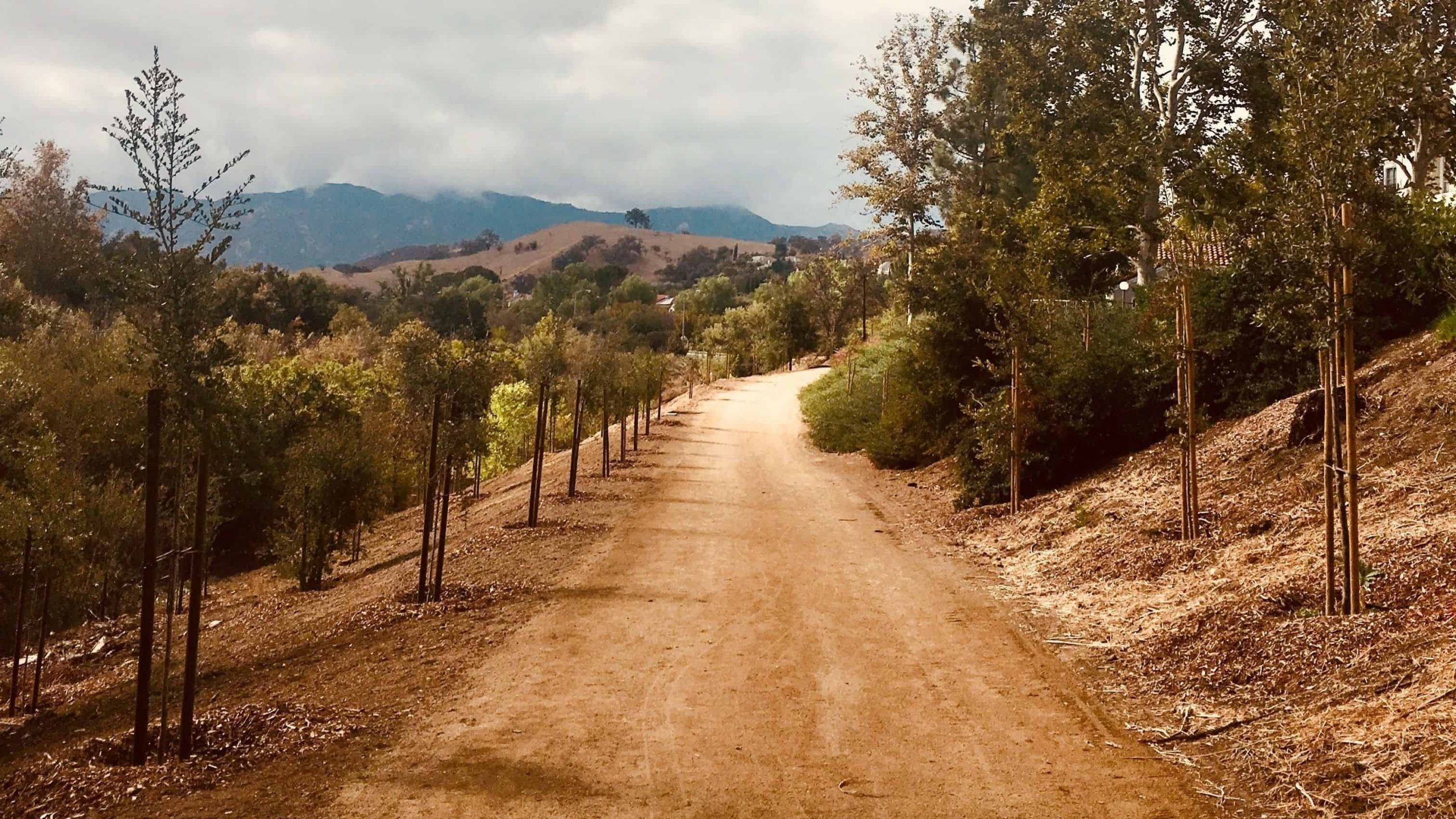
5.2 miles, 1140' gain, easy-intermediate. Warning: Google Maps may take you to the incorrect location, although the address is correct. Please follow the written directions. The Hike The hike starts on the Park View trail, completely flat along a gravel track that moves around the Dos Vientos Community park. It then gently rises into the […]
Welcome back!THIS A CONDITIONING HIKE! Our group hikes at a minimum of 2.5 miles per hour. You must be able to keep up with the group. Please sign up for this conditioning hike only if you can do this. Use the directions to the trailhead as described below. You must be able to hike 2.5 […]
Babu Bill, a CDH WWW member, has passed away and gone to far better trails than we have ever known. In honor of Babu, I'm scheduling this event which was the last hike that Babu did with our group. BEFORE YOU WILL BE MOVED TO THE GOING LIST, YOU WILL NEED TO UPDATE YOUR CDH […]
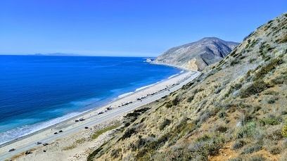
https://www.alltrails.com/trail/us/california/willow-creek-trail-to-nicholas-flat-loop?u=i Hello Fellow Hikers,So trying to keep the hikes closer to places with cooler weather and found this trail. Temps still show cooler weather here but if that changes I'll change to a slightly earlier time. Okay this will be another next to the Ocean but in the Mountains hike. This trail offers a continuous […]
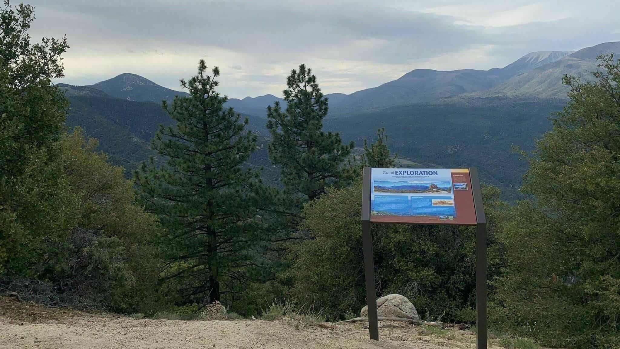
This online meeting is to discuss issues and logistics for our SB Camping and Hiking event this weekend. Topics will include whatever interests you plus: Post hike bbqTrailhead shuttleDiscuss hike and provide mapProvide map of campground with spaces labeledCell phone coverageCamping tips and tricks..and more Click on the zoom link to verify your computer or […]
This is a 2nd online meeting is to discuss issues and logistics for our SB Camping and Hiking event this weekend. You should attend at least one. Topics will include whatever interests you plus: Post hike bbqTrailhead shuttleDiscuss hike and provide mapProvide map of campground with spaces labeledCell phone coverageCamping tips and tricks..and leftovers from […]
3 miles, 500' gain, fit beginnerCross-posted with Thousand Oaks hikers. This is a pot-luck hike. We'll be stopping at the half-way point by some picnic tables, so please bring food and drink to share, and any utensils your items might require. Please park at the corner of Ranch Conejo Blvd and Conejo Center Dr in […]
Let's enjoy the beautiful sunset and great potluck with wonderful friends! Please bring - Food and drink to share- Your own cup, plate and utensils- Water- Flashlight or headlamp 3 miles out & back430’ elevation gain Meet at 1993 Rancho Conejo Blvd, Newbury Park. Please park at the corner of Ranch Conejo Blvd and Conejo […]
I have reserved a spot at the Los Prietos Campground in the Los Padres National Forest for 7/11 Sunday night and 7/12 Monday night. I am putting together a couple of hikes for Monday and Tuesday. Monday morning will be the main hike and will cover the following Aliso Canyon - a pretty little hike […]
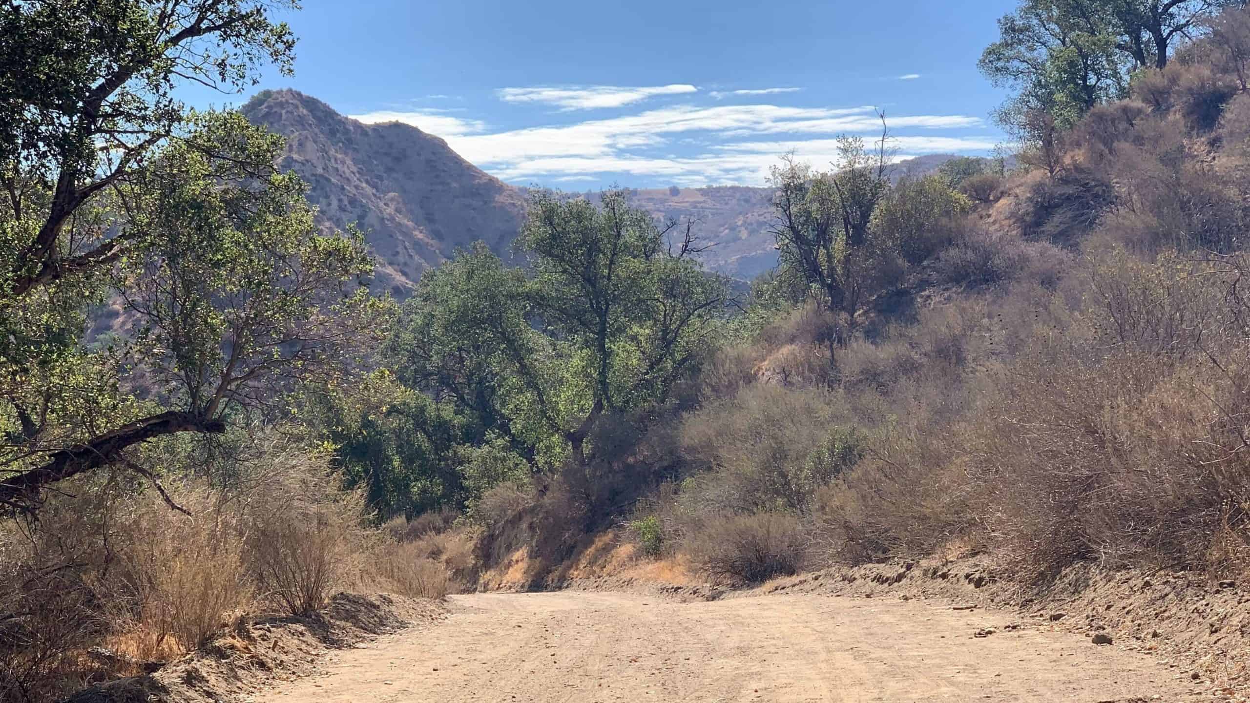
Out and back, trail is well maintained and shaded in the canyonNot for beginners. It will be at my pace Distance: 6> Elevation Gain: Under 2000, we will find out Directions On the 210 Freeway from La Canada/Hwy 2, take the Arroyo/Windsor exit and head north (left). Make an immediate right on Woodbury Rd. Make […]
This is a great mid-range hike for folks who want some good exercise and at the same time enjoy the local beauty offered in the Santa Monica Mountains. Join us for a moderate out and back hike that begins at the Caballero Canyon Trailhead Hiking Difficulty:Moderate, 1000 ft elevation gain, Approximately 7 miles Bring water, […]
https://www.alltrails.com/trail/us/california/tapo-canyon-trail?u=i Hello fellow hikers,The heat is here but we still need to keep moving so the goal is to hit this trail (which has partial shade ) and be back at our cars before it gets to hot... so...Join me on a easier moderate hike at Tapo Canyon Trail in Simi Valley. This hike has […]
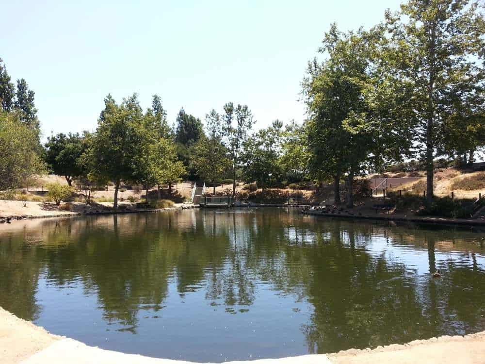
It's going to be warm inland, again. Meet on the water side of the Ventura Harbor Visitor Center at 08:45. We'll walk the shore, through the harbor to Portside, back through the harbor to the settling ponds, and return through the village to our cars. Total milage 6+. Those who are interested are welcome to […]
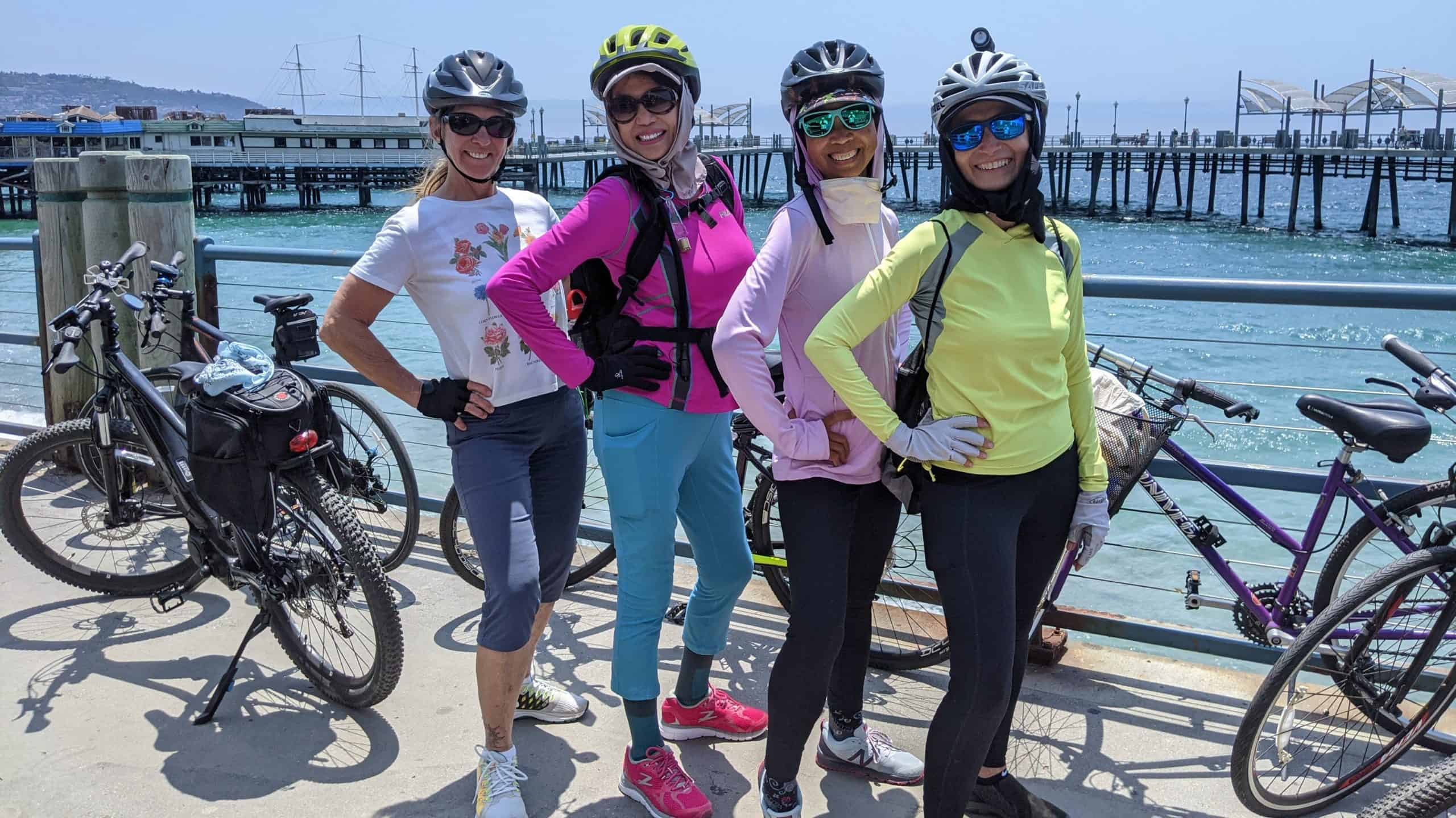
BEFORE YOU WILL BE MOVED TO THE GOING LIST, YOU WILL NEED TO UPDATE YOUR CDH PROFILE (The three questions must be answered with a "yes") IF YOU HAVE NOT ALREADY DONE SO. BIKE RIDE - Marina Del Rey to Redondo and back.The route will be on the Marvin Braude Bike Trail (aka the beach […]
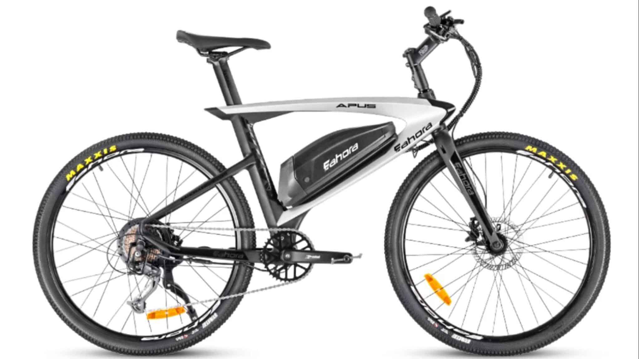
We're going to ride some EAHORA ebikes in Anaheim, have fried chicken for lunch and then do a beach hike. EBIKES - We're going to check out EAHORA bikes. David just bought the one pictured above one and we found out that we could test ride several of their models at Duke's Bicycles in Anaheim. […]
4.6 miles, 900' gain, easy-intermediate. This route takes us through a beautiful canyon via a counter-clockwise lollipop. Most of the hike has a clear view of the sky, with a few parts that have tree cover. We'll be stopping at the half-way point for a snack and beverage share (https://www.meetup.com/Hiking-Plus/messages/boards/thread/50879772). We'll start at the Palo […]
BEFORE YOU WILL BE MOVED TO THE GOING LIST, YOU WILL NEED TO UPDATE YOUR CDH PROFILE (The three questions must be answered with a "yes") IF YOU HAVE NOT ALREADY DONE SO 1. If you are not fully vaccinated then you must follow all safety guidelines regarding Covid. This means 6-ft social distancing, and […]
Approximately 5.0 mile loop. PLEASE FOLLOW THE DIRECTIONS IN THE WRITEUP BELOW TO GET TO THE TRAILHEAD. This Loop is about 5 miles long. This hike is rated moderate for its elevation gain and distance. The group hikes between 2.5 and 3.5 mph. If you cannot hike at a minimum of 2.5 mph, please do […]
https://www.alltrails.com/trail/us/california/gould-mesa-road-angeles-crest-hwy-to-paul-little-picnic-site?u=i Hello Fellow Hikers,Okay Found a trail with shade and water! This is a pretty hike that will take you through several wet creek crossings and over a few bridges. This trail has plenty of shaded areas throughout the hike, This is more of a easy moderate trail as only one section has a climb […]
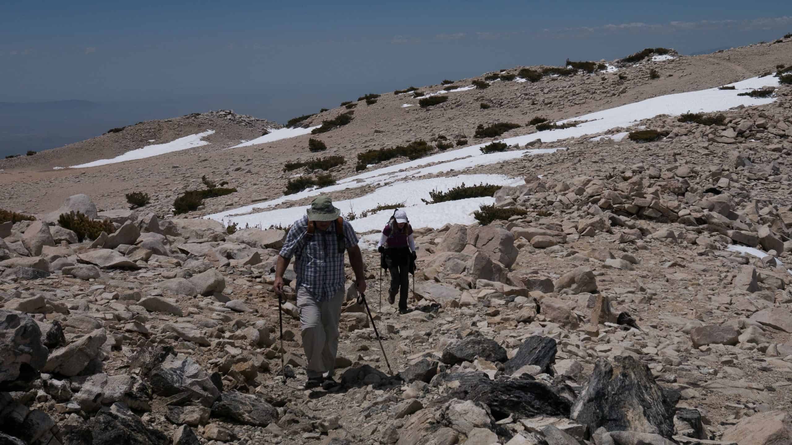
Total Distance: ~14 milesTotal Ascent: ~4,200 feetType: Out and backDifficulty: Strenuous NOT FOR BEGINNERSHighest Elevation: 8,696 feetPace: Moderate (25-30 minutes per mile)Optional: Post hike refreshment at the Mount Baldy Lodge restaurant in the Village. Join me on this beautiful hike to one of the major peaks in the San Gabriel mountains. The group will naturally […]
Join our Facebook group: https://www.facebook.com/groups/hikingwithdean/ Details Eagle Rock, the most impressive landmark in all of Topanga State Park, will afford us an airy perch overlooking the upper watershed of Santa Ynez Canyon and the ocean beyond. We will picnic and explore on this impressive sandstone rock covered with crevices and caves Our trip to […]
https://www.alltrails.com/trail/us/california/tapo-canyon-trail?u=i Hello fellow hikers,The heat is here but we still need to keep moving so the goal is to hit this trail (which has partial shade ) and be back at our cars before it gets to hot... so...Join me on a easier moderate hike at Tapo Canyon Trail in Simi Valley. This hike has […]
This is an optional day hike for people who want to spend an extra day after doing the Little Lakes Valley Trail event. Length : at least 5 milesElevation gain: 1,463 feetElevation at Treasure Lakes: about 10,600 feetRoute type: Out & backRating: StrenuousPace: Moderate Pace The plan: After doing the Little Lakes Valley Trail on […]
BEFORE YOU WILL BE MOVED TO THE GOING LIST, YOU WILL NEED TO UPDATE YOUR CDH PROFILE (The three questions must be answered with a "yes") IF YOU HAVE NOT ALREADY DONE SO.NEED HELP:go to: https://wp.me/P9MbG4-hC BIKE RIDE - Westlake VillageThe route will start at Triunfo Park and continue clockwise around the lake. The goal […]
5.3 miles, 600' gain, Easy-Intermediate2 miles, 100' gain, Beginner We start by crossing a bridge into a wooded area and continue down a relatively flat path alongside a stream. After about a mile, we'll come to a junction. For those that want the full hike, we'll turn right and complete a 3 mile loop with […]
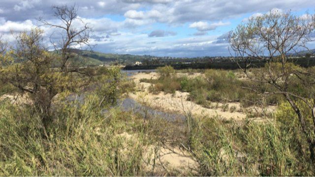
The Santa Clara River is one of the last mostly natural remaining river ecosystems left in our state. There is no concrete or cement lining its sides or bottom. Until now. The county watershed protection agency (WPD) plans to repair 2.8 miles of the south bank from Hwy 101 upstream to Central Ave. Sierra Club […]
3 miles, 700' gain, fit-beginner.This is one of the classic hikes in Simi Valley. We'll meet in the parking lot at the northeast corner of Madera and Royal, just south of the Donut Delite, on the east side of the Clinicas office. We'll walk from there to the trailhead at 2 Washburn St. where it […]
Welcome back!THIS A CONDITIONING HIKE! Our group hikes at a minimum of 2.5 miles per hour. You must be able to keep up with the group. Please sign up for this conditioning hike only if you can do this. Use the directions to the trailhead as described below. You must be able to hike 2.5 […]
BEFORE YOU WILL BE MOVED TO THE GOING LIST, YOU WILL NEED TO UPDATE YOUR CDH PROFILE (The three questions must be answered with a "yes") IF YOU HAVE NOT ALREADY DONE SO.NEED HELP:go to: https://wp.me/P9MbG4-hC I've been gradually stepping up our Friday hikes from beginner to eventually intermediate level. This one will have us […]
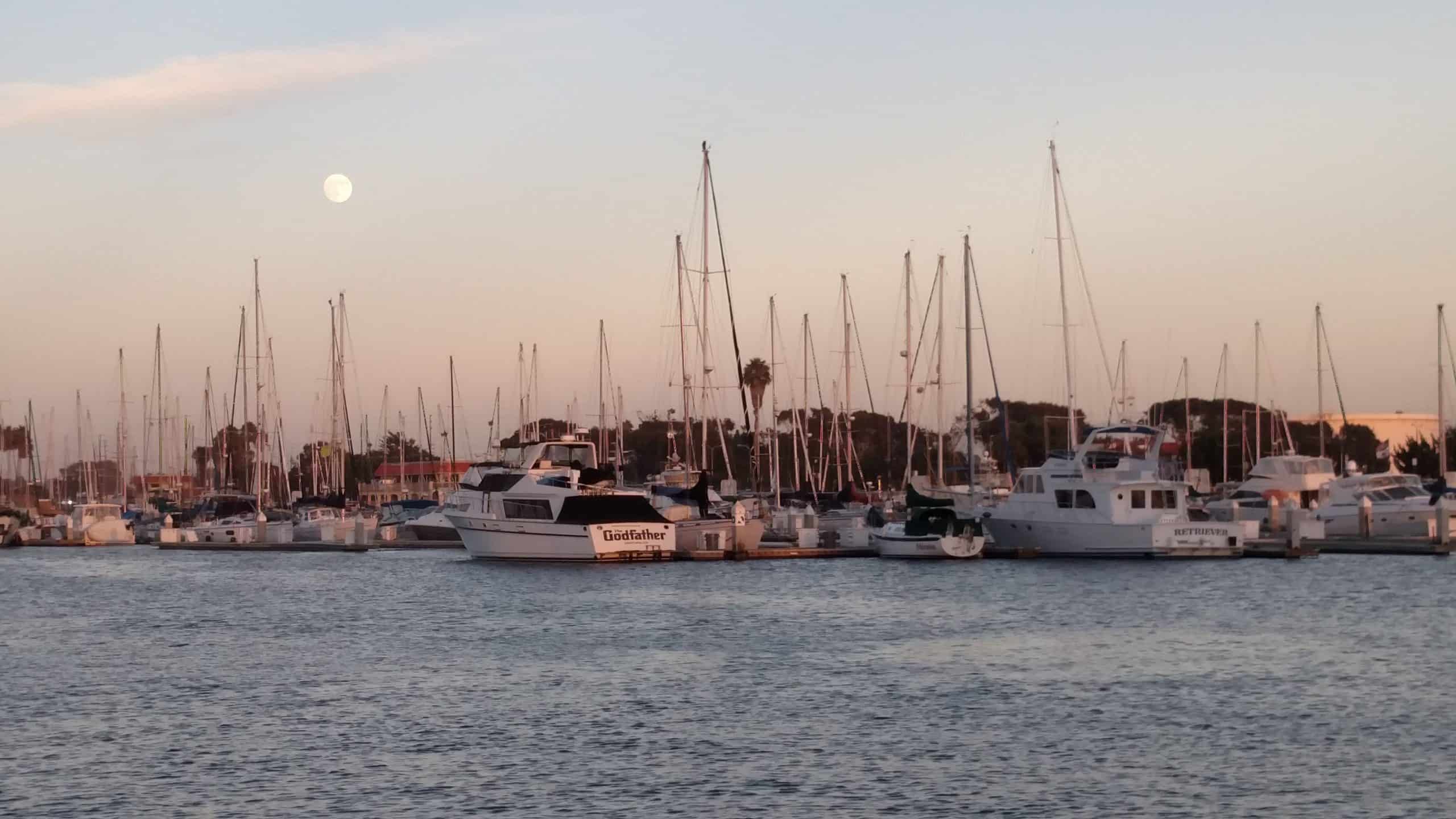
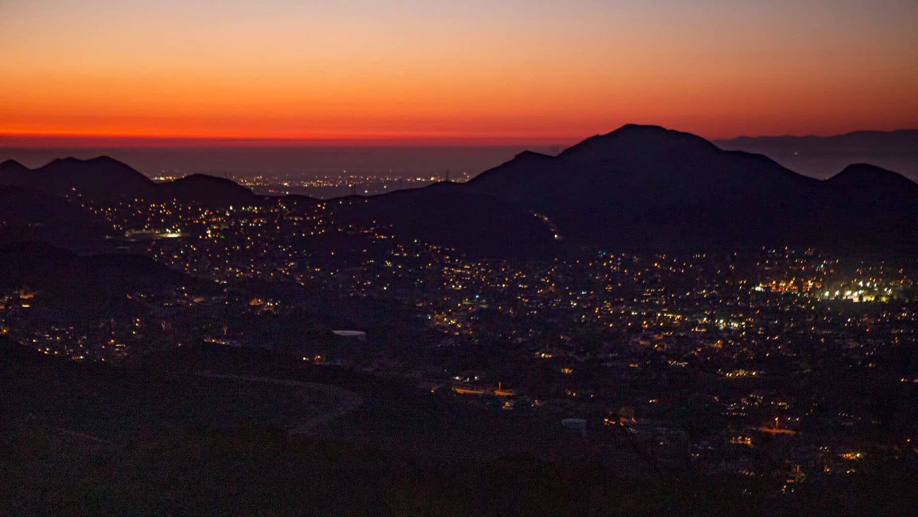
The Full Moon in July is the Buck Moon, named after the new antlers that emerge from a buck's forehead around this time of the year. It is also called Thunder Moon, Hay Moon, and Wort Moon. "Mt Basura" is my name for the Calabasas/Lost Hills Landfill. Our destination is a small peak overlooking the […]
Many from this group, plus other friends, will attend this event at Sagebrush Cantina. The band playing (Hindsite) puts on a fantastic show. This is one of the best venues I've experienced on LA's west side, and this is one of the best bands I've seen at this venue. Come see a Hollywood quality show […]
Let's beat the heat! Bring enough water and if you can bring extra for Don's tree that is at the peak. Not for beginners Distance: 6> miles Elevation Gain: 1900 feet Pace: My pace Trail: Single track, exposed, out and back Directions: From the 101 Fwy, exit Lindero and go north. Drive several miles. At […]
This event is cross-posted with:Ventura County Baby Boomer Fun Events: https://www.meetup.com/BabyBoomerEvents-com/events/279532287/BOOMER's GUYS AND GALS NETWORK!: https://www.meetup.com/BOOMER_FRIENDS_NETWORK/events/279532242/ Many of us from this group may attend this event. According to the Rancho Simi Recreation Park District website, the band playing is Fast Times. That band really puts on a fantastic show. Concerts start at 6:30 pm.Concert is […]
https://www.alltrails.com/trail/us/california/tapo-canyon-trail?u=i Hello fellow hikers,The heat is here but we still need to keep moving so the goal is to hit this trail (which has partial shade ) and be back at our cars before it gets to hot... so...Join me on a easier moderate hike at Tapo Canyon Trail in Simi Valley. This hike has […]
3.0 miles, 800' gain, easy-intermediate. This hike is rated easy-intermediate because it is a continuous incline for 1.5 miles. This isn't real steep, but it is continuous, and many beginner hikers have indicated this should be rated intermediate (https://www.meetup.com/Hiking-Plus/messages/boards/thread/50879781). That said, there is no reason a fit beginner cannot complete this hike. If needed, just […]
We’ll have enjoy potluck on the top under the beautiful full moon (well, this Buck moon is a bit shy. The moon rise is 9:42pm), then come back.Please bring some drinks and food to share.Let's do green, bring your own cup, plate and utensil. Cross-posted with Hiking Plus (https://www.meetup.com/Hiking-Plus/events/279616791/) Moderately easy a 3½ mile round […]
BEFORE YOU WILL BE MOVED TO THE GOING LIST, YOU WILL NEED TO UPDATE YOUR CDH PROFILE (The three questions must be answered with a "yes") IF YOU HAVE NOT ALREADY DONE SO.NEED HELP:go to: https://wp.me/P9MbG4-hC BIKE RIDE FROM LAKE BALBOA TO BURBANK AND BACKThe Orange Line bikeway runs along the Orange Line in the […]
Lets see whats growing in the Botanical Gardens. They are closed on Moday so will be free to us. After we're done we will walk down to the Promonade, along the beach to the River, and back to our cars.By joining this event, you understand that you may be hiking with vaccinated and non vaccinated […]
3.3 miles, 800' gain, fit beginner. A hike to Paradise Falls is one of the most popular things to do for those visiting Simi Valley, yet a lot of people that live nearby rarely make this fun hike or perhaps have never done it. There are several paths one can take to the falls. This […]
BEFORE YOU WILL BE MOVED TO THE GOING LIST, YOU WILL NEED TO UPDATE YOUR CDH PROFILE (The three questions must be answered with a "yes") IF YOU HAVE NOT ALREADY DONE SO.NEED HELP:go to: https://wp.me/P9MbG4-hC We're going to ride some more ebikes in El Segundo, have lunch at a trendy restaurant and then do […]
Approximately 5.0 mile loop. PLEASE FOLLOW THE DIRECTIONS IN THE WRITEUP BELOW TO GET TO THE TRAILHEAD. This Loop is about 5 miles long. This hike is rated moderate for its elevation gain and distance. The group hikes between 2.5 and 3.5 mph. If you cannot hike at a minimum of 2.5 mph, please do […]
3.5 miles, 700' gain, easy-intermediate. Short option: 2.0 miles, 500' gain option.There is an option to shorten this to 2.0 miles and 500' of gain by skipping the 2nd loop, which starts from our social event area. The wait would be about 35 minutes for the rest of the group to complete the 2nd loop. […]
BEFORE YOU WILL BE MOVED TO THE GOING LIST, YOU WILL NEED TO UPDATE YOUR CDH PROFILE (The three questions must be answered with a "yes") IF YOU HAVE NOT ALREADY DONE SO.NEED HELP:go to: https://wp.me/P9MbG4-hC I will be hiking 4 miles along the relatively new Las Virgenes Creek trail again, which we did recently […]
We are back! Since this adventure started, we have set ourselves apart. It's the people and the format of our events. Hiking is fun. Hiking-Plus is fun-Plus! This is Bowling with a Social Event! Please be aware there are two Harley's bowling alleys in Simi Valley. This is the one on Cochran at Stearns. You […]
Per Sachika and Carmen A. request. Out and back. Trail is well maintained, shaded and cooler in the canyon. Not for beginners. Distance: 6>Elevation Gain: 2086> we will find out Directions: On the 210 Freeway from La Canada/Hwy 2, take the Arroyo/Windsor exit and head north (left). Make an immediate right on Woodbury Rd. Make […]
Total Distance: 18.5 milesElevation: 5,470 elevation gainRating: Strenuous I have a permit for 12 on July 31st and would love to have some company on this iconic and strenuous hike. Everyone goes to the wait list first and then based upon my knowledge of your experience and qualifications, hikers will be added. This is an […]
We'll start on the Grassland Trail off of Mulholland Hwy and head south on a scenic stroll over rolling hills and through open fields of grain. Our destination is the famous Mash site.Hike will be an easy 7 miles with 500 ft elevation gain. Suitable for fit beginners. DIRECTIONSTrail head and free street parking on […]
Trail statistics are approximate. For safety purposes always assume they are underestimated. But don’t be disappointed if they are overestimated. Bring more water and snacks than you think you’ll need.
Trail descriptions are based on previous hikes. Current conditions are unknown until arrival. Expect the unexpected and plan accordingly.
The Organizers and members of Hiking With Dean are not professional leaders, guides, or mountaineers. The function of the member or organizer is only to organize the trip. Each person who shows up for a trip/meetup (and their guest or guests) is responsible for his or her own safety. By attending a hike, or any other event organized by this group, you are acknowledging that you and any guests that you bring are aware of the risks, dangers and hazards associated with the activity and freely accept and fully assume all such risks, dangers and hazards, and further agree to release and discharge the Organizers, Members of the Hiking With Dean Meetup Group from and against any and all liability arising from your participation in the group activities per our ASSUMPTION OF RISK AND LIABILITY WAIVER and Section 6.2 of the Meetup.com Terms of Service.


Recent Comments