PRACTICE SOCIAL DISTANCING WHENEVER POSSIBLE, ESPECIALLY AT TRAIL HEAD AND BREAK SPOTS. WEAR A MASK OR FACE COVERING WHENEVER SOCIAL DISTANCING IS IMPOSSIBLE OR IMPRACTICAL. IT IS MANDATORY THAT YOU BRING A FACE COVERING. BRING HAND SANITIZER IF YOU HAVE IT. Details I am lifting the Coronavirus group-size restrictions starting with this hike! RSVP the […]
BEFORE YOU WILL BE MOVED TO THE GOING LIST, YOU WILL NEED TO UPDATE YOUR CDH PROFILE (The three questions must be answered with a "yes") IF YOU HAVE NOT ALREADY DONE SO. BIKE RIDE FROM LAKE BALBOA TO BURBANK AND BACKThis is a new event for us. The Orange Line bikeway runs along the […]
BEFORE YOU WILL BE MOVED TO THE GOING LIST, YOU WILL NEED TO UPDATE YOUR CDH PROFILE (The three questions must be answered with a "yes") IF YOU HAVE NOT ALREADY DONE SO Since we are living in the age of Covid, I am limiting this event to a max of 10 people due to […]
https://www.alltrails.com/trail/us/california/tapo-canyon-trail?u=i Hello fellow hikers,Join me for a easier moderate hike on Tapo Canyon Trail in Simi Valley. This hike has a nice gradual walk until we start a gradual climb were we will start our loop. We should encounter wildflowers and mountain views. Our loop will drop down then we will continue until we start […]
Write up with a few changes from the same prior VHC event: PAYPAL PAYMENT SECURES YOUR SPOT. $27 per person for 2 nights. NO REFUNDS after March 31, 2021 to compel commitment. Forfeited fees will be be donated to the Yosemite Conservancy under VHC's name. MAX ~10 people. CAMPING INFO One group site (Good for […]
https://www.alltrails.com/trail/us/california/san-dimas-canyon-to-sunset-peak-radio-towers?u=i Hello Fellow Hikers,Are you looking to get out and hit a challenging hike but don't want to hit the popular peak hikes on the weekends? Yeah me neither. So join me on this less traveled but good distance with elevation gain hike. This trail starts off going up with switchbacks for the first 4 […]
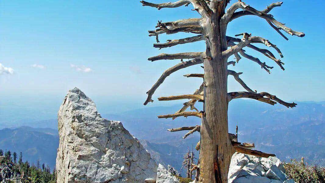
Join our Facebook Group - https://www.facebook.com/groups/hikingwithdean/ Details The official trail up Elliot Mountain (technically a peak at 1,063 ft) was built May 2015. Below is a photo showing how we used to climb it. The mountain, a bench and the trail are named after Burt Elliot who was very active with Conejo Open Space Conservation […]
BEFORE YOU WILL BE MOVED TO THE GOING LIST, YOU WILL NEED TO UPDATE YOUR CDH PROFILE (The three questions must be answered with a "yes") IF YOU HAVE NOT ALREADY DONE SO. BIKE RIDE FROM VENTURA TO FARIA POINT AND BACKWe'll be riding from San Buenaventura State Beach in Ventura to Faria Point. Afterwards, […]
COVID precautions still apply. YOU MUST BRING A FACE COVERING to meet up at the trailhead. Please be mindful of other people's space. Come out to celebrate VHC's 13th ANNIVERSARY, Cinco de Mayo, Teacher Appreciation Week, National Hoagie Day or simply come stretch your legs and enjoy the outdoors with friends. THE PLAN Always finding […]
BEFORE YOU WILL BE MOVED TO THE GOING LIST, YOU WILL NEED TO UPDATE YOUR CDH PROFILE (The three questions must be answered with a "yes") IF YOU HAVE NOT ALREADY DONE SO Since we are living in the age of Covid, I am limiting this event to a max of 10 people due to […]
Hello fellow Hikes,This is my favorite local hike. This has the perfect amount of elevation gain with views to make this a great hike. Not a long trail so you can get in a great workout and still go and enjoy the rest of your day. This trail is a nice wide trail that starts […]
This is a loop hike going up the Ski Hut trail and coming down the Devil's Backbone trail to Baldy notch. OPTIONAL lunch at the Notch Restaurant before heading down. From the notch, there is a 3 mile fire road to walk back to Manker Flats.If you want to take the ski lift down instead, […]
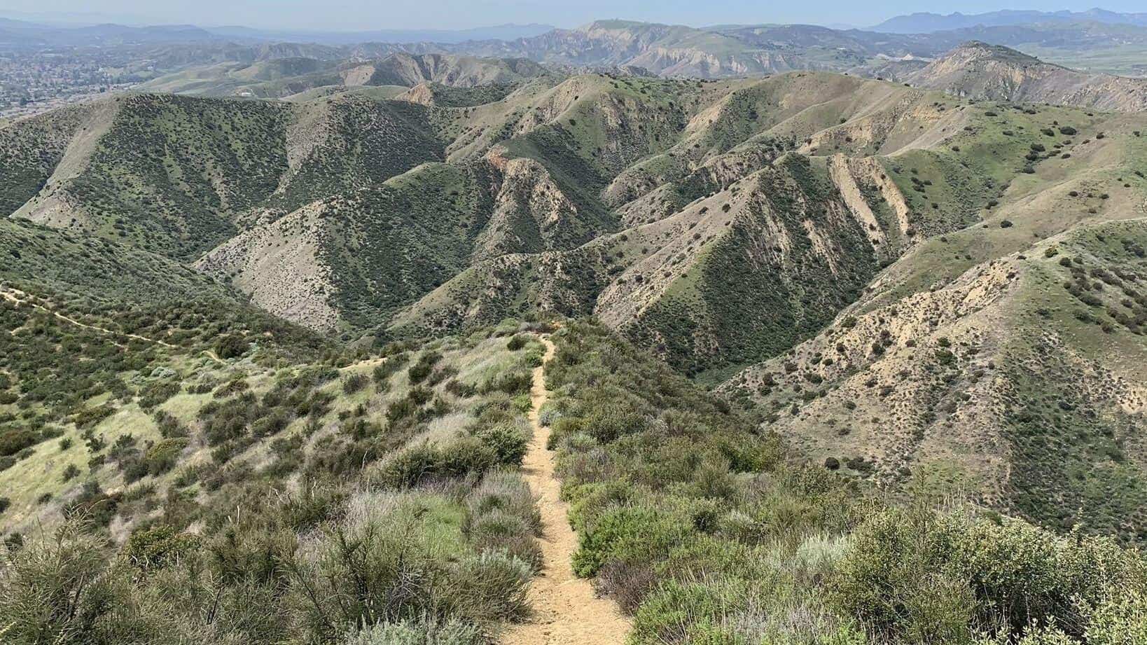
https://www.alltrails.com/trail/us/california/las-llajas-canyon-and-ridge-loop Hello Fellow Hikers,If you haven't done the Ridge trail in Simi Valley your in for a treat. This is a lesser known/traveled trail. You will follow the top Ridge of Las Llajas. The first 2 1/2 miles of this trail is where most of your incline comes in. Will have some steep sections to […]
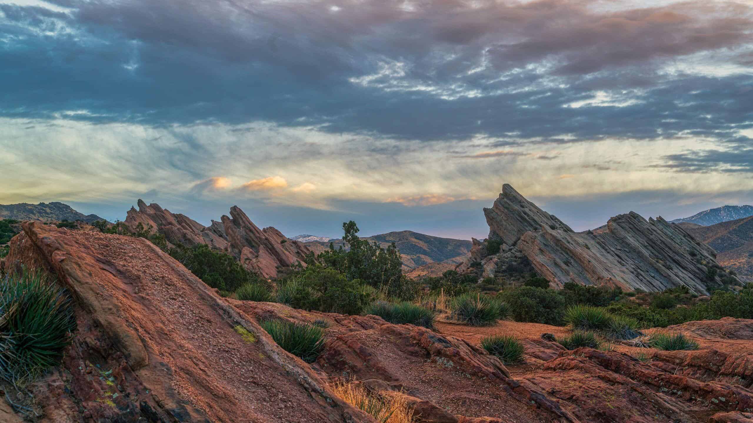
Length: 3.7 mi Elevation gain: 600 ft Route type: Loop Vasquez Rocks Extended Loop via PCT is a 3.7 mile heavily moderately easy hike through, well, Vasquez Rocks Natural Area. Vasquez Rocks Natural Area is a beautiful and unique park with rocks pointing out at 45 degrees, creating an impressive, almost surreal landscape. Check it […]
COVID precautions still apply. YOU MUST BRING A FACE COVERING to meet up at the trailhead. Please be mindful of other people's space. Tom Sloan Dragon on Mother's Day. This is a VERY steep climb (scramble) right off the bat with 1800 ft of gain in the first two miles. Not for beginners. The Stats […]
My Bell Canyon Loop starts and ends at the mouth of Bell Canyon. Its a little-known loop and I haven't seen any other meetup group do it -- so you are in luck today! 👉 Hike is about 4 miles with 900' total ascent. Most of that is during a one-mile stretch, thus I am […]
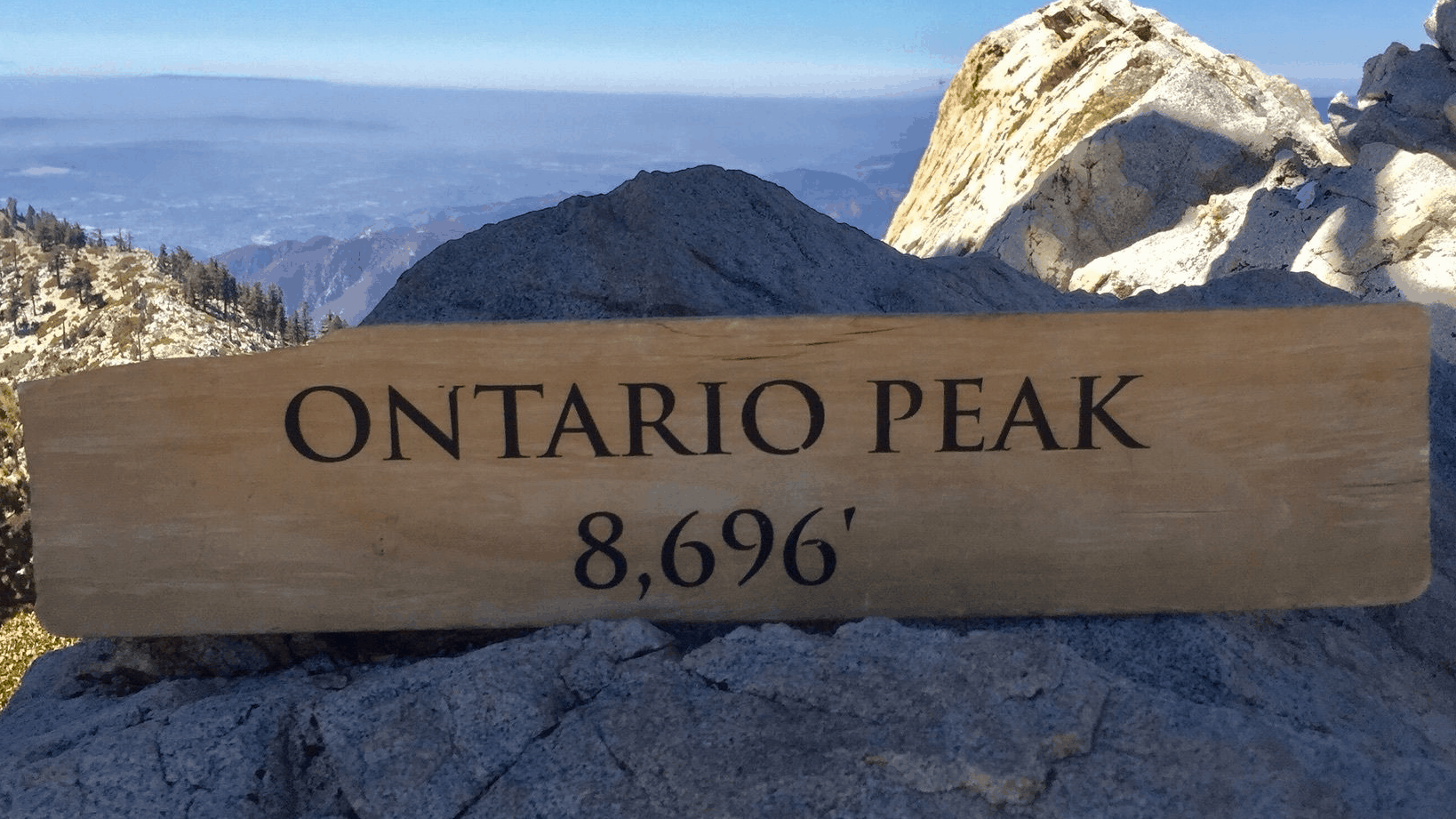
https://www.alltrails.com/trail/us/california/ontario-peak-and-bighorn-peak-loop?u=i Hello Fellow Hikers,This is one of my favorite peaks. It's a lesser traveled peak verses the others in your six pack of peak trails. But not to take any credit away from this beautiful peak! This trail will start from Ice House Canyon which we will follow to the Saddle. From there we will […]
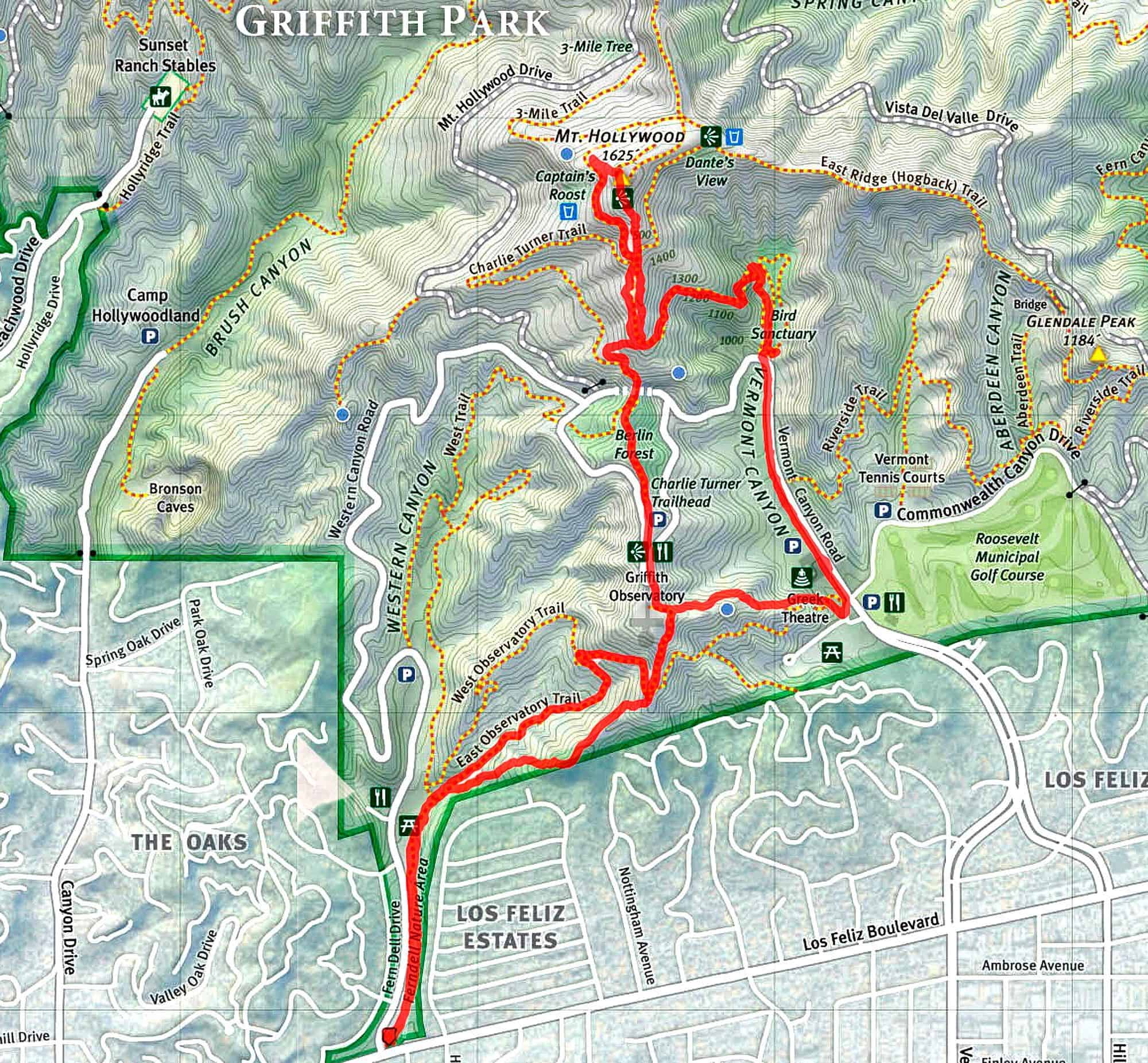
PLEASE HAVE A MASK AT THE TRAILHEAD!!!PLEASE NOTE 10 MINUTE GRACE PERIOD.Do not Park on Fern Dell Drive. Time - Meet at 6:30 p.m. , leave at 6:40 p.m.Distance - 6.5 milesElevation gain - approx 1500 ft.Difficulty: INTERMEDIATE/ADVANCED ... No beginners. Please be prepared for abrisk hike with minimal stops. Please no recent injuries! This […]
I need to put in some work. Up to the road junction and back via the single track. 5.5 miles. The hike starts at 9am. I’m in Mississippi right now thus the 11 am start time listed. Starts at 9
Make sure you're fully Covid vaccinated before signing up for this event, since we will be car pooling from the Flying J Ranch to the start of the hike which is 35 minutes away. Have you looked at our past events into the RAZORBACK ridge area of the Los Padres National Forest and wished you […]
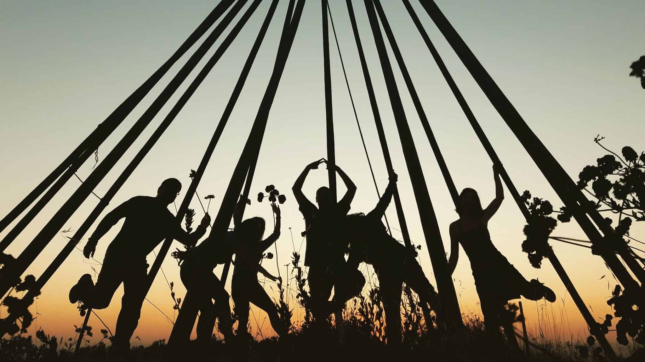
COVID precautions still apply. YOU MUST BRING A FACE COVERING to meet up at the trailhead. Please be mindful of other people's space. Going to the teepee for another evening hike. Such a great trail for a short but tough workout. We'll break at the top to enjoy some food and look at the city […]
BEFORE YOU WILL BE MOVED TO THE GOING LIST, YOU WILL NEED TO UPDATE YOUR CDH PROFILE (The three questions must be answered with a "yes") IF YOU HAVE NOT ALREADY DONE SO Since we are living in the age of Covid, I am limiting this event to a max of 10 people due to […]
Meet at the trailhead at 8. Feel free to read the description above or read about it in the link below.Check out this trail on AllTrails.https://www.alltrails.com/trail/us/california/coquina-mine-trail--3
BEFORE YOU WILL BE MOVED TO THE GOING LIST, YOU WILL NEED TO UPDATE YOUR CDH PROFILE (The three questions must be answered with a "yes") IF YOU HAVE NOT ALREADY DONE SO. BIKE RIDE AROUND THE SANTA CLARA RIVERBEDThe route will be primarily along the Santa Clara River and San Francisquito Creek. These are […]
Our route begins on Trailer Canyon fire road providing broad views over Santa Ynez Canyon and the surrounding mountains. But like nature and vacuums, we abhor fire roads. Thus, shortly after the hike begins we will leave the fire road and take a small, slightly overgrown use trail that passes a clay gully and crosses […]
COVID precautions still apply. YOU MUST BRING A FACE COVERING to meet up at the trailhead. Please be mindful of other people's space. THE PLAN THIS IS AN EXPLORATORY - I have only done portions of this trail and would like to see if we can connect a couple of them. Please read the whole […]
BEFORE YOU WILL BE MOVED TO THE GOING LIST, YOU WILL NEED TO UPDATE YOUR CDH PROFILE (The three questions must be answered with a "yes") IF YOU HAVE NOT ALREADY DONE SO. The weather is now perfect to start a series of Monday hikes in Santa Barbara County Parks geared for beginners on up. […]
PLEASE HAVE A MASK AT THE TRAILHEAD!!!PLEASE NOTE 10 MINUTE GRACE PERIOD.Do not Park on Fern Dell Drive. Time - Meet at 6:30 p.m. , leave at 6:40 p.m.Distance - 6.5 milesElevation gain - approx 1500 ft.Difficulty: INTERMEDIATE/ADVANCED ... No beginners. Please be prepared for abrisk hike with minimal stops. Please no recent injuries! This […]
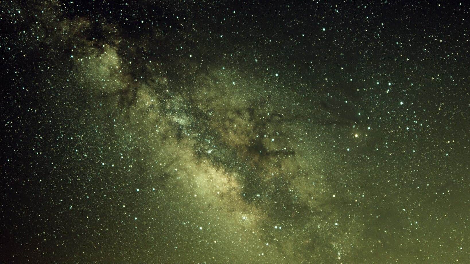
It's Milky Way season! And I’m shooting the Milky Way on Tuesday, 05/18/2021. The location will be at Cholla Cactus Garden inside of Joshua Tree National Park, where an L.A. astrophotography group went there this weekend under windy conditions. Having read their Meetup board, they were still able to have a great night. But 05/18/2021 […]
We will meet at the McDonalds in Fillmore at 7 am. High clearance vehicle recommended. Carpooling is available at the McDonalds in Fillmore. we will tag alamo and might be able to tag a couple more nearby.
Description: This is a backpacking trip. We meet at the Lodgepole Visitor Center of Sequoia National Park as walk-in backpackers at 7:00 a.m. But I will line up at 6:00 a.m. or earlier in the morning to secure a backpacking permit for 6. Based on the last time I did this trail on a weekend, […]
BEFORE YOU WILL BE MOVED TO THE GOING LIST, YOU WILL NEED TO UPDATE YOUR CDH PROFILE (The three questions must be answered with a "yes") IF YOU HAVE NOT ALREADY DONE SO. Since we are living in the age of Covid, I am limiting this event to a max of 10 people due to […]
COVID precautions still apply. Please be mindful of other people's space. Very limited space on this trip so please keep your RSVP accurate. Keeping it small to ease back into things. Apologies for not being able to add everyone. Car camping Friday - Sunday. Arrive at your convenience. Participation in planned hikes is optional. Being […]
https://www.alltrails.com/trail/us/california/ranch-overlook-old-boney-and-hidden-valley-overlook-trail?u=i Hello Fellow Hikers,This is showing as a less traveled route in this area so I thought hmm why not check it out. The trail is rated easy but the route stops at a junction so we will add a little more mileage and continue the Hidden Valley Overlook trail to the end. I'm guessing […]
BEFORE YOU WILL BE MOVED TO THE GOING LIST, YOU WILL NEED TO UPDATE YOUR CDH PROFILE (The three questions must be answered with a "yes") IF YOU HAVE NOT ALREADY DONE SO. BIKE RIDE - Marina Del Rey to Redondo and back.The route will be on the Marvin Braude Bike Trail (aka the beach […]
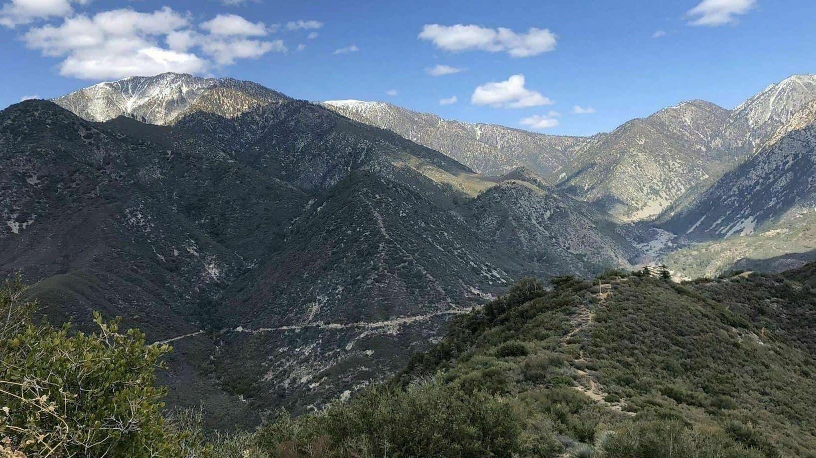
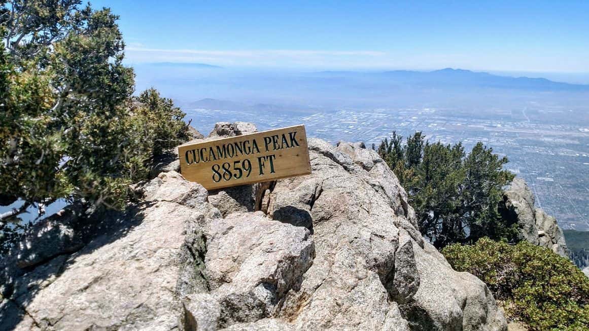
Total Distance: ~12 milesTotal Ascent: ~4,200 feetType: Out and backDifficulty: Strenuous NOT FOR BEGINNERSHighest Elevation: 8,859 feetPace: Moderate (20-30 minutes per mile)Optional: Post hike refreshment at the Mount Baldy Lodge restaurant in the Village. Join me on this beautiful hike to one of the major peaks in the San Gabriel mountains. The group will naturally […]
This used to be a 4-mile snow hike to Mr. Pinos hosted by Don T during the winter season. But I'm hosting it as a Spring conditioning hike, which is also posted by VHC hiker Kim who's hosting it in another hiking group. Just in case her group cancels due to cold weather, I'm still […]
Let’s enjoy a strenuous, brisk hike to Ontario Peak. Time: arrive at 6am and depart at 6:15. Parking is a hassle and may include a road walk.Distance: 13 miElevation Gain: ~3800 ftRating: 8/10Parking: Adventure Pass required.Trail: formal trailBottle opener: available at peak
This site was home to the Chumash, Spanish Rancho El Conejo, and modern ranching and farming operations. For many years, the Santa Monica Mountains sustained the Chumash and Tongva/Gabrielino cultures. Sycamore Canyon, which cuts through Rancho Sierra Vista/Satwiwa and Point Mugu State Park, was part of a Chumash trade route. Satwiwa, which means "the bluffs," […]
PLEASE HAVE A MASK AT THE TRAILHEAD!!!PLEASE NOTE 10 MINUTE GRACE PERIOD.Do not Park on Fern Dell Drive. Time - Meet at 6:30 p.m. , leave at 6:40 p.m.Distance - 6.5 milesElevation gain - approx 1500 ft.Difficulty: INTERMEDIATE/ADVANCED ... No beginners. Please be prepared for abrisk hike with minimal stops. Please no recent injuries! This […]
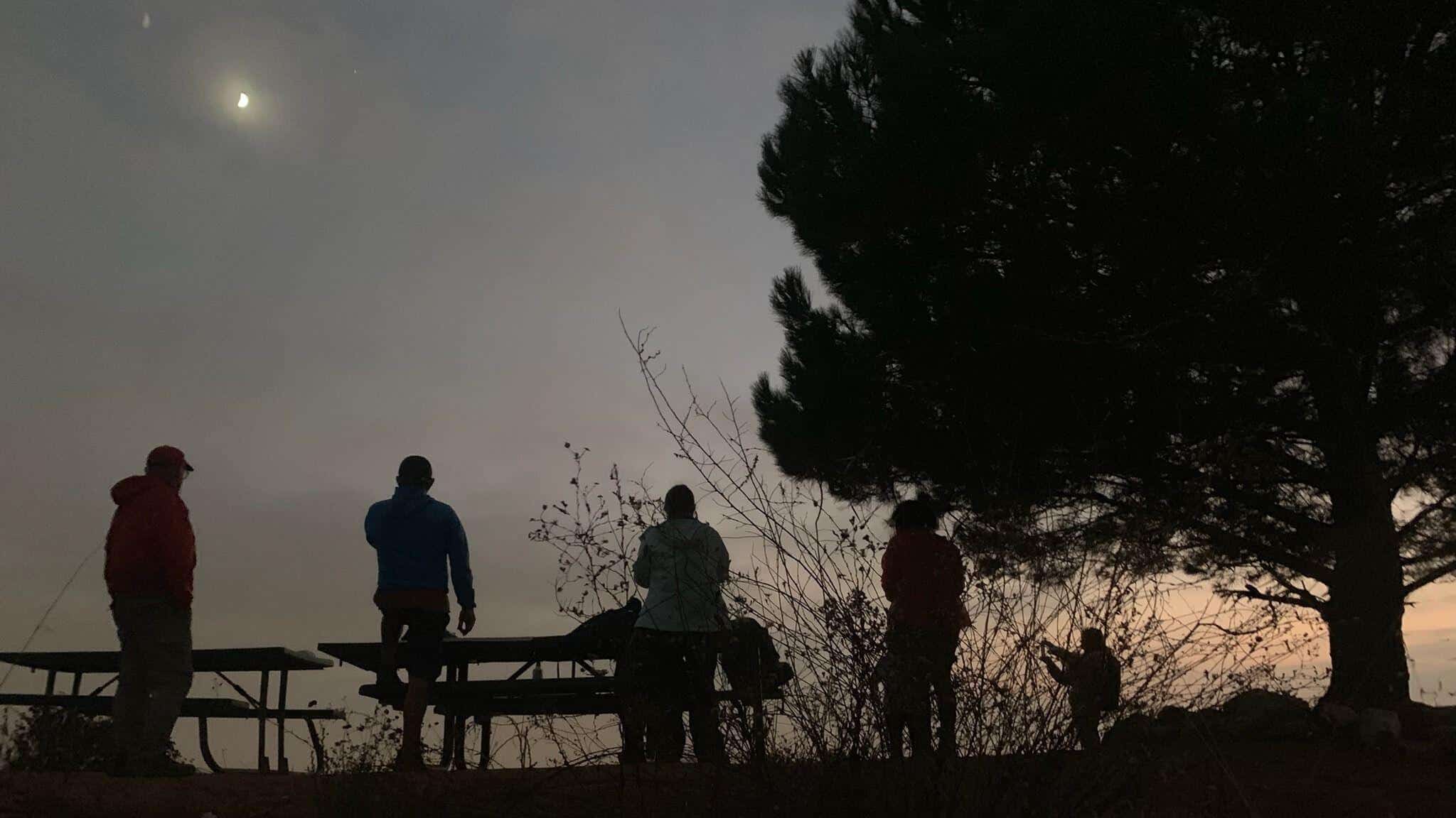
COVID precautions still apply. Please be mindful of other people's space. We will park just outside of the gate to the Stough Nature Center. We'll make our way up a steep trail off the main fireroad and loop around to the Wishing Tree where we'll take a snack break and watch the sunset. Moonrise is […]
BEFORE YOU WILL BE MOVED TO THE GOING LIST, YOU WILL NEED TO UPDATE YOUR CDH PROFILE (The three questions must be answered with a "yes") IF YOU HAVE NOT ALREADY DONE SO Since we are living in the age of Covid, I am limiting this event to a max of 10 people due to […]
4.5 miles, 1000' gain, Easy Intermediate There are several extended inclines and a couple short but steep climbs. Fit beginners can do this hike, but they may be cursing some of the extended and steeper climbs. That's OK, because we'll be stopping at various points to regroup and this is not a conditioning hike. It […]
https://www.alltrails.com/trail/us/california/tapo-canyon-trail?u=i Hello fellow hikers,Join me for a easier moderate hike on Tapo Canyon Trail in Simi Valley. This hike has a nice gradual walk until we start a gradual climb were we will start our loop. We should encounter wildflowers and mountain views. Our loop will drop down then we will continue until we start […]
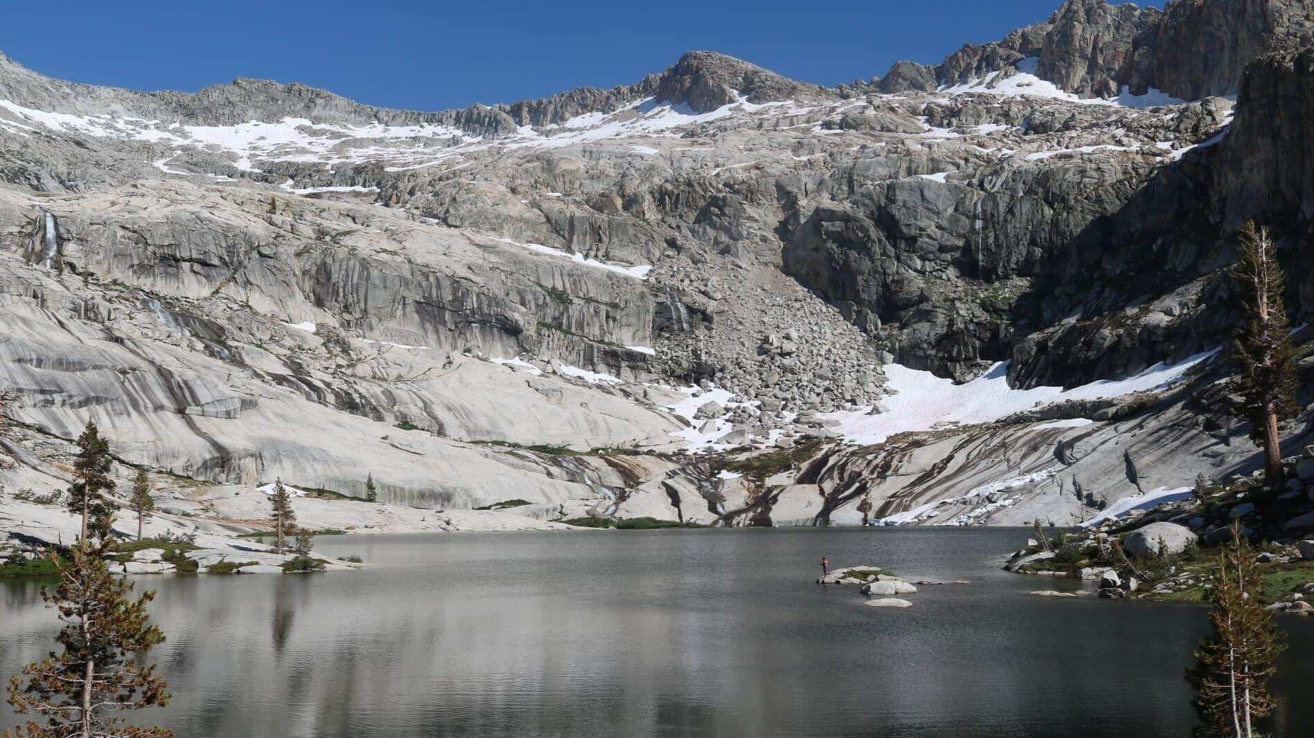
Description: This is a 2-night backpacking trip. On May 29, 2021, we meet at the Bishop Pass Trailhead at 7:00 a.m. Then, we start our hike to Bishop Lake at 7:30 a.m. At Bishop Lake, we set up our tents and stay overnight. The following day, we do a day hike and return to our […]
Scroll down to rsvp Details The trail that goes past the site has been open for quite a while now and today I will lead my VIPs to the crash site. After paying our respects and viewing the memorials left there by others (feel free to bring one of your own), we will return on […]
Fit Beginner - 6 miles, 600' gain This is a social hike and an out-and-back event. There is a pot-luck at end before we turn around for the return. If your item requires paper plates, utensils, etc. please bring them. Pot Luck guidelines: https://www.meetup.com/Hiking-Plus/messages/boards/thread/50879772 HikeDistance: 6.0 milesGain: 600'Distribution: Not much incline on this hike,Difficulty (https://www.meetup.com/Hiking-Plus/messages/boards/thread/50879781): […]
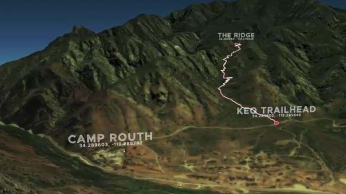
COVID precautions still apply. Please be mindful of other people's space. This is an advanced exploratory. You must be comfortable in very steep terrain, creek walking, rock hopping, scrambling, bushwhacking and trail finding. Apologies for not adding everyone but trail conditions and exploratory nature are prompting me to keep the group size small. The Stats […]
Scroll down to rsvpPark Closure Notice (May 30, 2021): Most trails in Topanga State Park are currently closed until further notice due to the Pacific Palisades fire. Los Leonis Trail is open. Temescal Ridge and Waterfall Trail in Temescal Gatway Park and Rivas Canyon have opened (but not part of TSP). Please continue to check […]
Here's an opportunity for our experienced beginner Trekkers to enjoy this beautiful area in Santa Barbara that our Intermediate Trekkers have done in the past. But this version is much shorter and far less elevation gain. As you can see from the photo above, there is a creek (San Roque) that the Arroyo Burrow trail […]
Come to the hike only (3:30p), picnic only (5:00p), or both. Warning: Google Maps may take you to the incorrect location, although the address is correct. Please follow the written directions. 3.5 miles, 500' gain, or if you choose to continue, 5.2 miles, 1140' gain. The Hike3:30 pm at the parking lot entrance. The hike […]
We will be tagging Haddock. Be at the trailhead by 9. 8-10 miles ( might include Reyes on the way back). Carpooling available from Ventura. FYI this is about a 2 hour drive from Ventura to the trailhead.
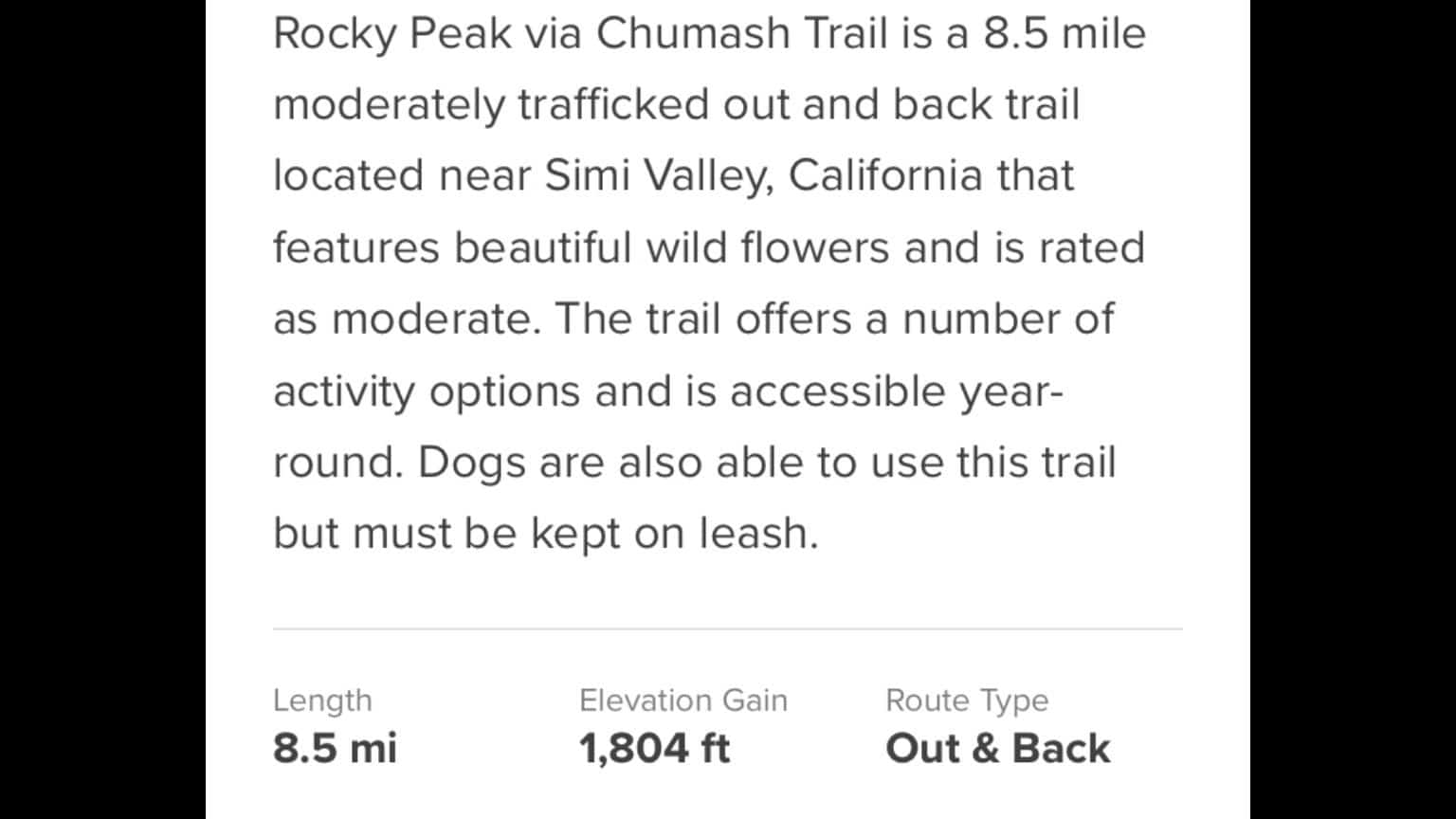
Distance: 3.25 milesGain: 750This hike is suitable for fit beginners (https://www.meetup.com/Hiking-Plus/messages/boards/thread/50879781). Park on the south side of the CA-118 at the Rocky Peak exit. We'll walk west along the Santa Susana Pass Rd. for about 500 feet. Directly across from Lilac Ln, we'll enter a trail. We'll move along a relatively flat section for 1/2 […]
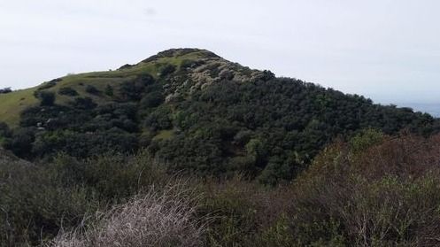
Description:The hike ascends to Mission Point, aka Mission Peak, via the Mario A DeCampos Trail. The peak is the second highest summit in the Santa Susana mountain range behind Oat Mountain. This trail meanders up a beautiful ridge through walnut and oak groves and open grassland, providing broad views of the San Fernando Valley and […]
Let's shoot the core of the Milky Way. This time let's aim at the sky from the Trona Pinnacles. I've never been to Trona Pinnacles. But based on the Clear Sky Chart, it's one of the places in California that is still rated at Bortle 2. The plan is to be at the shooting location […]
https://www.alltrails.com/trail/us/california/ocean-and-canyon-view-trail?u=i Hello Fellow Hikers,This is gonna be a collaboration hike with Facebook Hikerbabes (Malibu Chapter) Everyone is welcome and great to meet new fellow hikers that enjoy the outdoors like we do. Okay this trail...This is a more lightly trafficked trail. We will encounter more horses than mountain bikes on this one. The trail is […]
BEFORE YOU WILL BE MOVED TO THE GOING LIST, YOU WILL NEED TO UPDATE YOUR CDH PROFILE (The three questions must be answered with a "yes") IF YOU HAVE NOT ALREADY DONE SO.NEED HELP:go to: https://wp.me/P9MbG4-hC BIKE RIDE - Temescal Canyon to Marina Del Rey and back.The route will be on the Marvin Braude Bike […]
National Trails Day is a celebration of trails that evolved from the report of President Ronald Reagan's President's Commission on Americans Outdoors. In 1987, the report recommended that all Americans be able to go out their front doors and within fifteen minutes, be on trails that wind through their cities or towns and bring them […]
COVID precautions still apply. Please be mindful of other people's space. BOULDERING, ROCK HOPPING & UNEVEN HIKING SURFACES. Wear shoes you can get wet. You're almost guaranteed to go in at least knee deep into the water at some point. We'll be exploring past our usual lunch spot three miles in with regrouping points along […]
3.5 miles, 600' gain, Easy Intermediate. A fit beginner can handle this. Because there are a couple extended inclines, I've rated this at the easy end of the intermediate spectrum. That's OK, because this is a social hike, not a conditioning hike. We'll start by entering the Los Padres trail, through a spooky oak covered […]
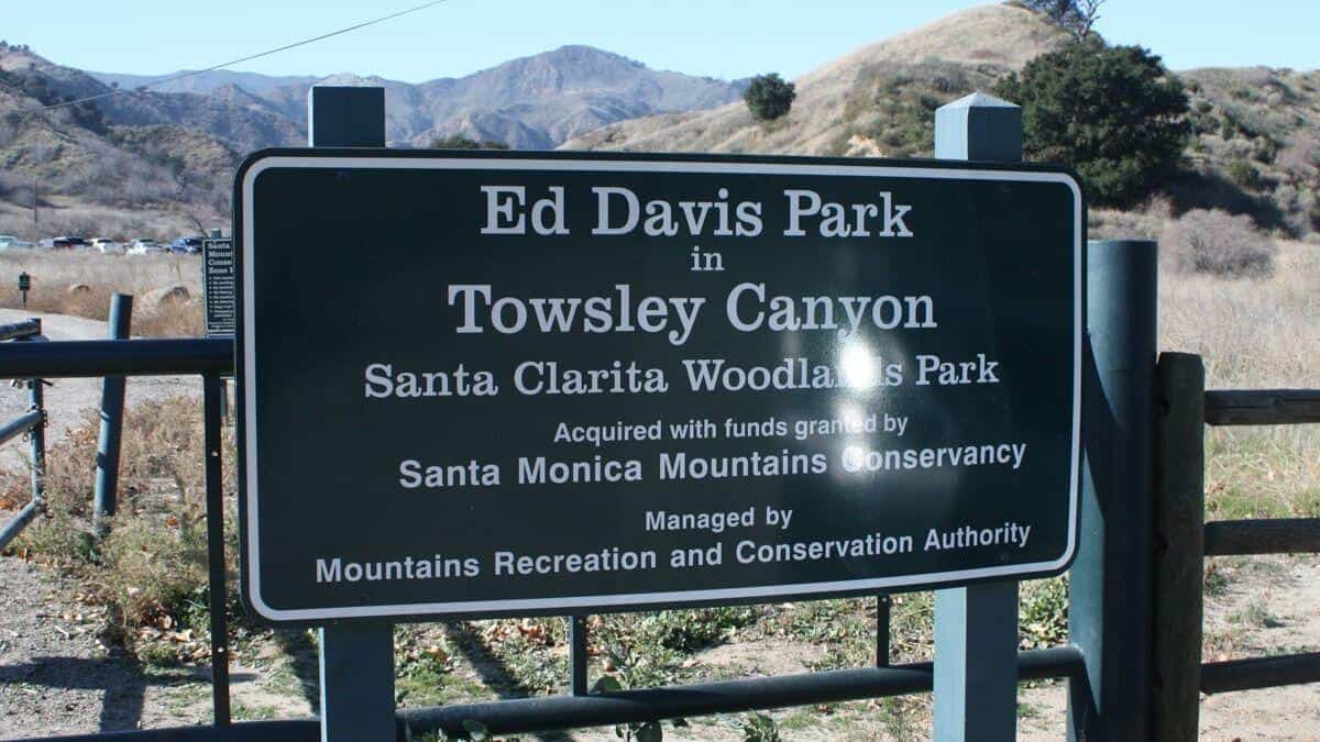
The Ed Davis Park in Towsely Canyon has several trails and we will take the most popular. Distance: 6 milesElevation Gain: 1600 ftDifficulty: Beginner to Intermediate pace.Dogs: are allowed in the park but must be leashed.Parking: There is lots of free parking on the outside of the gate and also on the inside. Pay attention […]
Trail statistics are approximate. For safety purposes always assume they are underestimated. But don’t be disappointed if they are overestimated. Bring more water and snacks than you think you’ll need.
Trail descriptions are based on previous hikes. Current conditions are unknown until arrival. Expect the unexpected and plan accordingly.
The Organizers and members of Hiking With Dean are not professional leaders, guides, or mountaineers. The function of the member or organizer is only to organize the trip. Each person who shows up for a trip/meetup (and their guest or guests) is responsible for his or her own safety. By attending a hike, or any other event organized by this group, you are acknowledging that you and any guests that you bring are aware of the risks, dangers and hazards associated with the activity and freely accept and fully assume all such risks, dangers and hazards, and further agree to release and discharge the Organizers, Members of the Hiking With Dean Meetup Group from and against any and all liability arising from your participation in the group activities per our ASSUMPTION OF RISK AND LIABILITY WAIVER and Section 6.2 of the Meetup.com Terms of Service.


Recent Comments