The total distance is around 4.6 miles with 870' of elevation gain. We will take Boat Canyon Trail up to Bommer Canyon. We will take Bommer to Water Tank trail. We will take this and then take a lower trail back to the beginning. Address: Dartmoor Trail Lookout Laguna Beach, CA 92651 https://goo.gl/maps/6N8c88XfdSeYu85M8 Dogs are […]
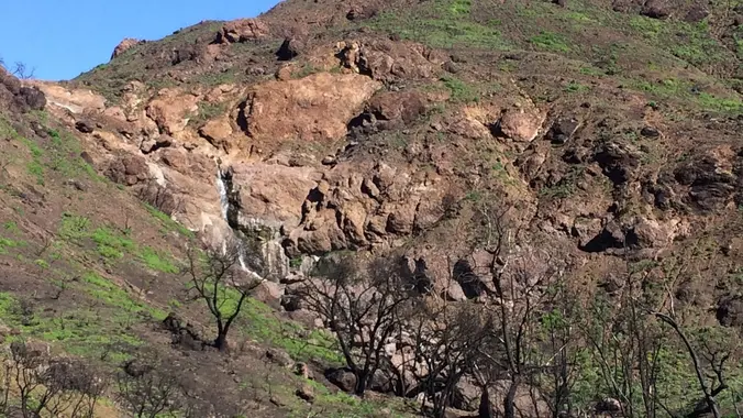
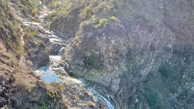
Let's go see what's in bloom in one of our favorite hiking spots, Newton Canyon to Buzzard's Roost! This area was burned over in the Woolsey fire, but since then it has been thick with wildflowers, freely flowing water, and a few waterfalls, including the Upper Newton Canyon falls, above. Last spring, we saw lupines, […]
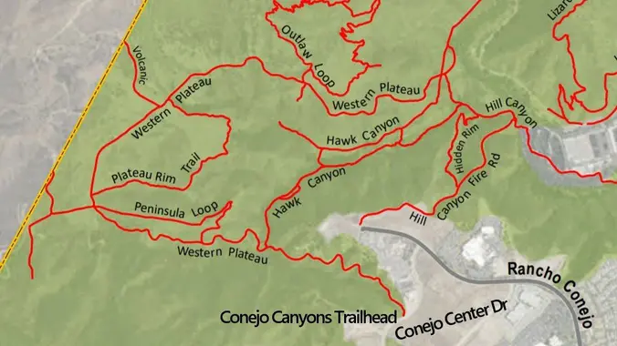
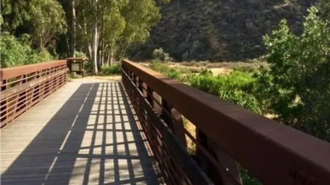
This is a second hike for Tuesday. We did this hike a few weeks ago but this time we will go the opposite direction. We will start at the parking area in Hill Canyon, cross the bridge over the runoff creek and follow that trail past the Western Plateau turn and keep on the Hawk […]
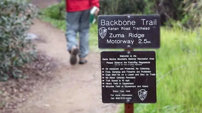
Our Out And Back (OAB) hike will take us on a less-traveled but quite beautiful part of the 60-mile Backbone Trail, which runs through the Santa Monica Mountains National Recreation Area from Will Rogers State Park in the east to Point Mugu in the west. The route begins at Kanan Dume Road and goes southerly […]
Ornithologist and multispecies expert Dr. Julie Morley will kick off COSF's 2024 speaker series at 7:00 p.m. on May 1 with a videoconference presentation on how you can help the Hummingbirds. She will discuss how to create a hospitable hummingbird habitat in your backyard, how to choose and maintain healthy feeders, and which species you’re […]
The hike we will be doing is a loop at about 5.5 miles with 725 ft. of elevation gain. We will meet at the Willow Staging Area that is right off of the 133. We will begin at the trail head of the Laurel Canyon Trail. We will take this to Lizard Trail, then we […]
http://photos4.meetupstatic.com/photos/event/d/e/9/6/event_99896982.jpeg Don’t be left behind for this hike or we will giggle when you come racing down the street to catch up! We are starting this Wildwood hike from Wildwood Avenue NOT Wildwood Park. One of many ways to experience versatile Wildwood Park, we'll start on the ridge, and travel down to the Santa Rosa […]
This is a second Gentler Hike on Thursday. It will also be at Wildwood, but starting from the main parking lot. Wildwood Park in Thousand Oaks is one of the most versatile local parks there is, with 27 miles of trails skittering through rocky cliffs, cacti-filled desert environs, volcanic rock, riparian forest, and a cool, […]
Come join the 19th annual Backbone Trek, hosted by the Santa Monica Mountains Trails Council! For a fee of $550 this guided event includes camping every night in a State Park campground, transportation to and from the trailheads and all your meals. You will need to provide your own camping gear (tent, sleeping bag, etc) […]
Backbone Trail Trek Saturday-to-Saturday May 4th - May 11th Gear up at the Amazon Hiking & Camping store Here is an opportunity to hike the 67 mile Backbone Trail end to end in 7 days. Registration is now open for The Santa Monica Mountains Trails Council BBT Trek for 2024. For more info go to […]
Our seventh Backbone Trail hike in the Santa Monica Mountains is 10 miles with 1400’ elevation gain on the BBT. We will take the Etz Meloy Trail, the newest addition to the BBT, starting at the Encinal Canyon trailhead. We will cross the Mulholland Highway and then take the Etz Moloy Trail, with views of […]
DESCRIPTION: This is a great local hike on a portion of the Pacific Crest Trail (PCT). We start near Green Valley Ranger station using the PCT heading North. We will cross the fire road leading up to Grass Mtn, stop briefly if it is clear to enjoy the views of the Mojave Desert and Tehachapi. […]
Join our Facebook group: https://www.facebook.com/groups/hikingwithdean/ We've been following the footsteps of ET since 2008 with the original HWD ET hike and its become one of our most popular hikes. We’ll be hiking on a section of the The Palisades featured in the movie, and will take our snack break at “E.T. Park” (Aliso Canyon Park) […]
Our eighth Backbone Trail hike in the Santa Monica Mountains will be 17 miles on the BBT on the Sandstone Peak, Chamberlain, Blue Canyon, Wood Canyon, and Ray Miller Trails before finishing the La Jolla Campground. This is a Sierra Club hike, so participants must sign in, carry their medical form, and hike between the […]
This hike will be about 5 miles total with 840 ft. of elevation gain. We are starting at the parking lot at the Wahoo's parking lot. We will take Live Oak Trail. This turns into Serrano Road which will take us to Dreaded Hill. We will take a short break at Four Corners. Then we […]
Happy Cinco de Mayo!! Let's celebrate together! Easy-Intermediate, 4 miles, 800' gain. Option not to hike: If for some reason you don't want to hike but still want to come, the social event can be driven to, and the main group of hikers should get there about an hour after we begin: 23601 W Red […]
We'll be looping around the Backbone and Mishe Mokwa Trails for 6.5 miles, moving up approximately 1500' as we go. We'll pass Echo Cliffs, where rock climbers ascend sheer cliffs, a house sized boulder delicately balanced on a small rock beneath, a giant split rock, stunning giant sandstone formations, and breathtaking views. Directions: Directions to […]
Let's meet under the solar panels near the community center entrance. This is a second, easier hike for Tuesday, and a little closer to home for some of us. This hike will loop around the periphery of Dos Vientos Open Space, passing Twin Ponds, overlooking Potrero Road and the Oxnard Plain with the Channel Islands […]
Easy Intermediate, 3 miles, 700' gain Easier Option: 2.4 mi, 530' gain. (1343 Los Amigos Ave, Simi Valley, CA 93065, or 89 La Paz Ct, Simi Valley, CA 93065 to save another 500' distance). We'll meet in the parking lot at the northeast corner of Madera and Royal, just south of the Donut Delite, on […]
Meet at the Rosewood sign, which is at the Regal Oak Ct. and Lynn Rd. intersection. The hike is about 5 miles with an elevation gain/loss approximately 900’. We'll walk a short distance on Lynn road to the lower Rosewood Trail, then take the dirt trail up a shaded ravine and continue on the Rosewood […]
RSVP waitlist will be managed one month in advance: April 9th, 2024 at 7:00AM. 🌞 Bucket list trip! This is not a beginner trip - you MUST have extensive backpacking experience, preferably with this group. You must be able to manage yourself and your transportation. This trip has minimal guidance involving anything off-trail. It may […]
**Must also register here: https://letsgooutside.org/activities/2024/05/09/thursday-morning-trek-agua-chinon-and-the-sinks-33/ We will be hiking around 8 miles with about 1,500 ft. of elevation gain. This is an out and back. Come out and join us on a breathtaking hike from the Irvine Open Space Preserve into OC Parks’ Limestone Canyon Nature Preserve. This week’s docent-led hike begins in the Agua […]
DESCRIPTION: WEEKDAY HIKE! This hike has an amazing variety of sites and smells including strange geologic formations, frothy streambeds, tar pits, and many different plant communities. The Tataviam people used the naturally occurring asphalt for healing purposes and to seal their basketry. At about the 0.9 mile you will encounter a slot-like canyon called the […]
This week I will be working with the MCSP docents and CA State Parks to reinstall the bridge over Malibu Creek to MASH. We will likely be the first large group to take advantage of the "dry" crossing (assuming all goes well on the install). We will start this hike from MCSP's Lower/Main Trailhead parking […]
Let's conquer Sitton Peak again! This peak is located in the Santa Ana Mountains in the Cleveland National Forest. The total mileage for this hike should be 9.5-10 miles with approximately 2,000' of elevation gain. This will be an out and back. This hike starts on the Bear Canyon Loop Trail, which takes us to […]
DESCRIPTION: NEW LOCAL AFTERNOON HIKE! Busy on Mother's Day (Sunday)? Then join us SATURDAY for a quick local LATER AFTERNOON hike in the Needham Ranch/Gates King Open Space in the hills south of Lyons/Newhall Avenue. This is a pretty easy hike distance and elevation wise - only 700 feet of elevation and 3.4 miles, but […]
The hike we will be doing will be around 5 miles long with 875 ft. of elevation gain. This will be a loop starting at the parking lot of Nix Nature Center. As you will see on the map, this is at the main park entrance off of the 133 (Little Sycamore Canyon Staging Area). […]
https://www.alltrails.com/trail/us/california/tapo-canyon-trail?u=i Hello Fellow Hikers, Join me on a easier moderate hike at Tapo Canyon Trail in Simi Valley. This hike has a nice gradual walk until we start a gradual climb were we will start our loop. We should encounter wildflowers and mountain views. Our loop will drop down then we will continue until we […]
Happy Mother's Day 🥂♥️ 3.5 miles, 700' gain, Easy Intermediate. Easy Option: 2.4 miles, 285' gain, Fit Beginner. We'll start by entering the Los Padres trail, through a spooky oak covered section, then move through until we come to a dead end. We'll turn right, and climb up to another junction, where we'll turn right […]
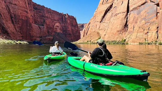
RSVP waitlist will be managed April 9th, 2024 at 7:00AM. 🌞 Bucket list trip! This is not a hiking or backpacking trip. This is an overnight via kayak on the Colorado River. You must be able to manage yourself and your transportation. This trip has minimal guidance. It may be possible to plan ridesharing by […]
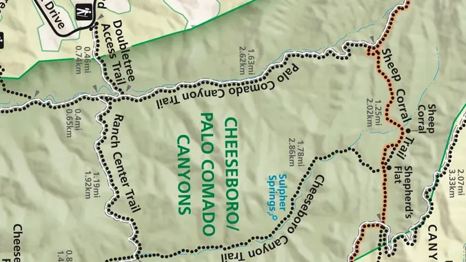
This week we’ll do a loop around the northeastern regions of the Santa Monica Mountains National Recreation Area and the Las Virgenes Open Space. This area traverses many ecosystems, including riparian, chaparral, and the rockscape from Galaxy Quest. The area is generally dry, but very nice! http://photos1.meetupstatic.com/photos/event/c/3/0/c/event_255709932.jpeg The trailhead is where Sunnycrest turns into Doubletree, […]
This will be the easier hike for Tuesday. We will also be a little slower and shorter. This out-and-back of 5-miles with an elevation gain/loss of +/-900’ provides a great overview of the Thousand Oaks area, the ocean and the western Santa Monica Mountains. The first portion is a narrow trail that zigzags its way […]
Easy Intermediate, 4.5 miles, 600' gain Easier Option, 3.5 miles, 460' gain This is a unique loop through Wildwood Park that takes us to the famous Lizard Rock. There are several extended inclines and a few short but steep climbs that cause this to be rated on the easy end of the intermediate spectrum. Beginners […]
http://photos1.meetupstatic.com/photos/event/9/9/3/6/event_278199222.jpeg Please read these restrictions before signing up. Don't show up unless you're shown on the "Attending" list Unregistered or waitlisted will be turned away No "Plus Ones" on this hike Welcome Trailblazers! Time to return to a favorite trail once again! Let's bag a couple peaks in our beautiful Western Plateau. We will do […]
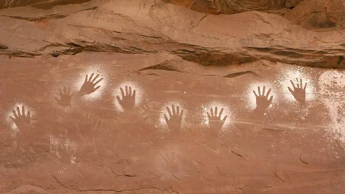
This trip will be archaeology focused to spend extra time finding and appreciating culturally significant ruins. You must be able to manage yourself and your transportation. This trip has minimal guidance off-trail. It may be possible to plan ridesharing by communicating with other attendees. The trip leader will not be traveling back to California after […]
Come join us to see a section of the Dos Vientos Open Space that includes 5 different colors of Sticky Monkey Flower. This hike will loop around the periphery of Dos Vientos Open Space, passing Twin Ponds, overlooking Potrero Road and the Oxnard Plain with the Channel Islands in the background. We will cross 2 […]
Let's meet at the tennis courts with the other group in case anyone wants to switch. Because there is a waitlist for the Dos Vientos hike, I'm posting a second, hike. It will be at the same place and same time, but we will go in the opposite direction and may be a bit shorter. […]
4 miles, 950' gain, Easy Intermediate 2 miles, 550', Fit Beginner This is a modified version of the famous Rocky Peak hike. It gives those that want something easier, a chance to climb one of the most well known trails in Simi Valley. It contains beautiful sandstone formations throughout the hike and there are fantastic […]
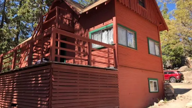
Hiking, shopping, dining, exploring. Avoid the traffic, stay at Keller for the weekend. Keller Ski Hut is open this weekend. It is a a hostel style lodge located immediately across the street from Snow Valley Mountain Resort. Walking distance to skiing! Day and overnight guests are welcome. We are open Friday to Sunday this weekend. […]
The total distance for this hike is roughly 9.5 miles with about 1500 ft. of elevation gain. We are going to start on Bommer Ridge Trail and take this to Moro Ridge Road. We will take this down towards the beach to El Moro Canyon. We will head back up No Dogs/No Name trail to […]
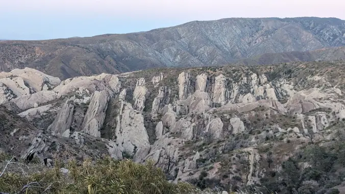
Saturday, May 18, 2024 at 8:00 – Hike the Devils Chair · Hike leader volunteer(s): Paul · Distance: ~ 7.5 Miles total (out and back style) · Elevation gain: 1,463 ft · Time: Approximately 4.5 hours hiking including a snack break. · Conditioning: You need to be in generally good physical condition. · Dogs: Dogs […]
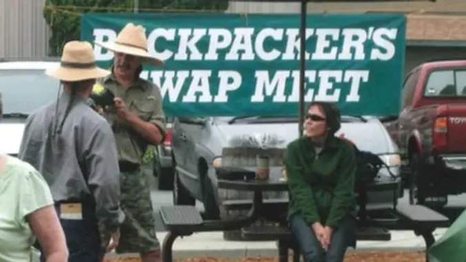
This is a gear swap and sale with no trip leader. An excellent opportunity to score a deal or for our newer folks to go check out gear and talk to backpackers. Enjoy! A16 Foundation: Great Outdoor Gear & Clothing Exchange Saturday, May 18 9:00AM - 12:00PM Helix Brewing Co parking lot 8101 Commercial St […]
The Bridge To Nowhere hike is a bucket list hike for many. While the destination is a draw . . . so is the terrain to get there. River crossings abound. Great hike to beat the heat. Along with the main hike to the bridge . . . we will ALSO visit to the hidden […]
The hike will be about 5.7 miles with about 750 ft. of elevation gain. We will start on Peters Canyon Trail and take this to East Ridge View Trail. This is where we will go up Big Red. Then we will continue on this trail until we get to Eucalyptus to loop back. We will […]
https://www.rsrpd.org/simi_valley/trails/chumash_park_and_trail.php Hello Fellow Hikers, Gonna be doing the Chumash Trail in Simi Valley to the junction of Rocky Peak then make our way back. It's a great moderate hike and a great workout with scenery of rock formations and mountain tops. The Chumash out and back is not on AllTrails but the above website will […]
Harmon Canyon Preserve includes 2,123 acres of ridgelines and canyons that feature diverse coastal sage scrub and coast live oak woodland habitats, ephemeral stream crossings with riparian scrub systems, and breathtaking views of our local coastline, the Santa Monica Mountains, and Channel Islands National Park. This spectacular preserve is the largest permanently protected open space […]
Nicknamed "Musch->Eagle Rock->Hub Junction->Eagle Springs->Topanga Fire Road Double Loop" by our co-leader Peter Swank (some of us refer to him as "Topanga Peter", we will be on a 6.4 mile, 1200 ft gain journey to see the best of the wildflowers in Topanga State Park. Bring your cameras, water, and happy spirits! Directions: From the […]
Meet at the Rosewood sign, which is at the Regal Oak Ct. and Lynn Rd. intersection. The hike is about 5 miles with an elevation gain/loss approximately 900’. We'll walk a short distance on Lynn road to the lower Rosewood Trail, then take the dirt trail up a shaded ravine and continue on the Rosewood […]
Join us and the small animals and birds of La Jolla Canyon on this loop hike with panoramic views of coastline and The Channel Islands. Flower blooms in the spring are phenomenal. One of the the main attractions are large swaths of native California grassland — some of the last remaining unspoiled areas in the […]
Meet at the Rosewood sign, which is at the Regal Oak Ct. and Lynn Rd. intersection. The hike is about 5 miles with an elevation gain/loss approximately 900’. We'll walk a short distance on Lynn road to the lower Rosewood Trail, then take the dirt trail up a shaded ravine and continue on the Rosewood […]
PLEASE READ BELOW IN ITS ENTIRETY. Kindly review the guidelines (link to the guidelines) to join our hikes. Restrictions apply for your attendance. Don't show up unless you're shown on the "Attending" list. Plan on KEEPING UP with the group and completing the entire hike or please find an alternative hike that better suits your […]
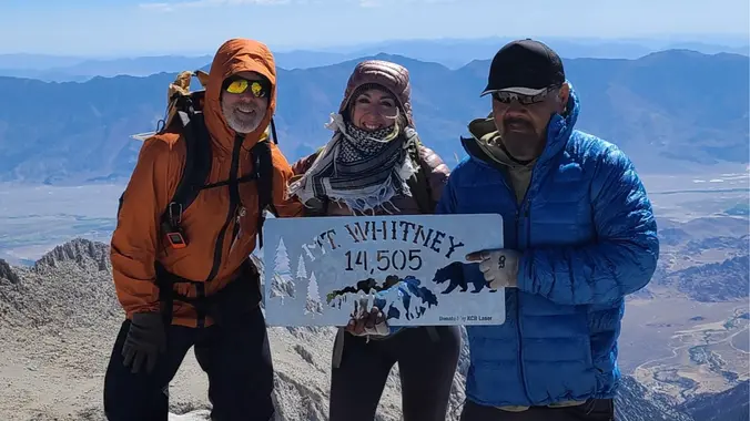
This is a casual presentation courtesy of the A16 Foundation, there is no trip leader. A great opportunity to hang out, meet other backpackers, and get ready for Whitney! Enjoy! A16 Foundation: Preparing to Climb Mt. Whitney with Jack and Betsy Northam Wednesday, May 22 6:30PM "Meet n' Drink" (food truck on site) 7:00PM Video […]
Meet at the Conejo Canyons trailhead next to the Thousand Oaks Recycling Center on Conejo Center Drive, near the end of Rancho Conejo. We'll walk down the fire road to Hawk Canyon and then we will Hawk Canyon to Five Points. From Five Points, we will take the Western Plateau trail up to intersection with […]
Because Thursday's hike has a waiting list, I'm adding another hike for Thursday close to, but miles apart from Peter's hike. The second hike will be a little slower and a little shorter. Feel free to change hikes, but don't forget to cancel the hike you leave. Wildwood Park in Thousand Oaks is one of […]
4.75 miles, 700' gain, easy-intermediate Option for 3 miles, 300' gain, easy. 30 minute wait while group completes the loop back to this spot. This is a link to the route: LINK We start with a 1/4 mile walk from where we park along Cottonwood Dr, to the trail head. There we make a left […]
Come on out and join your friends, make new ones, and dance to a great 80's band at one of our favorite places. 80's Invasion, led by Dirk Knight and Mony Mony, are a fun, high-energy act that does cool covers of everything 80's (with a little 70's and 90's mixed in sometimes.) They have […]
This is one of my favorite hikes around! Come join us for a super fun adventure. Prepare to get wet! We cross the San Gabriel River multiple times. The hike is going to be going to the Bridge to Nowhere in Azusa, CA. This is located in the San Gabriel Mountains. This hike is an […]
Hike #5 in the 2024 Saturdays in the Santa Monica Mountains series is to Eagle Rock (1957'), a moderate 9-miles, 1800' gain outing up Santa Ynez Canyon and the Musch Trail to brunch at Eagle Rock before returning to our start. Bring water, snacks, sunscreen, and a good attitude. Rain, excessive heat, or Red Flag […]
DESCRIPTION: This is a beautiful area containing 37 types of endangered species. It is prime yellow-legged frog and Arroyo Toad Habitat. Bring your camera. Not only is the area beautiful, but you might see some of the endangered species along the way. Please stay on the trails here and watch where you step during the […]
We are going to be starting at the Canyon View Staging Area. This hike will be about 6.2 miles with around 1,000 ft. of elevation gain. We will be starting at Canyon View Park and taking Cholla up to West Ridge and comic down Mathis. Link to Parking from Google Maps: https://www.google.com/maps/place/Canyon+View+Staging+Area/@33.585273,-117.7465062,17z/data=!3m1!4b1!4m5!3m4!1s0x80dce61b6bd45c2d:0x5ef3f1ad687cc8b5!8m2!3d33.585273!4d-117.7443175 Dogs are not […]
This hike will be about 5.4 miles total with 820 ft. of elevation gain. We are starting at the parking lot at the Wahoo's parking lot. We will take Live Oak Trail. This turns into Serrano Road which will take us to Serrano Cow Trail. At this part of the trail, we usually see a […]
This relatively easy, out-and-back hike, travels alongside Malibu Creek through some great terrain and old growth oak trees, with a special bonus — a visit to the site of television's legendary program hit M*A*S*H*. The site still draws visitors from all over the world decades after the show left the air. Now on display are […]
5.2 miles, 1140' gain, Intermediate Beginner Option: 3.5 miles, 500' gain, Fit Beginner Come to the hike only (2:30p), picnic only (4:00p), or both. This event has limited space. Those still on the waiting list will be moved to the RSVP list several days before the event, or even the day of the event, if […]
We'll hike up the Chumash Trail in Simi Valley to join the Rocky Peak trail. We'll turn left to head to the "Triangle" where several trails meet and provide panoramic views. The hike will be an out and back, and will be 7.7 miles with 1600 ft gain. It's mostly a single track trail during […]
NOTE: This will be a much easier hike for Tuesday. We will go slower and with less elevation gain and less miles. Anyone who wants to add more mileage, can take the loop near the Greenmeadow Parking lot. We will start in the parking lot at the end of Moorpark and walk down the street […]
http://photos2.meetupstatic.com/photos/event/b/0/e/c/event_80025292.jpeg Since the trail has been redesigned and is now about 8 1/2 miles, we will stop at Ventu Park Road for our break. AUGUST 2021 UPDATE: Please review the newly revised guidelines to participate in our hikes. We are again requiring proof of vaccination to join a hike. Here are some highlights and a […]
From the Kanan Rd trailhead, we'll jump on the Backbone Trail for a cruise down into Newton Canyon. On our way there, we'll cross the creek, pass under an oak canopy, and come out into an opening. At the opening, look toward the sandstone formations in the distance, and you'll see the now-maybe-flowing Upper Newton […]
The total distance for this hike is 4.5 miles with about 650 ft. of elevation gain. There are great mountain and ocean views along the ridge. We are going to start on Bommer Ridge Trail and take this to Lizard Trail. We will go down that and loop back up to Bommer via Upper Laurel. […]
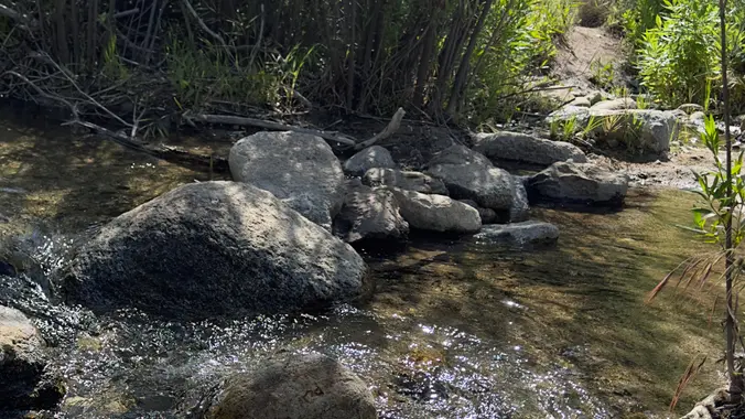
5.3 miles, 600' gain, Easy-Intermediate 2.5 miles, 100' gain, Beginner We start by crossing a bridge into a wooded area and continue down a relatively flat path alongside a stream. After about a mile, we'll come to a junction. For those that want the full hike, we'll turn right and complete a 3 mile loop […]
Come explore the Los Padres backcountry out near Frazier Park/Lockwood Valley off Interstate 5/Grapevine. 6/1 Meet at 9am at the gate off Lockwood Valley/Grade Valley Road. Cars may be able to make the washboard road but higher clearance is recommended. People can carpool from the gate to the trailhead in higher clearance cars. Should start […]
Let's do another awesome peak in the Angeles National Forest! This hike will be to Josephine Peak. It is an out and back hike that will be about 8 miles and 1,850 ft. of elevation gain. The peak has an elevation of 5,558 ft. It will be an easy hike to navigate. We take one […]
DETAILS: Description: LOCAL EASY HIKE FOR BEGINNERS AND FAMILIES Come join us as we explore this gorgeous canyon trail slowwwwwly. This trail is a favorite with lots of shade, giant old oak trees, a sulfur spring, and a waterfall reward at the end! We stop for wildflowers, stream crossings, and just generally to enjoy the […]
https://www.alltrails.com/trail/us/california/cedar-creek-fishbowl-loop-trail Hello Fellow Hikers, Okay this is a seasonal trail and the gates are finally open to hike it! Time to head to the forest and we're going back to Frazier Park. Several people comment on the wildflowers in bloom on this trail right now. What to expect...Several water crossings abit of overgrowth in some […]
The hike we will be doing is approximately 5 miles with 870 ft. of elevation gain. We will begin at the Live Oak Trail trailhead. This is where you will see on the map that the Live Oak Trail hits the paved road. This is the parking lot closest to the Edna Spaulding Trail. (There […]
https://www.alltrails.com/trail/us/california/tapo-canyon-trail?u=i Hello Fellow Hikers, Join me on a easier moderate hike at Tapo Canyon Trail in Simi Valley. This hike has a nice gradual walk until we start a gradual climb were we will start our loop. We should encounter wildflowers and mountain views. Our loop will drop down then we will continue until we […]
Distance: 3.5 miles, Gain: 700', Intermediate. This was previously designated easy-intermediate, but some thought it should be labeled as intermediate because of the extended inclines. Photo by Jim A strong and motivated beginner can do this hike. They would be challenged and slow during a few of these climbs. That's OK, because this is not […]
Trail statistics are approximate. For safety purposes always assume they are underestimated. But don’t be disappointed if they are overestimated. Bring more water and snacks than you think you’ll need.
Trail descriptions are based on previous hikes. Current conditions are unknown until arrival. Expect the unexpected and plan accordingly.
The Organizers and members of Hiking With Dean are not professional leaders, guides, or mountaineers. The function of the member or organizer is only to organize the trip. Each person who shows up for a trip/meetup (and their guest or guests) is responsible for his or her own safety. By attending a hike, or any other event organized by this group, you are acknowledging that you and any guests that you bring are aware of the risks, dangers and hazards associated with the activity and freely accept and fully assume all such risks, dangers and hazards, and further agree to release and discharge the Organizers, Members of the Hiking With Dean Meetup Group from and against any and all liability arising from your participation in the group activities per our ASSUMPTION OF RISK AND LIABILITY WAIVER and Section 6.2 of the Meetup.com Terms of Service.



























Recent Comments