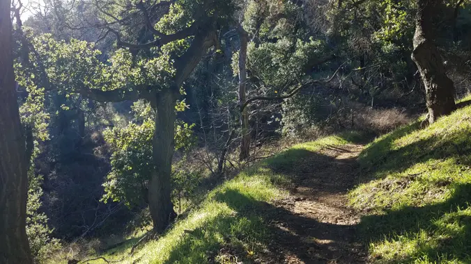
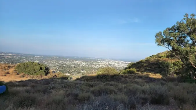
This hike will be about 5.4 miles total with 820 ft. of elevation gain. We are starting at the parking lot at the Wahoo's parking lot. We will take Live Oak Trail. This turns into Serrano Road which will take us to Serrano Cow Trail. At this part of the trail, we usually see a […]
This relatively easy, out-and-back hike, travels alongside Malibu Creek through some great terrain and old growth oak trees, with a special bonus — a visit to the site of television's legendary program hit M*A*S*H*. The site still draws visitors from all over the world decades after the show left the air. Now on display are […]
5.2 miles, 1140' gain, Intermediate Beginner Option: 3.5 miles, 500' gain, Fit Beginner Come to the hike only (2:30p), picnic only (4:00p), or both. This event has limited space. Those still on the waiting list will be moved to the RSVP list several days before the event, or even the day of the event, if […]
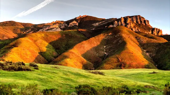
We'll hike up the Chumash Trail in Simi Valley to join the Rocky Peak trail. We'll turn left to head to the "Triangle" where several trails meet and provide panoramic views. The hike will be an out and back, and will be 7.7 miles with 1600 ft gain. It's mostly a single track trail during […]
NOTE: This will be a much easier hike for Tuesday. We will go slower and with less elevation gain and less miles. Anyone who wants to add more mileage, can take the loop near the Greenmeadow Parking lot. We will start in the parking lot at the end of Moorpark and walk down the street […]
http://photos2.meetupstatic.com/photos/event/b/0/e/c/event_80025292.jpeg Since the trail has been redesigned and is now about 8 1/2 miles, we will stop at Ventu Park Road for our break. AUGUST 2021 UPDATE: Please review the newly revised guidelines to participate in our hikes. We are again requiring proof of vaccination to join a hike. Here are some highlights and a […]
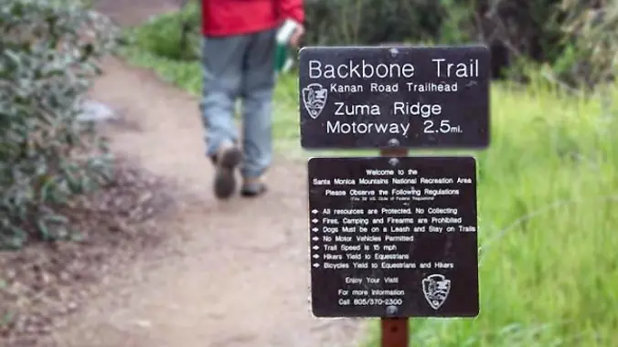
From the Kanan Rd trailhead, we'll jump on the Backbone Trail for a cruise down into Newton Canyon. On our way there, we'll cross the creek, pass under an oak canopy, and come out into an opening. At the opening, look toward the sandstone formations in the distance, and you'll see the now-maybe-flowing Upper Newton […]
The total distance for this hike is 4.5 miles with about 650 ft. of elevation gain. There are great mountain and ocean views along the ridge. We are going to start on Bommer Ridge Trail and take this to Lizard Trail. We will go down that and loop back up to Bommer via Upper Laurel. […]
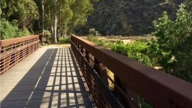
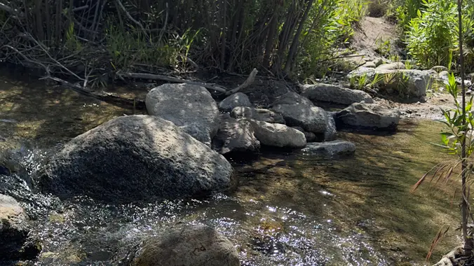
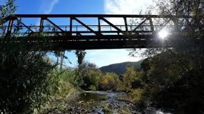
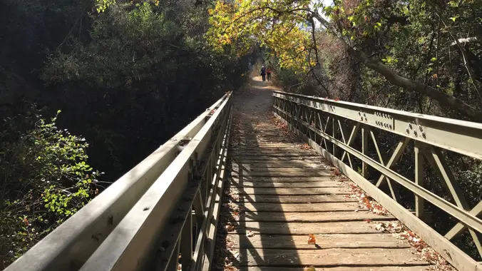
5.3 miles, 600' gain, Easy-Intermediate 2.5 miles, 100' gain, Beginner We start by crossing a bridge into a wooded area and continue down a relatively flat path alongside a stream. After about a mile, we'll come to a junction. For those that want the full hike, we'll turn right and complete a 3 mile loop […]
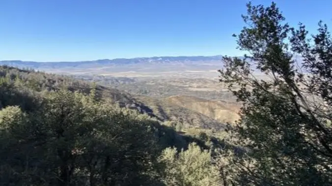
Come explore the Los Padres backcountry out near Frazier Park/Lockwood Valley off Interstate 5/Grapevine. 6/1 Meet at 9am at the gate off Lockwood Valley/Grade Valley Road. Cars may be able to make the washboard road but higher clearance is recommended. People can carpool from the gate to the trailhead in higher clearance cars. Should start […]
Let's do another awesome peak in the Angeles National Forest! This hike will be to Josephine Peak. It is an out and back hike that will be about 8 miles and 1,850 ft. of elevation gain. The peak has an elevation of 5,558 ft. It will be an easy hike to navigate. We take one […]
DETAILS: Description: LOCAL EASY HIKE FOR BEGINNERS AND FAMILIES Come join us as we explore this gorgeous canyon trail slowwwwwly. This trail is a favorite with lots of shade, giant old oak trees, a sulfur spring, and a waterfall reward at the end! We stop for wildflowers, stream crossings, and just generally to enjoy the […]
https://www.alltrails.com/trail/us/california/cedar-creek-fishbowl-loop-trail Hello Fellow Hikers, Okay this is a seasonal trail and the gates are finally open to hike it! Time to head to the forest and we're going back to Frazier Park. Several people comment on the wildflowers in bloom on this trail right now. What to expect...Several water crossings abit of overgrowth in some […]
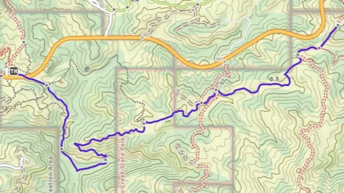
The hike we will be doing is approximately 5 miles with 870 ft. of elevation gain. We will begin at the Live Oak Trail trailhead. This is where you will see on the map that the Live Oak Trail hits the paved road. This is the parking lot closest to the Edna Spaulding Trail. (There […]
https://www.alltrails.com/trail/us/california/tapo-canyon-trail?u=i Hello Fellow Hikers, Join me on a easier moderate hike at Tapo Canyon Trail in Simi Valley. This hike has a nice gradual walk until we start a gradual climb were we will start our loop. We should encounter wildflowers and mountain views. Our loop will drop down then we will continue until we […]
Distance: 3.5 miles, Gain: 700', Intermediate. This was previously designated easy-intermediate, but some thought it should be labeled as intermediate because of the extended inclines. Photo by Jim A strong and motivated beginner can do this hike. They would be challenged and slow during a few of these climbs. That's OK, because this is not […]
Let's go to Wildwood Park through a new access route. After crossing the bridge from the parking lot, we will start the hike following Hill Canyon trail to the newly opened “Conejo Canyon Bridge” which connects trails on either side of the creek, Conejo Canyons and Wildwood Park. Wildwood Park in Thousand Oaks is one […]
I can't find a fancy description so deal with it.... - about 7 miles - about 1600 ascent We will start at Newton Canyon trailhead on Kanan-Dume Rd. and head over the road and up the hill. Down, and up, and then back again. Out and back, please plan to complete the whole distance unless […]
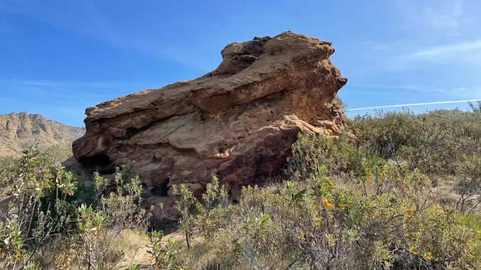
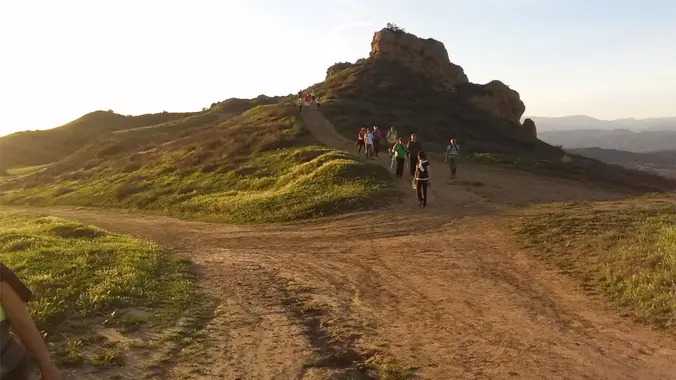
3.2 miles, 900' gain, easy intermediate. The first part is a steady incline, followed by a rolling trail to our destination. Fit beginners can complete this hike, but it will certainly get their blood pumping. There are no super steep sections. This hike takes us to a secret spot below a large rock formation. Naturally […]
Meet at the Rosewood sign, which is at the Regal Oak Ct. and Lynn Rd. intersection. The hike is about 5 miles with an elevation gain/loss approximately 900’. We'll walk a short distance on Lynn road to the lower Rosewood Trail, then take the dirt trail up a shaded ravine and continue on the Rosewood […]
An awesome ride surrounded by vineyards, orchards and stud farms, with beautiful wooded hills in the distance. Another highlight along the way will be the Potrero Creek bike path. Ride is about 18 miles with 1,250 ft total ascent on mostly paved or asphalt roads. Directions We meet at the Shell gas station on the […]
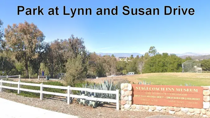
This is a 4-5 mile out-and-back trip from Lynn Road to the Rosewood Trail to Angel Vista. We’ll park at the playfield near Stagecoach Inn and walk from Lynn Road on the lower Rosewood Trail, to the usual trailhead and then on up the trail. The elevation gain/loss is about 875’ - 1000’. It is […]
4 miles, 700' gain, easy-intermediate Easy option: 2.5 miles, 500' gain Parking on the south side of the CA-118 at the Rocky Peak exit. We'll walk west along the Santa Susana Pass Rd. for about 500 feet, and directly across from Lilac Ln, we'll enter a trail. We'll move along a relatively flat section for […]
Weekend Backpacking Trip Cucamonga Peak is one of the highest peaks of the San Gabriel Mountains, with a summit elevation of 8,862 feet. It is within the Cucamonga Wilderness of the San Bernardino National Forest. Cucamonga Peak is located in a beautiful wooded stream-driven section of the forest near Mt. Baldy Village. The winding trail […]
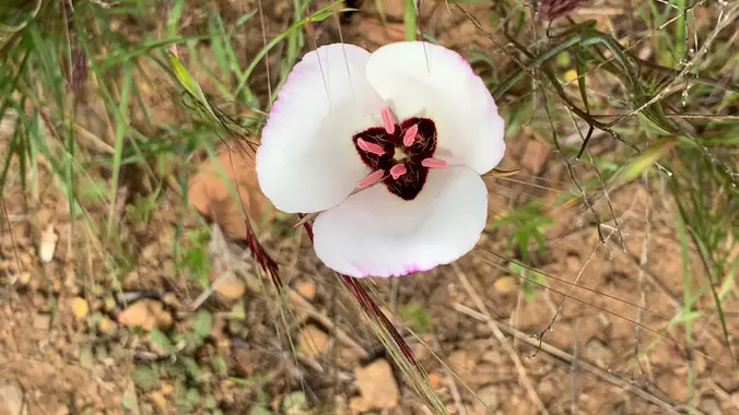
DESCRIPTION: Mt Pacifico looms high (7124 ft) on the northern edge of the San Gabriels, offering far reaching panoramas over Antelope Valley and the Mojave Desert. Our hike follows the well maintain PCT that is full of wildflowers this time of year. The last 1/2 mile before Mt. Pacifico is steep. We will follow the […]
Join us for an out and back hike through the old stomping grounds of Edgar Rice Burroughs in Caballero Canyon. This is a great hike for folks who want some good exercise and at the same time enjoy the local beauty offered in the Santa Monica Mountains. Hike is rated MEDIUM with 6 miles and […]
Hike #6 in the 2024 Saturday in the Santa Monica Mountains series, will be an adventurous 9-mile, 2300’ gain loop hike, taking the Mountaineer’s Route to the 360 panoramic view at Topanga Lookout (2469’) from Stunt Road. with a stop at Saddle Peak (2805’) with ocean views and lunch with return via the Stunt High […]
The hike we will be doing is a loop at about 5.5 miles with 725 ft. of elevation gain. We will meet at the Willow Staging Area that is right off of the 133. We will begin at the trail head of the Laurel Canyon Trail. We will take this to Lizard Trail, then we […]
https://www.rsrpd.org/simi_valley/trails/chumash_park_and_trail.php Hello Fellow Hikers, Gonna be doing the Chumash Trail in Simi Valley to the junction of Rocky Peak then make our way back. It's a great moderate hike and a great workout with scenery of rock formations and mountain tops. The Chumash out and back is not on AllTrails but the above website will […]
Fit Beginner - 6 miles, 600' gain (route link) Easy Option - 2 miles, 300' gain (route link) This is a social hike and an out-and-back event. There is a potluck at the M.A.S.H. site before we turn around for the return. If your item requires paper plates, utensils, etc. please bring them. You may […]
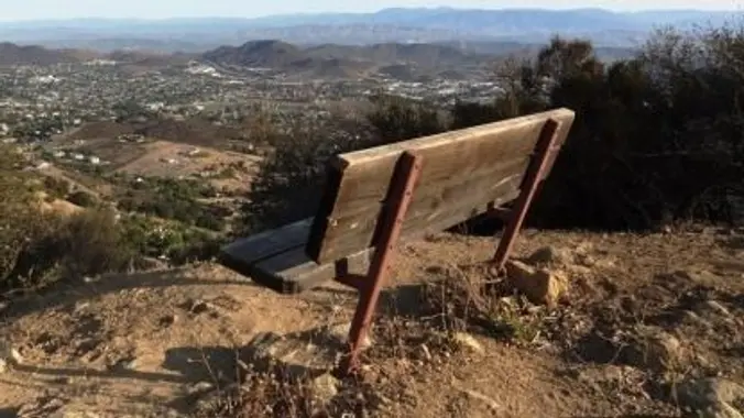
This hike route is sometimes called the Urban Trail. It starts in Sunset Hills Open Space and includes a big loop in Woodridge Open Space. It is a fairly gentle, hilly slope, where you'll get some great panoramic views of the entire area, including the Conejo Valley, Simi Hills and looking west towards Camarillo/Oxnard. Continue […]
Join us on an out and back hike up the Ray Miller Trail and the Overlook Trail. We’ll enjoy beautiful ocean views as we descend. We'll pick up about 1300’ gain on this 7 mile adventure. Lying along the brilliant blue Pacific Ocean at the west end of Malibu (just shy of Port Hueneme), the […]
4 miles, 950' gain, Intermediate Easy Option: 1.6 miles, 400' gain, Fit Beginner Hardest option: 5 miles, 1200' gain, Intermediate The entire hike outbound is a steady incline. Nothing super steep, just continuous and quite strenuous for many. There are virtually no junctions where one can get lost. This is one of the more famous […]
This loop hike is about 5 miles with about 800' of total elevation gain, spread out nicely, with a little bonus loop through Oak Creek Canyon. "Robles" is Spanish for oaks, and we'll see plenty of them on this beautiful, hike. Trailhead Directions: From the 101 in Thousand Oaks, turn south on Moorpark Road. Drive […]
NOTE: IF YOU SIGN-UP FOR THIS HIKE, BE SURE TO TAKE YOURSELF OFF THE WAITLIST FOR THE OTHER ONE. This is an alternative hike for Thursday, same area, same time, but different meeting place and a different direction. We will meet at the end of Moorpark (the other group is meeting on Las Padres) and […]
4.3 miles, 800' gain, Easy Intermediate. Easier Option: 3.2 miles, 400' gain, Fit Beginner. The address is not the address of the hike, but a nearby address that should get you to pass by the trailhead. The "cc" in the title means counter clockwise. We'll be stopping at various points to regroup. We will start […]
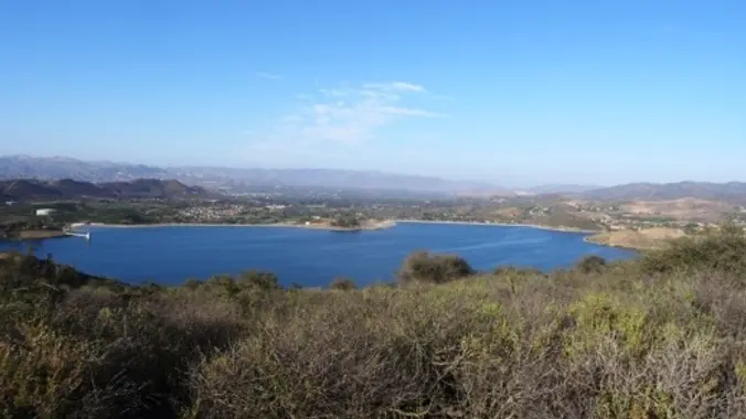
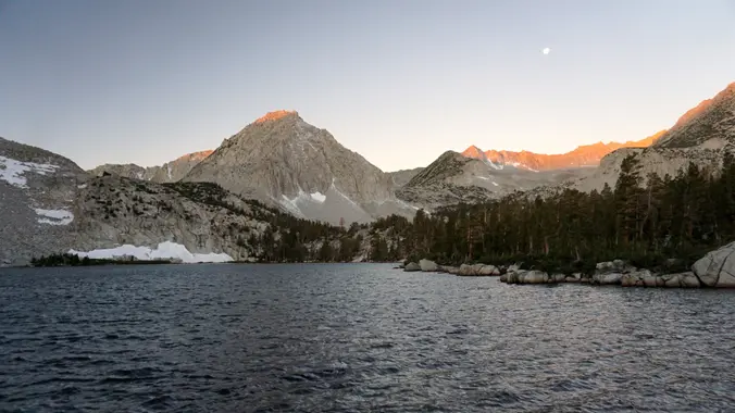
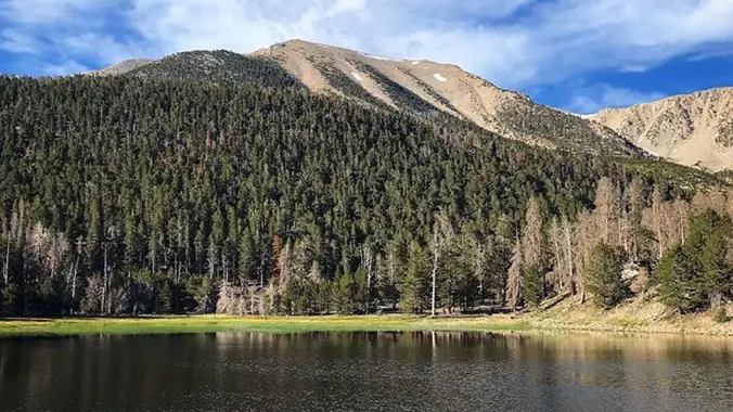
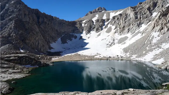
RSVPs WILL OPEN MARCH 1 (6 permits) Hilton Creek Trail to Hilton Lakes via the Rock Creek approach, Inyo National Forest AllTrails: https://www.alltrails.com/trail/us/california/hilton-lakes-trail?sh=fzrxlq Trail stats: Mileage: ~ 11.5 - 17 miles round trip Elevation gain: 2,000’ + Snow may still be on the trail ❄️ WARNING: MOSQUITOES WILL LIKELY BE BAD 🦟🦟🦟 but the views […]
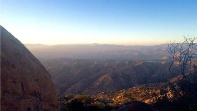
DESCRIPTION: This trek is all uphill to the peak (especially the adrenaline-pumping first mile), and then it's downhill on the return. Our journey begins by navigating a single-track trail through stunning chaparral, enveloped by Toyon, California Bay, yuccas, and, oaks. Along the path, we'll seize the chance to hike up to the Communications tower, injecting […]
I'm so excited to do this hike again! Come join us for this cool, historic hike! We will be doing a 7.5-8 mile loop with only about 600 ft. of elevation gain. There are a lot of trail options here. We will do some extra trais to get some mileage and then we will get […]
This hike will be about 7 miles total with 1200 ft. of elevation gain. We are starting at the parking lot at the Wahoo's parking lot. We will take Live Oak Trail. This turns into Serrano Road which will take us to Serrano Cow Trail. At this part of the trail, we usually see a […]
Happy Father's Day 🥂♥️ Fit Beginner - 4 miles, 600' gain The gain is well distributed, with half being on the return. We start at the Las Flores trailhead where Las Flores dead-ends at Wildwood Park, and head west. After 1/3 mile, the trail becomes Wildwood Canyon Trail. We continue for another 2/3 mile and […]
We will start our hike near the beginning of Regal Oak Ct. on the lower Rosewood Trail, a dirt trail heading up a shaded ravine at the base of the mountains, and continue to the usual Rosewood trail. Rosewood trail presents a clear view over the 101 Freeway carving up the Conejo Valley. This is […]
Let's head out to the famed Peace, Love, Joy arch at the Danielson. This out and back hike wanders through grasslands and chaparral from the Rancho Sierra Vista trailhead, then climbs up Danielson fire road for some fantastic views north to Port Hueneme and Oxnard and west toward the Pacific Ocean. If it's really clear, […]
Beginner, 5 miles, 500' gain. Bug spray recommended. This hike is entirely fire-road and is almost completely flat. Some of this trail is sandy, so walking it at times can be more difficult. There are a lot of different interesting plants on this hike. From the trail head, we walk along the fire road next […]
Meet at the Rosewood sign, which is at the Regal Oak Ct. and Lynn Rd. intersection. The hike is about 5 miles with an elevation gain/loss approximately 900’. We'll walk a short distance on Lynn road to the lower Rosewood Trail, then take the dirt trail up a shaded ravine and continue on the Rosewood […]
This out-and-back hike on the Backbone Trail is about 5 miles with about 1,200' of total elevation gain. The hike starts and ends at our usual trailhead for the Encinal Canyon hike. We'll cross the road, descend into a shaded single-track trail with a couple of lovely small water crossings, then ascend until we get […]
The Summer Solstice falls on June 20th at 1:50pm...And what better way to start the summer with a short hike and lunch at Malibu Seafood -- HWD's favorite post-hike lunch venue? Video: https://youtu.be/NJP-m1tCXxM?si=uSPgQmYCYb2QG54C with celebrity spottings Our hike will begin at sea level next to Malibu Seafood in Corral Canyon, the last undeveloped coastal canyon […]
3 miles. 560' gain, fit beginner (5:30, not 6p) Note the time change. This park closes at sunset, so we try to get out by then. Free parking is limited. Carpooling recommended. As of June 2023, the first part of the clockwise loop was closed, but we found a new route with a perfect place […]
WEEKEND BACKPACKING TRIP San Gorgonio Mountain is the tallest peak in Southern California (11,502 feet) We will be taking the South Fork Trail to Dry Lake. We will be camping near Dry Lake. Depending on weather conditions, we might need mircro spikes or crampons. Possibly snow at higher elevation. So San Gorgonio Peak will be […]
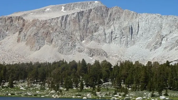
The Cottonwood Lakes are a great introduction to the high Sierras, very easy to access and relatively close to San Diego. Mount Langley is the easiest 14er in the Sierras. The primary difficulty of this trip is the high elevation (to which everyone reacts differently). BEAR CANISTER (or Ursack) REQUIRED Itinerary: Friday night: Walk-in site […]
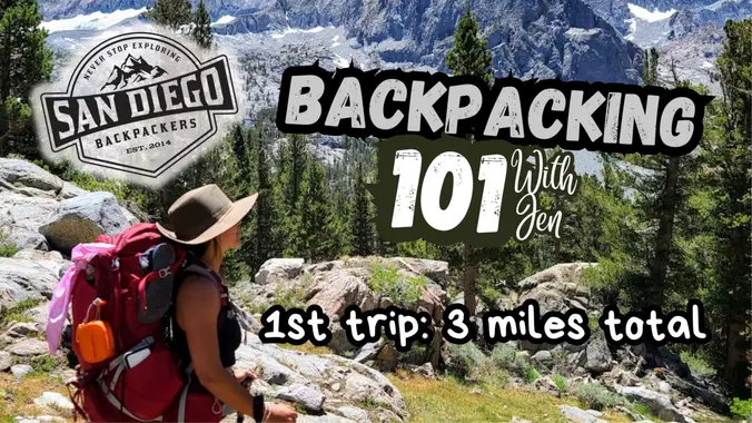
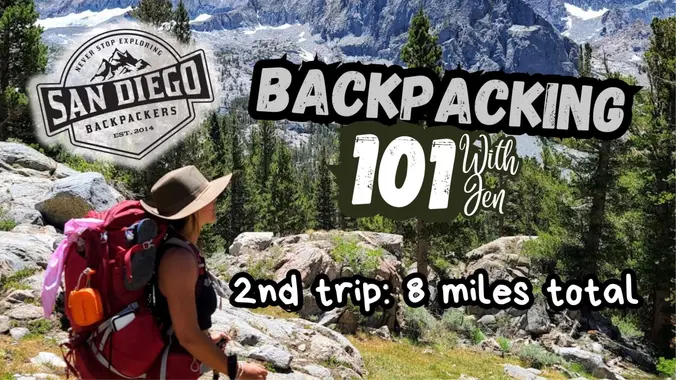
This is a Beginner's Backpacking trip. RSVP Opens: Saturday, June 8, 2024 8:00 AM Space is very limited. Please do not sign up for this trip if you are already confident hiking with your backpacking kit or using your backpacking kit. This trip is designed for those who want to take the plunge into backpacking. […]
This hike was so fun and beautiful last time! Let's do it again. The statistics for this hike: about 10 miles, 2,450 ft. of elevation gain. This hike will be an out and back. Thunder Mountain Peak: 8,587' We will be starting near the Manker Flats Campground. The trailhead is just up the road past […]
DESCRIPTION: If you enjoy hiking in high country meadows and old growth pine stands with expansive valley views below and meeting no one else on a backcountry trail in the Angeles Forest, this is a hike is for you. There will also be 3 miles of off-road vehicle thrills each way getting to and from […]
3.5 miles, 800' gain, easy intermediate The Potluck After the hike, we'll enjoy a potluck at another location a few miles away. The location will be announced at the trailhead. Please bring some food and drink to share. If your item requires it, bring plates and utensils to share. Please leave your potluck items in […]
The hike we will be doing will be around 5 miles long with 875 ft. of elevation gain. This will be a loop starting at the parking lot of Nix Nature Center. As you will see on the map, this is at the main park entrance off of the 133 (Little Sycamore Canyon Staging Area). […]
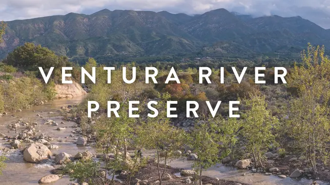
The Ventura River Preserve offers nearly 1600 acres of nature for us to frolic in. Located in the western Ojai Valley the Ventura River Preserve protects three miles of the Ventura River and surrounding canyons. The property is home to a wide variety of wildlife including black bear, mountain lion, bobcat, badger, coyote and mule […]
Our hike begins at the Greenwell Preserve parking lot. We'll hike up Ortega Ridge to the Ortega Reservoir and then onto the Coffin Family Trail, passing through wildflower meadows and under botanical archways. We descend back to the ocean along Romero Canyon Creek. From there we'll hook up with the Summerland Loop Trail, walk a […]
I pre-hiked this route on Friday as the weather is getting hot and I haven’t hiked the Canyon Overlook Trail for quite a while. It was pretty exposed, but the ocean breeze made it comfortable. The hike starts at the parking area on Hill Canyon Road and climbs Canyon Overlook Trail. The trail is a […]
http://photos1.meetupstatic.com/photos/event/b/f/8/6/event_22189030.jpeg Space Mountain is the name for Los Robles Trail West, starting at Moorpark Road in Thousand Oaks and switchbacking up the hill to the west. No one seems to know why it's called Space Mountain, though maybe the Disney ride inspired the name. We'll hike up towards Angel Vista but we’ll retrace our steps […]
4.6 miles, 1000' gain, Easy Intermediate Easier Option - 2.7 miles, 320' gain Many have gotten lost relying on GPS. This is the Wendy Trailhead, where S. Wendy Dr. ends at Potrero Rd. Heading out, we cross a creek, turn right at the split, then Turn right at the dead end. We regroup at the […]
Meet at the Rosewood sign, which is at the Regal Oak Ct. and Lynn Rd. intersection. The hike is about 5 miles with an elevation gain/loss approximately 900’. We'll walk a short distance on Lynn road to the lower Rosewood Trail, then take the dirt trail up a shaded ravine and continue on the Rosewood […]
The Ventura River Preserve offers nearly 1600 acres of nature for us to frolic in. Located in the western Ojai Valley the Ventura River Preserve protects three miles of the Ventura River and surrounding canyons. The property is home to a wide variety of wildlife including black bear, mountain lion, bobcat, badger, coyote and mule […]
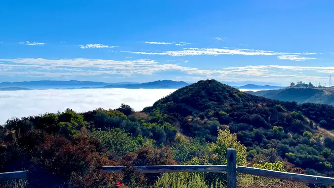
Please read these restrictions before signing up. Don't show up unless you're shown on the "Attending" list Unregistered or waitlisted will be turned away No "Plus Ones" on this hike We will go to our overlook on Boney for a beautiful 360 degree viewpoint. We will have a good time hiking through the area and […]
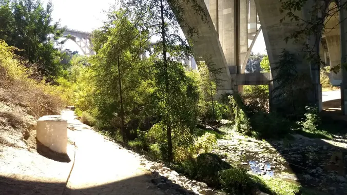
PLEASE NOTE THE EARLIER START TIME 8:30 AM OUR ROUTE : We will be leaving from the main parking lot on Ave. de Los Arboles, going west to Stagecoach Bluff, circle around the backside of Lizard Rock, along the ridge and down the switchbacks to the Hill Canyon Trailhead. We'll then cross the foot bridge […]
Intermediate, 5 mi, 1200' gain Easier Option, 4mi 900' gain. The address given, is not the address of the hike. It is a nearby address that may cause your GPS to drive past the trailhead. This variation is called Hidden Lollipop. Hidden because it includes a hike down the Hidden Canyon trail, Lollipop because of […]
Many from this group, plus other friends, will attend this event at Sagebrush Cantina. The band playing (Hindsite) puts on a fantastic show, playing dance, pop, r&b/funk, and hip hop music from the 70's up to the latest hits. We love this venue and this band. Hindsite will have you dancing all night! We'll be […]
***RSVPs will open APRIL 1, 2024. Add yourself to the waitlist and I will manually add at that time.*** Meysan Lake Trail starting from Whitney Portal https://www.fs.usda.gov/recarea/inyo/recreation/hiking/recarea/?recid=20804&actid=50 WARNING: This is a CHALLENGING and STRENUOUS trail that is rocky and extremely steep. Ultralight backpacking strongly recommended. Please be trained, in shape, and acclimated to this high […]
More details to come soon Low key overnight fishing trip. There will likely still be some snow. Hopefully the mosquitoes aren’t too bad but bring a bug net. Saturday meet at 9am to hike 5 miles to camp. Setup camp and enjoy the backcountry in a hammock or fish the lakes. Sunday pack up and […]
It’s summertime which means it’s time for the Sierras. This is a low key overnight fishing trip. Suitable for beginners who are able to hike with all your gear in altitude. There will likely still be some snow patches Hopefully the mosquitoes aren’t too bad but bring a bug net. Weather is looking nice! Saturday 6/29 […]
This is a Beginner's Backpacking trip. RSVP Opens: Saturday, June 8, 2024 8:00 AM Space is very limited. About Me: I am not a professional guide or backpacking instructor. In 2017 I asked a Facebook backpacking group in Virginia about learning how to backpack. Shortly after, I met up with a stranger who showed me […]
This hike will be about 7 miles with about 700 ft. of elevation gain. We will start the hike at Cañada Vista Park. From here we will take the Tijeras Creek Trail to the Arroyo Trabuco Trail and use this to loop back to where we started. There will be a few water crossings, so […]
We'll enjoy a great “lollipop” outing in the northeastern corner of Topanga State Park starting at the Viewridge Trailhead for Santa Maria Canyon. We'll connect up with the Summer Hill Ranch Trail -- a short and easy loop that curves around a low-rising hill dotted with coastal live oak trees. Highlights during this stroll through […]
Come join us for a fun and food filled festival day, with all the Greek food, music, and culture you can handle! Oh, and lots of Ouzo and beer, and definitely some dancing. This year, the location has changed from the Camarillo Airport to nearby the church, so church tours will be available, as well. […]
We are going to be starting at the Canyon View Staging Area. This hike will be about 6.2 miles with around 1,000 ft. of elevation gain. We will be starting at Canyon View Park and taking Cholla up to West Ridge and comic down Mathis. Link to Parking from Google Maps: https://www.google.com/maps/place/Canyon+View+Staging+Area/@33.585273,-117.7465062,17z/data=!3m1!4b1!4m5!3m4!1s0x80dce61b6bd45c2d:0x5ef3f1ad687cc8b5!8m2!3d33.585273!4d-117.7443175 Dogs are not […]
Starting at Descanso Gardens, this will be a bicycle tour of the hills, creeks and neighborhoods in the triangle bounded by routes/highways 2, 210 and 134. Points of Interest along the way will include: The historic Colorado Bridge (designed and built in 1912) Devils Gate Dam (near JPL, now abandoned) Brookside Park (a large aquatic […]
Trail statistics are approximate. For safety purposes always assume they are underestimated. But don’t be disappointed if they are overestimated. Bring more water and snacks than you think you’ll need.
Trail descriptions are based on previous hikes. Current conditions are unknown until arrival. Expect the unexpected and plan accordingly.
The Organizers and members of Hiking With Dean are not professional leaders, guides, or mountaineers. The function of the member or organizer is only to organize the trip. Each person who shows up for a trip/meetup (and their guest or guests) is responsible for his or her own safety. By attending a hike, or any other event organized by this group, you are acknowledging that you and any guests that you bring are aware of the risks, dangers and hazards associated with the activity and freely accept and fully assume all such risks, dangers and hazards, and further agree to release and discharge the Organizers, Members of the Hiking With Dean Meetup Group from and against any and all liability arising from your participation in the group activities per our ASSUMPTION OF RISK AND LIABILITY WAIVER and Section 6.2 of the Meetup.com Terms of Service.


Recent Comments