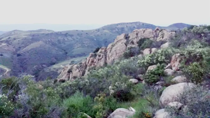
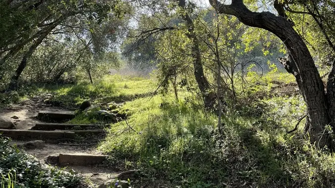
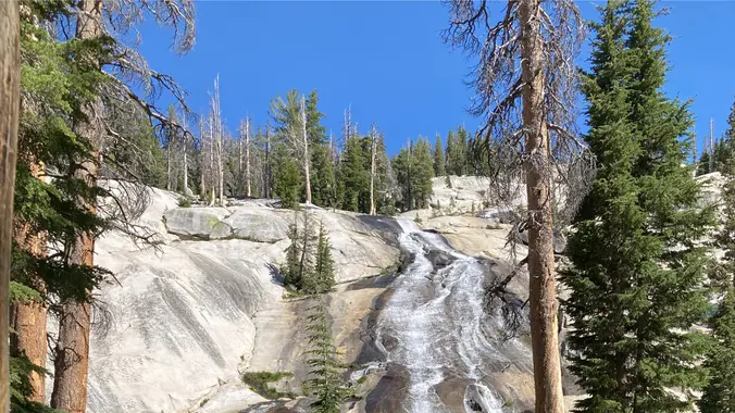
Wildwood Park is one of the most versatile local parks there is, with 27 miles of trails skittering through rocky cliffs, cacti-filled desert environs, volcanic rock, riparian forest, and a cool, watery canyon. Wildwood's archetypal western look served as the set for The Rifleman, Gunsmoke, and Wagon Train back in the day, as well as […]
Space Mountain is the name for Los Robles Trail West, starting at Moorpark Road in Thousand Oaks and switchbacking up the hill to the west. No one seems to know why it's called Space Mountain, though maybe the Disney ride inspired it. Maybe former major league pitcher Bill "Spaceman" Lee had something to do with […]
3.2 miles, 900' gain, easy intermediate. The first part is a steady incline, followed by a rolling trail to our destination. Fit beginners can complete this hike, but it will certainly get their blood pumping. There are no super steep sections. This hike takes us to a secret spot below a large rock formation. Naturally […]
This hike will be about 5.4 miles total with 820 ft. of elevation gain. We are starting at the parking lot at the Wahoo's parking lot. We will take Live Oak Trail. This turns into Serrano Road which will take us to Serrano Cow Trail. At this part of the trail, we usually see a […]
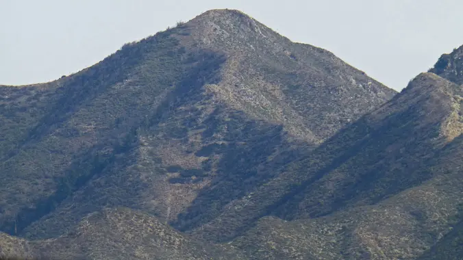
A special hike to Rocky Peak that only HWD can deliver. Rocky Peak, located in Rocky Peak Park, is the fourth-highest point in the Santa Susana Mountains, and overlooks the San Fernando Valley and Chatsworth, the Simi Hills, and the Simi Valley in Southern California. The peak, which is 2,715 feet in elevation, sits on […]
Please join Conejo Open Space Foundation for a live online presentation by local expert Jennifer Lancaster who will discuss the origins of our water, how it’s used, where it winds up, and whether those practices are sustainable at their current levels. After the presentations, there will be a Q & A session for attendees to […]
UPDATE: Please review our guidelines to participate in our hikes. Here are some highlights and a link to the guidelines: https://www.meetup.com/The-Weekday-Trailblazers/about/ Restrictions apply for your safety and ours: Don't show up unless you're on the "Attending" list No "Plus Ones" on this hike Plan on completing the entire hike at a reasonable pace or please […]
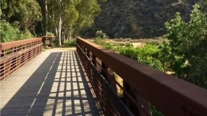
This is a second hike for Thursday at Hill Canyon in Camarillo. It is a gentler hike. We will start at the parking area in Hill Canyon, cross the bridge over the runoff creek, and stroll a mile before turning onto the Hawk Canyon Trail. The Hawk Canyon Trail connects to Western Plateau Trail and […]
Intermediate - 3 miles, 1000' gain Easier Option - Fit Beginner, 1.4 miles, 525' gain. This hike is relatively short, but the middle portion is a rugged and continuous incline for 1 mile with about 700' of gain. Even though we'll be taking this trail at the pace of a social hike, beginners may find […]
We are going to be starting at the Canyon View Staging Area. This hike will be about 6.2 miles with around 1,000 ft. of elevation gain. We will be starting at Canyon View Park and taking Cholla up to West Ridge and comic down Mathis. Link to Parking from Google Maps: https://www.google.com/maps/place/Canyon+View+Staging+Area/@33.585273,-117.7465062,17z/data=!3m1!4b1!4m5!3m4!1s0x80dce61b6bd45c2d:0x5ef3f1ad687cc8b5!8m2!3d33.585273!4d-117.7443175 Dogs are not […]
July 1, 2023 - Shorter or Longer Local Conditioning Hike: East Canyon to its end or go on a bit longer to Mission Peak (both are Out and Back) DISTANCE/ GAIN: Both hikes are Out and Back (O/B) style; length depends on whether you do the second part (an extra ~3 miles round trip). NOTE: […]
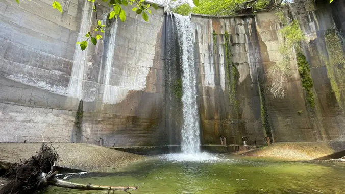
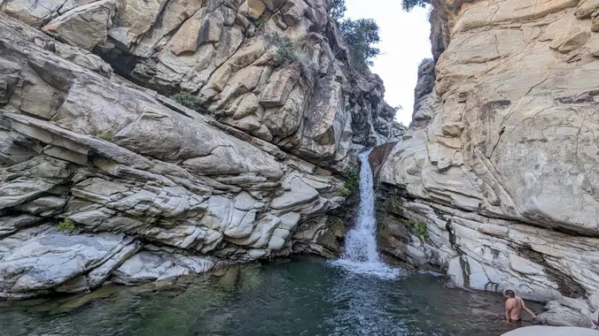
https://www.alltrails.com/trail/us/california/brown-mountain-dam-waterfall Hello Fellow Hikers, Historical Landmark Brown Mountain Dam sits right in the Middle of the Arroyo Seco River. This 81 foot waterfall quickly transports you from the suburbans to a natural wonderland. This dam was built in the early 1940's and has become a big part of the wildlife below. Not uncommon to come […]
This hike will be about 5.4 miles total with 820 ft. of elevation gain. We are starting at the parking lot at the Wahoo's parking lot. We will take Live Oak Trail. This turns into Serrano Road which will take us to Serrano Cow Trail. At this part of the trail, we usually see a […]
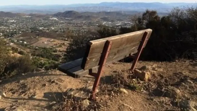
3.0 miles, 800' gain, easy-intermediate. Let's enjoy the gorgeous sunset and the full moon, and fun loaded potluck picnic at the beautiful Angel Vista! This hike is rated easy-intermediate because it is a continuous incline for 1.5 miles. This isn't real steep, but it is continuous, and many beginner hikers have indicated this should be […]
This hike will be about 5.4 miles total with 820 ft. of elevation gain. We are starting at the parking lot at the Wahoo's parking lot. We will take Live Oak Trail. This turns into Serrano Road which will take us to Serrano Cow Trail. At this part of the trail, we usually see a […]
https://www.alltrails.com/trail/us/california/tapo-canyon-trail?u=i (It's gonna be warm this day so we are gonna start at 8am to be off the trail by 10am..) Hello Fellow Hikers, Join me on a easier moderate hike at Tapo Canyon Trail in Simi Valley. This hike has a nice gradual walk until we start a gradual climb were we will start […]
We will enjoy our hike and have a post-hike potluck gathering to celebrate the 4th of July in my back yard from 12:30 pm to 4 pm. All active Trailblazers are also welcome to join the gathering and bring your favorite food, beverage or dessert to share. The address will be sent just after the […]
We are going to hike on Bommer Ridge Trail the whole time. We are going to take this until we hit the top of Boat Canyon, and then turn around. The total distance for this hike is 7.4 miles with about 800 ft. of elevation gain. There are great mountain and ocean views along the […]
PLEASE NOTE THE PARKING/MEETUP LOCATION DESCRIBED BELOW (IT'S NOT WENDY & POTRERO). Route is a past favorite with the Weekday Trailblazers and Geo-hikes. Joanne is visiting SoCal, will attend, just like old times! Hike is 9.2 miles and about 1150ft up. Pace will be moderate (~2.5 MPH). It's a longer than usual evening hike and […]
HIKE DETAILS: This is a gentler hike for Thursday, hopefully there will be a marine layer at the beach since we are starting at 9:00. This hike will go from the beach up to the picnic table on the fire road, approximately 5.5 miles. Most of the hike is exposed, but hopefully we will have […]
4.6 miles, 900' gain, easy-intermediate This route takes us through a beautiful canyon via a counter-clockwise lollipop. Most of the hike has a clear view of the sky, with a few parts that have tree cover. We'll be stopping at the half-way point for a snack and beverage share. We'll start at the Palo Comado […]
Saturday, July 8, 2023 - Santa Paula Cyn, along the creek to the Waterfall and the Punch bowls Smartphones - Please read the full hike description before RSVP! DISTANCE: ~8 tp 10 miles roundtrip - out and back style hike GAIN: ~ 1000' HIKING TIME: ~ 5 hours RATING: Moderate + (Not a beginner's hike, […]
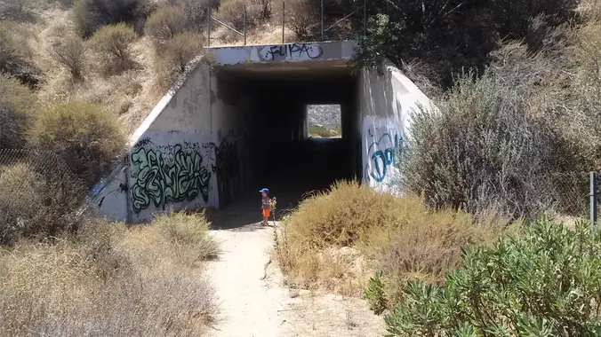
Saturday, July 8, 2023: LOCAL - Pacoima Wash Canyon to Dutch Louie's Tunnel and Dagger Flat ***** RAIN OR SNOW FALLING AT TRAILHEAD CANCELS THIS HIKE ****** DISTANCE: 6 miles (out and back, REVERSE style - that means uphill on the way back!) GAIN: ~ 850' elevation gain, all on the way back RATING: Moderate […]
We are going to be doing a different hike at the park, (not at the main park entrance). We are going to be starting at the Canyon View Staging Area. This hike is roughly 7 miles with relatively low elevation gain. The expectation is to definitely make it to Cave Rock and Dripping Cave. Hopefully […]
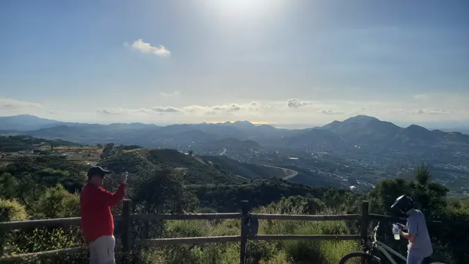
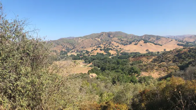
Details We'll start our loop at Dos Vientos Community Park exploring some of the neighborhood trails in the Dos Vientos area of the southwestern Conejo Valley. It provides a great overview of the nearby Dos Vientos residential area, as well as distant vistas including Camarillo, Thousand Oaks, surrounding mountains and open space, a secluded pond, […]
4.2 miles, 700' gain, easy-intermediate. Easier option: 2.7 miles, 500' gain, fit beginner. This is a pot-luck hike. We'll be stopping at the 3/4 point by a picnic table, so please bring food and drink to share, and any utensils your items might require. We have had occasions where there were no utensils, so it […]
The total distance is around 4.6 miles with 870' of elevation gain. We will take Boat Canyon Trail up to Bommer Canyon. We will take Bommer to Water Tank trail. We will take this and then take a lower trail back to the beginning. Address: Dartmoor Trail Lookout Laguna Beach, CA 92651 https://goo.gl/maps/6N8c88XfdSeYu85M8 Dogs are […]
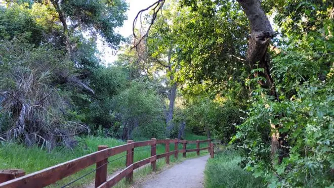
Oak Creek Canyon Trail is a rather special trail in Los Robles Open Space that is designed for the blind as well as the sighted. The all-access trail is shaded by a canopy of oaks, while the loop trail spends more time in the chaparral. The trails form a U-shape that is connected by hiking […]
Hike Description (Intermediate/Strenuous) We will be exploring one of the most beautiful areas of the Santa Monica Mountains. From the Sandstone Peak Parking lot we will begin with an ascent to Sandstone Peak (the highest point of the Santa Monica Mountains, 3111' above sea level) and then veer off to the right, taking the Mishe […]
This hike will be about 5.4 miles total with 820 ft. of elevation gain. We are starting at the parking lot at the Wahoo's parking lot. We will take Live Oak Trail. This turns into Serrano Road which will take us to Serrano Cow Trail. At this part of the trail, we usually see a […]
This loop hike is about 5 miles with about 800' of total elevation gain, spread out nicely, with a little bonus loop through Oak Creek Canyon. "Robles" is Spanish for oaks, and we'll see plenty of them on this beautiful, hike. Trailhead Directions: From the 101 in Thousand Oaks, turn south on Moorpark Road. Drive […]
This is a gentler hike on the Los Robles trail. This is a loop of about 4.5 miles with about 800' of total elevation gain, spread out nicely, with a little bonus loop through Oak Creek Canyon. "Robles" is Spanish for oaks, and we'll see plenty of them on this beautiful, relaxing hike. Trailhead Directions: […]
This Ebike ride will be on paved roads in the hills of Moorpark and west Simi Valley. We'll be meeting at the Miller Park Playgrounds in Moorpark. Make sure you bring along a spare inner tube. MEETUP LOCATION AND TIME: at 8:00am. RESTROOMS: At the meetup location and half way through the ride. ROUTE This […]
BKS ( Butt Kicker Series) Saturday July 15th, 2023 – Vincent Gulch Divide to Mount Baden-Powell O/B ****************************************************** ** Special Note on directions to the trailhead ** Highway 2 is still closed at Red Box. Make sure to take the route through Newhall via the northeast on CA-14 North and Pearblossom Hwy. See the map […]
This hike is so cool! It's a good distance with little elevation gain and it is beautiful. This hike will take us to the Brown Mountain Dam Waterfall. The hike is an out and back at around 8 miles total with 750 ft. of elevation gain, so not steep! This area of the Angeles National […]
Hike #7 in the 2023 highest and most interesting peaks in the Santa Monica Mountains series is to Cathedral Rocks (2000'), a moderate 9-miles, 1800' gain hike out and back hike past Hub Junction to Cathedral Rock (2000') with a stop for lunch at the Howard Kayton Bench (long-time SMMTF outings chair and leader) before […]
Scroll down to RSVP I have secret trail in Wildwood Park reserved for VIPs only. This hike will require a few a stream crossings so wear shoes you don’t mind getting wet, and shorts (or long pants you don’t mind getting wet). We’ll explore some cool artifacts along the way too! 🍴🥂 We’ll have a potluck picnic lunch under an […]
The hike we will be doing will be around 5 miles long with 875 ft. of elevation gain. This will be a loop starting at the parking lot of Nix Nature Center. As you will see on the map, this is at the main park entrance off of the 133 (Little Sycamore Canyon Staging Area). […]
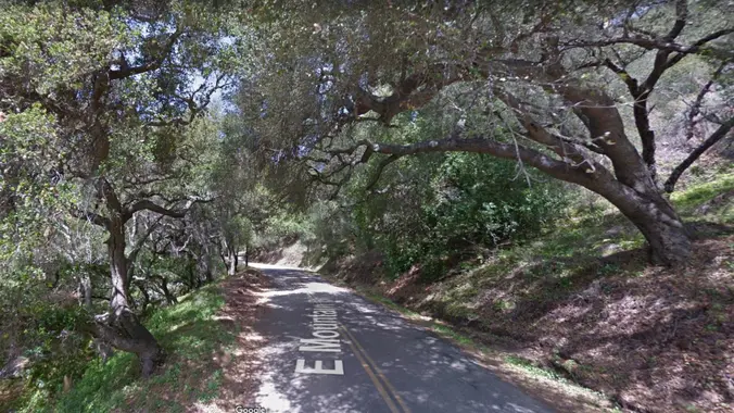
Here's an opportunity for us to see the beautiful upper roads of the Montecito area via our ebikes. We'll follow the baseline roads of the Santa Barbara mountain range which include Las Canoas Road, El Cielito Road, West and East Mountain Road, Park Lane, Bella Vista drive and possibly Viola Lane. The route is mostly […]
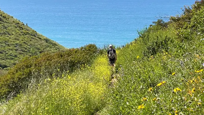
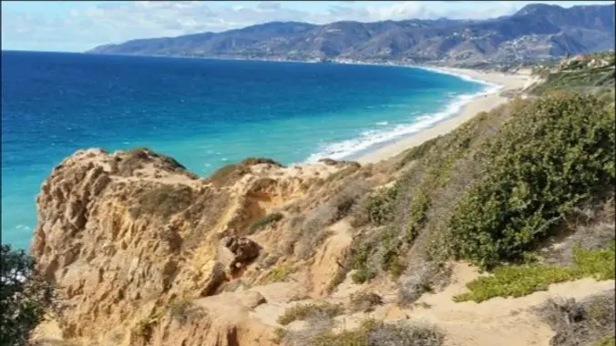
I pre-hiked the trail this morning and it is absolutely stunning with wildflowers beside the awesome blend of ocean and mountain views in Malibu’s La Jolla Canyon. The trail follows the canyon eastward, away from the ocean. Then, it quickly brings you back toward the ocean at a gradual incline. There’s a great lookout spot […]
This is a cooler, gentler hike after a hot, hot weekend. Because of the heat, we will pace this as a gentler hike and we will take some breaks to let slower hikers catch up and turn around just before going up to the monument. We will start in the parking lot at Rancho Sierra […]
5.2 miles, 1140' gain, easy-intermediate. Warning: Google Maps may take you to the incorrect location, although the address is correct. Please follow the written directions. The hike starts completely flat along a gravel track that moves around the Dos Vientos Community park. It then gently rises into the surrounding hills, continuing onto the Powerline trail. […]
Let's try to beat the heat! We are going to start on Bommer Ridge Trail and take this to Lizard. We will go down that and loop back up to Bommer via Upper Laurel. The total distance for this hike is 4.5 miles with about 650 ft. of elevation gain. There are great mountain and […]
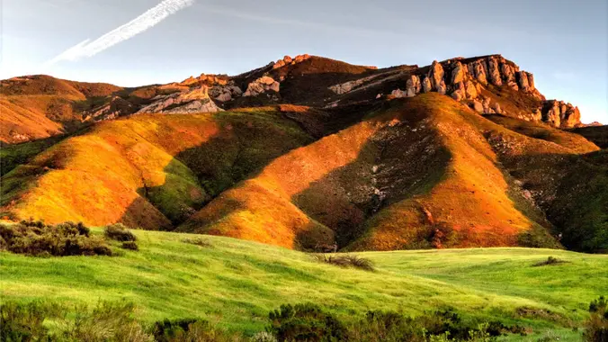
Another spectacular section of the Backbone Trail...this hike includes staggering views of pink colored sedimentary rock formations known as the Sespe Formation, Hondo canyon's pink "V" gourge, beautifully shaded live oak, streams and a sloping green meadow. Its perhaps one of the shadiest sections of the Backbone Trail. At the top we will see many […]
http://photos2.meetupstatic.com/photos/event/b/0/e/c/event_80025292.jpeg Since the trail has been redesigned and is now about 8 1/2 miles, we will stop at Ventu Park Road for our break unless everyone wants to go on to Angel Vista. It will be warm, so we may slow the pace down a little. AUGUST 2021 UPDATE: Please review the newly revised guidelines […]
We will start this hike into MCSP from Tapia Park. The Tapia Park entrance is just before the Piuma intersection. Note: a day use fee (machine at entrance) is required if you don't have a State Park Pass. After you enter Tapia, drive to the picnic area and take a hard left onto Dorothy Lane. […]
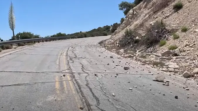
I've been wanting to travel on the upper end of Hwy 39 for years now, hoping that it would eventually be reopened. To get to the high country of the San Gabriel Mountains, I used to head up Hwy 39 out of Azusa to The Angeles Crest Hwy 2 at Islip Saddle. It's been closed […]
4.6 miles, 1000' gain, Easy Intermediate Easier Option - 2.7 miles, 320' gain Many have gotten lost relying on GPS. This is the Wendy Trailhead, where S. Wendy Dr. ends at Potrero Rd. Heading out, we cross a creek, turn right at the split, then Turn right at the dead end. We regroup at the […]
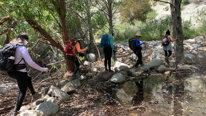
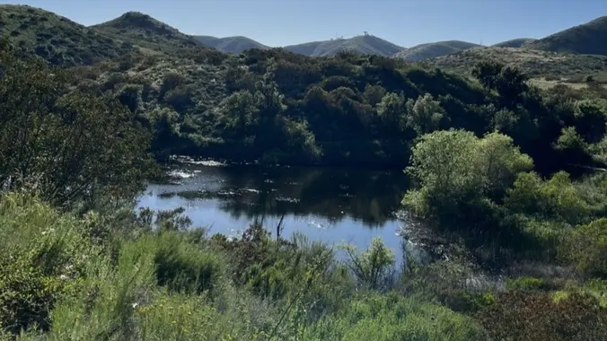
This hike will be about 7 miles with about 700 ft. of elevation gain. We will start the hike at Cañada Vista Park. From here we will take the Tijeras Creek Trail to the Arroyo Trabuco Trail and use this to loop back to where we started. There will be a few water crossings, so […]
https://www.alltrails.com/trail/us/california/hondo-canyon-backbone-trail Hello Fellow Hikers, This is a great trail for warmer weather as it has a lot of shaded areas. This trail has several canopy trees that cover the area. Will also have open field areas as well that are not shaded so we are starting the hike a little earlier. A side note will […]
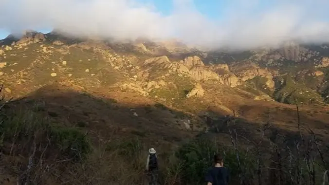
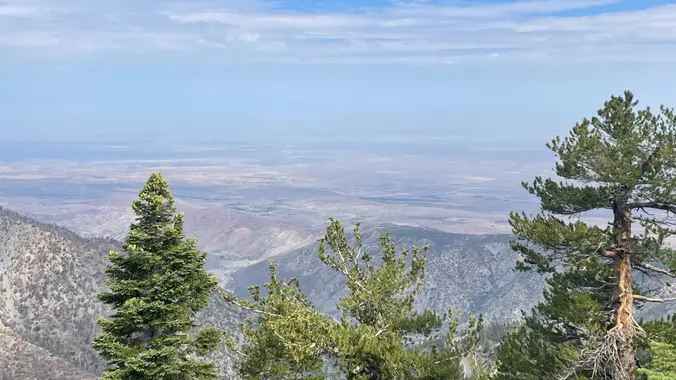
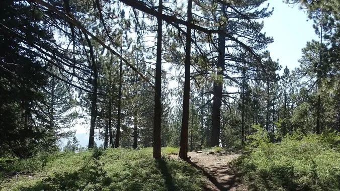
Saturday July 22, 2023 Meetup Time : 7:45 A.M. (8:00 am SHARP hiking start) It is predicted to be 100 F + in SCV this weekend. Escape with us to the cooler mountains nearby where we can enjoy the mid/high 70's at 8,000'. HEAT ALERT: Due to the current heat wave, I will provide a […]
The Rock Pool is one of the most popular landmarks in Malibu Creek State Park. It has been the site of many movies and TV shows including Planet of the Apes, Swiss Family Robinson series, Tarzan movies and Dr Quinn Medicine Woman. 🧺 🤽Bring a sack lunch -- we'll have an extended break by the […]
Note: The event starts at 7:30, but you want to get there early to get to the Nature Center, park, etc. so I put 7:10. **You must also register here: https://letsgooutside.org/activities/2023/07/23/small-but-mighty-bats-of-irvine-park-4/ Map: Nature Center - Irvine Regional Park https://maps.app.goo.gl/wBLXnRyaqAaBoGuc7 After the sun has set, the night sky fills with small but mighty flying bats. Enjoy […]
Fun night ride though the bike paths around town. Kid and family friendly ride. No speedsters. Helmet required. Bling out your ride with lights to make a statement! Open to all riders, ebike and non ebike (see we get along😂)
To beat this insane heat, let’s explore Carpinteria Bluffs Nature Preserve to Carpinteria State Beach, passing through Tar Pits Park and Seal Sanctuary Overlook! I pre-hiked today. Yes, it was cool as it was 67F when I was left there around 11am. This beautiful, beachside green space is one of the last undeveloped strips of […]
Join us on an out and back hike up the Ray Miller Trail and the Overlook Trail. We’ll turn back around the Guadalasca Trail intersection. We’ll enjoy beautiful ocean views as we descend. We'll pick up about 1500’ gain on this 8-9 mile adventure. IF it gets too hot we will have the option to […]
The total distance is around 4.6 miles with 870' of elevation gain. We will take Boat Canyon Trail up to Bommer Canyon. We will take Bommer to Water Tank trail. We will take this and then take a lower trail back to the beginning. Address: Dartmoor Trail Lookout Laguna Beach, CA 92651 https://goo.gl/maps/6N8c88XfdSeYu85M8 Dogs are […]
The Calabasas Day Hikers will be hiking up an easy dirt forest service road that skirts the Pinnacles, Mendenhall, McKinley and Iron Peaks. Their objective is Mendenhall Peak, while our ebikers take on the entire road to Iron Peak. Make sure you bring along a spare inner tube. MEETUP LOCATION AND TIME: 9:00am on Little […]
Please read these restrictions before signing up. Don't sign up unless you are two weeks past your 2nd vaccination Don't show up unless you're shown on the "Attending" list Unregistered or waitlisted will be turned away No "Plus Ones" on this hike You will be asked to show your vaccination card (a photo on your […]
This is a cooler, gentler hike along the surf during a hot, hot week! The Point Dume staircase has been restored and improved, so we'll park at Westward, climb up and over the bluff to the top of the stairs, make our way gingerly around the cliff, then down the stairs to the beach. On […]
5.3 miles, 600' gain, Easy-Intermediate 2.5 miles, 100' gain, Beginner We start by crossing a bridge into a wooded area and continue down a relatively flat path alongside a stream. After about a mile, we'll come to a junction. For those that want the full hike, we'll turn right and complete a 3 mile loop […]
We are going to be starting at the Canyon View Staging Area. This hike will be about 6.2 miles with around 1,000 ft. of elevation gain. We will be starting at Canyon View Park and taking Cholla up to West Ridge and comic down Mathis. Link to Parking from Google Maps: https://www.google.com/maps/place/Canyon+View+Staging+Area/@33.585273,-117.7465062,17z/data=!3m1!4b1!4m5!3m4!1s0x80dce61b6bd45c2d:0x5ef3f1ad687cc8b5!8m2!3d33.585273!4d-117.7443175 Dogs are not […]
https://www.alltrails.com/trail/us/california/backbone-trail-to-sandstone-peak-and-mishe-mokwa-trail-loop?u=i&sh=aoxfvb Hey Everyone, I am taking over for a couple weeks. It should be cooling down by the time this hike is scheduled. I might move up the start time if the heatwave decides to stick around a little longer since these trails have little to no shade. We will be going clockwise to get […]
The shady hike down Sullivan Canyon parallels a seasonal creek. Alive with the singing of birds, this hike sounds and feels like an aviary housed within huge stands of sycamore, oak, and willow trees. We’ll be hiking on both the Sullivan side and the Mandeville Canyon side of the ridge dividing the two canyons creating […]
Let's start early and beat the heat! The hike I am planning is around 6.3 miles with about 700 ft. of elevation gain. It starts at the very end of the paved road, the long gray strip that can be seen on the map. We will begin at the Bell Canyon Trail head. We will […]
3.0 miles, 800' gain, easy-intermediate. Let's enjoy the gorgeous sunset and the almost full moon, and fun loaded potluck picnic at the beautiful Angel Vista! This hike is rated easy-intermediate because it is a continuous incline for 1.5 miles. This isn't real steep, but it is continuous, and many beginner hikers have indicated this should […]
This will be the first day these trails we be reopened after being closed for a month and a half for trail maintenance. Come join us! The total mileage for this hike is 5 miles with about 800 ft. of elevation gain. We will start at the trail head of the Borrego Trail, which is […]
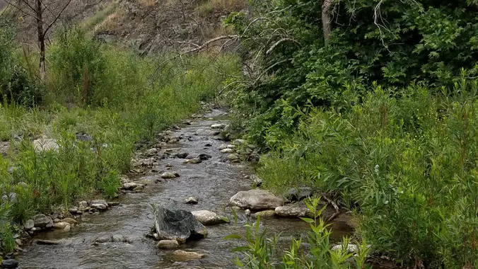
This hike starts at 7:30 am to beat the heat from Gold Canyon Trail to Wildwood Canyon Trail. It will pass through various trails with a long creek, crossing streams and bridges, Indian caves, volcanic rock cliffs, water falls, cacti-filled desert environs, riparian forest, and wildflowers. Highlights of the hike include waterfalls incorporating 40’ Paradise […]
This is a cooler, gentler hike after a hot, hot weekend. Because of the heat, we will pace this as a gentler hike and we will take some breaks to let slower hikers catch up. This hike is 5 miles, with +/- 600' climb. We'll start at the Rancho Sierra Vista trailhead, walk over to […]
This hike will be about 5.4 miles total with 820 ft. of elevation gain. We are starting at the parking lot at the Wahoo's parking lot. We will take Live Oak Trail. This turns into Serrano Road which will take us to Serrano Cow Trail. At this part of the trail, we usually see a […]
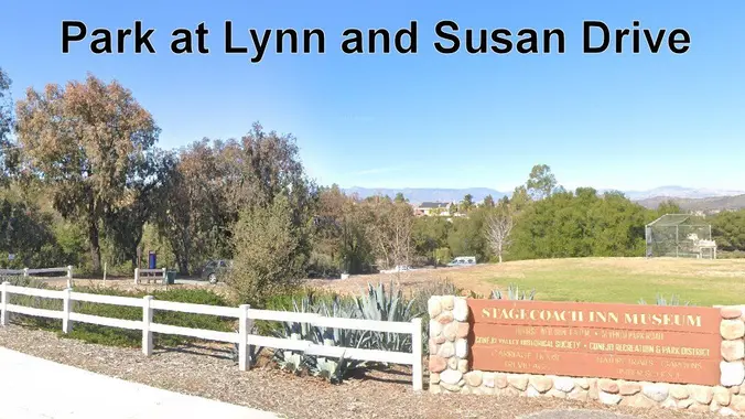
We’re keeping it short and sweet during the heat wave. This is a 4 mile out-and-back trip from Lynn Road to the Rosewood Trail to Angel Vista. We’ll park at the playfield near Stagecoach Inn and walk from Lynn Road on the lower Rosewood Trail, to the usual trailhead and then on up the trail. […]
Easy Intermediate, 3 miles, 700' gain Easier Option: 2.4 mi, 530' gain. (1343 Los Amigos Ave, Simi Valley, CA 93065, or 89 La Paz Ct, Simi Valley, CA 93065 to save another 500' distance). We'll meet in the parking lot at the northeast corner of Madera and Royal, just south of the Donut Delite, on […]
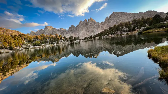
The snow is finally melting and hopefully Tioga pass will be open. This is a 4 day/3 night loop. The Route 32 miles 7100 feet Current plan: Day 0 (Thursday): Camp at one of the campground along Tioga Pass Rd. (backpackers camp in Tuolumne meadows is closed) Night 1: Nelson Lake Night 2: Merced Lake […]
Get to know this 12.4-mile out-and-back trail near Independence, California. Generally considered a challenging route. Day 1. We will hike to Kearsarge Lakes and setup a basecamp. Go fishing or explore the lakes. Day 2. Day hike to Bullfrog Lake/ Charlotte Lake (optional) Day 3. Pack up and hike out Days: 3/2 nights Rating: (Moderate/Strenuous) […]
⌚EARLY START TIME🕰️ My Bell Canyon Loop starts and ends at the mouth of Bell Canyon. Its a little-known loop and I haven't seen any other meetup group do it -- so you are in luck today! I've redesigned the hike so if you have done this with me in the past you can look […]
https://www.alltrails.com/trail/us/california/mugu-peak-to-la-jolla-nature-preserve?u=i&sh=aoxfvb Hey Everyone, It’s time to get some more elevation gain in or we (I) will never make it up Baldy. I’m not going to lie, the first mile to Mugu Peak will be difficult, but most of our elevation gain will be done. We are going to take it nice and slow because there’s […]
Hike #8 in the 2023 highest and most interesting peaks in the Santa Monica Mountains series is the Valley to the Sea, a strenuous 11 mile, 1000 gain hike from the Valley to the Sea in memory of Willy Blumhoff with a stop at the Eagle Rock (1957'), the outing peak. This is a one-way […]
Another shorter hike for a hot day (See Saturday's hike also) We'll enjoy a great “lollipop” outing in the northeastern corner of Topanga State Park starting at the Viewridge Trailhead for Santa Maria Canyon. We'll connect up with The Summer Hill Ranch Trail -- a short and easy loop that curves around a low-rising hill […]
This hike is so cool! It's a good distance with little elevation gain and it is beautiful. This hike will take us to the Brown Mountain Dam Waterfall. The hike is an out and back at around 7.75-8 miles total with 800 ft. of elevation gain, so not steep! This area of the Angeles National […]
Join us as TWISTED GYPSY celebrates and reinvents the timeless music of the legendary FLEETWOOD MAC. “More than just a tribute”, Twisted Gypsy transports you back in time and captures the band’s passion, stellar all-live harmonies and performances! Let's enjoy potluck picnic. Please bring food, drinks to share and your own cup and plate to […]
Trail statistics are approximate. For safety purposes always assume they are underestimated. But don’t be disappointed if they are overestimated. Bring more water and snacks than you think you’ll need.
Trail descriptions are based on previous hikes. Current conditions are unknown until arrival. Expect the unexpected and plan accordingly.
The Organizers and members of Hiking With Dean are not professional leaders, guides, or mountaineers. The function of the member or organizer is only to organize the trip. Each person who shows up for a trip/meetup (and their guest or guests) is responsible for his or her own safety. By attending a hike, or any other event organized by this group, you are acknowledging that you and any guests that you bring are aware of the risks, dangers and hazards associated with the activity and freely accept and fully assume all such risks, dangers and hazards, and further agree to release and discharge the Organizers, Members of the Hiking With Dean Meetup Group from and against any and all liability arising from your participation in the group activities per our ASSUMPTION OF RISK AND LIABILITY WAIVER and Section 6.2 of the Meetup.com Terms of Service.


Recent Comments