This will be the first day these trails we be reopened after being closed for a month and a half for trail maintenance. Come join us! The total mileage for this hike is 5 miles with about 800 ft. of elevation gain. We will start at the trail head of the Borrego Trail, which is […]
This hike starts at 7:30 am to beat the heat from Gold Canyon Trail to Wildwood Canyon Trail. It will pass through various trails with a long creek, crossing streams and bridges, Indian caves, volcanic rock cliffs, water falls, cacti-filled desert environs, riparian forest, and wildflowers. Highlights of the hike include waterfalls incorporating 40’ Paradise […]
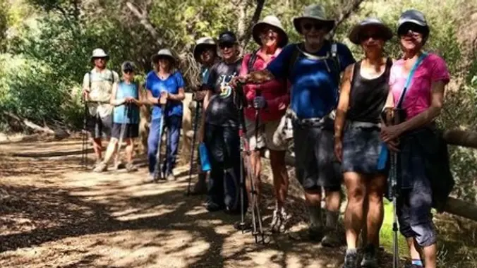
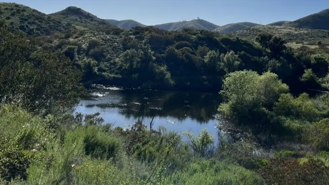
This is a cooler, gentler hike after a hot, hot weekend. Because of the heat, we will pace this as a gentler hike and we will take some breaks to let slower hikers catch up. This hike is 5 miles, with +/- 600' climb. We'll start at the Rancho Sierra Vista trailhead, walk over to […]
This hike will be about 5.4 miles total with 820 ft. of elevation gain. We are starting at the parking lot at the Wahoo's parking lot. We will take Live Oak Trail. This turns into Serrano Road which will take us to Serrano Cow Trail. At this part of the trail, we usually see a […]
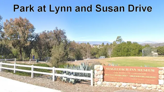
We’re keeping it short and sweet during the heat wave. This is a 4 mile out-and-back trip from Lynn Road to the Rosewood Trail to Angel Vista. We’ll park at the playfield near Stagecoach Inn and walk from Lynn Road on the lower Rosewood Trail, to the usual trailhead and then on up the trail. […]
Easy Intermediate, 3 miles, 700' gain Easier Option: 2.4 mi, 530' gain. (1343 Los Amigos Ave, Simi Valley, CA 93065, or 89 La Paz Ct, Simi Valley, CA 93065 to save another 500' distance). We'll meet in the parking lot at the northeast corner of Madera and Royal, just south of the Donut Delite, on […]
The snow is finally melting and hopefully Tioga pass will be open. This is a 4 day/3 night loop. The Route 32 miles 7100 feet Current plan: Day 0 (Thursday): Camp at one of the campground along Tioga Pass Rd. (backpackers camp in Tuolumne meadows is closed) Night 1: Nelson Lake Night 2: Merced Lake […]
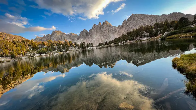
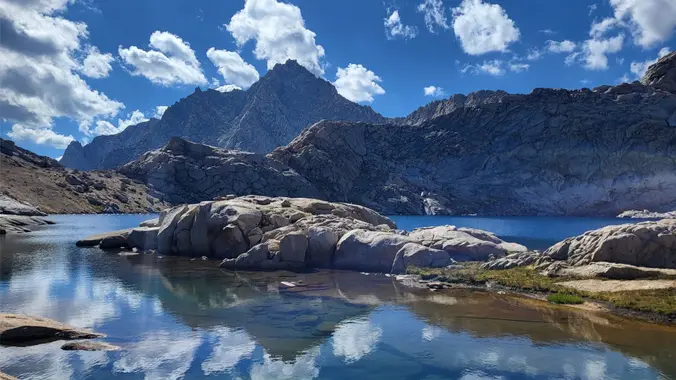
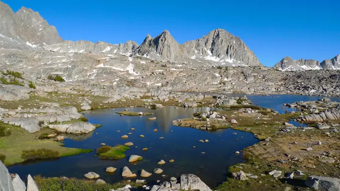
Get to know this 12.4-mile out-and-back trail near Independence, California. Generally considered a challenging route. Day 1. We will hike to Kearsarge Lakes and setup a basecamp. Go fishing or explore the lakes. Day 2. Day hike to Bullfrog Lake/ Charlotte Lake (optional) Day 3. Pack up and hike out Days: 3/2 nights Rating: (Moderate/Strenuous) […]
⌚EARLY START TIME🕰️ My Bell Canyon Loop starts and ends at the mouth of Bell Canyon. Its a little-known loop and I haven't seen any other meetup group do it -- so you are in luck today! I've redesigned the hike so if you have done this with me in the past you can look […]
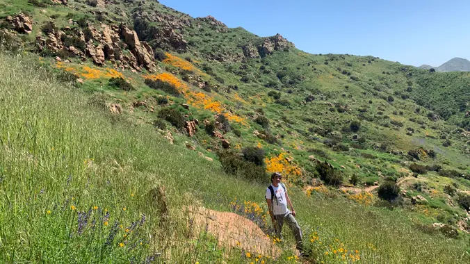
https://www.alltrails.com/trail/us/california/mugu-peak-to-la-jolla-nature-preserve?u=i&sh=aoxfvb Hey Everyone, It’s time to get some more elevation gain in or we (I) will never make it up Baldy. I’m not going to lie, the first mile to Mugu Peak will be difficult, but most of our elevation gain will be done. We are going to take it nice and slow because there’s […]
Hike #8 in the 2023 highest and most interesting peaks in the Santa Monica Mountains series is the Valley to the Sea, a strenuous 11 mile, 1000 gain hike from the Valley to the Sea in memory of Willy Blumhoff with a stop at the Eagle Rock (1957'), the outing peak. This is a one-way […]
Another shorter hike for a hot day (See Saturday's hike also) We'll enjoy a great “lollipop” outing in the northeastern corner of Topanga State Park starting at the Viewridge Trailhead for Santa Maria Canyon. We'll connect up with The Summer Hill Ranch Trail -- a short and easy loop that curves around a low-rising hill […]
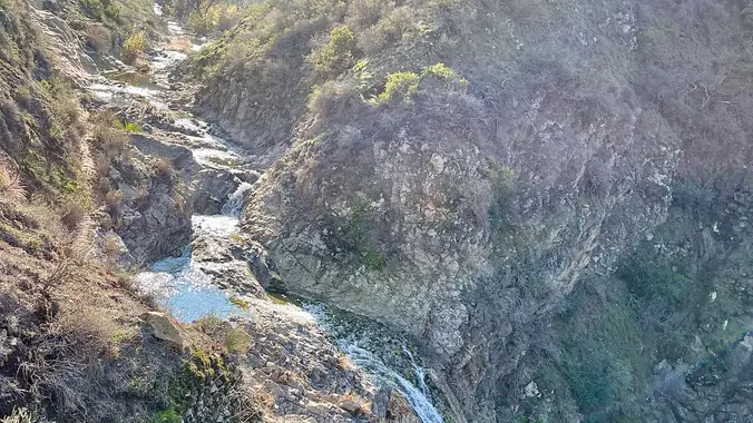
This hike is so cool! It's a good distance with little elevation gain and it is beautiful. This hike will take us to the Brown Mountain Dam Waterfall. The hike is an out and back at around 7.75-8 miles total with 800 ft. of elevation gain, so not steep! This area of the Angeles National […]
Join us as TWISTED GYPSY celebrates and reinvents the timeless music of the legendary FLEETWOOD MAC. “More than just a tribute”, Twisted Gypsy transports you back in time and captures the band’s passion, stellar all-live harmonies and performances! Let's enjoy potluck picnic. Please bring food, drinks to share and your own cup and plate to […]
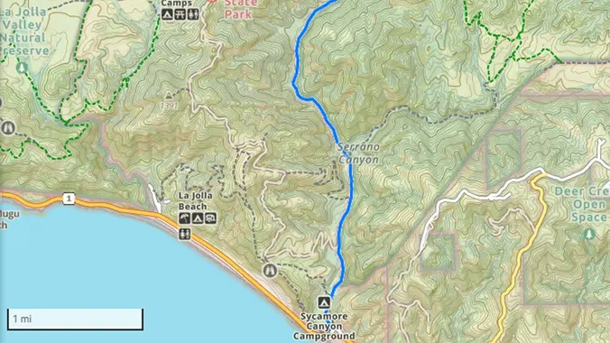
This is a loop hike. From the Sycamore Campground parking lot we’ll hike up Big Sycamore Canyon for about a mile and then head east on the Serrano Canyon trail into a densely wooded narrow canyon, with a lovely seasonal stream crisscrossing the trail numerous times, and abundant wildlife. As we begin to gain elevation […]
This hike will be about 5.4 miles total with 820 ft. of elevation gain. We are starting at the parking lot at the Wahoo's parking lot. We will take Live Oak Trail. This turns into Serrano Road which will take us to Serrano Cow Trail. At this part of the trail, we usually see a […]
The name “Zuma” is derived from the Chumash language and means “abundance.” There is an absolute abundance of beautiful and spectacular wildflowers engulfing the entire area and it appears that there was no impact from the Woolsey fire other than a few remnants of burnt trees. We will start to hike the Zuma Loop trail […]
https://a248.e.akamai.net/secure.meetupstatic.com/photos/event/4/5/b/c/event_52757852.jpeg Pandemic conditions and restrictions apply for your safety and ours: Don't show up unless you're shown on the "Attending" list Unregistered or waitlisted will be turned away No "Plus Ones" on this hike You will be asked to show your vaccination card if you have not done so previously. (A photo on your phone […]
No white lights, bring red or green -- red being the best. Amazon has some inexpensive ones that have worked well for me and other members: **https://amzn.to/3OAAu3S**. If you don't have one you can piggy back off the others'. If you need a white light, then you should not be attending. You don't need to […]
We are going to be starting at the Canyon View Staging Area. This hike will be about 6.2 miles with around 1,000 ft. of elevation gain. We will be starting at Canyon View Park and taking Cholla up to West Ridge and comic down Mathis. Link to Parking from Google Maps: https://www.google.com/maps/place/Canyon+View+Staging+Area/@33.585273,-117.7465062,17z/data=!3m1!4b1!4m5!3m4!1s0x80dce61b6bd45c2d:0x5ef3f1ad687cc8b5!8m2!3d33.585273!4d-117.7443175 Dogs are not […]
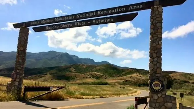
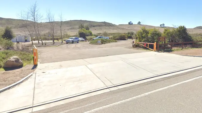
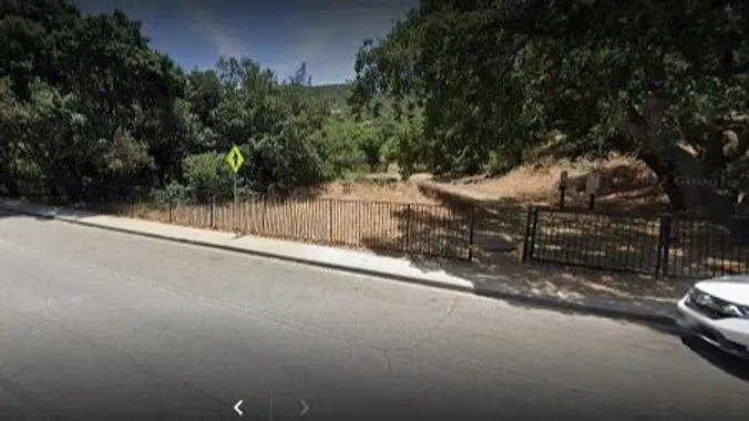
Instead of our usual starting point at the Rancho Sierra Vista trailhead for SAMO, this shorter, beginner hike will start at the newer COSCA trailhead lot, 1.5 miles west of the intersection of Lynn and Reino in Newbury Park. See photo for what to look for off of Lynn Road. Note: This is NOT the […]
INFORMATIONAL POSTING-November 11-12 Wilderness First Aid Course TO REGISTER PLEASE GO TO: http://wildernessfirstaidcourse.org Why Take the WFAC? More extensive and useful than Red Cross basic first aid · We teach the course twice a year in Fullerton; typically, May and November. The next class is November 11-12. · You receive 24 hours of credit for […]
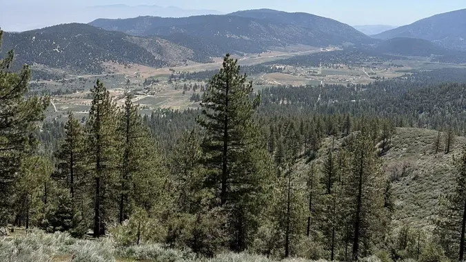
https://www.alltrails.com/trail/us/california/mt-pinos-via-mcgill-trail Hello Fellow Hikers, Okays it's time for some forest therapy. This is a really popular backpacking trail as your surrounded by lush pine trees and gorgeous mountain peaks. Once we reach Pinos peak will take a snack break and pics as this peak does have signs. This is one of the easier peaks to […]
Let's do another awesome peak in the Angeles National Forest! This hike will be to Josephine Peak. It is an out and back hike that will be about 8 miles and 1,850 ft. of elevation gain. The peak has an elevation of 5,558 ft. It will be an easy hike to navigate. We take one […]
We will be taking a moment to pause our hiking activities and take some time to evaluate our policies and procedures to ensure we can continue to keep our hikes fun and safe for everyone. Thank you for all your support.
The hike we will be doing will be around 5 miles long with 875 ft. of elevation gain. This will be a loop starting at the parking lot of Nix Nature Center. As you will see on the map, this is at the main park entrance off of the 133 (Little Sycamore Canyon Staging Area). […]
4.2 miles, 700' gain, easy-intermediate. Easier option: 2.7 miles, 500' gain, fit beginner. This is a pot-luck hike. We'll be stopping at the 3/4 point by a picnic table, so please bring food and drink to share, and any utensils your items might require. We have had occasions where there were no utensils, so it […]
**You must also register here: https://letsgooutside.org/activities/2023/08/15/enjoy-natures-story-vistas-and-special-places-intro-hike-in-limestone-canyon-4/ There are currently 9 spots left. Join us on a slow-paced hike along the back-country ridges and valleys of Limestone Canyon, part of OC Parks’ Irvine Ranch Open Space. We’ll travel on rough old ranch roads to the East Sinks View Deck passing by woodlands of majestic oak trees […]
We will start (early to beat the heat) our hike near the beginning of Regal Oak Ct. on the lower Rosewood Trail, a dirt trail heading up a shaded ravine at the base of the mountains, and continue to the usual Rosewood trail. Rosewood trail presents a clear view over the 101 Freeway carving up […]
8:15 AM START TIME We'll have to leave promptly because the 8:30 group will be on our heels! PLEASE ADJUST YOUR RSVP ON OTHER HIKES IF YOU JOIN THIS. While the heat is once again with us, we will take this at a gentler pace and we will take some breaks to let slower hikers […]
PLEASE READ BELOW IN ITS ENTIRETY. Kindly review the guidelines (link to the guidelines) to join our hikes. Restrictions apply for your safety and ours: Proof of vaccination required. Don't show up unless you're shown on the "Attending" list. Plan on KEEPING UP with the group and completing the entire hike or please find an […]
This hike will be about 5.4 miles total with 820 ft. of elevation gain. We are starting at the parking lot at the Wahoo's parking lot. We will take Live Oak Trail. This turns into Serrano Road which will take us to Serrano Cow Trail. At this part of the trail, we usually see a […]
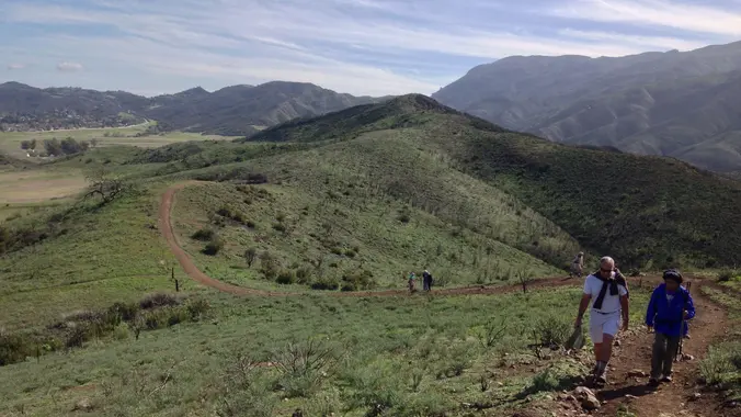
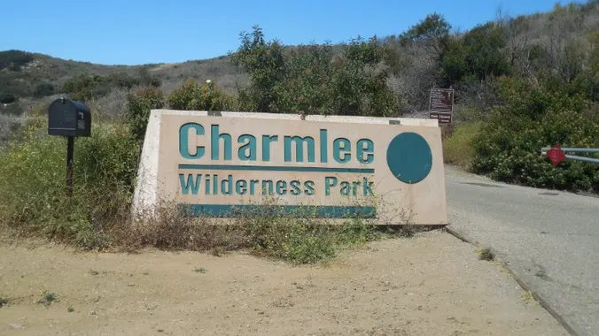
This is an alternative to Steve's Charmlee hike for those on the waiting list. Also note that due to the heat this hike will start at 8am!! We will meet at the trailhead parking area at the intersection of Wendy and Portrero Road. Pay attention as this is different than the Parking Lot where we […]
Another hot day, so let's get closer to the coast, and hike somewhere we haven't been since 2017 or before - Charmlee Wilderness Park. Although you can park in the official lot for $5, we'll meet at the dirt strip on Encinal 50 yards uphill from the park entrance, and bushwack through the thistle and […]
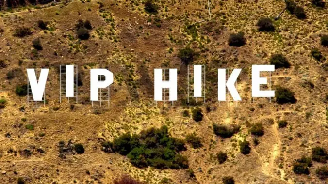
Announcing a new VIP hike. For more info go to the HWD website log in with your VIP account and RSVP Hang out after the hike for some light fare and adult refreshments. If you are not yet a member of the HWD VIP Club you can sign up here
This hike is going to be exploring new trails in the Saddleback Wilderness! We will be doing 3.3 miles. Come join us for this awesome event! ***Please note: You must be also be registered here: https://letsgooutside.org/activities/2023/08/19/saddleback-wilderness-access-2/ There are currently 40 spots left. Come explore 3.3 miles of new trails at Saddleback Wilderness, part of OC […]
Details On this one we'll hike on some secret trails converting a classic out and back hike into a loop. We'll start in La Jolla Canyon and hike on my secret trail to the to the Overlook Trail dividing La Jolla and Sycamore Canyons. From there we'll descend into Sycamore Canyon via the Fireline Trail […]
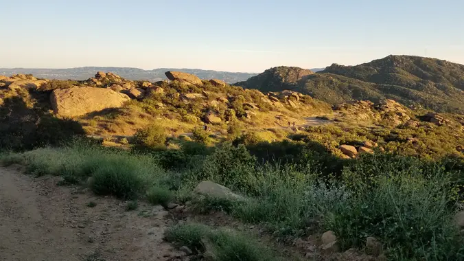
Let's start early and beat the heat! The hike I am planning is around 6.3 miles with about 700 ft. of elevation gain. It starts at the very end of the paved road, the long gray strip that can be seen on the map. We will begin at the Bell Canyon Trail head. We will […]
Let's enjoy the summer cool evening hike and potluck! 3.5 miles, 700' gain, Easy Intermediate. Easy Option: 2.4 miles, 285' gain, Fit Beginner. We'll start by entering the Los Padres trail, through a spooky oak covered section, then move through until we come to a dead end. We'll turn right, and climb up to another […]
Mineral King is a subalpine glacial valley located in the southern part of Sequoia National Park, in the U.S. state of California. The valley lies at the headwaters of the East Fork of the Kaweah River, which rises at the eastern part of the valley and flows northwest. 3 open spots available Dates: Aug 22-25, […]
PLEASE NOTE START TIME 8:30 & ALLOW PLENTY OF DRIVE TIME. Weather should be a Hi of 78* for the day partly cloudy low winds. It's an out and back, so go as far as you'd like and have time for. Please review the guidelines to participate in our morning hikes. Here are some highlights […]
The Miracle Country by Kendra Atleework is WINNER OF THE SIGURD F. OLSON NATURE WRITING AWARD WINNER OF THE WOMEN WRITING THE WEST WILLA LITERARY AWARD IN CREATIVE NONFICTION Incorporating the fascinating history of the landscape and powerful nature writing, Miracle Country is a moving and unforgettable memoir of flight and return, emptiness and bounty, […]
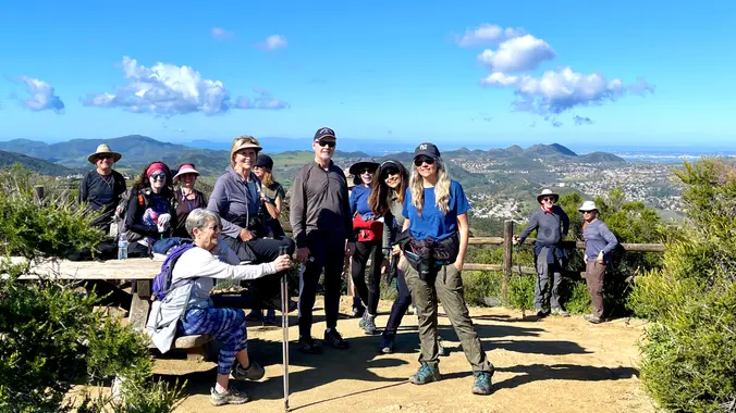
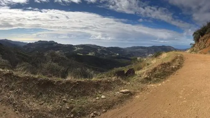
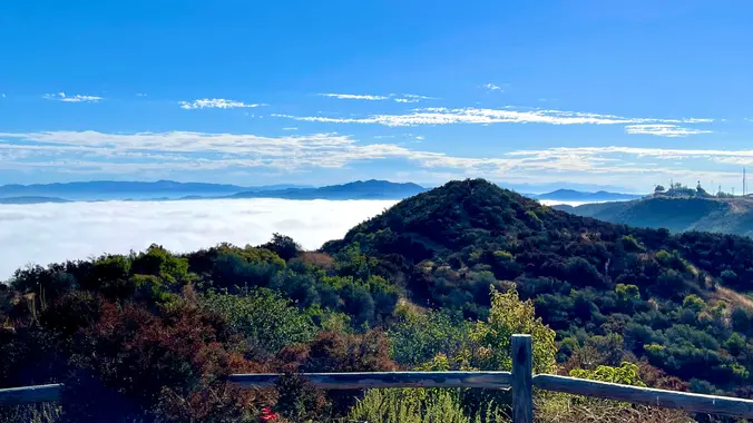
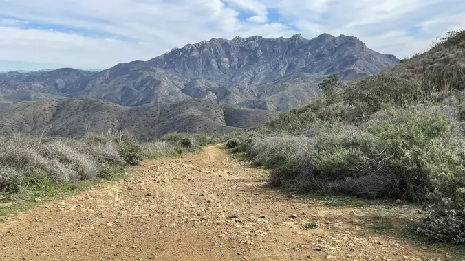
http://photos1.meetupstatic.com/photos/event/e/3/a/0/event_167038272.jpeg Hoping this trail will not be too muddy after Hurricane/Tropical Storm Hilary. This hike has some rocky parts, but no scrambling. This hike will take us on a scenic trip from the suburbs of Oak Park to the top of Simi Peak, which overlooks both the Simi and Conejo Valleys and offers splendid views […]
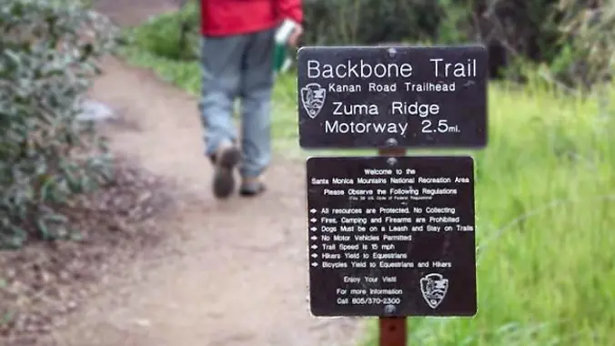
http://photos1.meetupstatic.com/photos/event/b/a/2/4/event_99467652.jpeg From the Kanan Rd trailhead, we'll jump on the Backbone Trail for a cruise down into Newton Canyon. On our way there, we'll cross the creek, pass under an oak canopy, and come out into an opening. At the opening, look toward the sandstone formations in the distance, and you'll see a trickle of […]
This is a second hike for Thursday, this hike is at Hill Canyon in Camarillo. This will be a gentler hike and we will start at 8:30, it is suppose to be a little cooler on Thursday. We will start at the parking area in Hill Canyon, cross the bridge over the runoff creek, and […]
4 miles, 950' gain, Easy Intermediate 2 miles, 550', Fit Beginner We've been getting some rain. This one should be less muddy because the trail is hard, gravelly, and rocky. This is a modified version of the famous Rocky Peak hike. It gives those that want something easier, a chance to climb one of the […]
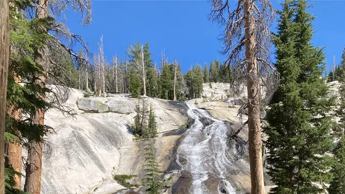
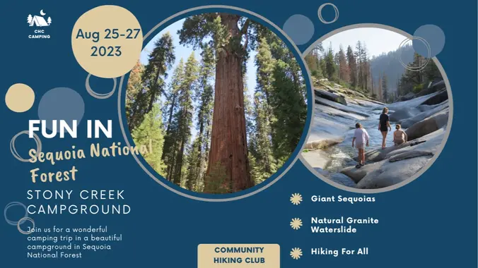
Sequoia National Forest is a beautiful alpine area with some of the largest trees on earth – the giant sequoias. Our campground is near a beautiful natural granite waterslide with swimming holes. Come prepared to get wet! Campground is about 4.5 hours from Santa Clarita. Road closures may cancel trip. Add your name to the […]
This is not an event. It's a call for music! There's often a lot of different ideas about what songs should be played. Play 80's, play new stuff, play Dance stuff, play Latin, play Blues, play MY list! To accommodate, we have a Hiking Plus playlist. It's the 3 favorite songs from each of those […]
INFORMATIONAL POSTING-November 11-12 Wilderness First Aid Course TO REGISTER PLEASE GO TO: http://wildernessfirstaidcourse.org Why Take the WFAC? More extensive and useful than Red Cross basic first aid · We teach the course twice a year in Fullerton; typically, May and November. The next class is November 11-12. · You receive 24 hours of credit for […]
INFORMATIONAL POSTING-November 11-12 Wilderness First Aid Course TO REGISTER PLEASE GO TO: http://wildernessfirstaidcourse.org Why Take the WFAC? More extensive and useful than Red Cross basic first aid · We teach the course twice a year in Fullerton; typically, May and November. The next class is November 11-12. · You receive 24 hours of credit for […]
This hike will be about 5.4 miles total with 820 ft. of elevation gain. We are starting at the parking lot at the Wahoo's parking lot. We will take Live Oak Trail. This turns into Serrano Road which will take us to Serrano Cow Trail. At this part of the trail, we usually see a […]
https://www.alltrails.com/trail/us/california/tapo-canyon-trail?u=i Hello Fellow Hikers, Join me on a easier moderate hike at Tapo Canyon Trail in Simi Valley. This hike has a nice gradual walk until we start a gradual climb were we will start our loop. We should encounter wildflowers and mountain views. Our loop will drop down then we will continue until we […]
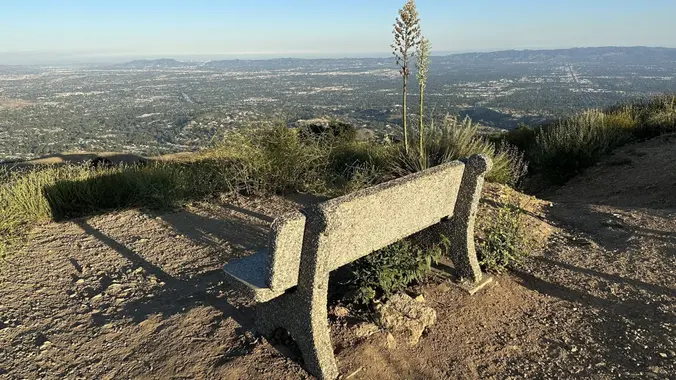
3.0 miles, 800' gain, easy-intermediate. Let's enjoy the gorgeous sunset and the almost Blue moon, and fun loaded potluck picnic at the beautiful Angel Vista! This is a potluck hike. Please bring food, drinks to share, your own cup, plate and utensils. Snacks and/or beverages to share This hike is rated easy-intermediate because it is […]
We are going to be starting at the Canyon View Staging Area. This hike will be about 6.2 miles with around 1,000 ft. of elevation gain. We will be starting at Canyon View Park and taking Cholla up to West Ridge and comic down Mathis. Link to Parking from Google Maps: https://www.google.com/maps/place/Canyon+View+Staging+Area/@33.585273,-117.7465062,17z/data=!3m1!4b1!4m5!3m4!1s0x80dce61b6bd45c2d:0x5ef3f1ad687cc8b5!8m2!3d33.585273!4d-117.7443175 Dogs are not […]
SUPER SOUL GROOVE (Disco, Funk, Soul, Motown & R&B) SUPER SOUL GROOVE is one of Southern California’s veteran, high-energy party bands that will have your feet dancing all night! Enjoy songs from Earth Wind and Fire, The Temptations, Al Green, and more. Let's enjoy potluck picnic. Please bring food, drinks to share and your own […]
http://photos1.meetupstatic.com/photos/event/9/9/3/6/event_278199222.jpeg Please read these restrictions before signing up. Pandemic conditions and restrictions apply for your safety and ours: Don't sign up unless you are two weeks past your recent vaccination Don't show up unless you're shown on the "Attending" list Unregistered or waitlisted will be turned away No "Plus Ones" on this hike You will […]
We will start (early to beat the heat) our hike near the beginning of Regal Oak Ct. on the lower Rosewood Trail, a dirt trail heading up a shaded ravine at the base of the mountains, and continue to the usual Rosewood trail. Rosewood trail presents a clear view over the 101 Freeway carving up […]
The hike we will be doing is a loop at about 5.5 miles with 725 ft. of elevation gain. We will meet at the Willow Staging Area that is right off of the 133. We will begin at the trail head of the Laurel Canyon Trail. We will take this to Lizard Trail, then we […]
While the heat is once again with us, we will stay fairly close to the coast and keep our elevation gain to a minimum. Temps are forecast to reach 89 at the furthest interior point of the hike, which we should get to by 9:30-10:00 a.m., before the heat of the day. We will start […]
This hike will be about 5.4 miles total with 820 ft. of elevation gain. We are starting at the parking lot at the Wahoo's parking lot. We will take Live Oak Trail. This turns into Serrano Road which will take us to Serrano Cow Trail. At this part of the trail, we usually see a […]
NOTE: EARLY START at 8:15 at Los Padres Drive With any luck we will encounter the faster hikers of Nancy's 8:30 group. It is still very hot, so we will take this Los Robles trail with lots of trees and begin at 8:15 and hopefully finish by 10:17. This is a loop of about 4.5 […]
NOTE: Starting at 8:30 It is still very hot, so we will take this Los Robles trail with lots of trees and begin at 8:30 and hopefully finish by 10:30. This is a loop of about 4.5 miles with about 800' of total elevation gain, spread out nicely, with a little bonus loop through Oak […]
I snagged a permit for Bishop Pass. Should be a beautiful high Sierra trip! Planning on doing a 12mi car shuttle (hike from South Lake to North Lake). Day 0 (Friday) Hopefully find some place to camp near the trailhead. Could be tough because it's a holiday weekend. Day 1 (Saturday) South Lake to Dusy […]
https://www.alltrails.com/trail/us/california/sage-ranch-center-wood-canyon-fire-road-and-guadalasca-loop Hello Fellow Hikers, This is a trail that is comprised of several trails into a loop. Will be hiking throughout the Point Mugu State Park. This route is rated hard but all the incline shows moderate and will be throughout the hike with most beginning in the middle. This trail is also rated 4.7 […]
This hike is so cool! It's a good distance with little elevation gain and it is beautiful. This hike will take us to the Brown Mountain Dam Waterfall. The hike is an out and back at around 8 miles total with 750 ft. of elevation gain, so not steep! This area of the Angeles National […]
https://www.alltrails.com/trail/us/california/saugus-to-the-sea-road-to-mission-point Hello Fellow Hikers, Gonna be hitting Mission Point again. This time from the other side of the mountain. This trail has some great inclines from the start of our hike, and pretty much a gradual incline until we reach the top. There will have a more leveled off hike until we reach the turn […]
This hike will be about 7 miles with about 700 ft. of elevation gain. We will start the hike at Cañada Vista Park. From here we will take the Tijeras Creek Trail to the Arroyo Trabuco Trail and use this to loop back to where we started. There will be a few water crossings, so […]
5.2 miles, 1140' gain, Intermediate Beginner Option: 3.5 miles, 500' gain, Fit Beginner Come to the hike only (2:30p), picnic only (4:00p), or both. Warning: Google Maps may take you to the incorrect location, although the address is correct. Please follow the written directions. The Hike 2:30 pm at the parking lot entrance. If it's […]
Trail statistics are approximate. For safety purposes always assume they are underestimated. But don’t be disappointed if they are overestimated. Bring more water and snacks than you think you’ll need.
Trail descriptions are based on previous hikes. Current conditions are unknown until arrival. Expect the unexpected and plan accordingly.
The Organizers and members of Hiking With Dean are not professional leaders, guides, or mountaineers. The function of the member or organizer is only to organize the trip. Each person who shows up for a trip/meetup (and their guest or guests) is responsible for his or her own safety. By attending a hike, or any other event organized by this group, you are acknowledging that you and any guests that you bring are aware of the risks, dangers and hazards associated with the activity and freely accept and fully assume all such risks, dangers and hazards, and further agree to release and discharge the Organizers, Members of the Hiking With Dean Meetup Group from and against any and all liability arising from your participation in the group activities per our ASSUMPTION OF RISK AND LIABILITY WAIVER and Section 6.2 of the Meetup.com Terms of Service.


Recent Comments