

Saturday July 22, 2023
Meetup Time : 7:45 A.M. (8:00 am SHARP hiking start)
It is predicted to be 100 F + in SCV this weekend. Escape with us to the cooler mountains nearby where we can enjoy the mid/high 70’s at 8,000′.
HEAT ALERT: Due to the current heat wave, I will provide a followup weather/temperature forecast by Thursday before event.
DISTANCE: 7 miles or 10.5 miles total (see Description) – out and back style.
GAIN: 1100′ or 1900′ total (see Description)
RATED: Not for beginners. This one is Moderate / Moderate +, mainly for thin air (low oxygen) impact and a few steeper stretches.
HIKE DURATION: About 4-1/2 hours (including a 20 minute snack break)
DESCRIPTION:
This 7 mile hike (3.5 miles each way) from the 8340 ft. trail head takes you to 2 summits (first Mount Pinos 8831 ft. and then Sawmill Mountain 8818 ft). Moderate hikers should be easily able to complete all three summits.
Extra credit: 3 extra miles to the final Peak at Grouse 8,573 ft and back.
Once we get to Sawmill, depending on the group make up/temperature/weather, etc. we will collectively decide, but most probably we will continue on to Grouse, yet another Peak. If we do, it would be almost 10.5 and 1200′ gain total for the hike.
Bear in mind, this entire “out and back” trail is very well marked/ easy to follow, so you can safely turn around at ANY stage, depending on your ability/ stamina. Also, we will have signposted the route with our popular orange chalk arrows to help you 🙂
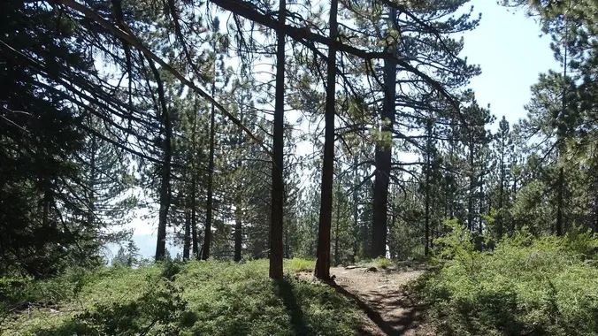
Mount Pinos is the highest point in Ventura County and lies on the edge of the Chumash Wilderness of the Los Padres National Forest. Mount Pinos, created over 100 million years ago was known as Iwihinmu to the indigenous Chumash people. The slopes are a mix of sub-alpine, white fir, and Jeffrey Pine habitats. The views from Mount Pinos are beautiful, especially if air is clear (San Joaquin Valley to the North, Tehachapi to the East, and the Carrizo Plain and Temblor Mountains to the Northwest).
Hopefully, there should still be plenty of wildflower action at this cooler altitude.
BRING:
Strong shoes, dress in layers (expecting 75 F at start). Poles are useful, if you have them; snack lunch; a hat; !!sunscreen!!, bug spray / bug net (in case). 3 liters of liquids (2L water/ 1 liter electrolytes, i.e. Gatorade), and your camera.
ADVENTURE PASS:
Not required in Summer. See bathroom note below.
MEET : (Google Coordinates 34.8135, -119.1263)
Your leader at the Mt Pinos / Nordic Hut trailhead parking at 8:00 AM; we will depart up the trail to Mt Pinos at 8:00 AM SHARP.
Allow 1-1/4 hours to get to trailhead from Santa Clarita.
DIRECTIONS: From Santa Clarita Valley: Take I-5 North ~ 40 miles to the Frazier Park off ramp. Exit, turn left under highway. Go West on the Frazier Park Road for about 12 miles passing Lockhart Valley Road (on the left) until you see signs for Mt. Pinos. Stay to the left at the main fork (do not go to Pine Mountain Club). Follow the road ahead, twisting and turning 9 miles up the mountain to the Nordic Hut parking area, at the end of the road. Park on the left side, by the Mt Pinos trailhead, and look for the group there.
NOTE: There may (or may not) be operational Porta Potty toilets at trailhead or campground nearby. We recommend a quick stop as you exit the 5 Fwy at the Truck stop / gas station on the left, before heading toward Frazier Park.
DRIVING: If you wish to arrange a carpool with friends – Towsley Canyon/ Rivendale Park (Google coordinates 34.35815928, -118.55535859) is a good meeting spot (24335 The Old Rd, Newhall, CA 91321 ) off I-5.
Leader: Gary S


