The total distance is around 4.6 miles with 870' of elevation gain. We will take Boat Canyon Trail up to Bommer Canyon. We will take Bommer to Water Tank trail. We will take this and then take a lower trail back to the beginning. Address: Dartmoor Trail Lookout Laguna Beach, CA 92651 https://goo.gl/maps/6N8c88XfdSeYu85M8 Dogs are […]
The hike we will be doing is a loop at about 5.5 miles with 725 ft. of elevation gain. We will meet at the Willow Staging Area that is right off of the 133. we will start up Willow Canyon Road. We will take this up to Bommer. We will come down Lizard to Laurel […]
This out-and-back, about 5 miles hike with an elevation gain/loss of +/-1000’ provides a great overview of the Thousand Oaks area, the ocean and the western Santa Monica Mountains. The first portion is a narrow trail that zigzags its way up and if you reach the top, you'll be enjoying 360 degree views toward Boney […]
Meet at the Rosewood sign, which is on the Regal Oak Ct. and Lynn Rd. intersection. The hike is about 5 miles with an elevation gain/loss approximately 900’. We'll walk a short distance on Lynn road to the lower Rosewood Trail, then take the dirt trail up a shaded ravine and continue on the Rosewood […]
Having trouble with the Meetup website so will make this description short. We will go from the trailhead by the outhouse and do the single track rolling trail to the fire road and go a short distance up the fire road before taking a short break and heading back. Please bring a flashlight or headlamp […]
BMFF World Tour features an international selection of films that present a wide range of outdoor adventures and portraits, including climbing, mountain expeditions, remote cultures, and the world's last great wild places! For pre-sale tickets: https://occtickets.universitytickets.com/w/event.aspx?id=2924
This hike will be about 5.4 miles total with 820 ft. of elevation gain. We are starting at the parking lot at the Wahoo's parking lot. We will take Live Oak Trail. This turns into Serrano Road which will take us to Serrano Cow Trail. At this part of the trail, we usually see a […]
The total distance is around 4.6 miles with 870' of elevation gain. We will take Boat Canyon Trail up to Bommer Canyon. We will take Bommer to Water Tank trail. We will take this and then take a lower trail back to the beginning. Address: Dartmoor Trail Lookout Laguna Beach, CA 92651 https://goo.gl/maps/6N8c88XfdSeYu85M8 Dogs are […]
We haven’t been on the Talepop Trail for quite some time, so let’s go! When I pre-hiked the route on Sunday morning, I saw four or five deer, lots of crows, some vultures, and a tarantula, but no snakes, poison oak, or thistles on the trail. Why Flip-Flop? I did find a pair of abandoned […]
This hike will be about 5.4 miles total with 820 ft. of elevation gain. We are starting at the parking lot at the Wahoo's parking lot. We will take Live Oak Trail. This turns into Serrano Road which will take us to Serrano Cow Trail. At this part of the trail, we usually see a […]
https://www.rsrpd.org/simi_valley/trails/chumash_park_and_trail.php Hello Fellow Hikers, Gonna be doing the Chumash Trail in Simi Valley to the junction of Rocky Peak then make our way back. It's a great moderate hike and a great workout with scenery of rock formations and mountain tops. The Chumash out and back is not on AllTrails but the above website will […]
The hike we will be doing will be around 5 miles long with 875 ft. of elevation gain. This will be a loop starting at the parking lot of Nix Nature Center. As you will see on the map, this is at the main park entrance off of the 133 (Little Sycamore Canyon Staging Area). […]
3.0 miles, 800' gain, easy-intermediate. Moonrise 8:09pm Let's enjoy the gorgeous sunset and the almost full moon, and fun loaded potluck picnic at the beautiful Angel Vista! This is a potluck hike. Please bring food, drinks to share. If your item requires utensils/plates/toothpicks, etc., please bring them. Snacks and/or beverages to share This hike is […]
We are going to be starting at the Canyon View Staging Area. This hike will be a little over 5 miles with around 850 ft. of elevation gain. We will be starting at Canyon View Park and taking Cholla up to West Ridge and coming down Rock-It. Link to Parking from Google Maps: https://www.google.com/maps/place/Canyon+View+Staging+Area/@33.585273,-117.7465062,17z/data=!3m1!4b1!4m5!3m4!1s0x80dce61b6bd45c2d:0x5ef3f1ad687cc8b5!8m2!3d33.585273!4d-117.7443175 Dogs […]
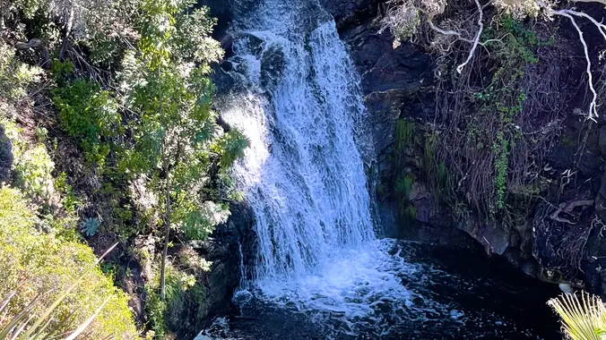
Wildwood Park in Thousand Oaks is one of the most versatile local parks there is, with 27 miles of trails skittering through rocky cliffs, cacti-filled desert environs, volcanic rock, riparian forest, and a cool, watery canyon. Highlights of the hike include waterfalls incorporating 40’ Paradise waterfalls along with a long creek, Indian caves, volcanic rock […]
School traffic and traffic on Topanga Canyon Blvd can make the drive longer than you expect, so please allow enough travel time! Topanga State Park is 36 square miles of natural wonder ensconced within Los Angeles' city limits. Starting at Trippet Ranch, we'll ramble through a shady oak grove favored by mule deer and into […]
Meet at the Rosewood sign, which is on the Regal Oak Ct. and Lynn Rd. intersection. The hike is about 5 miles with an elevation gain/loss approximately 900’. We'll walk a short distance on Lynn road to the lower Rosewood Trail, then take the dirt trail up a shaded ravine and continue on the Rosewood […]
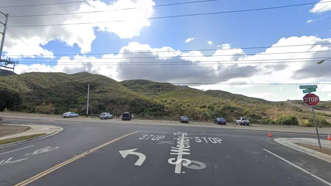
Please note this hike will start at the trailhead we use for the Boney Hike (junction of South Wendy Drive and Portrero Road). We will take the single track trail about one-half mile to where the Angel Vista TH begins to add about an extra mile to the hike. Hoping to get back before it […]
This hike will be about 5.4 miles total with 820 ft. of elevation gain. We are starting at the parking lot at the Wahoo's parking lot. We will take Live Oak Trail. This turns into Serrano Road which will take us to Serrano Cow Trail. At this part of the trail, we usually see a […]
For this adventure, we'll hike a lollipop loop, starting at the Potrero Ridge trailhead off Mountain Creek Drive in Newbury Park, climb to the top of the ridge and follow it west to the heart of the Dos Vientos trail system. From there we'll make a clockwise loop along several trails, starting with Sierra Vista, […]
To honor Bob's life and his love for hiking, we are dedicating this hike to him. We hope you can join us. Turtle Rock and French Hill hike. There are several hills with sweeping views of the coastline. The hike starts with a cardio warm up on a sustained hill, then goes on to a […]
YOU MUST REGISTER WITH THE HOST IN ADVANCE. Please no walk -ins. Host for this event is George Briggs - geob175@gmail.com We are looking forward to your visit to Keller Ski Hut (the Hut). Here are a few things to know for you visit to Keller Ski Hut. · Guests need to bring their own […]
INFORMATIONAL POSTING-November 11-12 Wilderness First Aid Course TO REGISTER PLEASE GO TO: http://wildernessfirstaidcourse.org Why Take the WFAC? More extensive and useful than Red Cross basic first aid · We teach the course twice a year in Fullerton; typically, May and November. The next class is November 11-12. · You receive 24 hours of credit for […]
INFORMATIONAL POSTING-November 11-12 Wilderness First Aid Course TO REGISTER PLEASE GO TO: http://wildernessfirstaidcourse.org Why Take the WFAC? More extensive and useful than Red Cross basic first aid · We teach the course twice a year in Fullerton; typically, May and November. The next class is November 11-12. · You receive 24 hours of credit for […]
Hike #10 in the 2023 Saturday in the Santa Monica Mountains series, will be an adventurous 9-mile, 2300’ gain loop hike, taking the Mountaineer’s Route to the 360 panoramic view at Topanga Lookout (2469’) from Stunt Road. with a stop at Saddle Peak (2805’) with ocean views and lunch with return via the Stunt High […]
I'm so excited for another Wilderness Open Access Day at Limestone Canyon. We will be doing the out and back trail to the Sinks. The hike will be about miles with roughly 630 ft. of elevation gain. **You must sign up on https://letsgooutside.org/activities/2023/10/07/wilderness-access-day-limestone-canyon-52/ At the time of posting, there are 190 spots left of 400. […]
https://www.alltrails.com/explore/recording/fri-17-nov-2017-18-49--3?p=-1&sh=aoxfvb Hello Fellow Hikers! (gonna be following kims route this was a hit the first time so join us and lets checkout her awesome hike) This is a route that Kim created on her own back when she hiked this area every week. Attached is her AllTrails recording from the last time she did this […]
Let's go see if there are still tons of frogs/toads around! The hike we will be doing is approximately 5 miles with 870 ft. of elevation gain. We will begin at the Live Oak Trail trailhead. This is where you will see on the map that the Live Oak Trail hits the paved road, right […]
Fit Beginner 4.3 miles, 480' gain. Easier Option: 4 miles, 230' gain. We walk a mostly flat section for 1.1 mi. to the 2nd junction. Easier option: Continue straight for 3/4 mi., left at the split, right after another 500', arriving at some picnic tables on the right after another 750'. Regular route: Left, heading […]
This intermediate hike starts in the Sunset Hills Open Space and includes a loop in the Woodridge Open Space. It provides views of Wood Ranch Reservoir, Simi Valley, northern Thousand Oaks, and the Tierra Rejada Valley. We’ll end with a loop around the Bard reservoir to finish with about 6.7 miles, 1300 ft gain. Directions: […]
We will start (early to beat the heat) our hike near the beginning of Regal Oak Ct. on the lower Rosewood Trail, a dirt trail heading up a shaded ravine at the base of the mountains, and continue to the usual Rosewood trail. Rosewood trail presents a clear view over the 101 Freeway carving up […]
4.25 miles, 1200' gain, intermediate We start with a 1/4 mile walk from where we park along Cottonwood Dr, to the trail head. There we make a left and take a relatively flat section and hike for about 3/4 mile. We'll come to the same tar pits as the Tapo Canyon tar pit hike, and […]
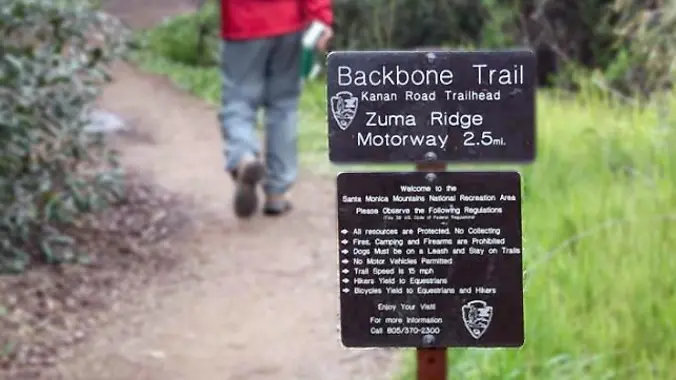
http://photos1.meetupstatic.com/photos/event/b/a/2/4/event_99467652.jpeg From the Kanan Rd trailhead, we'll jump on the Backbone Trail for a cruise down into Newton Canyon. On our way there, we'll cross the creek, pass under an oak canopy, and come out into an opening. At the opening, look toward the sandstone formations in the distance, and you'll see a trickle of […]
This hike will be about 5.4 miles total with 820 ft. of elevation gain. We are starting at the parking lot at the Wahoo's parking lot. We will take Live Oak Trail. This turns into Serrano Road which will take us to Serrano Cow Trail. At this part of the trail, we usually see a […]
Meet at the Rosewood sign, which is on the Regal Oak Ct. and Lynn Rd. intersection. The hike is about 5 miles with an elevation gain/loss approximately 900’. We'll walk a short distance on Lynn road to the lower Rosewood Trail, then take the dirt trail up a shaded ravine and continue on the Rosewood […]
http://photos4.meetupstatic.com/photos/event/d/e/9/6/event_99896982.jpeg Don’t be left behind for this hike or we will giggle when you come racing down the street to catch up! We are starting this Wildwood hike from Wildwood Avenue NOT Wildwood Park. One of many ways to experience versatile Wildwood Park, we'll start on the ridge, and travel down to the Santa Rosa […]
Many from this group, plus other friends, will attend this event at Sagebrush Cantina. The band playing (Hindsite) puts on a fantastic show, playing dance, pop, r&b/funk, and hip hop music from the 70' up to the latest hits. This is one of the best venues I've experienced on LA's west side, and this is […]
Join this rare opportunity to hoof it through the beautiful hills of OC’s most exclusive private horse trails. Challenging hill climbs with rewarding vistas throughout this moderately-paced 7-8 mile round-trip with 1,000’ elevation gain. There are bathrooms and water at the halfway point. Learn about the Prey/Predator relationship between horses and humans while getting a […]
WTC INTRODUCTORY HIKE: Echo Mtn, Inspiration Point and Mt Lowe (5597’) Hike the Sam Merrill trail to the historic railway and resort area at Echo Mtn, then up Castle Canyon to Inspiration Point and on to Muir Peak. We will return by the Middle Merrill trail. Trip is a total of 12 miles with 3900 […]
The hike I am planning is around 6.3 miles with about 700 ft. of elevation gain. It starts at the very end of the paved road, the long gray strip that can be seen on the map. We will begin at the Bell Canyon Trail head. We will continue onto that and then take it […]
4.2 miles, 700' gain, easy-intermediate. Easier option: 2.7 miles, 500' gain, fit beginner. This is a pot-luck hike. We'll be stopping at the 3/4 point by a picnic table, so please bring food and drink to share, and any utensils your items might require. We have had occasions where there were no utensils, so it […]
The total distance is around 4.6 miles with 870' of elevation gain. We will take Boat Canyon Trail up to Bommer Canyon. We will take Bommer to Water Tank trail. We will take this and then take a lower trail back to the beginning. Address: Dartmoor Trail Lookout Laguna Beach, CA 92651 https://goo.gl/maps/6N8c88XfdSeYu85M8 Dogs are […]
This hike starts at the Hill Canyon Trail and continues to the Lichen Trail via the Western Plateau and Outlaw Trails. At the peak of the ridge that separates the Western Plateau from the Santa Rosa Valley, you'll have amazing views of a beautiful system of deeply eroded canyons, plateaus, and ridgelines in the northwest […]
Please join us for a hike from Dos Vientos Community Park to the very tippy-top of Conejo Mountain, to the north. This 6-mile hike has a total elevation gain and loss of 1,450 feet (at least, according to GaiaGPS). We will cross Dos Vientos Community Park to Via Ricardo, then climb the Powerline Trail to […]
Meet at the Rosewood sign, which is on the Regal Oak Ct. and Lynn Rd. intersection. The hike is about 5 miles with an elevation gain/loss approximately 900’. We'll walk a short distance on Lynn road to the lower Rosewood Trail, then take the dirt trail up a shaded ravine and continue on the Rosewood […]
The Angeles Chapter Sierra Club's Wilderness Travel Course (WTC) will be teaming up with Montrose Search and Rescue to present a mini-webinar series on hiking safety! The first webinar, "Hiking Safety and Technology" will be held on Wednesday, October 18th from 7-8pm. Participants will learn valuable tips, tricks, and tools! Sign up here: https://www.eventbrite.com/e/hiking-safety-and-technology-tickets-734437220497?aff=oddtdtcreator Learn […]
This hike will be about 5.4 miles total with 820 ft. of elevation gain. We are starting at the parking lot at the Wahoo's parking lot. We will take Live Oak Trail. This turns into Serrano Road which will take us to Serrano Cow Trail. At this part of the trail, we usually see a […]
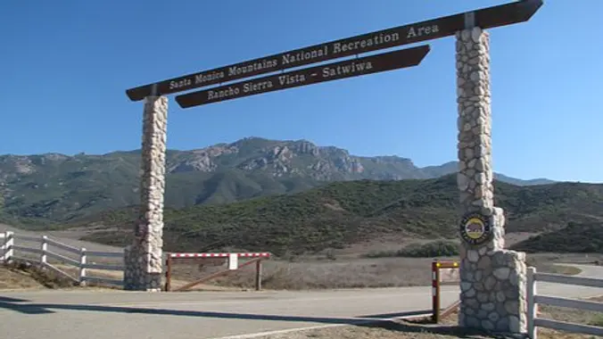
While the heat is once again with us, we will take this at a gentler pace and we will take some breaks to let slower hikers catch up. We will start in the parking lot at Rancho Sierra Vista and head up through grasslands and chaparral from the Rancho Sierra Vista trailhead, then climb up […]
3.3 miles, 800' gain, fit beginner A hike to Paradise Falls is one of the most popular things to do for those visiting Simi Valley, yet a lot of people that live nearby rarely make this fun hike or perhaps have never done it. There are several paths one can take to the falls. This […]
INFORMATIONAL POSTING-November 11-12 Wilderness First Aid Course TO REGISTER PLEASE GO TO: http://wildernessfirstaidcourse.org Why Take the WFAC? More extensive and useful than Red Cross basic first aid · We teach the course twice a year in Fullerton; typically, May and November. The next class is November 11-12. · You receive 24 hours of credit for […]
INFORMATIONAL POSTING-November 11-12 Wilderness First Aid Course TO REGISTER PLEASE GO TO: http://wildernessfirstaidcourse.org Why Take the WFAC? More extensive and useful than Red Cross basic first aid · We teach the course twice a year in Fullerton; typically, May and November. The next class is November 11-12. · You receive 24 hours of credit for […]
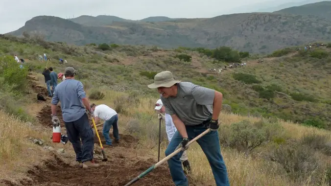
Come and join your COSCA and COSF friends to fix up some of Conejo Valley's most popular trails in Wildwood Park! We're still recovering from the many rainstorms we had last winter. You can help us restore them during the Conejo Open Space Conservation Agency's (COSCA) Fall Trail Work Day on Saturday October 21. We […]
Let's go see if there are still tons of frogs/toads around! The hike we will be doing is approximately 5 miles with 870 ft. of elevation gain. We will begin at the Live Oak Trail trailhead. This is where you will see on the map that the Live Oak Trail hits the paved road, right […]
We are going to be starting at the Canyon View Staging Area. This hike will be a little over 5 miles with around 850 ft. of elevation gain. We will be starting at Canyon View Park and taking Cholla up to West Ridge and coming down Rock-It. Link to Parking from Google Maps: https://www.google.com/maps/place/Canyon+View+Staging+Area/@33.585273,-117.7465062,17z/data=!3m1!4b1!4m5!3m4!1s0x80dce61b6bd45c2d:0x5ef3f1ad687cc8b5!8m2!3d33.585273!4d-117.7443175 Dogs […]
6.5 miles, 1300' gain, intermediate Let's enjoy hiking to the Danielson Monument in the Boney Mountain Wilderness and potluck fun! Please bring food and drinks to share, your own cup, plate and utencils. We'll have our typical snack-share social event at the top for 60-90 minutes before heading back the way we came. Please bring […]
From the Kanan Rd trailhead, we'll jump on the Backbone Trail headed west, crossing over Zuma Ridge Motorway toward Trancas Canyon. On our way there, we'll cross a stream (haha), pass under an oak canopy (a little, anyway), and come out into an opening. At the opening, look toward the sandstone formations in the distance, […]
Please note this hike begins at 8:30 am! We will meet under the solar panels and NOT by the tennis courts. Restrictions apply for your safety and ours: Don't show up unless you're on the "Attending" list Unregistered or waitlisted will be turned away No "Plus Ones" on this hike This hike will loop around […]
4.6 miles, 900' gain, easy-intermediate This route takes us through a beautiful canyon via a counter-clockwise lollipop. Most of the hike has a clear view of the sky, with a few parts that have tree cover. We'll be stopping at the half-way point for a snack and beverage share. We'll start at the Palo Comado […]
Meet at the Rosewood sign, which is on the Regal Oak Ct. and Lynn Rd. intersection. The hike is about 5 miles with an elevation gain/loss approximately 900’. We'll walk a short distance on Lynn road to the lower Rosewood Trail, then take the dirt trail up a shaded ravine and continue on the Rosewood […]
https://a248.e.akamai.net/secure.meetupstatic.com/photos/event/4/5/b/c/event_52757852.jpeg Don't show up unless you're shown on the "Attending" list Unregistered or waitlisted will be turned away No "Plus Ones" on this hike Time to re-explore the Los Robles trail system! This will be a 6 mile salt water taffy hike with approximately 1000 feet of elevation gain. We start at the trailhead at […]
Let's reacquaint ourselves with the spectacular rock formations and beautiful scenery in Red Rock Canyon, between Topanga and Calabasas. This hike is 5.25 miles and 1,000' total feet of gain, loss, gain, loss, gain, and loss :-). ; A map of our route is in the Photos and on GaiaGPS. The main route is on […]
Easy Intermediate, 4.5 miles, 600' gain Easier Option, 3.5 miles, 460' gain This is a unique loop through Wildwood Park that takes us to the famous Lizard Rock. There are several extended inclines and a few short but steep climbs that cause this to be rated on the easy end of the intermediate spectrum. Beginners […]
This hike will be about 5.4 miles total with 820 ft. of elevation gain. We are starting at the parking lot at the Wahoo's parking lot. We will take Live Oak Trail. This turns into Serrano Road which will take us to Serrano Cow Trail. At this part of the trail, we usually see a […]
The hike will be about 4.5 miles with about 500 ft. of elevation gain. We will start on Peters Canyon Trail and take this to East Ridge View Trail. This is where we will go up Big Red. Then we will continue on this trail until we get to Eucalyptus to loop back. We will […]
Join the Wilderness Adventures Section (WAS) for a fall picnic! We will work up our appetites with a hike in Duekmejian Wilderness Park followed by a picnic. Old, new, and perspective WAS members and friends are welcome as we enjoy the fall weather and share our summer adventure stories. Hike: Meet at 10:00 AM on […]
The total distance for this hike is 4.5 miles with about 650 ft. of elevation gain. There are great mountain and ocean views along the ridge. We are going to start on Bommer Ridge Trail and take this to Lizard Trail. We will go down that and loop back up to Bommer via Upper Laurel. […]
http://photos1.meetupstatic.com/photos/event/b/f/8/6/event_22189030.jpeg Space Mountain is the name for Los Robles Trail West, starting at Moorpark Road in Thousand Oaks and switchbacking up the hill to the west. No one seems to know why it's called Space Mountain, though maybe the Disney ride inspired it. Maybe former major league pitcher Bill "Spaceman" Lee had something to do […]
Meet at the Rosewood sign, which is on the Regal Oak Ct. and Lynn Rd. intersection. The hike is about 5 miles with an elevation gain/loss approximately 900’. We'll walk a short distance on Lynn road to the lower Rosewood Trail, then take the dirt trail up a shaded ravine and continue on the Rosewood […]
https://a248.e.akamai.net/secure.meetupstatic.com/photos/event/4/5/b/c/event_52757852.jpeg Don't show up unless you're shown on the "Attending" list Unregistered or waitlisted will be turned away No "Plus Ones" on this hike Time to re-explore the Los Robles trail system! This will be a 6 mile salt water taffy hike with approximately 1000 feet of elevation gain. We start at the trailhead at […]
The total mileage for this hike is 5 miles with about 800 ft. of elevation gain. We will start at the trail head of the Borrego Trail, which is right off of the parking lot. This is where we will meet. We will head up the Borrego Trail until we get to Mustard Road. Here […]
This hike starts in the Rancho Sierra Vista Trailhead parking lot, and traverses the Satwiwa area, climbs to the old windmill, and then continues up, up, and up to a beautiful view of the upper Sycamore Canyon and Hidden Valley. We'll loop around the hill at the top, then zig-zag our way back down the […]
If you're waitlisted for Steve's hike, please sign up for this one, and then remove yourself from Steve's waitlist. This alternate hike starts at the Wendy/Potrero trailhead, and traverses the Satwiwa area in the opposite direction to Steve's hike, climbs to a beautiful view of the upper Sycamore Canyon and Hidden Valley, does a loop […]
Another HWD Original! The HWD Ranch is located within the stunning Hidden Creeks parkland near the confluence of Browns Creek and Mormon Creek. The parkland provides a key migration corridor and perennial water source to a full complement of large mammals including black bear, mountain lion, mule deer, bobcat, American badger, grey fox, long-tailed weasel, […]
WTC INTRODUCTORY HIKE: MT LUKENS Mt Lukens it the highest point in the City of LA. Invigorating conditioning hike at a moderate pace. 9 mile r/t, 2800’ gain. Leaders will provide an overview of the Wilderness Travel Course (WTC), which begins January 2024 (WWW.WILDERNESSTRAVELCOURSE.ORG) Subjects include safe mountain travel, map & compass and wilderness first […]
This hike is so cool! It's a good distance with little elevation gain and it is beautiful. This hike will take us to the Brown Mountain Dam Waterfall. The hike is an out and back at around 8 miles total with 750 ft. of elevation gain, so not steep! This area of the Angeles National […]
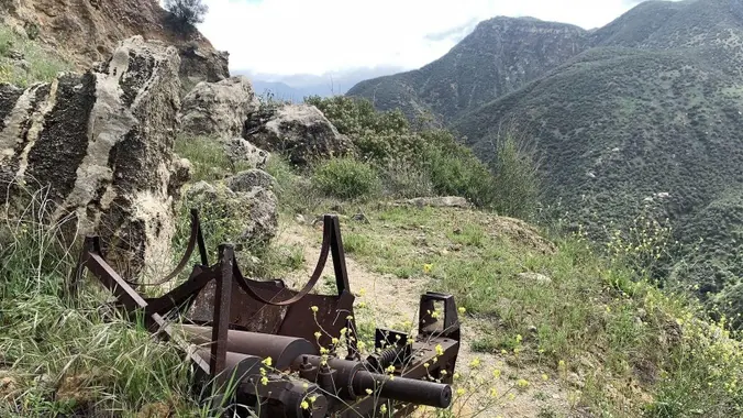
Trail starts with a flat field walk ,after 3 miles down and flat, there is one famous car wreck hill in Aliso Woods, where you can see one abandoned 1946 Dodge 5-passenger coupe,there is no explanation as to how this car ended up here, with no paved roads within miles of its resting place? After […]
The hike we will be doing will be around 5 miles long with 875 ft. of elevation gain. This will be a loop starting at the parking lot of Nix Nature Center. As you will see on the map, this is at the main park entrance off of the 133 (Little Sycamore Canyon Staging Area). […]
Time change! Enjoy extra one hour sleep and come at 4pm! Easy-Intermediate, 4 miles, 800' gain. Option not to hike: If for some reason you don't want to hike but still want to come, the social event can be driven to, and the main group of hikers should get there about an hour after we […]
Trail statistics are approximate. For safety purposes always assume they are underestimated. But don’t be disappointed if they are overestimated. Bring more water and snacks than you think you’ll need.
Trail descriptions are based on previous hikes. Current conditions are unknown until arrival. Expect the unexpected and plan accordingly.
The Organizers and members of Hiking With Dean are not professional leaders, guides, or mountaineers. The function of the member or organizer is only to organize the trip. Each person who shows up for a trip/meetup (and their guest or guests) is responsible for his or her own safety. By attending a hike, or any other event organized by this group, you are acknowledging that you and any guests that you bring are aware of the risks, dangers and hazards associated with the activity and freely accept and fully assume all such risks, dangers and hazards, and further agree to release and discharge the Organizers, Members of the Hiking With Dean Meetup Group from and against any and all liability arising from your participation in the group activities per our ASSUMPTION OF RISK AND LIABILITY WAIVER and Section 6.2 of the Meetup.com Terms of Service.





























Recent Comments