4.6 miles, 1000' gain, Easy Intermediate Easier Option - 2.7 miles, 320' gain Many have gotten lost relying on GPS. This is the Wendy Trailhead, where S. Wendy Dr. ends at Potrero Rd. Heading out, we cross a creek, turn right at the split, then Turn right at the dead end. We regroup at the […]
Our Friends of the Library at Orange Coast College are hosting the Banff Film Festival once again (post-Covid). Check out the film lineup for Wednesday and/or Thursday, and join avid hikers, backpackers, climbers, and generally cool adventurers at this fun event. Buy tickets directly through the below link. https://prod.orangecoastcollege.edu/academics/library/friends-of-the-library-events.html?fbclid=IwAR3GffIik-8RZmYXgUoxOPINn9IkXLcpbQXPU5Ov7yGjw43iB_oRkPb_Dpo
3 miles, 1000' gain, Intermediate. The entire first half is an incline. Nothing super steep, but beginners may find this climb exhausting. Fit beginners can still complete this hike, as we'll be stopping at junctions to let everybody catch up. This is not a conditioning hike, it is a social hike. There are several routes […]
https://www.alltrails.com/trail/us/california/tapo-canyon-trail?u=i Hello fellow hikers, The heat is here but we still need to keep moving so the goal is to hit this trail (which has partial shade ) and be back at our cars before it gets to hot... so... Join me on a easier moderate hike at Tapo Canyon Trail in Simi Valley. This […]
The hike I am planning is around 6.3 miles with about 700 ft. of elevation gain. It starts at the very end of the paved road, the long gray strip that can be seen on the map. We will begin at the Bell Canyon Trail head. We will continue onto that and then take it […]
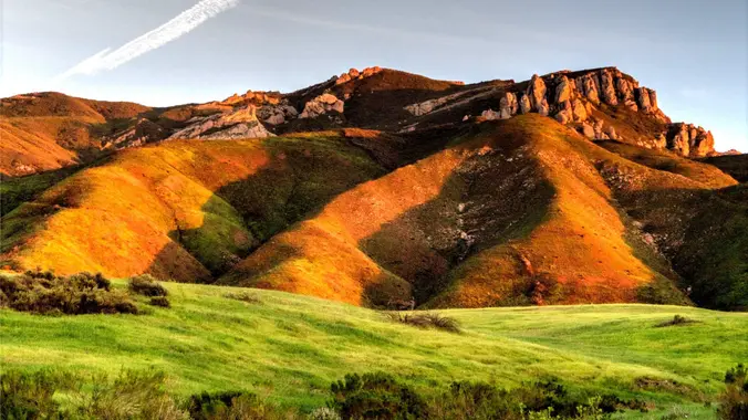
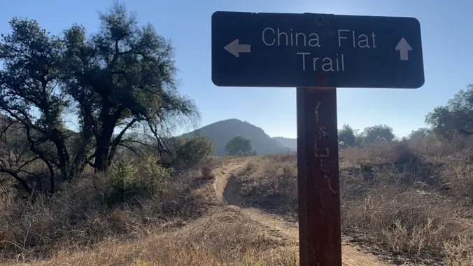
https://www.alltrails.com/trail/us/california/palo-comado-china-flats-loop Hello Fellow Hikers, Okay I think it is finally gonna cool down. So let's get in a hike. This is a pretty popular area with both hikers runners and mountain bikers. This trail is popular due to all the views. Will have both mountain views and open spaces with the first section more rocky […]
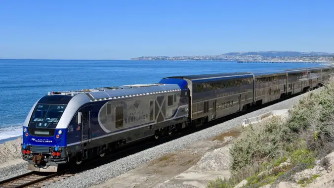
LET'S TAKE THE TRAIN --- FROM SIMI TO CARP! Saturday - October 1, 2022 TRAIN SCHEDULES AND PRICES ARE NOT SET/VERIFIED YET... I WILL UPDATE THEM HERE SOON! Depart the Simi Valley station at 10:07 AM and arrive in Carpinteria at 11:20. We can meet near the tracks starting around 9:20 AM. The AVOCADO FESTIVAL […]
Sunday October 02, 2022 : Los Pinetos Trial to Wilson Saddle, or on to Los Pinetos Peak (the Antennas), Both are Out and Back ** IF RAIN IS FALLING AT TRAILHEAD THIS HIKE WILL BE CANCELED ** Hike: Meet at 7:15 AM to head up trail at 7:30 AM (details below) DISTANCE: 7 miles Total, […]
Do you know how to use a compass? Oct. 2 Want to learn how to read a topo map? Nov. 6 How do you use a topo map and compass to navigate? Dec. 11 Maybe you learned but forgot and want to review? Come along... Wilderness Travel Course instructors are offering this FREE intro series […]
The hike we will be doing is a loop at about 5.5 miles with 725 ft. of elevation gain. We will meet at the Willow Staging Area that is right off of the 133. We will begin at the trail head of the Laurel Canyon Trail. We will take this to Lizard Trail, then we […]
Easy Intermediate, 4.5 miles, 600' gain Easier Option, 3.5 miles, 460' gain This is a unique loop through Wildwood Park that takes us to the famous Lizard Rock. There are several extended inclines and a few short but steep climbs that cause this to be rated on the easy end of the intermediate spectrum. Beginners […]
5.4 miles, 1050' gain, Easy Intermediate This hike is one of the most beautiful hikes in Simi Valley. There are 3 extended inclines, about 1000 steps each, on fire road. They are not especially steep, but they do continue for some time, which is why it is rated "Easy Intermediate." There are also several small […]
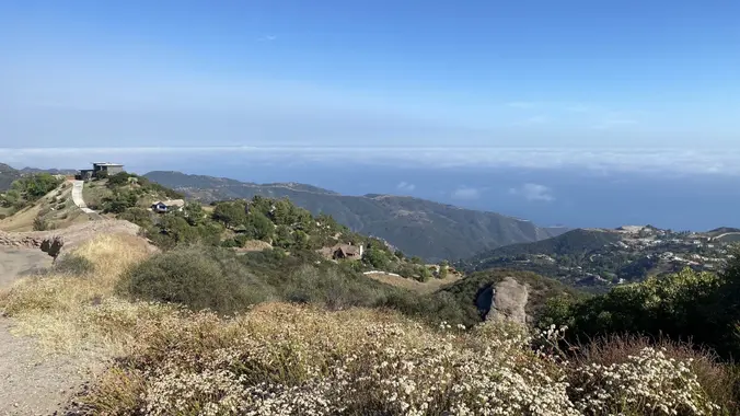
https://www.alltrails.com/trail/us/california/backbone-trail-loop Hello Fellow Hikers, We have another request and what a beautiful trail at that. This is one of the prettiest routes on the Backbone Trail. Will be doing this hike clockwise to tackle the hard stuff first and go up the incline instead of down it. Easier on the knees. This trail will have […]
I’m very excited to plan another hike up to the Hollywood Sign and the Bronson Caves. This will take us to the summit of Mt. Lee where we will get the best views of the Hollywood Sign. The total mileage for our journey will be approximately 7 miles. Our elevation change should be about 1,200 […]
Please read the full Description below CAREFULLY so you are aware of all meeting time/ location/ directions, details etc. THX La Jolla Cyn Trailhead/ Ray Miller Backbone Trail / Overlook Trail to La Jolla Valley Trail Camp TIME(s): Meet at Trailhead (at the back of the parking lot) at 7:45 AM to start hiking at […]
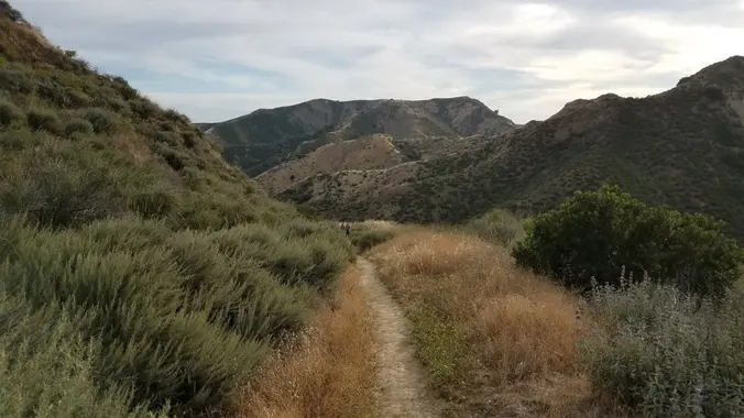
We begin our journey in Liberty Canyon — one of three natural preserves in Malibu Creek State Park. The canyon has a rare stand of California valley oak. Soon we turn west onto the Phantom Trail, cross a creek, up a ridge, then south and rise further along the western ridge of Liberty Canyon. We […]
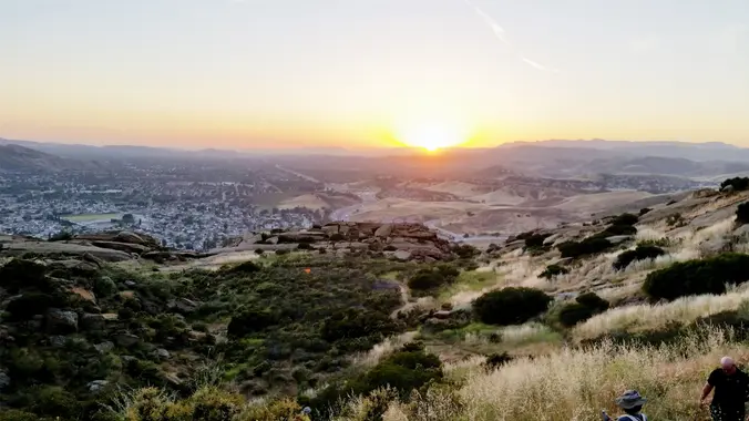
3.0 miles, 800' gain, easy-intermediate. Let's enjoy the gorgeous sunset and the full moon, "Full Harvest Moon", at the beautiful Angel Vista! This hike is rated easy-intermediate because it is a continuous incline for 1.5 miles. This isn't real steep, but it is continuous, and many beginner hikers have indicated this should be rated intermediate. […]
Distance: 3.5 miles, Gain: 700', Intermediate. This was previously designated easy-intermediate, but some thought it should be labeled as intermediate because of the extended inclines. A strong and motivated beginner can do this hike. They would be challenged and slow during a few of these climbs. That's OK, because this is not a conditioning hike, […]
3.5 miles, 600' gain, Easy Intermediate Easy Option: 2.4 miles, 285' gain, Fit Beginner A fit beginner can handle this. There are a couple extended inclines, so I've rated this at the easy end of the intermediate spectrum. That's OK, because this is a social hike, not a conditioning hike. We'll stop at various points […]
We are going to hike on Bommer Ridge Trail the whole time. We are going to take this until we hit the top of Boat Canyon, and then turn around. The total distance for this hike is 7.6 miles and we will get 900-1,000 ft. of elevation gain. There are great mountain and ocean views […]
https://www.alltrails.com/trail/us/california/towsley-canyon-loop-trail Hello Fellow Hikers, This is a great trail and area. A must to do at least once. Beautiful mountain views. This trail will have inclines and level off sections with both open views and shaded areas. We are gonna conjour this trail going clockwise to get the incline over with in the beginning and […]
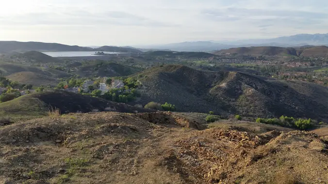
SATURDAY October 15, 2021 - Chumash Trail (Simi Valley) to Rocky Peak **** RAIN FALLING AT TRAILHEAD CANCELS ALL HIKES **** DISTANCE: ~ 8.0 Miles, Round trip, Out and Back style GAIN: 1400' Approx. DURATION OF HIKE: ~4 hours including a 20 minute break RATING: Moderate + , for gain/ distance Description: This weekend is […]
The hike will be about 4.5 miles with about 500 ft. of elevation gain. We will start on Peters Canyon Trail and take this to East Ridge View Trail. This is where we will go up Big Red. Then we will continue on this trail until we get to Eucalyptus to loop back. We will […]
https://www.alltrails.com/trail/us/california/tapo-canyon-trail?u=i Hello fellow hikers, The heat is here but we still need to keep moving so the goal is to hit this trail (which has partial shade ) and be back at our cars before it gets to hot... so... Join me on a easier moderate hike at Tapo Canyon Trail in Simi Valley. This […]
Distance 6 miles, Gain: 1400', Intermediate This hike is intermediate because of the continuous incline for the final mile on the way out. Still, fit beginners can complete this hike. It's a social hike, so we won't be doing it at a fast pace, and we'll be regrouping at the two points where we must […]
5.7 Miles, 1000' gain, Intermediate The starting point is NOT at the golf course entrance. It is at a dirt lot that can hold at least 50 cars. There is some real incline on this hike and a lot less trails coated with silt compared to the easier Happy Camp hike. Even though I have […]
4 miles, 1100' gain, Intermediate Easy Option: 1.5 miles, 400' gain, Fit Beginner The entire hike outbound is a steady incline. Nothing super steep, just continuous and quite strenuous for many. There are virtually no junctions where one can get lost. This is one of the more famous hikes in Simi Valley, and for good […]
The hike we will do starts from the parking lot across from the Ortega Oaks Candy Store. It will be 6.8 miles (total) with 1200 ft. of elevation gain. We will take the Bear Canyon Loop Trail to the 4 Corners trail junction. We will take the Bear Ridge Trail back and do a lollipop […]
Join our Facebook group at https://www.facebook.com/groups/hikingwithdean/ POST HIKE LUNCH: SONNY McLEAN'S 2615 Wilshire Boulevard Santa Monica, CA 90403 Take Allenford/26th st toward Wilshire https://goo.gl/maps/UnP6etQqotaUXGxU9 THE HIKE A hidden staircase, the longest public staircase in Los Angeles, drops 24 stories into the middle of lush Rustic Canyon. I will combine a 6-mile hike with the stairs […]
All bikes are welcome. On this one we’ll travel through Topanga State Park with stops at Eagle Rock, Parker Mesa, the Hub and Eagle Springs This outing will be an opportunity to discuss ebike tips and tricks. I am on my third ebike (pictured above) We’ll ride at a pace suitable for semi-beginners on mostly […]
We are going to hike on Bommer Ridge Trail the whole time. We are going to take this until we hit the top of Boat Canyon, and then turn around. The total distance for this hike is 7.6 miles and we will get 900-1,000 ft. of elevation gain. There are great mountain and ocean views […]
Fit Beginner 4.3 miles, 480' gain. There is an out-and-back option that lowers the gain to 230'. This is a pot luck picnic. Please bring something to eat and drink, and a little extra to share. If your item requires it, bring plates and utensils to share. Pot Luck guidelines: https://www.meetup.com/Hiking-Plus/messages/boards/thread/50879772 We'll share snacks and […]
3.3 miles, 800' gain, fit beginner A hike to Paradise Falls is one of the most popular things to do for those visiting Simi Valley, yet a lot of people that live nearby rarely make this fun hike or perhaps have never done it. There are several paths one can take to the falls. This […]
Join us at the REI in Tustin to learn about the treasures in our own backyard. We'll talk about how to find places to go, guided, solo, and groups to join, what apps and websites are helpful, and much more. Find inspiration and challenge as well as valuable information in this short one hour session. […]
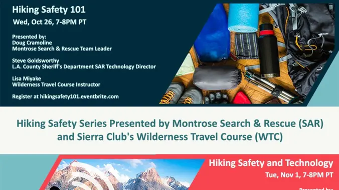
Register through Evenbrite link Join experts from Montrose Search & Rescue (SAR) and Sierra Club’s Wilderness Travel Course (WTC) for a discussion on hiking safety tips that can help hikers stay safe whether traveling alone or in a group. Montrose SAR will share real-life examples of recent rescues and provide insight on what could be […]
4.25 miles, 1200' gain, intermediate We start with a 1/4 mile walk from where we park along Cottonwood Dr, to the trail head. There we make a left and take a relatively flat section and hike for about 3/4 mile. We'll come to the same tar pits as the Tapo Canyon tar pit hike, and […]
Details We've been doing this one in Chatsworth since 2009, and is one of our most popular hikes. It's the scariest hike this side of Transylvania! Check out the scary night version here This will be a potluck/social event so bring some booze, edibles, etc to share …..A group of innocent hikers, unaware of […]
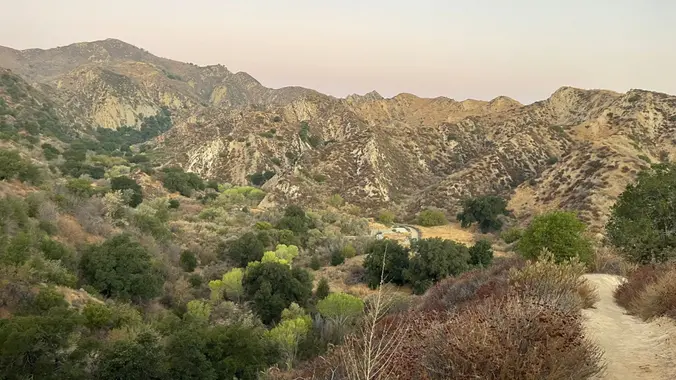
Details Distance/ Gain: The hike is a 6-mile loop with about 1200 feet of gain. Rating: Moderate + (mainly for distance and altitude). Description: Mt Waterman is better known as a ski area in the San Gabriel Mountains off Highway 2. It recently was hit by the Bobcat fire and is just now starting to […]
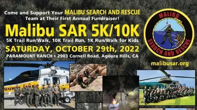
This is an informational post to help support Malibu Search and Rescue. Some of our members may participate in this event. To Register: https://tinyurl.com/msarrun 10K Trail Run @ 7:45 AM 5K Trail Run/Walk @ 8:00 AM 1K Kids Run/Walk @ 9:00 AM (under 13 only) Course Information The Malibu Search & Rescue Trial Race (run […]
We've been doing this one in Chatsworth/Twin Lakes since 2009. It's the scariest hike this side of Transylvania! The decorations are a little worn and I don't know if the solar lights are still working, but it will be a fun hike. There is a nice spot where we can share some drinks and small […]
https://www.alltrails.com/trail/us/california/san-vicente-mountain-old-nike-missile-site-trail--3/photos Hello Fellow Hikers, We are gonna be visiting LA96C Nike Missile Site to start our trail. Then will continue on Sullivan fire road down the mountain. Now for a little piece of history about our hike.... During the Cold War this was a military reservation. LA96C was one of 16 Nike missile sites that […]
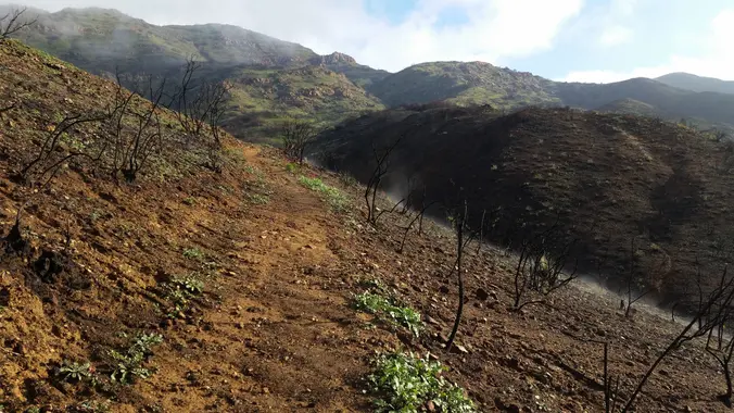
https://www.alltrails.com/trail/us/california/devils-chair-trail Hello Fellow Hikers, It's Halloween! What better hike to do then Devils Chair?! This trail is a fan favorite among hikers but unfortunately was devastated in the Bobcat fire and closed for a few years. It has finally reopened and what better day to hike it. Now a little about the trail....When you arrive […]
Intermediate, 5 mi, 1200' gain The address is a nearby address that may cause your GPS to drive past the trailhead. It is not the address of the hike. This variation is called Hidden Lollipop. Hidden because it includes a hike down the Hidden Canyon trail, Lollipop because of the shape of the route. There […]
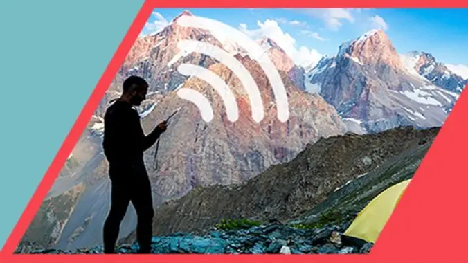
Use the Eventbrite link to reserve your spot. Join experts from Montrose Search & Rescue (SAR) and Sierra Club's Wilderness Travel Course (WTC) for a discussion on how technology has changed the landscape of hiking safety. Learn tips, tricks and tools that you can leverage to stay safe in the outdoors. Montrose SAR will share […]
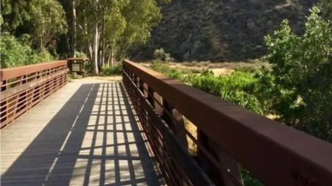
5.3 miles, 600' gain, Easy-Intermediate 2.5 miles, 100' gain, Beginner We start by crossing a bridge into a wooded area and continue down a relatively flat path alongside a stream. After about a mile, we'll come to a junction. For those that want the full hike, we'll turn right and complete a 3 mile loop […]
This week's hike will be in the Los Robles area of the Santa Monica Mountains. We'll begin at the Triunfo Canyon trail head and hike up one of the nicest trails in the Los Robles trail system, including White Horse Canyon and Conejo Crest Hike is about 9.5 miles and rated DIFFICULT. See hike rating […]
Let's enjoy another Open Access Day! This is where we get to explore trails that are normally closed off to the public. The plan is to a loop that's 3.5 to 4 miles with around 550 ft. of elevation gain. Since this is shorter, the plan is to take our time and explore. You don't […]
Saturday November 5, 2022 – PCT North to Fish Creek Trail Camp/ back via Maxwell Road (in part) Meet at Trailhead: 8:15AM, directions/ details below We leave at 8:30 Sharp. Distance: ~ 8 miles total, out and back / lollipop style hike (as we will only be on Maxwell Road for a short while coming […]
All about Topo Maps Maximize your understanding of the data points in the margins, identify natural and man-made features, learn about contour lines, gullies, ridges, peaks, and more. Wilderness Travel Course instructors are offering this FREE intro series to navigation. It's best if you can take all three, but join for any you can fit […]
3.0 miles, 800' gain, easy-intermediate. Let's enjoy the gorgeous sunset and the biggest full moon of the year, Harvest moon, at the beautiful Angel Vista! This hike is rated easy-intermediate because it is a continuous incline for 1.5 miles. This isn't real steep, but it is continuous, and many beginner hikers have indicated this should […]
Trail statistics are approximate. For safety purposes always assume they are underestimated. But don’t be disappointed if they are overestimated. Bring more water and snacks than you think you’ll need.
Trail descriptions are based on previous hikes. Current conditions are unknown until arrival. Expect the unexpected and plan accordingly.
The Organizers and members of Hiking With Dean are not professional leaders, guides, or mountaineers. The function of the member or organizer is only to organize the trip. Each person who shows up for a trip/meetup (and their guest or guests) is responsible for his or her own safety. By attending a hike, or any other event organized by this group, you are acknowledging that you and any guests that you bring are aware of the risks, dangers and hazards associated with the activity and freely accept and fully assume all such risks, dangers and hazards, and further agree to release and discharge the Organizers, Members of the Hiking With Dean Meetup Group from and against any and all liability arising from your participation in the group activities per our ASSUMPTION OF RISK AND LIABILITY WAIVER and Section 6.2 of the Meetup.com Terms of Service.


Recent Comments