There's an 80% chance of rain predicted for Tuesday, so rain cancels this hike. Rain is also predicted for Sunday and Monday, so trails will be wet and susceptible to damage, so we'll walk down the asphalt to Ranch Center, and return, for a total of six miles and 800' of elevation gain and loss. […]
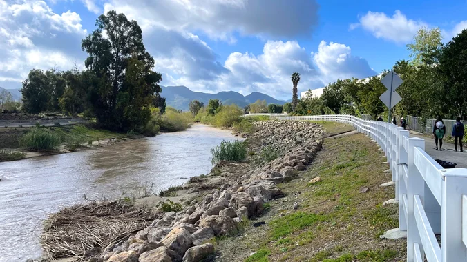
Let’s get out and repeat hike/walk the Calleguas Creek Bike Path along with a neighborhood trail that we can walk on without getting our feet wet or muddy. There are waterfalls in the creek during the rainy season that winds along the east side of Camarillo, a bedroom community on the outskirts of Los Angeles. […]
Distance: 3.5 miles, Gain: 700', Intermediate. This was previously designated easy-intermediate, but some thought it should be labeled as intermediate because of the extended inclines. A strong and motivated beginner can do this hike. They would be challenged and slow during a few of these climbs. That's OK, because this is not a conditioning hike, […]
Instead of Black Friday shopping, come burn off your Thanksgiving calories with Trail Mix! The hike we will be doing will be around 5 miles long with 875 ft. of elevation gain. This will be a loop starting at the parking lot of Nix Nature Center. As you will see on the map, this is […]
To be considered, you and I must have trip history together. Please add yourself to the wait-list to indicate interest. This is a difficult, dry, explorative backpack over rocky, prickly terrain. I am looking for qualified team members who are interested in seeking out locations of historical or cultural significance. Additional qualifications include a go-with-the-flow […]
This hike will be at Crystal Cove State Park. We will be doing part of the Moro Canyon trails. This hike will be about 6.6 miles with approximately 1,000 ft. of elevation gain. We are beginning at the Ridge Park Entrance (see the map for exact details on where to go.) This hike will take […]
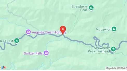
Moderately challenging 8.4 mile, 2150 ft gain hike through Colby Canyon ending at Josephine Peak. We will begin at the Colby Canyon trailhead, pass a seasonal waterfall, and begin the moderately strenuous ascent through oaks and chaparral to Josephine Saddle. From the saddle, we will head west along the Strawberry Spur Trail to reach the […]
Join me on a moderate five mile loop with a total elevation gain/loss of about 800 ft. Please meet at the Dos Vientos Community Park Tennis Courts near the corner of Rancho Dos Vientos and Borchard Rd. This hike explores some of the neighborhood trails in the Dos Vientos area of the southwestern Conejo Valley. […]
We are going to be starting at the Canyon View Staging Area. This hike will be about 6.2 miles with around 1,000 ft. of elevation gain. We will be starting at Canyon View Park and taking Cholla up to West Ridge and comic down Mathis. Link to Parking from Google Maps: https://www.google.com/maps/place/Canyon+View+Staging+Area/@33.585273,-117.7465062,17z/data=!3m1!4b1!4m5!3m4!1s0x80dce61b6bd45c2d:0x5ef3f1ad687cc8b5!8m2!3d33.585273!4d-117.7443175 Dogs are not […]
Need to work off some Thanksgiving dinner? If you also like stunning views, lush oak groves, and getting away from it all (while not really being too far from home) you’ll love this hike! Thanks to Dave, who pre-hiked this awhile back and was kind enough to let me leverage his efforts. We’ll take Oak […]
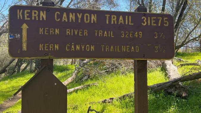
Moderate Hike Tomorrow to the Bench! Let's hike on the Kern Canyon River Trail to the Bench and burn some Thanksgiving calories. Distance: 10 miles roundtrip (up and back hike) Ascent: 1,100 feet Hiking time: Around 5 hours Meeting Location: Shell gas station on Highway 178 and Comanche Dr. https://goo.gl/maps/XhFx1HKrxkckrEvB9 Meeting Time: 9:00 a.m. by […]
Learn New Skills-Make New Friends-Experience New Adventure Details Informational Posting Only - See Website at www.wildernesstravelcourse.org INFORMATIONAL POSTING ONLY www.wildernesstravelcourse.org Dear Group Members, particularly the recent swell of new, never-been-backpacking-before-but-want-to-start members: There is a great Sierra Club opportunity that is about to begin….an opportunity that only happens one time each year and it is one […]
Learn New Skills-Make New Friends-Experience New Adventure Details Informational Posting Only - See Website at www.wildernesstravelcourse.org INFORMATIONAL POSTING ONLY www.wildernesstravelcourse.org Dear Group Members, particularly the recent swell of new, never-been-backpacking-before-but-want-to-start members: There is a great Sierra Club opportunity that is about to begin….an opportunity that only happens one time each year and it is one […]
School traffic and traffic on Topanga Canyon Blvd can make the drive longer than you expect, so please allow enough travel time! Topanga State Park is 36 square miles of natural wonder ensconced within Los Angeles' city limits. Starting at Trippet Ranch, we'll ramble through a shady oak grove favored by mule deer and into […]
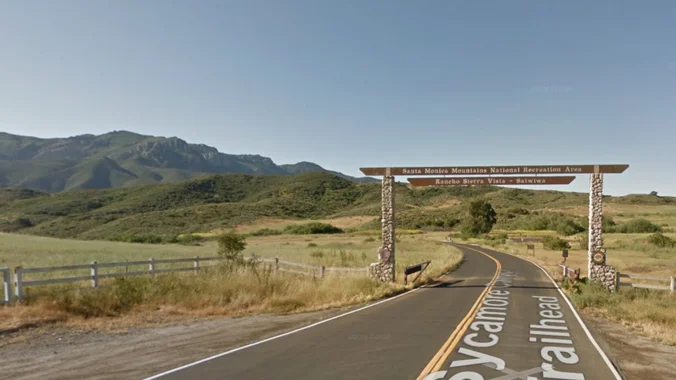
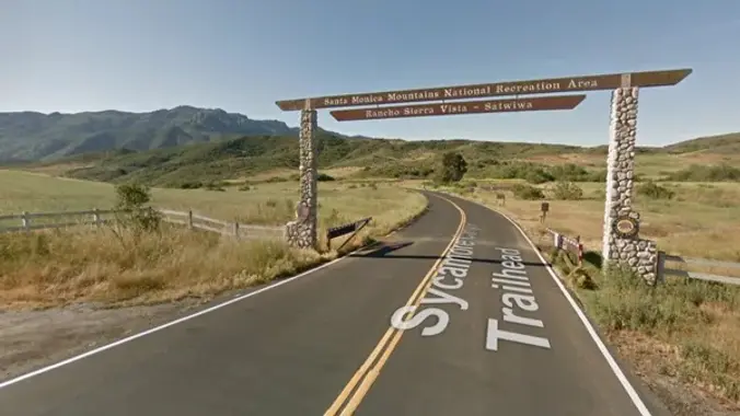
This hike starts at the Rancho Sierra Vista parking lot, goes down to the bridge on Sycamore Canyon asphalt, but then turns up the canyon alongside Upper Sycamore Creek. Along the way, we'll be in the shade of Boney Mountain while we climb, doing a handful of easy water crossings and finding a number of […]
Distance: 3.5 miles, Gain: 700', Intermediate. This was previously designated easy-intermediate, but some thought it should be labeled as intermediate because of the extended inclines. A strong and motivated beginner can do this hike. They would be challenged and slow during a few of these climbs. That's OK, because this is not a conditioning hike, […]
Note that this is a different start than the usual Rancho Sierra Vista Parking Lot!! Read carefully!! We have not done this hike in over a year and a half. We will meet at the trailhead parking area at the intersection of Wendy and Portrero Road. Pay attention as this is different than the Parking […]
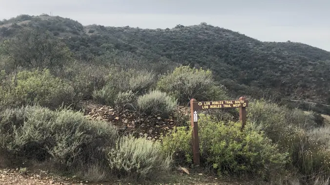
This hike is about 5 miles with 800' of total elevation gain, spread out nicely, with a little bonus loop through Oak Creek Canyon. This in addition to Cheryl's hike, but slower and easier. "Robles" is Spanish for oaks, and we'll see plenty of them on this beautiful, relaxing hike. After a short street walk […]
5 miles, 500' gain, Beginner This hike is a great trail for beginners because all the elevation gain is distributed. It is a walk down a rolling fire road through a really cool canyon, and you will find no difficult or extended elevation climbs. This is one of my favorite trails for people new to […]
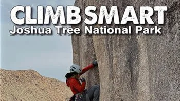
December 6-8, 2024 (registration link at the bottom) ClimbSmart is the largest gathering of climbers at Joshua Tree, and is owned and managed by Friends Of Joshua Tree (501 c3, founded 1991). Now in its 29th year, this event kicks off the climbing season in Joshua Tree with education and stewardship as the primary pillars, […]
Hike #12 in the 2024 Saturday in the Santa Monica Mountains series, will be an adventurous 11-mile, 3000’ hiked from Burbank Peak to Beacon Hill passing by Bee Rock, the Hollywood Sign, Dante’s View, and the Old Zoo. Peaklets, rocks, and hills include Bee Rock (1056’), Taco Peak (1572'), Mt. Bell (1587’), Baby Bell (1570’), […]
This hike is so cool! It's a good distance with little elevation gain and it is beautiful. This hike will take us to the Brown Mountain Dam Waterfall. The hike is an out and back at around 8 miles total with 750 ft. of elevation gain, so not steep! This area of the Angeles National […]
I'm so excited for another Wilderness Open Access Day at Limestone Canyon. We will be doing the out and back trail to the Sinks. The hike will be about 8 miles with roughly 800 ft. of elevation gain. **You must sign up here: https://letsgooutside.org/activities/2024/12/07/wilderness-access-day-limestone-canyon-59/ At the time of posting, there are 189 spots left of […]
Sunday identical alternative outing added to reduce Saturday numbers. Hike #12 in the 2024 Saturday in the Santa Monica Mountains series, will be an adventurous 11-mile, 3000’ hiked from Burbank Peak to Beacon Hill passing by Bee Rock, the Hollywood Sign, Dante’s View, and the Old Zoo. Peaklets, rocks, and hills include Bee Rock (1056’), […]
Let's hike at the Back Bay in Newport. We will be doing about 5 miles. It will be an out and back. A lot of the trail is asphalt. You can wear hiking or running shoes. There is a Upper Newport Back Bay Nature Preserve parking lot right off University Dr. and Irvine Ave. (See […]
Fit Beginner 4.3 miles, 480' gain. Easier Option: 4 miles, 230' gain. We walk a mostly flat section for 1.1 mi. to the 2nd junction. Easier option: Continue straight for 3/4 mi., left at the split, right after another 500', arriving at some picnic tables on the right after another 750'. Regular route: Left, heading […]
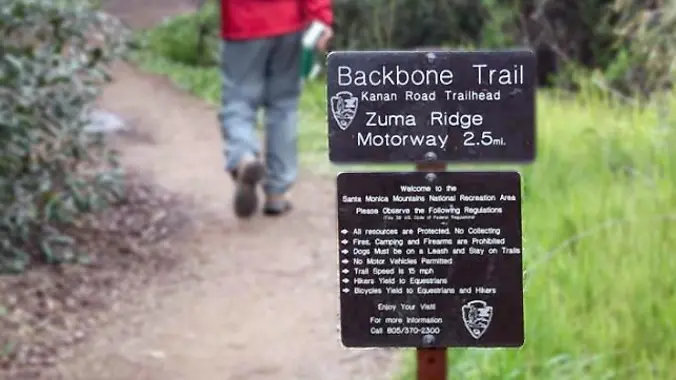
Newton Canyon looks like it's the most protected during Tuesday's Santa Ana winds. However, if there's an active Red Flag warning, we will cancel. Please check back before traveling Tuesday morning. From the Kanan Rd trailhead, we'll jump on the Backbone Trail for a cruise down into Newton Canyon. On our way there, we'll cross […]
3.0 miles, 800' gain, easy-intermediate. This hike is rated easy-intermediate because it is a continuous incline for 1.5 miles. This isn't real steep, but it is continuous, and many beginner hikers have indicated this should be rated intermediate. That said, there is no reason a fit beginner cannot complete this hike. If needed, just stop […]
3.5 miles, 600' gain, Easy Intermediate Easy Option: 2.4 miles, 285' gain, Fit Beginner We enter the Los Padres trail through a spooky oak covered section, then move through until we come to a dead end. We'll turn right, and continue climbing up. We'll come to another junction, where we'll turn right onto the Los […]
We will start our hike near the beginning of Regal Oak Ct. on the lower Rosewood Trail, a dirt trail heading up a shaded ravine at the base of the mountains, and continue to the usual Rosewood trail. Rosewood trail presents a clear view over the 101 Freeway carving up the Conejo Valley. This is […]
5.4 miles, 1050' gain, Easy Intermediate This hike is one of the most beautiful hikes in Simi Valley. There are 3 extended inclines, about 1000 steps each, on fire road. They are not especially steep, but they do continue for some time, which is why it is rated "Easy Intermediate." There are also several small […]
Get your pre-holiday conditioning hikes in. Join us for a Friday sunrise hike at Peter's canyon. We'll do a six mile loop starting at the south entrance. After the hike, feel free to join us for coffee at Peet's. This is a great hike for people wanting to learn about WTC and meet WTC leaders. […]
DESCRIPTION: Excellent write up of this hike at Hikespeak "Fish Canyon Narrows in the Sierra Polona Mountains" by Seth Snigelske. This is a beautiful area. Bring your camera. Not only is the area beautiful, but you might see some of the endangered species along the way. Please stay on the trails here and watch where […]
Additional registration is not required for the event. Details about the event: https://letsgooutside.org/activities/2024/12/14/wilderness-access-day-gypsum-canyon-wilderness-19/ Please join us for our first exploratory hike at Gypsum Canyon! Come explore 6 miles of new trails at Gypsum Canyon Wilderness through this self-guided opportunity. Located within OC Parks’ Irvine Ranch Open Space, Gypsum Canyon Wilderness features seven new trails for […]
Experience one of the world’s most beloved pieces of music in a fresh, new way. Areté Symphonic Choir will perform the Christmas portion of Handel’s musical masterpiece, Messiah, as treasures of visual art by master painters are projected above the stage. Join us for this unique marriage of music and art – a bold new […]
3.0 miles, 800' gain, easy-intermediate. Moonrise 5:02 pm Photo by Helen Let's enjoy the gorgeous sunset and fun loaded potluck picnic at the beautiful Angel Vista! This is a potluck hike. Please bring food, drinks to share. If your item requires utensils/plates/toothpicks, etc., please bring them. You may wish to bring your own cup, plate, […]
Learn New Skills-Make New Friends-Experience New Adventure Details Informational Posting Only - See Website at www.wildernesstravelcourse.org INFORMATIONAL POSTING ONLY www.wildernesstravelcourse.org Dear Group Members, particularly the recent swell of new, never-been-backpacking-before-but-want-to-start members: There is a great Sierra Club opportunity that is about to begin….an opportunity that only happens one time each year and it is one […]
Learn New Skills-Make New Friends-Experience New Adventure Details Informational Posting Only - See Website at www.wildernesstravelcourse.org INFORMATIONAL POSTING ONLY www.wildernesstravelcourse.org Dear Group Members, particularly the recent swell of new, never-been-backpacking-before-but-want-to-start members: There is a great Sierra Club opportunity that is about to begin….an opportunity that only happens one time each year and it is one […]
From the Kanan Rd trailhead, we'll jump on the Backbone Trail headed west, crossing over Zuma Ridge Motorway toward Trancas Canyon. On our way there, we'll cross a stream (haha), pass under an oak canopy (a little, anyway), and come out into an opening. At the opening, look toward the sandstone formations in the distance, […]
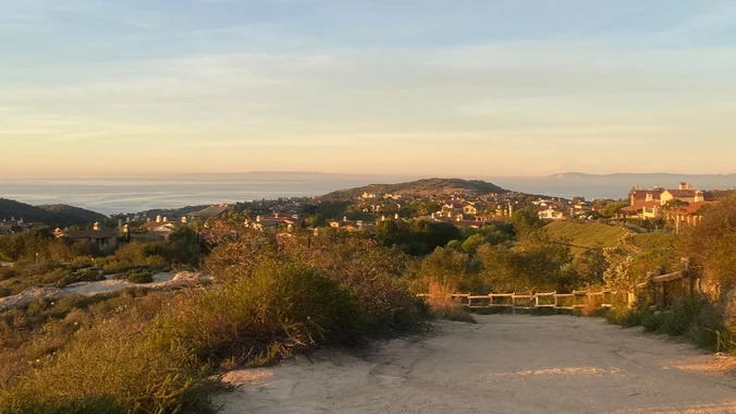
This out-and-back hike is about 5 miles with an elevation gain/loss of 1000’ -1200’ provides a great overview of the Thousand Oaks area, the ocean and the western Santa Monica Mountains. The first portion is a narrow trail that zigzags its way up and if you reach the top, you'll be enjoying 360 degree views […]
3.2 miles, 900' gain, Intermediate. The first part is a steady incline, followed by a rolling trail to our destination. Fit beginners can complete this hike, but it will certainly get their blood pumping. There are no super steep sections. This hike takes us to a secret spot below a large rock formation. Naturally into […]
This is an Intermediate level trip due to some off-trail scrambling up Smugglers Canyon and the fact that it is overnight dry camping (all water for the trip must be carried). At 10:00 am (12/18), we will meet up at the Pictographs Trailhead (search "Anza Borrego Pictographs Trailhead" in Google Maps). The backpacking route can […]
Please bring a flashlight or headlamp. http://photos2.meetupstatic.com/photos/event/7/2/1/c/600_358949212.jpeg Our usual conditions and restrictions apply for your safety and ours: Don't show up unless you're shown on the "Attending" list Unregistered or waitlisted will be turned away No "Plus Ones" on this hike No dogs on this or any other Weekday Trailblazers hike All participants must be […]
Palo Comado ("Burnt Stick" in Spanish) tells you a lot about the environs - frequently burned over by wildfires, this was directly in the line of the Woolsey Fire but much of the vegetation has re-grown. This is one of many routes from the Conejo Valley to China Flat. Except for one turn near the […]
Let's meet at the tennis courts. This hike will be in addition to Laurie's hike, but this will be a gentler hike. This hike will loop around the periphery of Dos Vientos Open Space, passing Twin Ponds, overlooking Potrero Road and the Oxnard Plain with the Channel Islands in the background. We will cross 3 […]
4 miles, 950' gain, Intermediate Easy Option: 1.6 miles, 400' gain, Fit Beginner Hardest option: 5 miles, 1200' gain, Intermediate The entire hike outbound is a steady incline. Nothing super steep, just continuous and quite strenuous for many. There are virtually no junctions where one can get lost. This is one of the more famous […]
Get your pre-holiday conditioning hikes in. Join us for a Friday morning hike at Peter's Canyon. We'll do a six mile loop starting at the south entrance. After the hike, feel free to join us for coffee at Peet's. This is a great hike for people wanting to learn about WTC and meet WTC leaders […]
Join us for a scenic 5.5-mile loop hike with 1,104 feet of cumulative elevation gain in Crystal Cove State Park! We'll wander through the upper and lower trails, taking in breathtaking views of the mountains and ocean along the way. Meet at the Coastal Peak Park parking lot next to the restrooms at 7:30AM. We'll […]
Join us for an exploratory hike in the new trails in the Red Rock Wilderness area. ***Must also register here: https://letsgooutside.org/activities/2024/12/21/wilderness-access-day-red-rock-wilderness-8/ They will send you a confirmation email with directions and a map to the staging area. As of now, there are 117 out of 250 spots left. About the event: Come explore OC Parks’ […]
Palo Comado and Cheeseboro Canyons, near Agoura Hills, is a wildlife corridor connecting the Santa Monica Mountains with the Santa Susana Mountains. This north-south corridor allows animals to move freely between the two ranges. We will enter Palo Comado from Agoura High School and loop around the underbelly of Cheeseboro and Palo Comado Canyons via […]
This hike will be about 7 miles total with 1200 ft. of elevation gain. We are starting at the parking lot at the Wahoo's parking lot. We will take Live Oak Trail. This turns into Serrano Road which will take us to Serrano Cow Trail. At this part of the trail, we usually see a […]
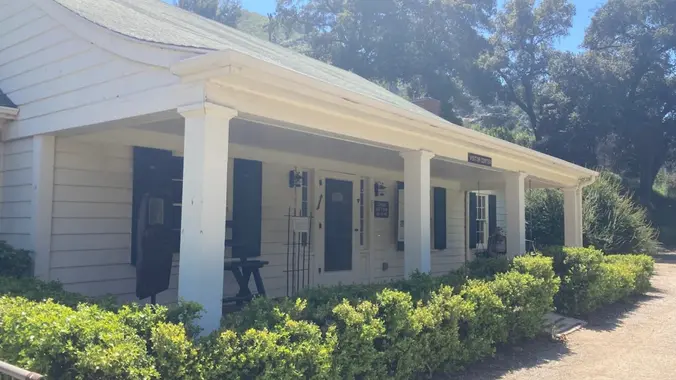
I'll be working in the Malibu Creek State Park Visitor Center on this Sunday. We are open from Noon to 4pm. Stop by and say hello -- and for a private tour. About the VC The MCSP Visitor Center (VC) is a historic building and is over 100 years old. Malibu Creek Docents operate the […]
I can't find a fancy description so deal with it.... and wanted to post so I wouldnt lose my nerve…. - about 7 miles - about 1600 ascent We will start at Newton Canyon trailhead on Kanan-Dume Rd. and head over the road and up the hill. Down, and up, and then back again. Out […]
"Satwiwa" is Chumashan and directly translates to "the bluffs," which can also translate to "higher places," and is the Chumashan name used for a former village near the current culture center. The Ranch Overlook Trail extends from just west of the culture center to the Palomino Trail in the Rancho Potrero Open Space. https://www.conejovalleyguide.com/dosomethingblog/ranch-overlook-trail-in-rancho-sierra-vistasatwiwa-in-newbury-park This […]
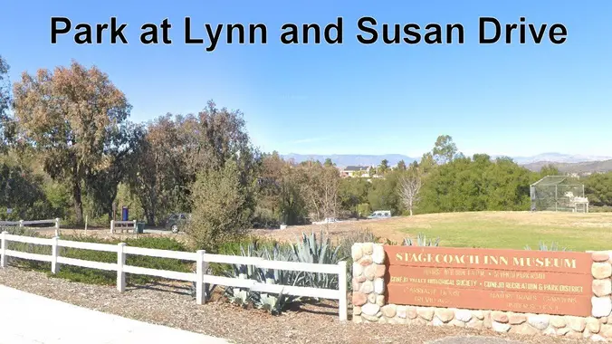
This is a 4-5 mile out-and-back trip from Lynn Road to the Rosewood Trail to Angel Vista. We’ll park at the playfield near Stagecoach Inn and walk from Lynn Road on the lower Rosewood Trail, to the usual trailhead and then on up the trail. The elevation gain/loss is about 875’ - 1000’. It is […]
Happy Holidays to all of Hiking Plus, your family, and friends. It's been a great year for the group, and I am wishing you all the best! Thank you so much for all the time you have spent with us, it is greatly enjoyed and appreciated. These memories will last the rest of our lives. […]
This is a gentler hike. We will start at the parking area in Hill Canyon, cross the bridge over the runoff creek, and stroll a mile before turning onto the fire road up the Western Plateau. We will go straight at the crest of the fire road and then turn on the Plateau Rim loop […]
3.5 miles, 600' gain, Easy Intermediate Easy Option: 2.4 miles, 285' gain, Fit Beginner We enter the Los Padres trail through a spooky oak covered section, then move through until we come to a dead end. We'll turn right, and continue climbing up. We'll come to another junction, where we'll turn right onto the Los […]
This hike will be at Crystal Cove State Park. We will be doing part of the Moro Canyon trails. This hike will be about 6.6 miles with approximately 1,000 ft. of elevation gain. We are beginning at the Ridge Park Entrance (see the map for exact details on where to go.) This hike will take […]
Let's get a head start on 2025 training with this hilly hike offering great views and a woodsy feel. 6.7 miles, 1233 elevation gain (we'll go up, down, up again and down again). This is a great opportunity to meet and greet 2025 WTC students and leaders plus train for your upcoming adventure. Bring sun […]
DESCRIPTION: This will be the last hike of 2024! I hope something a little closer to home and a little shorter to mark the end of the year might make it easier to get a larger - maybe celebratory - group together to ring out 2024 might be fun. As usual you can expect beautiful […]
Fit Beginner - 4 miles, 600' gain The gain is well distributed, with half being on the return. We start at the Las Flores trailhead where Las Flores dead-ends at Wildwood Park, and head west. After 1/3 mile, the trail becomes Wildwood Canyon Trail. We continue for another 2/3 mile and cross a bridge just […]
Learn New Skills-Make New Friends-Experience New Adventure Details Informational Posting Only - See Website at www.wildernesstravelcourse.org INFORMATIONAL POSTING ONLY www.wildernesstravelcourse.org Dear Group Members, particularly the recent swell of new, never-been-backpacking-before-but-want-to-start members: There is a great Sierra Club opportunity that is about to begin….an opportunity that only happens one time each year and it is one […]
Learn New Skills-Make New Friends-Experience New Adventure Details Informational Posting Only - See Website at www.wildernesstravelcourse.org INFORMATIONAL POSTING ONLY www.wildernesstravelcourse.org Dear Group Members, particularly the recent swell of new, never-been-backpacking-before-but-want-to-start members: There is a great Sierra Club opportunity that is about to begin….an opportunity that only happens one time each year and it is one […]
Come spend NYE in Joshua Tree! 2 sites are reserved (sites 8 & 10). 6 people and 2 cars per site. Will need to carpool. If there are more people interested then more sites can be reserved. (sites 5, 7, 9, and 11) are all close by $10 cash or zelle per person to cover […]
Encinal Canyon is named for encina, the Spanish word for the holm oak, a lovely Mediterranean tree with holly characteristics. Holm oaks are one of the main trees used to establish truffle orchards, but we'll be nosing around the canyon strictly for its beauty. The trail from Encinal is a smooth, firm, and well-traveled single […]
HIKE DETAILS: Let's use our 2024 passes one more time. This Tuesday hike will be a bit gentler. This hike will go from the beach up to the picnic table on the fire road, approximately 5.5 miles. Most of the hike is exposed, but hopefully we will have some marine layer. No dogs. We will […]
This event serves as a reminder and prompt: Don't forget to renew your California campfire permit for 2025. Campfire permits expire December 31st each year. Campfire permits are required for backpackers who intend to light a flame outside of established campgrounds for cooking, lanterns, or campfire. This permit is required in federal and state lands […]
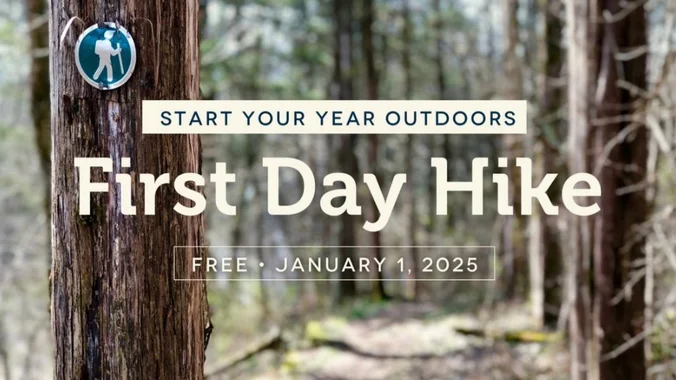
California State Parks has asked me to lead a hike for their annual First Day Hikes. So join us for a picturesque loop hike into movie & TV history in the heart of Malibu Creek State Park. Our first stop is Ronald Reagan's Yearling Row Ranch, now part of MCSP. During the 1950s, when Ronald […]
This hike will be about 5.4 miles total with 820 ft. of elevation gain. We are starting at the parking lot at the Wahoo's parking lot. We will take Live Oak Trail. This turns into Serrano Road which will take us to Serrano Cow Trail. At this part of the trail, we usually see a […]
This hike circles the trails between South Ranch and Conejo Ridge. This is about 6 miles (1000 foot elevation gain) lollipop. We will start at the trailhead at Triunfo Park's back (2nd) parking lot, go up to the Los Robles trail and turn left on the Whitehorse trail. We then loop around counterclockwise via the […]
NOTE: If you sign up for this hike, be sure to take yourself off the waitlist for the other hike. This is a second hike for Thursday in a similar area to the other hike, but starting at the end of Moorpark Road. We will meet in the parking lot at the end of S. […]
http://photos1.meetupstatic.com/photos/event/b/a/2/4/event_99467652.jpeg Please bring a headlamp or flashlight just in case. This is an Out and Back so all levels are welcome as we will do a sweep on our way back. It will be 5 miles with about 900+ elevation gain. From the Kanan Rd trailhead, we'll jump on the Backbone Trail for a cruise […]
start your year with this post-holiday conditioning hikes. Join us for a Friday morning hike at Peter's Canyon. We'll do a six mile loop starting at the south entrance. After the hike, feel free to join us for coffee at Peet's in Tustin. This is a great hike for people wanting to learn about WTC […]
Many from this group, plus other friends, will attend this event at Sagebrush Cantina. The band playing (Hindsite) puts on a fantastic show, playing dance, pop, r&b/funk, and hip hop music from the 70's up to the latest hits. This is one of the best venues I've experienced on LA's west side, and this is […]
The hike I am planning is around 6.3 miles with about 700 ft. of elevation gain. It starts at the very end of the paved road, the long gray strip that can be seen on the map. We will begin at the Bell Canyon Trail head. We will continue onto that and then take it […]
We are going to be starting at the Canyon View Staging Area. This hike will be about 6.2 miles with around 1,000 ft. of elevation gain. We will be starting at Canyon View Park and taking Cholla up to West Ridge and comic down Mathis. Link to Parking from Google Maps: https://www.google.com/maps/place/Canyon+View+Staging+Area/@33.585273,-117.7465062,17z/data=!3m1!4b1!4m5!3m4!1s0x80dce61b6bd45c2d:0x5ef3f1ad687cc8b5!8m2!3d33.585273!4d-117.7443175 Dogs are not […]
4.2 miles, 700' gain, easy-intermediate. Easier option: 2.7 miles, 500' gain, fit beginner. This is a pot-luck hike. We'll be stopping at the 3/4 point by a picnic table, so please bring food and drink to share, and any utensils your items might require. You may wish to bring your own cup, plate, and utensils […]
Trail statistics are approximate. For safety purposes always assume they are underestimated. But don’t be disappointed if they are overestimated. Bring more water and snacks than you think you’ll need.
Trail descriptions are based on previous hikes. Current conditions are unknown until arrival. Expect the unexpected and plan accordingly.
The Organizers and members of Hiking With Dean are not professional leaders, guides, or mountaineers. The function of the member or organizer is only to organize the trip. Each person who shows up for a trip/meetup (and their guest or guests) is responsible for his or her own safety. By attending a hike, or any other event organized by this group, you are acknowledging that you and any guests that you bring are aware of the risks, dangers and hazards associated with the activity and freely accept and fully assume all such risks, dangers and hazards, and further agree to release and discharge the Organizers, Members of the Hiking With Dean Meetup Group from and against any and all liability arising from your participation in the group activities per our ASSUMPTION OF RISK AND LIABILITY WAIVER and Section 6.2 of the Meetup.com Terms of Service.





























Recent Comments