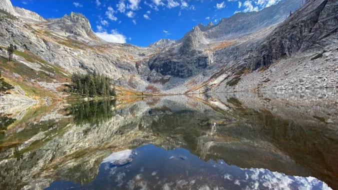
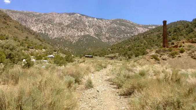
High Sierra Trail: Crescent Meadow to Hamilton Lakes The High Sierra Trail (HST) is the ultimate way to experience the wilderness of Sequoia National Park. This route is a multi-day trip that takes you on a section of the HST from it's beginning at Crescent Meadow to Hamilton Lakes, a popular backpack camp location. One […]
FALL SEASON: WE ARE BACK TO A 9:00a START TIME http://photos1.meetupstatic.com/photos/event/b/f/8/6/event_22189030.jpeg Space Mountain is the name for Los Robles Trail West, starting at Moorpark Road in Thousand Oaks and switchbacking up the hill to the west. No one seems to know why it's called Space Mountain, though maybe the Disney ride inspired the name. We'll […]
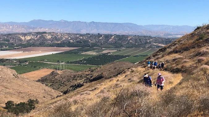
We will start our hike near the beginning of Regal Oak Ct. on the lower Rosewood Trail, a dirt trail heading up a shaded ravine at the base of the mountains, and continue to the usual Rosewood trail. Rosewood trail presents a clear view over the 101 Freeway carving up the Conejo Valley. This is […]
5.4 miles, 1050' gain, Easy Intermediate This hike is one of the most beautiful hikes in Simi Valley. There are 3 extended inclines, about 1000 steps each, on fire road. They are not especially steep, but they do continue for some time, which is why it is rated "Easy Intermediate." There are also several small […]
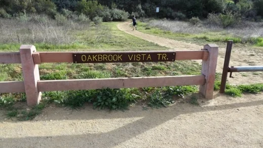
Restrictions apply for your safety and ours: Don't show up unless you're on the "Attending" list Unregistered or waitlisted will be turned away No "Plus Ones" on this hike What we'll do: Hike Oakbrook Vista trail to the crest of the ridge. Go left on the Sandstone Hills until it intersects power line roads. This […]
Spooky Night version! This hike is rated "CREEPY" due to past murders and mayhem. Dangers along the way include ghosts and phantoms. Scroll down for the ghost stories. Here is the origin story: On October 12th, 1936, the Camarillo State Mental Hospital opened its doors taking in the sick and mentally ill. Not just a […]
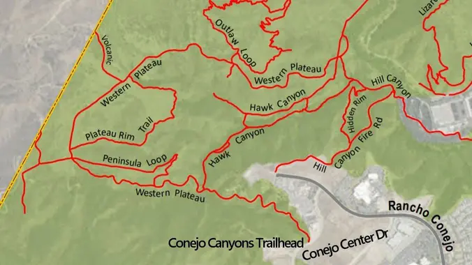
Meet at the Conejo Canyons trailhead next to the Thousand Oaks Recycling Center on Conejo Center Drive, near the end of Rancho Conejo. We'll walk down the fire road to Hawk Canyon and then we will take Hawk Canyon to Five Points. From Five Points, we will take the Western Plateau trail up to intersection […]
3.5 miles, 600' gain, Easy Intermediate Easy Option: 2.4 miles, 285' gain, Fit Beginner Halloween Hike - costumes encouraged! Time for another haunted HP hike, join us for a terrifying time on trail. We enter the Los Padres trail through a spooky oak covered section, then move through until we come to a dead end. […]
This event is a car camp, come enjoy beautiful Anza-Borrego with us! Please read the entire event description: 2024's SDB Annual Picnic will be held in Agua Caliente at group site CA1. Parking: All parking spots have been claimed (Updated July 17, 2024). The group site officially allows 10 vehicles. Any vehicles exceeding the allotted […]
Please do not enter this event if you are not committed to purchasing a commemorative "10 Year" bundle. No refunds will be dispersed. If you no longer wish to receive your bundle, we will consider your payment a donation to San Diego Backpackers. 📢 Please read the following directions: ❗This event will be used to […]
Please join us for our annual picnic! More details to be updated later. Please read the entire event description. 2024's SDB Annual Picnic will be held in Agua Caliente at group site CA1. Occupancy 50 with 10 vehicles. Event cost is $20 per person. Fees will be used to cover event costs. Any overage will […]
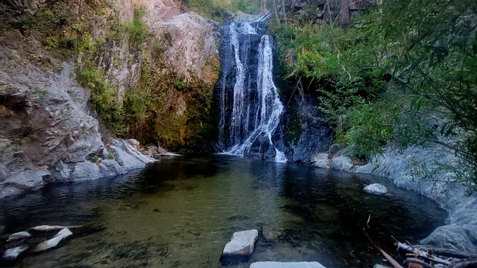
DESCRIPTION: This is a 7 mile out-and-back hike near Palmdale, California. Generally considered a moderately challenging route. We will start on the Pacific Crest Trail and hike to Cooper Canyon Falls. As of a few weeks ago there was a lot of water flowing. For those who are on the adventurous side, we will be […]
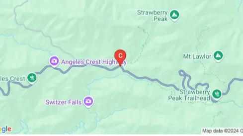
Let's hike to Strawberry Peak in the San Gabriel Mountains again! This is the tallest summit in the front country of the San Gabriel's. This hike will take us to the peak via Red Box Canyon. It is a 7.5 mile out and back hike. The elevation gain will be around 1,900 ft. The peak […]
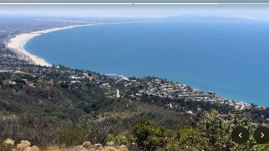
Sunset Hike: Los Liones to Parker Mesa Overlook Join us for a stunning 7-mile sunset hike in the beautiful Santa Monica Mountains on Saturday, November 2nd. We’ll meet at the trailhead for a 4:00pm departure, beginning on the lush Los Liones Trail, meandering through a vibrant canyon before connecting to a scenic fireroad. As we […]
The hike we will be doing is approximately 5 miles with 870 ft. of elevation gain. We will begin at the Live Oak Trail trailhead. This is where you will see on the map that the Live Oak Trail hits the paved road. This is the parking lot closest to the Edna Spaulding Trail. (There […]
Time change & start time change, clocks "fall back" one hour Fit Beginner 4.3 miles, 480' gain. Easier Option: 4 miles, 230' gain. We walk a mostly flat section for 1.1 mi. to the 2nd junction. Easier option: Continue straight for 3/4 mi., left at the split, right after another 500', arriving at some picnic […]
Learn New Skills-Make New Friends-Experience New Adventure Details Informational Posting Only - See Website at www.wildernesstravelcourse.org INFORMATIONAL POSTING ONLY www.wildernesstravelcourse.org Dear Group Members, particularly the recent swell of new, never-been-backpacking-before-but-want-to-start members: There is a great Sierra Club opportunity that is about to begin….an opportunity that only happens one time each year and it is one […]
Learn New Skills-Make New Friends-Experience New Adventure Details Informational Posting Only - See Website at www.wildernesstravelcourse.org INFORMATIONAL POSTING ONLY www.wildernesstravelcourse.org Dear Group Members, particularly the recent swell of new, never-been-backpacking-before-but-want-to-start members: There is a great Sierra Club opportunity that is about to begin….an opportunity that only happens one time each year and it is one […]
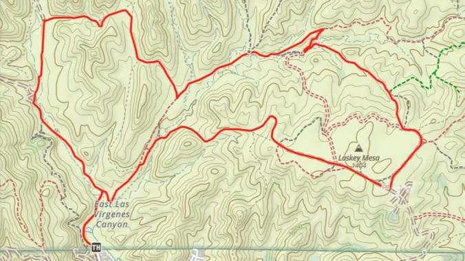
Welcome to the new parking area at the north end of Las Virgenes! Construction is complete, and cars may now park diagonally off Las Virgenes near the trailheads. We will be hiking northeast to Laskey Mesa, then around the mesa to the north, west, and back to upper Las Virgenes, then back to the cars […]
This hike begins at Upper Stunt High Trail, a couple hundred feet to the right on the other side of the street from the parking lot. The trail winds upward gradually over switchbacks, giving way as the trail heads up to a dramatic rocky overlook with striking views of the Pacific, Stunt Ranch State Park, […]
Easy Intermediate, 4.5 miles, 600' gain Easier Option, 3.5 miles, 460' gain This is a unique loop through Wildwood Park that takes us to the famous Lizard Rock. There are several extended inclines and a few short but steep climbs that cause this to be rated on the easy end of the intermediate spectrum. Beginners […]
Come join us to hike in a section of the Dos Vientos Open Space. This hike will loop around the periphery of the Dos Vientos Open Space, passing Twin Ponds, overlooking Potrero Road and the Oxnard Plain with the Channel Islands in the background. We will cross 2 streets along the way. This hike is […]
4.6 miles, 900' gain, easy-intermediate This route takes us through a beautiful canyon via a counter-clockwise lollipop. Most of the hike has a clear view of the sky, with a few parts that have tree cover. We'll be stopping at the half-way point for a snack and beverage share. We'll start at the Palo Comado […]
Many from this group, plus other friends, will attend this event at Sagebrush Cantina. The band playing (Hindsite) puts on a fantastic show, playing dance, pop, r&b/funk, and hip hop music from the 70's up to the latest hits. This is one of the best venues I've experienced on LA's west side, and this is […]
Distance - 5.5 miles one way Elevation gain - 3,675 feet Terrain - The trail was actually a road at one point but it's hard to believe it when you're hiking it. It's not too bad as a trail now but it's not maintained. It may have taken more damage in the recent flooding. Difficulty […]
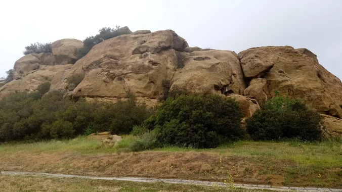
Scroll down to rsvp Details I will take you through Ape City, where the simian metropolis introduced in the original Planet of the Apes (1968 - starring Charlton Heston and Roddy McDowall) stood. The City is gone so you will have to use your imaginations. Click through the juxtaposed photos below for some inspiration. Perhaps […]
Hike #11 in the 2024 Saturday in the Santa Monica Mountains series, will be an adventurous 9-mile, 2700’ gain loop hike to 6 peaks, a point, and a rock. We will bag six peaks including the highest point in the Santa Monica Mountains, Sandstone Peak (3111’), then Boney Peak (2825’), Exchange Peak(2953’), Tri-Peaks (3010’), Pop […]
The hike I am planning is around 6.3 miles with about 700 ft. of elevation gain. It starts at the very end of the paved road, the long gray strip that can be seen on the map. We will begin at the Bell Canyon Trail head. We will continue onto that and then take it […]
This hike will be about 7 miles with about 700 ft. of elevation gain. We will start the hike at Cañada Vista Park. From here we will take the Tijeras Creek Trail to the Arroyo Trabuco Trail and use this to loop back to where we started. There will be a few water crossings, so […]
Fit Beginner - 4 miles, 600' gain The gain is well distributed, with half being on the return. We start at the Las Flores trailhead where Las Flores dead-ends at Wildwood Park, and head west. After 1/3 mile, the trail becomes Wildwood Canyon Trail. We continue for another 2/3 mile and cross a bridge just […]
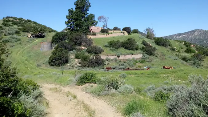
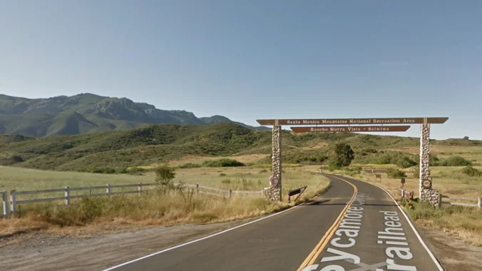
After a turbulent week, let's give one another a hug, then enjoy the peace and tranquility of our local mountainscape. We will start in the parking lot at Rancho Sierra Vista and head up through grasslands and chaparral from the Rancho Sierra Vista trailhead, then climb up Boney Mountain Trail for some fantastic views west […]
I pre-hiked this route on Friday as the weather is getting hot and I haven’t hiked the Canyon Overlook Trail for quite a while. It was pretty exposed, but the ocean breeze made it comfortable. The hike starts at the parking area on Hill Canyon Road and climbs Canyon Overlook Trail. The trail is a […]
This is a "piggyback" hike to Steve's of the same time & destination to accommodate the waitlisted hikers. Note the Wendy Trailhead start location. (COSCA requires us to limit groups to 25) After a turbulent week, let's give one another a hug, then enjoy the peace and tranquility of our local mountainscape. We will most […]
On this serendipitous hike we will rediscover some old trails I haven't used in a few years -- and others haven't used in about 10 years -- as we blaze a path around an ongoing housing development. Light bushwhacking may be required. We'll also be doing some creeking putting our poison oak avoidance skills to […]
This hike will loop around the periphery of Dos Vientos Open Space, passing Twin Ponds, overlooking Potrero Road and the Oxnard Plain with the Channel Islands in the background. We will cross 3 streets along the way. This hike is about 6.0 miles with 1000 feet of elevation gain. Pace: This is a gentler friendly […]
Let's meet at the tennis courts along with Cheryl's group. This hike will be in addition to Cheryl's hike, but we will go in the opposite direction. We will also be a little slower and possibly a bit shorter. This hike will loop around the periphery of Dos Vientos Open Space, passing Twin Ponds, overlooking […]
4.6 miles, 900' gain, easy-intermediate This route takes us through a beautiful canyon via a counter-clockwise lollipop. Most of the hike has a clear view of the sky, with a few parts that have tree cover. We'll be stopping at the half-way point for a snack and beverage share. We'll start at the Palo Comado […]
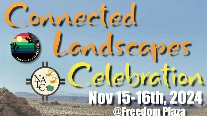
Join Friends of Joshua Tree and Native American Land Conservancy for a fun and educational two day special event featuring cultural speakers and workshops, activities and the E'Sulenem Film Festival. Through gathering in community face to face, we are facilitating a deeper relationship with the ancestral lands and living tribes of the high desert. Find […]
Get your pre-holiday conditioning hikes in. Join us for a Friday sunrise hike at Peter's canyon. We'll do a six mile loop starting at the south entrance. After the hike, feel free to join us for coffee at Peet's. This is a great hike for people wanting to learn about WTC and meet WTC leaders. […]
Please join us to share a meal in our beautiful desert. 🌙 Anza-Borrego Desert State Park Bow Willow Campground 200 Palm Canyon Drive, Borrego Springs, CA 92004 32.84175968, -116.22494267 November 16-17 Begin meal set-up at 3:00PM, sunset at 4:40PM Please bring a dish to share, a table if you've got it, and wood to burn. […]
Mt. Lukens is the tallest peak in the Los Angeles city limits and it has spectacular views of the Los Angeles basin and surrounding mountains from the summit - so bring your cameras and be ready to take some great pics! This hike makes a loop from Deukmejian Wilderness Park in Glendale, ascending via the […]
WTC Intro Hike - O: Point Vicente To Hesse Park Nov 16th. 8am 7.5 miles RT 1000'ft gain Please join us for our Introduction hike From Point Vicente to Hesse Park. This hike is designed for people to learn what Wilderness Travel course is all about. The course covers Day Hikes, Overnight Hikes, Map and […]
I'm excited to do this hike again! This hike is really cool so you should come out and join us! This hike will be about 10 miles with 1,300 ft. of elevation gain. We will start at the same place we do for the falls (Black Star Trailhead). We will take this road all the […]
The hike will be about 5.7 miles with about 750 ft. of elevation gain. We will start on Peters Canyon Trail and take this to East Ridge View Trail. This is where we will go up Big Red. Then we will continue on this trail until we get to Eucalyptus to loop back. We will […]
3.0 miles, 800' gain, easy-intermediate. Moonrise 6:22 pm Photo by Helen Let's enjoy the gorgeous sunset and fun loaded potluck picnic at the beautiful Angel Vista! This is a potluck hike. Please bring food, drinks to share. If your item requires utensils/plates/toothpicks, etc., please bring them. You may wish to bring your own cup, plate, […]
Learn New Skills-Make New Friends-Experience New Adventure Details Informational Posting Only - See Website at www.wildernesstravelcourse.org INFORMATIONAL POSTING ONLY www.wildernesstravelcourse.org Dear Group Members, particularly the recent swell of new, never-been-backpacking-before-but-want-to-start members: There is a great Sierra Club opportunity that is about to begin….an opportunity that only happens one time each year and it is one […]
Learn New Skills-Make New Friends-Experience New Adventure Details Informational Posting Only - See Website at www.wildernesstravelcourse.org INFORMATIONAL POSTING ONLY www.wildernesstravelcourse.org Dear Group Members, particularly the recent swell of new, never-been-backpacking-before-but-want-to-start members: There is a great Sierra Club opportunity that is about to begin….an opportunity that only happens one time each year and it is one […]
Join us on this sweet (maybe not so sweet!) hike that wanders through grasslands and chaparral, down into a canyon, then up to eye-stretching views. We will follow Sycamore Canyon fire road until it intersects with the Fossil Trail. We will then take the Fossil Trail to the Old Boney Trail. The Fossil Trail features […]
Don’t be left behind! Please note: We are starting this Wildwood hike from Wildwood Avenue NOT Wildwood Park. This intermediate loop hike will highlight the spectacular views on both sides of Mount Clef Ridge. From Wildwood Avenue we will take the spur trail down to Santa Rosa Trail. Instead of our traditional route, we will […]
4.75 miles, 700' gain, easy-intermediate Option for 3 miles, 300' gain, easy. 30 minute wait while group completes the loop back to this spot. This is a link to the route: LINK We start with a 1/4 mile walk from where we park along Cottonwood Dr, to the trail head. There we make a left […]
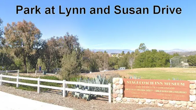
This is a 4-5 mile out-and-back trip from Lynn Road to the Rosewood Trail to Angel Vista. We’ll park at the playfield near Stagecoach Inn and walk from Lynn Road on the lower Rosewood Trail, to the usual trailhead and then on up the trail. The elevation gain/loss is about 875’ - 1000’. It is […]
NOTE: If you sign up for this hike, be sure to take yourself off the waitlist for the other hike. This is a second hike for Thursday in the same trail area, but starting at the end of Moorpark Road. We will meet in the parking lot at the end of S. Moorpark and Greenmeadow […]
Easy Intermediate, 3 miles, 600' gain Easier Option: 2.4 mi, 530' gain. (5 Washburn St, Simi Valley, CA 93065, or 89 La Paz Ct, Simi Valley, CA 93065 to save another 500' distance). We'll meet in the parking lot at the northeast corner of Madera and Royal, just south of the Donut Delite, on the […]
This hike will be about 7 miles total with 1200 ft. of elevation gain. We are starting at the parking lot at the Wahoo's parking lot. We will take Live Oak Trail. This turns into Serrano Road which will take us to Serrano Cow Trail. At this part of the trail, we usually see a […]
Meetup Time: 8:05 A.M. (Park Gates open at 8 AM) DISTANCE: 6.5 (ish) miles - Out and Back GAIN: 300 ft’ RATED: Beginner/Intermediate HIKE DURATION: About 4 hours (including a 20-minute snack break) DESCRIPTION: This 6ish-mile, easy-effort hike at Malibu Creek State Park will take you to several iconic locations from the park's history in […]
Earlier this year, a sinkhole on Iverson Rd prevented us from doing this hike. Let's try again! We begin in the prestigious gated neighborhood of the Indian Springs Estates in Chatsworth. From there we head north and enter Indian Springs Open Space, set within the backdrop of surrounding open and untouched mountains, ravines and hillsides. […]
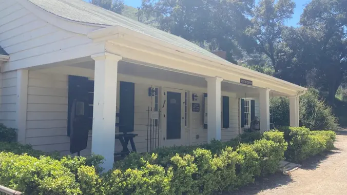
I'll be working in the Malibu Creek State Park Visitor Center on Sunday 11/24. We are open from Noon to 4pm. Stop by and say hello -- and for a private tour. About the VC The MCSP Visitor Center (VC) is a historic building and is over 100 years old. Malibu Creek Docents operate the […]
Easy-Intermediate, 4 miles, 800' gain. Option not to hike: If for some reason you don't want to hike but still want to come, the social event can be driven to, and the main group of hikers should get there about an hour after we begin: 23601 W Red Rock Rd, Topanga, CA 90290. It costs […]
There's an 80% chance of rain predicted for Tuesday, so rain cancels this hike. Rain is also predicted for Sunday and Monday, so trails will be wet and susceptible to damage, so we'll walk down the asphalt to Ranch Center, and return, for a total of six miles and 800' of elevation gain and loss. […]
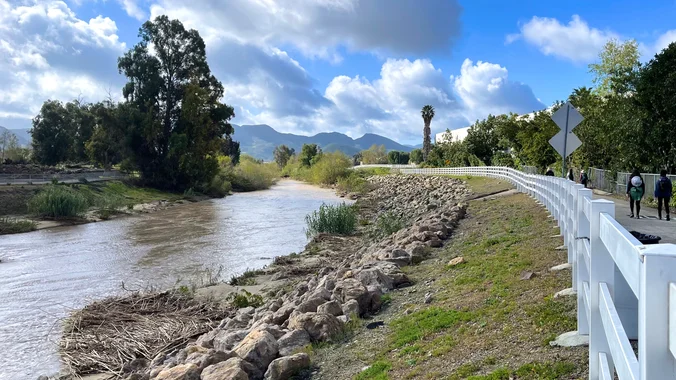
Let’s get out and repeat hike/walk the Calleguas Creek Bike Path along with a neighborhood trail that we can walk on without getting our feet wet or muddy. There are waterfalls in the creek during the rainy season that winds along the east side of Camarillo, a bedroom community on the outskirts of Los Angeles. […]
Distance: 3.5 miles, Gain: 700', Intermediate. This was previously designated easy-intermediate, but some thought it should be labeled as intermediate because of the extended inclines. A strong and motivated beginner can do this hike. They would be challenged and slow during a few of these climbs. That's OK, because this is not a conditioning hike, […]
Instead of Black Friday shopping, come burn off your Thanksgiving calories with Trail Mix! The hike we will be doing will be around 5 miles long with 875 ft. of elevation gain. This will be a loop starting at the parking lot of Nix Nature Center. As you will see on the map, this is […]
To be considered, you and I must have trip history together. Please add yourself to the wait-list to indicate interest. This is a difficult, dry, explorative backpack over rocky, prickly terrain. I am looking for qualified team members who are interested in seeking out locations of historical or cultural significance. Additional qualifications include a go-with-the-flow […]
This hike will be at Crystal Cove State Park. We will be doing part of the Moro Canyon trails. This hike will be about 6.6 miles with approximately 1,000 ft. of elevation gain. We are beginning at the Ridge Park Entrance (see the map for exact details on where to go.) This hike will take […]
Moderately challenging 8.4 mile, 2150 ft gain hike through Colby Canyon ending at Josephine Peak. We will begin at the Colby Canyon trailhead, pass a seasonal waterfall, and begin the moderately strenuous ascent through oaks and chaparral to Josephine Saddle. From the saddle, we will head west along the Strawberry Spur Trail to reach the […]
Join me on a moderate five mile loop with a total elevation gain/loss of about 800 ft. Please meet at the Dos Vientos Community Park Tennis Courts near the corner of Rancho Dos Vientos and Borchard Rd. This hike explores some of the neighborhood trails in the Dos Vientos area of the southwestern Conejo Valley. […]
We are going to be starting at the Canyon View Staging Area. This hike will be about 6.2 miles with around 1,000 ft. of elevation gain. We will be starting at Canyon View Park and taking Cholla up to West Ridge and comic down Mathis. Link to Parking from Google Maps: https://www.google.com/maps/place/Canyon+View+Staging+Area/@33.585273,-117.7465062,17z/data=!3m1!4b1!4m5!3m4!1s0x80dce61b6bd45c2d:0x5ef3f1ad687cc8b5!8m2!3d33.585273!4d-117.7443175 Dogs are not […]
Need to work off some Thanksgiving dinner? If you also like stunning views, lush oak groves, and getting away from it all (while not really being too far from home) you’ll love this hike! Thanks to Dave, who pre-hiked this awhile back and was kind enough to let me leverage his efforts. We’ll take Oak […]
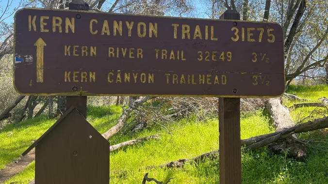
Moderate Hike Tomorrow to the Bench! Let's hike on the Kern Canyon River Trail to the Bench and burn some Thanksgiving calories. Distance: 10 miles roundtrip (up and back hike) Ascent: 1,100 feet Hiking time: Around 5 hours Meeting Location: Shell gas station on Highway 178 and Comanche Dr. https://goo.gl/maps/XhFx1HKrxkckrEvB9 Meeting Time: 9:00 a.m. by […]
Trail statistics are approximate. For safety purposes always assume they are underestimated. But don’t be disappointed if they are overestimated. Bring more water and snacks than you think you’ll need.
Trail descriptions are based on previous hikes. Current conditions are unknown until arrival. Expect the unexpected and plan accordingly.
The Organizers and members of Hiking With Dean are not professional leaders, guides, or mountaineers. The function of the member or organizer is only to organize the trip. Each person who shows up for a trip/meetup (and their guest or guests) is responsible for his or her own safety. By attending a hike, or any other event organized by this group, you are acknowledging that you and any guests that you bring are aware of the risks, dangers and hazards associated with the activity and freely accept and fully assume all such risks, dangers and hazards, and further agree to release and discharge the Organizers, Members of the Hiking With Dean Meetup Group from and against any and all liability arising from your participation in the group activities per our ASSUMPTION OF RISK AND LIABILITY WAIVER and Section 6.2 of the Meetup.com Terms of Service.






























Recent Comments