-

Just gonna do a little stroll along the Sespe River. Fairly easy 6ish miles. There is a stream crossing

Monday |
Tuesday |
Wednesday |
Thursday |
Friday |
Saturday |
Sunday |
|---|---|---|---|---|---|---|
1 hike,
-
Just gonna do a little stroll along the Sespe River. Fairly easy 6ish miles. There is a stream crossing |
1 hike,
-
ok so we are going to try to tag this peak. Meet at Santa Susana pass rd. and Lilac ln. We will carpool to the start location. Road walking, minor rock climbing to the peak...lets see what happens. |
0 hikes,
|
2 hikes,
-
Moderate five round trip mile hike, with a total elevation gain/loss about 400 feet. Follow the trail from Newbury Park to the Hill Canyon Water Treatment Plant. There is pleasant scenery along the Barranca and through riparian native plant communities. Return by way of the same trails. There are five creek crossings in each direction. […]
-
 One of Carmen's favorite trails at her request. This is a short trail but the first two miles are very steep. We'll take a short snack break at one of the towers, enjoy the view then head back down. Bring layers and a headlamp. Follow Covid guidelines. Distance: <6 miles Elevation Gain: 1,508' Trail: Single […] |
1 hike,
-
We are going to do a little exploring. Meet under the underpass of Smokey Bear Rd and I-5. You will need a 4wd or AWD as we will be going on forest roads. |
2 hikes,
Featured
-
Featured
Scroll down to rsvpThe lockdown loonies have cancelled Trick-or-Treat, but that doesn’t scare us! Special Treat: This time the hike coincides with a full moon PRACTICE SOCIAL DISTANCING WHENEVER POSSIBLE, ESPECIALLY AT TRAIL HEAD AND BREAK SPOTS. WEAR A MASK OR FACE COVERING WHENEVER SOCIAL DISTANCING IS IMPOSSIBLE OR IMPRACTICAL. IT IS MANDATORY THAT […]
-
Details to come, but briefly, this is 4.5 miles, with an 800’ elevation gain to a very large flat rock with beautiful views. Bring your dinner and plan to eat on the rock while (hopefully) watching sunset and a full moon rise. We can toast the evening with whatever is in your cup. Also, bring […] |
1 hike,
-
 Distance: <9> Rating: 7/10, not for beginners Pace: Intermediate/advanced There won't be a sweeper!! Elevation 2620’ gain COVID-19 GUIDELINES APPLIES, mask, social distancingEvent is waitlisted and limited to 10 hikers Trail Note: Wilderness permits (fee) are required here According to historian John Robinson, the name "Icehouse Canyon" dates from the 1860s when an ice plant […] |
|
0 hikes,
|
1 hike,
-
 Let's not let the time change keep us from hiking to stay in shape!Las LLajas is a good evening hike in the dark. It is an even, wide road that is safer than many other hiking trails.I will be going at a fast pace. If you are a beginner you can still join us, just […] |
1 hike,
-
 Masks are mandatory as we gather in the (2nd) Triunfo Community Park parking lot! They will also be mandatory anytime we are gathered and cannot keep an appropriate social distance between people. The hike begins with a 1.3 mile single-track section of the Los Robles system to a junction with a wide fire road, which […] |
0 hikes,
|
1 hike,
-
 Here's a stunning walkabout for our slow, old and WW (Walking Wounded) members to enjoy. It's a 4+ mile walk though beautiful LaCanada Flintridge neighborhoods. The entire hike will have us on a dirt trail starting out in Hahamongna Watershed Park before linking up with the Flint Canyon Trail.If you enjoyed our walkabout along oak […] |
1 hike,
-
 Due to the increase of party crashers, moving forward, I am now scheduling mystery hikes. I will provide minimal hiking info here, then to those going, I will send an email the morning of with complete details. Note: I have opened this hike to two groups of 10, each group led by a PM Hiker […] |
3 hikes,
-
 Let's enjoy a strenuous, brisk hike to Ontario Peak. Drive to Icehouse Canyon at https://goo.gl/R2aYUC . The Numbers: Time: arrive at 6am and depart at 6:15. Parking is a hassle and may include a road walk.Distance: 13 miElevation Gain: ~3800 ftCOVID: wear a mask around others, avoid close contact, and do not come if you […]
-
Stats:COVID-19 guidelines applies, mask, social distancingDistance: 9-10 miles, 5-7 hoursElevation Gain: 2700 ft.Rating: Mod/Adv 8/10Waitlist=10-priority previously had hiked with me this trail Trail: Looped, will be on mostly rocky and regular trails with a very short stretch of pavement. WARNING: There will be some short stretches of steep uphill climbs where some might feel more […]
-
Please read the entire write up before signing up *** YOU MUST BRING A FACE COVERING to meet up at the trailhead and to use on trail when it is not possible to avoid close proximity to other hikers. Please be mindful of other people's space. DO NOT APPROACH ANYONE WITHOUT YOUR FACE COVERING. *** […] |
|
0 hikes,
|
0 hikes,
|
3 hikes,
-
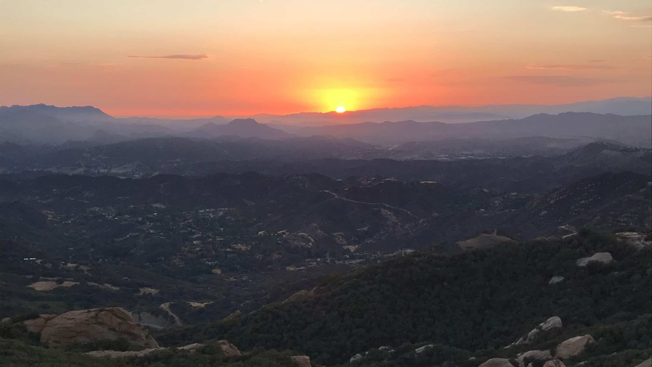
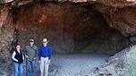
 A LOCAL, BUT CHALLENGING TREK SHERWOOD'S SENTINEL - Stands guard over Lake Sherwood and Lake Eleanor with views of The Las Virgenes and Westlake Reservoirs as well THE CAVE - We'll be stopping off at the largest cave in the Santa Monica Mountains If you're looking for more of a challenge than what ordinary trails […]
-
 Come join me Veterans Day November 11, for an afternoon hike. I have the day off and thought I would start the hike at 3pm, I hope you can join me!I was recently introduced to a new starting place for the Limekin trail. It is on Corbin Ave, just before the YMCA, if you get […]
-
 Hi All, Just a heads up: Barring extenuating circumstances, if you sign up and don't show up, or change your rsvp to "not going" less than 4 hours before the start of the hike more than once, you will not be welcome to hike with me again. It's not fair to those on the waiting […] |
0 hikes,
|
0 hikes,
|
1 hike,
-
 Lets hike a longer way to Angel Vista! We will start from the Oak Creek Canyon Trail off of Moorpark Road. This is a faster paced hike (only break is at the halfway point at the Vista).To get there, take the Moorpark Road exit and then go west until you reach the dirt lot that […] |
0 hikes,
|
1 hike,
-
 I'm starting a series of Monday walks for CDH's slow, old and walking wounded and will refer to them as MWW (Monday's Walking Wounded) hikes. These easy walkabouts were on Friday, but they will now be taking place on Monday's as Friday hikes move into more challenging events. The goal is to help some of […] |
0 hikes,
|
2 hikes,
-
Not my write up - someday I will type my own version - but George and Mark did such a great job, why bother? This hike is waitlist only - small small group due to Covid ************************************* This hikes offers great variety, we will start with a climb on a ridge line through beautiful rock […]
-
 Just a heads up: Barring extenuating circumstances, if you sign up and don't show up, or change your rsvp to "not going" less than 4 hours before the start of the hike more than once, you will not be welcome to hike with me again. It's not fair to those on the waiting list. Please […] |
1 hike,
-
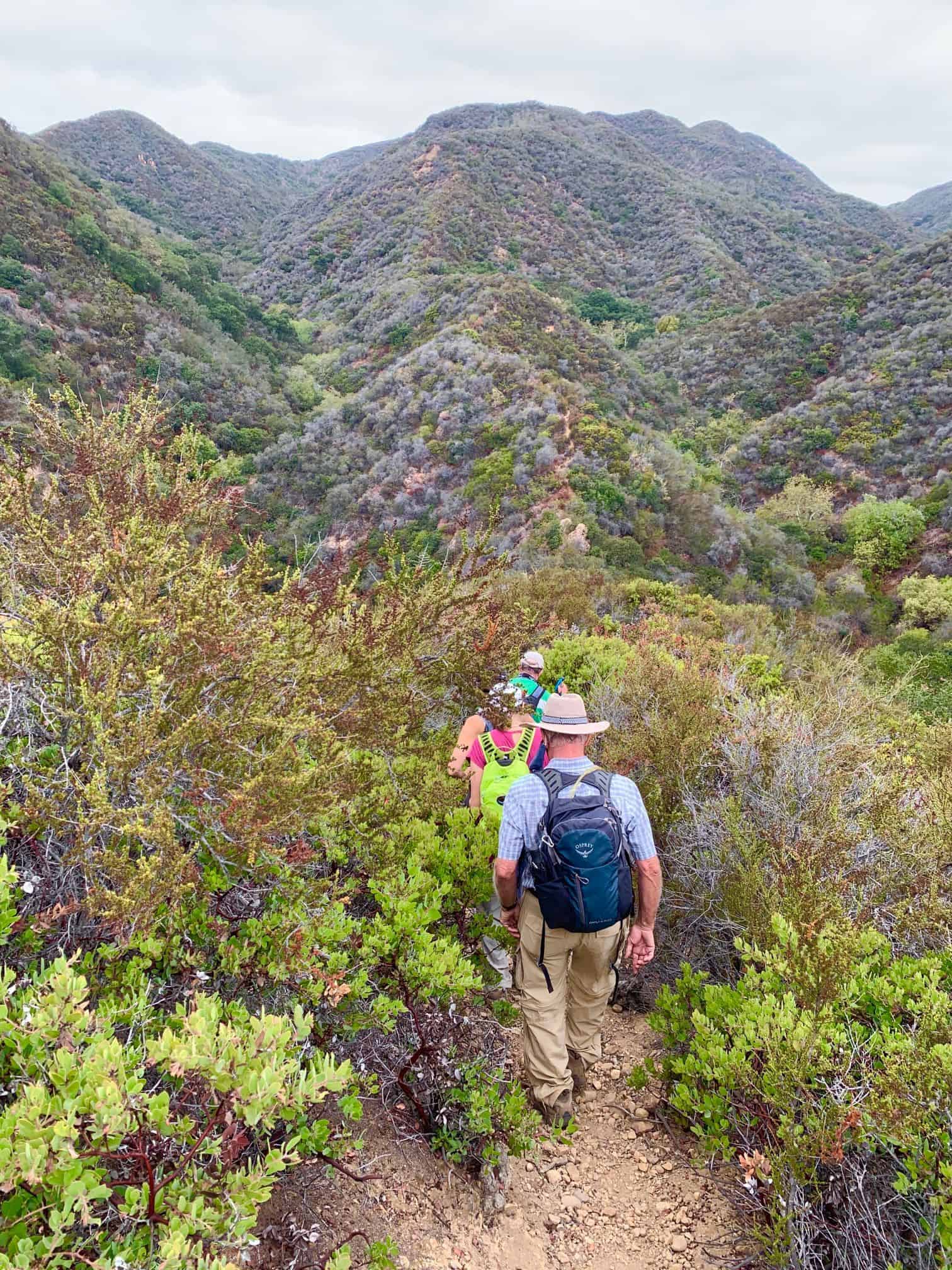
 This trek is for all you rock scramblers out there that love to meander through a maze of rocks. We'll start at the Humingbird Trailhead to the first of two caves (https://www.meetup.com/calabasasdayhikers/photos/30591378/487300580/) in the Simi Hills. From there we'll take on the second cave as seen above which is just off the Hummingbird Trail. Make […] |
1 hike,
-
 This event will be for seasoned beginners on up. Since this area is small, I'm planning on hiking most of the trails there. We'll start off on all the easy trails and work up to those that have some elevation gain. Those that might feel that they have had enough, can bail as the rest […] |
2 hikes,
-
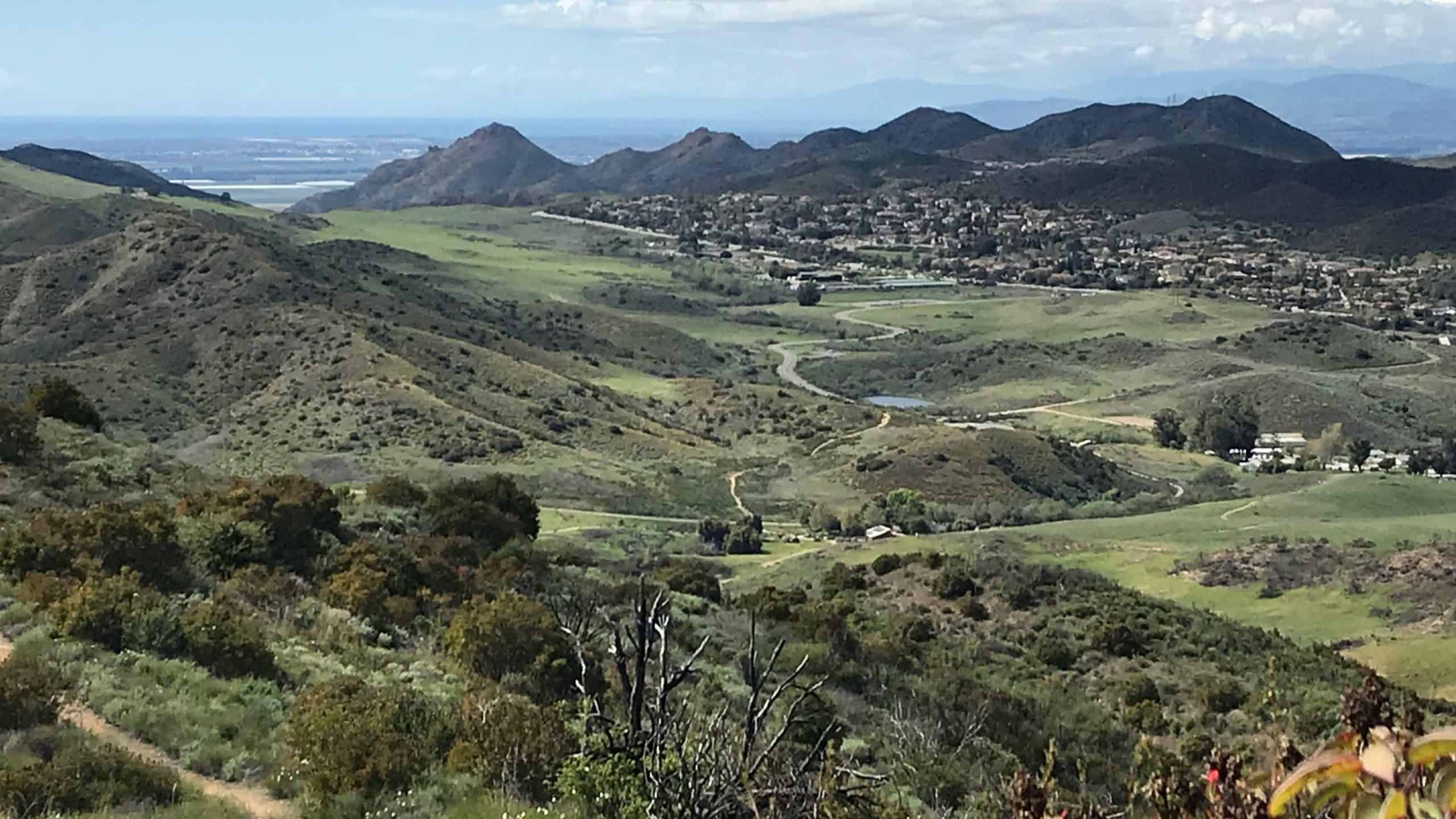
Perfect weather to enjoy a day hike! We'll start at the Los Robles Trailhead on Greenmeadow Ave. in Thousand Oaks and hike up to Angel Vista to enjoy the views and potluck lunch.Please bring water, drinks and food to share, your own cup, plate and utensils, sunscreen, and hat. We will hike about 7 miles […]
-
 Come join me for another fall afternoon hike at a beloved park at the very top of Reseda Blvd. There are many different trails up here. My favorite trail is the Garapito trail as you can go into some shaded bushy part of the canyon verses the exposed fire-road. We will take this to Eagle […] |
1 hike,
-
 The Stats Waitlisted. COVID-19 guidelines applies.Distance <6.5 milesRating 6-7/10, not for beginnersElevation gain: 2000 ft.Trail: Fire Roads and Trails w/ some steep uphills The PlanDon's writeup Warning: This route starts uphill 1950 feet in less than 2 miles so don't say I didn't warn you!! Depending on your abilities gloves could come in handy and […] |
|
0 hikes,
|
2 hikes,
-
 Come join me for a quick-paced (2.5-3 miles per hour) evening hike. Let's get in a good hike before our Thanksgiving feasts take place! We will be on pavement or gravel most of the way, which makes it good for nighttime! I am extending this hike an additional two miles from the last time I […] |
1 hike,
-
 Hi All, Barring extenuating circumstances, if you sign up and don't show up, or change your rsvp to "not going" less than 4 hours before the start of the hike more than once, you will not be welcome to hike with me again. Masks are mandatory as we gather at the trailhead and the Lookout! […] |
0 hikes,
|
5 hikes,
-
 YOU MUST MAINTAIN A DISTANCE OF SIX FEET FROM OTHERS DO NOT APPROACH ANYONE WITHOUT YOUR FACE COVERING For the safety of yourself and others, please follow these guidelines so we can continue posting hikes. ***YOU MUST BRING A FACE COVERING to meet up at the trailhead and to use on trail when it is […]
-
 PRACTICE SOCIAL DISTANCING WHENEVER POSSIBLE, ESPECIALLY AT TRAIL HEAD AND BREAK SPOTS. WEAR A MASK OR FACE COVERING WHENEVER SOCIAL DISTANCING IS IMPOSSIBLE OR IMPRACTICAL. IT IS MANDATORY THAT YOU BRING A FACE COVERING. BRING HAND SANITIZER IF YOU HAVE IT. Details If you like my Goat Peak hike, you'll love this one! A few […]
-
Please join After Thanksgiving Hike & Potluck Picnic! Let's enjoy Thanksgiving dinner at a maximum, burn off calories and enjoy potluck picnic!Please bring some drinks and food to share and your own cups, plates and so on. Wildwood Park-Santa Rosa Loop Moderate 6½ mile loop with an elevation gain/loss of about 1000 ft. For the […] |
2 hikes,
-
 Hi All, Just a heads up: Barring extenuating circumstances, if you sign up and don't show up, or change your rsvp to "not going" less than 4 hours before the start of the hike more than once, you will not be welcome to hike with me again. Please and thank you for being considerate! Masks […]
-
We’ll have enjoy potluck on the top under the beautiful full moon, then come back.Please bring some drinks and food to share. Moderately easy a 3½ mile round trip, with an elevation gain/loss of about 800 feet. For the trail and more detail, please click this link: http://www.cosf.org/website/html/rosewood-angel-vista.html How to get there: From Highway 101, […] |
2 hikes,
-
YOU MUST MAINTAIN A DISTANCE OF SIX FEET FROM OTHERS DO NOT APPROACH ANYONE WITHOUT YOUR FACE COVERING ***YOU MUST BRING A FACE COVERING to meet up at the trailhead and to use on trail when it is not possible to avoid close proximity to other hikers. Please be mindful of other people's space. Once […]
-
*** THIS HIKE IS FULL - even if someone drops out, I will not be adding anyone from the waitlist **^ Very limited attendance - wait list only - taking people I have hiked with regularly who follow the rules - max 5 people - masks must be worn if it’s not possible to distance […] |
1 hike,
-
Piedra Blanca Camp Trail is a 6.1 mile moderately trafficked out and back trail located near Ojai, California that features a river and is rated as moderate. An adventure Pass is required to park. |
1 hike,
-
We will park on the side of the road at the indicated spot. It is a sharp 180 degree turn. We will hike up the trail/road tag Knolls then up to peppertree and back. |
3 hikes,
-
 Explore Afton Canyon in the Mojave Preserve. Hiking to the Caves and try to locate the buried boxcar. The Mojave River crossing is doable with any SUV since the RR filled it with rocks. MEETUP LOCATION AND TIME: We'll meet at the campground entrance at Afton Canyon at 12:30 pm.N35.04133° W116.39367° https://nobodyhikesinla.com/2017/12/14/afton-canyon/ RESTROOM: YES DISTANCE: […]
-
Let's not let the time change keep us from hiking to stay in shape!Las LLajas is a good evening hike in the dark. It is an even, wide road that is safer than many other hiking trails.I will be going at a fast pace. If you are a beginner you can still join us, just […]
-
 Please note: If you don't show up, or change your rsvp to "not going" less than 4 hours before the start of the hike (which means people on the waitlist miss out) more than once , you will not be welcome to hike with me again. Masks are mandatory as we gather at the trailhead […] |
2 hikes,
-
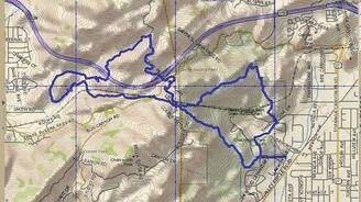
https://cosf.org/trails/other-trails/strenuous-hike-arroyo-conejo-lynnmere-loop/Moderately strenuous 7 mile loop, with a total elevation gain/loss about 1300 ft. A pleasant trail follows Arroyo Conejo from the Rancho Conejo Playfields in Newbury Park, to the Lynnmere loop trail above Wildwood Park. Nice views of the Barranca, Hill Canyon, Newbury Park, Thousand Oaks, and Wildwood Park.
-
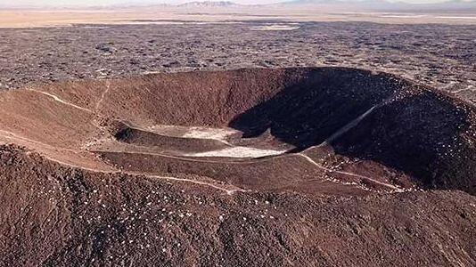 Explore Amboy Crater MEETUP LOCATION AND TIME: kiosk 10AM LATITUDE/LONGITUDE: -115.774688, 34.560312DIRECTIONS:From Needles, CA, take I-40 west approx. 65 miles to Kelbaker Road. Exit southbound on Kelbaker Road and drive approx. 10 miles to National Trails Highway. Turn left on National Trails Highway and drive approx. 8 miles to Crater Road. Turn left onto Crater […] |
2 hikes,
-
 This Santa Clarita walk about loop will have us walking along paved pathways 95% of the way. The neighborhoods here were designed with paseos meandering from one to another linked by foot bridges. Later this year DaveR and I will be posting a bike ride here which, like the walkways, has many dedicated foot and […]
-
The Bucksnort Trail is a beautiful 2.99 mile trail in the Sespe Wilderness in Ventura County . The trail connects the Agua Blanca Trail (19W10) and the Alder Creek Trail (20W11). http://www.hikelospadres.com/bucksnort-trail.html#.X5igQYhKiUk |
3 hikes,
Featured
-
Featured
PRACTICE SOCIAL DISTANCING WHENEVER POSSIBLE, ESPECIALLY AT TRAIL HEAD AND BREAK SPOTS. WEAR A MASK OR FACE COVERING WHENEVER SOCIAL DISTANCING IS IMPOSSIBLE OR IMPRACTICAL. IT IS MANDATORY THAT YOU BRING A FACE COVERING. BRING HAND SANITIZER IF YOU HAVE IT. Details Another HWD Exclusive On February 21, 2020 the MRCA announced that they acquired […]
-
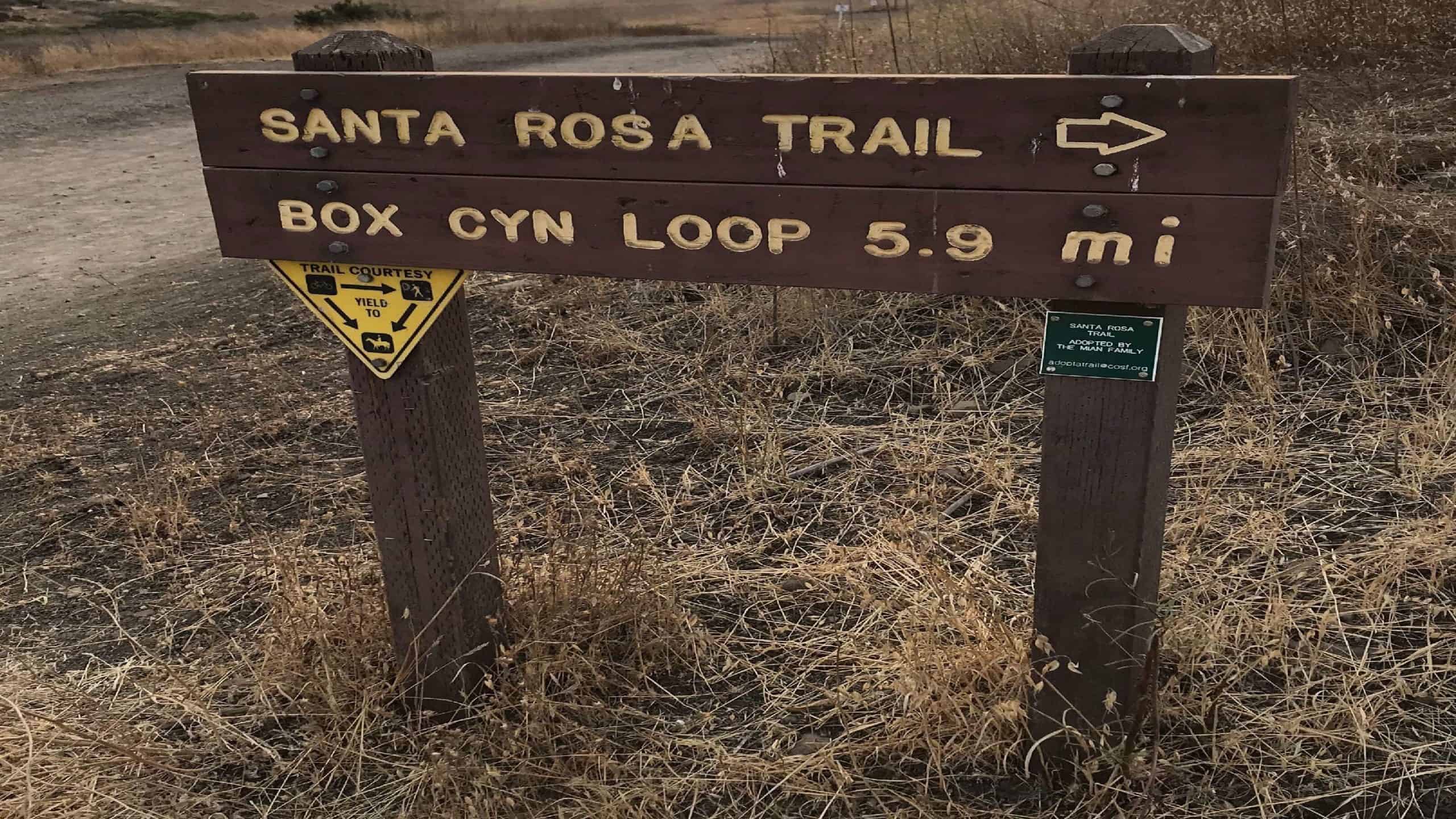 Come Join Us Saturday, December 5, for an afternoon/evening workout hike! We start on time at Wildwood Park where there are a ton of trails. We will be veering right at the Santa Rosa Trail/Box Canyon sign and go up a steep incline, which is about 1 mile to the top. If you are a […]
-
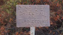 Come join me at a popular location for hiking in Altadena,Cobb Estate, Echo Mountain trail is a very popular hike and if you come or have been there before you'll know why! There are ruins from an old hotel and dance hall and the Mount Lowe Railway.We will begin on time at 2pm so I […] |
1 hike,
-
 TO ALLOW GROUP HIKES TO START UP AGAIN, IT'S ESSENTIAL TO FOLLOW THE COVID-19 SAFETY REQUIREMENTS TO KEEP ALL OF US SAFE NOW:• Masks and social distancing (6ft) required throughout the hike. If you don't agree, please don't join this hike. Read full disclaimer below description. This hike is limited to 10 but with a […] |
Trail statistics are approximate. For safety purposes always assume they are underestimated. But don’t be disappointed if they are overestimated. Bring more water and snacks than you think you’ll need. Trail descriptions are based on previous hikes. Current conditions are unknown until arrival. Expect the unexpected and plan accordingly. The Organizers and members of Hiking With Dean are not professional leaders, guides, or mountaineers. The function of the member or organizer is only to organize the trip. Each person who shows up for a trip/meetup (and their guest or guests) is responsible for his or her own safety. By attending a hike, or any other event organized by this group, you are acknowledging that you and any guests that you bring are aware of the risks, dangers and hazards associated with the activity and freely accept and fully assume all such risks, dangers and hazards, and further agree to release and discharge the Organizers, Members of the Hiking With Dean Meetup Group from and against any and all liability arising from your participation in the group activities per our ASSUMPTION OF RISK AND LIABILITY WAIVER and Section 6.2 of the Meetup.com Terms of Service. |
 MRCA Park Closures and Re-Openings
June 17, 2025
MRCA Park Closures and Re-Openings
June 17, 2025 Back to the Future
May 28, 2023
Back to the Future
May 28, 2023 Chivo Canyon to Coquina Mine
May 21, 2023
Chivo Canyon to Coquina Mine
May 21, 2023 Mission Point the Hard Way
May 12, 2023
Mission Point the Hard Way
May 12, 2023 Lower Zuma Canyon – Big Loop
March 24, 2023
Lower Zuma Canyon – Big Loop
March 24, 2023
Recent Comments