• PCT Sec – Scissors Crossing to Barrel Springs

    Calabasas Bark Park 4232 Las Virgenes Rd, Calabasas, CA, US

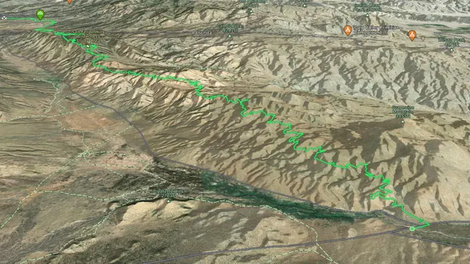
    PCT - WEEKEND BACKPACKING TRIP Days: 2 days, 1 nights Milage: 23 Elevation Gain: 3,642 ft Max Elevation: 4400′ Min Elevation: 2300 Type of Trip: Backpacking Difficulty: Moderate/Strenuous Location: ANZA BORREGO DESERT Starting Point: SCISSOR CROSSING Ending: BARREL SPRINGS Day 1: Distance 13.3 mi Ascent: 4,691 ft Descent: 3,424 ft Scissors Crossing (Hwy 78) to […]

  • Mishe Mokwa Funky Sculpture Fun Time – Backbone Trail – let’s try this again.

    437J+JP Malibu, CA, US

    Intermediate/Advanced Hike! Bust out your Trekking Poles and boots with good traction! DESCRIPTION: This is not a trail for the faint of heart, there are also some technical spots with some mild scrambling. Trekking poles are highly recommended. This is about a 6-mile loop that will feel more like 10 when you’re done. The Backbone […]

  • SPRING BACKBONE TRAIL 2024 #1 – Will Rogers to Skull Rock

    Skull Rock Trailhead - Topanga State Park Pacific Palisades, CA, US

    Come join us as we hike the entire Backbone Trail (67 miles) in eight hikes over four consecutive weekend Saturdays and Sundays. Our first Backbone Trail hike in the Santa Monica Mountains will be 10 miles with 2000 elevation gain on the BBT from the start at Will Rogers Park. We will first hike up […]

  • Las Llajas Canyon and Ridge Loop

    Las Llajas Canyon Trail 5715 Evening Sky Dr, Simi Valley, CA, US

    https://www.alltrails.com/trail/us/california/las-llajas-canyon-and-ridge-loop Hello Fellow Hikers, Okay it's that time again, time to hike The Ridge! dun dun dun dun..lol I know so dramatic. Okay for those of you who have not experienced this hike be prepared to workout! I know your thinking really 9.1 miles with a 1850 elevation gain? We have done much harder...But the […]

  • Sagebrush Cantina: The Replay

    Sagebrush Cantina 23527 Calabasas Rd, Calabasas, CA, United States

    They are starting at 9pm instead of 8pm because of UFX fight Many from this group, plus other friends, will attend. One of the band members is a friend of one of the Hiking Plus members. The Replay is a high-energy Classic Rock cover band from the San Fernando Valley. Led by Rocio Gil on […]

  • Hike at Laguna Coast Wilderness Park – Nix Nature

    Nix Nature Center Parking Lot 18751 Laguna Canyon Rd, Laguna Beach, CA, US

    The hike we will be doing will be around 5 miles long with 875 ft. of elevation gain. This will be a loop starting at the parking lot of Nix Nature Center. As you will see on the map, this is at the main park entrance off of the 133 (Little Sycamore Canyon Staging Area). […]

  • SPRING BACKBONE TRAIL 2024 #2 – Skull Rock to Trippet Ranch

    Trippett Ranch 20829 Entrada Road, Topanga, CA, US

    Our second Backbone Trail hike in the Santa Monica Mountains will be 8 miles on the BBT with 1000 elevation gain from Skull Rock to Trippet Ranch. We will start at the Skull Rock Trailhead taking the Temescal Ridge Trail for 3 miles to pick up the Backbone Trail. We will than take the BBT […]

  • Hawk Canyon lollipop – Potluck hike

    Conejo Canyons Trail Head 2010 Conejo Center Dr, Thousand Oaks, CA, US

    4.2 miles, 700' gain, easy-intermediate. Easier option: 2.7 miles, 500' gain, fit beginner. This is a pot-luck hike. We'll be stopping at the 3/4 point by a picnic table, so please bring food and drink to share, and any utensils your items might require. You may wish to bring your own cup, plate, and utensils […]

  • Rosewood Trail to Angel Vista – Gentler Intermediate

    150 Regal Oak Ct 150 Regal Oak Ct, Thousand Oaks, CA, US

    We will start (early to beat the heat) our hike near the beginning of Regal Oak Ct. on the lower Rosewood Trail, a dirt trail heading up a shaded ravine at the base of the mountains, and continue to the usual Rosewood trail. Rosewood trail presents a clear view over the 101 Freeway carving up […]


Trail statistics are approximate. For safety purposes always assume they are underestimated. But don’t be disappointed if they are overestimated. Bring more water and snacks than you think you’ll need.

Trail descriptions are based on previous hikes. Current conditions are unknown until arrival. Expect the unexpected and plan accordingly.

The Organizers and members of Hiking With Dean are not professional leaders, guides, or mountaineers. The function of the member or organizer is only to organize the trip. Each person who shows up for a trip/meetup (and their guest or guests) is responsible for his or her own safety. By attending a hike, or any other event organized by this group, you are acknowledging that you and any guests that you bring are aware of the risks, dangers and hazards associated with the activity and freely accept and fully assume all such risks, dangers and hazards, and further agree to release and discharge the Organizers, Members of the Hiking With Dean Meetup Group from and against any and all liability arising from your participation in the group activities per our ASSUMPTION OF RISK AND LIABILITY WAIVER and Section 6.2 of the Meetup.com Terms of Service.