Site Search

Hiking Calendar

Almost-Blue-Moon potluck hike Angel Vista

Rosewood Trailhead 305 Regal Oak Ct, Thousand Oaks, CA, US

3.0 miles, 800' gain, easy-intermediate. Moonrise 8:09pm Let's enjoy the gorgeous sunset and the almost full moon, and fun loaded potluck picnic at the beautiful Angel Vista! This is a potluck hike. Please bring food, drinks to share. If your item requires utensils/plates/toothpicks, etc., please bring them. Snacks and/or beverages to share This hike is […]

Hike at Aliso and Wood Canyons Park – Up Cholla, Down Rock-It

Canyon View Staging Area 22124 Utility Access, Aliso Viejo, CA, US

We are going to be starting at the Canyon View Staging Area. This hike will be a little over 5 miles with around 850 ft. of elevation gain. We will be starting at Canyon View Park and taking Cholla up to West Ridge and coming down Rock-It. Link to Parking from Google Maps: https://www.google.com/maps/place/Canyon+View+Staging+Area/@33.585273,-117.7465062,17z/data=!3m1!4b1!4m5!3m4!1s0x80dce61b6bd45c2d:0x5ef3f1ad687cc8b5!8m2!3d33.585273!4d-117.7443175 Dogs […]

Wildwood Central Park ~ Gentler Intermediate

Wildwood Regional Park 928 W Avenida De Los Arboles, Thousand Oaks, CA, US

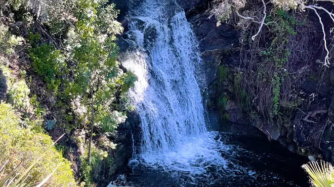
Wildwood Park in Thousand Oaks is one of the most versatile local parks there is, with 27 miles of trails skittering through rocky cliffs, cacti-filled desert environs, volcanic rock, riparian forest, and a cool, watery canyon. Highlights of the hike include waterfalls incorporating 40’ Paradise waterfalls along with a long creek, Indian caves, volcanic rock […]

Parker Mesa Overlook with extension – Intermediate Hike

Trippet Ranch 20825 Entrada Road, Topanga, CA, US

School traffic and traffic on Topanga Canyon Blvd can make the drive longer than you expect, so please allow enough travel time! Topanga State Park is 36 square miles of natural wonder ensconced within Los Angeles' city limits. Starting at Trippet Ranch, we'll ramble through a shady oak grove favored by mule deer and into […]

Long Canyon – Back to Front

572 Bannister Way 572 Bannister Way, Simi Valley, CA, US

4.5 miles, 1000' gain, Easy Intermediate The address given is not the address of the hike. It is nearby and may cause you to drive past the trailhead if navigating by GPS. Easy Option: From 1.5 miles, 500' gain. For something less, head up from the trail head at the parking lot to the bench […]

Rosewood Trail: Lynn to Angel Vista – Gentler Intermediate

150 Regal Oak Ct 150 Regal Oak Ct, Thousand Oaks, CA, US

Meet at the Rosewood sign, which is on the Regal Oak Ct. and Lynn Rd. intersection. The hike is about 5 miles with an elevation gain/loss approximately 900’. We'll walk a short distance on Lynn road to the lower Rosewood Trail, then take the dirt trail up a shaded ravine and continue on the Rosewood […]

Potrero Rd. & Wendy Dr. Roller Coaster Ride to Angel Vista (Fast Paced)

Rancho Sierra Vista/Satwiwa Wendy Trailhead Portrero Road & South Wendy Drive, Newbury Park, ca, US

Please note this hike will start at the trailhead we use for the Boney Hike (junction of South Wendy Drive and Portrero Road). We will take the single track trail about one-half mile to where the Angel Vista TH begins to add about an extra mile to the hike. Hoping to get back before it […]

Hike at Whiting Ranch – Wahoo’s Parking Lot

Wahoo's Fish Taco 27412 Portola Parkway, Foothill Ranch, CA, US

This hike will be about 5.4 miles total with 820 ft. of elevation gain. We are starting at the parking lot at the Wahoo's parking lot. We will take Live Oak Trail. This turns into Serrano Road which will take us to Serrano Cow Trail. At this part of the trail, we usually see a […]

Potrero Ridge from Mountain Creek Dr – Gentler Friendly

Mountain Creek Drive Mountain Creek Dr, Thousand Oaks, CA, US

For this adventure, we'll hike a lollipop loop, starting at the Potrero Ridge trailhead off Mountain Creek Drive in Newbury Park, climb to the top of the ridge and follow it west to the heart of the Dos Vientos trail system. From there we'll make a clockwise loop along several trails, starting with Sierra Vista, […]


Trail statistics are approximate. For safety purposes always assume they are underestimated. But don’t be disappointed if they are overestimated. Bring more water and snacks than you think you’ll need.

Trail descriptions are based on previous hikes. Current conditions are unknown until arrival. Expect the unexpected and plan accordingly.

The Organizers and members of Hiking With Dean are not professional leaders, guides, or mountaineers. The function of the member or organizer is only to organize the trip. Each person who shows up for a trip/meetup (and their guest or guests) is responsible for his or her own safety. By attending a hike, or any other event organized by this group, you are acknowledging that you and any guests that you bring are aware of the risks, dangers and hazards associated with the activity and freely accept and fully assume all such risks, dangers and hazards, and further agree to release and discharge the Organizers, Members of the Hiking With Dean Meetup Group from and against any and all liability arising from your participation in the group activities per our ASSUMPTION OF RISK AND LIABILITY WAIVER and Section 6.2 of the Meetup.com Terms of Service.