Site Search

Hiking Calendar

PCT: Indian Canyon to Vasquez Rocks

Vasquez Rocks Natural Area Park 10700 Escondido Canyon Rd, Agua Dulce, CA, US

** Please read the entire description before you RSVP as things will be a little different with this hike ** https://www.alltrails.com/trail/us/california/pct-vasquez-to-indian-canyon?u=i&sh=aoxfvb Hello Everyone, We will be doing this hike northbound (opposite the AllTrails route). We will do close to 9 miles of the PCT. We will see some interesting rock formations including Three Sisters Rock […]

🚘 Back to the Future Hike at China Flat (& Simi Peak) – Lunch at Lamppost Pizza

Rock Ridge Open Space 5600 Hollytree Dr, Oak Park, CA

On this one, Marty McFly will be taking us to China Flat, the 1885 location of the Seamus McFly farm, Boothill Cemetery and the Delgado Mine. Seamus was/is/will-be Marty's great-great-grandfather. DeLoreans are no longer allowed on the trail so this will be a little strenuous. We're heading back to the future in more ways than […]

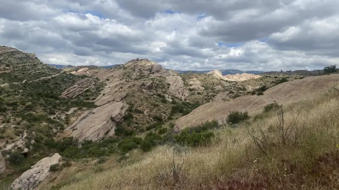
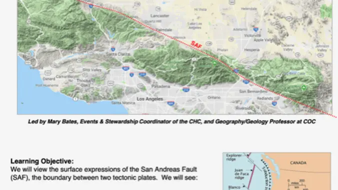
“It’s Not My Fault” – San Andreas Fault Field Trip

Carls Jr 49669 Gorman Post Road,, Gorman, CA, US

**PLEASE READ ENTIRE EVENT DESCRIPTION FOR LOCATION/ HOST IF YOU ATTENDED THE LAST FIELD TRIP FOR “ITS NOT MY FAULT” PLEASE DO NOT SIGN UP FOR THIS ONE. THIS WAS MEANT FOR THISE WHO WERE UNABLE TO ATTEND PREVIOUSLY. WE ARE LIMITING THIS TRIP TO 25 PEOPLE AND 10 CARS, SO IF YOU SIGN UP, […]

Wildwood Park – Las Flores potluck hike – Fit Beginner

604 W Avenida De Las Flores 604 W Avenida De Las Flores, Thousand Oaks, CA, US

Fit Beginner - 4 miles, 600' gain The gain is well distributed, with half being on the return. We start at the Las Flores trailhead where Las Flores dead-ends at Wildwood Park, and head west. After 1/3 mile, the trail becomes Wildwood Canyon Trail. We continue for another 2/3 mile and cross a bridge just […]

Hike at Whiting Ranch Wilderness Park – Borrego Trail & Billy Goat Trail

Whiting Ranch Wilderness Park 26701 Portola Parkway, Foothill Ranch, CA, US

The total mileage for this hike is 5 miles with about 800 ft. of elevation gain. We will start at the trail head of the Borrego Trail, which is right off of the parking lot. This is where we will meet. We will head up the Borrego Trail until we get to Mustard Road. Here […]

BACKBONE TRAIL – Mishe Mokwa to La Jolla Canyon

Ray Miller Canyon Trailhead pacific coast highway & la jolla canyon, malibu, CA, US

Our eighth Backbone Trail hike in the Santa Monica Mountains will be 17 miles on the BBT on the Sandstone Peak, Chamberlain, Blue Canyon, Wood Canyon, and Ray Miller Trails before finishing the La Jolla Campground. This is a Sierra Club hike, so participants must sign in, carry their medical form, and hike between the […]

Tapo Canyon Trail

Tapo Canyon Road Tapo Canyon Rd, Simi Valley, CA, US

https://www.alltrails.com/trail/us/california/tapo-canyon-trail?u=i Hello Fellow Hikers, Join me on a easier moderate hike at Tapo Canyon Trail in Simi Valley. This hike has a nice gradual walk until we start a gradual climb were we will start our loop. We should encounter wildflowers and mountain views. Our loop will drop down then we will continue until we […]

Memorial Day Hike at Caspers Wilderness Park (2 Options)

Caspers Wilderness Park 33401 Ortega Hwy, San Juan Capistrano, CA, US

The longer hike I am planning is around 6.3 miles with about 825 ft. of elevation gain. It starts at the very end of the paved road, the long gray strip that can be seen on the map. The shorter alternate cuts off the last hill and ridge. That distance is 4.8 miles with about […]

Dos Vientos – Memorial Day Picnic

Dos Vientos Community Park 4801 Borchard Road, Newbury Park, CA, US

5.2 miles, 1140' gain, Intermediate Beginner Option: 3.5 miles, 500' gain, Fit Beginner Come to the hike only (3:30p), picnic only (5:00p), or both. Warning: Google Maps may take you to the incorrect location, although the address is correct. Please follow the written directions. The Hike 3:30 pm at the parking lot entrance. We take […]

[asa2_collection tpl=”Flex_1″ orderby=”rand” limit=”4″]2[/asa2_collection]

Trail statistics are approximate. For safety purposes always assume they are underestimated. But don’t be disappointed if they are overestimated. Bring more water and snacks than you think you’ll need.

Trail descriptions are based on previous hikes. Current conditions are unknown until arrival. Expect the unexpected and plan accordingly.

The Organizers and members of Hiking With Dean are not professional leaders, guides, or mountaineers. The function of the member or organizer is only to organize the trip. Each person who shows up for a trip/meetup (and their guest or guests) is responsible for his or her own safety. By attending a hike, or any other event organized by this group, you are acknowledging that you and any guests that you bring are aware of the risks, dangers and hazards associated with the activity and freely accept and fully assume all such risks, dangers and hazards, and further agree to release and discharge the Organizers, Members of the Hiking With Dean Meetup Group from and against any and all liability arising from your participation in the group activities per our ASSUMPTION OF RISK AND LIABILITY WAIVER and Section 6.2 of the Meetup.com Terms of Service.