Red Rock Canyon Potluck Hike
1699 Stunt Rd 1699 Stunt Rd, Calabasas, CA, USEasy-Intermediate, 4 miles, 800' gain. Option not to hike: If for some reason you don't want to hike but still want to come, the social event can be driven to, […]

Easy-Intermediate, 4 miles, 800' gain. Option not to hike: If for some reason you don't want to hike but still want to come, the social event can be driven to, […]

3.5 miles, 800' gain, easy intermediate Easy option: 450', 50' gain, short walk. The Easy Option does not start at the same place, but gets you to the social event. […]

5 miles, 500' gain, Beginner This hike is a great trail for beginners because all the elevation gain is distributed. It is a walk down a rolling fire road through […]

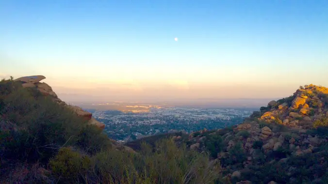
3.0 miles, 800' gain, easy-intermediate. Moonrise 8:09pm Let's enjoy the gorgeous sunset and the almost full moon, and fun loaded potluck picnic at the beautiful Angel Vista! This is a […]

4.5 miles, 1000' gain, Easy Intermediate The address given is not the address of the hike. It is nearby and may cause you to drive past the trailhead if navigating […]

3.5 miles, 600' gain, Easy Intermediate Easy Option: 2.4 miles, 285' gain, Fit Beginner We enter the Los Padres trail through a spooky oak covered section, then move through until […]

Fit Beginner 4.3 miles, 480' gain. Easier Option: 4 miles, 230' gain. We walk a mostly flat section for 1.1 mi. to the 2nd junction. Easier option: Continue straight for […]

4.25 miles, 1200' gain, intermediate We start with a 1/4 mile walk from where we park along Cottonwood Dr, to the trail head. There we make a left and take […]

Easy Intermediate, 4 miles, 900' gain The address given, is not the address of the hike. It is a nearby address that may cause your GPS to drive past the […]
[asa2_collection tpl=”Flex_1″ orderby=”rand” limit=”4″]2[/asa2_collection]
Trail statistics are approximate. For safety purposes always assume they are underestimated. But don’t be disappointed if they are overestimated. Bring more water and snacks than you think you’ll need. Trail descriptions are based on previous hikes. Current conditions are unknown until arrival. Expect the unexpected and plan accordingly. The Organizers and members of Hiking With Dean are not professional leaders, guides, or mountaineers. The function of the member or organizer is only to organize the trip. Each person who shows up for a trip/meetup (and their guest or guests) is responsible for his or her own safety. By attending a hike, or any other event organized by this group, you are acknowledging that you and any guests that you bring are aware of the risks, dangers and hazards associated with the activity and freely accept and fully assume all such risks, dangers and hazards, and further agree to release and discharge the Organizers, Members of the Hiking With Dean Meetup Group from and against any and all liability arising from your participation in the group activities per our ASSUMPTION OF RISK AND LIABILITY WAIVER and Section 6.2 of the Meetup.com Terms of Service. |
Meetuphikes.com is the brainchild of Dean, the founder and organizer of the Meetup hiking group Hiking With Dean. Here you will find past and upcoming Meetup group hikes from all over southern California. Don’t see your favorite group? Drop us a line and ask us to add it.
 MRCA Park Closures and Re-Openings
June 17, 2025
 Back to the Future
May 28, 2023
 Chivo Canyon to Coquina Mine
May 21, 2023
 Mission Point the Hard Way
May 12, 2023
 Lower Zuma Canyon – Big Loop
March 24, 2023
Recent Comments