

[av_textblock size=” font_color=” color=” av-desktop-hide=” av-medium-hide=” av-small-hide=” av-mini-hide=” av-medium-font-size=” av-small-font-size=” av-mini-font-size=” av_uid=’av-278ajj1′]
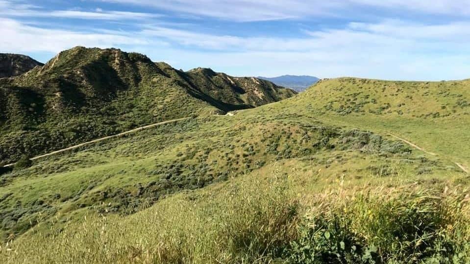
Leave the sights and sounds of civilization behind on this quick getaway on a non-technical trail. The Tapo Canyon Trail is wide most of the time with firm smooth ground and many sandy sections. The hike is roughly 4.5 miles round trip starting from the trailhead and incorporating a “lollipop” loop. Total ascent is about 800 ft.
On the way out we’ll stop and party, so bring some wine/booze and snacks to share
NO WHITE LIGHTS – Red and Green lights only. If you don’t have one you can tailgate off of someone else’s. Here are some recommendations:
[asa2_collection show_prime=”no” title_length=”50″ savings_text_style=”long” max_width=”2000″ max_row_items=”3″ tpl=” Flex_1″ width=”50%”]4[/asa2_collection]
[/av_textblock]
[av_notification title=’Rating’ icon_select=’no’ icon=’ue800′ font=’entypo-fontello’ color=’silver’ border=’solid’ custom_bg=’#444444′ custom_font=’#ffffff’ size=’normal’ close_btn=” cookie_lifetime=’60’ av_uid=’av-376g59′ custom_class=” admin_preview_bg=”]
Hike is rated MEDIUM due to elevation gain . See the new hike ratings guide
[/av_notification]
[av_textblock size=” font_color=” color=” av-desktop-hide=” av-medium-hide=” av-small-hide=” av-mini-hide=” av-medium-font-size=” av-small-font-size=” av-mini-font-size=” av_uid=’av-1jvg1vh’]
Dogs on leash OK
DIRECTIONS
From the 118 Freeway, take Tapo Canyon Road exit and head north. The trail head will be on the right side of the road at 1.5 miles, shortly before the intersection with Lost Canyon Drive. Free parking is available in a small dirt lot.
[/av_textblock]


