Site Search

Chevron Gas Station

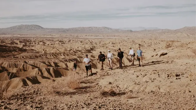
Wind Caves – The Domelands (Anza Borrego Desert)

Chevron Gas Station 1071 N Imperial Hwy Ocotillo, CA 92259, Ocotillo, CA, US

Intermediate Backpacking Trip (only because it's a Dry Camp) Milage: 7 - 14 miles (depending on route) Some Cross country hiking. Ascent: +700-1000 ft High clearance vehicles recommended....but we have seen regular car make it. Dry camp (no water) Maps/GPX files/Google map From last year trip. Instagram Video) There are several places in Anza-Borrego State […]

Wind Caves – The Domelands (Anza Borrego Desert) DAY HIKE

Chevron Gas Station 1071 N Imperial Hwy Ocotillo, CA 92259, Ocotillo, CA, US

TRAINING HIKE Day Hike this (SUNDAY 1/19/25) Milage: 7 - 8 miles LOOP Some Cross country hiking. Ascent: +700-1000 ft High clearance vehicles recommended....but we have seen regular car make it. From last year trip. Instagram Video There are several places in Anza-Borrego State Park where exposed sandstone layering has been slowly eroded by the […]

PCT Sec – Scissors Crossing to Barrel Springs

Chevron Gas Station 1071 N Imperial Hwy Ocotillo, CA 92259, Ocotillo, CA, US

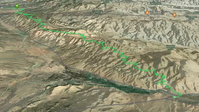
PCT - WEEKEND BACKPACKING TRIP Days: 2 days, 1 nights Milage: 23 Elevation Gain: 3,642 ft Max Elevation: 4400′ Min Elevation: 2300 Type of Trip: Backpacking Difficulty: Moderate/Strenuous Location: ANZA BORREGO DESERT Starting Point: SCISSOR CROSSING Ending: BARREL SPRINGS Day 1: Distance 13.3 mi Ascent: 4,691 ft Descent: 3,424 ft Scissors Crossing (Hwy 78) to […]

Wind Caves – The Domelands (Anza Borrego Desert)

Chevron Gas Station 1071 N Imperial Hwy Ocotillo, CA 92259, Ocotillo, CA, US

Intermediate Backpacking Trip (only because it's a Dry Camp) Milage: 7 - 14 miles (depending on route) Some Cross country hiking. Ascent: +700-1000 ft High clearance vehicles recommended....but we have seen regular car make it. Dry camp (no water) Maps/GPX files/Google map From last year trip. Instagram Video) There are several places in Anza-Borrego State […]


Trail statistics are approximate. For safety purposes always assume they are underestimated. But don’t be disappointed if they are overestimated. Bring more water and snacks than you think you’ll need.

Trail descriptions are based on previous hikes. Current conditions are unknown until arrival. Expect the unexpected and plan accordingly.

The Organizers and members of Hiking With Dean are not professional leaders, guides, or mountaineers. The function of the member or organizer is only to organize the trip. Each person who shows up for a trip/meetup (and their guest or guests) is responsible for his or her own safety. By attending a hike, or any other event organized by this group, you are acknowledging that you and any guests that you bring are aware of the risks, dangers and hazards associated with the activity and freely accept and fully assume all such risks, dangers and hazards, and further agree to release and discharge the Organizers, Members of the Hiking With Dean Meetup Group from and against any and all liability arising from your participation in the group activities per our ASSUMPTION OF RISK AND LIABILITY WAIVER and Section 6.2 of the Meetup.com Terms of Service.