

Intermediate Backpacking Trip (only because it’s a Dry Camp)
Milage: 7 – 14 miles (depending on route)
Some Cross country hiking.
Ascent: +700-1000 ft
High clearance vehicles recommended….but we have seen regular car make it.
Dry camp (no water)
Maps/GPX files/Google map
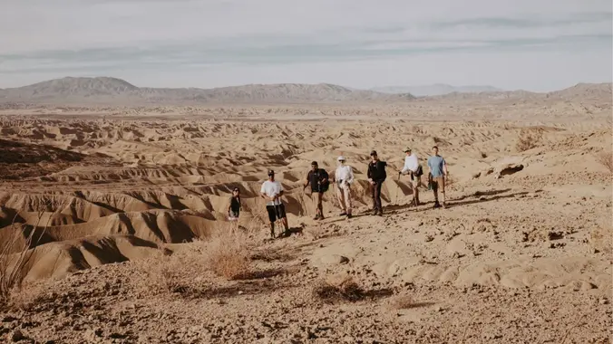
From last year trip.
There are several places in Anza-Borrego State Park where exposed sandstone layering has been slowly eroded by the wind to create odd and whimsical-shaped formations. Near Split Mountain, there are some formations that have a rather sinister look to them. The formations also seem to resemble buildings from the fictional town of Bedrock, which was the hometown of America’s favorite prehistoric family, The Flintstones. This place is known as the Wind Caves and can be visited by following a loop-trail hike.
Not only does this hike take in the Wind Caves, but it also offers outstanding views of the heavily eroded Carrizo Badlands to the west. These badlands look like a choppy sea with large waves frozen in place. Naturally, there is classic desert vegetation growing profusely along the trail
NO WATER ON THE TRAIL ( we must carry all of our water)
Total milage 12 +
Day 1
Meet: We will meet at the Chevron Station @ 9:am
1071 Imperial Hwy,
Ocotillo, CA 92259
32.730716, -115.994637
•We will caravan to the trailhead @9:15am
• We will hike about 4.5 miles basecamp.
• Hike to the wind caves 2. (4 miles round trip)
• Hike back to camp and eat dinner.
Day 2
• 8am break down camp and head back to the cars.
DISCLAIMER: Hike at your own risk. Be responsible for yourself and your safety. Make good decisions. With any trip, things can change, reservations can get lost, the unexpected can happen. A go-with-the-flow attitude is always a good thing, and most importantly, let’s all have fun! This is an intermediate hike. Make sure you are in good enough physical shape for the distance, elevation changes, and terrain. The hike leaders in this group aren’t professional hike leaders. By signing up for these events, you agree not to hold the Meetup organizers responsible for whatever happens to you on these events. The hiking group does not certify the expertise of the organizers, the event or assistant organizers (hike leaders) and…We are NOT responsible for any possible losses or injuries.


