This will be one of several conditioning hikes for David and me as we work on building up our endurance which has been weekend from past surgeries. You’re welcomed to join us on these local treks.
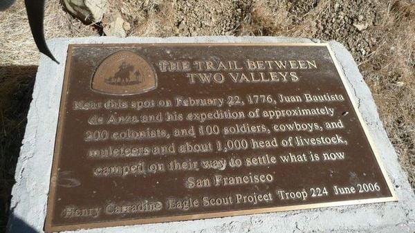
The Juan Bautista de Anza Trail is one of several hiking trails that hides in plain sight, right next to Highway 101 in Calabasas. It provides a good workout, with nice views of the west San Fernando Valley, the Santa Monica Mountains, Santa Susanas and, if the air is clear, the San Gabriels. It explores part of the historic route traveled by Juan Bautista de Anza, after whom its named.
This stretch of pavement is a small piece of the El Camino Real of the early 20th century. In the 1860’s the path was improved for the use of stagecoaches. Improvement meant grading and widening what was really a path to allow a coach to pass. Some of the grades were so steep that male passengers were asked to get out and walk – or push. In the early 20th century, the “Good Roads” movement lobbied for all-weather paved roads for automobiles and the last section of the route was paved in 1926. By the early 1950s, this portion of us 101 had become a “modern” 4-lane highway.
AGENDA:
This event will require a car shuttle. We’ll all meet at the end of Calabasas Road at 8:00 am. and then car shuttle, in as few cars as possible, to Bark Park to begin the hike. We’ll gain 450′ over the first mile of the Bark Park Trail before it levels off on the New Millenium Trail. We’ll follow this trail for three miles where it connects to The Juan Bautista de Anza Trail. Hiking one mile on this trail will bring us to our cars on Calabasas Rd. We’ll need a car or two to take the car shuttle drivers back to their cars at Bark Park.
MEETUP LOCATION: The end of Calabasas Road – Exit the 101 at Parkway Calabasas and head south. Turn right (west) on Calabasas Rd. and proceed until it ends at the trailhead.
Link to a google map showing exact meetup location:
https://www.google.com/maps/place/34%C2%B008’59.6%22N+118%C2%B040’36.6%22W/@34.1498864,-118.679018,956m/data=!3m2!1e3!4b1!4m6!3m5!1s0x0:0x0!7e2!8m2!3d34.1498822!4d-118.6768315
MEETUP DATE AND TIME: Oct. 19th. Meet at the end of Calabasas Rd. at 8:00.
DISTANCE: About 5 miles
ELEVATION GAIN: About 800 feet
DURATION: About 3 hours which includes the car shuttle time
LEVEL: Advanced beginner capable of an 800′ gain with a pace of 2.5 mph.
Ignore Google Map-Read the description...
N/A
N/A, CA, US




