Hiking Calendar
Week of Hikes
Arroyo Seco Walk-in Trail Camp Adventure June 22-25 Limited to 12 guests
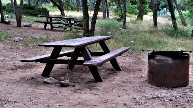
This is a walk-in trail campground. Amenities are few. There is a rest room, a 4 fire pits, a SINGLE bear vault and 4 picnic tables/benches. You cannot make reservations, so getting there early is imperative. Pack lightly. You will be walking downhill for approximately 1 mile to the camping area. There are no numbered […]
Cottonwood Lakes Overnight Trip (with optional ascent of Mt. Langley)
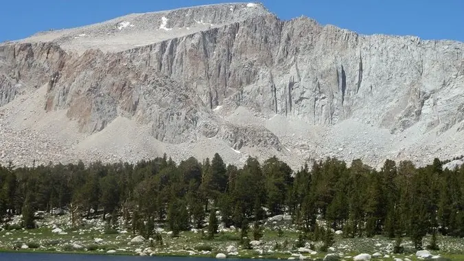
The Cottonwood Lakes are a great introduction to the high Sierras, very easy to access and relatively close to San Diego. Looks like it's still quite snowy up there. Pictures from 2021 (much less snowy!): https://www.meetup.com/sandiegobackpackers/events/278793005/ Snow depth: https://www.nohrsc.noaa.gov/interactive/html/graph.html?ey=2023&em=6&ed=16&units=0&station=CWDC1 Weather (still unseasonably cold, hopefully it will be warm up): https://forecast.weather.gov/MapClick.php?lon=-118.21492172105822&lat=36.49599812734478 BEAR CANISTER (or Ursack) REQUIRED […]
Hike at Laguna Coast Wilderness Park – Willow Staging Area
Hike at Laguna Coast Wilderness Park – Willow Staging Area
The hike we will be doing is a loop at about 5.5 miles with 725 ft. of elevation gain. We will meet at the Willow Staging Area that is right off of the 133. We will begin at the trail head of the Laurel Canyon Trail. We will take this to Lizard Trail, then we […]
Saddle Peak and Topanga Lookout Trails ~ Gentler Intermediate
Saddle Peak and Topanga Lookout Trails ~ Gentler Intermediate
We will have two short hikes; Saddle Peak hike (about 3 miles with approximately 500' elevation gain) and Topanga Lookout hike (about 2 miles with approximately 400' elevation gain). https://www.hikespeak.com/trails/topanga-lookout/ We will begin Saddle Peak hike at the end of the Stunt Road hike near the intersection of Stunt Road and Schueren Road. Saddle Peak […]
Intermediate Hike ~ Palo Comado / Cheseboro Loop via Ranch Center trail
Intermediate Hike ~ Palo Comado / Cheseboro Loop via Ranch Center trail
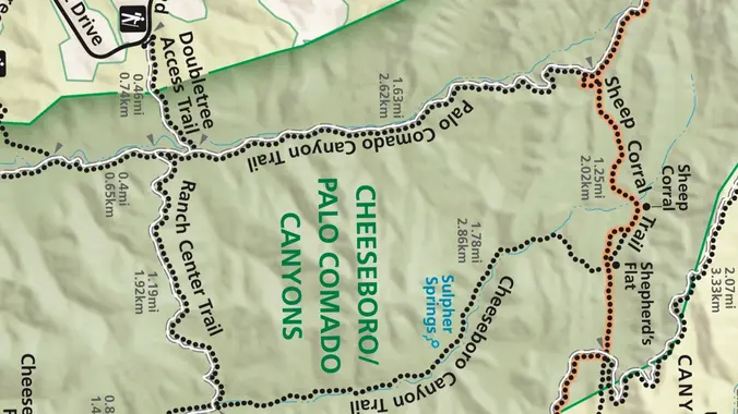
This week we’ll do a loop around the northeastern regions of the Santa Monica Mountains National Recreation Area and the Las Virgenes Open Space. This area traverses many ecosystems, including riparian, chaparral, and the rockscape from Galaxy Quest. The area is generally dry, but very nice! http://photos1.meetupstatic.com/photos/event/c/3/0/c/event_255709932.jpeg The trailhead is where Sunnycrest turns into Doubletree, […]
Upper Stunt High Trail To Saddle Peak ~ Gentler Intermediate at a Slower Pace
Upper Stunt High Trail To Saddle Peak ~ Gentler Intermediate at a Slower Pace
This hike begins at Upper Stunt High Trail, a couple hundred feet to the right on the other side of the street from the parking lot. The trail winds upward gradually over switchbacks, giving way as the trail heads up to a dramatic rocky overlook with striking views of the Pacific, Stunt Ranch State Park, […]
Hike at Laguna Coast Wilderness Park – Willow Staging Area
Hike at Laguna Coast Wilderness Park – Willow Staging Area
The hike we will be doing is a loop at about 5.5 miles with 725 ft. of elevation gain. We will meet at the Willow Staging Area that is right off of the 133. We will begin at the trail head of the Laurel Canyon Trail. We will take this to Lizard Trail, then we […]
Sage Ranch Lollipop – Fit Beginner
Sage Ranch Lollipop – Fit Beginner
3 miles. 560' gain, fit beginner (5:30, not 6p) Note the time change. This park closes at sunset, so we try to get out by then. Free parking is limited. Carpooling recommended. As of Agust. 2022, the first part of the clockwise loop was closed, but we found a new route with a perfect place […]
The Bridge is Back! – MASH via the Grassland Trail
The Bridge is Back! – MASH via the Grassland Trail
Please review our guidelines to participate in our hikes. Restrictions apply for your safety and ours: Please don't show up unless you're on the "Attending" list Unregistered or waitlisted will be turned away Sorry, no "Plus Ones" on this hike No dogs allowed in the state park The usual access to MASH (Reagan Ranch) is […]
Hike at Boat Canyon to Bommer Ridge
Hike at Boat Canyon to Bommer Ridge
The total distance is around 4.6 miles with 870' of elevation gain. We will take Boat Canyon Trail up to Bommer Canyon. We will take Bommer to Water Tank trail. We will take this and then take a lower trail back to the beginning. Address: Dartmoor Trail Lookout Laguna Beach, CA 92651 https://goo.gl/maps/6N8c88XfdSeYu85M8 Dogs are […]
Ray Miller trail up to the fire road
Ray Miller trail up to the fire road
On this hike we will go up the Ray Miller trail to the fire road and back, about 6 miles. It will probably still be cool enough on the beach to start at 9:00, that will change soon. We’ll enjoy beautiful ocean views as we descend. Lying along the brilliant blue Pacific Ocean at the […]
Long Canyon – Lower Loop
Long Canyon – Lower Loop
3 miles, 800' gain, Easy Intermediate. Easy option, 1.4 miles, 450' gain, Fit Beginner The address given is not the address of the hike. It is nearby and may cause you to drive past the trailhead if navigating by GPS. Route From the trailhead parking lot, up for 0.7 mile on Long Canyon Trail to […]
Fun Beginer Hike – Gabrieleno Trail to Brown Mountain Dam – Out and Back
Fun Beginer Hike – Gabrieleno Trail to Brown Mountain Dam – Out and Back
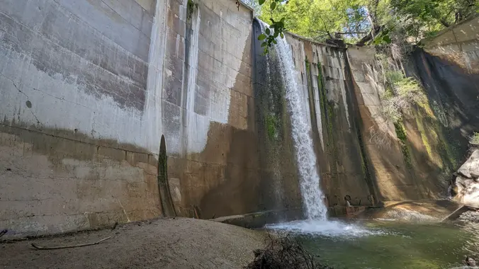
Meetup Time: 7:15 A.M. (We hit the trail at 7:30) DISTANCE: 8 miles – out and back. GAIN: 652 ft RATED: Beginner hike with some wet stream crossings. HIKE DURATION: About 3 1/2 to 4 hours (including a 20-minute snacky time!) DESCRIPTION: Brown Mountain Dam Trail, is nestled in the beautiful San Gabriel Mountains, offering […]
Hike to the Black Star Canyon Indian Village Site
Trailer Canyon to Temescal Peak
Trailer Canyon to Temescal Peak
https://www.alltrails.com/trail/us/california/trailer-canyon-to-temescal-peak Hello Fellow Hikers, Were gonna be taking the less traveled route that leads you to both Will Rogers State Park and Topanga State Park. This route has a gradual incline to the peak with the hardest climb being a short distance to the peak. From there will have both mountain and ocean views. Our […]
Mash Site – Malibu Creek State Park Potluck Hike
Mash Site – Malibu Creek State Park Potluck Hike
Fit Beginner - 6 miles, 600' gain (route link) Easy Option - 2 miles, 300' gain (route link) This is a social hike and an out-and-back event. There is a potluck at the M.A.S.H. site before we turn around for the return. If your item requires paper plates, utensils, etc. please bring them. Pot Luck […]
🐸 Hike at O’Neill Regional Park – Live Oak + Vista Trail
🐸 Hike at O’Neill Regional Park – Live Oak + Vista Trail
Let's go see if there are still tons of frogs/toads around! The hike we will be doing is approximately 5 miles with 870 ft. of elevation gain. We will begin at the Live Oak Trail trailhead. This is where you will see on the map that the Live Oak Trail hits the paved road, right […]
Hike for World Peace with TKBC Buddhist Center
Hike for World Peace with TKBC Buddhist Center
Join our community for a peaceful hike for world peace on the beautiful Los Padres Trail and Vista Loop to help raise funds for world peace. Enjoy a beautiful day in serene surroundings with like-minded spiritual friends while supporting a worthy cause. Tushita KBC is a non-profit 501(c)3 organization run by volunteers that has been […]
Fort Wildwood – Paradise Falls – And More
Fort Wildwood – Paradise Falls – And More
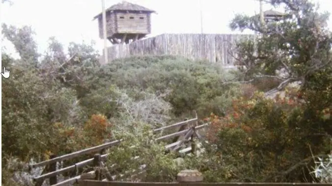
With two waterfalls, scenic volcanic outcroppings, a variety of hiking trails, several pleasant picnic areas, and abundant open space, Wildwood Park is a great place to escape the hustle and bustle of the nearby city. For you stairs fans: Did you know Wildwood has a trail with 76 steps? Highlights along the way: Fort Wildwood […]
Greek Festival in Camarillo! Opa!!
Greek Festival in Camarillo! Opa!!
Come join us for a fun and food filled festival day, with all the Greek food, music, and culture you can handle! Oh, and lots of Ouzo and beer, maybe even some dancing. St. Demetrios Greek Orthodox Church is hosting their annual Greek Festival, and HP will be there to take in the sights and […]
Trail statistics are approximate. For safety purposes always assume they are underestimated. But don’t be disappointed if they are overestimated. Bring more water and snacks than you think you’ll need. Trail descriptions are based on previous hikes. Current conditions are unknown until arrival. Expect the unexpected and plan accordingly. The Organizers and members of Hiking With Dean are not professional leaders, guides, or mountaineers. The function of the member or organizer is only to organize the trip. Each person who shows up for a trip/meetup (and their guest or guests) is responsible for his or her own safety. By attending a hike, or any other event organized by this group, you are acknowledging that you and any guests that you bring are aware of the risks, dangers and hazards associated with the activity and freely accept and fully assume all such risks, dangers and hazards, and further agree to release and discharge the Organizers, Members of the Hiking With Dean Meetup Group from and against any and all liability arising from your participation in the group activities per our ASSUMPTION OF RISK AND LIABILITY WAIVER and Section 6.2 of the Meetup.com Terms of Service. |









Recent Comments