Hiking Calendar
Tag a Peak tuesday- Knolls Peak and Peppertree Summit
Black Canyon Road Black Canyon Rd, Simi ValleyHump Day- Wildwood Park (exact destination to follow)
Wildflower Playfield 635 W Avenida De Los Arboles, Thousand OaksSanta Rosa Trail Loop through Box Canyon
Wildwood Regional Park 928 W Avenida De Los Arboles, Thousand OaksWeek of Hikes
Piedra Blanca Trail Camp
Piedra Blanca Trail Camp
Piedra Blanca Camp Trail is a 6.1 mile moderately trafficked out and back trail located near Ojai, California that features a river and is rated as moderate. An adventure Pass is required to park.
Tag a Peak tuesday- Knolls Peak and Peppertree Summit
Tag a Peak tuesday- Knolls Peak and Peppertree Summit
We will park on the side of the road at the indicated spot. It is a sharp 180 degree turn. We will hike up the trail/road tag Knolls then up to peppertree and back.
Afton Cave exploratory near the Mojave Preserve
Afton Cave exploratory near the Mojave Preserve
Explore Afton Canyon in the Mojave Preserve. Hiking to the Caves and try to locate the buried boxcar. The Mojave River crossing is doable with any SUV since the RR filled it with rocks. MEETUP LOCATION AND TIME: We'll meet at the campground entrance at Afton Canyon at 12:30 pm.N35.04133° W116.39367° https://nobodyhikesinla.com/2017/12/14/afton-canyon/ RESTROOM: YES DISTANCE: […]
Fast paced evening hike at Las Llajas
Fast paced evening hike at Las Llajas
Let's not let the time change keep us from hiking to stay in shape!Las LLajas is a good evening hike in the dark. It is an even, wide road that is safer than many other hiking trails.I will be going at a fast pace. If you are a beginner you can still join us, just […]
Hump Day- Wildwood Park (exact destination to follow)
Hump Day- Wildwood Park (exact destination to follow)
Please note: If you don't show up, or change your rsvp to "not going" less than 4 hours before the start of the hike (which means people on the waitlist miss out) more than once , you will not be welcome to hike with me again. Masks are mandatory as we gather at the trailhead […]
Arroyo Conejo Lynnmere loop
Arroyo Conejo Lynnmere loop
https://cosf.org/trails/other-trails/strenuous-hike-arroyo-conejo-lynnmere-loop/Moderately strenuous 7 mile loop, with a total elevation gain/loss about 1300 ft. A pleasant trail follows Arroyo Conejo from the Rancho Conejo Playfields in Newbury Park, to the Lynnmere loop trail above Wildwood Park. Nice views of the Barranca, Hill Canyon, Newbury Park, Thousand Oaks, and Wildwood Park.
Amboy Crater near the Mojave Preserve
Amboy Crater near the Mojave Preserve
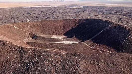
Explore Amboy Crater MEETUP LOCATION AND TIME: kiosk 10AM LATITUDE/LONGITUDE: -115.774688, 34.560312DIRECTIONS:From Needles, CA, take I-40 west approx. 65 miles to Kelbaker Road. Exit southbound on Kelbaker Road and drive approx. 10 miles to National Trails Highway. Turn left on National Trails Highway and drive approx. 8 miles to Crater Road. Turn left onto Crater […]
Hike the Los Padres- Bucksnort trail
Hike the Los Padres- Bucksnort trail
The Bucksnort Trail is a beautiful 2.99 mile trail in the Sespe Wilderness in Ventura County . The trail connects the Agua Blanca Trail (19W10) and the Alder Creek Trail (20W11). http://www.hikelospadres.com/bucksnort-trail.html#.X5igQYhKiUk
SANTA CLARITA LOOP WALK ABOUT + optional lunch
SANTA CLARITA LOOP WALK ABOUT + optional lunch
This Santa Clarita walk about loop will have us walking along paved pathways 95% of the way. The neighborhoods here were designed with paseos meandering from one to another linked by foot bridges. Later this year DaveR and I will be posting a bike ride here which, like the walkways, has many dedicated foot and […]
New Open Space — V.I.P.s Only
New Open Space — V.I.P.s Only
PRACTICE SOCIAL DISTANCING WHENEVER POSSIBLE, ESPECIALLY AT TRAIL HEAD AND BREAK SPOTS. WEAR A MASK OR FACE COVERING WHENEVER SOCIAL DISTANCING IS IMPOSSIBLE OR IMPRACTICAL. IT IS MANDATORY THAT YOU BRING A FACE COVERING. BRING HAND SANITIZER IF YOU HAVE IT. Details Another HWD Exclusive On February 21, 2020 the MRCA announced that they acquired […]
Santa Rosa Trail Loop through Box Canyon
Santa Rosa Trail Loop through Box Canyon
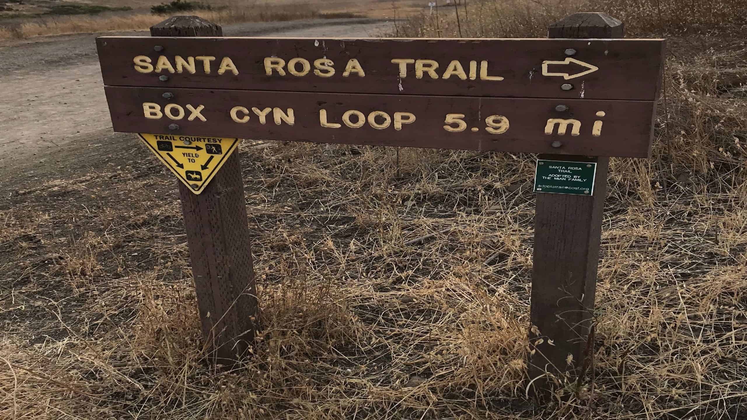
Come Join Us Saturday, December 5, for an afternoon/evening workout hike! We start on time at Wildwood Park where there are a ton of trails. We will be veering right at the Santa Rosa Trail/Box Canyon sign and go up a steep incline, which is about 1 mile to the top. If you are a […]
Echo Mountain Via Sam Merrill Trail
Echo Mountain Via Sam Merrill Trail
Come join me at a popular location for hiking in Altadena,Cobb Estate, Echo Mountain trail is a very popular hike and if you come or have been there before you'll know why! There are ruins from an old hotel and dance hall and the Mount Lowe Railway.We will begin on time at 2pm so I […]
Hill Canyon Trail to Hawk Canyon
Hill Canyon Trail to Hawk Canyon
TO ALLOW GROUP HIKES TO START UP AGAIN, IT'S ESSENTIAL TO FOLLOW THE COVID-19 SAFETY REQUIREMENTS TO KEEP ALL OF US SAFE NOW:• Masks and social distancing (6ft) required throughout the hike. If you don't agree, please don't join this hike. Read full disclaimer below description. This hike is limited to 10 but with a […]
Trail statistics are approximate. For safety purposes always assume they are underestimated. But don’t be disappointed if they are overestimated. Bring more water and snacks than you think you’ll need. Trail descriptions are based on previous hikes. Current conditions are unknown until arrival. Expect the unexpected and plan accordingly. The Organizers and members of Hiking With Dean are not professional leaders, guides, or mountaineers. The function of the member or organizer is only to organize the trip. Each person who shows up for a trip/meetup (and their guest or guests) is responsible for his or her own safety. By attending a hike, or any other event organized by this group, you are acknowledging that you and any guests that you bring are aware of the risks, dangers and hazards associated with the activity and freely accept and fully assume all such risks, dangers and hazards, and further agree to release and discharge the Organizers, Members of the Hiking With Dean Meetup Group from and against any and all liability arising from your participation in the group activities per our ASSUMPTION OF RISK AND LIABILITY WAIVER and Section 6.2 of the Meetup.com Terms of Service. |
About Us
Meetuphikes.com is the brainchild of Dean, the founder and organizer of the Meetup hiking group Hiking With Dean. Here you will find past and upcoming Meetup group hikes from all over southern California. Don’t see your favorite group? Drop us a line and ask us to add it.
Recent Posts
-
 MRCA Park Closures and Re-Openings
June 17, 2025
 -
 Back to the Future
May 28, 2023
 -
 Chivo Canyon to Coquina Mine
May 21, 2023
 -
 Mission Point the Hard Way
May 12, 2023
 -
 Lower Zuma Canyon – Big Loop
March 24, 2023





Recent Comments