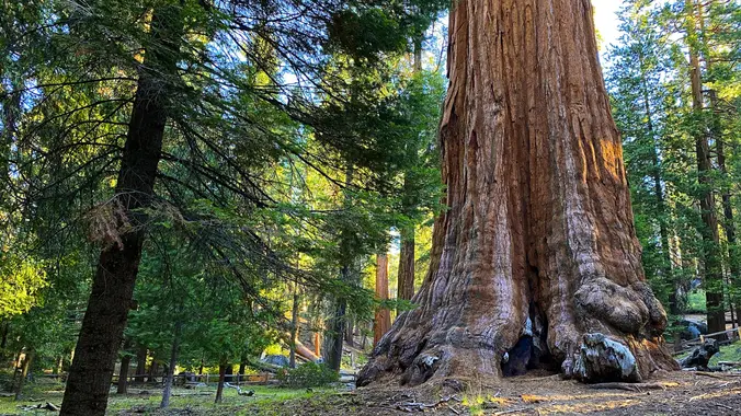
I'll be camping and hiking at Sequoia Aug 25-29. Let me know if you'd like to join me on any of those days and I will put something together. I have a site reserved at Lodgepole Campground -- if you are unable to reserve a site anywhere let me know and I may have room […]
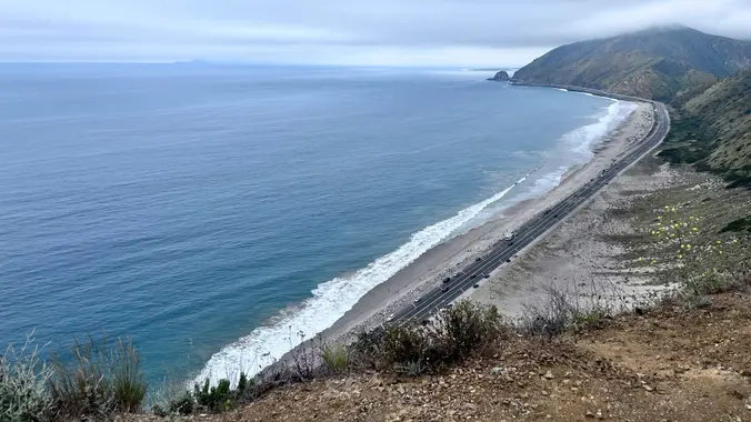
The Tuesday weather forecast remains hot. We will hike Ray Miller Trail again as it is the coolest area to hike. The weather forecast on Tuesday at 8 am is 63 and at 11 am, 71. The trail is an awesome blend of ocean and mountain views in Malibu’s La Jolla Canyon. We will start […]
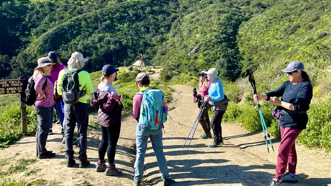
Please review the guidelines to participate in our hikes. Here are some highlights and a link to the guidelines. Restrictions apply for your safety and ours: Don't show up unless you're on the "Attending" list Unregistered or waitlisted will be turned away No "Plus Ones" on this hike Plan on completing the entire hike or […]
5.7 Miles, 1000' gain, Intermediate The starting point is NOT at the golf course entrance. It is at a dirt lot that can hold at least 50 cars. There is some real incline on this hike and a lot less trails coated with silt compared to the easier Happy Camp hike. Even though I have […]
Please note this hike will start at the trailhead we use for the Boney Hike (junction of South Wendy Drive and Portrero Road). We will take the single track trail about one-half mile to where the Angel Vista TH begins to add about an extra mile to the hike. Hoping to get back before it […]
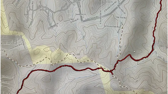
From the Kanan Rd trailhead, we'll jump on the Backbone Trail for a cruise down into Newton Canyon. On our way there, we'll cross the creek, pass under an oak canopy, and come out into an opening. At the opening, look toward the sandstone formations in the distance, and you'll see the now-maybe-flowing Upper Newton […]
This is also a gentler hike for Thursday starting at Newton Canyon, another group is starting at 8:30 and going down the backbone trail. We will go up and cross over Kanan and hike to Latigo. This hike was a bit overgrown last time but I am hoping they have come and trimmed it back, […]
3 miles, 650' gain, Fit Beginner Easy option, 1.4 miles, 450' gain, Fit Beginner The address given, is not the address of the hike. It is a nearby address that may cause your GPS to drive past the trailhead. Those that prefer the Easy Option, should head UP from the trail head, waiting when they […]
Start your holiday weekend off right with great friends and music! Come on out and join your friends, make new ones, eat, drink, and dance to an amazing 80's band at one of our favorite places for fun times. 80's Invasion, led by the dynamic vocal duo of Dirk Knight and Mony Mony, are a […]
MORE DETAILS AND PHOTOS WILL BE POSTED LATER. For moderately to advanced backpackers due to the longer mileage, several passes, and extreme steepness and unmaintained nature of Baxter Pass Trail. This hike requires us to shuttle vehicles between Onion Valley and Baxter trailheads. Add yourself to the waitlist and I will manually add you. Friday: […]
Join s for an invigorating sunrise yoga followed by a short and easy hike. A great start to your work day or weekend. More details will be posted soon.
The hike will be about 5.7 miles with about 750 ft. of elevation gain. We will start on Peters Canyon Trail and take this to East Ridge View Trail. This is where we will go up Big Red. Then we will continue on this trail until we get to Eucalyptus to loop back. We will […]
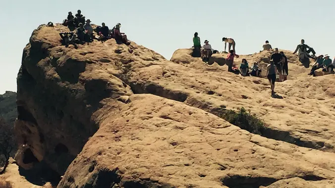
Eagle Rock, the most impressive landmark in all of Topanga State Park, will afford us an airy perch overlooking the upper watershed of Santa Ynez Canyon and the ocean beyond. We will eat, drink and explore on this impressive sandstone rock covered with crevices and caves. We'll get there the classic Musch Loop in a […]
The total mileage for this hike is 4.5 miles with about 460 ft. of elevation gain. We will start at the trail head of the Borrego Trail, which is right off of the parking lot. This is where we will meet. We will head up the Borrego Trail until we get to the Red Rock […]
5.2 miles, 1140' gain, Intermediate Eassier Option: 3.5 miles, 500' gain, Fit Beginner Come to the hike only (2:30p), picnic only (4:00p), or both. This event has limited space. Those still on the waiting list will be moved to the RSVP list several days before the event, or even the day of the event, if […]
The hike I am planning is around 6.3 miles with about 700 ft. of elevation gain. It starts at the very end of the paved road, the long gray strip that can be seen on the map. We will begin at the Bell Canyon Trail head. We will continue onto that and then take it […]
Let's enjoy potluck picnic! The concert begins at 5:00 p.m. Internationally renowned as “The Ultimate 80s New Wave Tribute,” the Spazmatics come with all the awesome sounds, styles, and way cool dance steps from the decade we’ll never forget. Please bring food, drinks to share. If your item requires utensils/plates/toothpicks, etc., please bring them. You […]
HIKE DETAILS: This Tuesday hike will be gentler than the second hike that will be posted for Tuesday. Hopefully, there will be a marine layer at the beach as we are starting at 8:30. This hike will go from the beach up to the picnic table on the fire road, approximately 5.5 miles. Most of […]
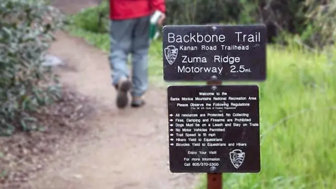
Looking for a short and shady hike before temperatures get too high? Join us as we go up and over Kanan Dume Rd and hike to Latigo Canyon Rd. This hike is only 5 about miles with about 900’ gain and will take us on a less-traveled but quite beautiful part of the 67-mile Backbone […]
Intermediate, 5.25 mi, 1000' gain Easy option: 2.8 mi, 700' gain. Even easier option: 2.2 mi, 600' gain. Fit beginners can complete this hike, but it will certainly get their blood pumping. This is not a conditioning hike, it's a social hike. We'll be stopping at various points to let people catch up and to […]
More details to come soon Zion narrows overnight Sept. 3 Drive to Zion Sept. 4 drive 1.5hours to trailhead and hike 11.5 miles to camp. Camp is located next to Big Spring for water supply. Sept. 5 hike 4.5 miles to end of narrows Sept. 5 or 6 drive home Need at least 3 cars […]
3.0 miles, 800' gain, easy-intermediate. This hike is rated easy-intermediate because it is a continuous incline for 1.5 miles. This isn't real steep, but it is continuous, and many beginner hikers have indicated this should be rated intermediate. That said, there is no reason a fit beginner cannot complete this hike. If needed, just stop […]
This hike will be about 5.4 miles total with 820 ft. of elevation gain. We are starting at the parking lot at the Wahoo's parking lot. We will take Live Oak Trail. This turns into Serrano Road which will take us to Serrano Cow Trail. At this part of the trail, we usually see a […]
Hike #9 in the 2024 Saturday in the Santa Monica Mountains series, is a strenuous 11 mile, 2800 gain hike in the Verdugo Mountains. The trail starts with a challenging steep ascent to Mount Thom and then mellows out along the ridge with panoramic views of the city. We'll take Verdugo Motorway past Tongva Peak […]
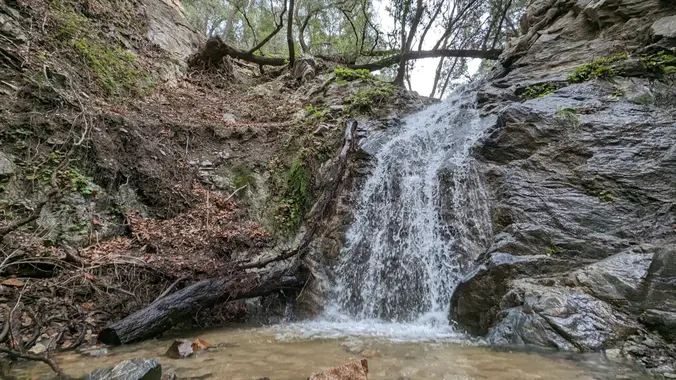
Nice and easy hike, if you are thinking about hiking and want to try something easy this is the hike for you! We will hike out to the waterfall area and see if there is any water in the waterfall. Chances are not likely but we shall see, there might even be some cool rocks! […]
This hike will be about 7 miles with about 700 ft. of elevation gain. We will start the hike at Cañada Vista Park. From here we will take the Tijeras Creek Trail to the Arroyo Trabuco Trail and use this to loop back to where we started. There will be a few water crossings, so […]
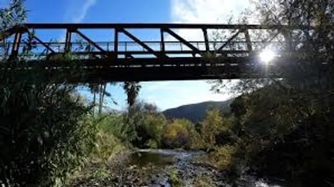
Fit Beginner - 4 miles, 600' gain The gain is well distributed, with half being on the return. We start at the Las Flores trailhead where Las Flores dead-ends at Wildwood Park, and head west. After 1/3 mile, the trail becomes Wildwood Canyon Trail. We continue for another 2/3 mile and cross a bridge just […]
3 miles, 600' gain, easy intermediate. Easy option: 2.5 miles, 500' gain, fit beginner. The route is similar to the Beach Party hikes. From the parking lot, we return to the main entrance road and walk about a quarter mile to the trailhead. From the trailhead, we will hike 0.1 miles up the Sycamore Canyon […]
This hike starts at the Rancho Sierra Vista parking lot, goes down to the bridge on Sycamore Canyon asphalt, but then turns up the canyon alongside Upper Sycamore Creek. Along the way, we'll be in the shade of Boney Mountain while we climb, doing a handful of easy water crossings and finding a number of […]
Just off the ocean, Sycamore Canyon is a wide, seemingly flat stroll among grasses, wildflower, and sycamore trees, surrounded by mountains on both sides. Rather than letting that lull you into a false sense of complacency, we'll take a left turn just after we start, and hike up the southern fork of Overlook Trail to […]
Free yoga session for active people. Whether you're a hiker, biker, backpacker, runner, or court sports player, we could all benefit from some restorative yoga. Co-hosted by Margue Wang, a yoga instructor at Sender One Climbing in Santa Ana, and The Wilderness Travel Course. Invite your sore friends.
https://a248.e.akamai.net/secure.meetupstatic.com/photos/event/4/5/b/c/event_52757852.jpeg Please bring a flashlight or headlamp in case we don't make it back before dark. Kindly note the folowing: Don't show up unless you're shown on the "Attending" list Unregistered or waitlisted will be turned away No "Plus Ones" on this hike No dogs allowed on the hike Time to re-explore the Los Robles […]
This is an online event. If you want to view the talk, you'll need to register with Conejo Open Space Foundation at this link. Also, please consider donating $10-$20 to this very worthwhile non-profit. They keep our trails open and maintained, and much more. Please join COSF for a live online presentation by geologist Dr. […]
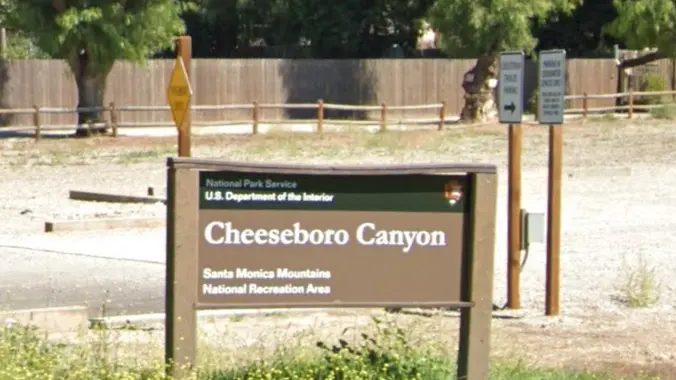
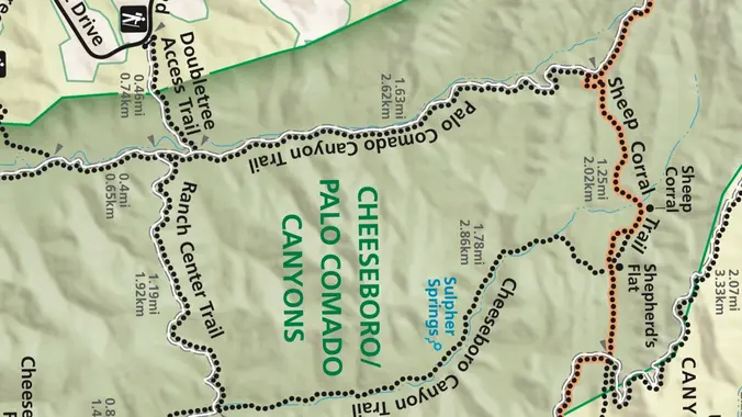
Please join us on a cooler hike through the oaks. We'll start at the Cheseboro trailhead parking lot in Agoura Hills, and hike north 3 miles to Ranch Center Road, where we'll turn around and return. According to GaiaGPS, this route has a very gentle 400' of elevation gain and descent with no abrupt transitions. […]
NOTE: We will leave from the Greenmeadow Parking lot and NOT from the Moorpark Lot. Our hike leaves from Greenmeadow Trailhead (a.k.a. Braille Trail). This hike will be an IN/OUT on the Los Robles West Trail. We will go out 2 1/2 miles and return the same, for exactly 5 miles with about 800' of […]
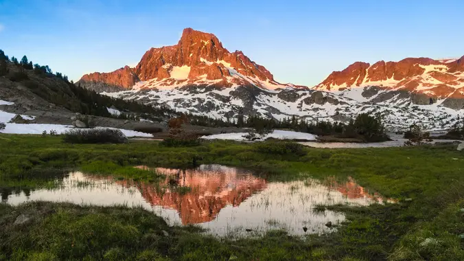
Inyo National Forest - Ansel Adams Wilderness Thousand Island Lake/Garnet Lake/Ruby Lake Days: 3 days, 2 nights (does not include travel time) Total Miles: 25 + miles in/out Trailhead: Rush Creek (June Lake area) Elevation Loss/Gain: 3000 +/~ Difficulty: Moderate/Strenuous due to elevation gain Limited to 8 people NO PLUS 1 ($10 permit fee/Meetup fee.) […]
Day Hike from the Bottom and Back Shuttle Stop to Start from: #9 Temple of Sinawava Trailhead Location: Adjacent to shuttle stop and restrooms. Pets: Not allowed Distance (roundtrip): 9.4 mi / 15.1 km maximum Elevation Change: 334 ft / 102 m Estimated Hiking Time: 1-8 hours Permits: Permits are not required for this hike. […]
Jackson Lake to Jackson Flats DESCRIPTION: We’ll meet at scenic Jackson Lake early in an attempt to minimize the heat and crowds as usual. The Jackson Flat Trail forks left at the Boy Scout trail junction, and climbs up moderately to the top of the ridge and the PCT trail junction at 7400 ft. From […]
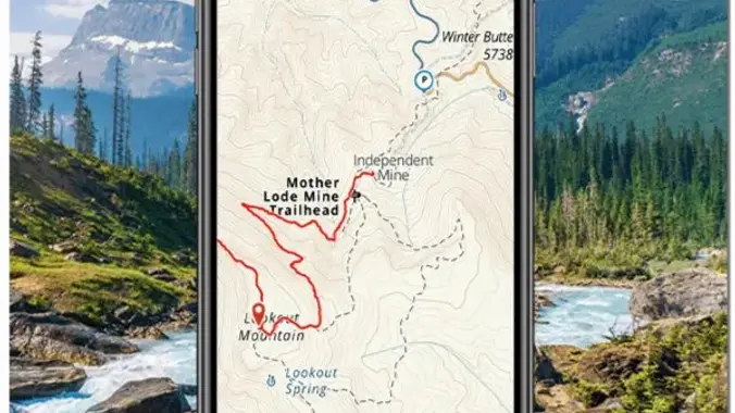
Gardiner Basin Loop Tour with Rae Lakes. I am posting this trip to gauge interest from the club, please add your name to the waiting list if you want to join. Potential attendees will be screened and manually added based on experience and history with the group. This trip passes through some of the most […]
Fit Beginner - 4 miles, 600' gain The gain is well distributed, with half being on the return. Moonrise 5:51 pm We start at the Las Flores trailhead where Las Flores dead-ends at Wildwood Park, and head west. After 1/3 mile, the trail becomes Wildwood Canyon Trail. We continue for another 2/3 mile and cross […]
Join us on an out and back hike up the Ray Miller Trail and the Overlook Trail. We’ll enjoy beautiful ocean views as we descend. We'll pick up about 1300’ gain on this 7 mile adventure. Lying along the brilliant blue Pacific Ocean at the west end of Malibu (just shy of Port Hueneme), the […]
Let's go to Wildwood Park through a new access route. After crossing the bridge from the parking lot, we will start the hike following Hill Canyon trail to the newly opened “Conejo Canyon Bridge” which connects trails on either side of the creek, Conejo Canyons and Wildwood Park. Wildwood Park in Thousand Oaks is one […]
Easy Intermediate, 4 miles, 900' gain The address given, is not the address of the hike. It is a nearby address that may cause your GPS to drive past the trailhead. This is an upside down lollipop that takes us first to the highest point in the area where the views are fantastic. The return […]
http://photos1.meetupstatic.com/photos/event/e/3/a/0/event_167038272.jpeg This hike has some rocky parts, but no scrambling. This hike will take us on a scenic trip from the suburbs of Oak Park to the top of Simi Peak, which overlooks both the Simi and Conejo Valleys and offers splendid views of the Santa Monica range and offshore islands to the south and […]
This session will highlight some of our favorite apps, their uses, how much they cost, and their pros and cons. The following is an example of some of the content you can expect. * Creating and using offline maps (Google, Caltopo, Gaia, and others) * Smart GPS Watches (Garmin, Coros, Apple, Suunto) * Fun Facts […]
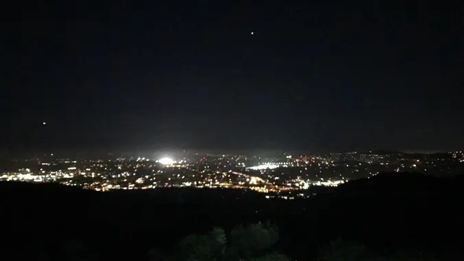
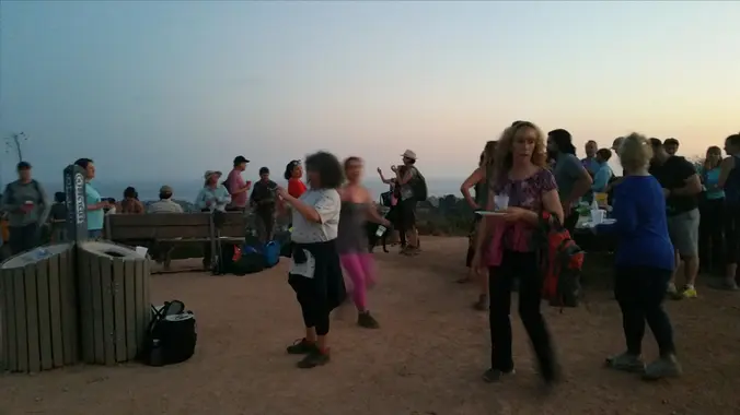
99.9% full moon potluck. Bring booze, drinks and food to share. Comfy picnic benches above Will Rogers SHP. Free parking 👉NO WHITE LIGHTS ALLOWED ON HIKE. Green and/or red lights are ok (but lights may not be needed since the area will be well lit by the moon). If you require a white light then […]
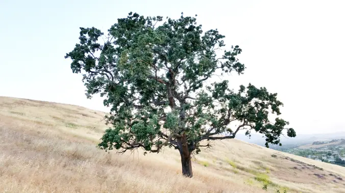
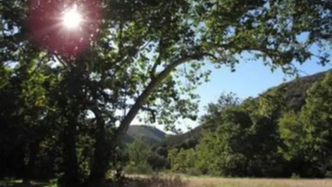
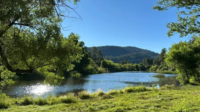
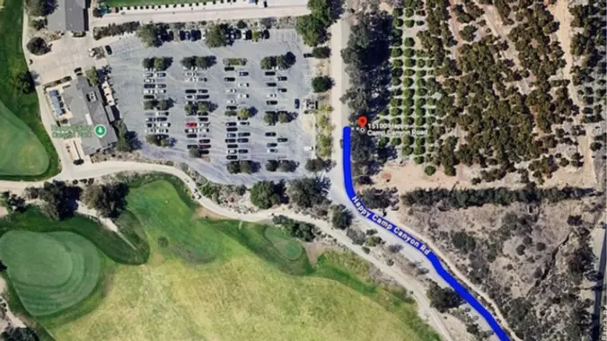
Happy Camp Canyon Park was once part of a large cattle ranch. It is an important wildlife corridor linking the Simi Hills with the Santa Susana Mountains. It is a lush riparian oak woodland with an intermittent stream. It's a beautiful park right in our backyards.(Writeup modified from Jan Lyon's hike description. Thank You Jan!) […]
Let's meet at the Community Center under the solar panels in the parking lot. This hike will be in addition to Peter's hike at Happy Camp Canyon, but we will be a little slower. This hike will loop around the periphery of Dos Vientos Open Space, passing Twin Ponds, overlooking Potrero Road and the Oxnard […]
4 mi, 500' gain, beginner Easier option: 1.5 mi, 125' gain, beginner. This is a beginner hike on the beautiful Limekiln trail. This hike is a slight lollipop, (the shape of the route). There are no extended inclines, however there are about 5 bumps in the trail with 25-40' gains, about 35-65 steps each. This […]
Many from this group, plus other friends, will attend. One of the band members is a friend of a few of the Hiking Plus members. The Replay is a high-energy Classic Rock cover band from the San Fernando Valley. Led by Rocio Gil on vocals, they deliver non-stop, kick-ass performances spanning hits from the 70s, […]
· Hike leader volunteer(s): Paul · Distance: 10.2 Miles total (out and back style) · Elevation gain: 2,084 ft · Time: Approximately 6.5 to 7 hours hiking including a snack break. · Conditioning: You need to be in generally good physical condition. · Dogs: Dogs are welcome but need to be on a leash. · […]
Come join us for the Wilderness Adventures Section Fall Backbone Trail series as we hike the entire Trail (67 miles) in two consecutive weekends. Our first Backbone Trail in the Santa Monica Mountains will be a 16 mile, 3000 gain outing on the BBT from the start at Will Rogers Park. We will first hike […]
This hike will be about 5.4 miles total with 820 ft. of elevation gain. We are starting at the parking lot at the Wahoo's parking lot. We will take Live Oak Trail. This turns into Serrano Road which will take us to Serrano Cow Trail. At this part of the trail, we usually see a […]
Our second Fall Backbone Trail hike in the Santa Monica Mountains will be a 17 mile, 3100 gain outing going from Lois Ewen Overlook to the Latigo Canyon Backbone Trailhead. The hike will climb past Saddle Peak and then descend along the BBT crossing Piuma Road then following the trail though the upper Corral and […]
The hike we will be doing is approximately 5 miles with 870 ft. of elevation gain. We will begin at the Live Oak Trail trailhead. This is where you will see on the map that the Live Oak Trail hits the paved road. This is the parking lot closest to the Edna Spaulding Trail. (There […]
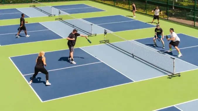
Get your Pickleball game on! Come learn the game everyone is either already playing or wanting to learn to play. Pickleball is not just a game, it's a community. HWD's very own Mark E will be teaching an introductory class on the rules and various shots of the game. Little or no experience is ok. […]
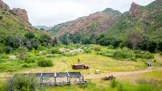
This week we’ll do a loop around the northeastern regions of the Santa Monica Mountains National Recreation Area and the Las Virgenes Open Space. This area traverses many ecosystems, including riparian, chaparral, and the rockscape from Galaxy Quest. The area is generally dry, but very nice! We'll be hiking about 7 miles/1100’ gain over the […]
NOTE: IF YOU SIGN-UP FOR THIS HIKE, BE SURE TO TAKE YOURSELF OFF THE OTHER TUESDAY HIKE. This is an alternative hike for Tuesday and in place of Jaesoon's hike. We will meet at the end of Moorpark and head East on the the trail, turning around at the 2 1/2 mile marker. We will […]
Beginner, 5 miles, 500' gain. Bug spray recommended. This hike is entirely fire-road and is almost completely flat. Some of this trail is sandy, so walking it at times can be more difficult. There are a lot of different interesting plants on this hike. From the trail head, we walk along the fire road next […]
http://photos1.meetupstatic.com/photos/event/b/a/2/4/event_99467652.jpeg From the Kanan Rd trailhead, we'll jump on the Backbone Trail for a cruise down into Newton Canyon. On our way there, we'll cross the creek, pass under an oak canopy, and come out into an opening. At the opening, look toward the sandstone formations in the distance, and we may see a flow […]
Join adventure seeking, nature loving, and arts supporting community as the Friends of the Library at Orange Coast College present a screening of the Banff Film Festival. $16 tickets can be purchased in advance on the OCC website, or pay $20 at the door. There will be raffle prizes from sponsoring vendors. Donations for snacks […]
http://photos4.meetupstatic.com/photos/event/d/e/9/6/event_99896982.jpeg Don’t be left behind for this hike or we will giggle when you come racing down the street to catch up! We are starting this Wildwood hike from Wildwood Avenue NOT Wildwood Park. One of many ways to experience versatile Wildwood Park, we'll start on the ridge, and travel down to the Santa Rosa […]
Because Thursday's hike has a waiting list, I'm adding another hike for Thursday close to, but miles apart from Laurie's hike. The second hike will be a little slower and with less elevation gain. Feel free to change hikes, but don't forget to CANCEL the hike you leave. Wildwood Park in Thousand Oaks is one […]
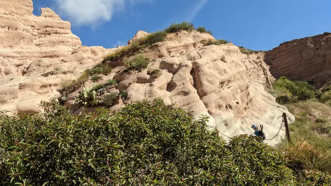
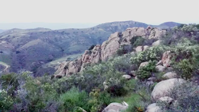
3.2 miles, 900' gain, easy intermediate. The first part is a steady incline, followed by a rolling trail to our destination. Fit beginners can complete this hike, but it will certainly get their blood pumping. There are no super steep sections. This hike takes us to a secret spot below a large rock formation. Naturally […]
Our third Fall Backbone Trail hike in the Santa Monica Mountains will be a 17 mile, 2600 gain outing from the Backbone Trail at the Latigo Canyon Trailhead to the Mishe Mokwa Trailhead. The BBT will take us through Newton, Zuma, Trancas and Encinal Canyons then the Etz Meloy Roadway on the way to Mishe […]
This hike is so cool! It's a good distance with little elevation gain and it is beautiful. This hike will take us to the Brown Mountain Dam Waterfall. The hike is an out and back at around 8 miles total with 750 ft. of elevation gain, so not steep! This area of the Angeles National […]
We are going to be starting at the Canyon View Staging Area. This hike will be about 6.2 miles with around 1,000 ft. of elevation gain. We will be starting at Canyon View Park and taking Cholla up to West Ridge and comic down Mathis. Link to Parking from Google Maps: https://www.google.com/maps/place/Canyon+View+Staging+Area/@33.585273,-117.7465062,17z/data=!3m1!4b1!4m5!3m4!1s0x80dce61b6bd45c2d:0x5ef3f1ad687cc8b5!8m2!3d33.585273!4d-117.7443175 Dogs are not […]
This hike will be about 7 miles with about 700 ft. of elevation gain. We will start the hike at Cañada Vista Park. From here we will take the Tijeras Creek Trail to the Arroyo Trabuco Trail and use this to loop back to where we started. There will be a few water crossings, so […]
Our hike begins at Las Virgenes Highlands Park. A steep trail up Firehouse Hill will take us to peaks that offer panoramic views towards the Santa Monica Mountains, Agoura Hills, Calabasas, Simi Hills and beyond. We'll take a break atop Mount Basura. Aftere our break, we'll descend into Cheeseboro Canyon via the Canyon View Trail […]
This hike is a shorter/gentler Tuesday hike (5 1/2 mile, 500' gain) due to the hot weather forecast. We will enter MCSP on the Yearling Trail which crosses the grasslands of the former Reagan Ranch and meets up with the scenic Lookout Trail. The Lookout Trail climbs through a chaparral "forest" to panoramic views of […]
This is a second hike for the overflow on Tuesday. We will be a little shorter and possibly a little slower. If you change hikes, don't forget to take yourself off the waitlist or the regular list on the Malibu Creek hike. Let's go to Wildwood Park through Hill Canyon. The parking lot at the […]
5 miles, 500' gain, Beginner This hike is a great trail for beginners because all the elevation gain is distributed. It is a walk down a rolling fire road through a really cool canyon, and you will find no difficult or extended elevation climbs. This is one of my favorite trails for people new to […]
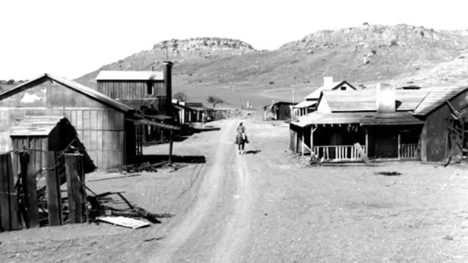
Let's hike a loop through Wildwood we haven’t done in a long time. Wildwood's archetypal western look served as the set for Davy Crocket, The Rifleman, Gunsmoke, and Wagon Train back in the day, as well as the movie Spartacus. This hike takes us from the main parking lot up the Santa Rosa Trail to […]
NOTE: There is quite a bit of shade on this hike. This will be a gentler hike for Thursday. We will go slower and with less elevation gain and less miles. Some hikers may want to add a mile by going to the Greenmeadow parking lot at the end of the hike and taking the […]
4.75 miles, 700' gain, easy-intermediate Option for 3 miles, 300' gain, easy. 30 minute wait while group completes the loop back to this spot. This is a link to the route: LINK We start with a 1/4 mile walk from where we park along Cottonwood Dr, to the trail head. There we make a left […]
This is not a hiking or backpacking trip. This is an overnight via kayak in the Black Canyon on the Colorado River on the NV/AZ border. You must be able to manage yourself and your transportation. This trip has minimal guidance. It may be possible to plan ridesharing by communicating with other attendees. The trip […]
I love this hike and everyone seems to have a good time, so let's do it again! There should be a good amount of water, so you will get wet. The hike will be 8-8.5 miles with 940 ft. of elevation gain. The hike starts on an asphalt road, but once we turn to the […]
I'm so excited for another Wilderness Open Access Day at Limestone Canyon. We will be doing the out and back trail to the Sinks. The hike will be about 8 miles with roughly 630 ft. of elevation gain. **You must sign up here: https://letsgooutside.org/activities/2024/10/05/wilderness-access-day-limestone-canyon-58/ At the time of posting, there are 198 spots left of […]
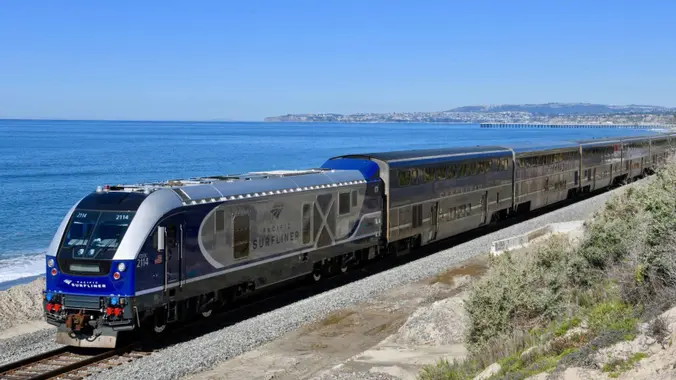
Let's take the train --- From Simi to Carp! 38th Annual Californa Avocado Festival Saturday - October 5, 2024 FESTIVAL ENTRANCE IS FREE! Prior events to the festival: October 2021 October 2022 Train Schedule, $20 each way: Simi Valley 10:11a Carpenteria 11:32a Return Train Options Capenteriea 2:03p Simi Valley 3:37p Carpenteria 4:57p Simi Valley 6:19p […]
This hike will be about 7 miles total with 1200 ft. of elevation gain. We are starting at the parking lot at the Wahoo's parking lot. We will take Live Oak Trail. This turns into Serrano Road which will take us to Serrano Cow Trail. At this part of the trail, we usually see a […]
Our fourth Fall Backbone Trail hike in the Santa Monica Mountains will be 17 miles on the BBT on the Sandstone Peak, Chamberlain, Blue Canyon, Wood Canyon, and Ray Miller Trails before finishing the La Jolla Campground. Bring water, snacks, sunscreen, and a good attitude. Rain, excessive heat, or Red Flag alert cancels. This is […]
3 miles, 600' gain, easy intermediate. Easy option: 2.5 miles, 500' gain, fit beginner. The route is similar to the Beach Party hikes. From the parking lot, we return to the main entrance road and walk about a quarter mile to the trailhead. From the trailhead, we will hike 0.1 miles up the Sycamore Canyon […]
Trail statistics are approximate. For safety purposes always assume they are underestimated. But don’t be disappointed if they are overestimated. Bring more water and snacks than you think you’ll need.
Trail descriptions are based on previous hikes. Current conditions are unknown until arrival. Expect the unexpected and plan accordingly.
The Organizers and members of Hiking With Dean are not professional leaders, guides, or mountaineers. The function of the member or organizer is only to organize the trip. Each person who shows up for a trip/meetup (and their guest or guests) is responsible for his or her own safety. By attending a hike, or any other event organized by this group, you are acknowledging that you and any guests that you bring are aware of the risks, dangers and hazards associated with the activity and freely accept and fully assume all such risks, dangers and hazards, and further agree to release and discharge the Organizers, Members of the Hiking With Dean Meetup Group from and against any and all liability arising from your participation in the group activities per our ASSUMPTION OF RISK AND LIABILITY WAIVER and Section 6.2 of the Meetup.com Terms of Service.


Recent Comments