Site Search

Hiking Calendar

Hike at Whiting Ranch – Wahoo’s Parking Lot

Wahoo's Fish Taco 27412 Portola Parkway, Foothill Ranch, CA, US

This hike will be about 5.4 miles total with 820 ft. of elevation gain. We are starting at the parking lot at the Wahoo's parking lot. We will take Live Oak Trail. This turns into Serrano Road which will take us to Serrano Cow Trail. At this part of the trail, we usually see a […]

Gentler Friendly (but not easy!) Latigo Canyon to Upper Solstice Canyon

Latigo Canyon Trailhead 1765 Latigo Canyon Rd, Malibu, CA, US

Down and up and down, and then up and down and up. We will hike out and back on the Backbone Trail from Latigo Canyon, across Castro Crest and descending into Upper Solstice Canyon. 2.5 miles out, 2.5 miles back. Elevation gain is about or under 1000 ft. Trail is single track almost all the […]

Sunset Hike

1 Concordia 1 Concordia, Irvine, CA, US

Turtle Rock and French Hill hike. There are several hills with sweeping views of the coastline. The hike starts with a heart pumping hill then goes on to a series of rolling hills and some neighborhood connections. 4.2 miles, 900 feet of overall elevation gain. Although not considered easy, it is certainly a great doable […]

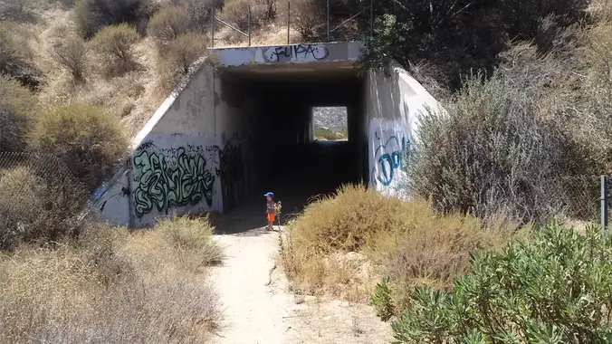
Wildlife Tunnel Loop – Intermediate. Easier Option: Fit Beginner

Santa Susana Pass Road & Rocky Peak Road Simi Valley, CA, US

Intermediate - 3 miles, 1000' gain Easier Option - Fit Beginner, 1.4 miles, 525' gain. This hike is relatively short, but the middle portion is a rugged and continuous incline for 1 mile with about 700' of gain. Even though we'll be taking this trail at the pace of a social hike, beginners may find […]

Hike at Caspers Wilderness Park – Bell Canyon + Oso Trail

Caspers Wilderness Park 33401 Ortega Hwy, San Juan Capistrano, CA, US

The hike I am planning is around 6.3 miles with about 700 ft. of elevation gain. It starts at the very end of the paved road, the long gray strip that can be seen on the map. We will begin at the Bell Canyon Trail head. We will continue onto that and then take it […]

National Public Lands Day (Volunteer Event)

About this event The Angeles National Forest, National Forest Foundation, and St. Francis Dam National Memorial Foundation invite you to volunteer in the Angeles National Forest to celebrate National Public Lands Day on Saturday, September 23, from 9am-12pm followed by a provided lunch from 12pm-1pm. Volunteers will join the St. Francis Dam National Memorial Foundation […]

INFORMATIONAL POSTING-November 11-12 Wilderness First Aid Course

Sycamore Canyon Campground 9000 Pacific Coast Hwy, Malibu, CA, US

INFORMATIONAL POSTING-November 11-12 Wilderness First Aid Course TO REGISTER PLEASE GO TO: http://wildernessfirstaidcourse.org Why Take the WFAC? More extensive and useful than Red Cross basic first aid · We teach the course twice a year in Fullerton; typically, May and November. The next class is November 11-12. · You receive 24 hours of credit for […]

INFORMATIONAL POSTING-November 11-12 Wilderness First Aid Course

950 N Ventu Park Rd 950 N Ventu Park Rd, Thousand Oaks, CA, US

INFORMATIONAL POSTING-November 11-12 Wilderness First Aid Course TO REGISTER PLEASE GO TO: http://wildernessfirstaidcourse.org Why Take the WFAC? More extensive and useful than Red Cross basic first aid · We teach the course twice a year in Fullerton; typically, May and November. The next class is November 11-12. · You receive 24 hours of credit for […]

Hike at Aliso and Wood Canyons Park – Up Cholla, Down Mathis

Canyon View Staging Area 22124 Utility Access, Aliso Viejo, CA, US

We are going to be starting at the Canyon View Staging Area. This hike will be about 6.2 miles with around 1,000 ft. of elevation gain. We will be starting at Canyon View Park and taking Cholla up to West Ridge and comic down Mathis. Link to Parking from Google Maps: https://www.google.com/maps/place/Canyon+View+Staging+Area/@33.585273,-117.7465062,17z/data=!3m1!4b1!4m5!3m4!1s0x80dce61b6bd45c2d:0x5ef3f1ad687cc8b5!8m2!3d33.585273!4d-117.7443175 Dogs are not […]


Trail statistics are approximate. For safety purposes always assume they are underestimated. But don’t be disappointed if they are overestimated. Bring more water and snacks than you think you’ll need.

Trail descriptions are based on previous hikes. Current conditions are unknown until arrival. Expect the unexpected and plan accordingly.

The Organizers and members of Hiking With Dean are not professional leaders, guides, or mountaineers. The function of the member or organizer is only to organize the trip. Each person who shows up for a trip/meetup (and their guest or guests) is responsible for his or her own safety. By attending a hike, or any other event organized by this group, you are acknowledging that you and any guests that you bring are aware of the risks, dangers and hazards associated with the activity and freely accept and fully assume all such risks, dangers and hazards, and further agree to release and discharge the Organizers, Members of the Hiking With Dean Meetup Group from and against any and all liability arising from your participation in the group activities per our ASSUMPTION OF RISK AND LIABILITY WAIVER and Section 6.2 of the Meetup.com Terms of Service.