Site Search

Hiking Calendar

Tapo Canyon Trail

Tapo Canyon Road Tapo Canyon Rd, Simi Valley, CA, US

https://www.alltrails.com/trail/us/california/tapo-canyon-trail?u=i (It's gonna be warm this day so we are gonna start at 8am to be off the trail by 10am..) Hello Fellow Hikers, Join me on a easier moderate hike at Tapo Canyon Trail in Simi Valley. This hike has a nice gradual walk until we start a gradual climb were we will start […]

Los Padres Potluck Hike – Mother’s Day celebration

Los Padres Trailhead 15 Los Padres Drive, Thousand Oaks, CA, US

Happy Mother's Day to all beings who have a motherly heart! Let's celebrate this special day with the beautiful Mother nature and great friends 🥂♥️ 3.5 miles, 700' gain, Easy Intermediate. Easy Option: 2.4 miles, 285' gain, Fit Beginner. We'll start by entering the Los Padres trail, through a spooky oak covered section, then move […]

Lynnmere Trail to Wildwood Park

Lynnmere Trailhead 930 Lynnmere Dr., Thousand Oaks, ca, US

We will start early to beat the heat, entering the north branch of Lynnmere Trail via Thistle Trail, which connects the north and south branches of Lynnmere Trail. The Lynnmere Trail is high above Thousand Oaks, providing pleasant scenery along the Conejo Canyons, Wildwood Park, Paradise Falls, Boney Mountain, the Pacific Ocean, and glimpses of […]

**8:30 start time!! Triunfo Park Lollipop – Intermediate Hike

Triunfo Community Park 1935 Tamarack St, Thousand Oaks, CA, US

Time to re-explore the Los Robles trail system. This will be about a 7 mile lollipop hike with approximately 1400 feet of elevation gain. We start at the trailhead at the back parking lot of Triunfo Park and go up to the Los Robles trail. We then loop around counter-clockwise by way of the White […]

Cave of Munitz – Intermediate

Cave of Munitz 24501 Woodglade Ln., West Hills, CA, US

Intermediate, 4.5 miles, 1100' gain. Intermediate hikers will love this hike. It is not well suited for beginners. It has some of the most variations of terrain of any hike in the area and is one of my personal favorites. This is an interesting gem and one of the famous formations that every hiker in […]

Two Peaks in the Conejo Canyon Western Plateau (Fast Paced)

Thousand Oaks CNG Fueling Station 1993 Rancho Conejo Boulevard, Thousand Oaks, CA, US

http://photos1.meetupstatic.com/photos/event/9/9/3/6/event_278199222.jpeg Please read these restrictions before signing up. Pandemic conditions and restrictions apply for your safety and ours: Don't sign up unless you are two weeks past your 2nd vaccination Don't show up unless you're shown on the "Attending" list Unregistered or waitlisted will be turned away No "Plus Ones" on this hike You will […]

Hike at Whiting Ranch – Wahoo’s Parking Lot

Wahoo's Fish Taco 27412 Portola Parkway, Foothill Ranch, CA, US

This side of the park is back open! I'm excited to be back. This hike will be about 5.4 miles total with 820 ft. of elevation gain. We are starting at the parking lot at the Wahoo's parking lot. We will take Live Oak Trail. This turns into Serrano Road which will take us to […]

RSV to Hidden Valley Overlook – Gentler (but not Beginner) Friendly

Rancho Sierra Vista Rancho Sierra Vista/Point Mugu, Newbury Park, CA, US

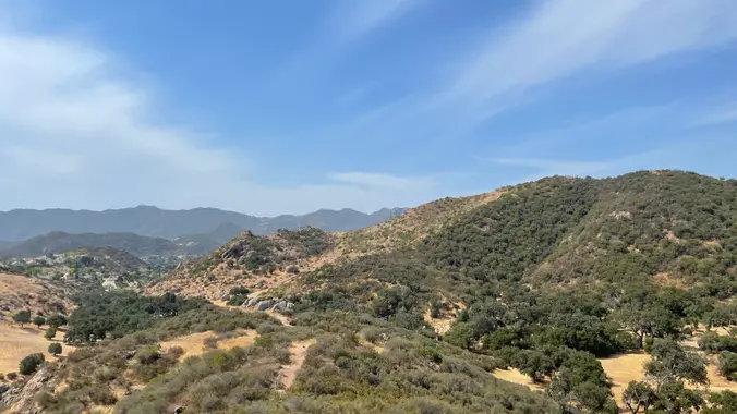
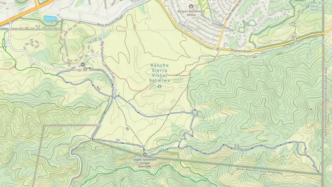
Let's head out to Hidden Valley Overlook via Rancho Sierra Vista. This double-lollipop out and back hike wanders through wildflowers, grasslands and chaparral from the Rancho Sierra Vista trailhead, then climbs up a foothill of Boney Mountain for some fantastic views east into Hidden Valley and Lake Sherwood, north to Port Hueneme and Oxnard and […]

Whitehorse Lollipop – Intermediate / Easier option

Triunfo Community Park 1869 Tamarack St., Westlake Village, ca, US

Intermediate, 5.25 mi, 1000' gain Easy option: 2.8 mi, 700' gain. Even easier option: 2.2 mi, 600' gain. Fit beginners can complete this hike, but it will certainly get their blood pumping. This is not a conditioning hike, it's a social hike. We'll be stopping at various points to let people catch up and to […]

[asa2_collection tpl=”Flex_1″ orderby=”rand” limit=”4″]2[/asa2_collection]

Trail statistics are approximate. For safety purposes always assume they are underestimated. But don’t be disappointed if they are overestimated. Bring more water and snacks than you think you’ll need.

Trail descriptions are based on previous hikes. Current conditions are unknown until arrival. Expect the unexpected and plan accordingly.

The Organizers and members of Hiking With Dean are not professional leaders, guides, or mountaineers. The function of the member or organizer is only to organize the trip. Each person who shows up for a trip/meetup (and their guest or guests) is responsible for his or her own safety. By attending a hike, or any other event organized by this group, you are acknowledging that you and any guests that you bring are aware of the risks, dangers and hazards associated with the activity and freely accept and fully assume all such risks, dangers and hazards, and further agree to release and discharge the Organizers, Members of the Hiking With Dean Meetup Group from and against any and all liability arising from your participation in the group activities per our ASSUMPTION OF RISK AND LIABILITY WAIVER and Section 6.2 of the Meetup.com Terms of Service.