Site Search

Hiking Calendar

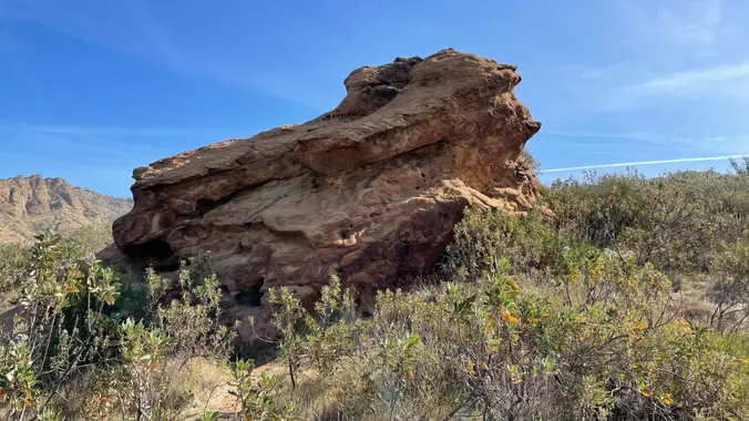
Saturday in the Santa Monica Mountains 2024 #5 – Santa Ynez Eagle Rock

Santa Ynez Canyon Trailhead - Topanga State Park Santa Ynez Canyon Trail, Pacific Palisades, CA, US

Hike #5 in the 2024 Saturdays in the Santa Monica Mountains series is to Eagle Rock (1957'), a moderate 9-miles, 1800' gain outing up Santa Ynez Canyon and the Musch Trail to brunch at Eagle Rock before returning to our start. Bring water, snacks, sunscreen, and a good attitude. Rain, excessive heat, or Red Flag […]

80’s Invasion at Sagebrush Cantina

Sagebrush Cantina 23527 Calabasas Rd, Calabasas, CA, United States

Come on out and join your friends, make new ones, and dance to a great 80's band at one of our favorite places. 80's Invasion, led by Dirk Knight and Mony Mony, are a fun, high-energy act that does cool covers of everything 80's (with a little 70's and 90's mixed in sometimes.) They have […]

Hike at Aliso and Wood Canyons Park – Up Cholla, Down Mathis

Canyon View Staging Area 22124 Utility Access, Aliso Viejo, CA, US

We are going to be starting at the Canyon View Staging Area. This hike will be about 6.2 miles with around 1,000 ft. of elevation gain. We will be starting at Canyon View Park and taking Cholla up to West Ridge and comic down Mathis. Link to Parking from Google Maps: https://www.google.com/maps/place/Canyon+View+Staging+Area/@33.585273,-117.7465062,17z/data=!3m1!4b1!4m5!3m4!1s0x80dce61b6bd45c2d:0x5ef3f1ad687cc8b5!8m2!3d33.585273!4d-117.7443175 Dogs are not […]

Hike at Whiting Ranch – Wahoo’s Parking Lot

Wahoo's Fish Taco 27412 Portola Parkway, Foothill Ranch, CA, US

This hike will be about 5.4 miles total with 820 ft. of elevation gain. We are starting at the parking lot at the Wahoo's parking lot. We will take Live Oak Trail. This turns into Serrano Road which will take us to Serrano Cow Trail. At this part of the trail, we usually see a […]

Hiking with Mark E: Memorial Day Hike to MASH Site and Century Lake

Malibu Creek State Park Trailhead SMHC 1925 Las Virgenes Rd, Calabasas, CA, US

This relatively easy, out-and-back hike, travels alongside Malibu Creek through some great terrain and old growth oak trees, with a special bonus — a visit to the site of television's legendary program hit M*A*S*H*. The site still draws visitors from all over the world decades after the show left the air. Now on display are […]

Dos Vientos – Memorial Day Picnic

Dos Vientos Community Park 4801 Borchard Road, Newbury Park, CA, US

5.2 miles, 1140' gain, Intermediate Beginner Option: 3.5 miles, 500' gain, Fit Beginner Come to the hike only (2:30p), picnic only (4:00p), or both. This event has limited space. Those still on the waiting list will be moved to the RSVP list several days before the event, or even the day of the event, if […]

Los Robles trailhead, walking down to Las Padres and up and around

Los Robles Trail 351 S Moorpark Rd, Thousand Oaks, CA, US

NOTE: This will be a much easier hike for Tuesday. We will go slower and with less elevation gain and less miles. Anyone who wants to add more mileage, can take the loop near the Greenmeadow Parking lot. We will start in the parking lot at the end of Moorpark and walk down the street […]

Chumash Trail to Rocky Peak/Triangle

Chumash Park and Trail 3200 Flanagan Dr, Simi Valley, CA, US

We'll hike up the Chumash Trail in Simi Valley to join the Rocky Peak trail. We'll turn left to head to the "Triangle" where several trails meet and provide panoramic views. The hike will be an out and back, and will be 7.7 miles with 1600 ft gain. It's mostly a single track trail during […]

Oak Creek Canyon to Ventu Park Rd. (Fast Paced)

Oak Creek Canyon Trailhead 472 Greenmeadow Ave., Thousand Oaks, CA, US

http://photos2.meetupstatic.com/photos/event/b/0/e/c/event_80025292.jpeg Since the trail has been redesigned and is now about 8 1/2 miles, we will stop at Ventu Park Road for our break. AUGUST 2021 UPDATE: Please review the newly revised guidelines to participate in our hikes. We are again requiring proof of vaccination to join a hike. Here are some highlights and a […]


Trail statistics are approximate. For safety purposes always assume they are underestimated. But don’t be disappointed if they are overestimated. Bring more water and snacks than you think you’ll need.

Trail descriptions are based on previous hikes. Current conditions are unknown until arrival. Expect the unexpected and plan accordingly.

The Organizers and members of Hiking With Dean are not professional leaders, guides, or mountaineers. The function of the member or organizer is only to organize the trip. Each person who shows up for a trip/meetup (and their guest or guests) is responsible for his or her own safety. By attending a hike, or any other event organized by this group, you are acknowledging that you and any guests that you bring are aware of the risks, dangers and hazards associated with the activity and freely accept and fully assume all such risks, dangers and hazards, and further agree to release and discharge the Organizers, Members of the Hiking With Dean Meetup Group from and against any and all liability arising from your participation in the group activities per our ASSUMPTION OF RISK AND LIABILITY WAIVER and Section 6.2 of the Meetup.com Terms of Service.