Site Search

Hiking Calendar

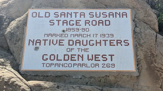
Santa Susana Stage Road – Beginer hike but the Devils in the details

Andora trailhead 9861 Andora Ave, Chatsworth, CA, US

Details This is a beginner hike with a tad bit of challenge due to gains and a tad bit of scrambling and bush whacking. *** Safety Note: Rain or Extreme Heat at trailhead cancels hikes. Meetup Time: 7:15 A.M. (We hit the trail at 7:30) DISTANCE: 5 miles - out and back GAIN: 863 ft […]

Wilderness Access Day – Black Star Canyon

Baker Canyon Staging Area Silverado, CA, US

Let's enjoy another Open Access Day! This is where we get to explore trails that are normally closed off to the public. The plan is to a loop that's 3.5 to 4 miles with around 550 ft. of elevation gain. Since this is shorter, the plan is to take our time and explore. You don't […]

Hike at O’Neill Regional Park – Live Oak + Vista Trail

O'Neill Regional Park 30892 Trabuco Canyon Rd, Trabuco Canyon, CA, US

The hike we will be doing is approximately 5 miles with 870 ft. of elevation gain. We will begin at the Live Oak Trail trailhead. This is where you will see on the map that the Live Oak Trail hits the paved road, right off of the parking lot marked P. This is the parking […]

Backbone Trail: Corral Canyon to Latigo Canyon

Backbone Trail & Latigo Canyon Road California, CA, US

https://www.alltrails.com/trail/us/california/backbone-trail-corral-canyon-to-latigo-canyon Hello Fellow Hikers, (Please note later start time due to high for this day is showing 68 degrees plus its the day after Cinco De Mayo😉) Lets hike the pretty Corral Canyon and Latigo Canyon on the Backbone Trail. Several hikers have commented on the wild flowers still in bloom along these trails. And […]

Hike at Whiting Ranch Wilderness Park – Borrego Trail & Red Rock Canyon

Whiting Ranch Wilderness Park 26701 Portola Parkway, Foothill Ranch, CA, US

The total mileage for this hike is 4.5 miles with about 460 ft. of elevation gain. We will start at the trail head of the Borrego Trail, which is right off of the parking lot. This is where we will meet. We will head up the Borrego Trail until we get to the Red Rock […]

Mission Point The Hard Way

O'Melveny Park - HWD 17300 Sesnon Blvd, Granada Hills, ca, US

O’Melveny Park spreads over 672 acres, second on the list of largest parks within the City of Los Angeles, right after Griffith Park. Noted for its picture-perfect picnic grounds with white fences and towering eucalyptus trees, O’Melveny Park also challenges hikers with several miles of steep, backcountry fire roads and primitive trails. Normally our hike […]

Tapo Canyon Trail

Tapo Canyon Road Tapo Canyon Rd, Simi Valley, CA, US

https://www.alltrails.com/trail/us/california/tapo-canyon-trail?u=i Hello Fellow Hikers, Join me on a easier moderate hike at Tapo Canyon Trail in Simi Valley. This hike has a nice gradual walk until we start a gradual climb were we will start our loop. We should encounter wildflowers and mountain views. Our loop will drop down then we will continue until we […]

Angel Vista – Easy Intermediate

Rosewood Trailhead 305 Regal Oak Ct, Thousand Oaks, CA, US

3.0 miles, 800' gain, easy-intermediate. Let's enjoy the gorgeous sunset and fun loaded potluck picnic at the beautiful Angel Vista! This hike is rated easy-intermediate because it is a continuous incline for 1.5 miles. This isn't real steep, but it is continuous, and many beginner hikers have indicated this should be rated intermediate. That said, […]

Zuma Loop, Ocean and Canyon View Trails ~ Gentler Intermediate

Zuma Canyon Trailhead 5721 Bonsall Dr, Malibu, CA, US

I pre-hiked the trail this morning. The name “Zuma” is derived from the Chumash language and means “abundance.” There is an absolute abundance of beautiful and spectacular wildflowers engulfing the entire area and it appears that there was no impact from the Woolsey fire other than a few remnants of burnt trees. We will start […]

[asa2_collection tpl=”Flex_1″ orderby=”rand” limit=”4″]2[/asa2_collection]

Trail statistics are approximate. For safety purposes always assume they are underestimated. But don’t be disappointed if they are overestimated. Bring more water and snacks than you think you’ll need.

Trail descriptions are based on previous hikes. Current conditions are unknown until arrival. Expect the unexpected and plan accordingly.

The Organizers and members of Hiking With Dean are not professional leaders, guides, or mountaineers. The function of the member or organizer is only to organize the trip. Each person who shows up for a trip/meetup (and their guest or guests) is responsible for his or her own safety. By attending a hike, or any other event organized by this group, you are acknowledging that you and any guests that you bring are aware of the risks, dangers and hazards associated with the activity and freely accept and fully assume all such risks, dangers and hazards, and further agree to release and discharge the Organizers, Members of the Hiking With Dean Meetup Group from and against any and all liability arising from your participation in the group activities per our ASSUMPTION OF RISK AND LIABILITY WAIVER and Section 6.2 of the Meetup.com Terms of Service.