• Hike at Crystal Cove/Moro Canyon – Ridge Park Entrance/Bommer Ridge

    Crystal Cove SP/Laguna Coast - Ridge Park Entrance (map) Ridge Park Rd & E Coastal Peak, Newport Beach, CA, US

    This hike will be at Crystal Cove State Park. We will be doing part of the Moro Canyon trails. This hike will be about 6.6 miles with approximately 1,000 ft. of elevation gain. We are beginning at the Ridge Park Entrance (see the map for exact details on where to go.) This hike will take […]

  • Post Thanksgiving Potluck Hike: Josephine Peak via Colby Canyon

    Bolsa Chica Ecological Reserve California 1, Huntington Beach, CA, United States

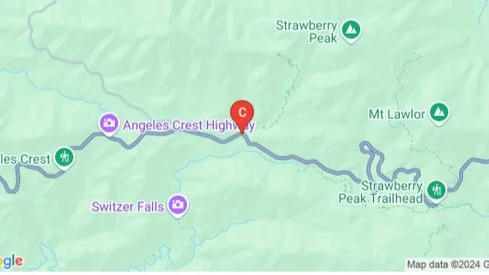
    Moderately challenging 8.4 mile, 2150 ft gain hike through Colby Canyon ending at Josephine Peak. We will begin at the Colby Canyon trailhead, pass a seasonal waterfall, and begin the moderately strenuous ascent through oaks and chaparral to Josephine Saddle. From the saddle, we will head west along the Strawberry Spur Trail to reach the […]

  • Dos Vientos Loop – 5 miles

    Dos Vientos Community Park 4801 Borchard Road, Newbury Park, CA, US

    Join me on a moderate five mile loop with a total elevation gain/loss of about 800 ft. Please meet at the Dos Vientos Community Park Tennis Courts near the corner of Rancho Dos Vientos and Borchard Rd. This hike explores some of the neighborhood trails in the Dos Vientos area of the southwestern Conejo Valley. […]

  • ANZA-BORREGO: Goat Canyon Adventure (TENTATIVE)

    Big Pine Visitor center Big Pines Highway, Wrightwood, CA, United States

    To be considered, you and I must have trip history together. Please add yourself to the wait-list to indicate interest. This is a difficult, dry, explorative backpack over rocky, prickly terrain. I am looking for qualified team members who are interested in seeking out locations of historical or cultural significance. Additional qualifications include a go-with-the-flow […]

  • Hike with Beach Party and Fire

    Point Mugu State Park/ Sycamore Cove Beach 9000 Pacific Coast Hwy, Malibu, CA, US

    2.7 miles, 650' gain, Easy-Intermediate. A hike, then a potluck party on the beach with a fire. Come for the hike, the beach party, or both! Temps likely to be 70'sF during the day, 60-70F after 5p. Note: GPS has taken people to the incorrect location. Please read the written directions. Please post in the […]

  • Hike at Aliso and Wood Canyons Park – Up Cholla, Down Mathis + Brunch

    Canyon View Staging Area 22124 Utility Access, Aliso Viejo, CA, US

    We are going to be starting at the Canyon View Staging Area. This hike will be about 6.2 miles with around 1,000 ft. of elevation gain. We will be starting at Canyon View Park and taking Cholla up to West Ridge and comic down Mathis. Link to Parking from Google Maps: https://www.google.com/maps/place/Canyon+View+Staging+Area/@33.585273,-117.7465062,17z/data=!3m1!4b1!4m5!3m4!1s0x80dce61b6bd45c2d:0x5ef3f1ad687cc8b5!8m2!3d33.585273!4d-117.7443175 Dogs are not […]

  • Oak Spring Trail Loop (Turkey Trot)

    Oak Spring Trail Gold Creek Road 9998, Los Angeles, CA, United States

    Need to work off some Thanksgiving dinner? If you also like stunning views, lush oak groves, and getting away from it all (while not really being too far from home) you’ll love this hike! Thanks to Dave, who pre-hiked this awhile back and was kind enough to let me leverage his efforts. We’ll take Oak […]

  • Kern River Trail to the Bench – 10 miles & 1,100 feet of climbing

    Shell gas station on 178 at Comanche Rd 5812 Commanche Dr., Bakersfield, ca, US

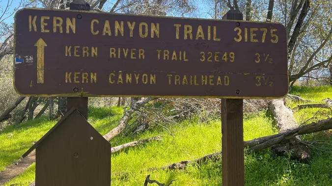
    Moderate Hike Tomorrow to the Bench! Let's hike on the Kern Canyon River Trail to the Bench and burn some Thanksgiving calories. Distance: 10 miles roundtrip (up and back hike) Ascent: 1,100 feet Hiking time: Around 5 hours Meeting Location: Shell gas station on Highway 178 and Comanche Dr. https://goo.gl/maps/XhFx1HKrxkckrEvB9 Meeting Time: 9:00 a.m. by […]

  • Hawk Canyon lollipop – Potluck hike

    Conejo Canyons Trail Head 2010 Conejo Center Dr, Thousand Oaks, CA, US

    4.2 miles, 700' gain, easy-intermediate. Easier option: 2.7 miles, 500' gain, fit beginner. This is a pot-luck hike. We'll be stopping at the 3/4 point by a picnic table, so please bring food and drink to share, and any utensils your items might require. You may wish to bring your own cup, plate, and utensils […]


Trail statistics are approximate. For safety purposes always assume they are underestimated. But don’t be disappointed if they are overestimated. Bring more water and snacks than you think you’ll need.

Trail descriptions are based on previous hikes. Current conditions are unknown until arrival. Expect the unexpected and plan accordingly.

The Organizers and members of Hiking With Dean are not professional leaders, guides, or mountaineers. The function of the member or organizer is only to organize the trip. Each person who shows up for a trip/meetup (and their guest or guests) is responsible for his or her own safety. By attending a hike, or any other event organized by this group, you are acknowledging that you and any guests that you bring are aware of the risks, dangers and hazards associated with the activity and freely accept and fully assume all such risks, dangers and hazards, and further agree to release and discharge the Organizers, Members of the Hiking With Dean Meetup Group from and against any and all liability arising from your participation in the group activities per our ASSUMPTION OF RISK AND LIABILITY WAIVER and Section 6.2 of the Meetup.com Terms of Service.