• Rosewood Trail to Angel Vista – Gentler Intermediate

    150 Regal Oak Ct 150 Regal Oak Ct, Thousand Oaks, CA, US

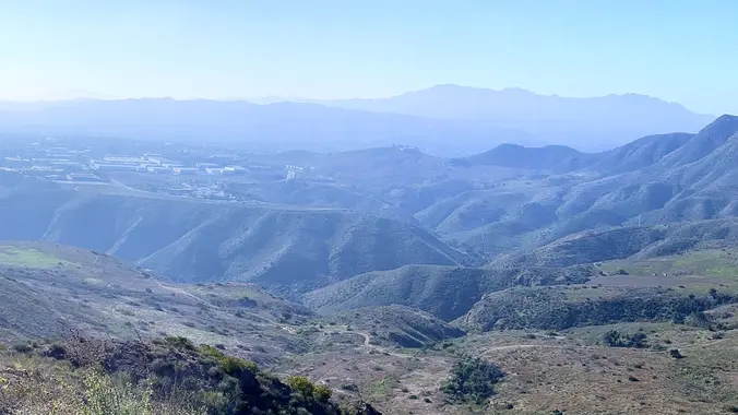
    We will start (early to beat the heat) our hike near the beginning of Regal Oak Ct. on the lower Rosewood Trail, a dirt trail heading up a shaded ravine at the base of the mountains, and continue to the usual Rosewood trail. Rosewood trail presents a clear view over the 101 Freeway carving up […]

  • Sunset Hills & Woodridge Loop – Intermediate Hike

    3863 Erbes Rd 3863 Erbes Rd, Thousand Oaks, CA, US

    This intermediate hike starts in the Sunset Hills Open Space and includes a loop in the Woodridge Open Space. It provides views of Wood Ranch Reservoir, Simi Valley, northern Thousand Oaks, and the Tierra Rejada Valley. We’ll end with a loop around the Bard reservoir to finish with about 6.7 miles, 1300 ft gain. Directions: […]

  • Doin’ the Big, Fig Newton Canyon (Fast Paced)

    BBT - Kanan Dume 1720 Kanan Dume Rd, Malibu, CA, US

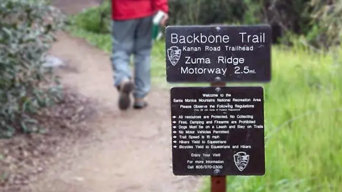
    http://photos1.meetupstatic.com/photos/event/b/a/2/4/event_99467652.jpeg From the Kanan Rd trailhead, we'll jump on the Backbone Trail for a cruise down into Newton Canyon. On our way there, we'll cross the creek, pass under an oak canopy, and come out into an opening. At the opening, look toward the sandstone formations in the distance, and you'll see a trickle of […]

  • Rosewood Trail: Lynn to Angel Vista – Gentler Intermediate

    150 Regal Oak Ct 150 Regal Oak Ct, Thousand Oaks, CA, US

    Meet at the Rosewood sign, which is on the Regal Oak Ct. and Lynn Rd. intersection. The hike is about 5 miles with an elevation gain/loss approximately 900’. We'll walk a short distance on Lynn road to the lower Rosewood Trail, then take the dirt trail up a shaded ravine and continue on the Rosewood […]

  • All Aboarddddd the Southern Pacific Express – Gentler Friendly

    Wildwood Avenue Trail head 936 Wildwood Avenue, Thousand Oaks, CA, US

    http://photos4.meetupstatic.com/photos/event/d/e/9/6/event_99896982.jpeg Don’t be left behind for this hike or we will giggle when you come racing down the street to catch up! We are starting this Wildwood hike from Wildwood Avenue NOT Wildwood Park. One of many ways to experience versatile Wildwood Park, we'll start on the ridge, and travel down to the Santa Rosa […]

  • Wildwood Central Park ~ Gentler, Slower, Intermediate

    Wildwood Regional Park 928 W Avenida De Los Arboles, Thousand Oaks, CA, US

    This hike is in addition to Laurie's hike on the same day and same park, but a totally different area. We will also go a bit slower and we will skip the Moonridge Trail and head strait to the Stagecoach Bluff Trail via the Mesa Trail. Hopefully, we can meet up with Laurie's hike for […]

  • Conejo Canyons/Western plateau Loop via Lichen Trail – Gentler Intermediate

    Hill Canyon Trailhead Hill Canyon Rd, Camarillo, CA, US

    This hike starts at the Hill Canyon Trail and continues to the Lichen Trail via the Western Plateau and Outlaw Trails. At the peak of the ridge that separates the Western Plateau from the Santa Rosa Valley, you'll have amazing views of a beautiful system of deeply eroded canyons, plateaus, and ridgelines in the northwest […]

  • Conejo Mountain’s Majesty

    Dos Vientos Community Park 4801 Borchard Rd, Newbury Park, CA, US

    Please join us for a hike from Dos Vientos Community Park to the very tippy-top of Conejo Mountain, to the north. This 6-mile hike has a total elevation gain and loss of 1,450 feet (at least, according to GaiaGPS). We will cross Dos Vientos Community Park to Via Ricardo, then climb the Powerline Trail to […]

  • Rosewood Trail: Lynn to Angel Vista – Gentler Intermediate

    150 Regal Oak Ct 150 Regal Oak Ct, Thousand Oaks, CA, US

    Meet at the Rosewood sign, which is on the Regal Oak Ct. and Lynn Rd. intersection. The hike is about 5 miles with an elevation gain/loss approximately 900’. We'll walk a short distance on Lynn road to the lower Rosewood Trail, then take the dirt trail up a shaded ravine and continue on the Rosewood […]


Trail statistics are approximate. For safety purposes always assume they are underestimated. But don’t be disappointed if they are overestimated. Bring more water and snacks than you think you’ll need.

Trail descriptions are based on previous hikes. Current conditions are unknown until arrival. Expect the unexpected and plan accordingly.

The Organizers and members of Hiking With Dean are not professional leaders, guides, or mountaineers. The function of the member or organizer is only to organize the trip. Each person who shows up for a trip/meetup (and their guest or guests) is responsible for his or her own safety. By attending a hike, or any other event organized by this group, you are acknowledging that you and any guests that you bring are aware of the risks, dangers and hazards associated with the activity and freely accept and fully assume all such risks, dangers and hazards, and further agree to release and discharge the Organizers, Members of the Hiking With Dean Meetup Group from and against any and all liability arising from your participation in the group activities per our ASSUMPTION OF RISK AND LIABILITY WAIVER and Section 6.2 of the Meetup.com Terms of Service.