• Lindero Canyon Road to Simi Peak (Fast Paced)

    Lindero Canyon & Wembly Lindero Canyon Road & Wembly Ave, Oak Park, CA, US

    http://photos1.meetupstatic.com/photos/event/e/3/a/0/event_167038272.jpeg This hike has some rocky parts, but no scrambling. This hike will take us on a scenic trip from the suburbs of Oak Park to the top of Simi Peak, which overlooks both the Simi and Conejo Valleys and offers splendid views of the Santa Monica range and offshore islands to the south and […]

  • Palo Comado to the Edge of China Flat – Gentler Friendly but not Beginner

    Palo Comado Canyon - Doubletree Trailhead Aspen Ridge Ct, Oak Park, CA, US

    Palo Comado ("Burnt Stick" in Spanish) tells you a lot about the environs - frequently burned over by wildfires, this was directly in the line of the Woolsey Fire but much of the vegetation has re-grown. This is one of many routes from the Conejo Valley to China Flat. Except for one turn near the […]

  • Hill Canyon Santa Rosa Regional Park

    Hill Canyon Trailhead 10241 Hill Canyon Road, Camarillo, CA, US

    A second hike for Thursday, this will be a bit slower. We will start at the parking area in Hill Canyon, cross the bridge over the runoff creek, and stroll a mile before turning onto the fire road up the Western Plateau. We will go straight at the crest of the fire road and then […]

  • Rosewood Trail to Angel Vista – Gentler Intermediate

    150 Regal Oak Ct 150 Regal Oak Ct, Thousand Oaks, CA, US

    We will start (early to beat the heat) our hike near the beginning of Regal Oak Ct. on the lower Rosewood Trail, a dirt trail heading up a shaded ravine at the base of the mountains, and continue to the usual Rosewood trail. Rosewood trail presents a clear view over the 101 Freeway carving up […]

  • Los Robles trailhead, walking down to Las Padres and up and around

    Los Robles Trail 351 S Moorpark Rd, Thousand Oaks, CA, US

    NOTE: I have cancelled the hike for Newton Canyon off Kanan for Tuesday April 16, because there was more rain that I expected and that hike takes us down into the valley and I think it will be too wet. So this is an alternative, but we will still get in at least 5 miles. […]

  • Encinal Canyon to Top of the World ~ 8 mile Intermediate Hike

    Encinal Canyon Road Backbone Trail 1097 Encinal Canyon Road, malibu, CA, US

    Encinal Canyon is named for encina, the Spanish word for the holm oak, a lovely Mediterranean tree with holly characteristics. Holm oaks are one of the main trees used to establish truffle orchards, but we'll be nosing around the canyon strictly for its beauty. The trail from Encinal is a smooth, firm, and well-traveled single […]

  • Fig Newton Canyon (off Kanan Road) to fire road

    Guadalupe Canyon Oasis Calle 0 0"N, Empalme, MX

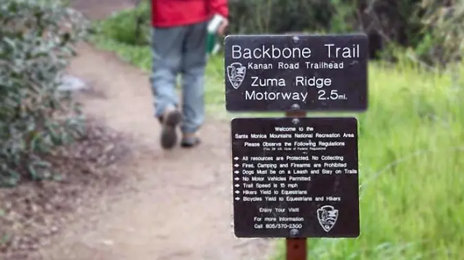
    This is an alternative hike for Tuesday, and not quite as fast-paced as the other hike. We're only going 5 miles to the fire road. From the Kanan Rd trailhead, we'll jump on the Backbone Trail for a cruise down into Newton Canyon. On our way there, we'll cross the creek, pass under an oak […]

  • Rosewood Trail: Lynn to Angel Vista – Gentler Intermediate

    150 Regal Oak Ct 150 Regal Oak Ct, Thousand Oaks, CA, US

    Meet at the Rosewood sign, which is at the Regal Oak Ct. and Lynn Rd. intersection. The hike is about 5 miles with an elevation gain/loss approximately 900’. We'll walk a short distance on Lynn road to the lower Rosewood Trail, then take the dirt trail up a shaded ravine and continue on the Rosewood […]

  • Boney Mountain Hike (Fast Paced)

    Rancho Sierra Vista/Satwiwa Wendy Trailhead Potrero Rd & S Wendy Dr, Newbury Park, CA, US

    Please read these restrictions before signing up. Don't show up unless you're shown on the "Attending" list Unregistered or waitlisted will be turned away No "Plus Ones" on this hike We will go to our overlook on Boney for a beautiful 360 degree viewpoint. We will have a good time hiking through the area and […]


Trail statistics are approximate. For safety purposes always assume they are underestimated. But don’t be disappointed if they are overestimated. Bring more water and snacks than you think you’ll need.

Trail descriptions are based on previous hikes. Current conditions are unknown until arrival. Expect the unexpected and plan accordingly.

The Organizers and members of Hiking With Dean are not professional leaders, guides, or mountaineers. The function of the member or organizer is only to organize the trip. Each person who shows up for a trip/meetup (and their guest or guests) is responsible for his or her own safety. By attending a hike, or any other event organized by this group, you are acknowledging that you and any guests that you bring are aware of the risks, dangers and hazards associated with the activity and freely accept and fully assume all such risks, dangers and hazards, and further agree to release and discharge the Organizers, Members of the Hiking With Dean Meetup Group from and against any and all liability arising from your participation in the group activities per our ASSUMPTION OF RISK AND LIABILITY WAIVER and Section 6.2 of the Meetup.com Terms of Service.