Site Search

Ventura County Day Hikes

Tapo Canyon Trail

Tapo Canyon Road Tapo Canyon Rd, Simi Valley, CA, US

https://www.alltrails.com/trail/us/california/tapo-canyon-trail?u=i Hello fellow hikers, The heat is here but we still need to keep moving so the goal is to hit this trail (which has partial shade ) and be back at our cars before it gets to hot... so... Join me on a easier moderate hike at Tapo Canyon Trail in Simi Valley. This […]

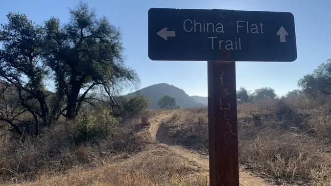
Palo Comado China Flats Loop

713 Quail View Ct 713 Quail View Ct, Oak Park, CA, US

https://www.alltrails.com/trail/us/california/palo-comado-china-flats-loop Hello Fellow Hikers, Okay I think it is finally gonna cool down. So let's get in a hike. This is a pretty popular area with both hikers runners and mountain bikers. This trail is popular due to all the views. Will have both mountain views and open spaces with the first section more rocky […]

White Sage Trail

2487 Crown View Ct 2487 Crown View Ct, Thousand Oaks, CA, US

https://www.alltrails.com/trail/us/california/white-sage-trail Hello Fellow Hikers, Okay we did a part of this trail in a past Meetup and said we would never do it as a "out and back" (remember that Kim) ha ha okay here we go... Don't let the 5.1 mile and 1158 elevation gain fool ya its a good up and down then […]

Backbone Trail Loop

1667 Stunt Rd 1667 Stunt Rd, Calabasas, CA, US

https://www.alltrails.com/trail/us/california/backbone-trail-loop Hello Fellow Hikers, We have another request and what a beautiful trail at that. This is one of the prettiest routes on the Backbone Trail. Will be doing this hike clockwise to tackle the hard stuff first and go up the incline instead of down it. Easier on the knees. This trail will have […]

Towsley Canyon Loop Trail

24255 The Old Rd 24255 The Old Rd, Newhall, CA, US

https://www.alltrails.com/trail/us/california/towsley-canyon-loop-trail Hello Fellow Hikers, This is a great trail and area. A must to do at least once. Beautiful mountain views. This trail will have inclines and level off sections with both open views and shaded areas. We are gonna conjour this trail going clockwise to get the incline over with in the beginning and […]

Tapo Canyon Trail

Tapo Canyon Road Tapo Canyon Rd, Simi Valley, CA, US

https://www.alltrails.com/trail/us/california/tapo-canyon-trail?u=i Hello fellow hikers, The heat is here but we still need to keep moving so the goal is to hit this trail (which has partial shade ) and be back at our cars before it gets to hot... so... Join me on a easier moderate hike at Tapo Canyon Trail in Simi Valley. This […]

Kagel Mountain via Dillon Divide

Kagel Mountain Trailhead Kagel Canyon, CA, US

https://www.alltrails.com/trail/us/california/kagel-mountain-via-dillon-divide Hello fellow Hikers, This is a little known hike actually most people are even unaware these mountains are back there. This is however a very popular spot for Hang gliders, Paragliders and Wing gliders. They travel to the top of this mountain by helicopter and from there they make there descend off the mountain. […]

San Vicente Mountain: Old Nike Missile Site Trail

Upper Canyonback Trailhead 17024 Mulholland Dr, Encino, CA, US

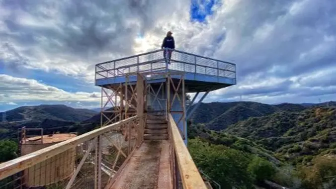
https://www.alltrails.com/trail/us/california/san-vicente-mountain-old-nike-missile-site-trail--3/photos Hello Fellow Hikers, We are gonna be visiting LA96C Nike Missile Site to start our trail. Then will continue on Sullivan fire road down the mountain. Now for a little piece of history about our hike.... During the Cold War this was a military reservation. LA96C was one of 16 Nike missile sites that […]

Devils Chair Trail

Devil's Punchbowl Natural Area 28000 Devils Punchbowl Rd, Pearblossom, CA, US

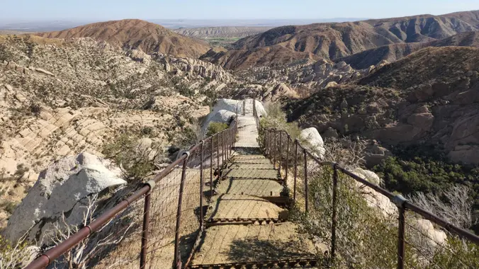
https://www.alltrails.com/trail/us/california/devils-chair-trail Hello Fellow Hikers, It's Halloween! What better hike to do then Devils Chair?! This trail is a fan favorite among hikers but unfortunately was devastated in the Bobcat fire and closed for a few years. It has finally reopened and what better day to hike it. Now a little about the trail....When you arrive […]


Trail statistics are approximate. For safety purposes always assume they are underestimated. But don’t be disappointed if they are overestimated. Bring more water and snacks than you think you’ll need.

Trail descriptions are based on previous hikes. Current conditions are unknown until arrival. Expect the unexpected and plan accordingly.

The Organizers and members of Hiking With Dean are not professional leaders, guides, or mountaineers. The function of the member or organizer is only to organize the trip. Each person who shows up for a trip/meetup (and their guest or guests) is responsible for his or her own safety. By attending a hike, or any other event organized by this group, you are acknowledging that you and any guests that you bring are aware of the risks, dangers and hazards associated with the activity and freely accept and fully assume all such risks, dangers and hazards, and further agree to release and discharge the Organizers, Members of the Hiking With Dean Meetup Group from and against any and all liability arising from your participation in the group activities per our ASSUMPTION OF RISK AND LIABILITY WAIVER and Section 6.2 of the Meetup.com Terms of Service.