Site Search

Ventura County Day Hikes

Backbone Trail: Corral Canyon to Latigo Canyon

Backbone Trail & Latigo Canyon Road California, CA, US

https://www.alltrails.com/trail/us/california/backbone-trail-corral-canyon-to-latigo-canyon Hello Fellow Hikers, (Please note later start time due to high for this day is showing 68 degrees plus its the day after Cinco De Mayo😉) Lets hike the pretty Corral Canyon and Latigo Canyon on the Backbone Trail. Several hikers have commented on the wild flowers still in bloom along these trails. And […]

Tapo Canyon Trail

Tapo Canyon Road Tapo Canyon Rd, Simi Valley, CA, US

https://www.alltrails.com/trail/us/california/tapo-canyon-trail?u=i Hello Fellow Hikers, Join me on a easier moderate hike at Tapo Canyon Trail in Simi Valley. This hike has a nice gradual walk until we start a gradual climb were we will start our loop. We should encounter wildflowers and mountain views. Our loop will drop down then we will continue until we […]

Harmon Canyon Road and West Road

Harmon Canyon Road Harmon Canyon Rd, Ventura, CA, US

https://www.alltrails.com/trail/us/california/harmon-canyon-road-and-west-road?search=true Hello Fellow Hikers, Harmon Canyon is back open after the rain damage and now it is time to hit this trail. This is a really popular area so will need to start earlier plus the weather is starting to ease towards summer now. If you haven't been to the area before it's a great […]

Elliot Peak via Western Plateau

Conejo Canyons Trail Head 2010 Conejo Center Dr, Thousand Oaks, CA, US

https://www.alltrails.com/trail/us/california/elliott-peak-via-western-plateau-trail Hello Fellow Hikers, Ok this is a last minute put together as our previous plan had to be cancelled due to trail closure. This is a popular trail as the scenery has a little of everything. Open views a peak and easy trails to follow. The incline is doable and gratual. Will be doing […]

Tapo Canyon Trail

Tapo Canyon Road Tapo Canyon Rd, Simi Valley, CA, US

https://www.alltrails.com/trail/us/california/tapo-canyon-trail?u=i (It's gonna be warm this day so we are gonna start at 8am to be off the trail by 10am..) Hello Fellow Hikers, Join me on a easier moderate hike at Tapo Canyon Trail in Simi Valley. This hike has a nice gradual walk until we start a gradual climb were we will start […]

Upper Zuma Falls via Backbone and Zuma Canyon Trail

Newton Canyon trailhead Newton Canyon at Kanan Road, Malibu, CA, US

https://www.alltrails.com/trail/us/california/upper-zuma-falls-via-backbone-and-zuma-canyon-trail?sh=jw81u0 Hello Fellow Hikers, This is a beautiful area still green with wild flowers, creek crossings and a waterfall ( should still have water ) this hike is a nice gradual incline so you can enjoy the views yet still get in a good workout. By 9:00am the parking lot fills up so we plan […]

PCT: Indian Canyon to Vasquez Rocks

Vasquez Rocks Natural Area Park 10700 Escondido Canyon Rd, Agua Dulce, CA, US

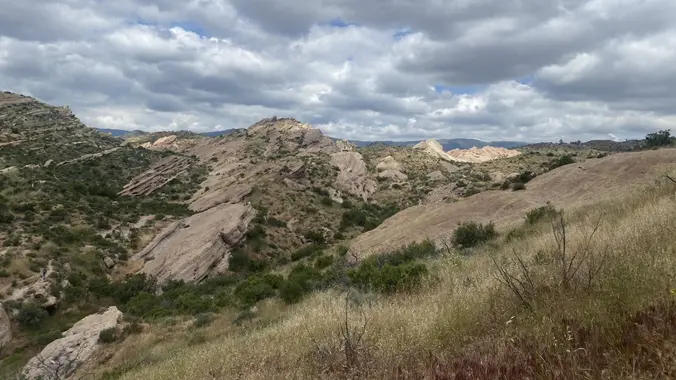
** Please read the entire description before you RSVP as things will be a little different with this hike ** https://www.alltrails.com/trail/us/california/pct-vasquez-to-indian-canyon?u=i&sh=aoxfvb Hello Everyone, We will be doing this hike northbound (opposite the AllTrails route). We will do close to 9 miles of the PCT. We will see some interesting rock formations including Three Sisters Rock […]

Tapo Canyon Trail

Tapo Canyon Road Tapo Canyon Rd, Simi Valley, CA, US

https://www.alltrails.com/trail/us/california/tapo-canyon-trail?u=i Hello Fellow Hikers, Join me on a easier moderate hike at Tapo Canyon Trail in Simi Valley. This hike has a nice gradual walk until we start a gradual climb were we will start our loop. We should encounter wildflowers and mountain views. Our loop will drop down then we will continue until we […]

The Pianobox Prospect via Fish Canyon trail

Los Angeles City Water and Power Road & Templin Highway California, CA, US

https://www.alltrails.com/trail/us/california/the-pianobox-prospect-via-fish-canyon-trail?search=true Hello Fellow Hikers, A bit of history to the area. It's said these hills were once inhabited by the Allikliks a branch of the Shoshonean tribe. There is also a lot of lore surrounding this place that includes talk of Indian burial grounds, gold mines, spanish gold, and even ghosts. Pianobox was named for […]


Trail statistics are approximate. For safety purposes always assume they are underestimated. But don’t be disappointed if they are overestimated. Bring more water and snacks than you think you’ll need.

Trail descriptions are based on previous hikes. Current conditions are unknown until arrival. Expect the unexpected and plan accordingly.

The Organizers and members of Hiking With Dean are not professional leaders, guides, or mountaineers. The function of the member or organizer is only to organize the trip. Each person who shows up for a trip/meetup (and their guest or guests) is responsible for his or her own safety. By attending a hike, or any other event organized by this group, you are acknowledging that you and any guests that you bring are aware of the risks, dangers and hazards associated with the activity and freely accept and fully assume all such risks, dangers and hazards, and further agree to release and discharge the Organizers, Members of the Hiking With Dean Meetup Group from and against any and all liability arising from your participation in the group activities per our ASSUMPTION OF RISK AND LIABILITY WAIVER and Section 6.2 of the Meetup.com Terms of Service.