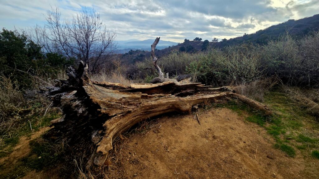
DESCRIPTION: We will be hIking this trail counterclockwise as a loop, exploring an incredible variety of sights, scents, and landscapes along the way. The trail features unusual geological formations, bubbling streambeds, natural tar pits, and diverse plant communities.
Around mile 0.9, we will reach the Narrows, a slot-like canyon with dramatic, nearly vertical rock layers. After passing through the Narrows, we will begin climbing the switchbacks on the Towsley Canyon Loop Trail. At the high point of approximately 2,450 feet, the trail transitions into a steep, winding descent into Wiley Canyon, where we will enjoy beautiful views of rolling hills and scenic landscapes.
A quick note about pace: I’m easing back into hiking after recent foot surgery, so we may be taking things a little slower than usual. Thanks for your patience and understanding!
Looking forward to seeing everyone again!
DETAILS:
- Hike leader volunteer(s): Michele
- Meet: Outer Towsley Park Parking Lot at 7:15 am, departure at 7:30 am sharp (Nov 7).
- Distance: Approximately 5.5 miles.
- Elevation gain: Approximately 1,417 feet.
- Time: 2.5-3 hours hiking including a snack break.
- Conditioning: You need to be in general good physical condition.
- Dogs: Dogs are welcome but must be on a leash.
- Restrooms – None.
- Adventure Pass – None Required. Pass – None Required.IMPORTANT NOTES: We typically maintain a moderate pace, but as mentioned above, we may be moving slower than usual as I return to hiking following foot surgery. Please plan to stay with the group so everyone can enjoy a safe and pleasant outing.
Be aware that trail conditions may include stream crossings, exposed areas, insects, and other potential hazards. As with any hike, there is always a risk of slipping or falling, as well as encountering poison oak, snakes, and other natural hazards.
Hikes may be cancelled due to inclement weather, either in advance or at the start of the hike. Please check the weather forecast and plan accordingly.
ESSENTIAL GEAR: Hiking boots or sturdy trail shoes with good grip for the rocks. Trekking poles are helpful on the rolling climbs. Clothing layers—it can be cool at the start. Hat, sunscreen, and sun-protective clothing; there’s no shade on this route. Snacks and a refillable water bottle with 2+ liters of water, plus electrolytes or salt tablets.
The Ten Essentials of Hiking (link)
THIS HIKE RATING: Level 3, Intermediate (see chart below).
Please only sign up to attend hikes that are consistent with your ability. Based on your hiking during the last 90 days, how would you score on the Santa Clarita Valley Hikers (SCVHikers) hike rating scale of one to five, assuming a moderate pace (~2.5 mph)?
SCVH HIKE RATING SCALE:
- Beginner: 1–3 miles, less than 500 feet elevation gain.
- Beginner/Intermediate: 1–7 miles, less than 700 feet elevation gain.
- Intermediate: 5–10 miles, 1000–2000 feet elevation gain.
- Intermediate/Advanced: 7–12 miles, up to 3000 feet elevation gain.
- Advanced: 10–17 miles, 3000 feet or more elevation gain.
TRAILHEAD LOCATION: Towsley Park Parking Lot – We are meeting in outer parking lot, before you go into the gate.
24255 The Old Rd, Newhall, CA 91381
NAVIGATION: We highly recommend the AllTrails app be installed on your cell phones and/or you print a copy of the trail map so you can personally navigate the trail if you need to. Cell service may be spotty in the canyon—download your AllTrails maps for offline access before you leave home. The Forest Service has placed black-and-red diamond markers on rocks along the trail, but they don’t cover the entire route. Navigation can be tricky, especially past the creek crossings where multiple use trails diverge.
If You Need Help on the Trail
In AllTrails, swipe up on the Navigate drawer and tap “GPS details” to see your coordinates. Screenshot them, then call 911 and read off the numbers. As a backup, the What3Words app names any location with three words that are easy to read aloud to a dispatcher. Your GPS works even without cell service—you just need signal to make the call.
We rely on donations to continue sponsoring hikes like this. Please contribute via cash or Venmo at each hike.
DISCLAIMER / RELEASE OF LIABILITY — PLEASE READ IN ITS ENTIRETY
When you sign up for this event, you are releasing Santa Clarita Valley Hikers (SCVHikers) and its volunteer organizers from any liability or responsibility in connection with your participation in this activity. Hiking is inherently risky. By signing up, you are taking full responsibility for your own safety and well-being.
SCVHikers and its organizers are not trained, certified, or compensated guides, and the club does not confirm the qualifications of any member to lead or participate in its events. All participants take full responsibility for their own actions and judgment.
By signing up for any SCVHikers event, you are releasing SCVHikers and its organizers from all liability for possible injury or death, as stated in paragraph 6.2 of the Meetup Terms of Service (available at the bottom of the Meetup website). Your personal safety depends on your own judgment and experience. If you sign up for this hike, you are confirming that the hike is within your current abilities.
At the trailhead, we will ask every participant to read and sign the SCVHikers Release of Liability and Express Assumption of Risk before the hike begins. If you are unwilling to sign, you will not be able to join the group that day. Signing up on Meetup does not substitute for the trailhead sign-in.
The outing begins and ends at the trailhead. SCVHikers does not organize, advertise, or coordinate carpools. Transportation to and from the trailhead is your own responsibility, and all risks of that travel are yours alone.
This event may be cancelled or modified due to weather, trail conditions, or other safety considerations.