


VOLUNTEERS: Gary and Deena
DATE: Saturday September 26, 2026
MEET: At Trailhead NO LATER than 8:00 AM – departure promptly at 8:15
DISTANCE: ~ 7.1 miles, Lollipop style
GAIN: 1200’ Gain
HIKING TIME: ~ 4 – 4.5 hours hiking
DOGS: Not permitted due to excessive plant growth along creek with poison oak, plus poodle dog bush
ADVENTURE PASS: Not required
CLOTHING/PROTECTIVE GEAR: LONG PANTS AND LONG SLEEVE SHIRTS. Gloves recommended. Hiking shoes/boots with good tread. Layers are always a good idea. Hat, sunscreen; Wet bandana or cooling towel recommended in case of heat. Bring Face Nets! There WILL BE a LOT of flying bugs/gnats/etc trying to fly up your nose!
HIKING POLES: Highly recommended since we’re crossing an overgrown creek many times!.
FOOD/DRINKS: Snacks and 2-1/2+ liters of water MINIMUM, and sufficient electrolytes or salt tablets. We will be stopping along the PCT for a snack break.
HIKE DESCRIPTION:
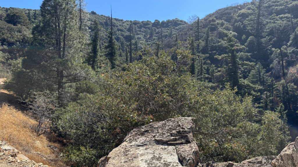
From the Lower Shake Trailhead on Pine Canyon Road, we’ll head up a steep canyon, with an active stream, so there is a LOT of plant overgrowth along the creek – and along with that is LOTS of poison oak. I’ve cleared a pathway through it, but you still have to be aware of what poison oak looks like. IT IS AVOIDABLE IF YOU ARE OBSERVANT AND CAREFUL!
We’ll make our way to Upper Shake Campground and take a short breather and water break.
We’ll do the trail in “reverse” of many past visits. Rather than walking UP a long road, we’ll do the uphill on the more pleasant PCT. We’ll climb up the Upper Shake Trail to the shady PCT. Along the PCT, we’ll stop at a little camping spot the thru-hikers use for a snack break, then continue on the PCT for quite a while, towards Forest Route 7N23, then down that dirt road to Upper Shake Campground, where we’ll head back down the canyon to the trailhead. We will get great views here and there out over the Mojave and toward Tehachapi.
**THIS HIKE RANKING: Level 3 (Intermediate – see chart below)**:
HIKE RANKING SCALE – Consider your capabilities before RSVP’ing for a hike to ensure you are properly conditioned for a hike:
1) Beginner: 1-3 miles, less than 500 feet elevation gain
2) Beginner/Intermediate: 1-7 miles, less than 700 feet elevation gain
3) Intermediate: 5-10 miles, 1000-2000 feet elevation gain
4) Intermediate/Advanced: 7-12 miles, up to 3000 feet elevation gain
5) Advanced: 10-17 miles, 3000 feet or more elevation gain
WARNINGS:
- The canyon leaving the trailhead has lots of poison oak (and Poodle Dog Bush up higher). If you are squeamish or reactive to poison oak, I highly advise that you wear long sleeve shirt, long pants, and gloves. Higher up the trail, we’ll find some poison oak, and quite a bit of Poodle Dog Bush on the crossing the trail. Both Poison Oak and Poodle Dog Bush are toxic to touch. PAY ATTENTION TO THE HIKE LEADER, AND KNOW WHAT BOTH PLANTS LOOK LIKE, since they are both very prevalent along parts of the trail, and hard to avoid if you are not CAREFUL! I HIGHLY RECOMMEND you wear long pants and long sleeves. Gloves would be a good idea also. I recommend you have Ivarest Poison Ivy Itch Cream or other suitable alternative. I would put it on before the hike, but also bring it in case you are exposed to poison oak.
- There are portions of this trail with adjacent steep drop offs. They are not dangerous, but if drop offs disturb you, please bear this in mind.
- Wear protective clothing!
- There are no restrooms at the trailhead or on the hike, so plan accordingly.
Trail Map (download a GPX file from GAIA GPS)
https://www.gaiagps.com/public/sr87MD9VMTO1Ip1d22pNcE5B/
TRAILHEAD LOCATION:
AVAILABLE PARKING IS EXTREMELY LIMITED (LIKE 3-4 CARS MAXIMUM). BRING A HIGH WHEELBASE VEHICLE IF POSSIBLE.
20895-21033 Pine Canyon Rd, Lake Hughes, CA 93532
What3Words Link to Lower Shake Trailhead location: https://w3w.co/clubbed.procession.categorically
DRIVING DIRECTIONS (BUT USE WHAT3WORDS!)
From SCV (45 mins): From Santa Clarita, I recommend San Francisquito Cyn Road from the intersection with Copper Hill Drive. Head North on San Francisquito Cyn for 19.9 miles, through Green Valley to the junction with Elizabeth Lake Road – bear left. At next main junction with the Lake Elizabeth sign ahead of you, turn left and go 4.6 miles into Lake Hughes town and out the other side. After seeing the junction with Lake Hughes Road come in on your left, stay on Pine Canyon Road, for 4.5 miles more after the Lake Hughes Road junction. Trail head is on left (look for mile marker 4.54).
From 5 FWY: Take the 5 North and get off at Exit 176B, Lake Hughes Road/ Castaic. Turn right at bottom of ramp, (McDonalds will be at the first light, on left). Go straight through light, following Lake Hughes Road, for 22.9 miles from McDonalds out of town to Lake Hughes. Arriving at the junction of Lake Hughes Road and Pine Canyon Road, turn left and head almost 5 miles North out Pine Canyon Road to the trailhead. Look for white Mile Marker 4.54, on the right of road. Park on the shoulder opposite the posts at trail head (see photos of trailhead/ mile marker in the album attached to this listing).
From Antelope Valley/ Acton: Drive West taking Elizabeth Lake Road through Leona Valley to Lake Hughes. Pass through Lake Hughes town and after seeing the junction with Lake Hughes Road come in on your left, continue straight. Now on Pine Canyon Road, drive almost 4.5 miles to the trailhead (white Mile Marker 4.54), details above and photos in album attached/ below.
The Ten Essentials of Hiking (link)
NAVIGATION: For ALL hikes, we highly recommend you use a GPS software app (GAIA or AllTrails) on your cell phone. Cell service may be spotty in the canyon—download the GAIAGPS map for offline access before you leave home.
If You Need Help on the Trail
In AllTrails, swipe up on the Navigate drawer and tap “GPS details” to see your coordinates. Screenshot them, then call 911 and read off the numbers. Your GPS works even without cell service — you just need signal to make the call.
We rely on donations to continue sponsoring hikes like this. We gladly accept cash or venmo.
DISCLAIMER / RELEASE OF LIABILITY – IMPORTANT, PLEASE READ BELOW IN ITS ENTIRETY:
When you sign up for this event, you are releasing SCVHikers from any liability or responsibility with your participation in this group activity. While safety is a priority for everyone in the group, hiking can be inherently risky. By participating in any posted event, you are assuming responsibility for your own safety and well-being. SCVHikers Meetup Group and its organizers are not trained leaders, and we do not confirm the qualifications of any of its members to lead or participate in our events. All participants take full responsibility for their own actions. If you choose to sign up for any SCVHikers Meetup events, you are releasing SCVHikers Meetup Group and hike organizers from all liability in case of possible injuries or death as stated in paragraph 6.2 of the Meetup “Terms of Service” located on the bottom of the Meetup website. Your personal safety depends on your own judgment and experience. If you sign up for this hike, you are verifying that this hike is within your abilities.
SHAKE CANYON: HISTORY, GEOLOGY & CHARACTER
Shake Canyon is a surprisingly historic and geologically interesting corner of the Angeles National Forest, tucked against the north side of Sawmill Mountain west of Lake Hughes. Its character comes from the unusual combination of a shady, tree-lined canyon, nearly century-old recreation sites, abandoned Forest Service infrastructure, the Pacific Crest Trail, and the nearby San Andreas Fault system.
Lower Shake Camp and Upper Shake Campground were established by at least the 1930s. A 1938 Los Angeles County Trails Magazine describes driving Pine Canyon Highway to a rough access road leading ¼ mile to Lower Shake Camp, then hiking a “beautiful tree lined canyon” 1½ miles to Upper Shake Campground and continuing toward Sawmill Mountain. The complete recommended outing was about ten miles. A nearby Pine Canyon Ranger Station issued fire permits.
Thus, both the campgrounds and their access roads/trails are at least about 90 years old, and possibly older. By the 1950s, USGS maps show Lower Shake, Upper Shake, Sawmill Campground, the ranger station and an extensive network of motorways, firebreaks and trails.
Geologically, the setting is exceptional. Pine Canyon Road follows the San Andreas Rift Zone, the great tectonic corridor separating the Pacific and North American plates. Shake Canyon also contains a separate Shake Canyon Fault, named by USGS geologists for exposures near Upper Shake Campground.
The historic canyon trail eventually reaches the Pacific Crest Trail, linking an early Southern California recreation route with today’s Mexico-to-Canada trail system. Upper Shake later became accessible by Forest Service road, but storm damage forced its closure in 2005; the Forest Service subsequently planned reconstruction.
Today the area’s appeal is partly its sense of forgotten history: old roads, pipes, campground sites and trails remain among oaks, maples and surprisingly lush canyon vegetation. Shake Canyon feels less like a modern trail and more like walking through layers of Southern California geology, early Forest Service history and nearly a century of mountain recreation.




