

SANTA BARBARA COAST- SERIES OF HIKES
We will hike together as a group and enjoy the beauty that this series offers.
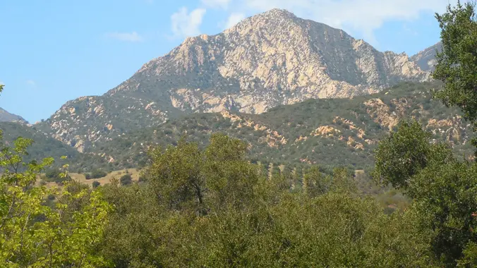
SANTA BARBARA COASTAL RANGE TREK – Arlington Peak
Continuing our Santa Barbara Coastal series, we’ll do this one as an in and out trek. THIS WILL BE AN EXTREMELY TOUGHER TREK than the first ones in the series, so please don’t sign on if rock scrambling along a steep ridge bothers you. Also, don’t sign on if you have no experience with this type of terrain. We’ll be starting our hike at the Tunnel Trail’s trailhead at the end of Tunnel Rd. The fun begins in less than a mile along the Tunnel Trail, as we leave it and head up a steep ridge line following a “use” trail and rock scrambling all the way to Arlington Peak. This will not be along the Dragonback ridge, but instead, along a new trail along a southern access to Arlington Peak. After that, those that have a lot of energy left, can tackle Cathedral Peak (an extra mile round trip) as an option which will involve additional scrambling as the rest kick back, wait and rest.
There are three ways to get to Arlington Peak.
1) It’s northern ridge from La Cumbre Peak
2) Its Eastern ridge long the dreaded Dragonback
3) Its southern ridge
CDH has taken the first two routes and now will be taking the relatively new third route.
This area is a little over an hours drive from Thousand Oaks, so keep that in mind when signing on. Devote the whole day to this and don’t sign on if you have other commitments later that day and be aware of the difficulties this route entails.
After the hike, those that are interested in stopping off at the Nugget restaurant in Summerland, can join me.
MEETUP LOCATION AND TIME: The Tunnel Trail trailhead at the end of Tunnel Road no later than 8:00 a.m.
https://www.google.com/maps/place/34%C2%B027’51.8%22N+119%C2%B042’45.9%22W/@34.4644014,-119.7149437,17z/data=!3m1!4b1!4m6!3m5!1s0x0:0x9ebc2c2c8f7084f4!7e2!8m2!3d34.4643972!4d-119.7127547
Pay attention to street parking signs in that area. Please be quite when arriving, since this is a residential area.
EARLIER MEETUP TIME, LOCATION AND DIRECTIONS: For those out my way, we can meet at the Thousand Oaks Park and Ride at the corner of Rancho Rd. and Haaland Dr. NO LATER THAN 6:30 a.m. WE WILL BE LEAVING FROM THERE AT 6:40 a.m.. Have a full tank of gas and be willing to drive if needed. Those that don’t drive can help pay for gas. It’s about an 1 hour 15 minute drive to our meetup at the end of Tunnel Rd. in Santa Barbara.
https://www.google.com/maps/place/34%C2%B010’26.7%22N+118%C2%B051’38.8%22W/@34.1740754,-118.8629737,17z/data=!3m1!4b1!4m6!3m5!1s0x0:0xd0cb7d8a6208886e!7e2!8m2!3d34.1740705!4d-118.8607853
DISTANCE: 6.2 miles
ELEVATION GAIN/LOSS: 2250’/2250′
THE PACE: No faster than the slowest Trekker
DURATION: 6+ hours or whenever the slowest finishes
TERRAIN: Single, double track and “use” trails along with rock scrambling
LEVEL: Strong Intermediate Trekker who loves to rock scramble
MY CELL# IS 805-358-5972


