

Ready to give orienteering a shot? This location is mostly flat and very beginner friendly. The terrain is described as “Flat flood basin with subtle features and highly variable vegetation thickness.”
Come up with a team name, pick a course, register and the race is on… Post a comment if you’d like to be matched with a group. GIVE IT A TRY – IT’S FUN!
Meet at Starbucks or drive directly to the dam ($12 parking fee).
COVID Mitigation
To protect the safety of our volunteers and participants, the following protocols will be in place at this event:
Attendance by Pre-registration ONLY. No day of event registration. Sign up here:
LAOC Website https://www.laorienteering.org/events-1/santa-fe-dam-2022
Prepayment encouraged. This will enable non-contact pick-up of materials.
Assigned start times to ensure that large crowds do not gather
A “Mask Required” zone will be instituted around the registration area to insure that those approaching volunteers are masked.
The recommended course is orange… or yellow. Courses: White (Basic), Yellow (Intermediate), Orange (Advanced), Brown (Expert), Green (Expert), Red (Expert).
This write up is Don’s:
Orienteering is an organized sport for individuals, navigating a course by hiking to find your way through the trees and fields. Map reading, navigation and route choice are the key. Orienteering is a sport for everyone, regardless of age or experience. At advanced levels it is very competitive. Others, while learning, often go in small groups . It is done at your pace, whether you run or walk it . The satisfaction is in finding your own way. Sample ‘O’ maps will show you more about Orienteering than any words. We will be meeting for breakfast prior to heading over to the orienteering site in order to further explain and answer any additional questions about this event.
10:00 am Course Opens
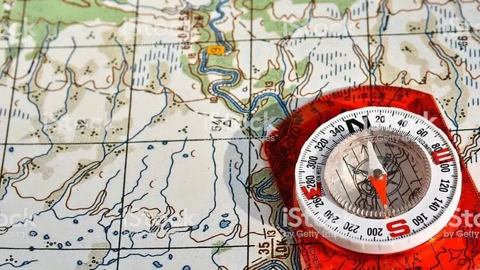
All who attended previous events have enjoyed them so doing this again was a no-brainer. There are numerous levels of courses made available to all participants. Each course gets longer and offers more control points to locate along the way. In a nutshell, each team will receive an electronic e-chip which fits on your finger and will be assigned to one team member and is used to record the start, finding of all control points and finish, ultimately providing that teams statistics and time to complete the course. The starts are staggered and you won’t receive the actual map until your team starts the course. If you have a compass feel free to bring it or they will have them available there for a small rental fee. Everything else will be provided on-site. The map provided will identify the location of up to 14 “control points”. Your team will try and locate all the control points in the correct order by orienting the map with your surrounding terrain. There is a sample orienteering map in the files section of our site.
STATS:
Distance: 3-5+ miles, depends upon your route finding abilities
Elevation Gain: unknown
Rating: 2-4/10, fun, fun, fun.
Fees:
$5 member youth
$8 member adult (age 21+)
$10 non-member youth
$13 non-member adult
One Child, 10 years and younger, is FREE per paying adult.
Equipment rental fees:
$2 E-stick rental (mandatory for each entry unless you have your own, or the event is Urban O)
$2 compass rental (based on availability)
$40 charge for a lost estick
LAOC is a non-profit organization. Fees collected are used for permits, insurance, additional supplies, labor, and mapping to provide more orienteering opportunities!
IMPORTANT INFORMATION, PLEASE READ:
At Registration: Each individual or group going on a course needs to have an EP finger stick (also called an SI card, e-card, chip, dibber, etc.). Be sure your name, course, and e-punch number are entered so the organizers can determine who’s on a given course (and check that everyone returns safely).
At the Start Area: Request a start time from the Start official. Then, while you’re waiting for your start time, be sure to clear and check your finger stick before going out on your course. The CLEAR unit deletes any old data on the card that may cause confusing results, and the CHECK unit confirms that the card has been cleared and is ready to be used. It takes about 6 seconds to clear the card, and less than one second for a check. When you are told to start, or when your start time has arrived, be sure to punch the START unit before heading out on your course. This writes your start time to your finger stick.
On the Course: Visit each control in the proper order (if it’s a point-to-point course). Be sure to check that the control code on the unit matches the control code on your course. Insert your finger stick at each control unit, and wait until you hear a beep and see a flash on the unit. It usually takes about a second. If there is no beep or flash, the unit may be malfunctioning; if so, punch the edge of your map with the pin punch attached to the control flag to prove that you visited the control.
If you punch a wrong control by mistake, or punch controls out of order, it does not matter as long as you eventually punch all of the controls in the proper order. Thus, for example, if you find and punch control #4 before control #3, it is okay as long as you then find #3 and punch it, and then revisit #4 and re-punch it before continuing on to #5. Also, it does not cause any problems if you happen to punch a control that is not on your course.
Remember to punch the final control on your course–that is, the last control before the Finish, often called the “Go” control. It is sometimes very close to the Finish, and may be easy to overlook.
At the Finish: Punch the FINISH unit at the Finish line. This writes the finish time on your finger stick.
After the Finish: Then go directly to the EP table and download your results. To do that, place your finger stick in the download unit until it beeps (which can take several seconds). You will be told if you completed the course correctly and what your time was. You will receive a printout of your splits. You may keep your map and the splits printout.
Keep In Mind…
Be sure to check in at the EP table whether or not you finish your course, or if you decide not to go out on a course after you have entered your name in the competitor list. If you do not check in, you will be listed as a missing runner, and we will have to initiate a search for you.
DIRECTIONS
We will meet at Starbucks right down the street at 9 am for a caffeine fix and to develop some strategies and answer questions. We can also consolidate cars here to split the parking fee at the dam. Address: 15700 Arrow Hwy, Irwindale 91706
The actual orienteering is at Santa Fe Dam – look for orange and white O-signs.
From the north (210 fwy), using 605 S, exit Arrow Hwy. Go east (left). From the south (10, 60, etc), using 605 N, get off at Live Oak Ave, go east (right) and join onto Arrow Hwy. Continue on Arrow Hwy to Park Entrance on left opposite Azusa Canyon Rd and pay entrance fee of $12. To go to Starbucks, just continue for a couple of blocks to the corner of Arrow and 4th St. It will be on the right.
********************
The Fine Print
PLEASE – Know your limits and abilities. Bring snacks and drink plenty of liquids when hiking. Check weather conditions and dress accordingly and be aware of your surroundings at all times. Watching out for poison oak, snakes, ticks, uneven footing, spectacular views, beautiful fauna all while interacting with awesome (usually) fellow hikers can be extremely hazardous, rewarding and fun.
The Farzan Rule: Posted hike times are the time the hike starts or we leave from a posted shuttle location. I’m aware other Meetup groups offer a grace period for late arrivals; we don’t. It’s your responsibility to know the location of the meeting spot and be there and ready to participate at the posted time. If you have any concerns about the directions feel free to contact the organizer of the event, preferably in advance of the event and not at the start time. I’m of the opinion that it’s not fair to delay an event when the majority of attendees have arrived on-time. (so named after a conversation I had with a certain un-named member).
RSVP’s: If you RSVP for an event be responsible and update your RSVP if your plans change. If your plans change at the last second and you’re not able to update your RSVP also let us know. In my opinion a no-show is someone who has no regard for following the guidelines we request from our members and will risk being removed from future events that have a limit.
VHC HIKE RATING SCALE
Rating a hike is subjective, meaning the difficulty of a hike will be in direct relation to how often you hike and the type of hike you prefer. Keep in mind that any hike can have the following: un-even hiking surfaces, various obstructions, water and/or water crossings or bouldering and/or rock hopping. A great hike will have all of these!
1 – A long walk
2 – 4 mile hike w/little elevation gain
3 – 5 mile hike w/up to 1000 ft. elevation gain
4 – 5+ mile hike w/up to 1500 ft. elevation gain (heart rate increases at times)
5 – 7+ mile hike w/over 1500 ft. elevation gain (heart rate increasing even more at times)
6 – 7+ mile hike w/over 2000 ft. elevation gain (at times you might be trying to remember how to perform CPR)
7 – 5+ mile hike w/over 2000 ft. elevation gain (at times you might be muttering expletives to yourself)
8 – 10+ mile hike w/over 3500 ft. elevation gain (at times you might be angry with the hike leader)
9 – 10+ mile hike w/over 5000 ft. elevation gain (at times you might be thinking of reporting the hike leader to the authorities)
10 – Use your imagination
Class 3 Scrambling: Scrambling or un-roped climbing. You must use your hands at times to hold the terrain or find your route. This may be caused by a combination of boulders, steepness and extreme terrain. Some Class 3 routes have ropes in place for assistance.
DISCLAIMER / RELEASE OF LIABILITY
IMPORTANT, PLEASE READ BELOW IN ITS ENTIRETY:
I am a volunteer (i.e. not liable for the group). Safety is a priority for everyone in the group. Think of this as hiking with a group of friends.
Outdoor sports and other events we plan can be inherently dangerous and accidents may happen. By participating in any posted event, you’re taking responsibility for your own safety and well-being. The VHC Meetup Group and its organizers are not trained leaders and we do not confirm the qualifications of any of its members to lead or participate in trips. All participants take full responsibility for their own actions. If you choose to sign up for any VHC Meetup events, you are releasing the VHC Meetup Group and it’s organizers from all liability in case of possible injuries as stated in paragraph 6.2 of the Meetup “Terms of Service” located on the bottom of the Meetup website. Your personal safety depends on your own judgment and experience.


