

3.2 miles, 900′ gain, easy intermediate.
The first part is a steady incline, followed by a rolling trail to our destination. Fit beginners can complete this hike, but it will certainly get their blood pumping. There are no super steep sections.
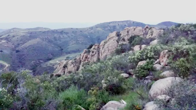
This hike takes us to a secret spot below a large rock formation. Naturally into the side of the rock is a half-globe carved out of it, giving us a quasi-cave area to sit and have our social event.
This is not a conditioning hike, it’s a social hike. We’ll be stopping at various points to let people catch up and to make sure they make any turns. We’ll stop at the turn around point for a social event lasting 30 – 60 minutes, where we will share snacks and beverages.
Hike
Distance: 3.2 miles
Gain: 900′
Distribution: Most of the incline is in the first half.
Difficulty
Shape: Out and Back.
Pace: approx. 2.0 mph.
Trail Type: Double track, single track.
Trail Variations:
Duration: 3.5 hours
Dogs: Yes.
Restrooms: Yes, about a block from the start.
Drinking Fountains: Maybe by the restrooms.
Parking: Park in the street.
What to bring
1 liter of water for every 3 miles.
Hiking shoes/boots. Not required, but recommended.
Flashlight or headlamp.
Sunscreen and/or hat as needed.
Snacks and/or beverages to share
Hosting
Route: The host knows the route. A pic of the route has been posted.
Navigation: Host memory, enhanced by GPS navigation as needed.
Hike type: Social.
We won’t be hiking at a fast pace because this is a social hike, not a conditioning hike. There is nothing wrong with stopping, even if it means every 50 steps.
Stops: The host may designate stopping points to let others catch up. This hike will include an extended stop for a Snack and Beverage Share at the half way point. We will stop at junctions to make sure everybody makes any turns or chooses the correct direction at splits, else something will be used to mark the direction, usually a large arrow made of baking soda or some sticks in the shape of an arrow. There may not always be a sweeper designated to be the last hiker.
Each hiker is responsible for knowing their capability, only attending events where they are able to sustain the described pace, for keeping up with the group sufficiently enough to make the turns and not get left behind, and for making sure the host is notified if they are going to split from the group.
Group separation: Sometimes hikers wish to move significantly ahead and not wait at designated stopping points. Please let the host know. They are on their own regarding route and navigation.
Interesting Notes
Here are a couple plants you are sure to see on this hike:
Manzanita
Rounded leaves. Redish trunk and stems. Hard wood. Lots of curves. People used to spray this tree with lacquer and mount on their walls like a “tree of life” for decoration.
Sticky Monkeyflower
Of the Snapdragon family. The flowers are supposed to resemble a laughing monkey’s face. Leaves are very sticky on the underside.
Directions
Oakbrook Vista Trailhead
3222 Lang Ranch Pkwy.
Thousand Oaks, CA 91362
Coordinates of trailhead: 34.212466, -118.820325
From CA-23
Exit 15 Avenida de Los Arboles.
East on Avenida de Los Arboles until it ends, 1.6 miles.
Right (south) on N. Westlake Blvd 0.2 miles.
Left (east) on Lang Ranch Pkwy. 0.2 miles.
Park on street, trailhead on the right (south) side.
FAQ
Hiking Plus Page Links
Disclaimer / Release of Liability


