

Distance: ~14 miles
Elevation gain: ~2,400 feet
Level: Moderate
Type: Out and Back
Trail Type: some single track and fire road
Route: Hoyt Mountain Road to Grizzly Flat Trail to Haines Canyon Motorway to Mount Lukens Truck Trail and back.
What to Bring: 3+ liters of water, food for snacks/lunch, hat for sun protection. (optional: hiking poles and bug repellent)
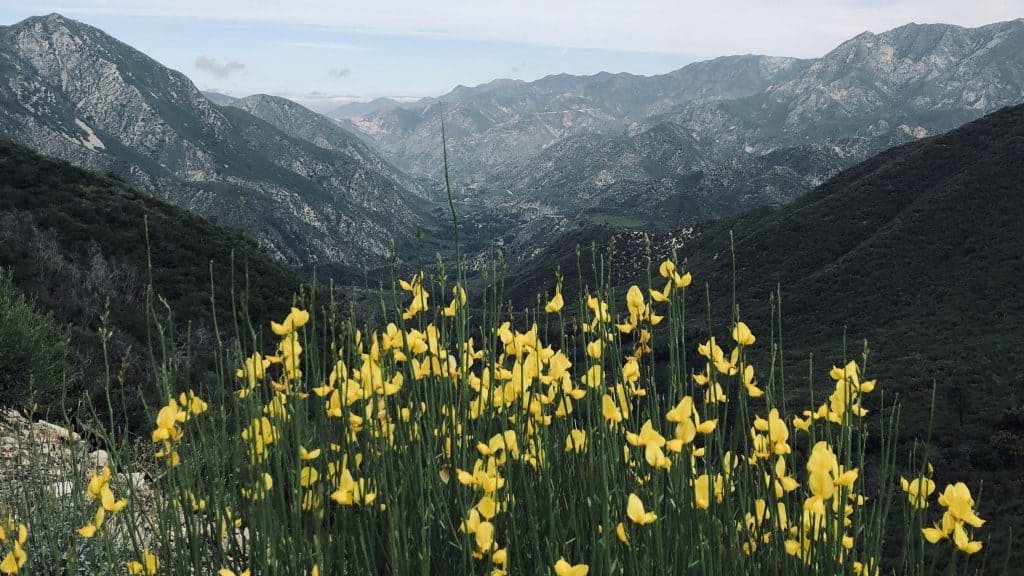
This is a gentle though lengthy hike. I did this hike last May when the spring flowers were in full bloom and Grizzly Flats was absolutely lovely. Trail is partially shaded with some single track trail, some overgrown fire road and some fully exposed fire road as you approach the summit. It is likely that poodle dog bush will be thriving as well as poison oak, so be advised. Some people are highly allergic to these plants and there are places along the trail that are overgrown with vegetation and you may not be able to avoid contact.
NOT FOR BEGINNERS due to distance.
Parking: on the North side of Angeles Crest Highway at a small unmarked turnout near mile marker 30.60. Trail is approximately 2.4 miles beyond the Angeles Crest Fire Station.
Directions: From the 210 freeway, take the Angeles Crest Highway (Highway 2) exit and head north for 6.2 miles. A National Forest Service Adventure Pass ($5 per day or $30 for the year) is required for parking here.
DISCLAIMER / RELEASE OF LIABILITY
IMPORTANT, PLEASE READ BELOW IN ITS ENTIRETY:
I am a volunteer (i.e. not liable for the group). Safety is a priority for everyone in the group. Think of this as hiking with a group of friends. As a courtesy and in keeping with Covid-19 safety protocols, hikers are expected to wear a mask if within 6 feet of another hiker.


