

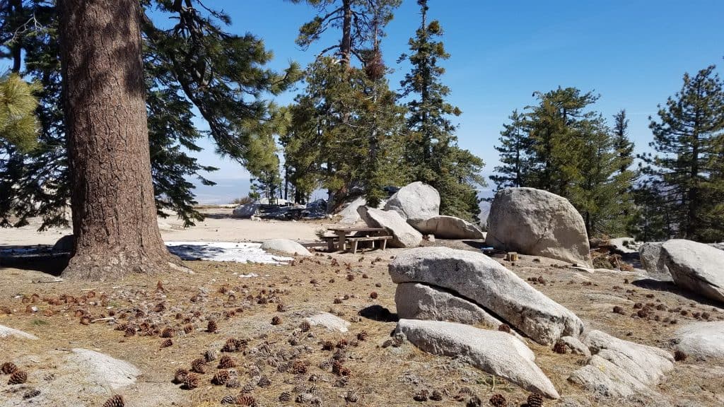
Hike to Mt. Pacifico via the PCT from the Mill Creek Summit Ranger Station at the crest of the Angeles Forest Hwy and return. The top of Mt. Pacifico has very nice picnic tables and is a frequent destination for campers.
There is LOTS of exposure on this hike, so be prepared for lots of sun.
Mt. Pacifico itself is beautiful and in the trees.
A word of caution, Mt. Pacifico lies just west of the western edge of the Bobcat fire closure. I don’t believe the camp or the route has been affected.
Bring snacks for the summit and trail.
Stats:
Distance: 13 miles
Elevation Gain: 2,400 ft.
Max elevation : 7,103 ft.
Rating: 7/10 Somewhat strenuous
Trail: Mostly single track and a bit of graded forest service road.
ESSENTIALS:
2 Liters of water (Minimum)
Sunscreen
Hat
Snacks
Hiking Poles (Recommended)
Layered clothing (can be windy & chilly at the summit)
Check the Weather
https://forecast.weather.gov/MapClick.php?lon=-118.04616458004175&lat=34.38350843275154
PLEASE – Know your limits and abilities. Bring and drink plenty of liquids when hiking. Check weather conditions and dress accordingly and be aware of your surroundings at all times. Watching out for snakes, ticks, uneven footing, spectacular views, beautiful fauna all while carrying on a conversation with awesome (usually) fellow hikers can be extremely hazardous, rewarding and fun.
*******************************************************************
VHC HIKE RATING SCALE
Rating a hike is subjective, meaning the difficulty of a hike will be in direct relation to how often you hike and the type of hike you prefer. Keep in mind that any hike can have the following: un-even hiking surfaces, various obstructions, water and/or water crossings or bouldering and/or rock hopping. A great hike will have all of these!
1 – A long walk
2 – 4 mile hike w/little elevation gain
3 – 5 mile hike w/up to1000 ft. elevation gain
4 – 5+ mile hike w/up to1500 ft. elevation gain (heart rate increases at times)
5 – 7+ mile hike w/over 1500 ft. elevation gain (heart rate increasing even more at times)
6 – 7+ mile hike w/over 2000 ft. elevation gain (at times you might be trying to remember how to perform CPR)
7 – 5+ mile hike w/over 2000 ft. elevation gain (at times you might be muttering expletives to yourself)
8 – 10+ mile hike w/over 3500 ft. elevation gain (at times you might be angry with the hike leader)
9 – 10+ mile hike w/over 5000 ft. elevation gain (at times you might be thinking of reporting the hike leader to the authorities)
10 – Use your imagination
Class 3 Scrambling: Scrambling or un-roped climbing. You must use your hands at times to hold the terrain or find your route. This may be caused by a combination of boulders, steepness and extreme terrain. Some Class 3 routes have ropes in place for assistance.
DISCLAIMER / RELEASE OF LIABILITY
IMPORTANT, PLEASE READ BELOW IN ITS ENTIRETY:
I am a volunteer (i.e. not liable for the group). Safety is a priority for everyone in the group. Think of this as hiking with a group of friends.
Outdoor sports and other events we plan can be inherently dangerous and accidents may happen. By participating in any posted event, you’re taking responsibility for your own safety and well-being. The Valencia Hiking Crew Meetup Group and its organizers are not trained leaders and we do not confirm the qualifications of any of its members to lead or participate in trips. All participants take full responsibility for their own actions. If you choose to sign up for any Valencia Hiking Crew Meetup events, you are releasing the Valencia Hiking Crew Meetup Group and it’s organizers from all liability in case of possible injuries as stated in paragraph 6.2 of the Meetup “Terms of Service” located on the bottom of the Meetup website. Your personal safety depends on your own judgment and experience.


