

**3 miles, 800′ gain, Easy Intermediate.**
Easy option, 1.4 miles, 450′ gain, Fit Beginner
The address given is not the address of the hike. It is nearby and may cause you to drive past the trailhead if navigating by GPS.
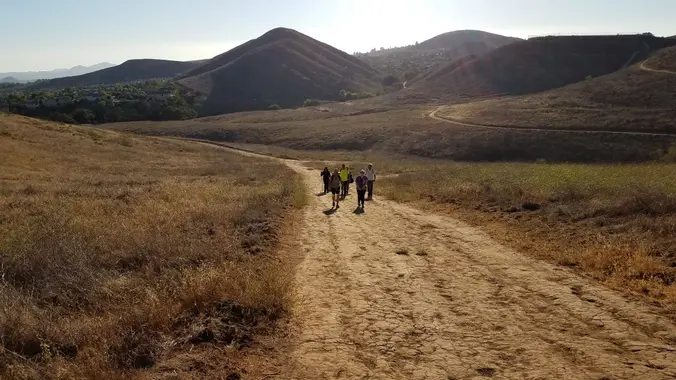
**[Route](https://secure.meetupstatic.com/photos/event/d/c/3/c/highres_501236380.jpeg)**
From the trailhead parking lot, up for 0.7 mile on Long Canyon Trail to a bench. For those doing the easy option, wait here about 40 minutes. They can spend that time going out and back in the area, if they like.
For the regular route, we do a 2 mile loop with 400′ of gain.
We turn right, go up 300 feet, then down Sunrise Trail 4/5 of a mile.
Left at the junction for 300 feet.
Left at the split for 200 feet up a relatively steep incline.
Left on Autumn Ridge, which is a fire road.
Continue on this extended incline for about 2000 steps, arriving at the five-points intersection.
Take an “easy” left, not a hard left, for about 500′ back to the bench were those that did the easy route will be waiting.
We’ll have a [snack share](https://www.meetup.com/Hiking-Plus/messages/boards/thread/50879772) social event for 30-60 minutes before turning right and heading back down to the trail head parking lot.
**Interesting Notes**
*[Turkey Mullein](https://secure.meetupstatic.com/photos/event/d/c/4/0/highres_501236384.jpeg)*
Smashed leaves can be thrown into the water to stupify fish, causing them to float to the surface, a practice illegal in most states. The seeds are not toxic to birds and are enjoyed especially by doves and wild turkeys.
Ancient Greeks rolled and dried the leaves, then used them as wicks for oil lamps. It stalks were used as torches burned at funerals. Many tribes employed the use of mullein leaf tea for coughs, colds, and rheumatism. They considered it to be analgesic, anti-inflammatory, antispasmodic, and expectorant. The astringent and demulcent properties of the leaf tea were found useful in cases of diarrhea.
*[Wild Oats](https://secure.meetupstatic.com/photos/event/d/c/4/2/highres_501236386.jpeg)*
The mature seed of the plant is used as a cereal grain. All oats have edible seeds, although they are small and hard to harvest in most species. Oats are hard to tell apart from weedy relatives, so the term “sowing wild oats” came to be used to describe unprofitable activities and destructive sexual liaisons of an unmarried young male that could result in children being born out of wedlock.
**Hike**
Distance: 3 miles
Gain: 800
Distribution: Most of the incline is in the first 15 minutes of the hike, followed by an extended incline at the halfway point.
[Difficulty:](https://www.meetup.com/Hiking-Plus/messages/boards/thread/50879781) Easy Intermediate.
Shape: Lollipop, counter-clockwise.
Pace: 2.0 mph.
Trail Type: Fire road, single and double track. Areas of sand, gravel, and rock, some of it rugged.
Trail Variations: The beginning is a tough climb.
There is an extended incline of about 2000 steps half way through the hike.
Duration: 3.5 hours
Dogs: Yes.
Restrooms: No
Drinking Fountains: No.
Parking: Free in the paved parking area in front of the trail head.
*What to bring:*
1 liter of water for every 3 miles.
[Snacks and/or beverages to share.](https://www.meetup.com/Hiking-Plus/messages/boards/thread/50879772)
Hiking shoes preferred, but athletic shoes will be OK.
Flashlight or headlamp for hikes that end after sunset.
Sunscreen and/or hat if needed.
**Hosting**
*Route:* The host knows the route.
*Navigation:* Host memory, enhanced by GPS navigation as needed.
*Hike type:* Social.
We won’t be hiking at a fast pace because this is a social hike, not a conditioning hike. There is nothing wrong with stopping, even if it means every 50 steps.
Those that wish to return immediately instead of hanging around during the snack and beverage share, can head directly back down to the parking lot.
*Stops:*
The host may designate stopping points to let others catch up. This hike will include an extended stop for a [snack and beverage share](https://www.meetup.com/Hiking-Plus/messages/boards/thread/50879772) at the 3/4 point.
We will stop at junctions to make sure everybody makes any turns or chooses the correct direction at splits, else something will be used to mark the direction, usually a large arrow made of baking soda or some sticks. There may not always be a sweeper designated to be the last hiker.
**Directions**
Where Long Canyon Rd. and S. Wood Ranch Pkwy. intersect in Simi Valley. There is a free paved parking lot at the trailhead on the southwest corner.
*From CA-23 and I-101*
North CA-23, exit Olsen Rd.
Right (east) on Olsen Rd., which becomes Madera Rd., for 2 miles.
Right (south) on N. Wood Ranch Pkwy., which becomes S. Wood Ranch Pkwy., for 2 miles.
Right at dead end (intersection with Long Canyon Rd.) and immediate left into parking lot.
Trailhead at the opposite corner.
*From CA-118 and CA-27*
West CA-118, exit 23 onto 1st St.
Left (south) on 1st St., which becomes Long Canyon Rd., for 5 miles.
Cross at dead end (intersection with S. Wood Ranch Pkwy.) and immediate left into parking lot.
Trailhead at the opposite corner.
Coordinates of trailhead: 34.228330, -118.803130
A nearby address that should get you to pass by the trailhead: 572 Bannister Way, Simi Valley, CA 93065
In the Spring and Summer, arrive early, because sometimes the parking lot gets full. If this happens, we’ll need another 15 minutes to carpool from a nearby parking lot.
**[FAQ](https://www.meetup.com/Hiking-Plus/pages/23772638/Frequently_Asked_Questions)**
**[Disclaimer / Release of Liability](https://www.meetup.com/Hiking-Plus/pages/29622459/Is_Hiking_Dangerous)**


