

5 miles, 1000′ gain, Easy Intermediate
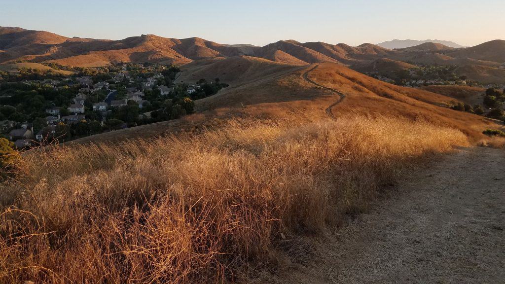
From the trail head, we cross the street. We walk a block and then head up behind the houses. This first climb will get your blood pumping. At the top of the hill, there are spectacular views of the neighborhoods and Bard Lake.
We’ll head down, then up a steep climb for about 200 steps to a bench. We’ll regroup to let people catch up. Then we’ll walk along the ridge. The trail then circles right, and head back down to Long Canyon Rd. We walk along the road for 750′, then enter a trail to the left.
We walk a flat trail for 3/4 of a mile, reaching Coyote Park. We’ll keep going, and where the basketball courts are, we’ll see a cement path to the left. We’ll take it up and after about 100′, we’ll find a cement platform to the right, where we’ll stop for a social event for up to 1 hour (https://www.meetup.com/Hiking-Plus/messages/boards/thread/50879772).
Those that wish to leave before the end of the event, should study the route so they can navigate the rest of the way back on their own.
We’ll continue along this path, making a left when we can, then follow the trail up for about 1500′ of a thigh burning climb. We turn right when when we can, returning us to a trail we came on. We take it back the way we came. It will go up a hill, then back down to Long Canyon Rd.
The Route.
• Start at the trail head parking lot.
• Instead of entering the trail head, cross the road to back side.
• Left at first trail head and begin our first difficult climb up along Canyon View Trail.
• Turn right at junction and make our second difficult climb, up to bench. We’ll stop there and let others catch up and perhaps share a beverage.
• Continue along the ridge and then down Canyon View Trail to Long Canyon Road.
• Left along the road for 1/4 mile, then left on a mostly flat horse trail to Coyote Hills Park.
• Pass the horse track and left in front of the basketball court. After about 50′ up the trail, we’ll stop for a beverage and snack share.
• Continue for a mild climb up, then left at Wood Ranch Trail.
• Another difficult climb before reaching a trail we came on. Return to the lot the way we originally came, which will include an extended incline before heading back to the road.
Interesting Notes
You will see these two plants on this hike:
Turkey Mullein
Smashed leaves can be thrown into the water to stupify fish, causing them to float to the surface, a practice illegal in most states. The seeds are not toxic to birds and are enjoyed especially by doves and wild turkeys.
Ancient Greeks rolled and dried the leaves, then used them as wicks for oil lamps. It stalks were used as torches burned at funerals. Many tribes employed the use of mullein leaf tea for coughs, colds, and rheumatism. They considered it to be analgesic, anti-inflammatory, antispasmodic, and expectorant. The astringent and demulcent properties of the leaf tea were found useful in cases of diarrhea.
Curly Dock
Also called Yellow Dock. The casing enables the seeds to float on water and get caught in wool and animal fur, and this helps the seeds to spread to new locations. Add leaves directly to salads in moderate amounts. Eat only in moderation. Root is used to treat anemia because it has high iron levels.
Whips the blood into shape restoring its ability to distribute nutrients and eliminate toxins from the system. Can ease abscess-induced toothache in minutes. Tea from roots and leaves used for: Anemia, Bleeding lungs or bowels, Blood Toxicity, Cancer, Low Energy , Liver Problems, Skin Problems, Abscesses, Acne, Bladder, Boils, Childhood Diseases, Cleansing, Diabetes, Digestive Disorders, Earache, Ear Infection, Fatigue, Fever, Flu, Fractures, Gall Bladder, Glands, Swollen, Gout, Inflammation, Itching Pancreas, Leprosy, Pituitary Gland, Psoriasis, Rheumatic conditions, Skin problems, Spleen, Tumors, Ulcers, and Venereal Disease.
Directions:
Where of Long Canyon Rd. and S. Wood Ranch Pkwy. intersect in Simi Valley. There is a free paved parking lot at the trailhead on the southwest corner.
From CA-23 and I-101:
North CA-23, exit Olsen Rd.
Right (east) on Olsen Rd., which becomes Madera Rd., for 2 miles.
Right (south) on N. Wood Ranch Pkwy., which becomes S. Wood Ranch Pkwy., for 2 miles.
Right at dead end (intersection with Long Canyon Rd.) and immediate left into parking lot.
Trailhead at the opposite corner.
From CA-118 and CA-27:
West CA-118, exit 23 onto 1st St.
Left (south) on 1st St., which becomes Long Canyon Rd., for 5 miles.
Cross at dead end (intersection with S. Wood Ranch Pkwy.) and immediate left into parking lot.
Trailhead at the opposite corner.
Coordinates of trailhead: 34.228256, -118.803187
The Hike:
Distance: 5 miles, 3.5 hours
Elevation Gain: 1000′
Difficulty: Easy Intermediate
Pace: 2.0 mph
Dogs: Yes
Restrooms: No.
Drinking Fountains: No.
Parking: Free in the paved lot at the southwest corner of the intersection.
Trail: Fire Road and Fire Road with powdered sand.
What to Bring:
1-2 liters of water.
Snacks and/or beverages to share (https://www.meetup.com/Hiking-Plus/messages/boards/thread/50879772)
Hiking shoes preferred, but athletic shoes will be OK.
Flashlight or headlamp.
Release of Liability: https://www.meetup.com/Hiking-Plus/pages/29622459/Is_Hiking_Dangerous/


